
The island of Saint Martin is a popular tourist attraction in the Caribbean which meant that traveling there was a fairly straightforward process. The one main hassle was taking a COVID test within a few days of leaving so that we could present our negative test results on arrival. Saint Martin had also set up an online registration system where travelers had to upload their vaccination status ahead of time in order to be allowed into the country. However, these were relatively minor barriers since the island's economy is heavily depedent on tourism and its government wanted to do everything possible to encourage visitors. We were flying very early on a Monday morning with an initial departure time of 6:00 AM out of Washington DC (ouch!) and then connecting through the massive Delta hub in Atlanta. This was significantly easier than our previous trip to the Galapagos earlier in 2021 and we were able to relax on the passage southward outside of our obnoxiously early wakeup time.
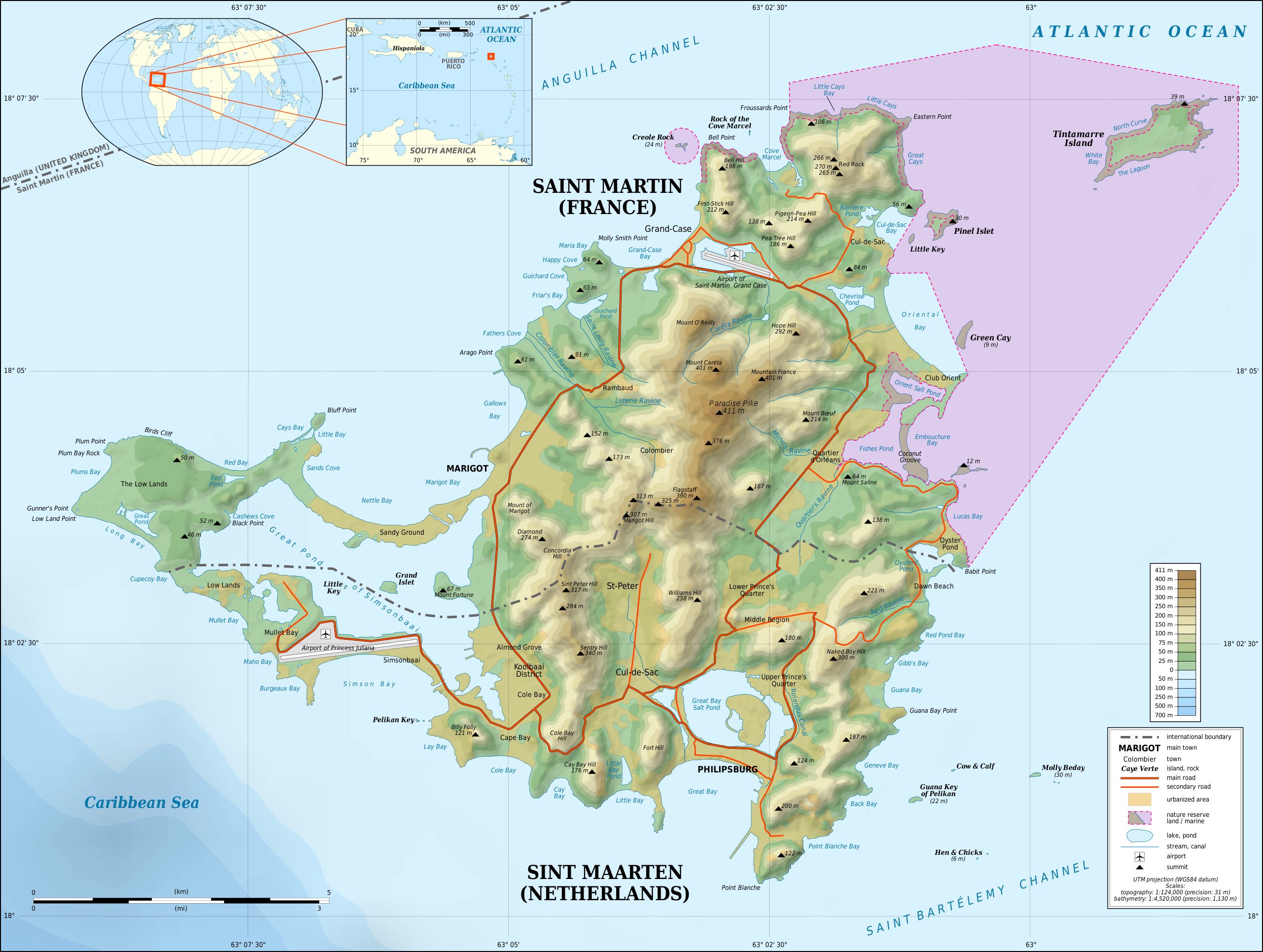
Saint Martin is located in the northeastern portion of the Lesser Antilles, the chain of tiny islands that runs in an arc from Puerto Rico down to the South American mainland. Saint Martin is part of a cluster of islands and we were able to spot several of its neighbors (Anguilla, Saint Barthelemy, and Saba) off in the distance whenever the weather was clear. It's a small island at only 37 square miles / 95 square kilometers in extent and we found that it took roughly an hour to drive in a circuit around its shores, at least when we weren't hitting the bad traffic infamous to Saint Martin. The main airport on Saint Martin is situated on the Dutch side of the island at the southwest corner of the landmass. From there, we would be renting a car for the week and then driving over to our hotel which was located at Oyster Pond, just barely on the Dutch side of the border at the eastern edge of the island. There are no barriers crossing between the Dutch and French sides of the island and we crossed back and forth half a dozen time or more during our stay. For organizational purposes, this page will focus on the Dutch side (Sint Maarten) while the next page covers the French side of Saint Martin.

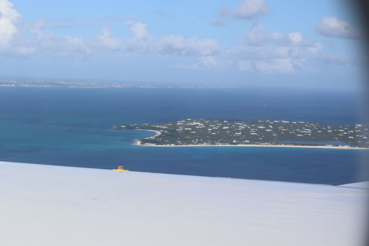


Liz was able to capture some views of the island from the air as our plane descended out of the clouds. The first picture above might look like a bird's eye perspective of Saint Martin and that was our initial thought as we stared out the window. However, it was actually the entirely separate island of Anguilla which is Saint Martin's close neighbor to the north. This is easier to see in the next few pictures which have Saint Martin in the foreground and Anguilla in the background. The two islands are divided by less than 10 miles of water and in normal non-pandemic times ferries make the crossing between them in only 20 minutes of travel time. We would see Anguilla off in the distance many times throughout this trip but couldn't travel there since Anguilla was requiring visitors to quarantine for a full week on arrival. As our plane went through its final descent, we were treated to great views of some of the hotels running along the beaches before touching down at the airport.

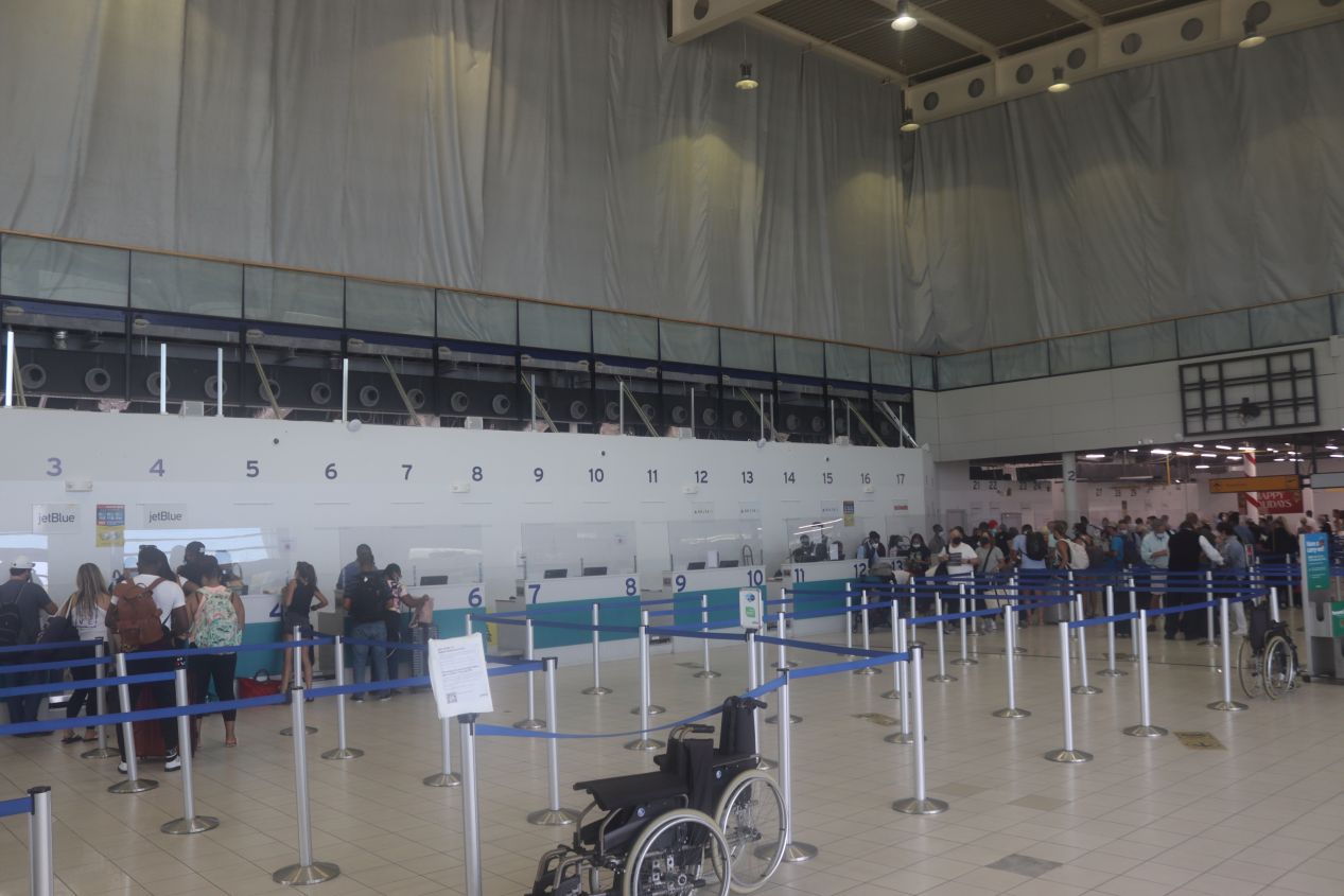


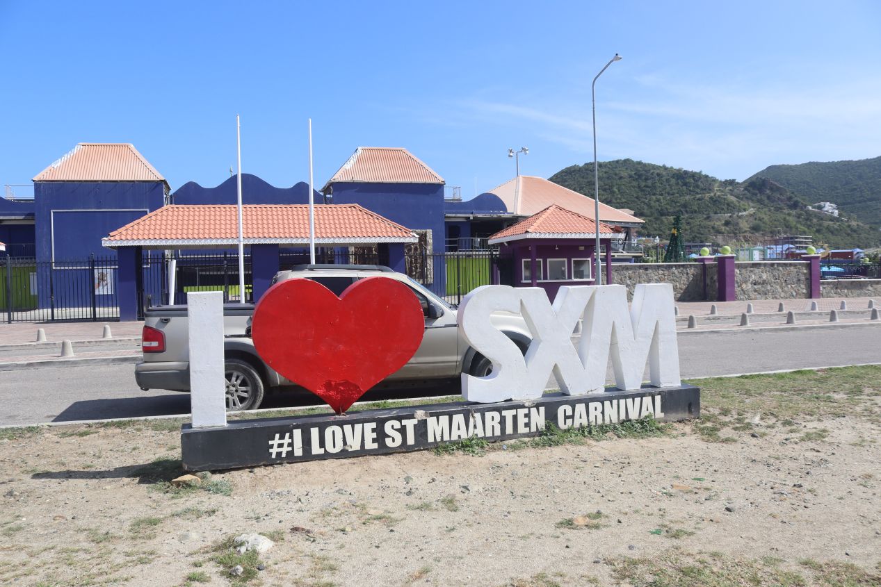
Saint Martin's landing hub is named Princess Juliana International Airport after one of the members of the Dutch royal family (the future Queen Juliana) who visited the island during World War II. The airport on Saint Martin holds an unusual importance as both a cultural signifier and as a tourist attraction in its own right. For the first part, the airport is noteworthy because its three digit identifying code "SXM" is commonly used as a shorthand for the whole island. We saw T-shirts and all sorts of other tourist stuff proudly bearing the SXM logo everywhere while we were traveling around Saint Martin. For the second part, one of the big tourist draws on the island involves watching the huge international planes fly just over the beach and land at the airport. We would check this out for ourselves a few days later and it was pretty entertaining. Princess Juliana International Airport was under heavy construction when we visited due to an ongoing project to increase its size. The airport was badly damaged by Hurricane Irma in 2017 and it had been rebuilding and modernizing throughout the four years since the hurricane's passage.

We picked up our rental car near the airport and we were off to our hotel... albeit a bit slower than expected. The island of Saint Martin is known for bad traffic jams on its narrow, winding roads and we ran into this mess immediately after leaving the airport. We later discovered that late afternoon was the busiest time of the day for traffic since that's when all of the big international flights land and it mixes together with the normal rush hour commute for the island's residents. As a result, it took the better part of an hour to drive from the airport over to our hotel at Oyster Bay at the eastern tip of the Dutch side. We were surprised at just how hilly the island's terrain proved to be; we were treated to some nice panoramic views but couldn't stop to take pictures since we were driving.

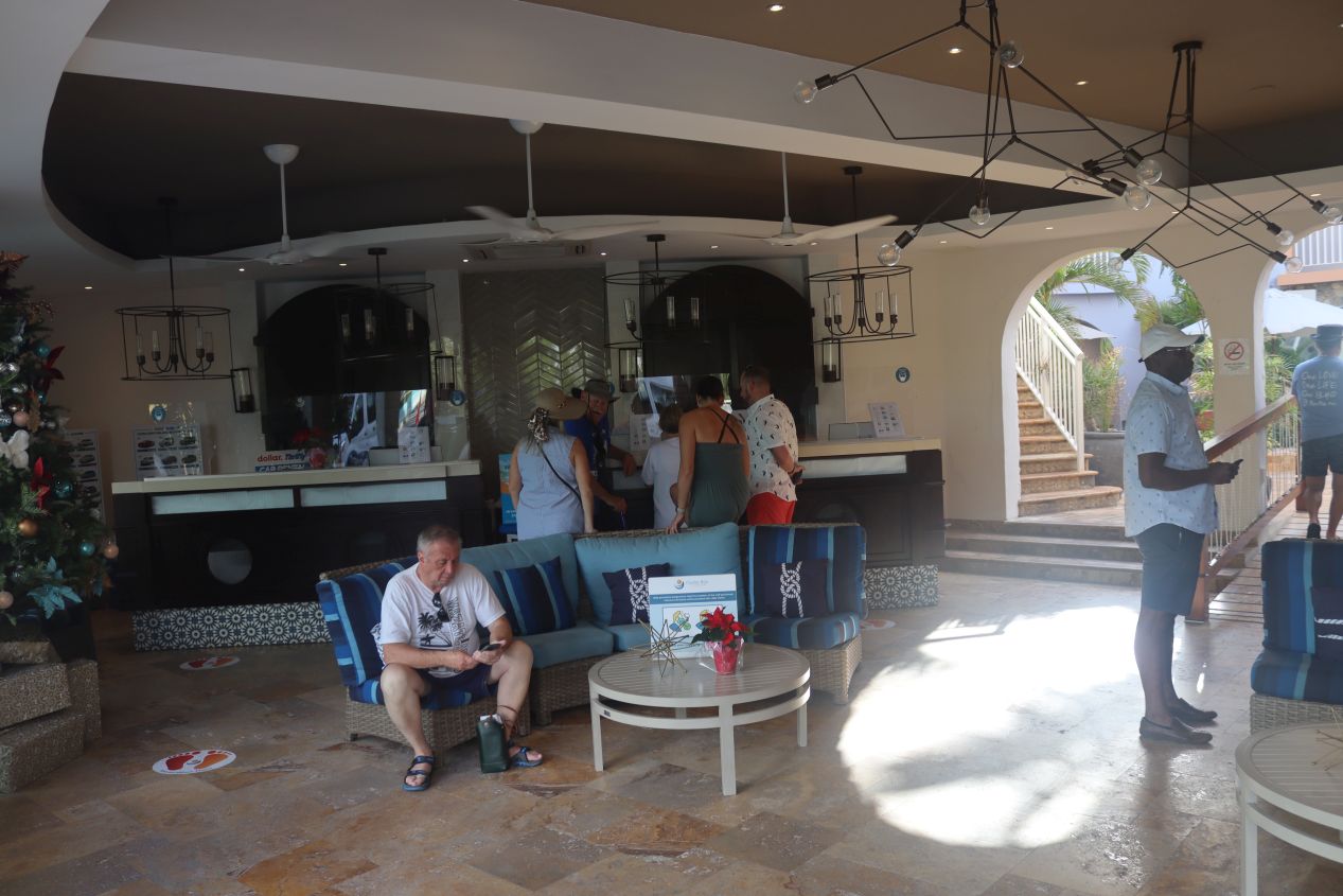


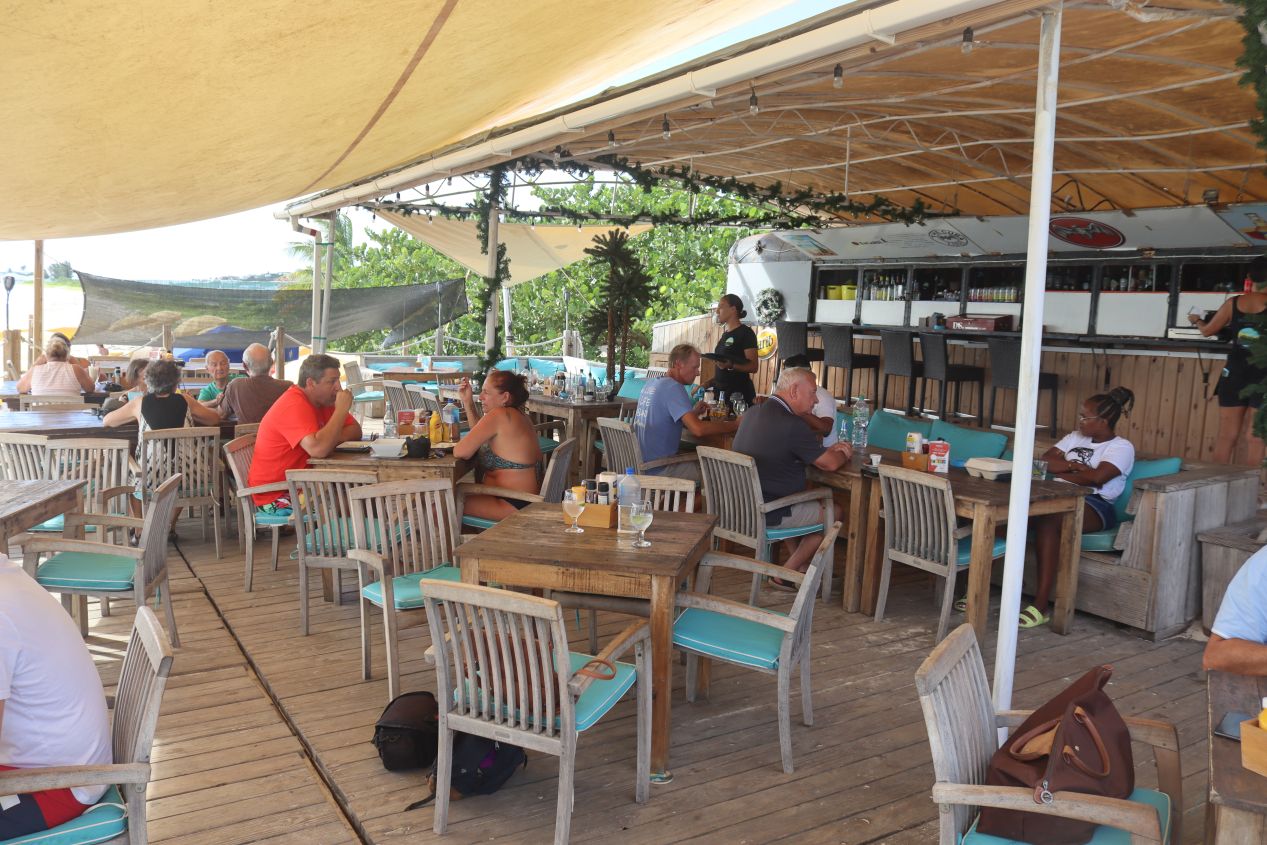
Eventually we arrived at our hotel, the Oyster Bay Beach Resort. We were even treated to a rainbow overhead the main entrance which had to be a good omen for our stay. The Oyster Bay resort had all of the amenities that visitors would expect at a Caribbean tourist destination with two restaurants, a nice bar area, fitness and spa facilities, and so on. This place was fairly expensive but Liz had booked our weeklong stay months in advanced and gotten a great deal at about half the normal asking price. The resort had been desperate for any kind of visitors during the pandemic and thus we were able to land a sweet deal. The resort was large enough that there were a number of group activities that they ran during the week and we were able to take part in a free wine tasting and enjoy live music, that sort of thing. Oyster Bay was particularly known for its waterfront location:
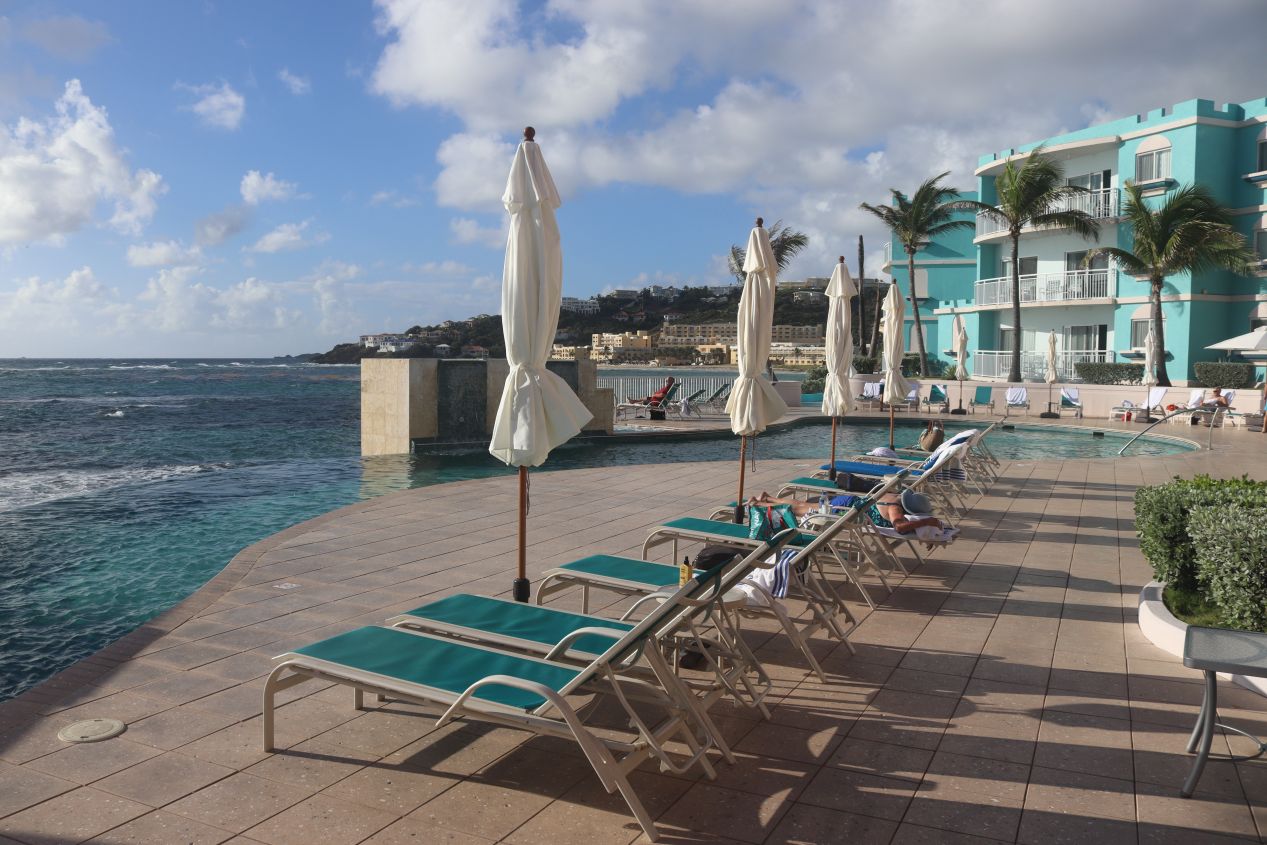
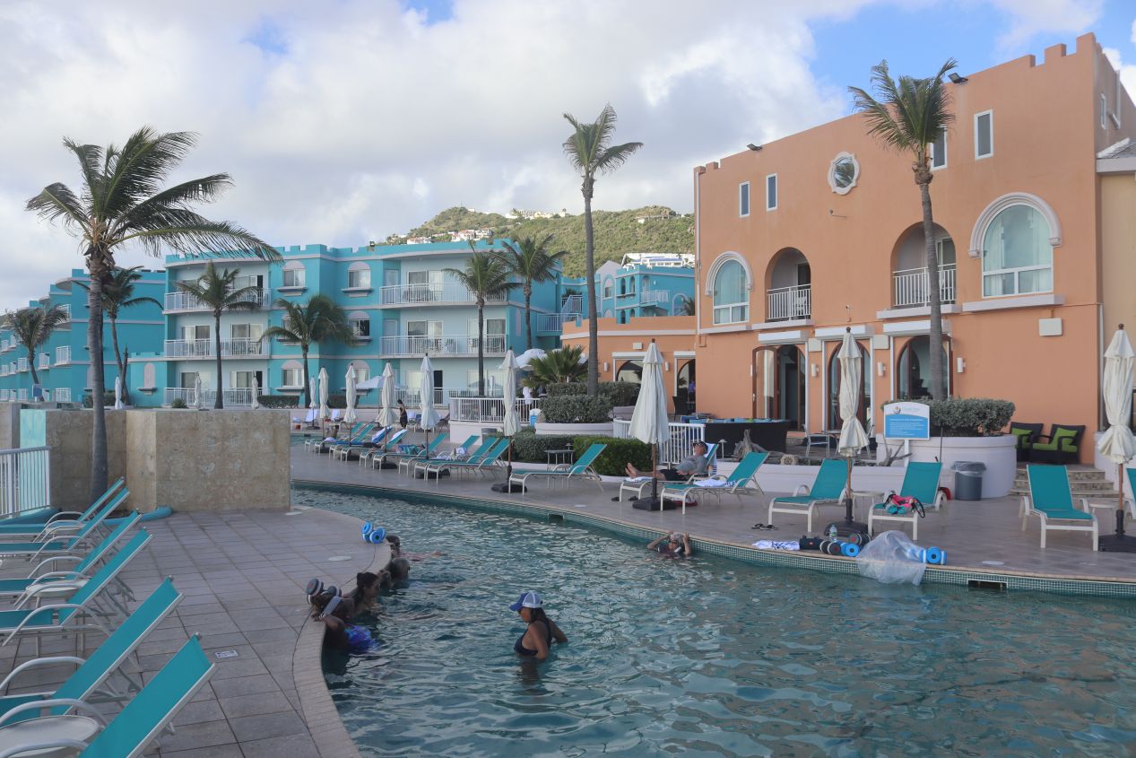


Ah, now that was more like it! Those were the seaside views that we were paying to enjoy on this vacation. Oyster Bay had a good sized infinity pool that appeared to plunge straight into the ocean below along with a convenient hot tub whenever the water in the main pool felt too chilly. The views from the pool area were pretty spectacular and on clear days we could easily see the island of Saint Barthelemy off in the distance. The French side of the island was similarly almost close enough that we could toss a stone and hit it from here. The only minor downside was the rocky shoreline which wasn't conducive to swimming. There actually was a beach here at the resort but it was a short distance away, over by the second restaurant a few minutes walking distance from the pool area.

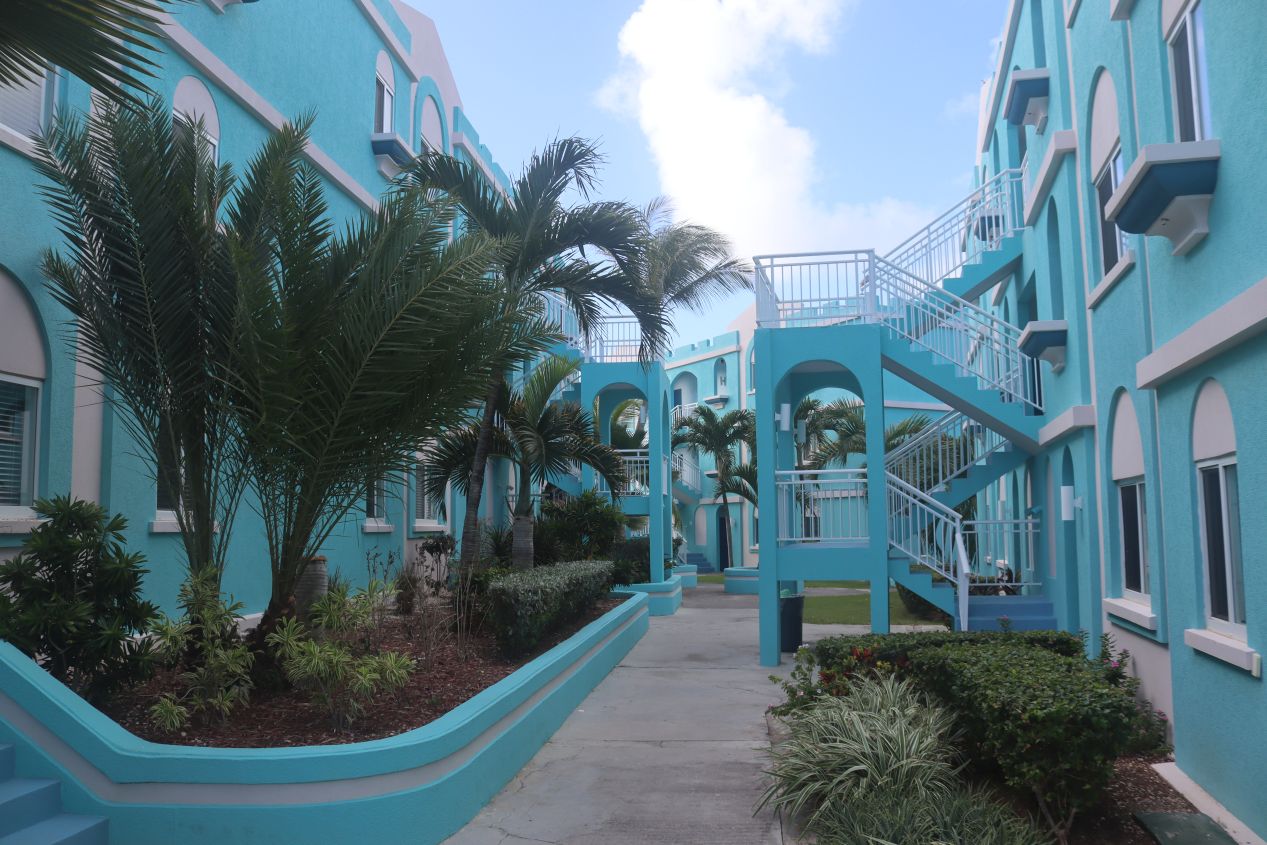


These were some more pictures from around the resort area. Most of the buildings at Oyster Bay used a light blue coloring that gave the place the feeling of a seaside vacation house. There were about half a dozen buildings containing hotel rooms at different price points; we were staying in the central building up on the second floor above the main reception area. There was surprisingly an old cannon on the hotel grounds which was left over from the colonial period of Saint Martin's history. Like most of the little islands in the Caribbean, Saint Martin was contested by various European powers during the 17th and 18th centuries for the production of sugar cane that could only be grown in the tropics.

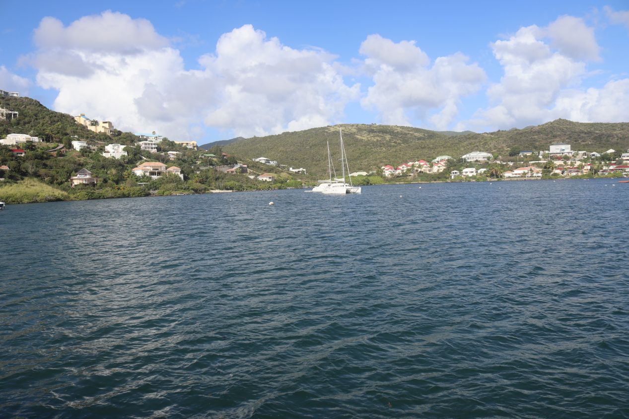


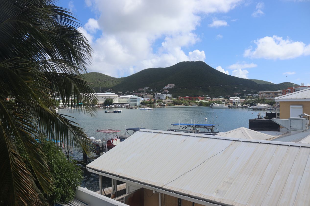
Oyster Bay resort was located next to Oyster Pond, a little inlet of the sea used as one of the dividing lines between the Dutch and French sides of the island. I took these photos looking across Oyster Pond at some of the various hotels and vacation homes that had been built around its shores. The French side of the island captured in the first image was completely indistinguishable from the Dutch side where we were staying. We would later cross over to the French side to eat dinner at a restaurant which was a few minutes away. But first, we wanted to check into our hotel room:


We initially checked into the first room pictured which had a small balcony with a view looking out at the ocean to the east. This would normally have been perfect for the two of us and I'm guessing that the sunrises on that balcony would have been amazing to experience. However, this room was located right above the bar where the hotel was playing loud music and we realized right away that it would be very difficult to sleep later that night. Liz talked to the hotel staff and they were kind enough to move us to the second room which had a more sheltered location away from the bar. This quieter spot gave up the seaside views in favor of a larger room with a small kitchen area and a second bed. It was probably a less expensive room and the resort definitely wasn't at full capacity which is likely why we were able to change.

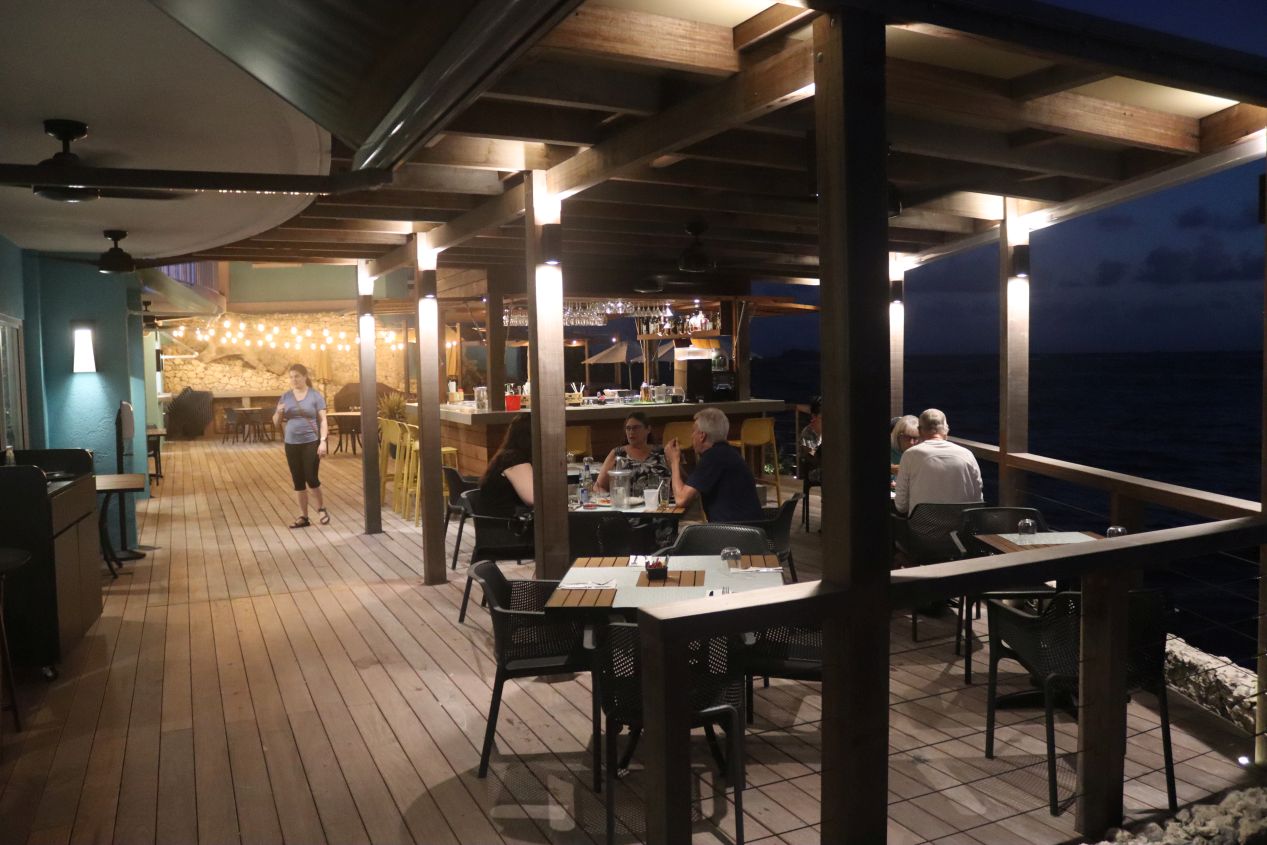


By the time that we had everything sorted out and unpacked our luggage, night had fallen and and the resort area had transitioned into the soft glow of its artificial lights. I was a bit surprised at how early the sun went down in the Caribbean although I think that this was my natural assumption that warm weather equaled long periods of summer daylight. Saint Martin is close enough to the equator that it has roughly 12 hours of daylight and darkness throughout the year, with the seasons mostly affecting how much rainfall the island gets instead of changing the temperature. The evening turned out to be one of the most pleasant times of the day, as we didn't have to worry about getting sunburned in the tropics at night, and we spent some more time walking around the resort getting accustomed to the available facilities. We walked over to the second restaurant named the Veranda which was perched on a deck overlooking Dawn Beach. The water was beautiful at night with the empty beach reflecting back the lights from surrounding hotels. Then we went back to the main restaurant at Oyster Bay which was offering an all-you-can-eat buffet that we were happy to enjoy. Although the quality of this food wasn't the best that I've ever had, the opportunity to load up on Carribean-style chicken and ribs and shrimp made for an excellent meal overall.

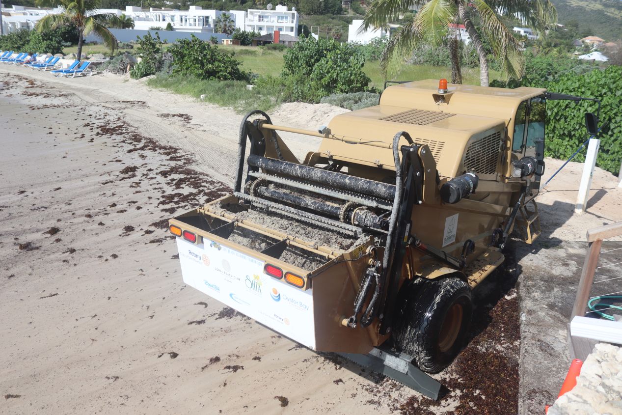


We had breakfast the next morning at the secondary restaurant and this time we were able to see Dawn Beach in the light of day. The beach continued to look picturesque from afar but up close we realized that it was marred by the presence of heavy seaweed. There was a machine working to clean the beach of the seaweed (it was very loud throughout our breakfast!) and the machine did a pretty good job of removing the stuff from the sands. By way of comparison, I have a picture of the same beach from a different morning before the seaweed removal took place to demonstrate just how much of the stuff built up each night. There was enough seaweed here that we didn't spend much time at Dawn Beach despite how close it was to our hotel room. By the way, I also have to mention that we kept seeing little iguanas crawling around on the deck when we ate breakfast in the morning. The lizards were cute and a good sign that we were in a very different environment from our home.


Our main destination for this first full day on the island was visiting Philipsburg, the capital and main administrative center for Dutch Sint Maarten. Philipsburg was founded in 1763 and quickly became a major center of international trade due to its strategic location in the Caribbean. The town sits in a naturally sheltered harbor on the south side of the island and the remnants of two colonial-era forts can still be seen at the entrance to this waterway. Today Philipsburg is best known for being the main port where the big cruise ships dock and many of the visitors to Saint Martin never see anything beyond the streets of the town. Philipsburg is downright tiny for a capital with less than 2000 permanent residents and it had a laidback feeling befitting its status as a tourist destination. We took the pictures above near the public parking lot where we left our rental car; the first image is the administrative building that houses the government of Sint Maarten. Right across the street was an open space where the island holds its Carnival festival each year and a small baseball stadium. There was a group of teenage youngsters rehearsing steelband instruments when we passed nearby that brought to mind my own days when I was part of my high school steelband. No doubt they were practicing for Carnival which was only a few months away from this December visit.

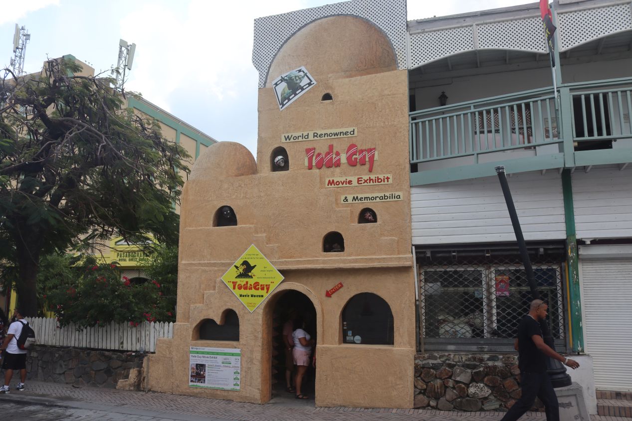


We walked a few blocks south from the government building into the narrow streets of Phililpsburg proper. The small town is particularly known for its shopping and many of the vendors were geared towards higher-end customers due to the presence of wealthy tourists hopping off those cruise ships. In addition to a bunch of jewelry and clothing stores, we also came across the "Yoda Guy" Movie Museum which is dedicated to a bunch of Star Wars memorabilia. It's supposed to be a decent attraction run by someone who worked on the films but we weren't interested enough to head inside. We were more attracted to the Guavaberry Emporium which sold all different types of rum made with the locally grown guavaberry. This store was happy to let visitors enjoy free tastings of several different types of rum and we would have purchased some spirits if there had been any easy way to get them back home. Phililpsburg is small enough that it didn't take long before we reached the end of the shopping district and found ourselves walking along the beach:

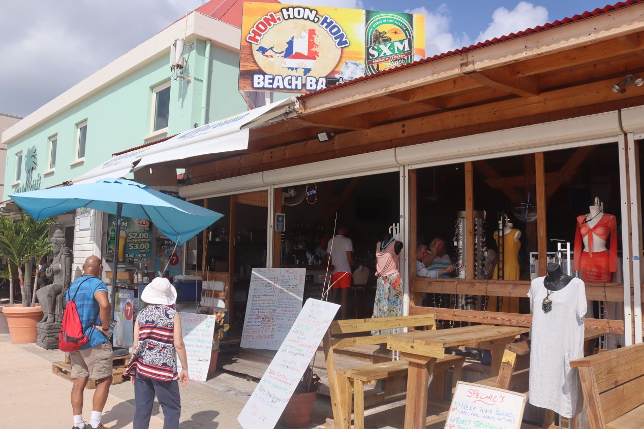


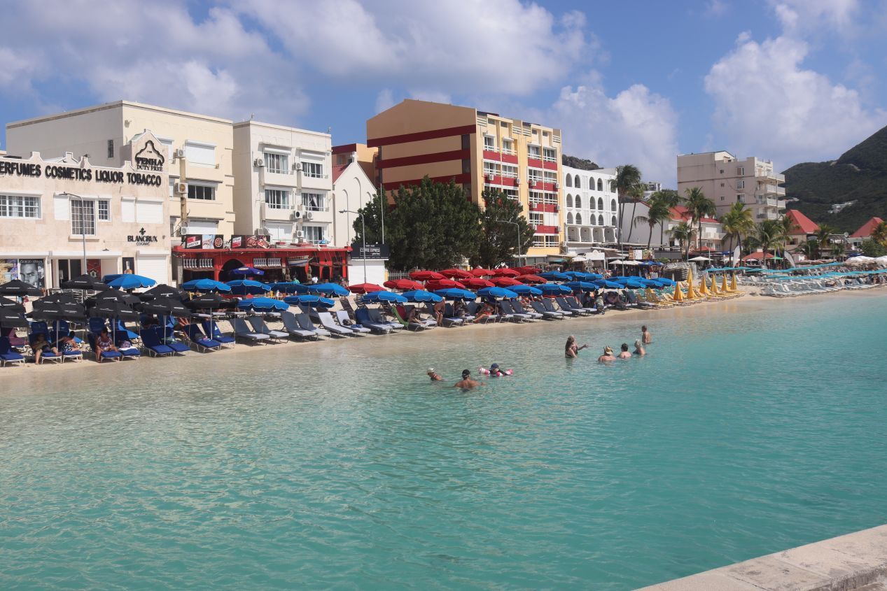
The Philipsburg waterfront had the usual collection of hotels, restaurants, and more stores selling souvenirs. Many of these had creative names and various special deals offering cheap alcohol for tourists; thanks to their heritage of sugar production, the Caribbean islands in this area are also known for their rum. We quickly realized that the eastern side of the waterfront was where the cruise ships docked and figured that the western side would likely have less expensive food and umbrella rentals for the beach. This would also give us a chance to walk the full length of the beach and see which places were most appealing. It was moderately crowded as we walked, with more people here than we had seen elsewhere but clearly nowhere near full capacity. The COVID pandemic had abated somewhat from its worst point while still depressing tourism far below where it would normally be.


More pictures of the Philipsburg waterfront as we strolled along. It was a beautiful day of mostly sunny skies although I have to point out that it was also quite hot with temperatures approaching 90 degrees Fahrenheit / 32 degrees Celsius. That was hardly a surprise given Saint Martin's tropical location but it was a stark contrast to the December weather in the Washington DC area. As we walked, we passed by the main wharf in the middle of the harbor and caught a glimpse of the historic building labeled "Courthouse" which is where the Parliament of Sint Maarten meets. The island has a very small parliament with only 15 total members and control over local affairs within the greater framework of the Dutch government.

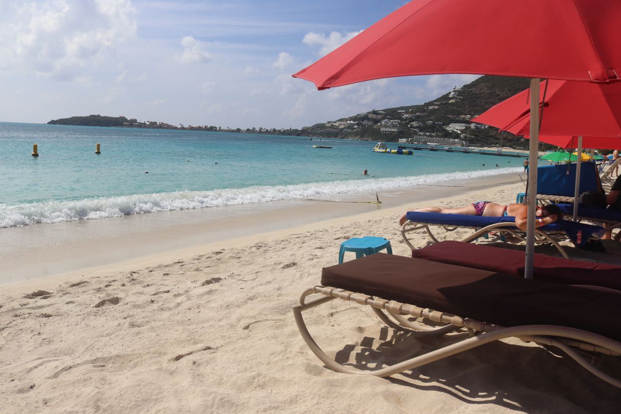


Eventually we reached the western edge of the waterfront and turned around to find a place to relax on the beach. We ended up getting lunch at a restaurant named Castaway which served mostly sandwiches; we were able to rent an umbrella and beach chairs from them as part of a package deal with the food. Our meal was served right on the beach and it was pretty decent aside from having a server who kept getting our order mixed up. We spent a couple of hours relaxing here on the beach and enjoying the warm waters of the harbor. The swimming here was excellent (no seaweed on this beach) and I spent a lot of time in the water. This was the platonic ideal of a vacation in the Caribbean: sitting on the beach under an unbrella while sipping on a cool drink. We stayed until the late afternoon and then headed back to our rental car feeling nice and refreshed. Afterwards, we tried to drive out to historic Fort Amsterdam at the entrance to the harbor but entry was blocked off by a gated resort. We had to be content with taking a picture of Great Bay that captured a panoramic view of Philipsburg.
We had dinner that evening at our hotel over at the Veranda as part of a nighttime wine and cheese tasting experience. We left the camera in our hotel room and thus don't have any pictures to share; it was quite enjoyable and we learned a good bit about different types of Dutch cheese. The following day we traveled to the French side of the island for the first time which I'll skip over for the moment to continue our exploration of the Dutch side of Sint Maarten on our third full day:


This time we drove back towards the airport to visit some of the attractions in the Simpson Bay area. We passed up eating breakfast at our hotel in favor of visiting this restaurant named Zee Best which specialized in serving different kinds of breakfast meals. Zee Best was rated as one of the best places on the island to eat pastries, crepes, and omeletes and this was a convenient day to visit since we were heading to Simpson Bay anyway. Liz ordered one of the special crepes while I had some croissants and bacon since I don't care for the different types of breakfast sandwiches. The food at Zee Best was good enough that we came back to this same restaurant for breakfast on our last day on Sant Martin before flying back home. Definitely recommended for a hot breakfast!


Zee Best was located on a very busy road that runs through the Simpson Bay portion of Saint Martin. The geography of this portion of the island is pretty unusual, with a narrow isthmus of land separating Simpson Bay along the ocean coastline from the inland body of water named Simpson Bay Lagoon. All of this is close to the airport and as a result there's a ton of tourist infrastructure that's been built up nearby. This is where all of the casinos on the island are located which we ignored since we don't have an interest in gambling. Simpson Bay Lagoon is a sheltered place to park boats and therefore this is where the mega-wealthy tend to keep their private yachts. We spotted a bunch of very, very expensive boats docked here. We kept our car parked at Zee Best and walked along the main road for a few blocks until reaching this blue-and-white colored building with views looking out at the lagoon. The building in question was Topper's Rhum Distillery which specialized in the production of rum and has become a local tourist attraction. We walked around the interior of the building and took some pictures:

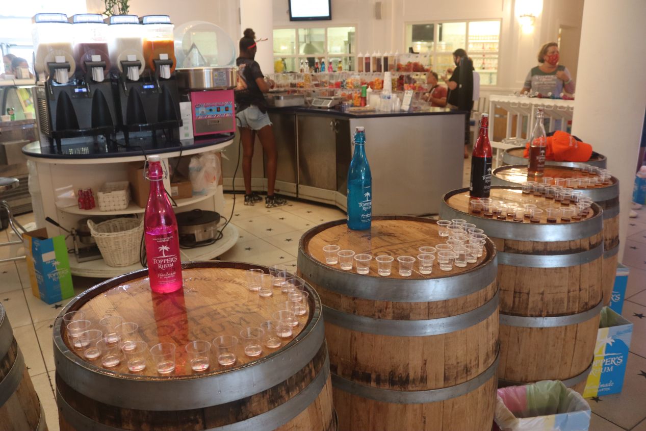


There was no shortage of different types of rum for sale here, pretty much any kind of flavor that customers might want to purchase was available. The bright colors everywhere gave off the feeling of being in a candy store or one of those old time soda shops from the early 20th century. Topper's Distillery was a popular enough tourist attraction that there was a bus of visitors when we arrived and more tourist buses scheduled to show up throughout the day. This was a good thing in one way: the staff told us to go ahead and take as many free samples of the rum that we wanted, and only later did we figure out that they had assumed we were part of the tour. Normally we would have had to pay for a tasting. However, the tour group was also a bit of a bad thing because they had eaten up all of the available slots to take a formal tour of the distillery which we otherwise likely would have checked out. Oh well, we had the chance to sample six different types of rum anyway which was already more than we should have had given that it was only noon. This was another fun place to visit well worth the stop.

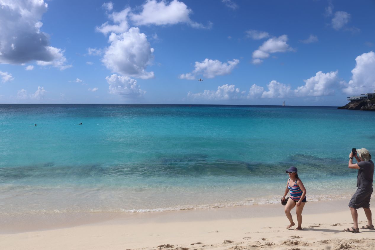


After finishing up at Topper's, we returned to our rental car and drove a short distance past the airport to Maho Beach on the western coast of the island. Maho Beach is famous on Saint Martin for the airplanes that fly directly overhead when taking off and landing at Princess Juliana Airport. The airplanes fly extremely close above the beach, as little as 50 feet / 15 meters over the heads of the tourists below, since the airport runway is located so close to the coastline. People gather every afternoon to watch the big international flights arrive and we wanted to test out the experience from a safe vantage point. There are a bunch of signs warning visitors not to stand too close to the airport runway because the backdraft from the jet engines is extremely powerful and can cause serious injury. People being people, there are always idiots that ignore these warnings and stand right next to the fence where they are often lifted off their feet and thrown into the air by the force of the airplanes taking off and landing. One person actually died from this in 2017 when they were thrown and their head landed on concrete. It was entirely their own fault and people still line up every day to be equally foolish.

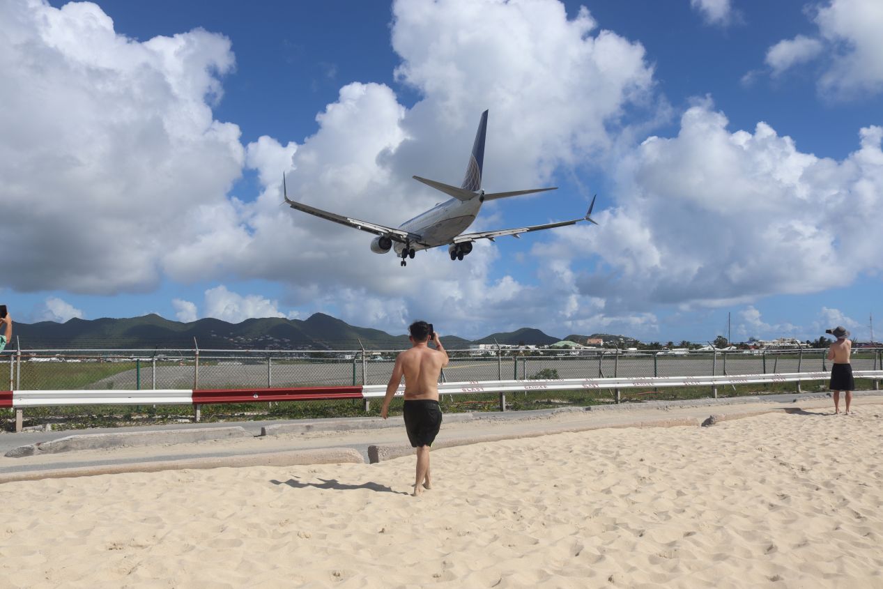


Leaving aside the tourists who act like maniacs, Maho Beach is perfectly safe for visitors and it was a lot of fun to watch the planes land and take off. There was a schedule of flight times posted at one of the restaurants flanking Maho Beach and we were able to find an even more detailed list online at the airport website. We stayed at the beach for about two hours watching the planes and otherwise relaxing in the sun. There were only a handful of the really big international flights but a much higher volume of little prop planes landing on the runway. We could see the planes off in the distance over the water and then watched them grow from tiny dots into huge shapes before they soared overhead at the last second and then touched down on the runway. Fewer planes were leaving the airport than arriving but we did get to experience that as well, with all of the other tourists lined up to photograph or film the process. The one thing that I forgot to do was take some pictures of the planes landing from a distance in order to capture the perspective of how low they were relative to the beach; this picture from Google will have to do.


We left Maho Beach in the midafternoon and drove in a semicircle around the airport over to Simpson Bay proper to eat a late lunch and spend some more time by the water. We were quite close to Maho Beach as the crow flies but had to drive a circuitous route due to the weird geography of the island and the intruding presence of the airport runway. The restaurant in question was named Karakter Beach Bar and the food here was excellent; I ordered a pasta dish while Liz had tuna with fries and a salad. Karakter wasn't crowded at all (partly because we were eating lunch at 2:30 PM in the afternoon) and they were happy to let us remain seated for several hours relaxing by the water. There were even two dogs here, one brought by another customer and one associated with the restaurant itself. As these pictures demonstrate, this beach was essentially deserted and I spent about an hour in the ocean while Liz relaxed at our table. There was one oddity here: the beach was very steep with the sand plunging at an angle down into the water and then continuing with a rapid dropoff in the sea. I'm guessing that this is probably an artificial beach and it was designed with a steep angle to protect against erosion or something like that.
There was one more activity that we had planned for the day: riding horses at the only stables located on the Dutch side of the island. We had an evening reservation to go horseback riding and the location was only a couple of miles away from Simpson Bay Beach. We left in plenty of time to arrive at the stables only to hit a terrible traffic jam while driving back through Simpson Bay right near Zee Best and Topper's Distillery. This was a full-blown standstill of traffic, cars sitting in place for minutes on end with no movement whatsoever. I was not a happy camper over the thought of losing our horseback riding reservation (which was not cheap!) and this was the worst part of our vacation experience. Finally the traffic started moving and we were able to make it to the stables just in time, arriving at 5:00 PM on the dot instead of half an hour ahead of time as we had planned.

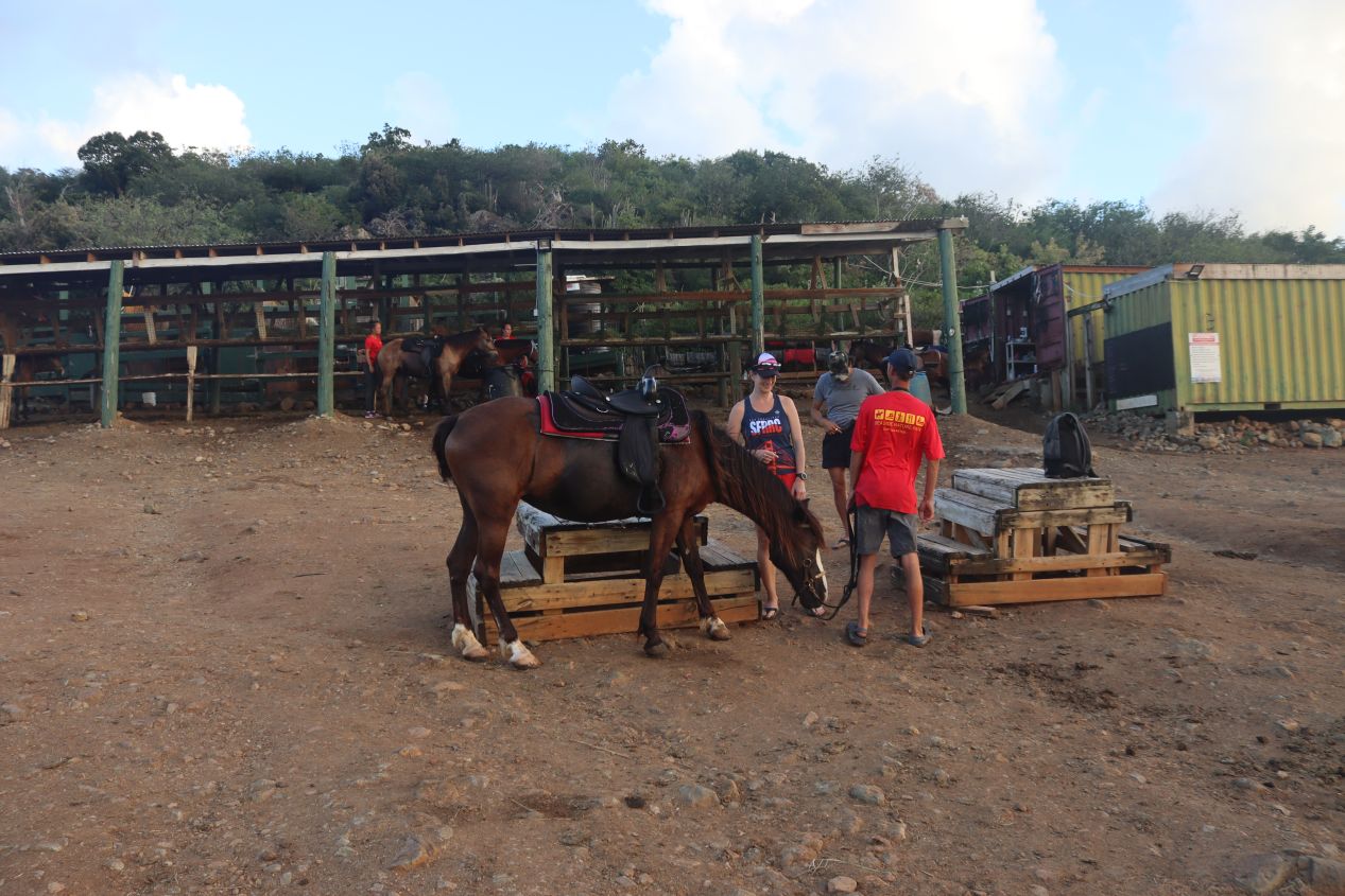


The horseback riding was provided by Lucky Stables which bizarrely happened to be located next an industrial power plant complex. We thought at first that we were going to the wrong location but no, Google Maps did indeed take us to the correct place. We were taking the sunset trail ride which lasted for two hours and included champagne to drink while watching the sun fade from the horizon. (Alcohol and horseback riding are far from the best combination but this was a sedate trail ride that never went above a gentle walk.) There was only one other couple from San Francisco on this trail ride which made for a relaxing and friendly experience. Liz was given a horse named Prince while I had a horse named Electra, and we probably should have had our horses switched because Electra kept trying to cut in front of Prince in line. Liz is a much better rider than me and she would have been better able to keep her mount under control. It was amusing how my horse kept trying to slip up to the front of the group over and over again even though I was riding in the rear.

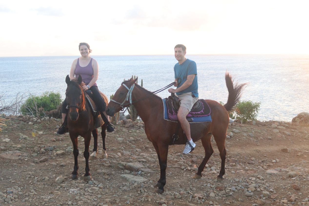


We rode for about half an hour as the sun dropped down over the sea in the west. It was a wonderful evening to be out on a trail ride and we were treated to a beautiful sunset off in the distance. The trail led us up into the hills overlooking Cole Bay where Lucky Stables was located and eventually we stopped at a picturesque overlook. Our guide tied the horses to a hitching post and built a small fire for roasting marshmallows while we sat drinking champagne. After the stressful drive over from Simpson Bay, this was a deservedly relaxing way to close out our day.

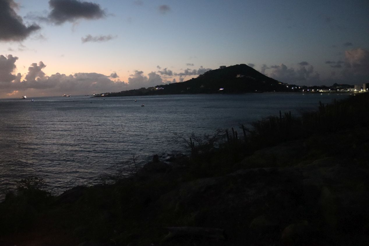


While we sat in front of the fire, we spotted a cruise ship leaving the main port in Philipsburg and heading out to sea en route to another island in the Caribbean. We were also easily able to see the island of Saba off in the distance (visible in the first picture above) which is an even smaller island than Saint Martin also owned by the Dutch. After half an hour of enjoying the fire, we mounted the horses once again and continued the trail ride in a loop that headed back to Lucky Stables. This was the first time that I had ridden a horse in the dark and I can't say that it was a great experience. The trail ride was less fun when it was difficult to see much of anything because we were heading through an area with no lights. Soon enough we were back at Lucky Stables and it was time for the other highlight of the trail ride: taking the horses for a swim in the ocean. Horses are good natural swimmers and as herd animals they'll basically follow the lead horse anywhere. We obviously couldn't take our cameras along for this portion of the ride and therefore have no pictures, but after dropping off our belongings we followed our guide into the surf along the beach. Electra took this opportunity to cut right to the front of the line and I wasn't willing to try stopping her given that we were plunging waist-deep into the water. The horses handled the ocean just fine and we spent a couple of minutes looping back and forth as they swam, with the water coming up to about my knees (i.e. about neck-deep for the horses). The whole thing was a little bit weird but fun to experience nonetheless. I wish that we'd been able to get some pictures of what this looked like!
That was the conclusion of our last full day spent on the Dutch side of the island. We would spend several days exploring the French side of Saint Martin which was significantly more European and less American in its feel. The French portion of Saint Martin is the focus of the next page.


