
After leaving Quebec City, my trip was heading next into the hinterlands of eastern Canada. While this particular day wasn't quite as busy as some of the others on my itinerary, I would be heading further northeast into the region of the Saguenay Fjord, formed by the Saguenay River that runs between Lake Saint-Jean and the Saint Lawrence. This is an area of great natural beauty with high cliffs surrounding the deep river, and I was planning to do some hiking during the day in one of the local parks. After that, it was another long drive to the south and east until reaching Rivière-du-Loup where I would be staying for the evening.

Quebec City itself is already a little bit off the beaten path, and as soon as I left the city to the north, I found myself entering into some rather remote regions. The small city of Saguenay is located about 210 kilometers (130 miles) to the north of Quebec City, a drive of roughly two hours. I wasn't heading there, however, but instead aiming for the parkland running along the southern edge of the fjord. This drive took me east along Canadian highway 138, and the traffic disappeard almost completely when I turned north and headed along the much smaller route 381. This road traveled through a densely forested region with few signs of human habitation. Outside of individual houses and the very occasional small town, it was nothing but an unbroken procession of trees. This made for a pleasant drive as long as there was no emergency need to stop.

Here's a map of Saguenay Park, written entirely in French since this was all taking place in Quebec province. I was heading to the Eternity Bay (Baie-Éternité) region, circled on the left side of the picture above on the south side of the fjord. This section of the park featured a hiking trail that ran to the edge of Cape Trinity, where a statue was built dedicated to Our Lady of Saguenay. I thought that would make for a good afternoon hike, and it would provide me with excellent views of the fjord from the cliffs overlooking the water. Afterwards, I would head over to the town of Tadoussac on the north bank of the fjord and check it out, then return back to the south side and drive towards my hostel for the night.

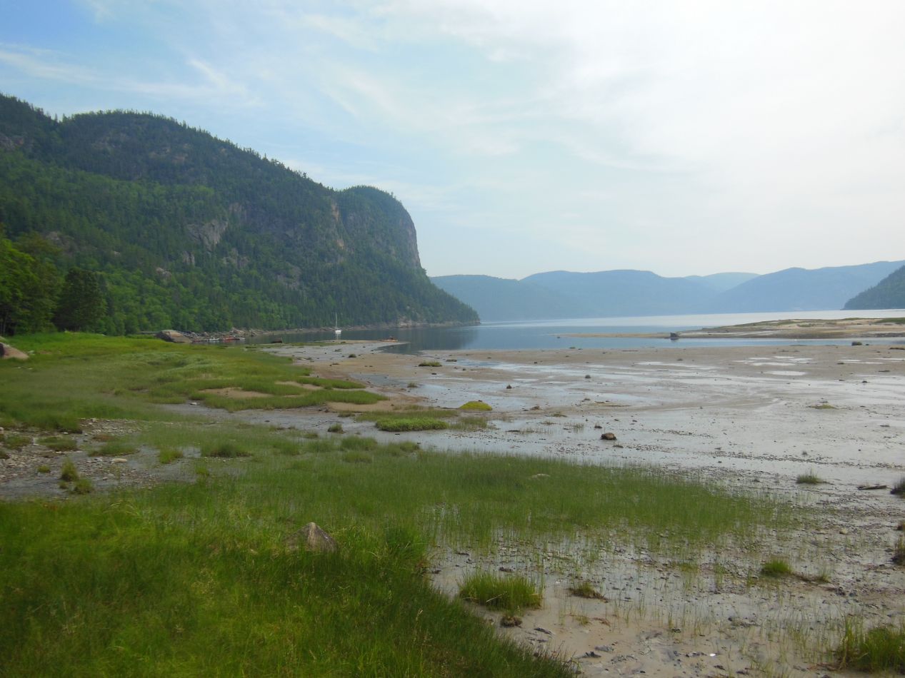


I arrived at Saguenay Park in midmorning. After parking my car in the mostly empty lot, I headed off to explore the nearby trail. The sign above showed that I was in the right place, and the distance to the statue was only 3.5 km (a little over 2 miles). However, the sign indicated that the path was "difficile" and that proved to be correct, as I would discover that the hiking trail was quite steep. In the meantime, I was able to see views of the southern end of Eternity Bay, and the sights didn't live up to the elegant name attached to them. It turned out that I had arrived here at low tide, and like the Bay of Fundy that I had visited a few years earlier, Saguenay Fjord has some of the most dramatic tides in the world. It's not unusual for the water to level to change by 10-15 feet between high and low tide in this area. I was seeing the mud flats exposed by low tide at the moment, and they weren't particularly attractive.

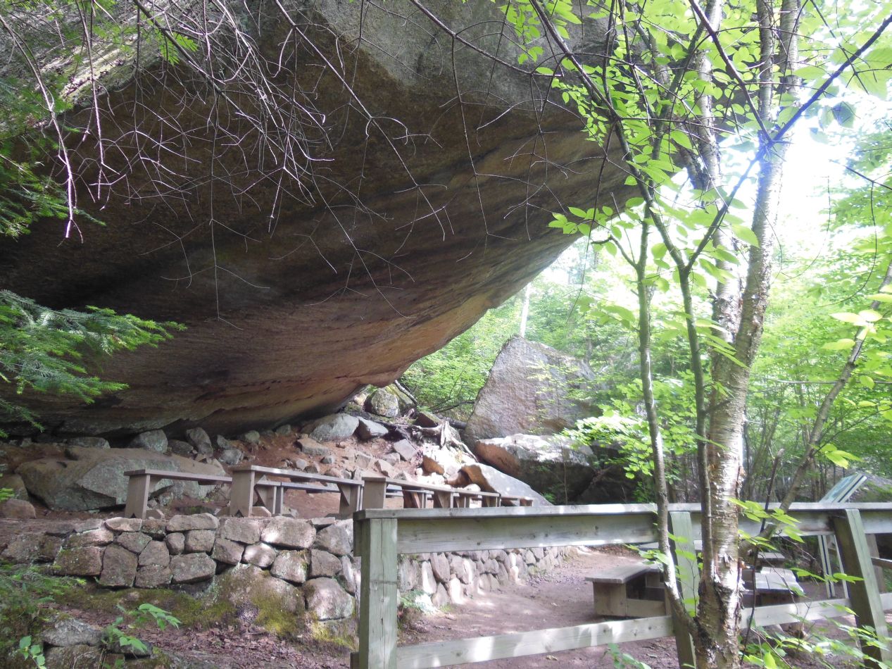


The trail to the statue began climbing uphill almost immediately. It was a beautiful walk upwards, with the morning sunlight dappled into small patches by the leaves overhead, with few other people on the trail at this time of day. The path was far from easy, however, as the march gained several hundred feet of elevation as it wound its way to the north. There were plenty of rewards for the exertion along the way, starting with a small outdoor theatre that had been built underneath an overhanging rock. That thing looked precarious and likely to tip over an any moment, but I knew it had to have stood there for years. As I made it higher up I was able to see further and further into the distance, both out into the waters of the fjord and looking back towards the entrance area. The tide was beginning to come back in, and I could already see those mudflats starting to be subsumed under the much prettier blue waters of the fjord.


After close to an hour of hiking, I came across a sign that indicated the statue was 800 meters ahead. This was near the top of the trail's elevation gain, and it was mostly downhill from this point to the statue itself. A wooden railing had been built here to help visitors manage the descent, and one or two places had stairs where the hill became particularly steep. After a little while longer of hiking, I reached the head of Cape Trinity and finally spotted the statue itself:

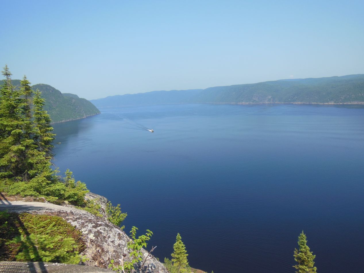


The statue was named Notre Dame du Saguenay, Our Lady of Saguenay in English, and it has been situated on this spot since 1881. It stands 9 meters tall (about 30 feet) including the base, and has been used as a navigational aid and symbol of good luck for mariners traveling this waterway since its construction. According to a little sign posted next to the statue, the builders had a terrible time getting the statue up to the top of the cape. It fell off of the boat transporting it - fortunately floating since it was made out of wood - and then had to be disassembled and carried by hand up to the top. This vantage point was breathtaking, with a clear view of across the fjord and for a long distance to both east and west. This is a deep water channel and whales often swim into it; one thing that I had considered doing was going on a whale watching tour. There was a boat coming in from the west, which looked microscopic against the huge expanse of water surrounding it on all sides. It was quite a reward for making the hike out to this spot.
The hike back proved to be much easier going. It was mostly downhill and that inherently meant less strain on my legs. One other thing that was different were the people; unlike the hike outwards where I saw few other travelers, there were lots and lots of people on the trail now, most of them struggling slowly uphill as I skipped past them in the opposite direction. I was getting tired of hailing them with "Bonjour" and "Merci" by the time that I reached the bottom. Even the parking lot was full by the time that I pulled out to leave. This was a Saturday and it seemed that a lot of people from the city of Saguenay were enjoying the nice weather outside at the park.

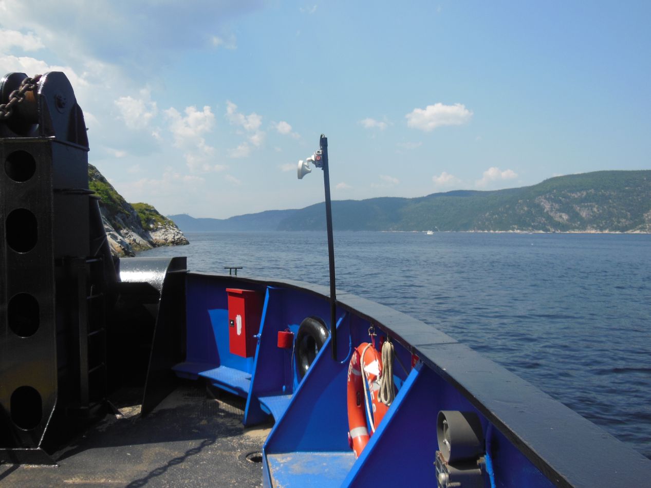


After more backtracking on the road, I made it around to the eastern edge of the fjord. There's an interesting phenomenon here: highway 138 simply stops at the mouth of the Saguenay River and picks back up again on the other side. A ferry service takes cars across the intervening waterway, and even better, there was no fee to make the trip. I didn't have to wait very long before I drove my car onto the ferry and then took the five minute trip across to the other side. Up close, the water was a very dark blue and cold to the touch.

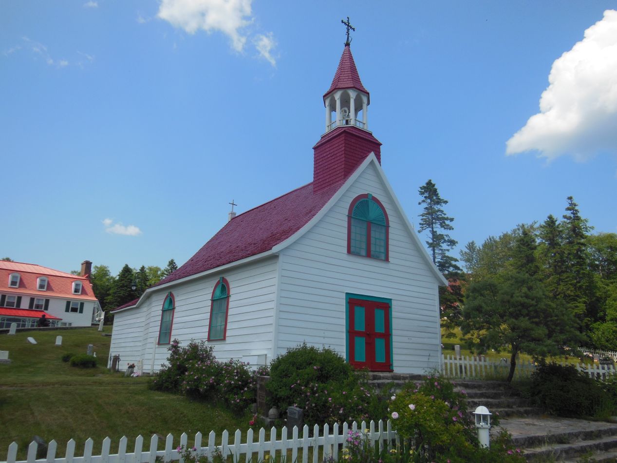


The town of Tadoussac stood at the northern end of the ferry service. This place is best known for the role it played in the early colonial period, where it was the site of a trading post between the French and the First Nations people living in the northern Saint Lawrence region. There was a permanent French presence in this region since the year 1600, although the initial French settlers numbered only in the dozens, not the hundreds or thousands. Today Tadoussac is a sleepy little town that sees an infusion of tourists in the summer, and likely remains almost empty for the rest of the year. The highlight was the Hotel Tadoussac, a two-story white building with a central belltower. The place is known for its distinctive red roof and dates all the way back to 1864. There were also a number of reconstructed wooden buildings designed to replicate the French trading post from the 17th century, the original buildings long since having crumbled to dust. This was a place that seemed to want to live in the past during the days of the New France colony. The other attraction was apparently the beachfront area, although the water was cold enough that I didn't think swimming would be too pleasant. (As always, some kids were in the water regardless.) This looked like a beautiful place to take a trip out on a boat, either on a pleasure cruise or in the hopes of seeing some wildlife.
Now the original plan had been to travel further up the northern coast of the Saint Lawrence to Baie-Comeau and then drive north into Labrador from there. However, I had been forced to change those plans due to the huge wildfires burning up in Labrador that made traversing the Trans-Labrador Highway impossible. Instead, I had to take a highly inefficient route through Quebec, New Brunswick, and Nova Scotia to reach Newfoundland via the ferry route. For this day, that path meant traveling back down to the south, through Quebec City and across the bridges there, and then along the southern edge of the Saint Lawrence to the small city of Rivière-du-Loup.

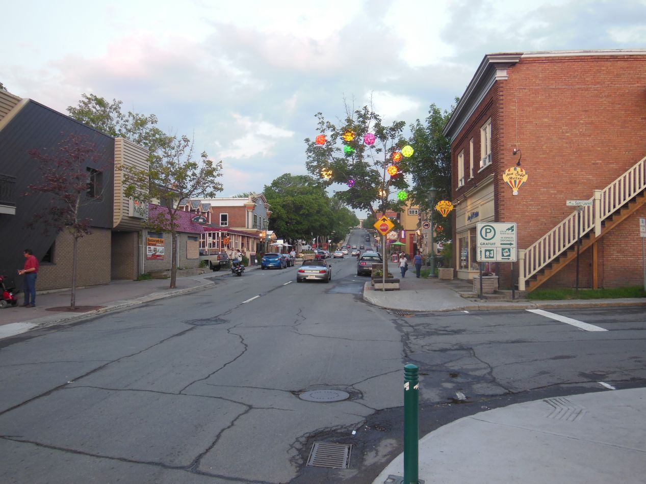


I didn't reach this destination until the onset of evening. After parking my car and checking into my hostel for the night, I decided to walk around the downtown area a bit and see what I could find. Rivière-du-Loup seemed to be a pleasant small city with a very walkable downtown area. This wasn't a major tourist attraction in any way and was well off the beaten path; I had no difficulty getting a room at the local hostel even though I only called two days ahead of time. They didn't seem to be terribly busy. With the sun already set and the sky darkening in the west, I came across the most interesting spot in town, Waterfall Park (Parc des Chutes), containing a good-sized waterfall. There were several walking trails here and I would have spent more time exploring them if it hadn't been getting dark already. I enjoyed getting a chance to snap some atmospheric pictures, like the one above of a bridge over the water with a single pedestrian silouetted against the darkening sky.

I did not take any pictures at all the following day. This was a pure driving day, as I needed to travel from the Saint Lawrence region over to the northern edge of Cape Breton Island, where I would be catching the ferry over to Newfoundland. The drive traversed a distance of more than 1000 kilometers (625 miles) and took the entirety of the day. There was little to see along the way, and I had passed along most of this route on my previous trip through Maritime Canada a few years earlier. I finally reached North Sydney in the late afternoon, where I ate dinner and went to bed early. My car had to be lined up at 3:00 AM the next morning to get on the ferry, and that meant it was going to be a very early start. Next stop: Newfoundland.


