
As the second week of my trip got underway, I was about to leave the open plains of Iowa and Nebraska behind and head into the mountains for the first time. My main destination for the day was Rocky Mountain National Park, located across the border in Colorado and one of the most popular tourist attractions in this part of the country. Unlike a lot of my previous stops off the beaten path, Rocky Mountain National Park is very much a big draw and I knew that this was a day where I would be seeing a lot of other tourists. My plan was to spend the morning hiking in the park and then drive to Denver in the afternoon to see a bit of the city's downtown area before attending a baseball game that night. I had scheduled my vacation to arrive in Denver on a weekend when the Rockies were in town, and this was my chance to visit yet another ballpark and compare it to the others that I'd seen on past trips. As I mentioned on the previous page, this was a day where I would be seeing the Colorado Rockies in two senses of the term.
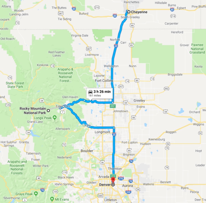
While the entrance to Rocky Mountain National Park isn't that far as the crow flies from Cheyenne, getting there in practice takes a lot longer due to the mountainous landscape. There's no way to make good time on the narrow, winding roads that head up into the elevated terrain, and I knew that it would take at least two hours to do this drive. I left early in the morning again as a result, trying to beat the crowds that would fill up the parking lots by waking up at 5:30 AM to begin the drive south. I was treated to a beautiful early morning sunrise as I left Wyoming behind, with the cloudy sky lighting up with an artist's easel full of colors. It's never easy to take pictures while driving and the one that I threw in here doesn't do the sight justice.
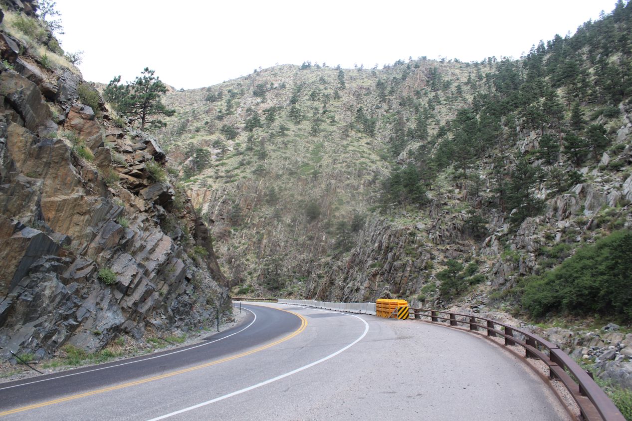
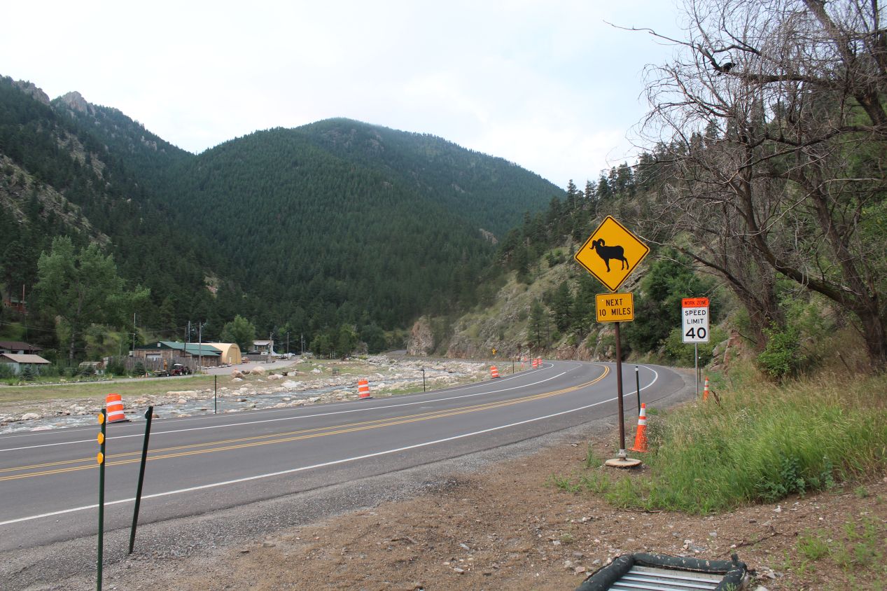
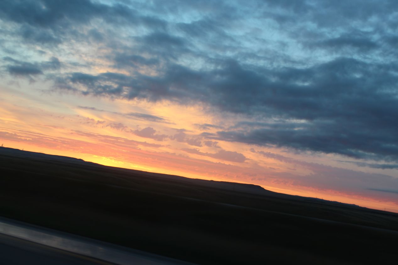
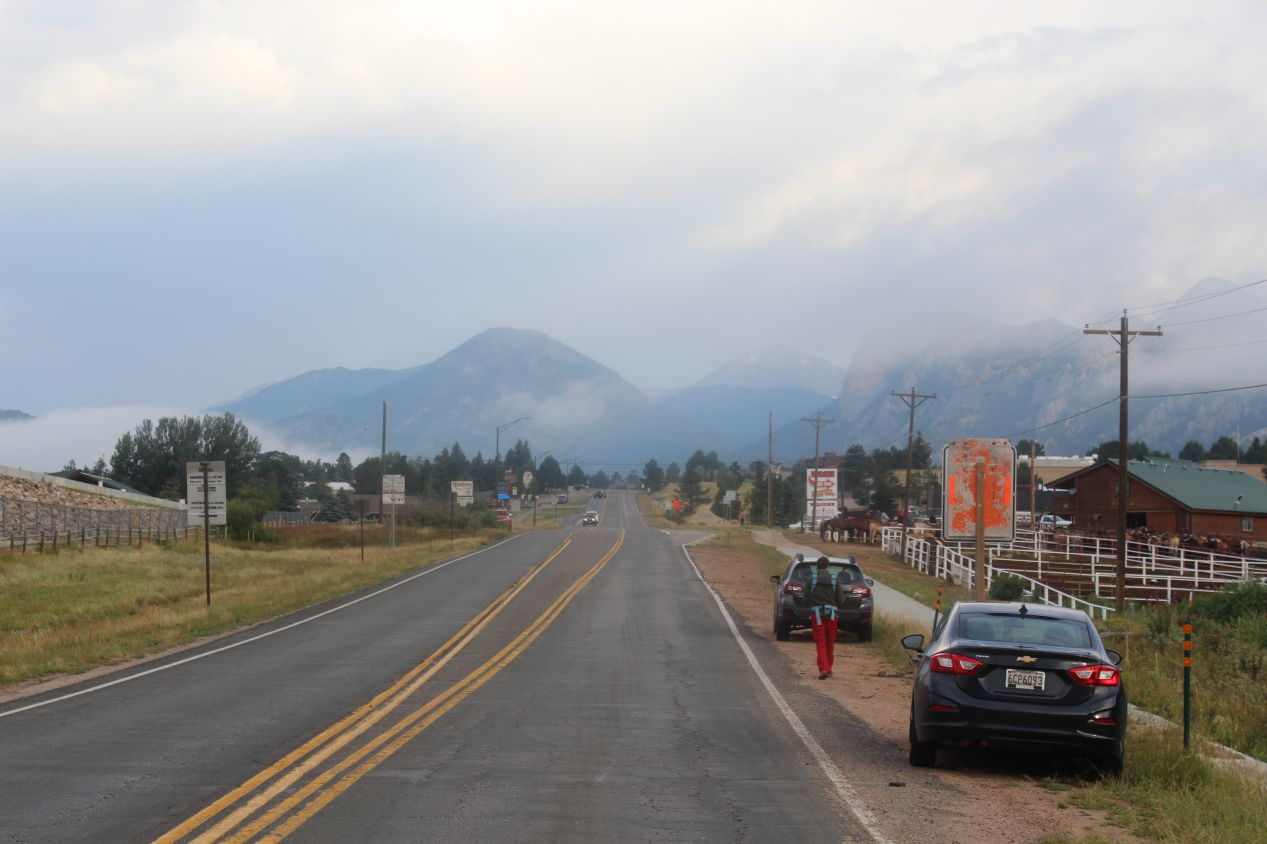
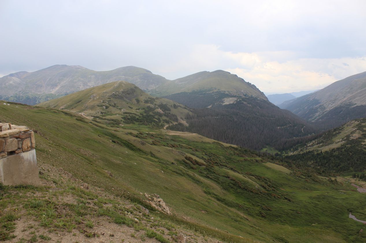
I drove on the interstate for about an hour and then headed west on Colorado state road 34 en route to Rocky Mountain National Park. These were some of the images that I captured along the way, as I passed through a series of forests that were only lightly inhabited by people. At times, rock walls rose up on either side of the road as it traveled through a series of canyons, with a river running alongside the road that had evidently done the original carving through stone. At other times, the rocks gave way to hills covered with a vast sea of evergreen trees. It was always hilly as I drove west, and increasingly some of the hills began to rear large enough that they might be better described as mountains. I kept an eye out for wildlife along the way, and ultimately I did spot a fine example as I approached the outskirts of Estes Park:
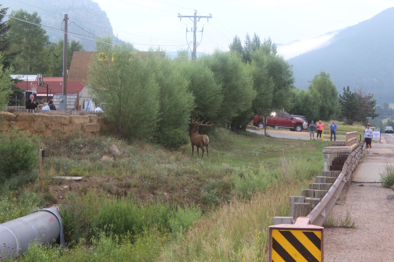
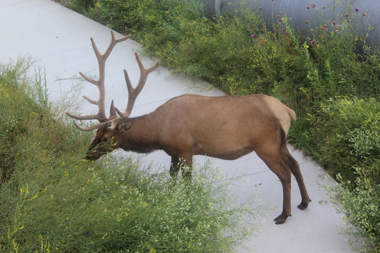
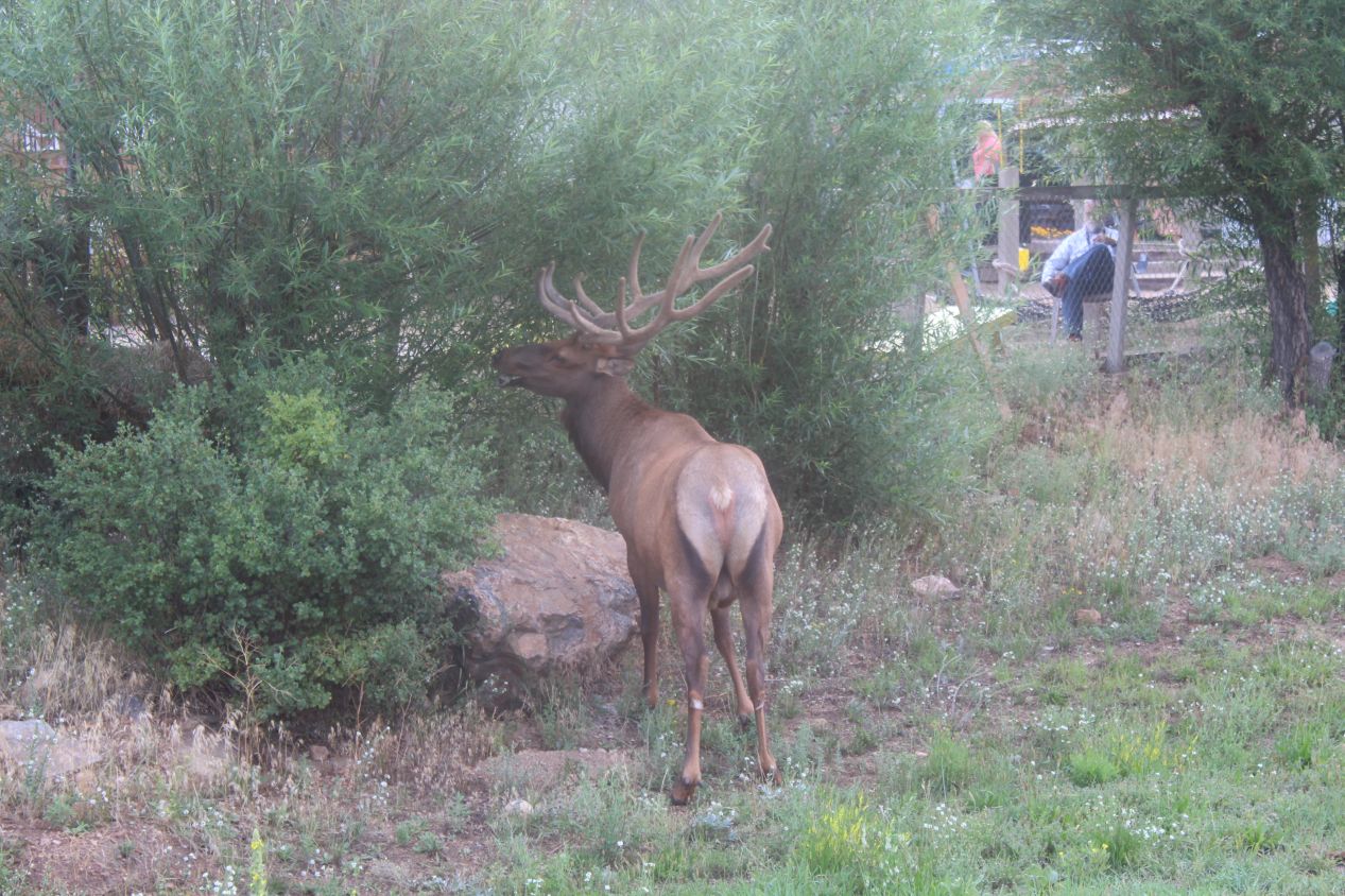
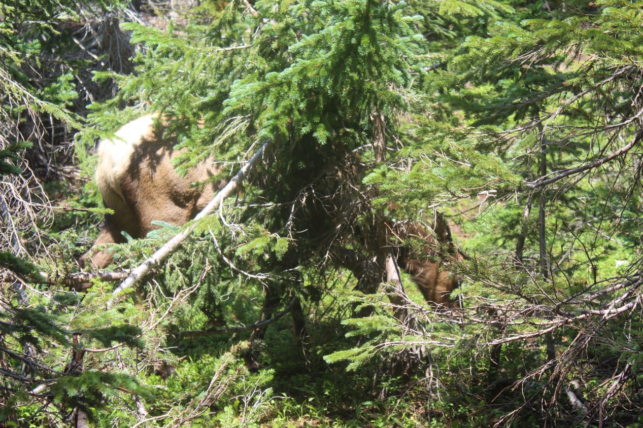
Estes Park is a town nestled in a mountain valley located just outside the entrance to Rocky Mountain National Park. I had been here before in 1991 when I went on a family trip to Colorado as a child, and the town had increased in size significantly in the quarter century since my last visit. While the permanent population of Estes Park is only about 5000 people, more than 2 million people pass through the town annually to visit the national park, and there's a sizable local industry in the form of restaurants and hotels and activities designed to cater to the visitors. It was somewhat ironic that I came across this pair of elks on the outskirts of the town rather than in the wilderness that I had been passing through, but I might have missed them if it weren't for the other people who had stopped their cars to take pictures. As best I can tell, this was a pair of Rocky Mountain elks who had decided to get some morning breakfast along the side of the road. One of them was happily munching on some branches near a restaurant, and then a second animal was down below on a walking path that ran underneath the road. They were not bothered by humans at all and I was able to get within about 30 feet (10 meters) of the one below. They must have been males due to their magnificent antlers which would also help to explain why they were off by themselves. This was a great start to the day: I hadn't even entered the park yet and I already had my first wildlife spotting!
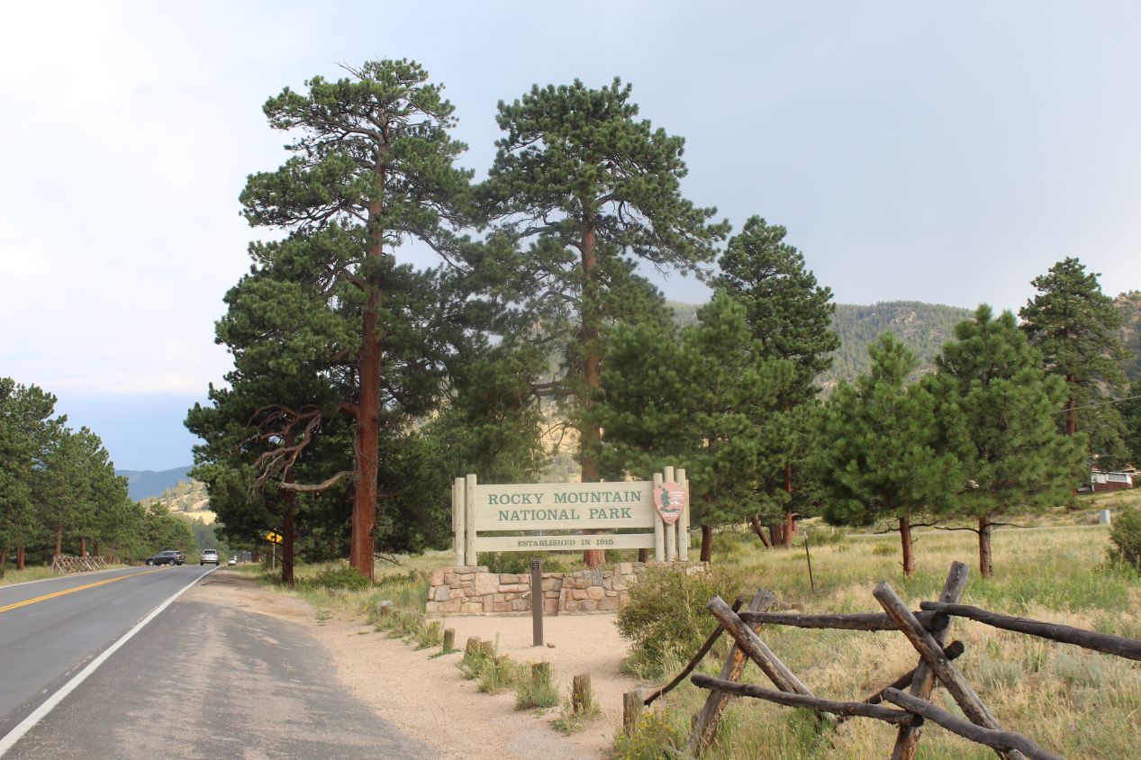
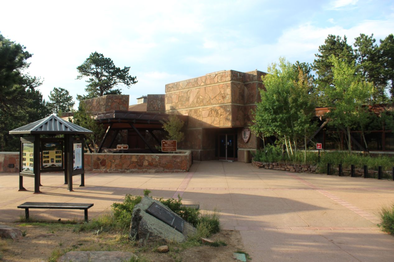

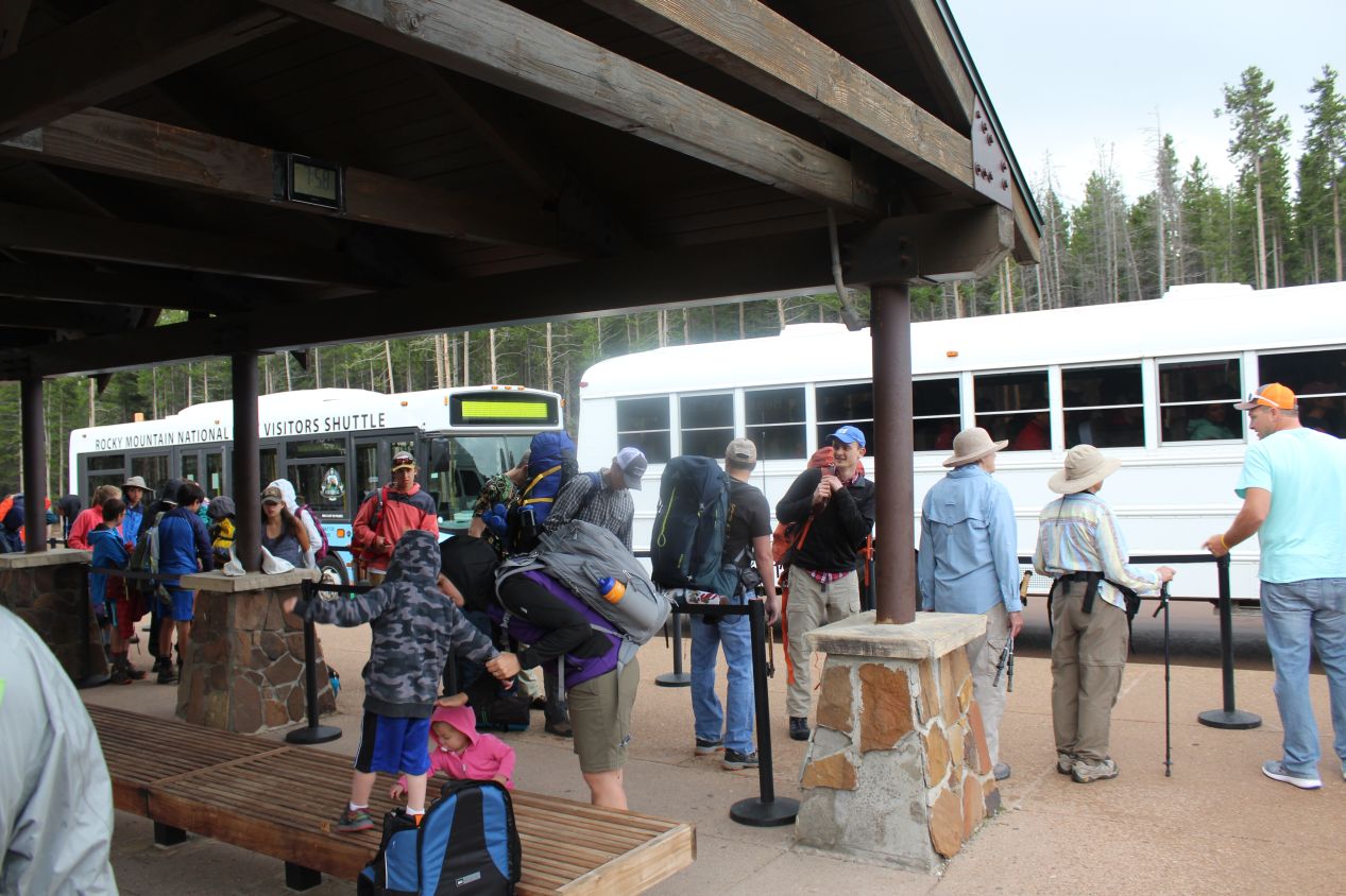
I arrived at the entrance to Rocky Mountain National Park at around 8:00 AM. This is one of the oldest national parks in the United States, dating back to 1915, and as I mentioned also one of the most popular. The particular specialty of Rocky Mountain National Park is the presence of dozens of tall mountains, with 60 different peaks topping 12,000 feet (3600 meters) in elevation and a handful of them cresting the 14,000 feet (4250 meters) mark. This is also one of the few places in the United States that has paved roads that reach high elevations, and therefore makes them accessible to the general public. The visitor center was closed at the time of my arrival since it was still early in the day, but the park itself was far from empty. In fact, it was already so crowded that the small parking lots near the hiking trails were all full, and I was forced to park in the Glacier Basin satellite lot and then take a shuttle bus to the trailhead. As you can see, there were dozens of people present despite the early hour, and I was forced to wait in line until there were enough buses to pick up everyone. I can only imagine what it would have been like in the middle of the day - I might not have been able to go hiking at all.

Rocky Mountain National Park is gigantic and you could easily spend weeks here without seeing more than a small portion of the park grounds. There are more than 70 official trails that range in difficulty from easy strolls to some of the most punishing mountaineering available. I had researched what would make for a good day hike and ended up choosing the Sky Pond Trail, one of the most popular offerings in the park. The Sky Pond Trail leaves from the Glacier Gorge Trailhead in the south-central portion of the park and runs past three different mountain lakes before terminating at its namesake of Sky Pond. The roundtrip length is about 9 miles / 15 kilometers and there's some serious elevation gain along the way. To make things more interesting, the whole hike is also done at high altitute where the air is thinner and many people can experience a feeling of dizziness. I had done longer hikes before on past vacations but I knew that this was going to be a strenuous walk.
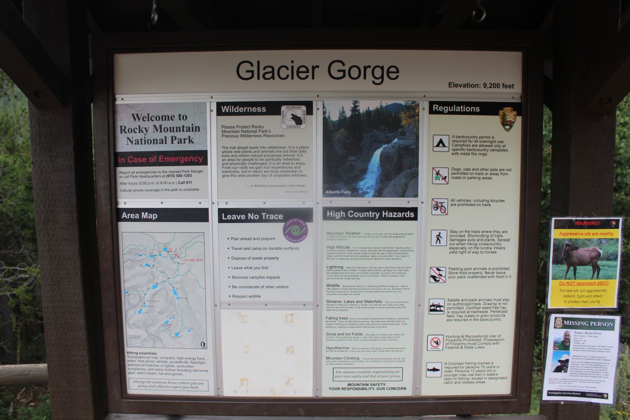
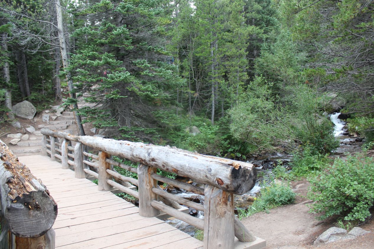
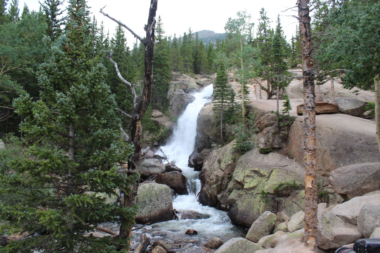
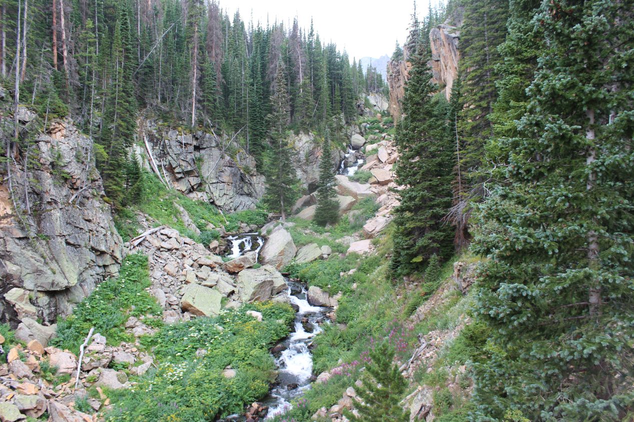
Things started out simply enough. I was one of the few individuals to exit the packed bus at the Glacier Gorge Trailhead, with most of the people choosing to continue on to Bear Lake, and I was fine with that. You generally don't want to be the only one hiking on a trail but it's also nice not to be too crowded. The trail headed through a dense evergreen forest to start, frequently following the path of a little river and crossing over it on a wooden bridge at one point. There was a gentle uphill slope but it wasn't too noticeable for the most part. After about a mile, the trail passed next to a 30 foot / 10 meter waterfall known as Alberta Falls. This was a place where the same river that I'd been following in reverse plunged over a series of rocks and tumbled down into a canyon below. It was quiet and peaceful on the trail to this point, with the only irritation coming from occasional short rain showers that would last for a few minutes and then dry up. This weather had forced me to bring a light jacket that I would have rather left back in the car.
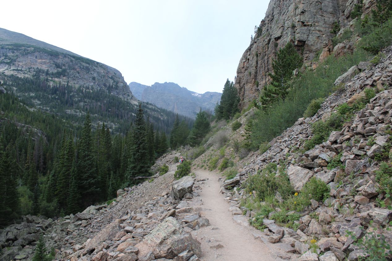
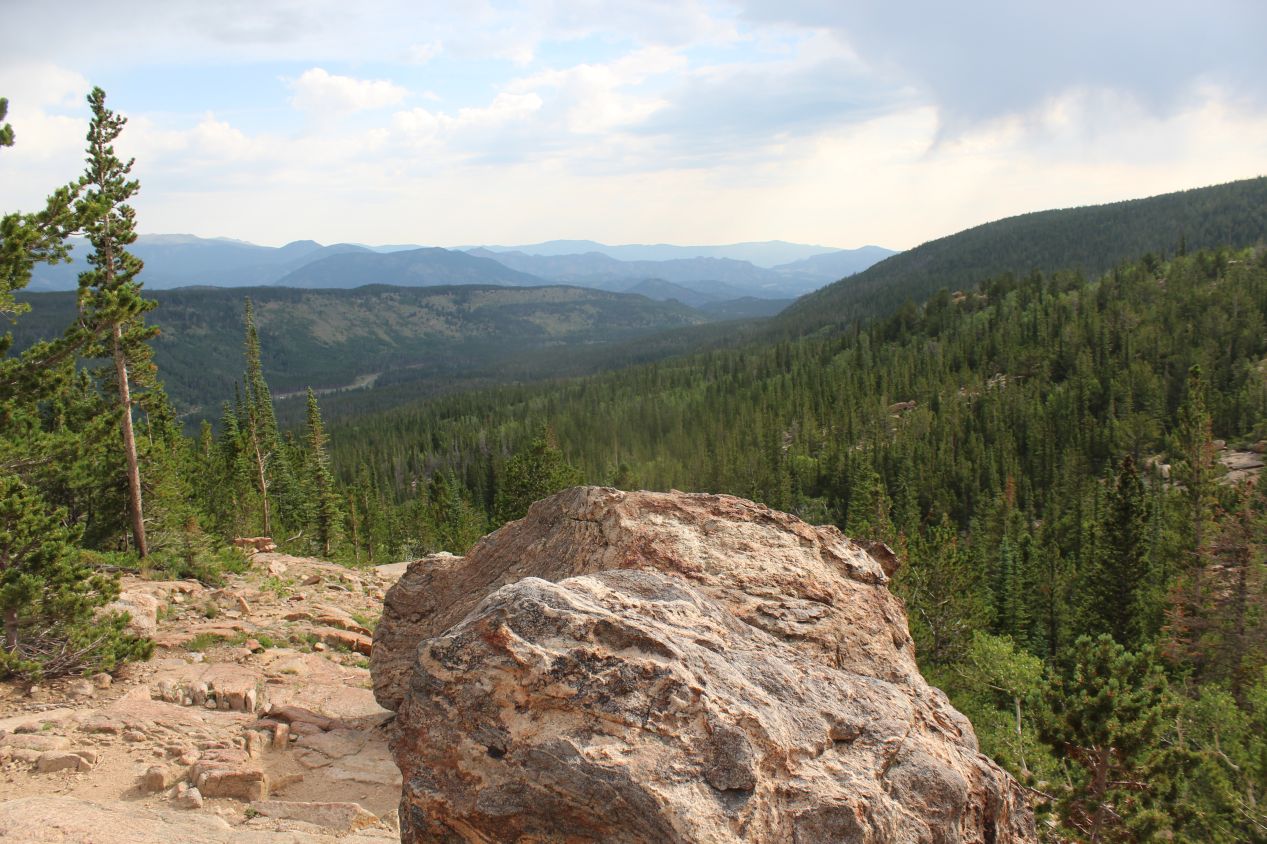
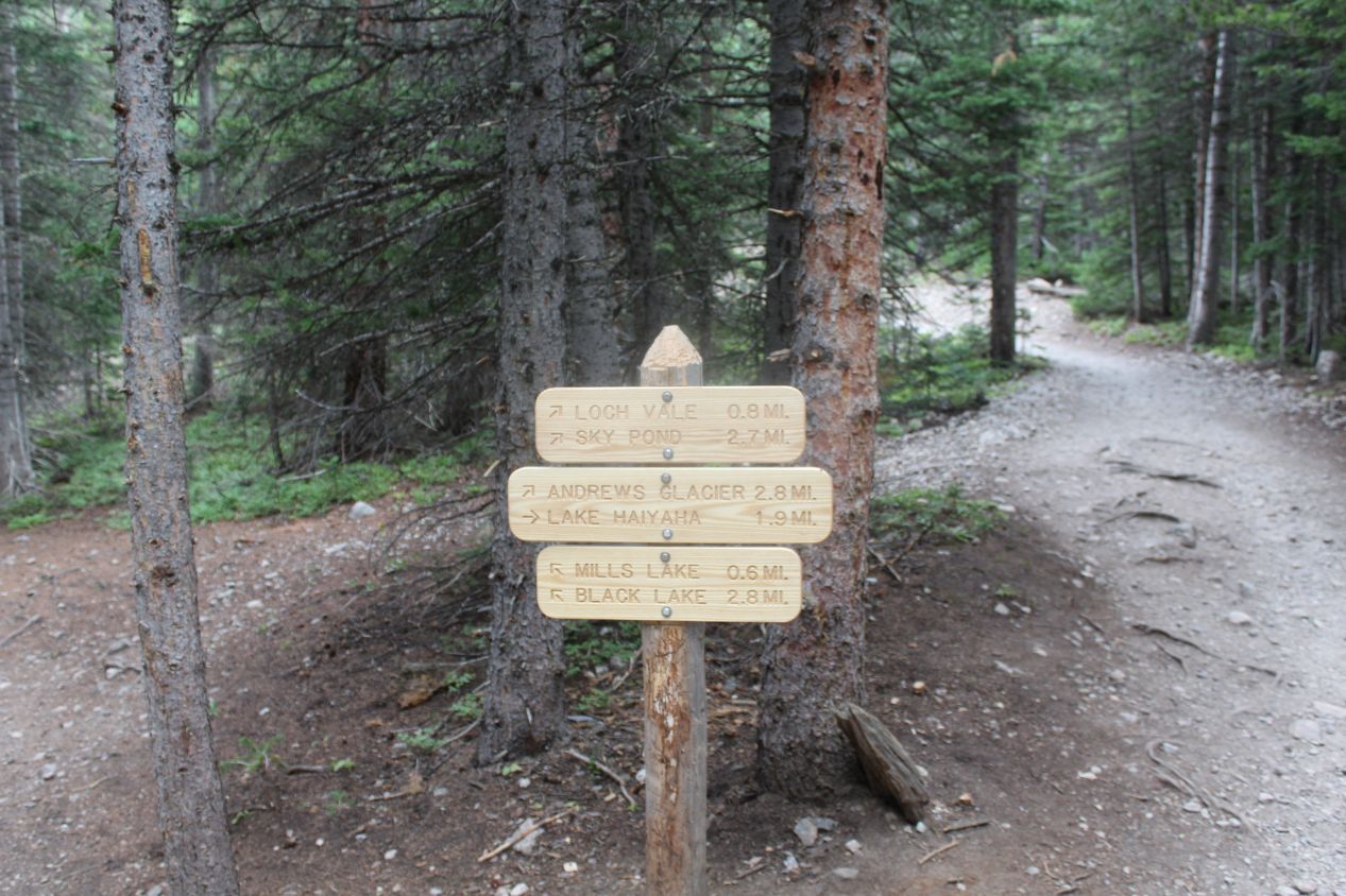
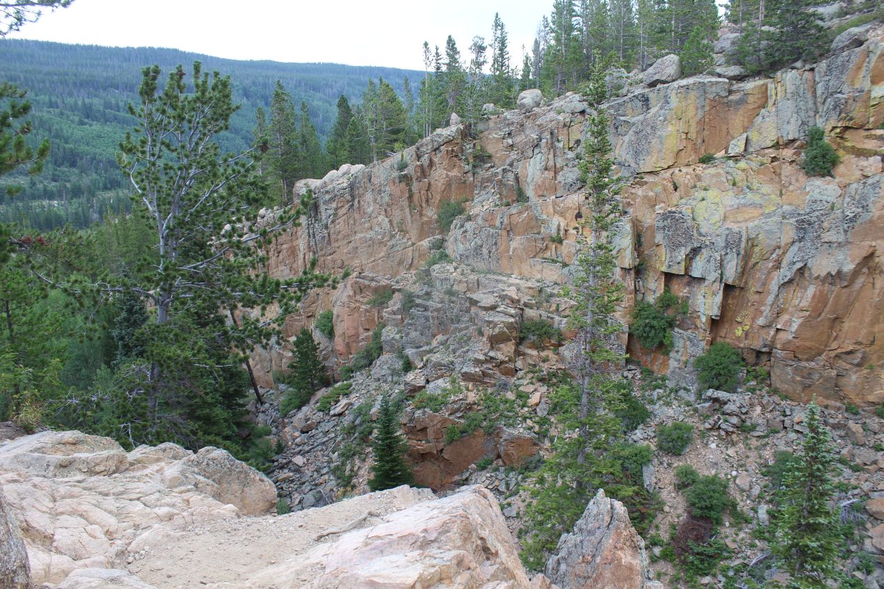
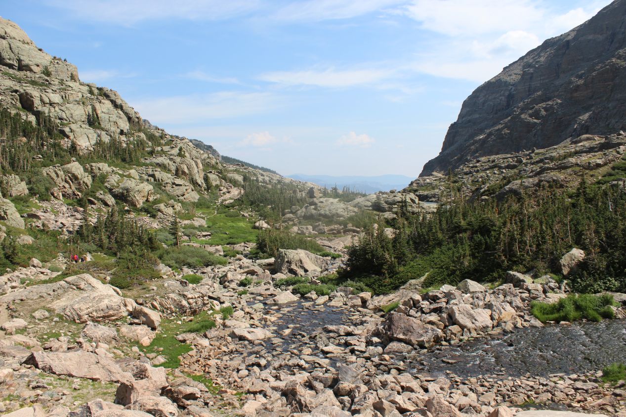
Occasionally the trail would open up and reveal grand panoramas of the surrounding area. The countryside up in the mountains was nothing short of gorgeous, between the evergreen forests and the weathered hills that ran off into the distance in the east. In the opposite direction, the west held towering mountains of stone that often plunged the hiking path into shadows. The sun still hadn't come up far enough yet to illuminate everything in light. After 1.5 miles, I came to a fork in the trail at the North Longs Peak junction. This was roughly the one third mark for the hike to date, and I turned right to continue onwards along the Sky Pond Trail. As the sign indicated, there were many other trails here to explore, and I wish that I could somehow live out an alternative life nearby in Colorado to devote lots of time to hiking throughout the park. It would be amazing to come back in the fall and in the winter to see what some of these trails look like as the seasons change. Anyway, after passing the junction in the trail, the path became a bit more steep and went through a series of switchbacks to gain additional elevation. I was still paralleling the same river from before, as it now passed over a series of boulders instead of falling in one large cascade. The trail guide says that this little river is known as Icy Brook, no doubt due to the frigid water coming down from the mountains above.
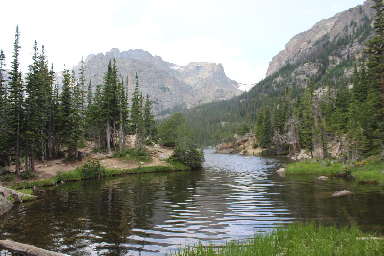
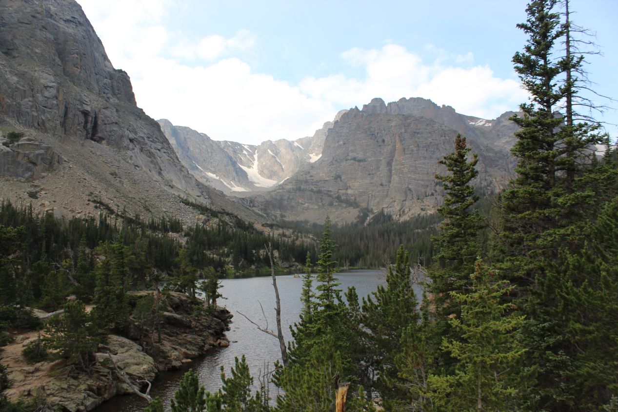

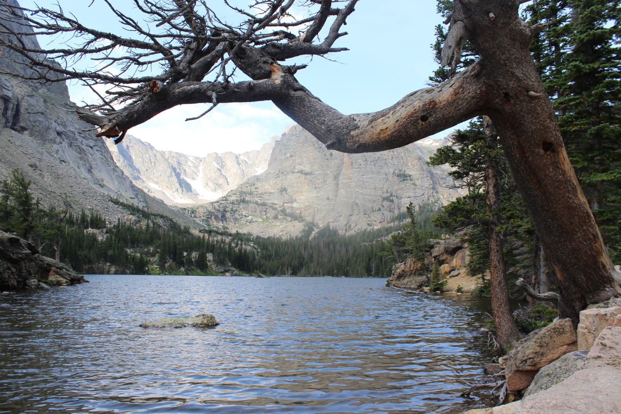
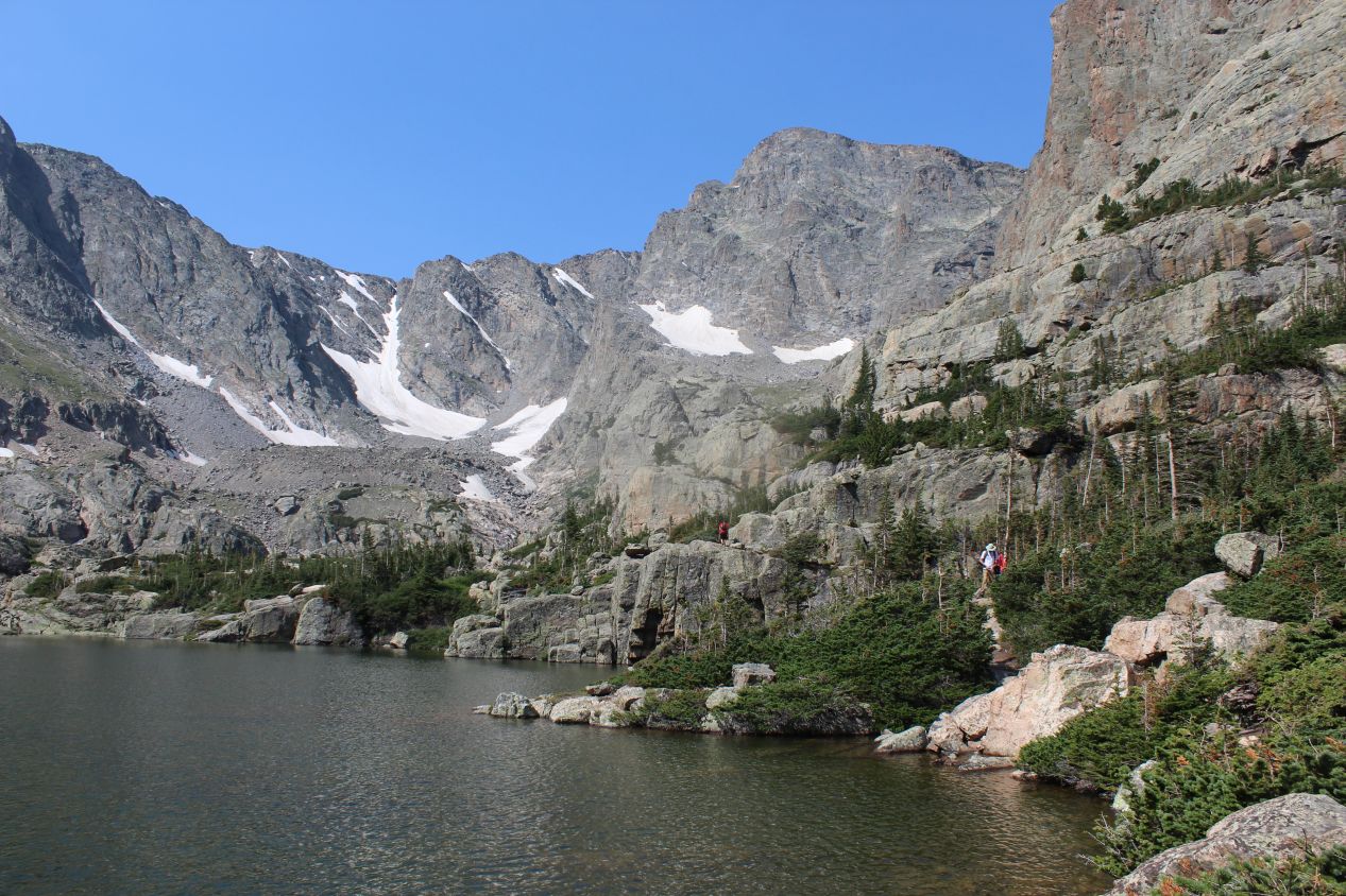
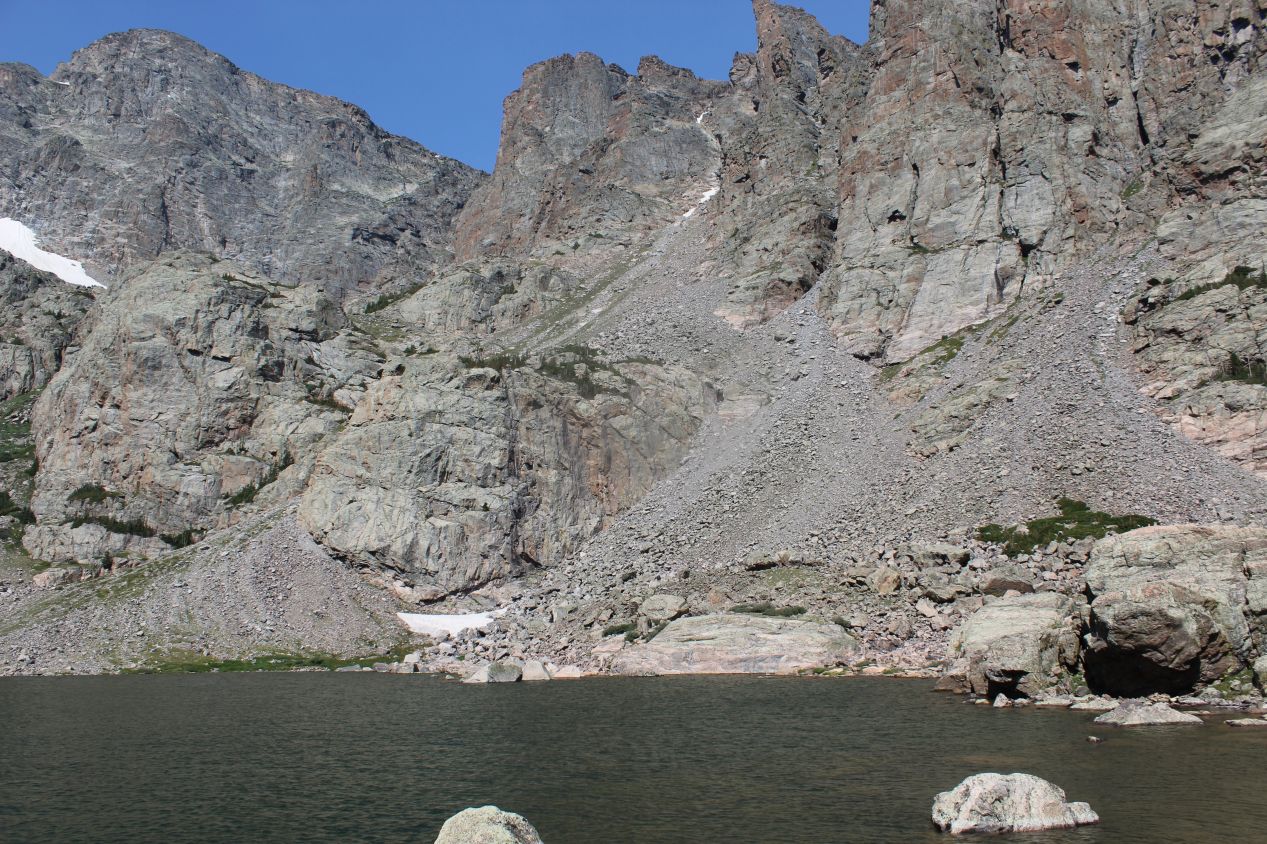
After surmounting that series of switchbacks, I reached an elevation plateau and found the first mountain lake along the way. This was Loch Vale, a beautiful subalpine lake situated at a little over 10,000 feet / 3100 meters in elevation. It was stunning to see the narrow river that I had been following open up into this lake, with has its own widely-studied ecosystem complete with fish living inside the waters. The Loch was ringed by mountain peaks that were mostly barren of trees, leaving exposed rock faces with only the occasional patch of snow for cover. With this being the middle of the summer, I knew that we had to be getting pretty high up there in terms of elevation to have snow patches still remaining. The trail ran around the edge of the lake, and for a wonder it was flat here for the moment. I knew that this could only be a temporary reprieve though, since there were still two more mountain lakes at higher elevations than Loch Vale yet to be reached.
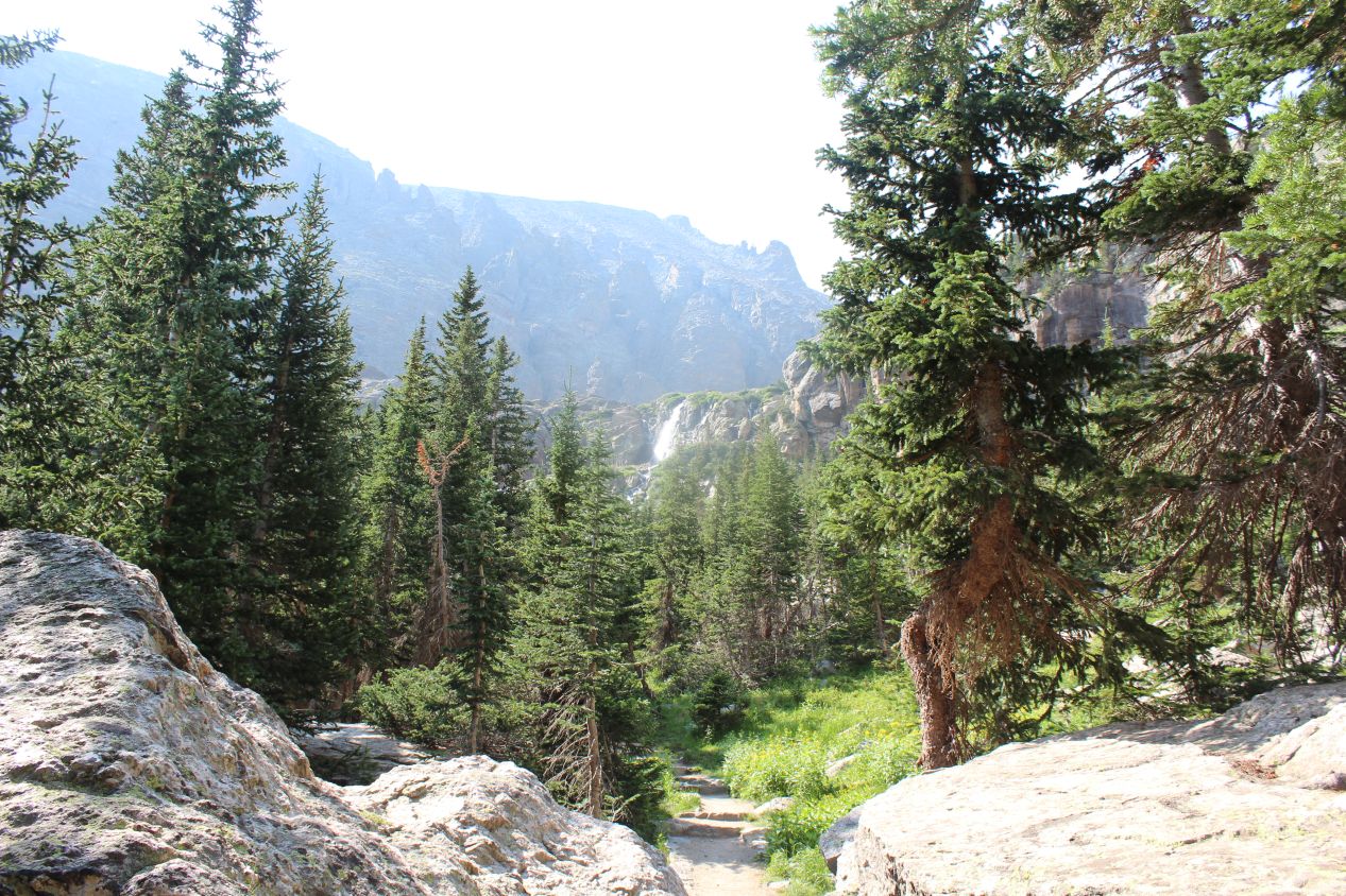
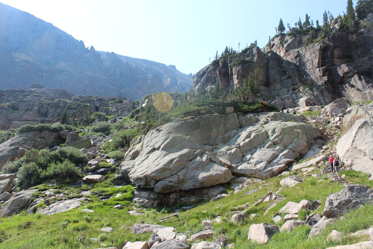
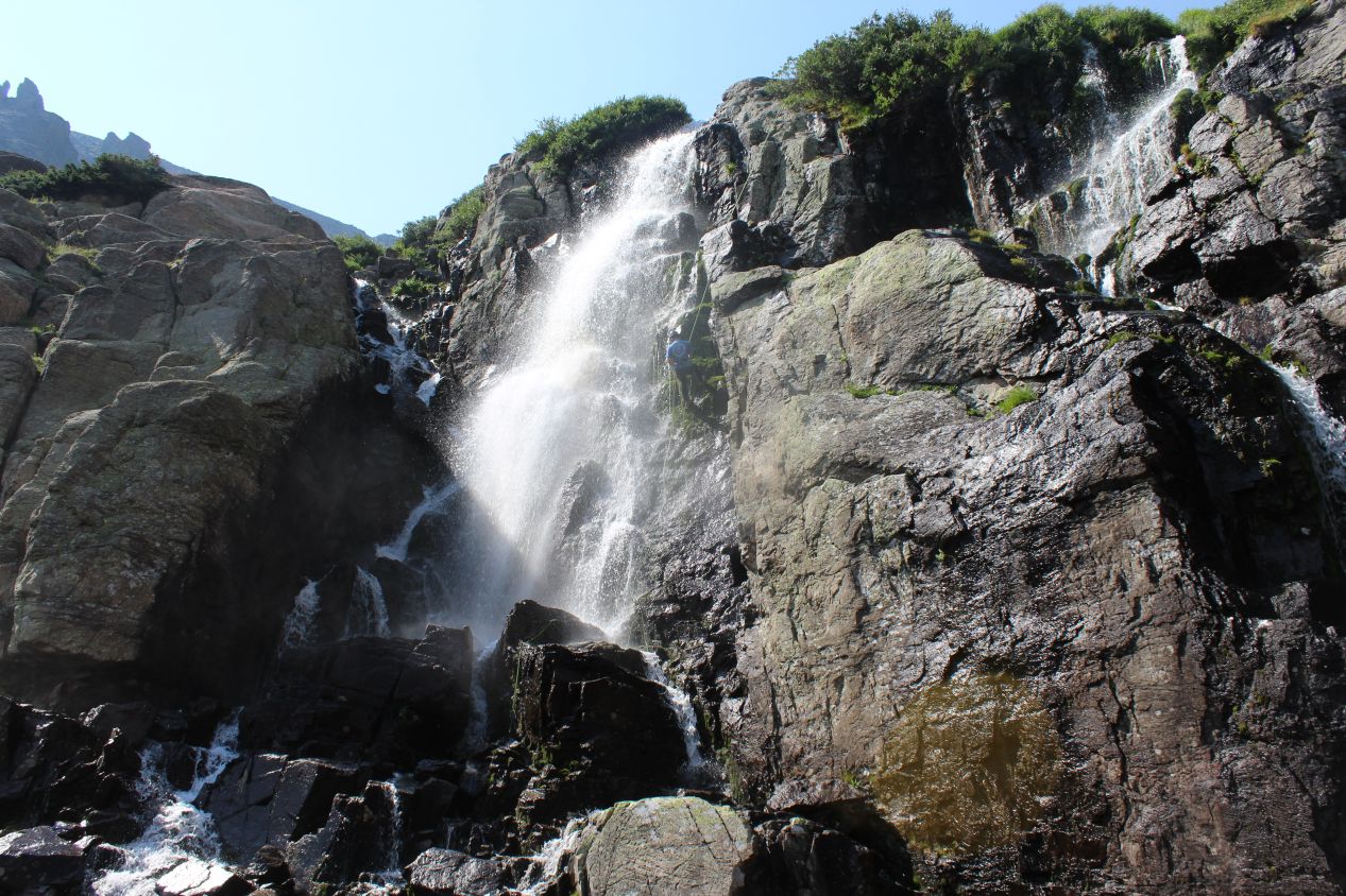
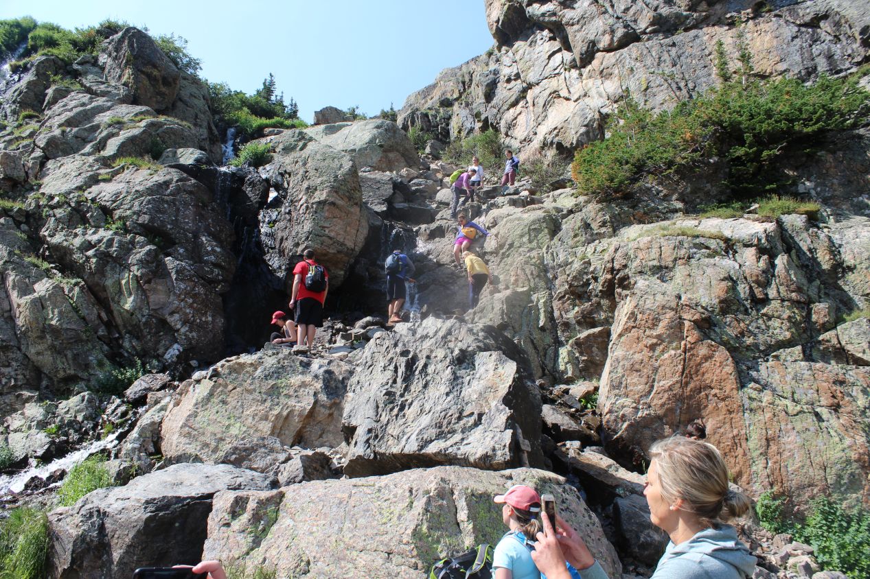
The trail entered the forest again after passing by Loch Vale, but I could see another waterfall up ahead in the distance and I knew that was where I was heading next. This is known as Timberline Falls, and getting past it would prove to be a major challenge as the trail quite literally went up the side of the waterfall. Obviously the general public wasn't rapelling up and down ropes like the one person that I captured above, but we were scrambling up a very steep series of rocks just to the side of the waterfall, and the spray kicked up by the falls made everything slippery to the touch. The trail guide claims that this little section of the trail goes up 200 feet vertically in just 0.15 miles of distance - that's a foot upwards for every four feet forwards, steeper than a flight of stairs. This was a strenuous, difficult ascent and I say that as someone who has spent a good bit of time over the years climbing up and down various rock formations.
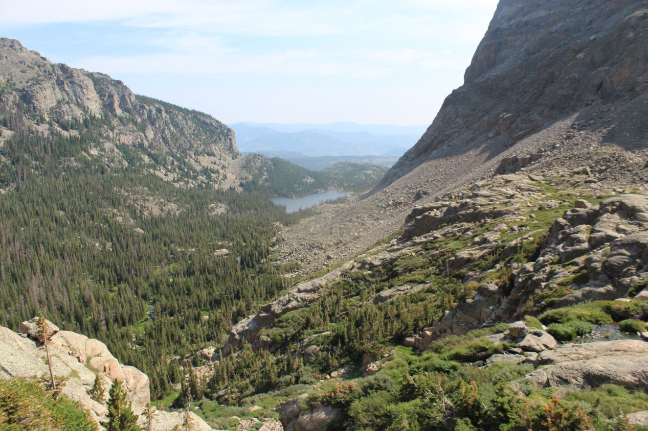
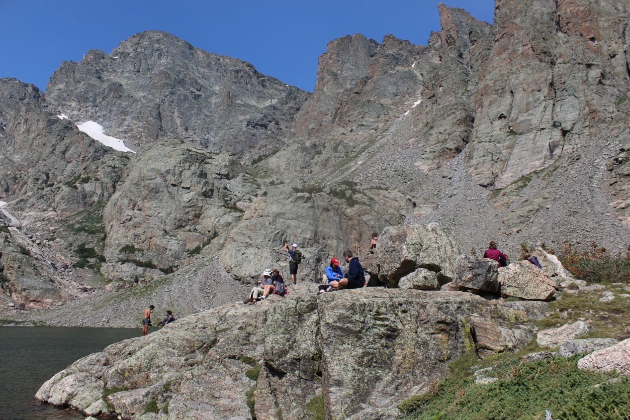
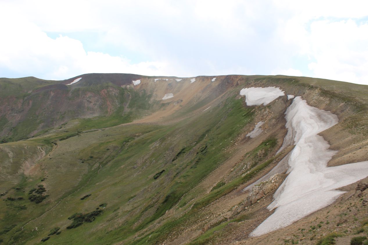
The view from the top though... "Spectacular" is the only way that I can describe it. This second mountain lake is known as the Lake of Glass due to its smooth, reflective surface. It didn't look so much like glass today, as the winds were churning up a series of waves along the top of the lake and stirring the deep, dark blue waters. I was high enough at this point that the tree cover was beginning to fade, and only a handful of stunted evergreens were able to cling to the rocky soil near the sides of the lake. Most the surrounding mountain faces were bare rock at this point, and the snow banks tucked into the crevices between the peaks seemed to be getting larger. With that said though, the most impressive view from up here wasn't the Lake of Glass, but rather turning and looking back in the opposite direction, down at the path that I had previously traversed. Loch Vale was easily visible about a mile away, and it was clear how much higher up the trail had climbed since I had reached the previous lake. Having Loch Vale as a visible indicator of the elevation gain was a neat symbol of how far I had traveled, and how far I still had yet to go since I had to return via the same trail eventually. And there was still another lake even higher up that I hadn't reached yet!
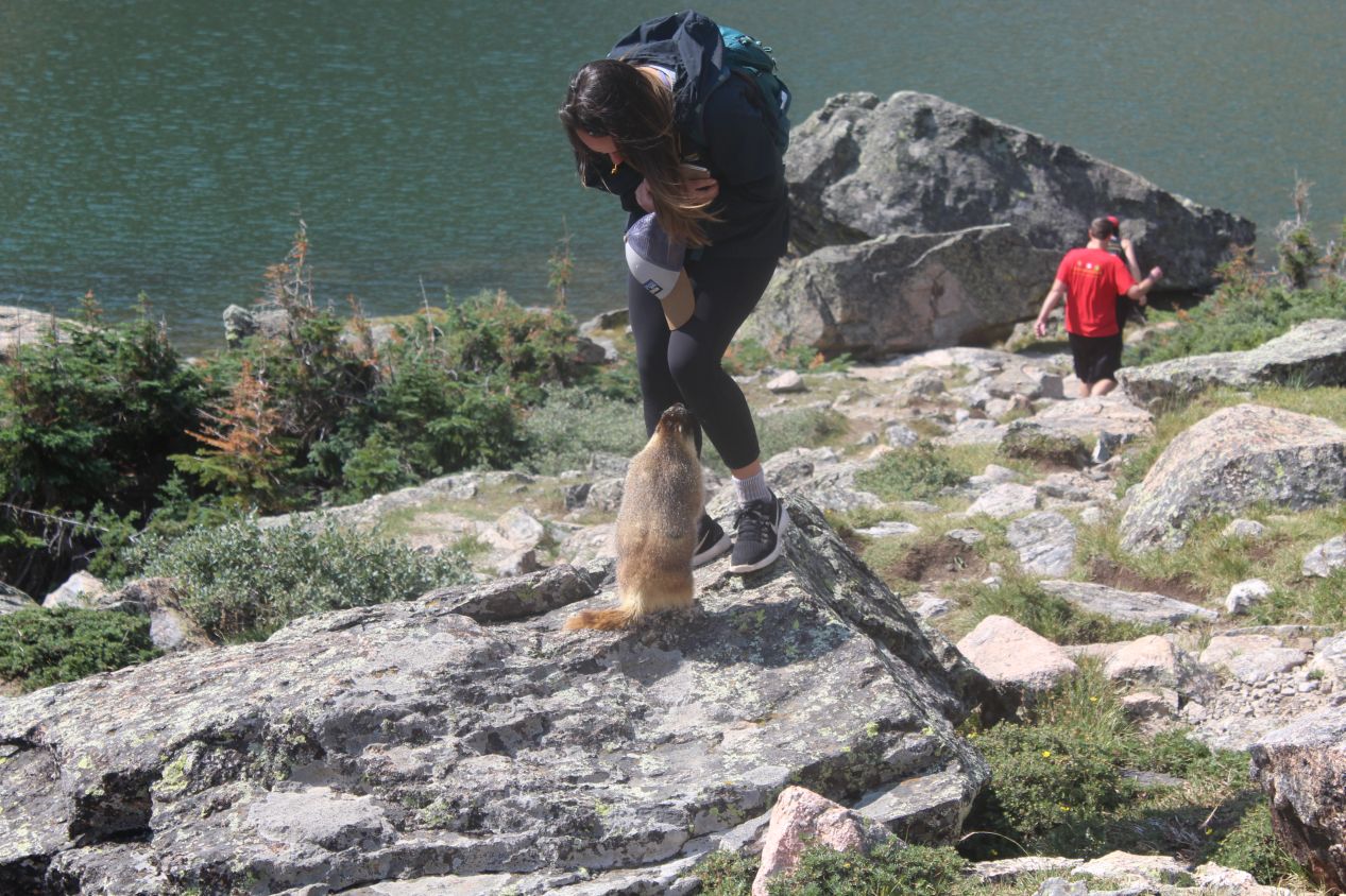
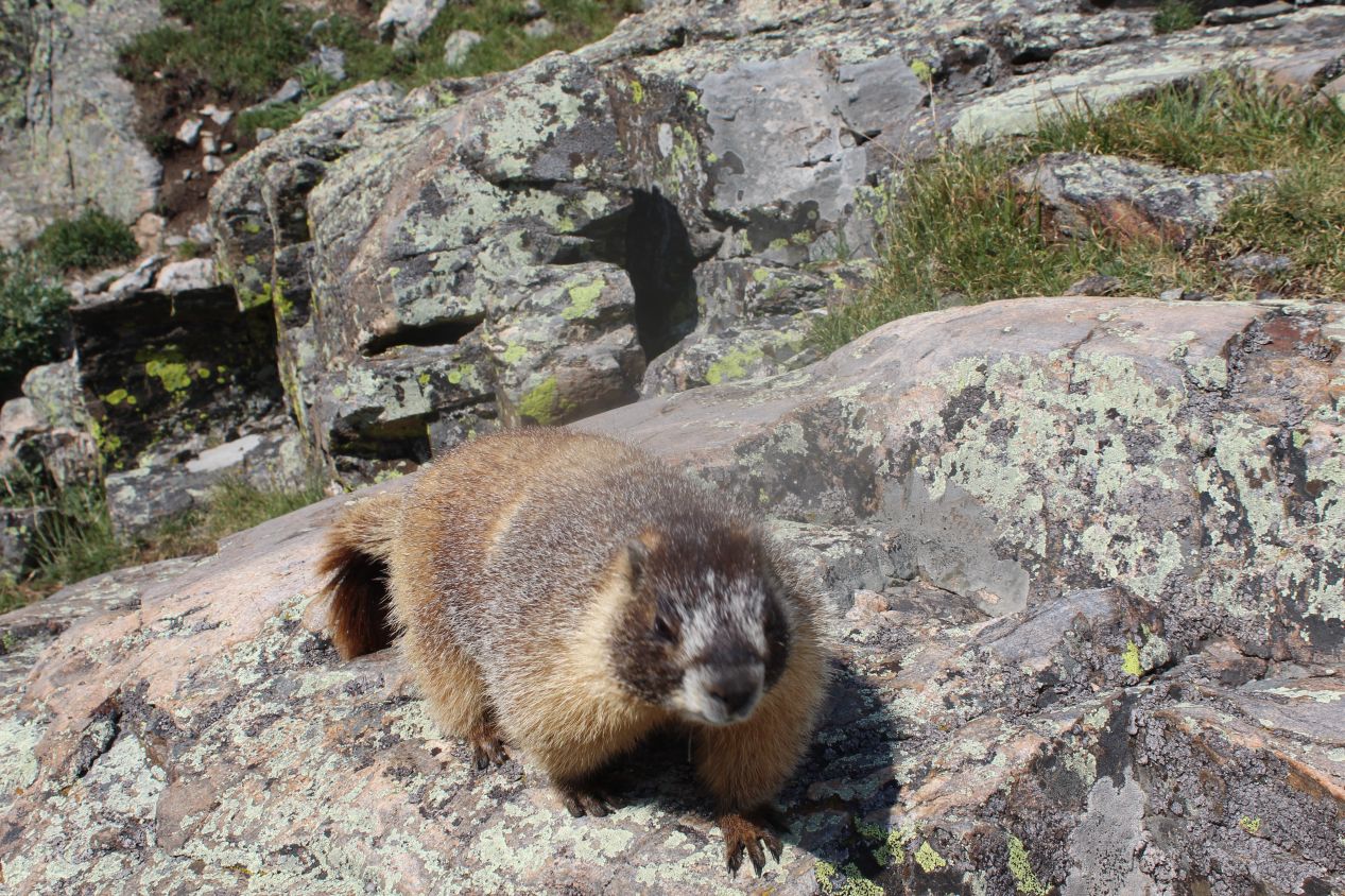
While I was walking around the Lake of Glass, I spotted this adorable little marmot next to the trail. Marmots are a large species of rodent that tend to live in alpine regions; they are similar to prarie dogs but don't live in the same kind of large colonies. This particular marmot was quite familiar with the hikers, as it went over to the young woman pictured above in search of food, and then came over to see me. This little critter went up on its hind legs and put its paws on my leg, and I wish that I could have been fast enough to snap that picture in the moment. I had nothing to give the marmot in terms of food though, and it quickly scampered away in search of a handout from someone else. It's probably better not to feed these animals regardless, as they're still wild creatures.
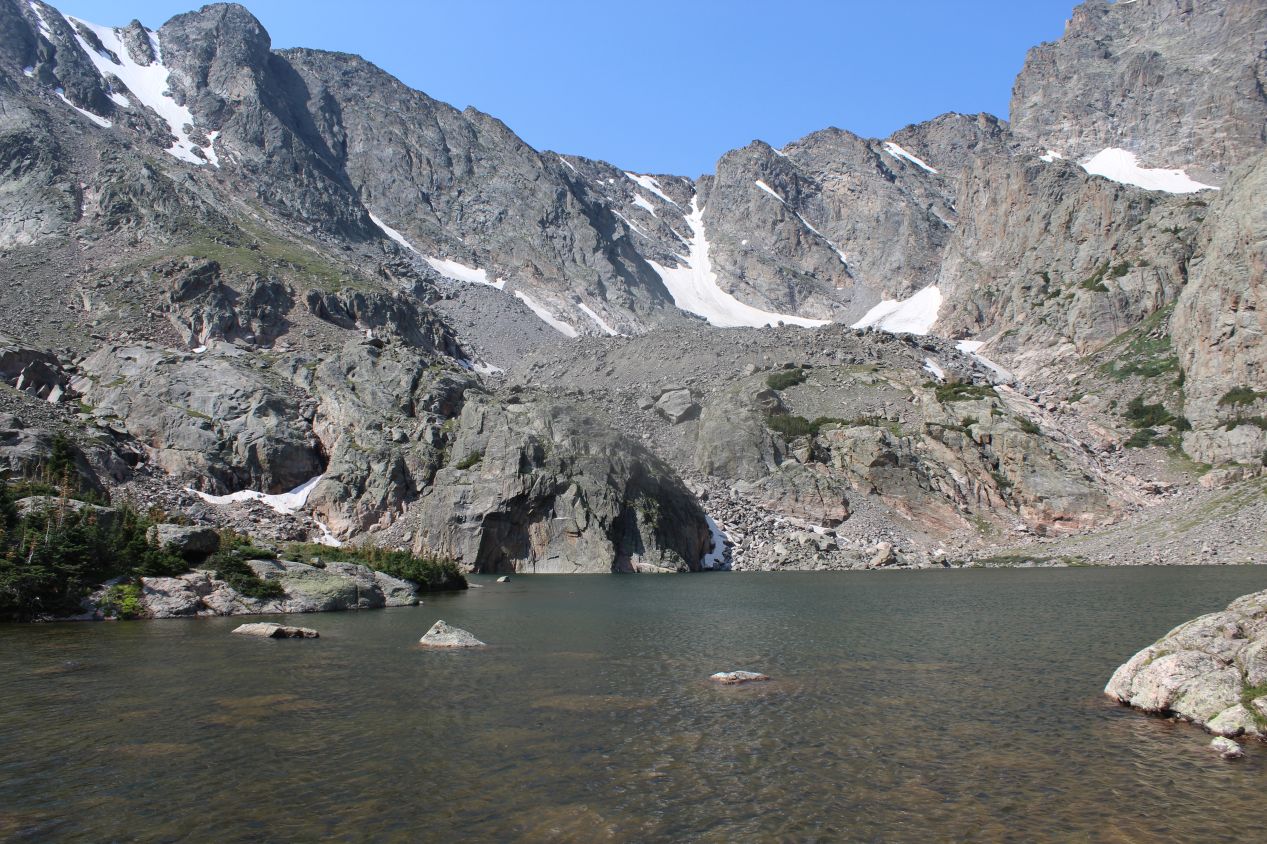
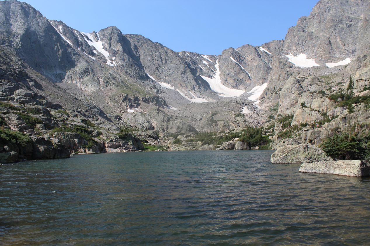
The last part of the trail wasn't marked very well, and it was a bit tough to determine where the path was supposed to run. Fortunately it was only a short distance from the Lake of Glass up to the terminus of trail, located at the final of the three lakes at Sky Pond. This was a slightly larger body of water than the Lake of Glass, and it was surrounded on three sides by sheer cliff walls. Off to the right were the granite spires of rock known as the Sharkstooth, and I was now finally high enough that there were no trees at all along the pond's shores. Sky Pond is officially listed as having an elevation of 10,900 feet / 3320 meters and there was no question that this was higher elevation than I was used to experiencing. I was more tired than I should have been from a hike of this length, and I found myself feeling a bit lightheaded at times. This wasn't helped by my own foolishness, as I had stupidly forgotten to bring my water bottle that I had expressly filled the night before for this hike. Traveling around in the mountains at elevation with no water and no food is just a bad idea - make sure not to do this, for anyone who might be reading.
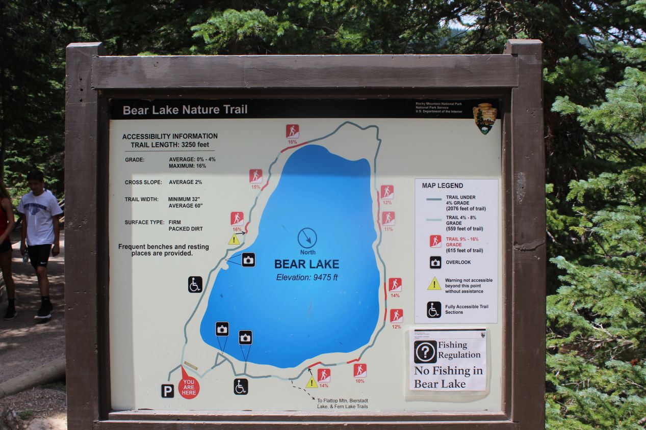
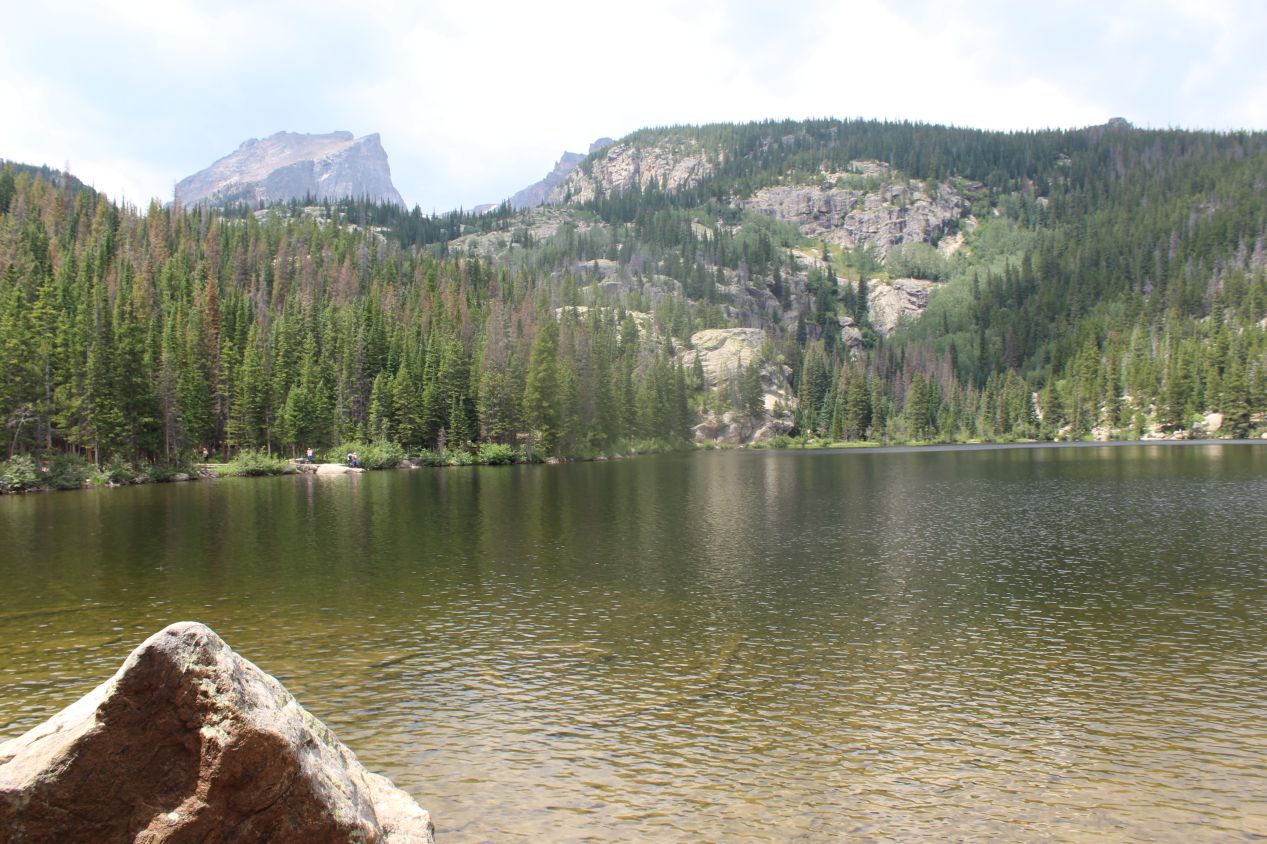
Now that I had reached the end of the trail at Sky Pond, I had to get back down to the bottom again. This was a lengthy trek that took several hours to complete, and since I was seeing the same things that I had experienced on the way up, I didn't stop to take very many pictures along the way. I did have another wildlife spotting next to Loch Vale, where I ran into a deer back among the trees. I'm going to assume that this animal was female since it lacked the big antlers that I had seen from the same species earlier in the day. I had been planning to take a slightly different trail when I reached the junction on the way back, but the other route would have added a full mile and some more elevation gain to the process. I was tired enough that I passed this up and stuck to the same trail. However, Bear Lake was close enough at the bottom that I took the extra 10 minutes to walk over. Bear Lake was less impressive than the other mountain lakes I had experienced, and far more crowded since the shuttle buses took visitors there directly. I was actually shocked when I saw that sign above and realized that the elevation was 9475 feet at the BOTTOM of the trail where I had been hiking. I had not known that I'd been up near 11,000 feet at Sky Pond earlier, and suddenly it made a lot more sense why I had been struggling more than usual on the hike. I suspect that I had a mild case of altitude sickness since I was doing about the worst thing possible from a health perspective, jumping immediately into strenuous physical activity with no time to acclimate to the higher elevation. Once again, try not to follow my example here.
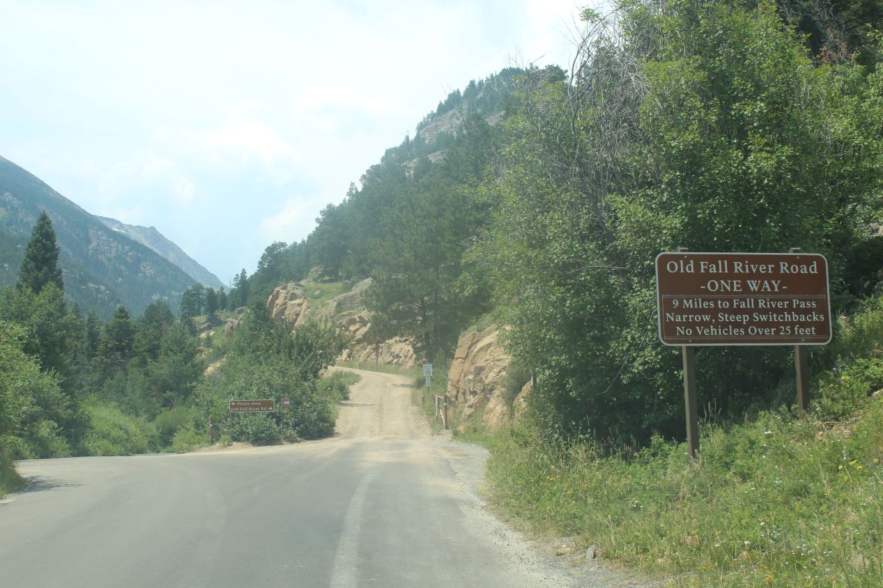
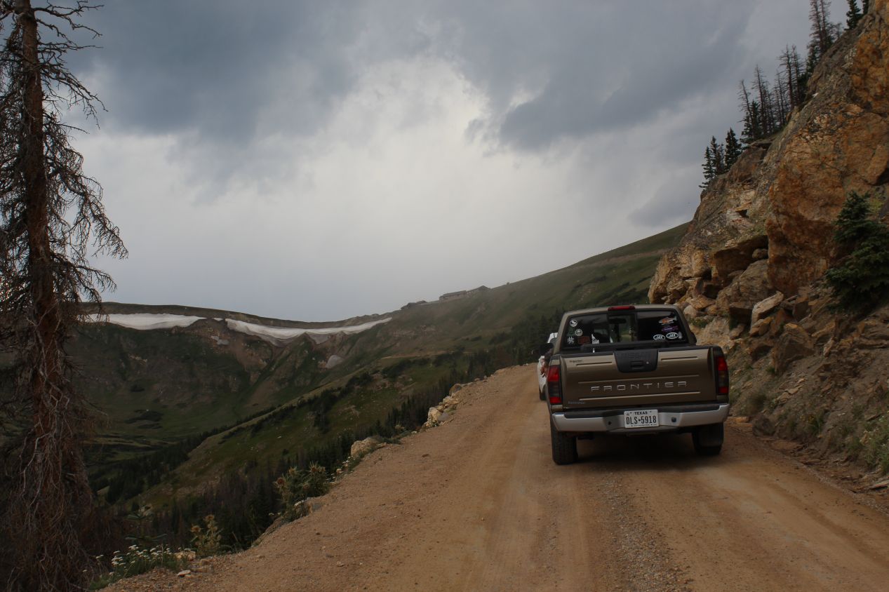
After taking the shuttle bus back to the parking lot and returning to my car, I decided that I wanted to visit one more location in Rocky Mountain National Park: the Alpine Visitor Center. This is located on top of a ridge of mountain peaks that runs through the center of the park, and the Alpine Visitor Center is reachable by car so it wouldn't involve any more difficult hiking. I had spotted on the map that there were two ways to reach the visitor center. The standard route was the Trail Ridge Road, a normal paved route that winded its way up into the mountains to the visitor center. The other route was the Old Fall River Road, a pathway only open in the summer months which seemed like it would be more of a scenic route. The Old Fall River Road is a one-way unpaved dirt track, and I thought that it would be fun to go up to the visitor center via this older road and then come back down on the main paved road. What I hadn't counted on was the presence of the other cars: the Old Fall River Road was crowded and the drivers ahead of me were extremely slow. Now granted, this was a dirt road with no guardrails and a deadly plummet off to the side, but the one-lane situation meant that everyone was forced to go up the mountain at the rate of the slowest car, and that proved to be very slow indeed. It took me almost an hour to travel the 9 miles of the Old Fall River Road, which should give you an indication of how slowly the group of vehicles was traveling. I spent almost all of that time staring at the rear bumper of the truck in front of me and slowly edging my car forward. As such, I do not recommend taking this route unless you're prepared to spend a long time going up the mountain. Only use the Old Fall River Road if you can go in the early morning before the traffic starts to back up.
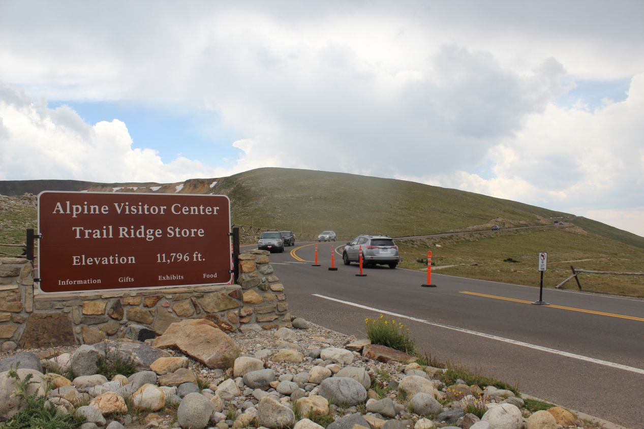
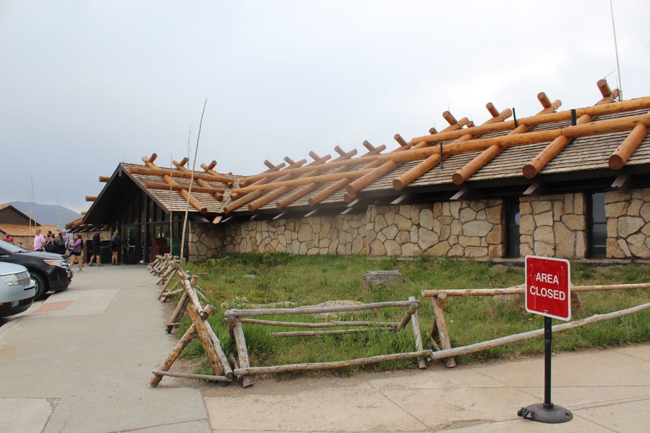
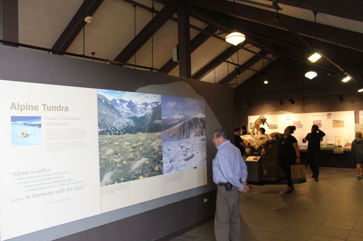
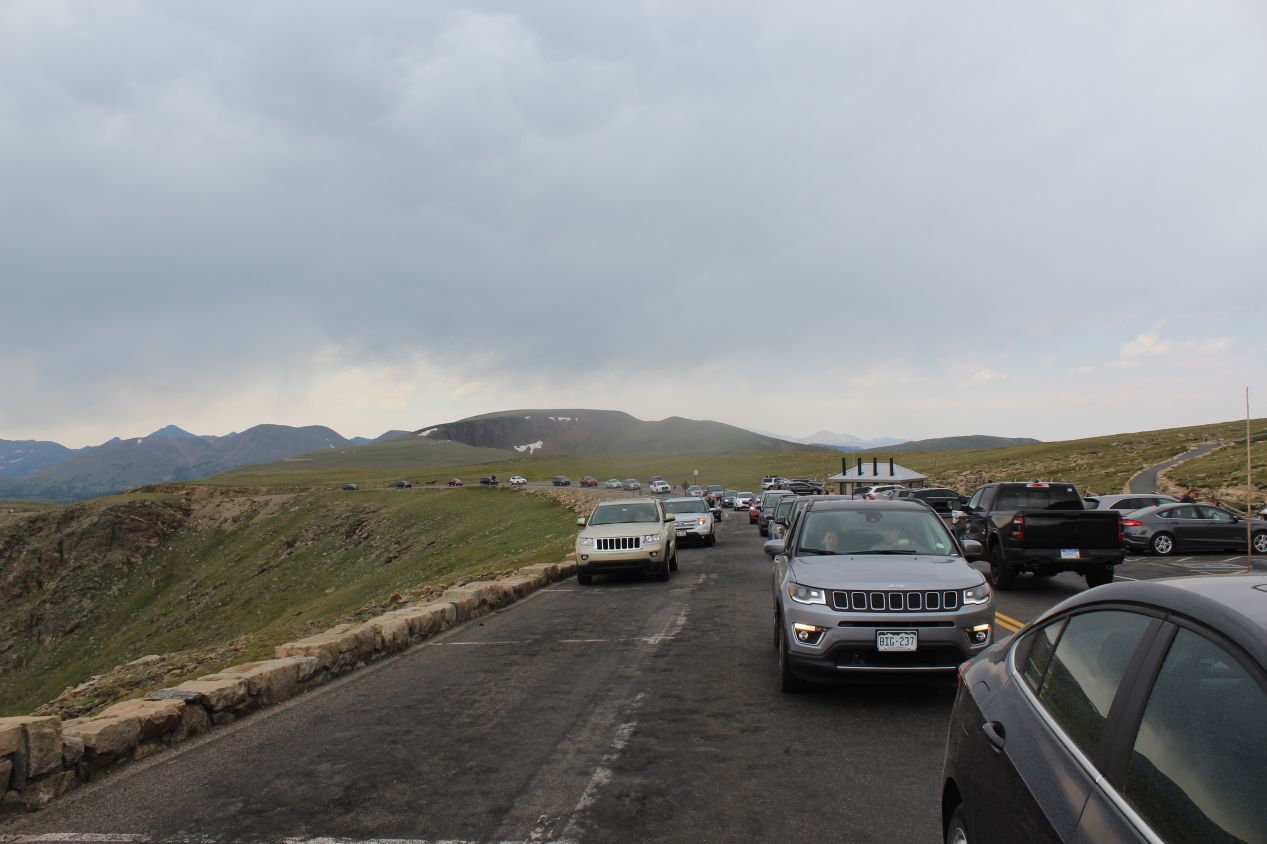
It was the same story when I finally reached the Alpine Visitor Center, which was absolutely packed with people. It was a miracle that I was even able to get a spot in the overcrowded parking lot, as I snuck into a vacated parking spot just as another car was leaving. The elevation was even higher here than it had been at Sky Pond, and unlike the location of the pond in an enclosed bowl that kept out the wind, the visitor center was completely open and exposed to the elements. It was genuinely cold up here, with the thermostat reading 51 Fahrenheit (10 Celsius) and the outside air feeling colder still due to the constant wind swirling about. Since this visit was taking place in late July, most everyone was wearing summer clothes and looked quite chilly. I had on shorts and a light jacket, neither of which were sufficient to stay outside for long here. The visitor center itself was pretty small, largely a place for people to purchase merchandise and get outside of the elements. The Alpine Visitor Center isn't even open in the winter months, as it would be impossible to keep the roads clear of snow. This place is reserved for summer visitors only.
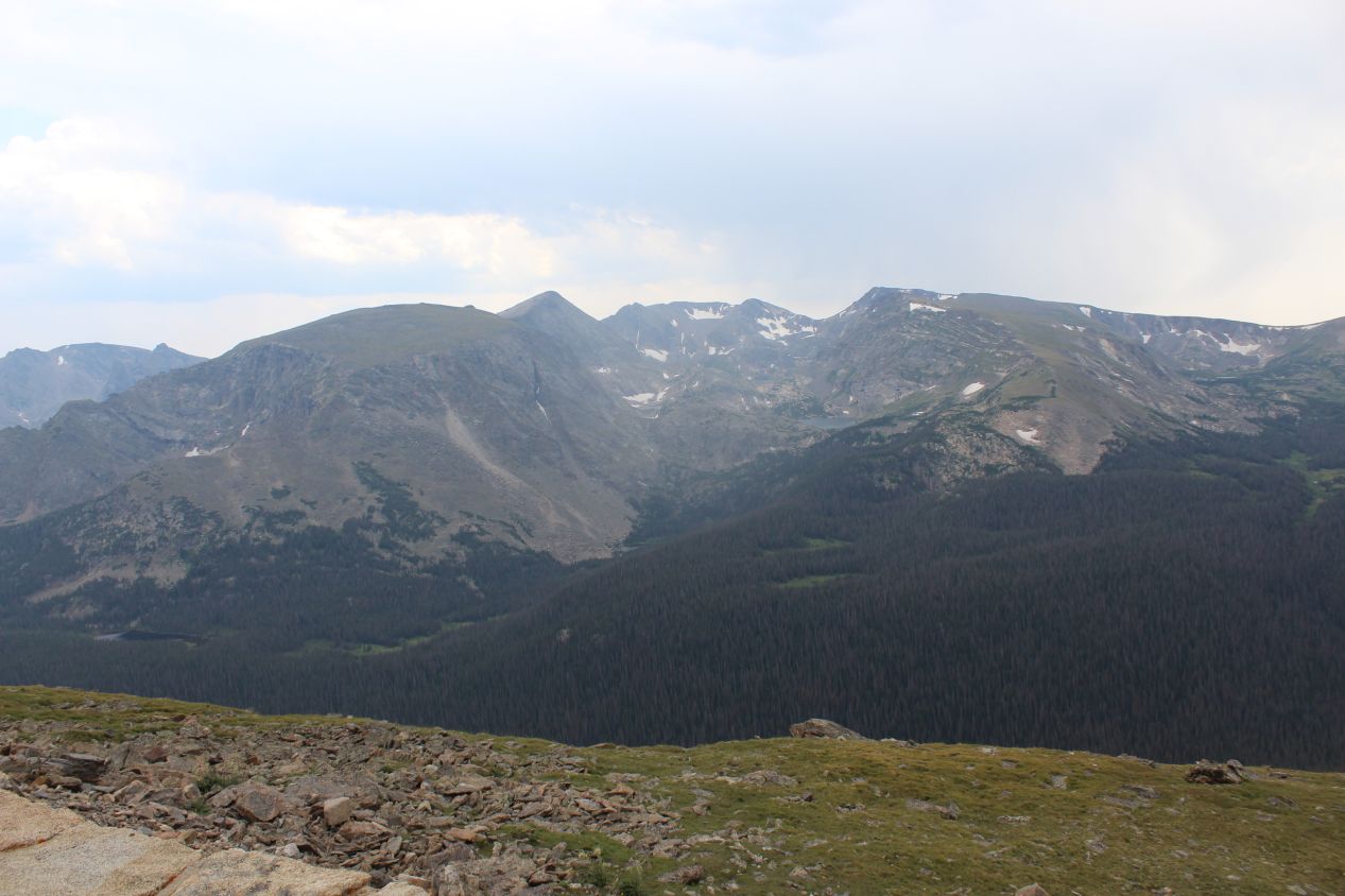
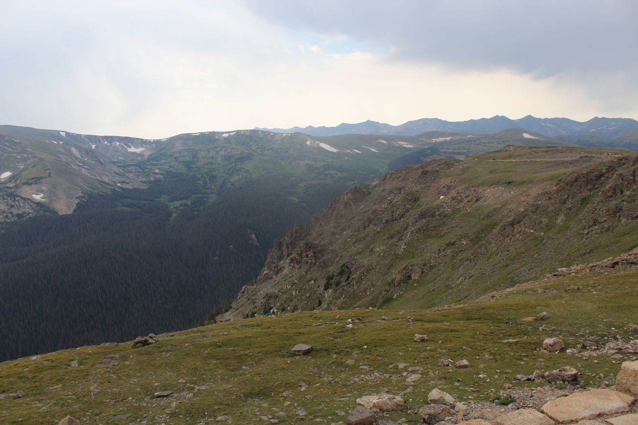
The payoff for the difficulty of getting up here came in the form of some magnificent scenery. From this vantage spot high up in the mountains of the Mummy Range, there were no trees to block the view and I could see a long distance in every direction. Off to the east, I could see the winding dirt path of the Old Fall River Road that had brought me up to the visitor center. It rose up out of the valley that would eventually lead back to Estes Park, which was too far away to be seen from here. In the opposite direction to the west, the land fell away sharply down into a canyon only to rise again in the form of another ridge of mountains further in the distance. There was a mountain lake over there that likely had its own hiking trails running to it. This was a beautiful way to take in the scenery of the rarely-seen alpine environment, another one of those places where I felt like I was standing on the rooftop of the world and looking down on everything else.
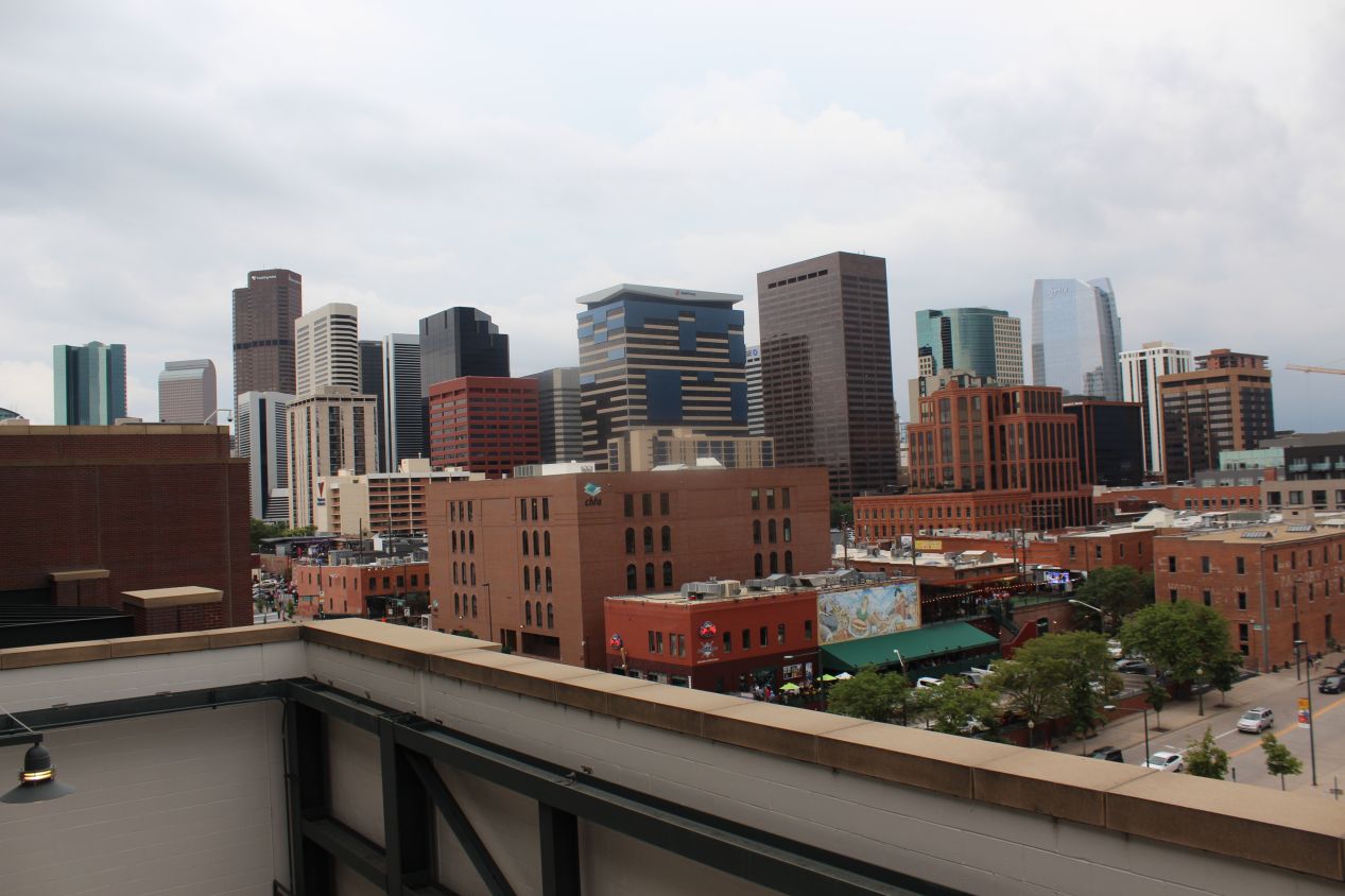
Unfortunately, just as I had needed to hike down from Sky Pond earlier, I also had to drive down from the Alpine Visitor Center and get back to the park entrance. The traffic was nearly as bad heading down on the main Trail Ridge Road as it had been on the dirt track up, and it took me nearly an hour just to reach Estes Park... which had its own heavy traffic now that it was late afternoon. It was too bad that my trip planning had put me in Rocky Mountain National Park on a Friday as opposed to something like a Tuesday, although I think it would have been even more crowded on a Saturday or a Sunday. I was definitely taken aback by how many people were visiting the national park. The original plan had been to see the Colorado State Capitol building in Denver before it closed for the day, but all of the various traffic delays meant that that wasn't going to be happening. Instead, I had to head straight for the ballpark as I didn't have a lot of time to spare before the Rockies were due to start their game.
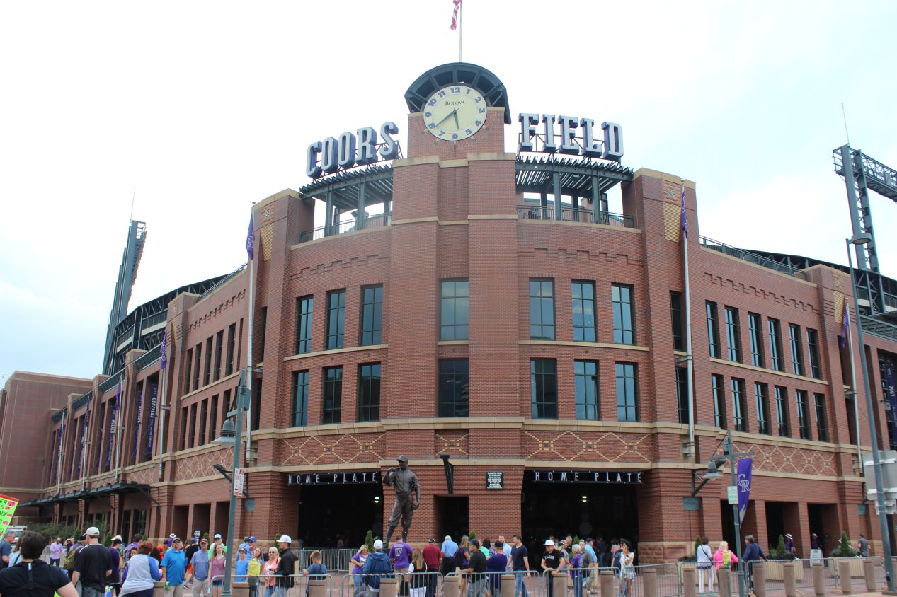
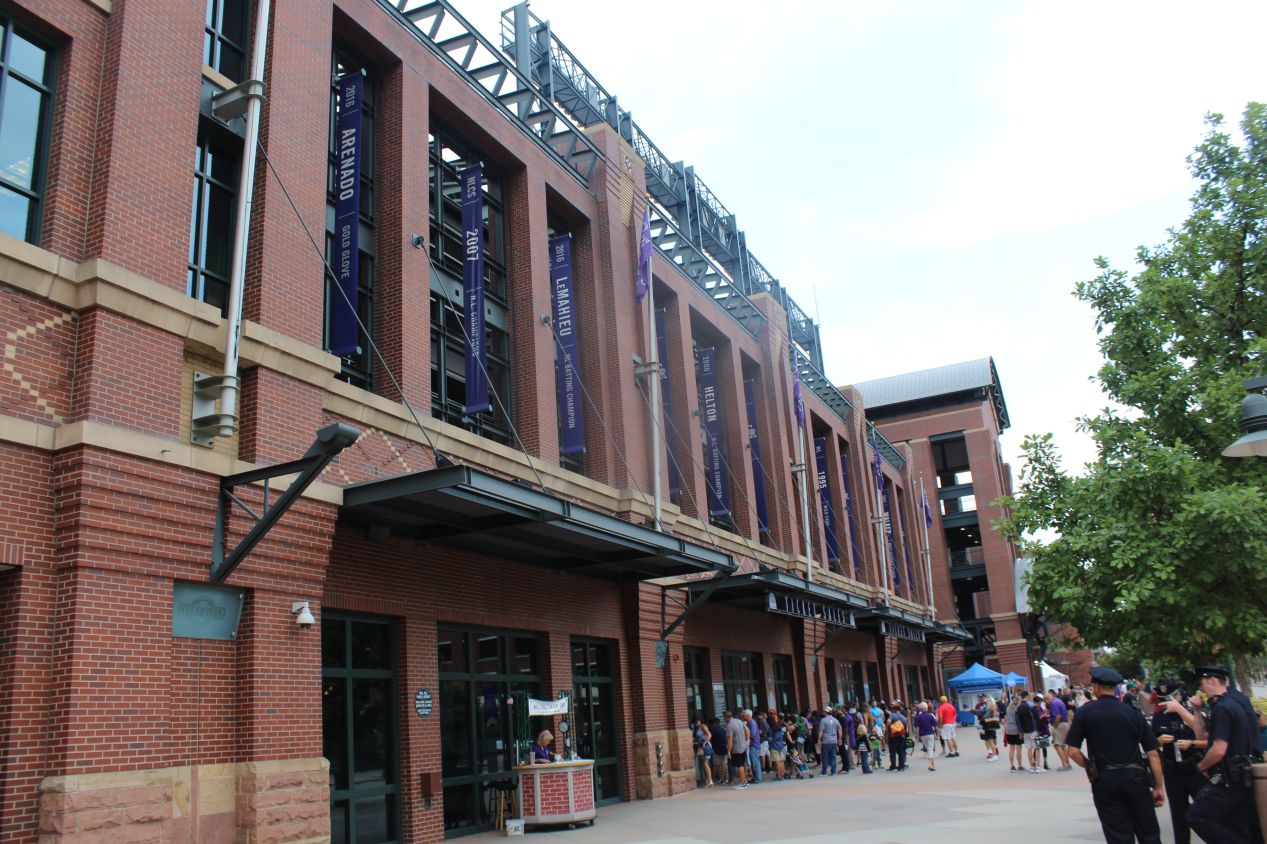
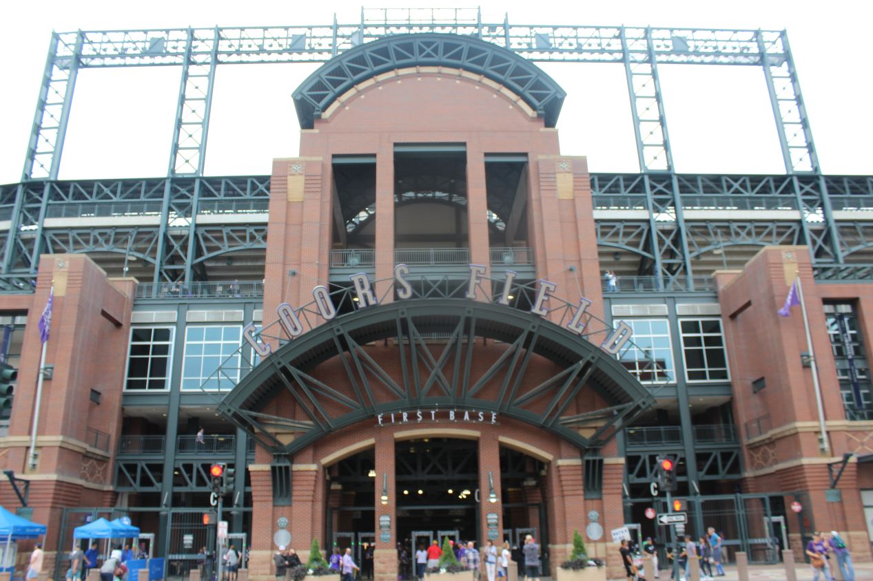
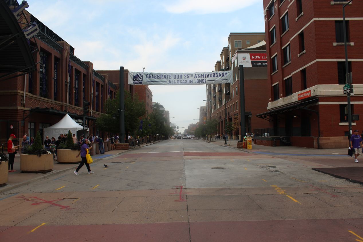
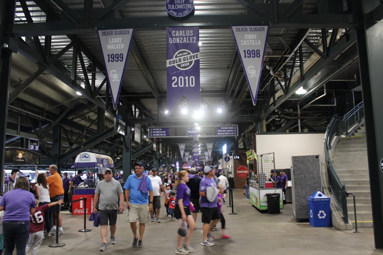
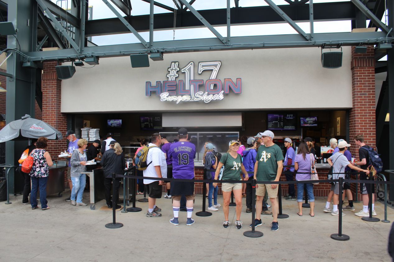
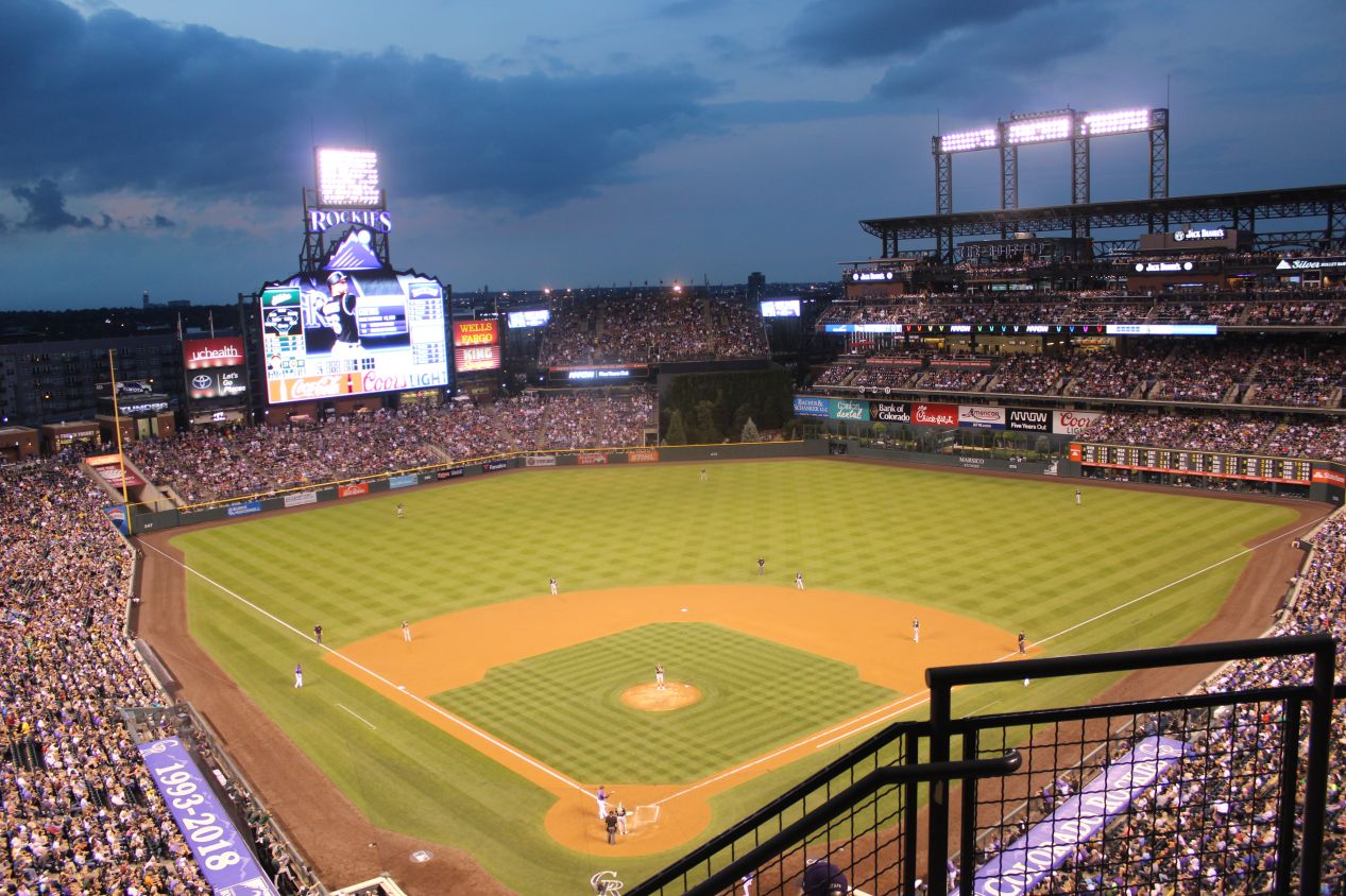
The Colorado Rockies were an expansion team that first started playing baseball in the 1993 season. I remember that the creation of the team had recently been announced in 1991 during my childhood visit to Denver, and how we wished at the time that we could have seen one of their games. Well, the Rockies were celebrating their 25th season at the time of this trip and that had me feeling pretty old. The Rockies play their games in Coors Field, which is located in downtown Denver not far from the home stadiums of the Denver Broncos and the Denver Nuggets. Coors Field is in a walkable neighborhood that gets abbreviated as "Lodo", which is short for Lower Downtown and is home to some of the city's best-known restaurants, galleries, shops, and boutiques. It's a trendy area and the ballpark is very much woven into the city's cultural fabric. Coors Field was built in the early 1990s shortly after the Baltimore Orioles opened their ballpark at Camden Yards, and it looked as though this stadium had been influenced by the Baltimore design. Lots of brickwork on the exterior recalled the warehouse at Camden Yards for me, as well as the green coloring used as a decorative element on the seats and light fixtures (again, the same coloring used at Camden Yards). It didn't look bad or anything like that, and I suppose if you're going to imitate another ballpark, you may as well choose one of the best. 
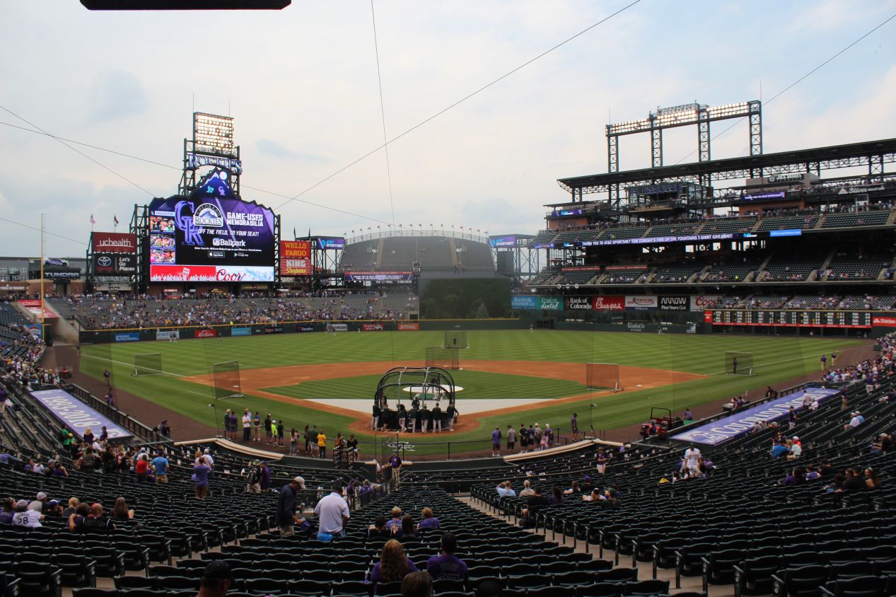
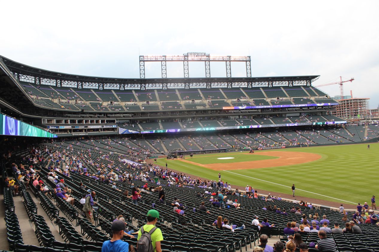
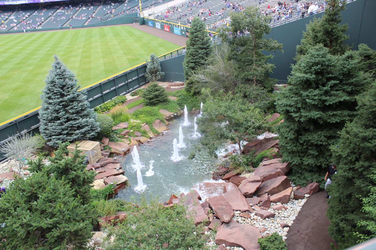
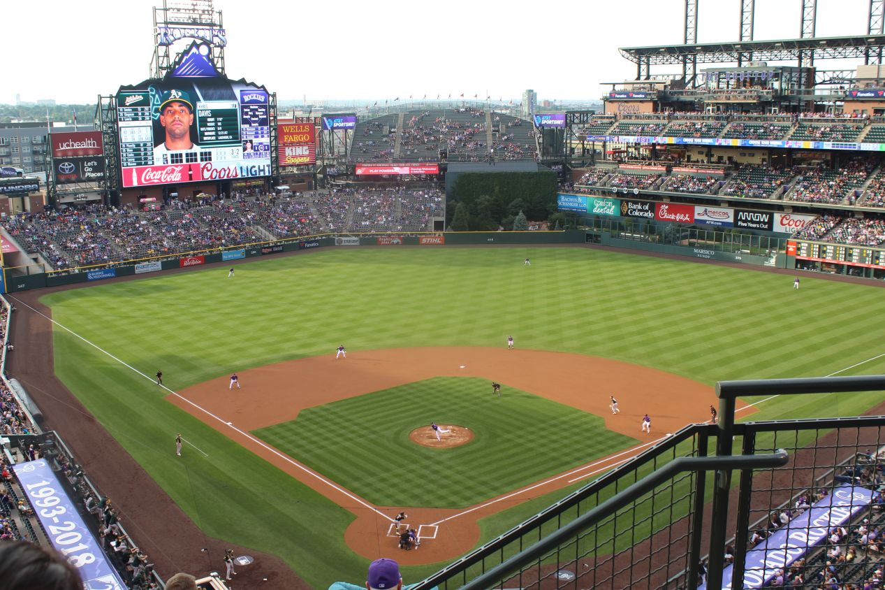
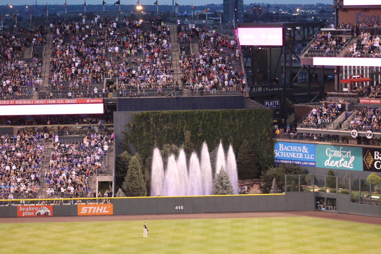
I didn't arrive at the stadium early enough to see either of the teams take batting practice, so I went ahead and walked my usual circuit of the ballpark to get some different viewing angles before the game started. The weather was raining a little bit right now, and I was hoping that it would clear up enough for the game to be held. For baseball fans, Coors Field is most famous for being a offensive launching pad when the team first started playing its games. Because the city of Denver is situated at an elevation of about 5000 feet / 1500 meters, a batted baseball travels about 10% further than it does at sea level, and for the first couple years of the team's existence homeruns were flying out of Coors Field at an incredible pace. The offensive numbers here were so lopsided that there's a mental asterisk next to some of the stats compiled by longtime Colorado hitters for most baseball fans. I found this stat online: from the 1995 to 2001 seasons, National League pitchers at Coors Field recorded a horrendous earned-run average (ERA) of 6.50, more than two runs a game higher than the 4.37 ERA recorded at other stadiums. This problem was eventually solved in more recent years by storing the game baseballs in a humidor ahead of time, which keeps them from drying out and keeps the offensive numbers more in line with league averages. This ties in with the most famous part of the Coors Field ballpark design: the fountains located in center field. When a Rockies player hits a homerun, the fountains erupt in a shower of water, and this has become one of the trademarks of the team. There was a T-shirt giveaway on the night that I visited, and I picked up a purple "Fire Up the Fountains!" Rockies shirt that I've worn around the house quite a bit. It's a comfy shirt!

One of the problems with a newer team like the Rockies is that they don't have as much past history to draw upon with their fan base. The Rockies have only made it to a single World Series, back in 2007 when they had an incredible end-of-season run where they won 21 of their last 22 games (!) which I still can't believe actually happened. But then the Rockies were crushed by a far superior Red Sox team in the World Series, losing all four games played, and they've never made it back since then. The Rockies have actually never won the NL West division as of 2018, and the team hasn't produced a Hall of Fame player in their history to date either. I wouldn't say that this has been a terrible franchise, but they're had more losing seasons than winning ones. Despite that, the fan support for the Rockies has been tremendous over the years, repeatedly near the top of the league in attendence despite Denver being a far smaller market than some of the country's largest cities. It's too bad that the team hasn't managed to produce any truly stellar players for the fans to support; the best players in Rockies history have been the likes of Todd Helton and Larry Walker, good players but not historically great ones.


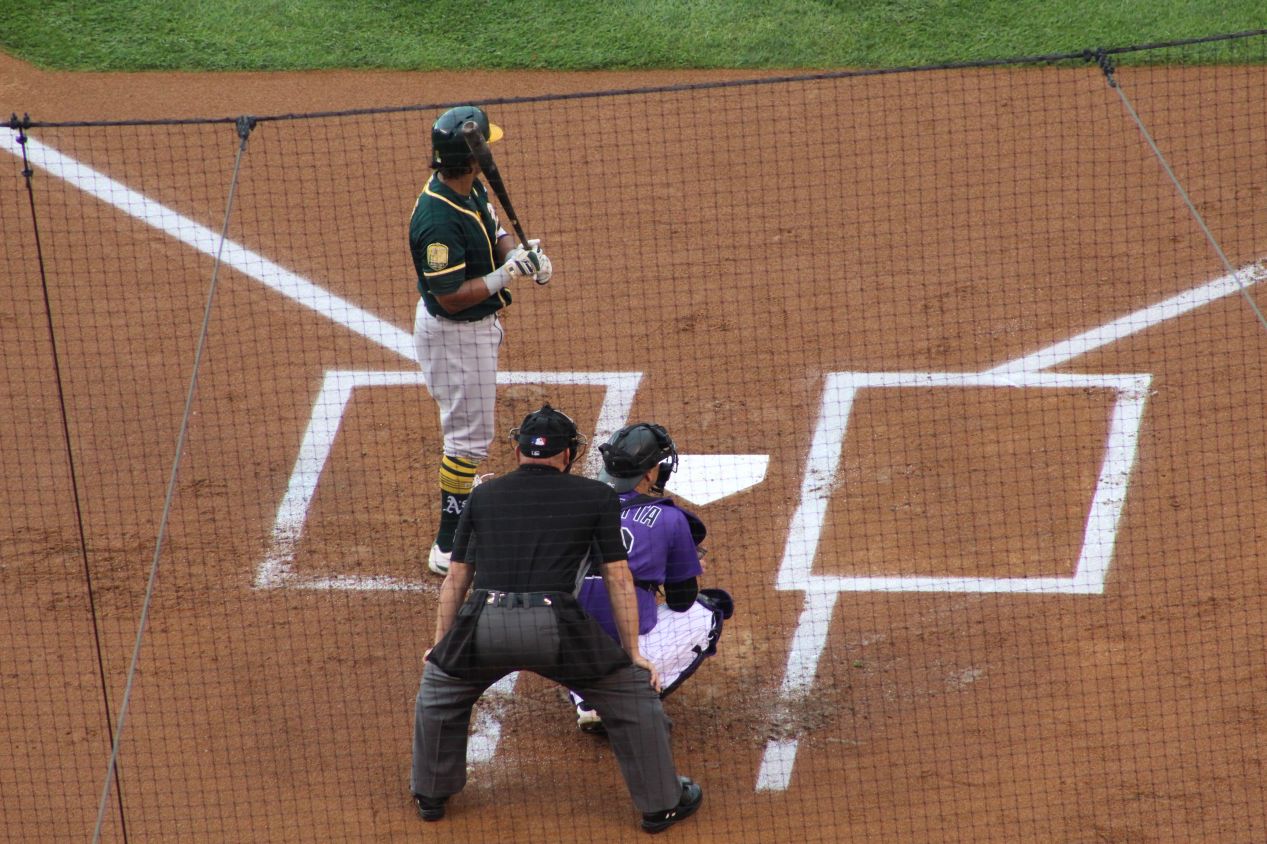
The rain had dried up and the sun emerged from behind the clouds by the time that the game was set to begin, with the Rockies kicking things off at the unorthodox local time of 6:30 PM. The Rockies were playing the Oakland Athletics on this night in a rare interleague game, and there was a sprinkling of fans in green A's shirts there to support the road team in a place where they almost never travel. Both of these teams were having good seasons in 2012, and both of them would wind up in the playoffs as Wildcard teams at the end of the year. The A's would win 97 games and lose to the Yankees in their one-game playoff match, while the Rockies would win 91 games and defeat the Cubs in their own one-game playoff. (The Rockies actually tied the Dodgers and they held a one-game match to determine the winner of the NL West, which the Dodgers won, and then the Rockies played another one-game match against the Cubs in the Wildcard game, which they won in upset fashion. It was a dramatic year for them.) Neither of the starting pitchers in this game were particularly famous, with Kyle Freeland pitching for the Rockies against Sean Manea for the A's. Both of them were having good years at the time, with winning records and ERAs around 3.50.
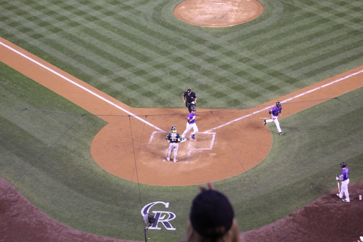
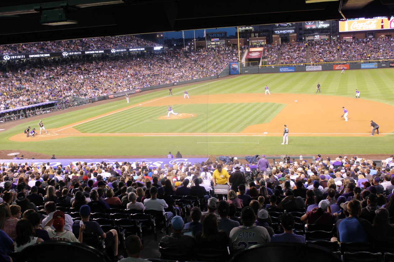
Perhaps not surprisingly, this game turned into a low-scoring affair. The A's threatened to score in the first two innings but couldn't manage to get a hit with runners in scoring position, and then the Rockies broke through with three straight singles in the second inning to score their first run. They wasted a chance to tack on more runs by following up their three singles with three straight outs that failed to advance the runners on base. The fifth inning proved to be the pivotal one in the game, as the A's loaded the bases with only one out but then saw Stephen Piscotty ground into a 5-4-3 double play to end the inning. In the bottom of the fifth, the Rockies scored two more runs on a double, a single, and a homerun (it should have been three runs but Ian Desmond was thrown out at second trying to stretch the single into a double). The homerun was hit by Nolan Arenado, who was probably the best player on this Rockies team, and I was delighted at getting to see the fountains erupt out in center field. The Rockies would then hold on to win by a score of 3-1 after the bullpen worked out of jams in the seventh and the eighth inning. It was a fun game between two good teams, and very much representative of National League baseball. Here's the Baseball Reference link for the curious.
Between the hiking, the driving, and the baseball game, this had been a very full day of sightseeing for me. I didn't get back to my hotel until about 11:00 PM, and I had been up since before sunrise. While I was disappointed that I didn't get to visit the state capitol and the other public buildings in downtown Denver, I decided that I would fit them into the schedule for the next morning, exploring the downtown on a Saturday morning when it wouldn't be crowded. This had been a great day for outdoors exploration, and I can't say enough good things about Rocky Mountain National Park. There's a reason why it's visited by millions of people each year, and I'd encourage anyone reading this to try and make it there at some point. You don't need to do a hike as difficult as the trip to Sky Pond to experience the beauty of the Rocky Mountains.


