

The first step in our Galapagos trip was physically getting to the remote islands. We planned to visit the Galapagos because we'd been able to find an amazing deal on airfare: $650 per person roundtrip from our home in the Washington DC area. Typical flights to the Galapagos were at least double that amount if not more and we snapped up the deal when it appeared, then afterwards set about booking with a local touring company for meals, lodging, and activities. We had everything arranged in March 2020 for a summer vacation later that year only to see all international travel shut down mere weeks later due to the COVID-19 pandemic. Over the next 18 months, we had no choice but to delay our Galapagos trip repeatedly until it became safer to travel. I think we re-booked our flights two or three different times and it often felt like we were never going to be able to take this already pre-paid trip. Fortunately the development of safe and effective COVID vaccines allowed us to travel in August 2021 after this lengthy period of delay. We took COVID tests to prove that we were negative just before leaving and wore our masks throughout the trip to make our travel as safe as possible.
It's not possible to fly directly to the Galapagos Islands from other international locales. The only flights that travel to the islands are domestic flights within Ecuador, which means that anyone who wants to visit the Galapagos has to pass through one of the airports in Ecuador ahead of time. We decided that we would fly to the capital city of Quito and spend a day there before traveling onwards to the Galapagos. Quito is a fascinating city in its own right, a mountainous metropolis located almost 10,000 feet above sea level with a historic downtown area full of preserved buildings from the Spanish colonial period. We would be flying into Quito in the evening and then have a single day to explore the area before flying out to the Galapagos on the following morning. We were going to have to rent a car to get around to the sights we wanted to see in Quito and I knew ahead of time that this was going to be a bit tricky to navigate.

Then we found ourselves experiencing an unexpected obstacle when the actual day of travel arrived. Our flight was scheduled to leave from Washington DC at noon and then arrive at Miami, Florida in the afternoon followed by a second flight to Quito in the evening. This plan went entirely out the window when we awoke at 5:00 AM to a text message telling us that our flight into Miami had been canceled! No explanation was ever given and we have no idea why this flight was canceled mere hours before we were set to depart. Liz immediately called the airline and somewhat amazingly got through to a customer service representative who was able to re-route us on a different sequence of flights. Now we would fly from Washington to Orlando, Orlando to Miami, and then still make it onto our previously scheduled Miami to Quito flight. However, the initial flight out of Washington was leaving at 9:30 AM (almost three hours before we had been planning to depart) and therefore we had to race to the airport to ensure that we could make the new flight. This wasn't exactly what we wanted to be doing at 5:30 AM! Thankfully we had already packed the night before and dropped off our dog Sidney with family who would be watching him during the trip. Complicating matters further, there was a tropical storm heading for Miami and we were worried that our flight to Quito might also get canceled. Thankfully we made all three flights without issue and the weather proved not to be a factor; this day just wound up being far more stressful than it had to be.
We made it to Quito on time with a flight that landed around 9:00 PM local time. After passing through customs and grabbing our luggage, we had to pick up our rental car so that we could drive ourselves into the city. This also ended up being a tougher task than expected: there was only one customer service representative working for our rental company and it took a little while for the car to be ready for pickup. Then we discovered that there were no GPS units available for rental, even though we had specifically reserved one because we knew that we would need it. How in the world were we going to find our way to our hotel in Quito's historic center with no navigation system in the darkness of night? It wasn't as if our phones could connect to the Internet here in South America! Eventually we worked out a solution: Liz used the wi-fi at the car rental place to download the data for the Quito area in Google Maps and then had them available for use in offline mode. We didn't know that this was possible and we'll have to remember it for the future when traveling. That allowed us to make the 45 minute drive from Quito's airport (which is a good 25 miles / 40 kilometers east of the city center) using that offline navigation system. There were relatively few cars on the roads now that it was about 11:00 PM but the local terrain was extremely hilly and this was far from the easiest drive.


We were staying at a small hotel named Casa Gardenia located at the northern edge of the historic city center. We had chosen this hotel mostly due to its good reviews and excellent location but also because it was one of the few places that included parking for our rental car. Well, we arrived at the address listed on Google Maps and found ourselves on a deserted one-way street at 11:30 PM with no apparent place to park the car. I was definitely feeling panicked and wondering if we had made a terrible mistake in booking this location. Those fears wound up being completely misplaced, however, as the host who ran Casa Gardenia could not possibly have been a nicer individual. He was still awake and waiting for us to arrive, and in fact parked our car for us in the extremely tiny one-car resting place connected to the hotel. I don't even want to call it a garage because it was so small, smaller than the garages attached to private houses. Our host showed us to our room and I was able to snap the one nighttime image looking out over the city before we went to bed. We were exhausted at this point and needed to get some rest before a busy day of sightseeing.

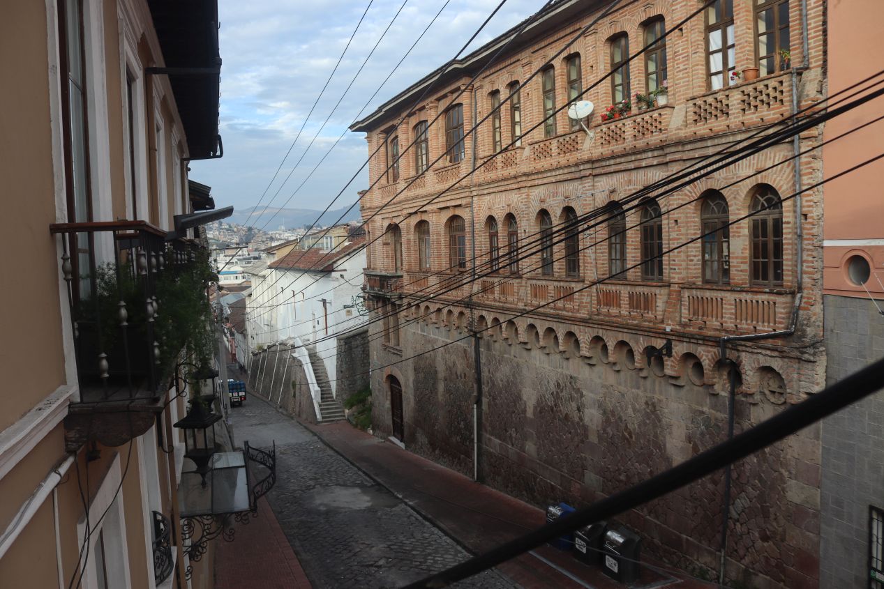


These were some pictures taken the next morning at Casa Gardenia. The first two were taken from the little balcony attached to our room, looking both uphill and downhill on the narrow Sebastián de Benalcázar road outside. These were the first of many pictures taken on this day indicating the extreme elevation changes throughout the Quito area. The other images capture some of the interior of Casa Gardenia, which was built around an interior staircase that wound up across three floors. We were staying in Room 7 and there were only seven total rooms in the whole hotel. This allowed our host to provide the excellent service that we enjoyed during our brief stay here and we would recommend Casa Gardenia to anyone interested in traveling to Quito. On this morning, we were treated to a full breakfast with eggs and meat and rolls. (Our host even put together a breakfast-to-go when we had to leave very early the next morning at 5:30 AM so that we would have something to eat while driving!) We also happened to run into another family of American tourists at breakfast and discovered that they lived only a few miles away from us in the Washington DC suburbs. Even allowing that we were disproportionately likely to encounter other tourists while doing touristy stuff, this was a pretty amazing coincidence.
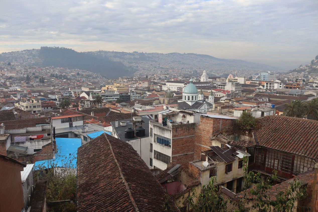
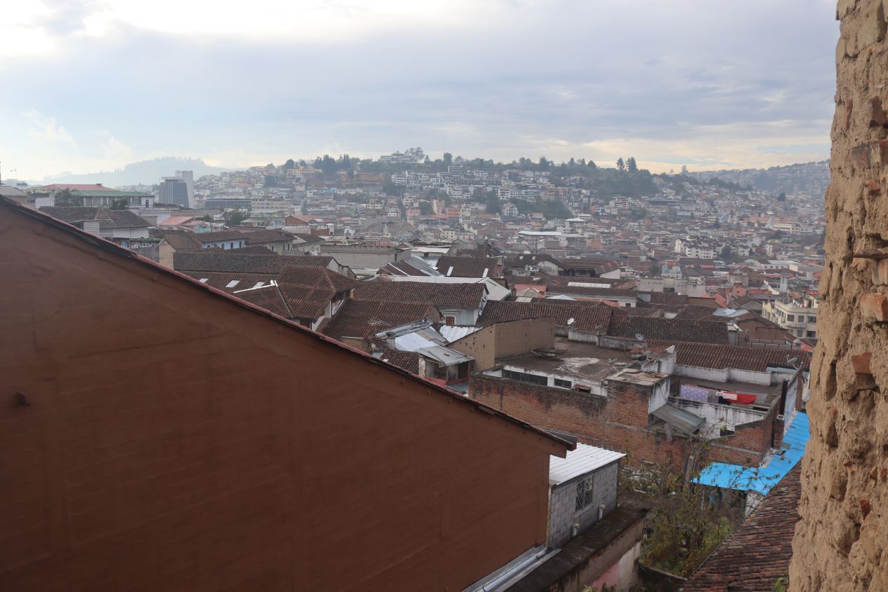


One other nice feature of Casa Gardenia was a rooftop viewing area with wonderful sights looking across the city. This was where I'd taken the quick nighttime shot earlier and we had an even better view of Quito in the brightness of morning. Quito is located in a valley that runs north-south in between the towering heights of the Andes located to the east and west. It's therefore an oddly narrow city that stretches about 20 kilometers on the vertical axis while only about 2 kilometers horizontally. From our vantage point, we could see the historic homes of the city spawling out across the hills in every direction. Quito is located almost exactly on the equator but it has a relatively cool climate due to its high elevation. When combined together with the influence of its colonial history, the result was a truly unique city that wasn't anything like other places that I'd visited previously.
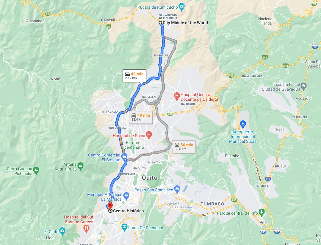


After finishing with breakfast, we returned to our rental car and drove north to visit our first tourist destination of the day. We were heading roughly 20 miles / 30 kilometers to the north where there were several sights to enjoy at the outskirts of Quito's metropolitan area. This required driving through Quito's monstrously hilly streets and then braving the rush hour traffic as the local residents took part in their morning commute. I've done a number of difficult long distance drives in the past and this was one of the tougher short drives that I can remember. It all worked out just fine but this was a stressful trip with a lot of traffic and a lot of people on the sides of the road. Liz took a few pictures while I was driving and captured some families heading to school and some of the outdoor produce markets. There were many people walking and biking along the edge of the busy road that we were driving on. Some of the areas that we passed were quite nice and some of them were severely poor as one would expect when visiting a country like Ecuador. We were passing through a good portion of the city and that meant seeing a bit more of its true character, not just the sanitized version presented for tourists.

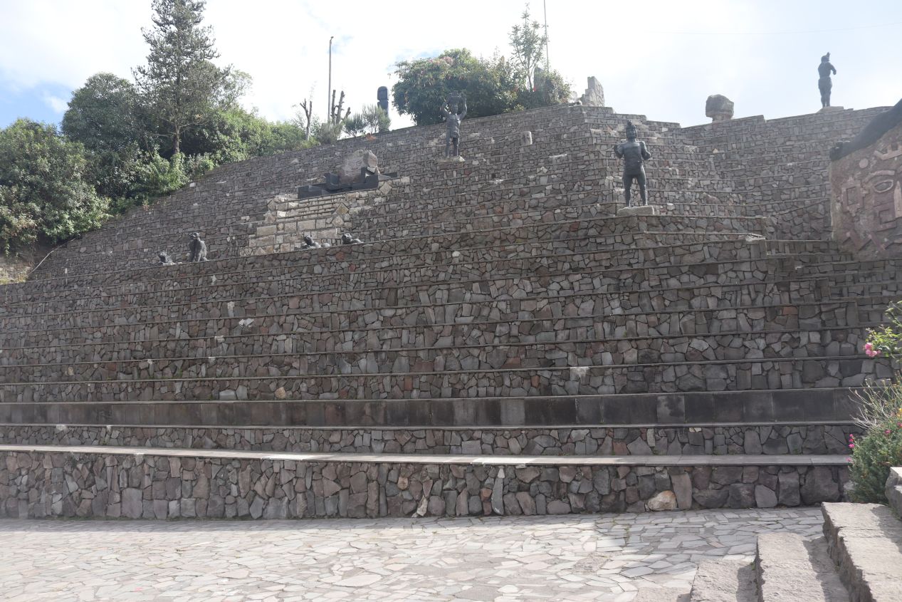


We arrived at our destination a little after 9:00 AM at the pictured location known as Intiwakawasi or the Temple of the Sun. This was a reconstructed version of an indigenous temple from the pre-Columbian period which served as a local tourist attraction. The local Caras and Narino peoples featured at the Temple of the Sun were conqered by the Incans under Huayna Capac at the tail end of the 15th century shortly before the arrival of the Spanish in the New World. This structure was designed as a callback to those indigenous peoples whose descendents still make up much of the current population in Ecuador. The Temple of the Sun was a bit gimmicky in its overall design (I seriously doubt that the actual indigenous structures looked too much like this) but it benefited from having an amazing location in the hills to the north of Quito. There were mountains in seemingly every direction and this place helped drive home the fact that we were visiting a very different geological part of the world.

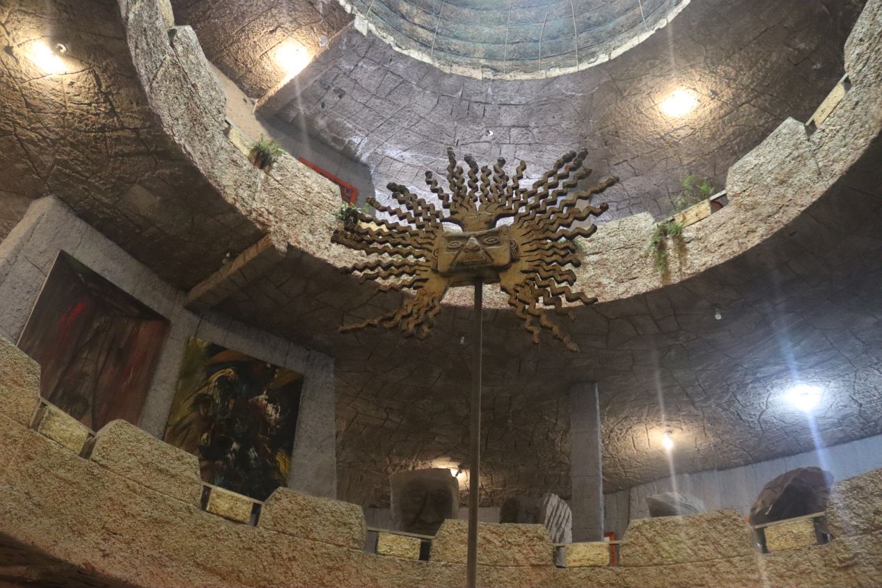


The first tour of the temple started at 9:30 AM and began with an outdoor ceremony where everyone took part in burning some local herbs. Liz and I were the only two English-speakers on the tour and we had our own guide translating for us (the other dozen people naturally spoke Spanish like everyone else in Ecuador). These are some pictures of the interior of the temple which had an open room at the bottom underneath a central vertical shaft that stretched up to the roof. The ground floor of the temple was decorated with more artwork inspired by the indigenous peoples of the Quito region. These were not original pre-Columbian artifacts, of course, which would have been far too valuable to leave out on display. Our guide discussed some of the rituals performed by the local peoples which often seemed to center around the sun in one form or another. He also asked us to see if we could balance an egg on the top of a nail, something that he claimed was only possible in this area because we were so close to the equator. (We were less than a kilometer away from the real equator here at this temple.) This is apparently a total lie and it's no easier or harder to balance an egg on a nail at the equator as compared to anywhere else. But Liz did an impressive job of getting the egg to balance in less than a minute of trying - not bad!

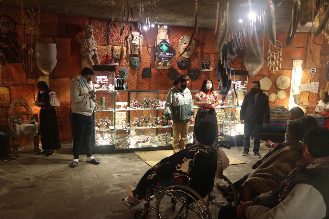


After this the Temple of the Sun experience started getting a bit more tacky and a bit more touristy. The tour brought everyone into a gift shop area where there was a demonstration of different types of perfume and incense that could be found in the local area - all available for sale at the store, of course. While we were getting a bit more information about the indigenous inhabitants of the region, this felt a bit less like an anthropological presentation and a bit more like a television infomercial. Afterwards, we visited the upper floors of the temple which were being used as a museum for the artwork of artist Cristobal Ortega Maila. His specific claim to fame was the ability to paint complete works of art in as little as five to ten minutes and then sell them for thousands of dollars - not a bad line of work if you can get it! Ortega Maila actually owned the entire Temple of the Sun which was a cultural project that he was sponsoring. His art studio was up on the top floor although he was not in residence when we visited.

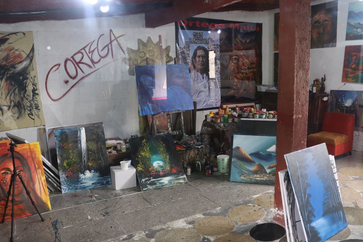


These are a few more examples of Ortega Maila's artwork and then some of the views of the surrounding countryside from the highest tower of the temple. I didn't personally care for Ortega Maila's artwork all that much but he's been a popular and successful artist, the winner of a series of awards for his portraits of life in Ecuador. I do find it highly impressive at how he's able to create these paintings in just a few minutes of work. Anyway, there's one other odd story to relate from our visit to the Temple of the Sun. Our guide served us some hot tea when we reached the conclusion of the tour up at the top of the building and then asked us if we wanted to purchase any of the local drugs that can be used as additives when drinking tea. This actually included heroin - yes, the people at the Temple of the Sun asked us if we wanted to buy a raw form of heroin from them!  We politely declined while wondering what in the world was going on here. Anyway, I'm not sure that I can fully recommend visiting the Temple of the Sun because it was kind of a tourist trap but it was worth driving out here because there were other more interesting places to visit in its immediate vicinity.

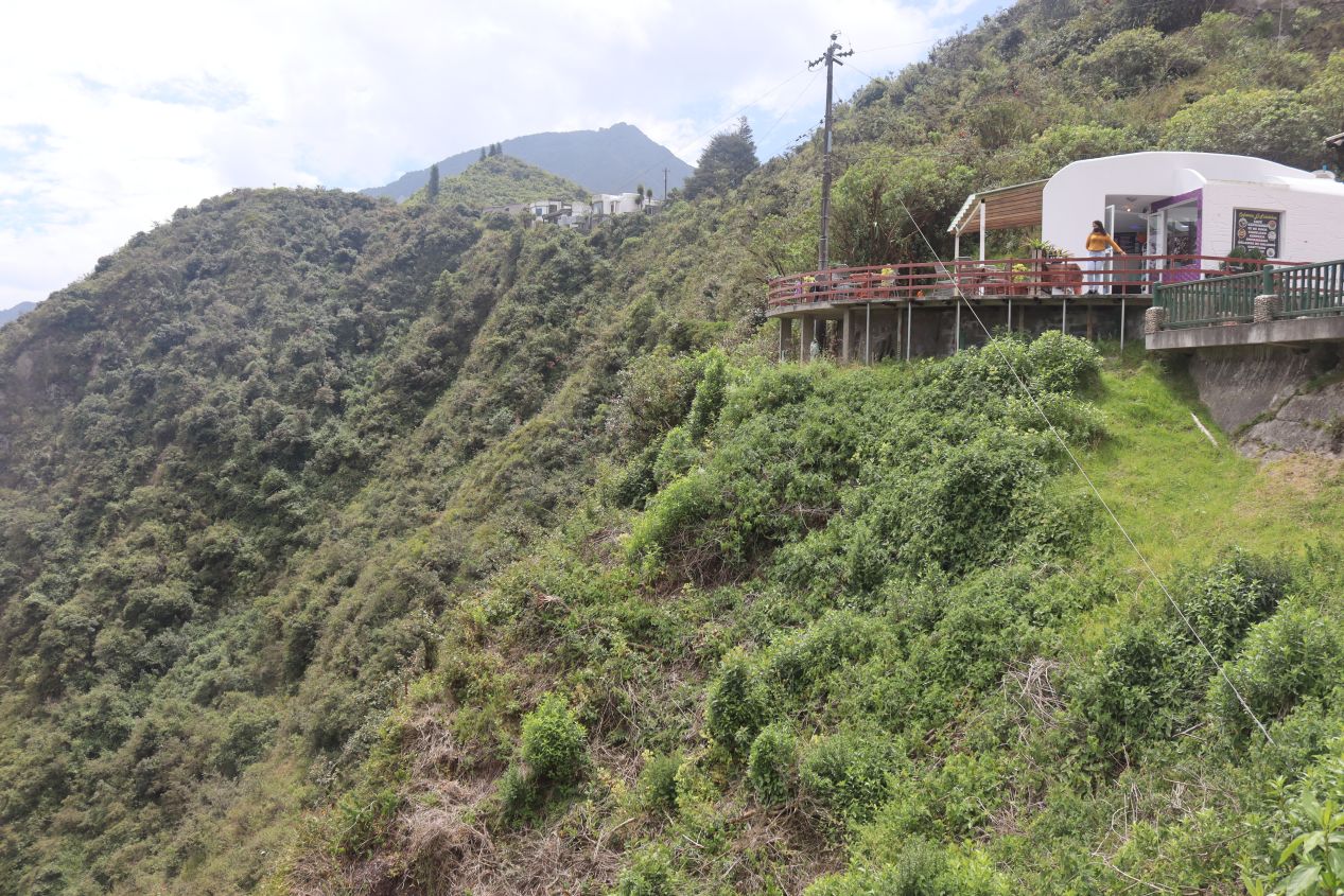


One of those places happened to be close enough that it shared the same parking lot with the Temple of the Sun. This was the Reserva Geobotánica Pululahua, a protected area surrounding Pululahua volcano, which we could view from this vantage point looking downwards into the valley below. This place is apparently one of only two inhabited volcano craters in the whole world and the only volcanic crater to be farmed and used for commercial agriculture. The volcanic soil is supposed to be rich in nutrients which is why the indigenous people have been farming here for centuries. There was a trail that headed down to the floor of the crater which was only about a mile in length but quite steep in nature. We had plenty of other things on our list to see for the day and were therefore quite content to remain up at the top enjoying the view. There was also a small cafe here where we could get some water to drink before heading onwards to our next destination. The food wasn't anything special but the seating area looking out over the valley floor had some spectacular views.

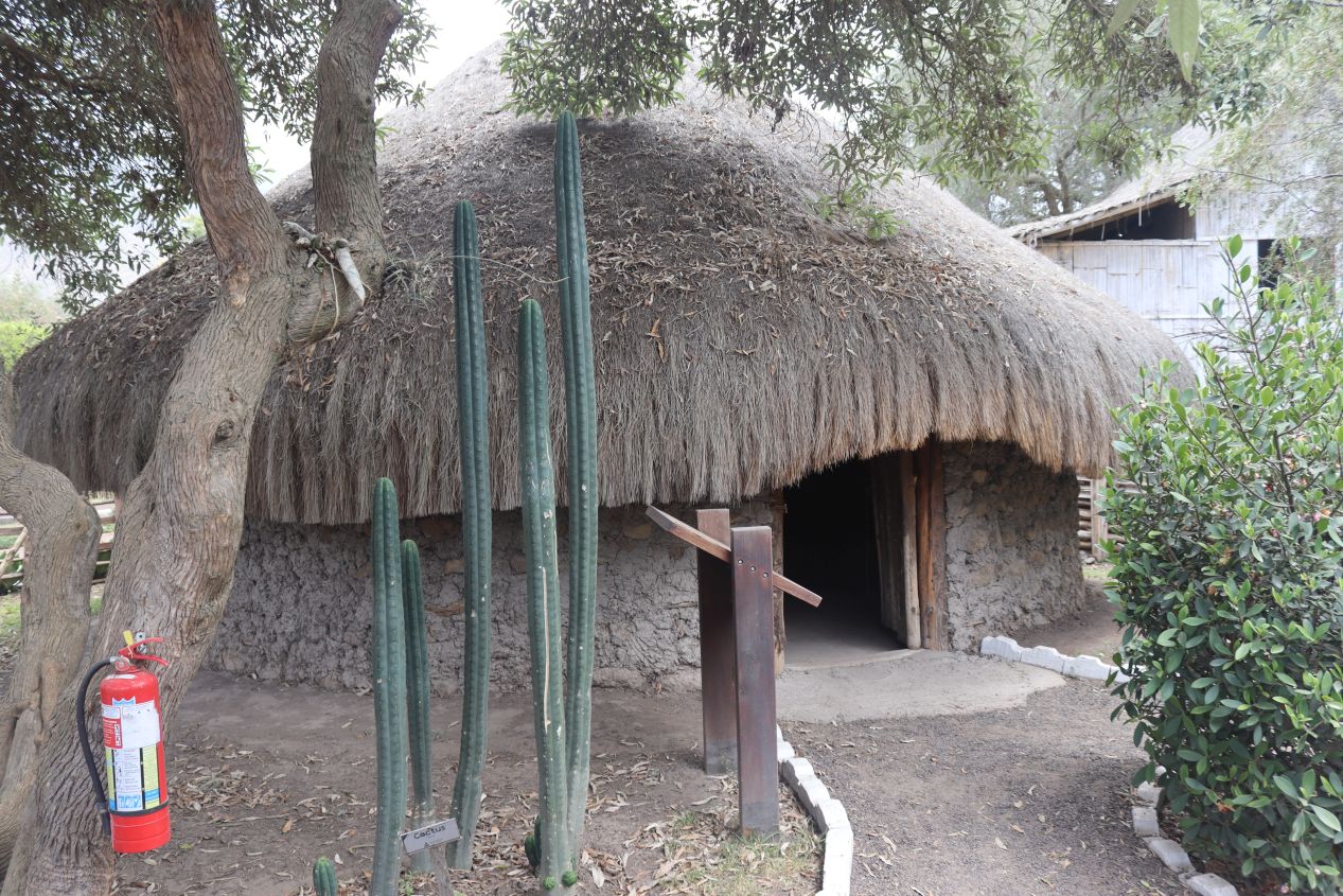


Our next destination was only a mile or two away and the main reason why we had driven out here in the first place. This was an attraction known as Ciudad Mitad del Mundo which translates as the "middle of the world city" into English. Mitad del Mundo is located (almost) exactly on top of the planet's equator and there's a towering monument here built in the 1970s to commemorate this unique spot on the Earth's surface. Over the following decades since the monument's construction, Mitad del Mundo has been built up into a full tourist attraction with more information on traditional Ecuadorean culture and lots of stores selling local craftswork. Liz posed for a picture in front of the big Mitad del Mundo sign and then we wandered around exploring the various attractions in the area. As with all of the tourist destinations that we were visiting this day, the overwhelming majority of tourists were locals from elsewhere in Ecuador. We didn't see very many of the typical international tourists from the United States, Europe, East Asia, or Oceania. As far as the sights on display, the little shops at Mitad del Mundo had some impressive handicrafts on display in a variety of traditional designs. We were less impressed by the cultural exhibits on the indigenous peoples of Ecuador which were passable but nothing special.

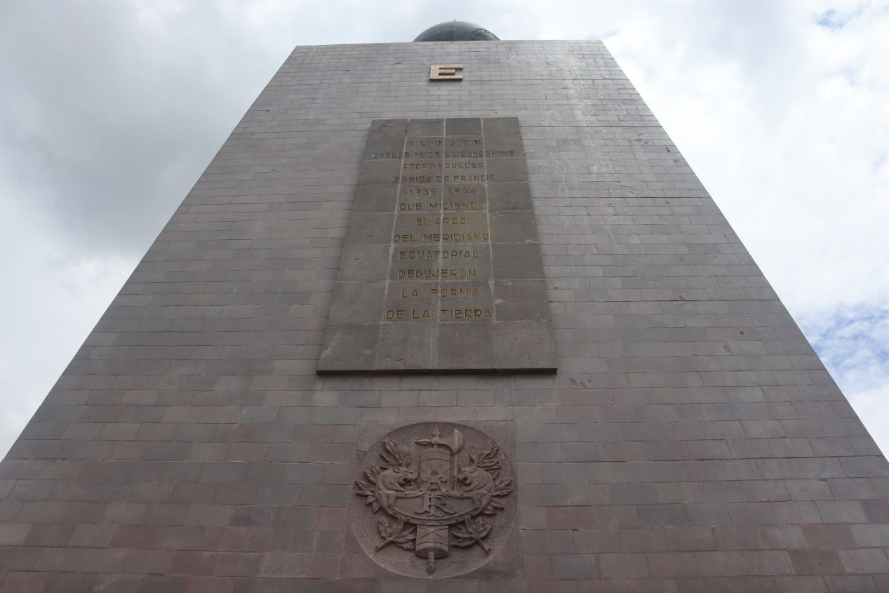


The main attraction at Mitad del Mundo is the monument to the equator itself. This structure stands 30 meters / 100 feet in height and divides the world into the northern and southern hemispheres. Unfortunately, the monument was first placed in the 1930s before the advent of modern GPS systems and it turned out that this is not precisely where the actual equator is located. The true middle point of the world is located about 200 meters to the north so the big tourist attraction is very close without being exactly correct. It's good enough for all intents and purposes though and we had driven across the real equator while heading to and returning from the Temple of the Sun. I've had pretty good luck in visiting these famous geographical locations, previously traveling to the Prime Meridian in Greenwich, United Kingdom and the Arctic Circle north of Fairbanks, Alaska. The Prime Meridian is of course a purely arbitrary location on the Earth's surface but the equator and the Arctic Circle are real geologic phenomena. (Now I need to get to the International Date Line and the poles somehow...)

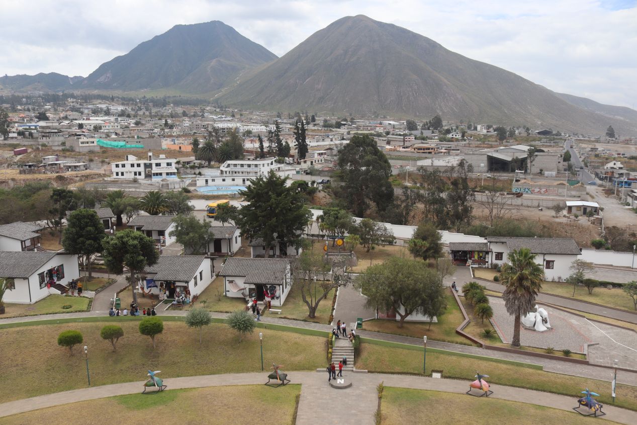


These were the views from up on top of the monument looking out over Mitad del Mundo. The invisible line of the real equator is visible in the second picture looking to the north; there's a road that runs through the middle portion of that image (a blue car driving on that road is visible on the right side of the picture) and the equator is situated just on the far side of that road. Down below us was a technically inaccurate but highly picturesque yellow line diving the world into north and south. The elevated position from the top of the monument also provided some great views looking out at the rugged hills surrounding the area. The dry slopes of mountains could be seen in every direction along with the houses of ordinary people living here in the northern suburbs of Quito. Not pictured here was the interior of the monument which had informational displays about the different regions of Ecuador. There was some useful information about the peoples and the natural wildlife in the various parts of the country: the highlands, the coastal region, the rainforests, and so on. We did take some pictures of the inside only to find that the lighting was surprisingly poor and didn't make for great images.

Liz took this picture of me standing astride the fake equatorial line. Let's just pretend that I really had one foot in each hemisphere, shall we? 

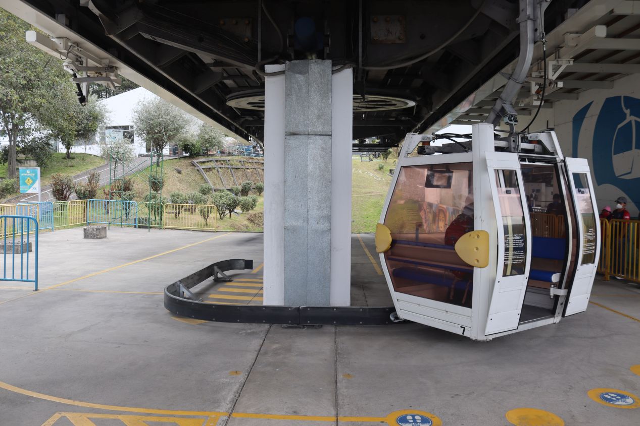


We finished sightseeing at Mitad del Mundo around noon and drove back back towards Quito along the same route that we had taken that morning. This time we dodged the morning rush hour commute and the traffic was more manageable, if not exactly a walk in the park. We drove to the foothills of the mountains west of the city center to visit a gondola lift named TelefériQo. This is one of the highest cable car systems in terms of elevation to be found anywhere in the world, rising from 3,117 meters / 10,226 ft to 3,945 meters / 12,943 feet. There was a bit of a carnival atmosphere at the base of the gondola lift, with a small amusement park that was temporarily closed due to COVID along with a series of fast food stands. TelefériQo was moderately crowded when we visited in the early afternoon and we had to stand in line for about 45 minutes waiting for our trip to ride up to the top of the lift. Once we finally boarded our gondola, we were unfortunately stuck with one of the cars that had foggy windows and a bike rack attached to the back. Even with our point of view slightly impaired, we were still treated to sweeping vistas looking out over the city of Quito and the surrounding mountains. There were even cows down below us improbably grazing on the grass growing on the steep vertical slopes.

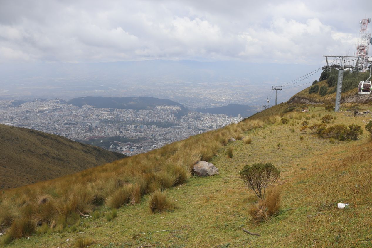


Up at the top of the cable car system, we found a cafe and gift shop overlooking the drop down to the city of Quito below. It was noticeably colder up at the top of the lift and we were glad that we had brought long pants and light jackets to wear. It was chilly considering that we were practically on top of the equator - but then again we were at nearly 4,000 meters / 13,000 feet elevation! The TelefériQo gondola lift is a popular local attraction both for the views that it offers as well as a gateway to hike to the summit of Pichincha, an active nearby volcano. The summit of that mountain was another 800 meters higher in elevation and we had no desire to try scaling its even greater heights.

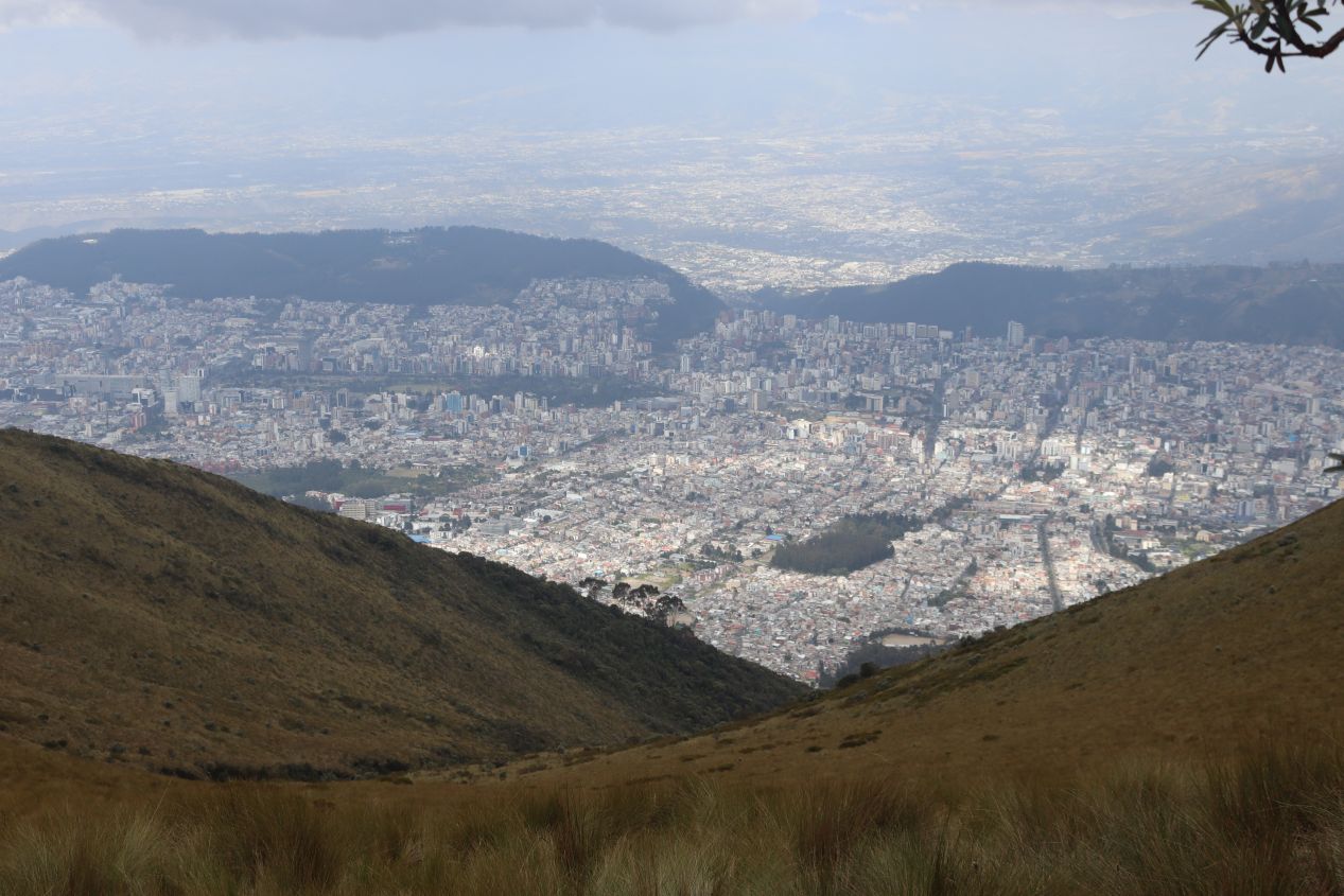


These are a few additional pictures of the trail heading up towards the top of Pichincha and some of the surrounding scenery. While we were fortunate to have clear views looking down at the city of Quito, the upper reaches of the mountain were shrouded in fog and prevented us from seeing the crest at the top. A trail marker indicated that it was about 4 kilometers and 800 vertical meters upwards with a suggested duration of five hours to reach the top. (The challenge rating was "exigente" or "demanding" when translated into English.) Maybe we could have thought about taking on this challenge if we'd had another day to spend in Quito but we still wanted to be able to spend some time in the historic city center before the day was finished. Then there was also the problem of altitude sickness: we were pretty high in terms of elevation and both of us were feeling a bit lightheaded. I'm not sure that I would have wanted to hike to a peak which was almost 5,000 meters / 16,000 feet in elevation, at least not without having some time to acclimate ahead of time. We walked around the top of the cable car for a little bit and grabbed a late lunch from the cafe before heading back down again.


Liz snapped these pictures while I was driving to help provide a sense of what it was like operating a car in Quito. Imagine taking the hills of Boston or San Francisco and then combining them with a maze-like street layout dating back to the Spanish colonial period of the 18th century. Quito's historic center was amazing when explored on foot, not so amazing while driving through in a car.

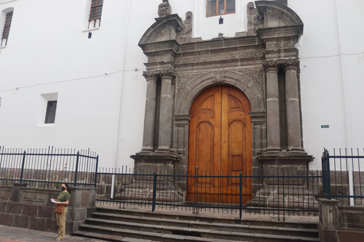


It was late afternoon by the time that we made it back to our hotel where we were able to park our rental car in that same tiny garage as before. We wanted to use the remaining hours of daylight to explore as much of the historic town as we could, which was fortunately only a few blocks away from the location of Casa Gardenia. Our host had provided us with a map that helpfully listed some of the top attractions in the downtown and all of them were within easy walking distance. The pictures above included some of the colorful churches and apartment complexes that we passed as we walked towards the main plaza. Quito's historic center is considered to be the largest, least-altered, and best-preserved historic center in the Americas. It was one of the first places to be designated a UNESCO world heritage site back in the 1970s and we found it to be a wonderful place to explore on this comfortable Saturday evening. This gigantic door pictured above was from the Iglesia de la Inmaculada Concepción (Church of the Immaculate Conception) which was not one of the more famous churches in Quito. This entrance was closed to the public and we didn't spot another one if the building was open for visitors.

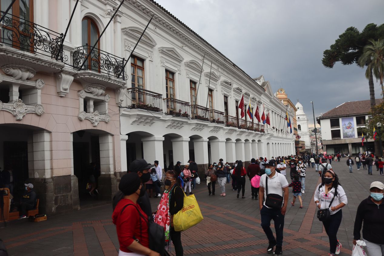


The road that we were following eventually led to the Plaza Grande, the historic heart of the city of Quito dating back to its earliest days in the colonial period. This open area is also known as Independence Square and it houses many of the oldest and most important buildings in the city. The white-colored building with the tall central Ecuadorean flag was the Carondelet Palace, the seat of the Ecuadorean government where the president of the nation resides. We had arrived too late in the day to take a tour of the inside and would have to be content with these views of the building's exterior. The other large building on the north side of the square was the Palacio Arzobispal or Archbishop's Palace, housing the administrative offices of Quito's Catholic church. With this being a weekend evening, the Plaza Grande was bustling with people shopping or eating or simply going for a stroll outside. Our one concern at this point was the weather, as there were some dark storm clouds off on the horizon. We were hoping that the threat of rain would hold off until after we had finished walking around the historic part of the city.

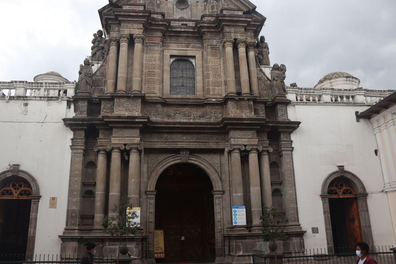


We continued walking to the southern side of the Plaza Grande where we encountered several historic churches. The first two pictures capture the Catedral Metropolitana de Quito, known locally simply as the Catedral or Cathedral, which is the seniormost Catholic church in Ecuador. A church of some kind has stood here on the Plaza Grande since 1565 although most of the current structure dates from the 19th century. These pictures capture the view of the Catedral from the main square as well as the primary entrance to the building a little bit to the south. I very much wanted to explore the building's interior, however this was a Saturday evening and there was a mass taking place at the time. We couldn't do more than peek our heads inside for a quick look and snap the dark picture above so here's a much better image from Wikipedia showing the beautiful main altar. As for the last picture, that was the exterior of a completely different church located across the street from the Catedral, this one known as Iglesia de la Compañía de Jesús (Church of the Society of Jesus). As the name indicates, this was a Jesuit church which first began construction in the early 17th century and took well over a hundred years to construct before finishing in 1765. This church is famous for its extremely ornate interior, which we did not get to see because of services again taking place inside. I'll link to another image from Wikipedia so that readers can decide for themselves whether this setup is beautiful or gaudy.

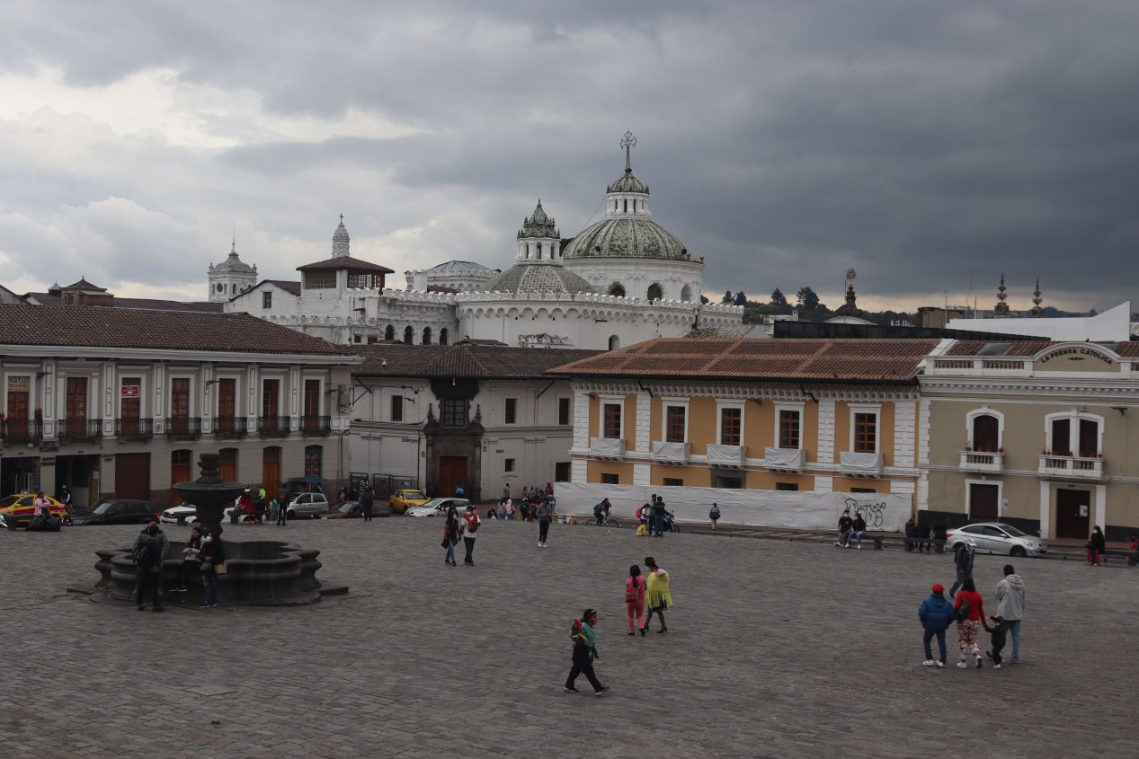


About two blocks away from the Plaza Grande was another square holding yet another famous church, this one the Iglesia de San Francisco. The church of San Francisco has the distinction of being the oldest surviving chuch in Quito, first established in 1550 and completed as far back as 1680. San Francisco contains both a church and a convent which together take up a huge amount of space, over 40,000 square meters (roughly 400,000 square feet) when counting all of the attached buildings. Due to the length of time when the church was under construction, San Francisco contains a number of different architectural styles ranging from Renassiance to Baroque to something known as Mudéjar which was based on Moorish Spain prior to the Reconquista. We found that the plaza outside San Francisco was bustling with people and I wish that I could have done more than take a quick look inside to snap the picture above. Like the other churches we had passed, San Francisco was also conducting Saturday evening mass and we didn't want to be rude.

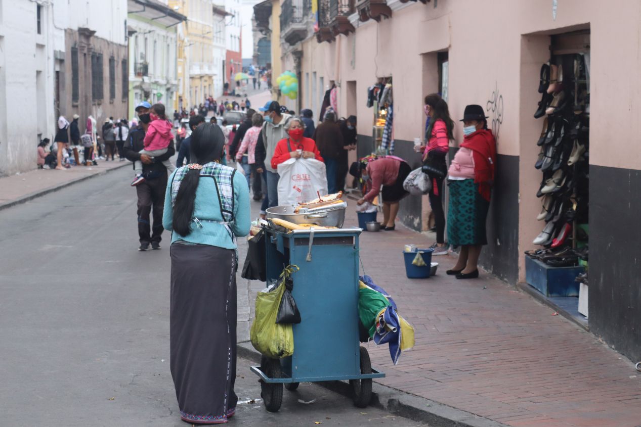


Aside from visiting all of these various churches, we were also enjoying the chance to wandering through the historic center of Quito and enjoy the street scenes along the way. Most of the buildings were highly colorful and there were people seemingly everywhere to give the area a lively feel. We saw many street vendors selling food or tourist souvenirs to the crowds passing through to add to the overall atmosphere. Off in the distance on top of a hill to the south was El Panecillo, a statue of the Virgin Mary that overlooks the downtown. The views from atop that hill are supposed to be excellent but it also has the reputation of being a rough area so tourists are not encouraged to visit. In the other direction to the north were the twin spires of the Basílica del Voto Nacional, an even larger and more modern church. It was located fairly close to our hotel and we hoped to swing past it on our return walk later that night.


We briefly stopped by one additional square, the Plaza de Santo Domingo along with its attached Iglesia de Santo Domingo. This spot was a bit further away from the Plaza Grande and the square was relatively deserted. There wasn't too much of interest here aside from a statue of Marshal Sucre in the middle of the square, and we were growing increasingly concerned about the pitch-dark stormclouds rolling into the area. Time to find a place to get dinner out of the path of the incoming weather.

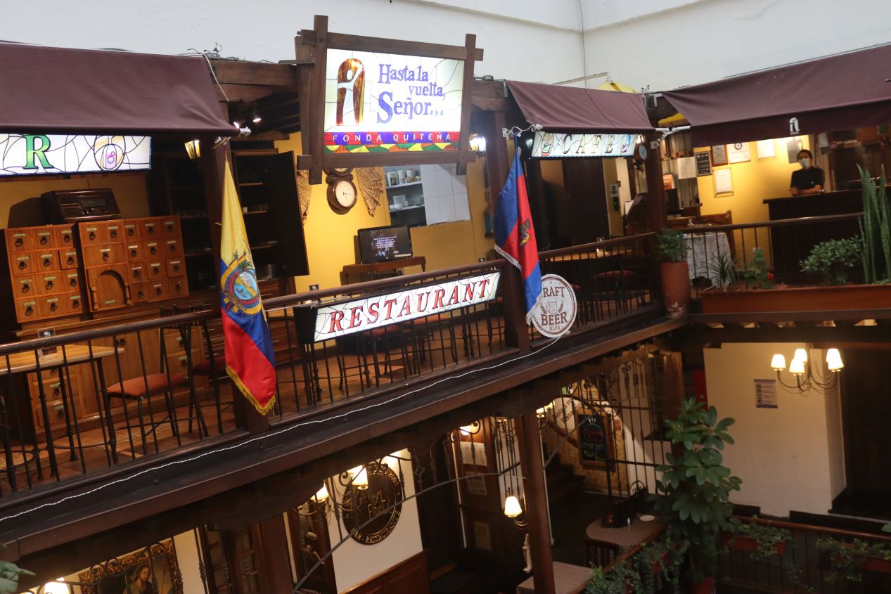


Our restaurant of choice was located in an enclosed shopping area just off the Plaza Grande and went by the name of Hasta la Vuelta, Señor! The unusual name was in reference to a local legend about a lecherous monk named Father Almeida who kept sneaking out of his monastery late at night to meet with women, and supposedly kept giving Jesus the excuse of "until I come back, Lord" (hasta la vuelta, señor). It was probably something that made perfect sense to everyone growing up in Ecuador and we simply didn't get the reference. Leaving the name aside, the restaurant was up on the third floor of a lovely little courtyard full of bright lights and colorful flowers. We were also lucky in terms of timing as we had only been seated for a few minutes when the storm finally broke outside and a torrential downpour began. There was a glass ceiling in the center of the courtyard and we could see the rain pounding on the glass at a furious rate. It was one of those storms where you can't be outside for more than five seconds without getting completely soaked and we managed to dodge it by eating dinner at just the right point in time. This evening would have been a lot less fun if we'd gotten caught outside in the wet.


Hasta la Vuelta, Señor! had excellent food and we were both very hungry after a day of furious sightseeing. I had been pushing the two of us to keep moving throughout the day and felt as though I had been rushing Liz a bit at times. The problem was the fact that we only had this single day in Quito and there wasn't anything that we wanted to cut out of our itinerary. There was certainly more than enough to do here to justify a stay of several days rather than the one day that we had. I think everything worked out just fine but it certainly had been a busy day.

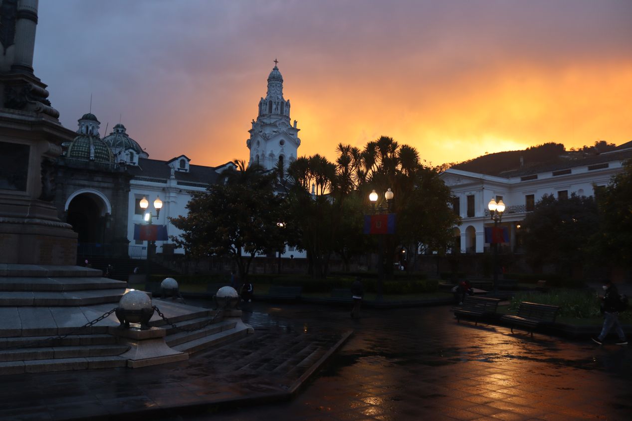
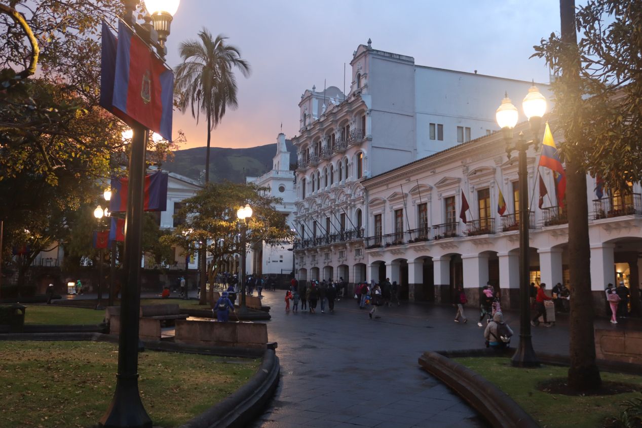

Then we left the restaurant and were delighted to find this surprise: the rain had completely stopped and we were treated to a dazzling rainbow of colors as the sun set behind the clouds! The Plaza Grande was now sopping wet and had been completely cleared of visitors due to the heavy downpour. Even as the darkness of twilight continued to approach, there were a few minutes remaining of sunset and the view to the west was nothing less than spectacular. We hurried to snap a bunch of pictures of the Carondelet Palace and the Catedral before the light faded completely. This is one of those times where I wish that we were professional photographers as we had stumbled into the perfect moment to capture the historic heart of Quito. While I don't think we did half bad with these images, I have no doubt that a real photographer could have produces some truly amazing stuff if given this opportunity.

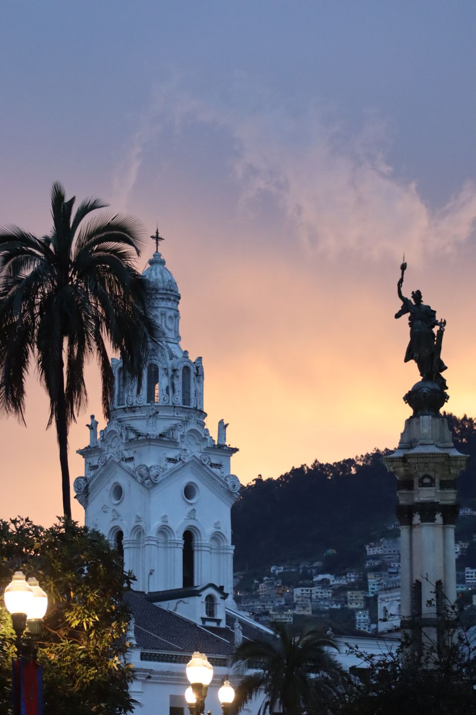


These were some more pictures taken by Liz as night was falling across the city. She captured some more views of the Catedral and El Panecillo as well as the Basílica del Voto Nacional. We were heading north towards the Basilica at this point, walking uphill away from the city center and back towards our hotel.

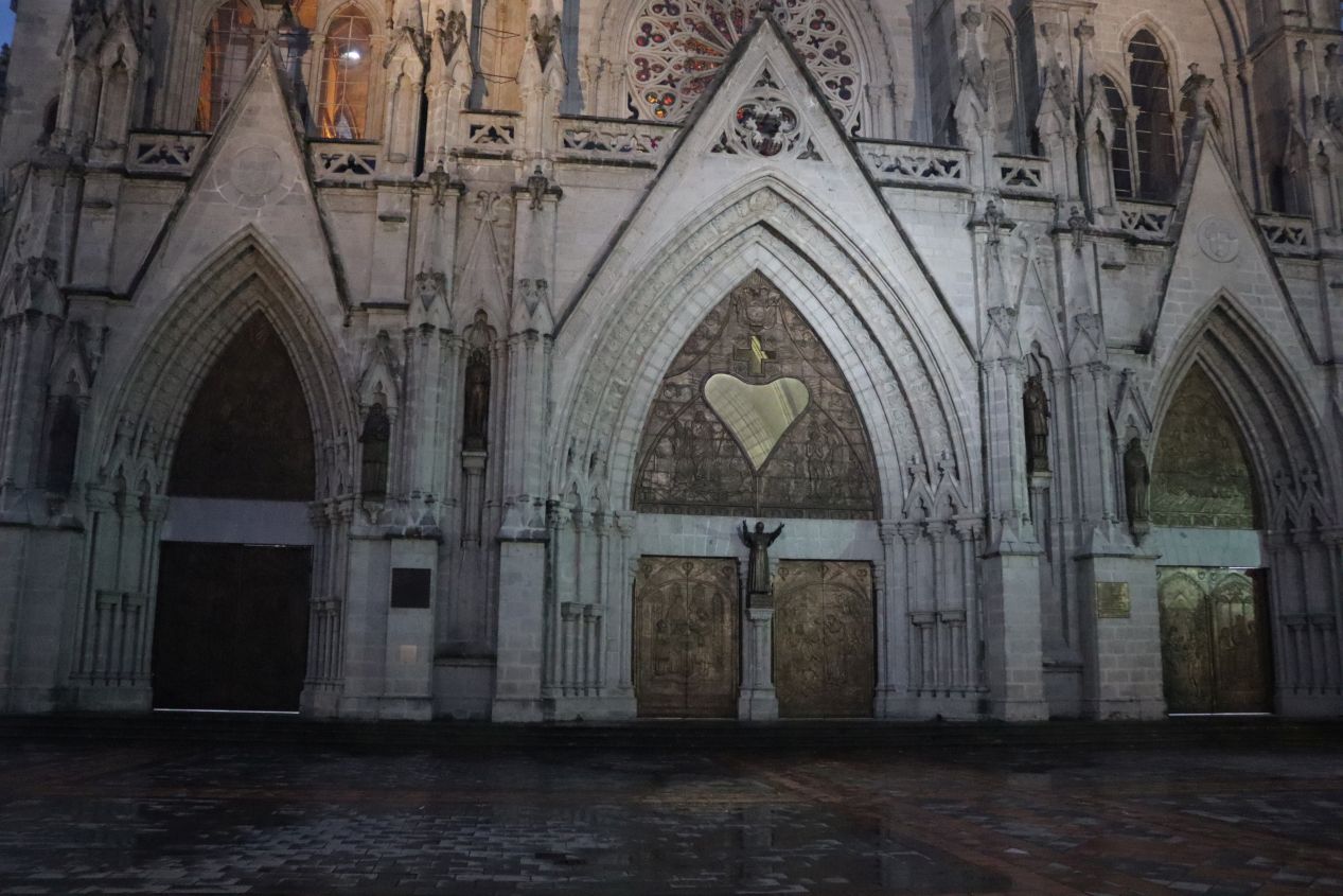


It was full night by the time that we reached the Basilica and stopped to take our last pictures for the day. The Basílica del Voto Nacional is not a historic church as construction started in 1892 and then finished a century later in 1988. However, it does have the distinction of being the largest Neogothic basilica to be found anywhere in the New World and the sheer size of the place makes it one of the top tourist destinations in Quito. We were arriving after the Basilica was closed for the night and therefore we were only able to take a few picture of the building's exterior architecture. As far as I've been able to tell, the Basilica had a very standard Gothic setup straight out of the Middle Ages: high ceilings on the interior, two rows of pillars running down the sides of the central aisle, and colorful stained glass windows to let in light from the outside. It reminded me a bit of the National Cathedral in Washington DC, another Gothic design intended to be reminiscent of the medieval period despite being constructed in the recent past. (Note that like the National Cathedral, the Basilica didn't require flying buttresses on the outside to hold up the weight of the building; it might look like a medieval cathedral but could take advantage of stronger modern building materials.) It was only a few blocks from the Basilica back to our hotel and we captured one final picture looking downhill at the center of Quito shrouded in the darkness of night. It was quite pretty seeing the streets and major buildings shining with light off in the distance.
This was our one and only day to see Quito and I'd like to think that we were able to make the most of the opportunity. We had a chance to visit the equator, take in some of the local culture (even if it was done in touristy manner), visit the top of the nearby mountains, enjoy some Ecuadorean food, and explore the historic city center in the downtown. Quito is a fascinating city and I'd definitely recommend visiting for anyone who found this interesting to read about. As for us, we were up at 5:30 AM the next morning so that we could drive back to the airport and prepare for our flight to the Galapagos. It felt like we had already seen a lot and the real focus of our vacation hadn't even started yet!


