
Off in the opposite direction of Mount Rainier, across the Pugent Sound to the west of Seattle, lies the quiet natural preserve of the Olympic Peninsula. This is the part of Washington state that looks a bit like a flexing arm, or perhaps an elephant's trunk. Tucked away in the northwestern corner of the continental United States, the Olympic Peninsula is a sparsely populated region of small towns located along the coastline. Most of the peninsula has been set aside to be preserved as part of Olympic National Park, which was created back in 1938 by the Franklin Roosevelt administration. This is an area of incredible ecological diversity; a visitor can pass through multiple different climate zones, with completely different flora and fauna, in the span of only a few hours. We spent only one day on the Olympic Peninsula and visited three distinct regions: alpine meadows, temperate rainforests, and the Pacific coastline. If we had known more about how much there was to see in Olympic National Park, we would have spent an additional day exploring the region. This is an easily overlooked gem of an area to visit.

Getting around on the Olympic Peninsula can be a difficult task. While the region isn't that huge in terms of square milage, it takes a long time to traverse by anything other than plane due to the presence of the national park sitting squarely in the middle of the peninsula. There are no roads that run through the park from one side to the other and only a couple that even enter the park at all. Most of Olympic National Park remains an untouched wilderness of craggy mountains and rain-soaked forests. As a result, travelers must drive in a wide loop around the park's boundaries and that can make for some long travel times. We were leaving from the southern suburbs of Seattle near the SeaTac airport, and although the distance was only about 140 miles / 225 kilometers, it took almost three hours to reach the main visitor entrance to the park just outside the town of Port Angeles. The drive itself had been pretty after leaving the Tacoma region, passing through lots of small towns nestled up against the water. There's virtually no access to Olympic National Park from the eastern side beyond a few hardy campgrounds, and as a result we had to drive around to the north and approach from the main entrance up there.


The initial entrance was nondescript aside from the standard National Park Service sign. Nothing as neat here as the overhanging arch entrance that Mount Rainier National Park had featured on our previous excursion. After paying the entrance fee to the park, we drove along a winding road that snaked up into the hills. We were heading for Hurricane Ridge, located in the alpine section of the park's grounds and home to the largest visitor's center in Olympic National Park.

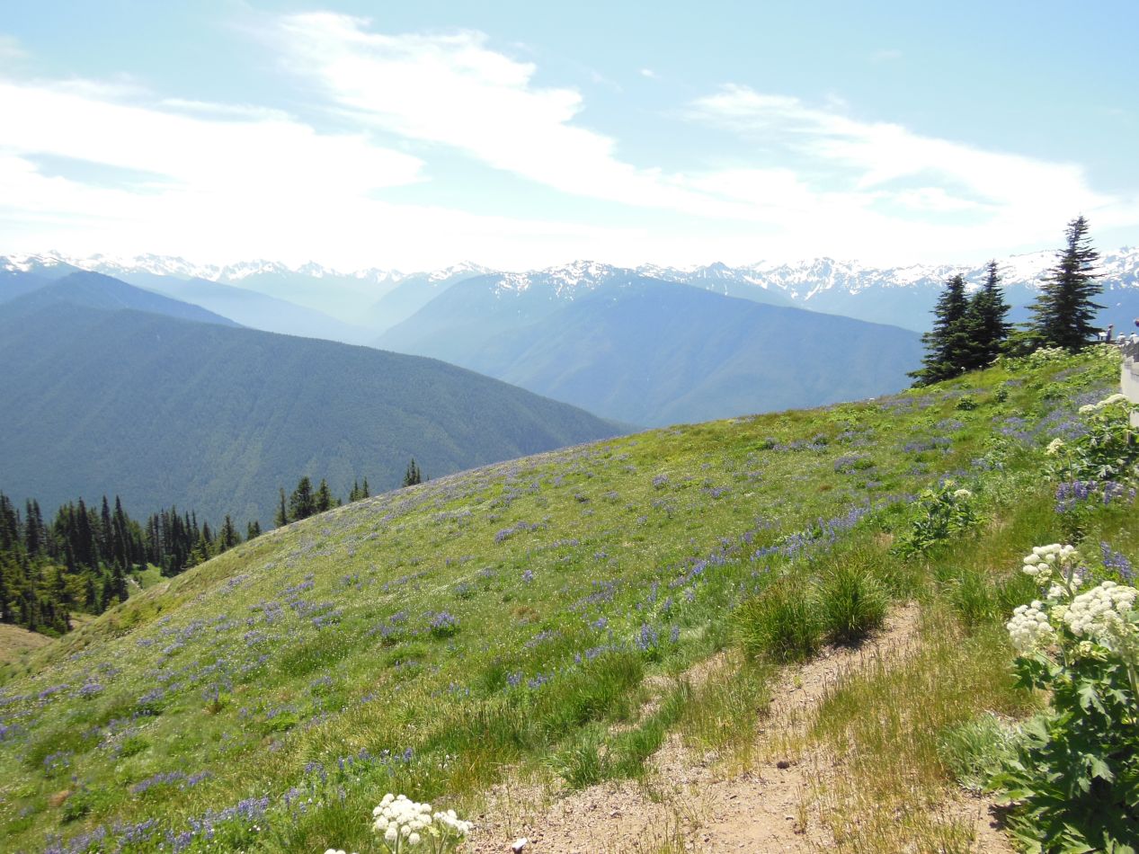
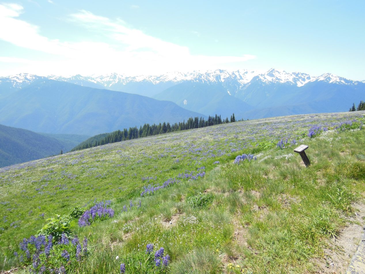

The only word that I can use to describe the views at the top is "stunning". The views on the way up to the top of Hurricane Ridge had mostly been obscured by surrounding tree cover as the car ascended. Up here at the top though, we could suddenly see far off into the distance at the surrounding snow-capped peaks. The visitor's center was located just barely above the tree line, but not so high that the ground turned into a bare rock surface. Instead, the landscape was made up of tough grasses and beautiful small flowers, a series of alpine meadows that allowed visitors to see miles and miles into the distance. These pictures were taken looking to the south into the heart of the park, and it was all wilderness out there, no roads at all. Just a few hiking trails that headed deep enough into the park that they typically require multiple days to complete, with an overnight stay or two along the way. It was an incredible display of natural beauty in a remote part of the state.
I also threw in a picture of another one of those three dimensional topographic maps located inside the Hurricane Ridge visitor's center. This is one of the best ways to convey the experience of what the landscape looks like to tourists, and it helped make sense of the region and its climate to me. You can easily see why the western edge of the peninsula get so much rain and has the climate of a temperate rainforest: weather systems run into those peaks and dump all of their rain on the western slopes, leaving the alpine meadows comparatively drier. Hurricane Ridge itself was on the north-central part of that map, directly below the upside-down word "OF" in the Straight of Juan de Fuca. With this as a reference, it was much easier to situate our location within the larger structure of the park.

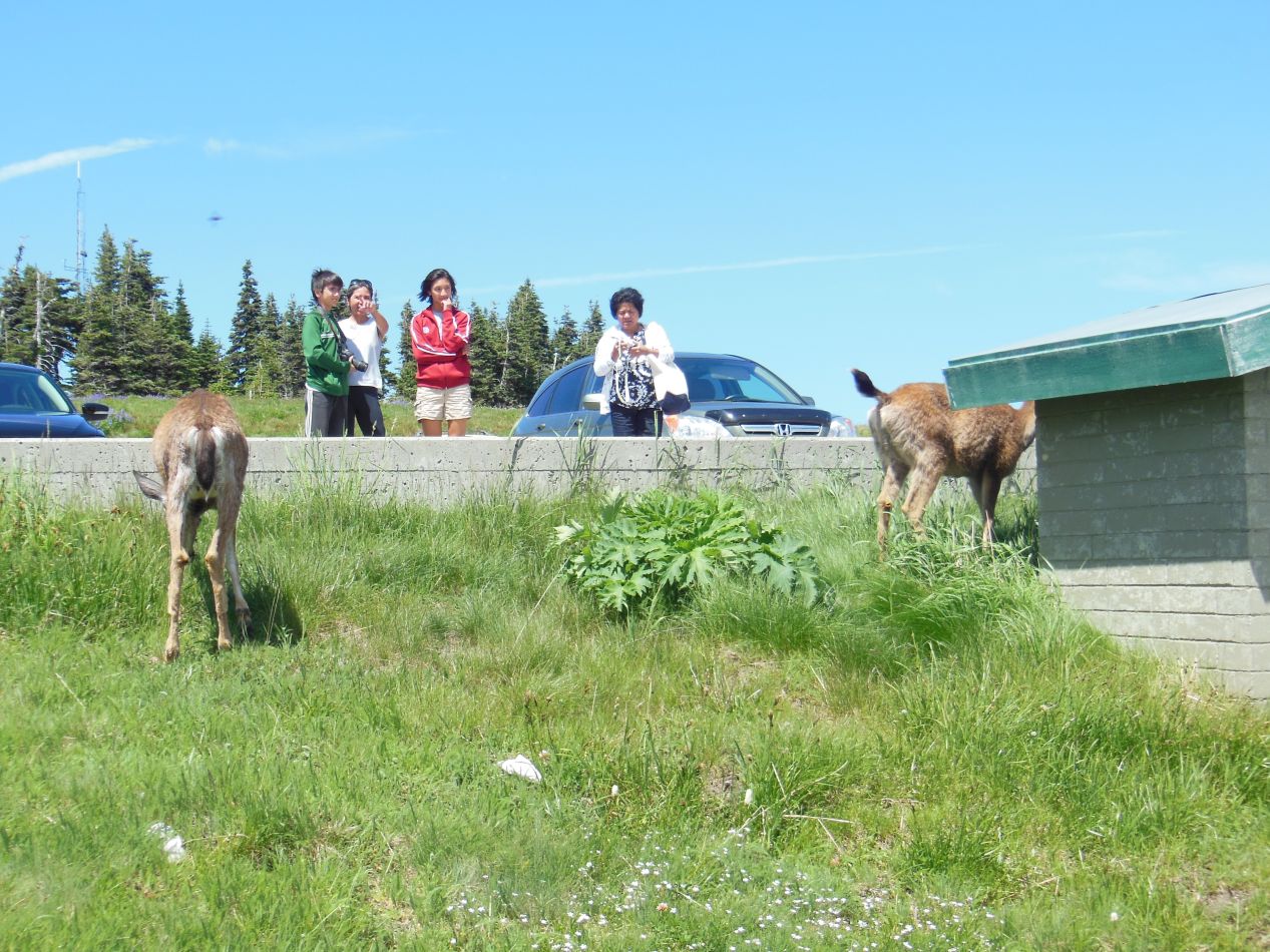


By the way, these deer were all over the place in the parking lot surrounding the visitor's center. They were evidently used to the tourists who arrive each year because they were not scared at all of humans. They went right ahead eating the grasses underfoot as people walked past taking pictures and cars drove up to park. One of them even looked back at me as I was taking its picture and gave me the deer equivalent of a saucy grin.  The presence of all these deer was an unexpected surprise, and they were fun to watch as they roamed about without a care in the world beyond filling their stomachs.


There were a bunch of hiking trails that left from Hurricane Ridge, of course, and we took a short walk along one of them that led off to the north. The views here weren't nearly as spectacular, as they looked down towards the coastline as opposed to deeper into the park where all of the mountains were located. However, the slopes below still teemed with forests of evergreen trees, and we could see the blue waters of the Straight of Juan de Fuca off in the distance. The town of Port Angeles and the ferry over to the Canadian side of the straight were located down there, looking like a child's set of building blocks from this height. We walked to the overlook indicated on the map, but otherwise didn't engage in too much hiking here. We wanted to visit the Hoh rainforest on the western side of the park, and that meant a significant amount of driving yet to do.

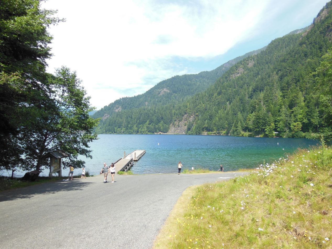


The Hoh rainforest ws only about 20 miles away from Hurricane Ridge by air, but getting there would require driving a little over 100 miles / 160 kilometers along the circuitous route around the boundaries of the park. Along the way, we stopped at the lake pictured above to stretch our legs and walk a bit. This was Lake Crescent, located just inside the northern edge of Olympic National Park, and easily accessible due to the road that runs alongside it. It was about as picturesque a body of water as I've ever seen, especially on a sunny summer day like this one. The lake was ringed by densely forested hills, and the water was a deep greenish-blue color. We could easily see down to the rocky bottom from the dock in the picture above; it was nice clear water, likely safe to drink although we didn't try. I especially liked seeing the man who was taking his dogs swimming. While it was a little on the cold side for people to go swimming, the dogs seemed to be having a blast!

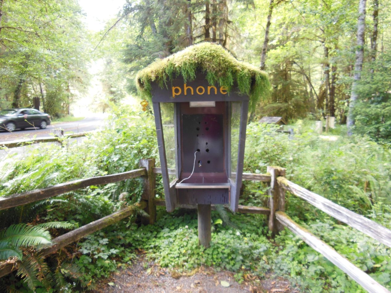


Eventually we reached the Hoh visitor's center in the afternoon. Located on the western slopes of the park, this region has one of the more unique climates that I've been fortunate enough to visit: a temperate rainforest. As the name suggests, this is an area that receives a massive amount of rainfall each year, but is located outside of the tropics where most of the world's rainforests can be found. The result is a unique ecosystem teeming with life that often can't be found anywhere else, and this was one of the biggest factors in setting aside land for the park as a natural preserve back in the 1930s. The Hoh visitor's center receives about 150 inches / 380 centimeters of rain annually, making it the wettest location in the continental United States. (There are parts of Hawaii that get significantly more rain; the island of Kauai actually gets TRIPLE this amount of rain each year.) The huge amounts of water falling as rain allows for the growth of enormous coniferous trees, different types of spruces and firs and hemlock trees. The constant moisture also leads to the growth of massive amounts of moss, and this is what the Hoh rainforest is best known for. The old fashioned phone booth provides a good example of how moss simply takes over any surface that isn't kept cleared of it. It grows on the trees and coats the forest floor in shaggy carpeting in a truly unique ecological phenomenon.

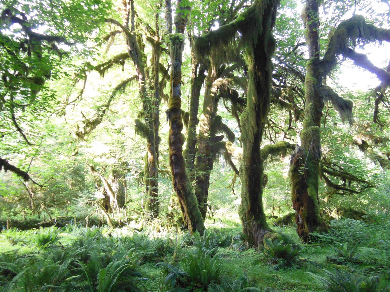


The main attraction at the Hoh visitor's center is a short walking trail known as the Hall of Mosses. This path extended in a circular route for roughly a mile in length and takes visitors through a series of maple trees drooping over with clinging strands of moss. Despite what it might look like, apparently the moss is not harmful to the trees and merely piggybacks off of them to reach air and sunlight more easily. The visual spectacle, however, can only be described as impressive. The tree appear to be bowed down, barely supporting the weight of the mosses that cling to every possible surface. And these are not tiny trees either, with some of them easily reaching heights of 200 feet / 60 meters. I deliberately took a picture with some of the other tourists on the walking path to capture a sense of scale for the size of these trees. Absolutely amazing. It was worth the long drive out to this point to see these giants with their mossy companions. I've never seen anything else quite like the greenery in the Hall of Mosses.

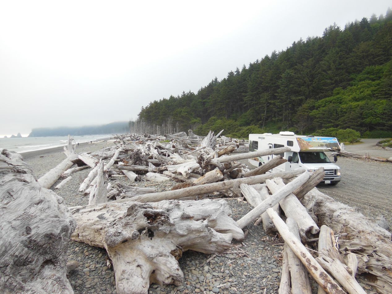


After leaving the Hoh rainforest, we drove further to the west in the hopes of stopping to see the Pacific coastline. We ended up visiting Rialto Beach, a public beach reachable by road that's also contained within the boundaries of Olympic National Park. There's a narrow strip of shoreline that runs for almost 50 miles along the coast, and this forms a discontiguous part of the park separate from the main inland portion. One of the oddities of Olympic National Park is that visitors can hike along the coast for several days taking in the wind and the surf. This particular beach is one of the few areas accssible by road, making it one of the most heavily trafficked parts of the seashort. Despite that fact, it was practically deserted and looked to be one of the emptiest coastal regions that I'd ever seen. I can't imagine how remote the shoreline would look after hiking 20 miles to the north, where there was no road for miles and miles in any direction.

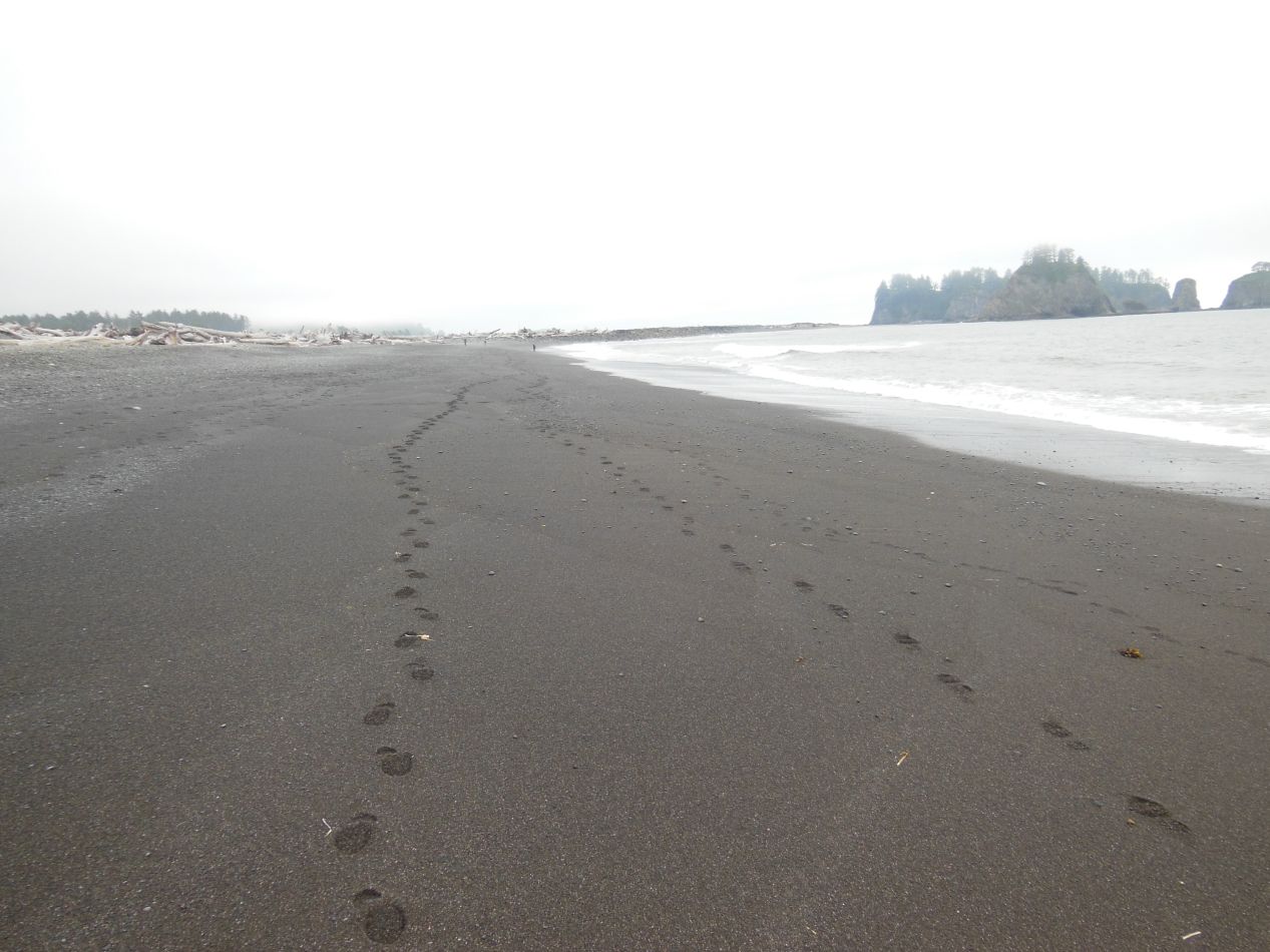


Rialto Beach was cold and windy. It was surprising how much the temperature and the climate had changed from the Hoh rainforest only a dozen or so miles away. It was probably about 20 degrees Fahrenheit cooler here than it had been back at the Hall of Mosses, and of course there was a steady breeze blowing in off of the ocean. It was late afternoon by this point and we likely could have seen the sun beginning to set over the water if the whole beach hadn't been shrouded in a dense layer of fog. That particular bit of weather had obviously been caused by the ocean, as there was no such fog only a mile or two inland. The beach itself was rocky and there was a lot of driftwood that had piled up over time along the shore. Several kids were playing in the water a little ways down, but it was too cold for anyone else to venture into the ocean.
The most notable feature here at Rialto Beach was a series of rocky pillars that rose up out of the water. These were large enough to have trees growing on top of them, and they were visible both to the north and south along the coast. That must have been erosion at work there, countless centuries of wind and surf wearing away at the rock to carve out those structures. As someone who grew up visiting the gentle Atlantic coastline of Maryland and Delaware, the rugged conditions along much of the Pacific coast always catch me by surprise. Outside of Maine and maritime Canada, there really isn't much like this on the eastern side of North America. Overall, Rialto Beach made for quite the contrast from the alpine meadows of Hurricane Ridge and the moss-covered Hoh rainforest. It was oddly beautiful in its own gloomy way, and the foggy weather conditions were evocative of the Twilight series of books and movies (officially set in the closest town to Rialto Beach, Forks). We grabbed a meal in the Subway located in Forks, which had a sign telling visitors to watch out for vampires, heh.


Having driven to the Hoh rainforest and Rialto Beach over on the western edge of the Olympic Peninsula, we now had to reverse course and drive back to Port Angeles again. This was the town at the foot of Hurricane Ridge, and the place where we were staying for the night in anticipation of taking the ferry over to Canada the next day. That was another 2.5 hour drive back again, which fortunately I can skip over for the purposes of this travel blog. It was a lot of driving today, more than my family typically likes to do in one day. We arrived in Port Angeles just after the sun had set, during that brief magical moment when the sun has gone down but the sky remains a rainbow of colors ranging from soft pink to dark blue. I took a few pictures of the ferry terminal in the fading light, catching these views looking back at the town from the waterfront. As for the town of Port Angeles, it may have been the largest town for a long distance in any direction, but at only 20,000 people there wasn't much to see other than the ferry terminal.
This brought a close to a fantastic day of traveling. We visited three different parts of Olympic National Park and experienced three completely different climates, from alpine to rainforest to coastal. The diversity of these three areas contained within the same park was hard to believe, and as I said before, we could have easily split this excursion into several more days to explore each one in more detail. The tourist materials that we read while planning this trip had said very little about Olympic National Park, and this whole day was a pleasant surprise about how many things there were to see. I would love to go back someday and do more hiking, particularly over by the Hoh rainforest on some of the trails that head deep into the wilderness. For the moment though, we would be moving on across the straight to the Great White North on the other side. Vancouver Island and the city of Victoria were beckoning.


