
The third and final day that I spent in New Mexico had the goal of exploring some of the state's natural attractions. I started by driving to White Sands National Monument, home to a unique environment of empty sand dunes, before continuing on to the great underground wonders of Carlsbad Caverns. The caverns in particular attract visitors from around the world to southeastern New Mexico, where they put to shame all of the other caves that I had seen on previous trips. Afterwards, I even stopped briefly in Roswell to experience the kitschy alien-themed tourist stuff in that infamous town. This was a day where I avoided the urban environments where I spent so much of this vacation and enjoyed the beauty of nature instead.
New Mexico is a big state, the fifth-largest in the United States, and I had to cross a sizable portion of it to visit my intended destinations. White Sands and Carlsbad Caverns are both located in out of the way areas and the two of them are not especially close to one another. That meant another day of significant driving time as I tried to combine them together into a single trip. It was 225 miles / 360 kilometers from Albuquerque to White Sands, a trip that took about 3.5 hours of driving time to complete. This was yet another morning where I was off before the sun came up to get an early head start on travel. Along the way, I kept seeing mileage signs to El Paso, Texas and I was surprised to realize how close I was drawing to the border with Mexico. This was the furthest point that I had reached in terms of distance from home, about 2000 miles away from the Washington DC region. Then after leaving White Sands, I would have a shorter distance in terms of mileage to cover but about the same length in terms of driving time to reach Carlsbad Caverns. There was no interstate heading east from White Sands and I would be reliant on the local roads for most of the trip to Carlsbad. With roughly seven hours spent inside the car driving from place to place, this was going to be another long day of sightseeing.

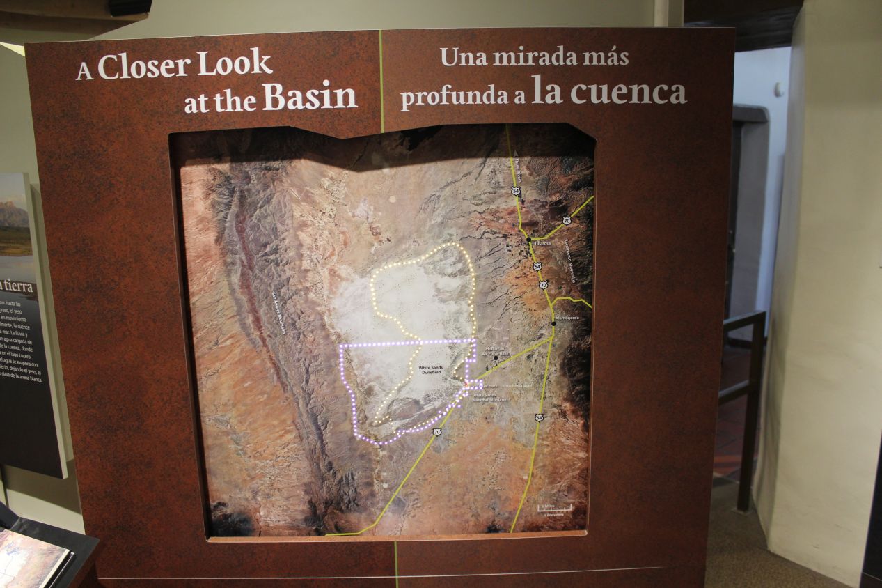
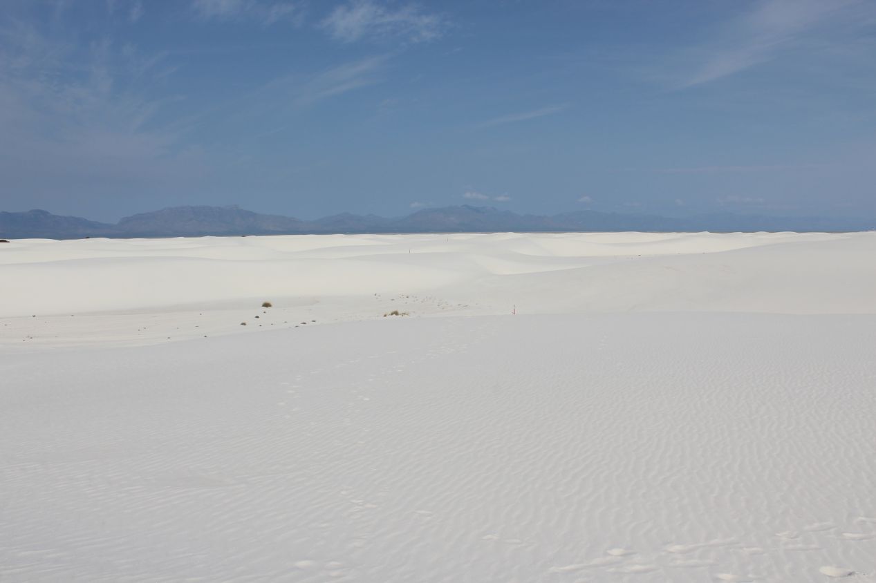
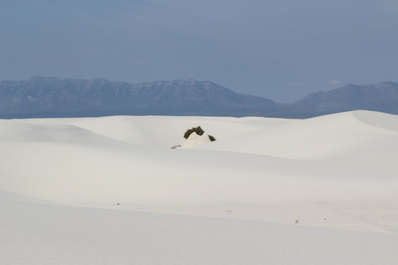
I arrived at White Sands around 9:30 AM and stopped to check out the historic visitor center at the entrance before heading into the park area. This visitor's center was constructed in the 1930s when White Sands was first designated as a national monument. It was relatively small and had some basic background information about the climate and the wildlife that can be found inside White Sands. I appreciated having the chance to see the satellite imagery depicting the dunefield from high above, providing a view of this arid basin tucked in between several mountain ranges. It was not crowded due to the early hour and the single road running into the park was deserted as I passed through the gates. Here at the entrance the landscape still looked like the typical New Mexico dry prairie made up of grasses and scrub brushes. The dunes themselves were still up ahead.
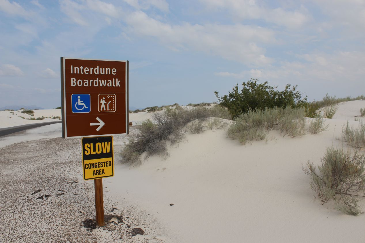
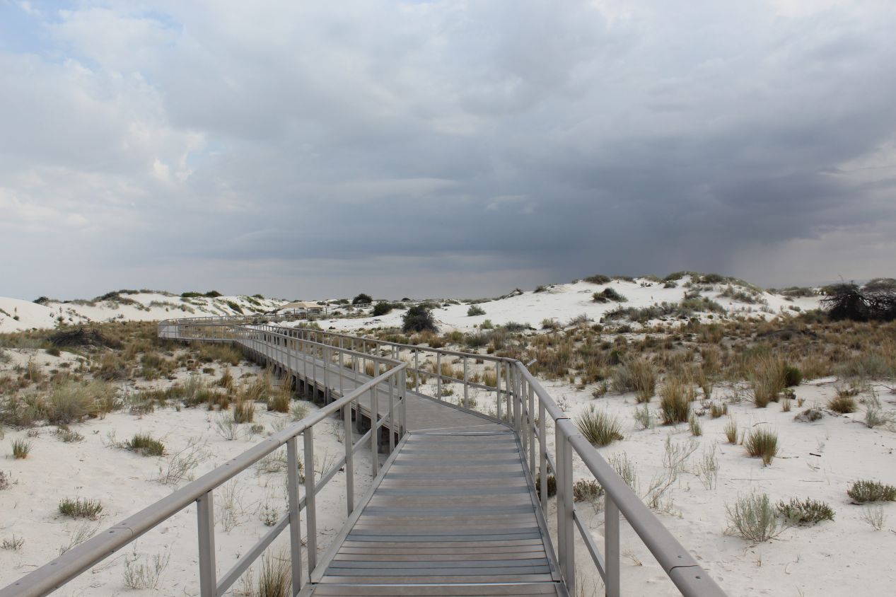
The park road had several different stopping points with small trails leading off into the protected monument lands. The first one that looked interesting enough to stop at was the Interdune Boardwalk, a short raised platform that ran above some of the dunes. This was my first experience with the white sands that gave the place its name, with this spot still located on the outer edges of the main dunefields. The sands only came up to waist level here and there were plants growing in patches throughout the sands, their roots digging deep enough to reach the soil underneath. There were little informational signs that accompanied the trail and it made for a nice walk, even if I wasn't lucky enough to spot anything in the form of wildlife.
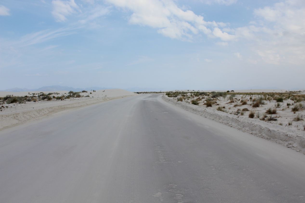
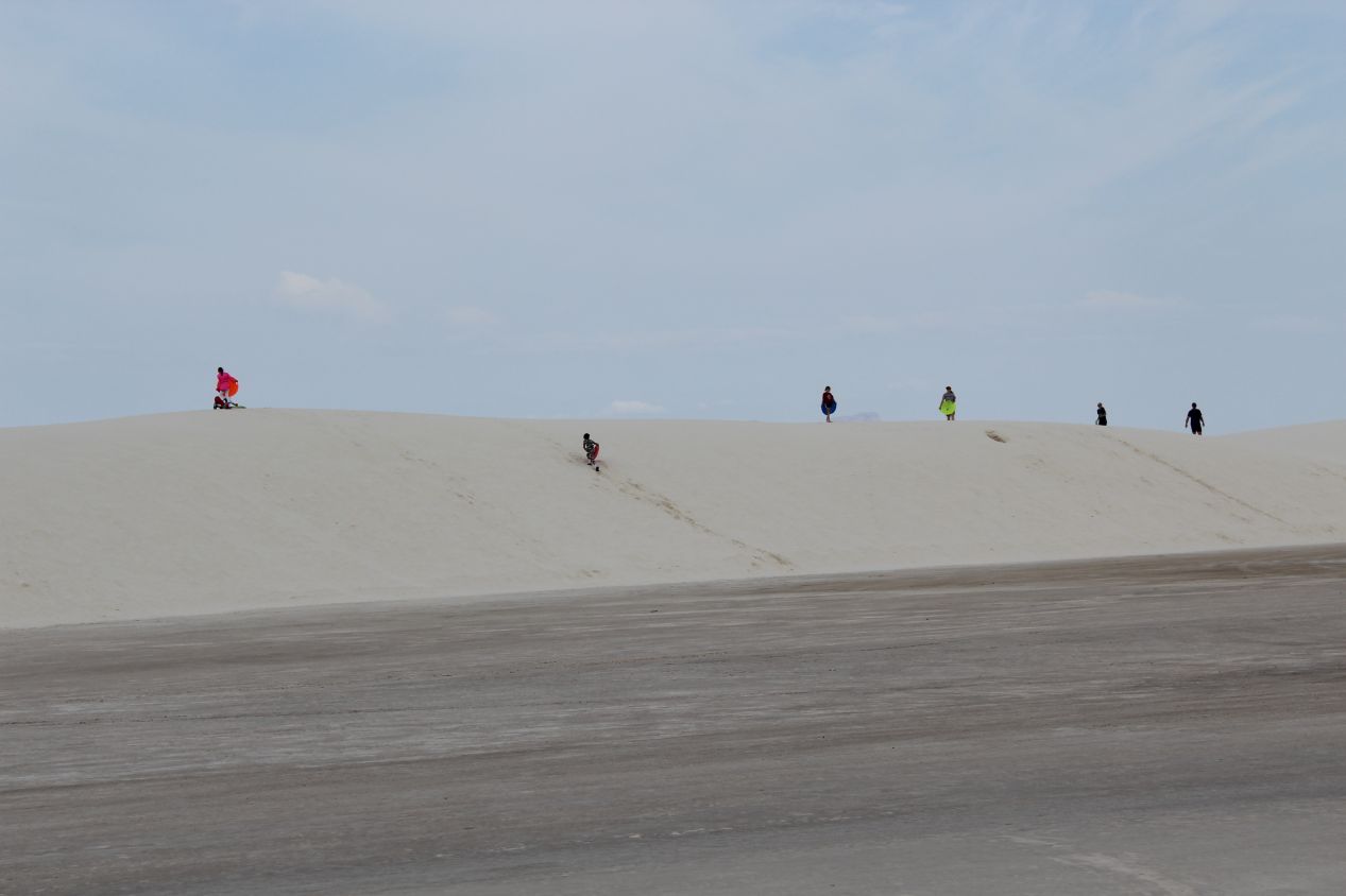
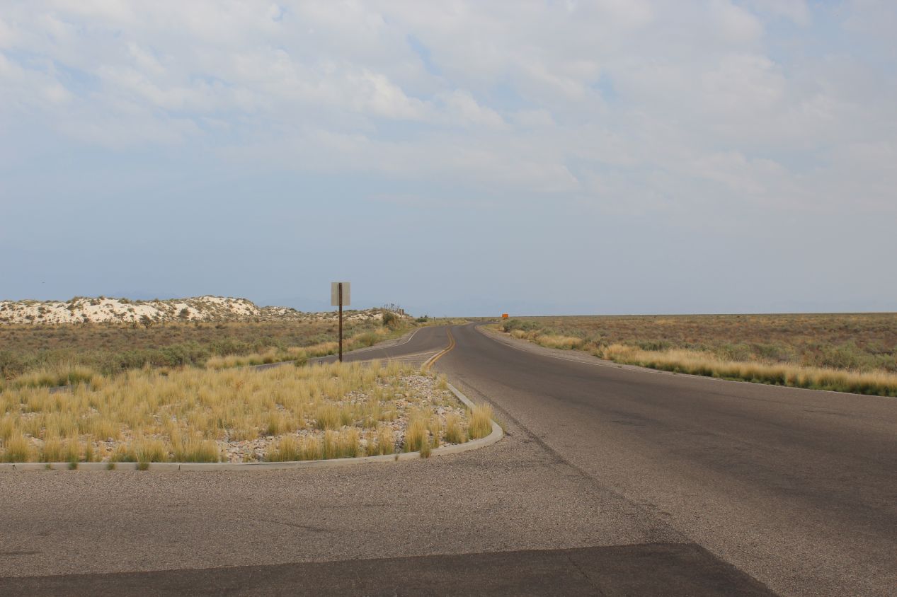
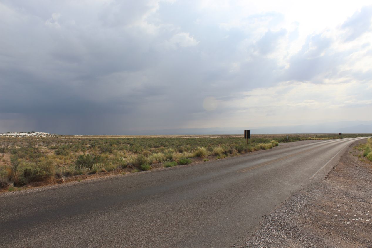
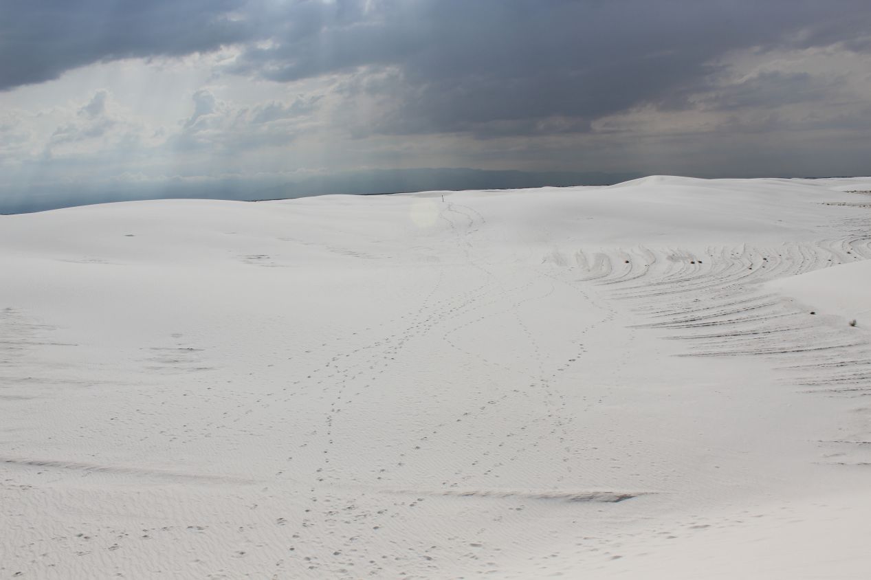
These are some pictures from the road that ran through the national monument. It didn't take too long to reach the dunefields proper, where the road itself began passing over a surface coated with a layer of fine white dust. I could see the mountains off in the distance to both east and west, and it looked like it was raining somewhere out there near the horizon. Hopefully the storm clouds would remain out there and not trouble me while I was walking around. I did begin to see some other visitors to White Sands, where the most popular activity seemed to be sledding on the sand dunes. Just as families will ride down banks of snow in colder climates, I spotted a number of kids tossing themselves down the sand dunes on plastic saucers. It looked weird to see this kind of sledding from people in shorts and T-shirts instead of bundled up for the winter chill.
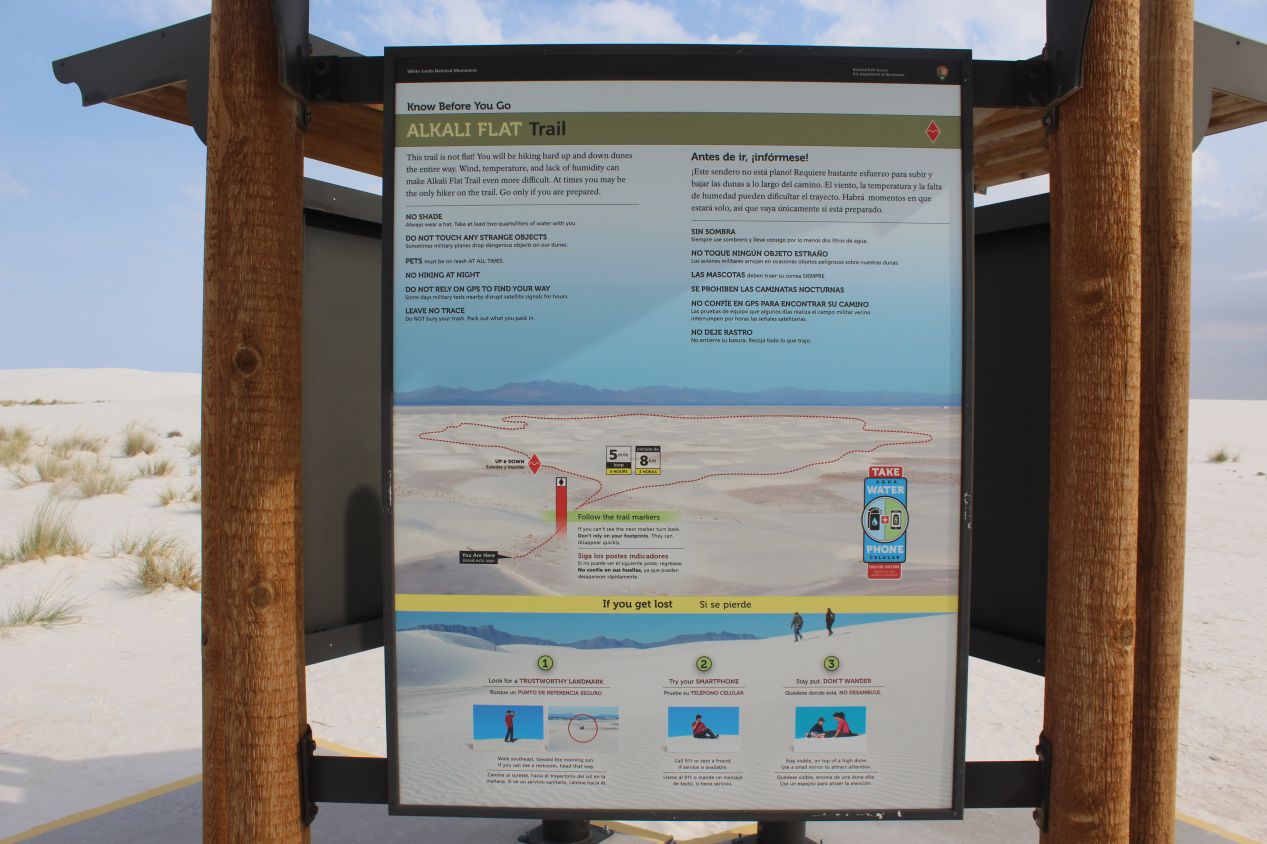
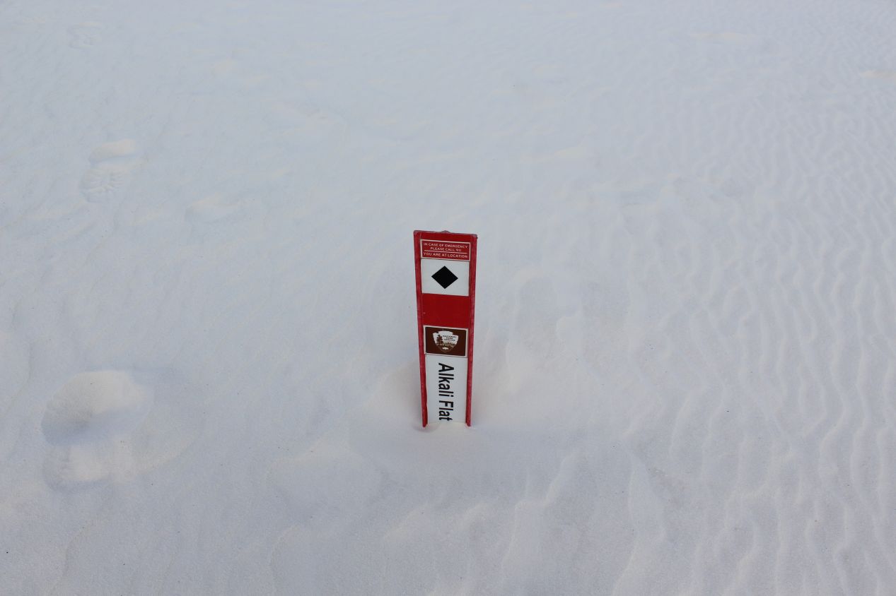
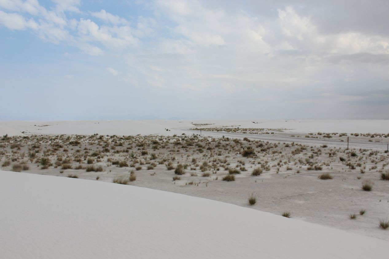
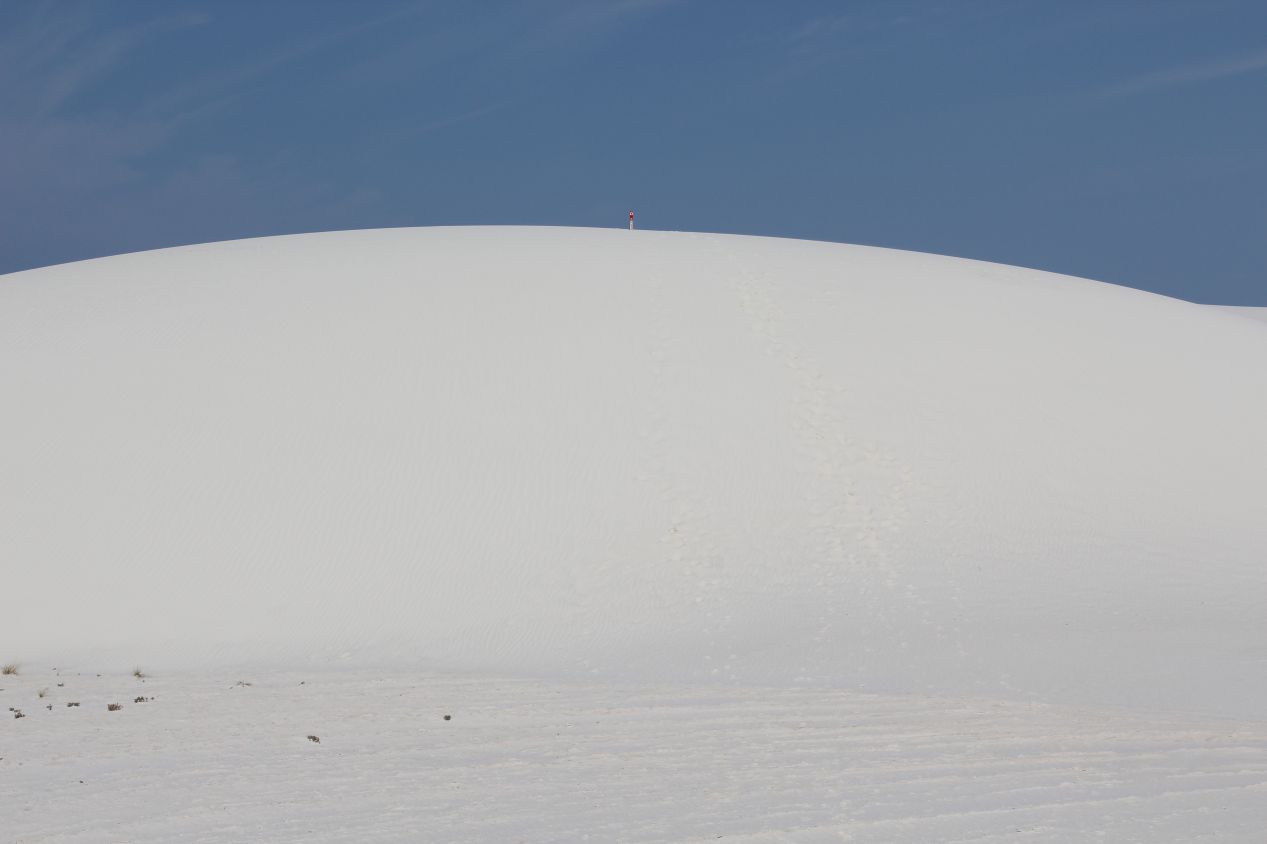
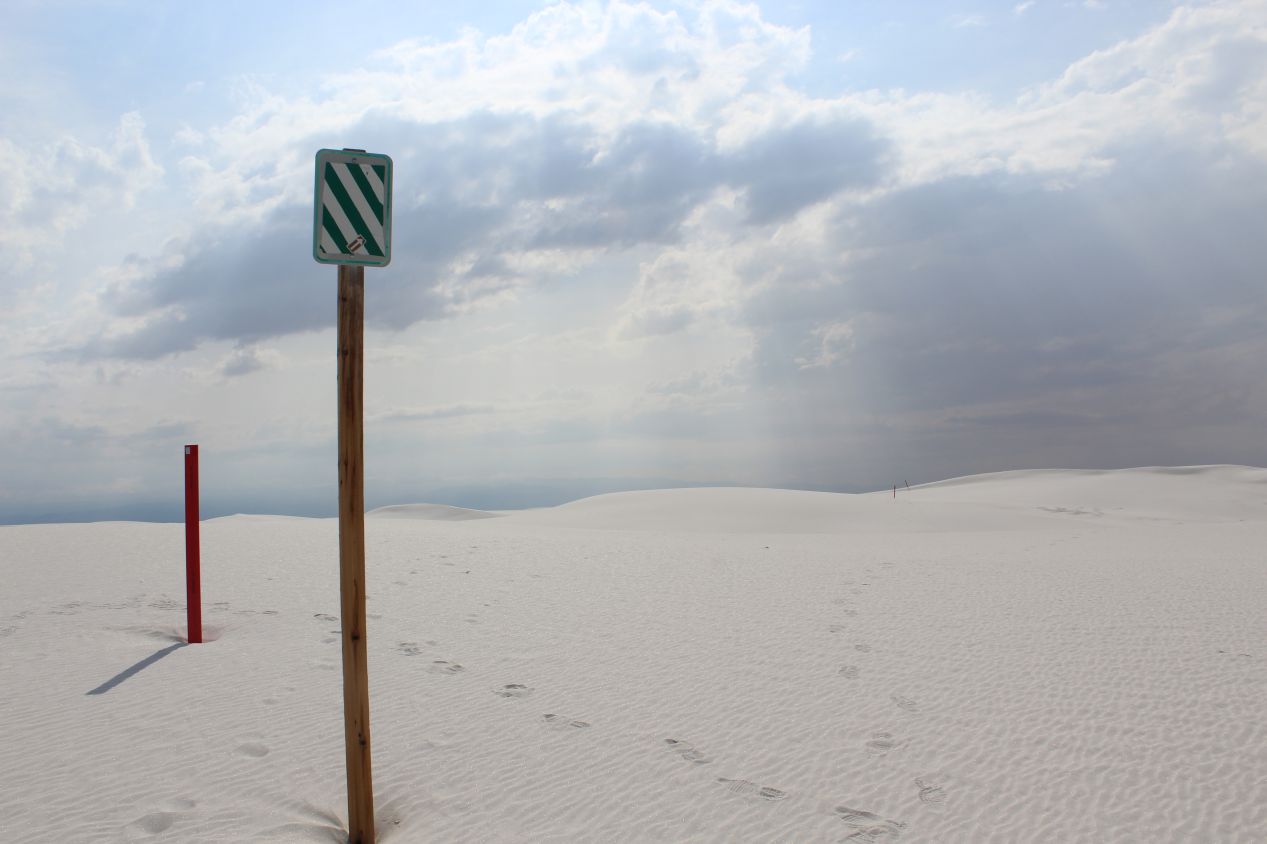
The main activity that I planned to do at White Sands was to hike the Alkali Flat Trail. This is a 5 mile / 8 kilometer route that takes visitors out into the heart of the sand dunes, passing up and down the hills in a field of unbroken white sands. Navigation comes from following a series of trail markers and it's easy to get lost out in the dunes. The guidepost at the start of the trail had lots of warnings about the need to bring water and stick to the trail; it's not unusual for visitors to lose their way and need rescuing on this particular trail. I was hoping to escape the worst of the heat by hiking in the morning before the temperature warmed up, as the average high temperature at White Sands in July is 97 Fahrenheit / 36 Celsius. You can get yourself into danger in a real hurry under those conditions. The initial sections of the Alkali Flat Trail looked much like what I had seen earlier on the Interdune Boardwalk, low rolling mounds of sand with bushes poking through. The trail markers also proved harder to follow than I'd been expecting, with several of them nearly buried underfoot.
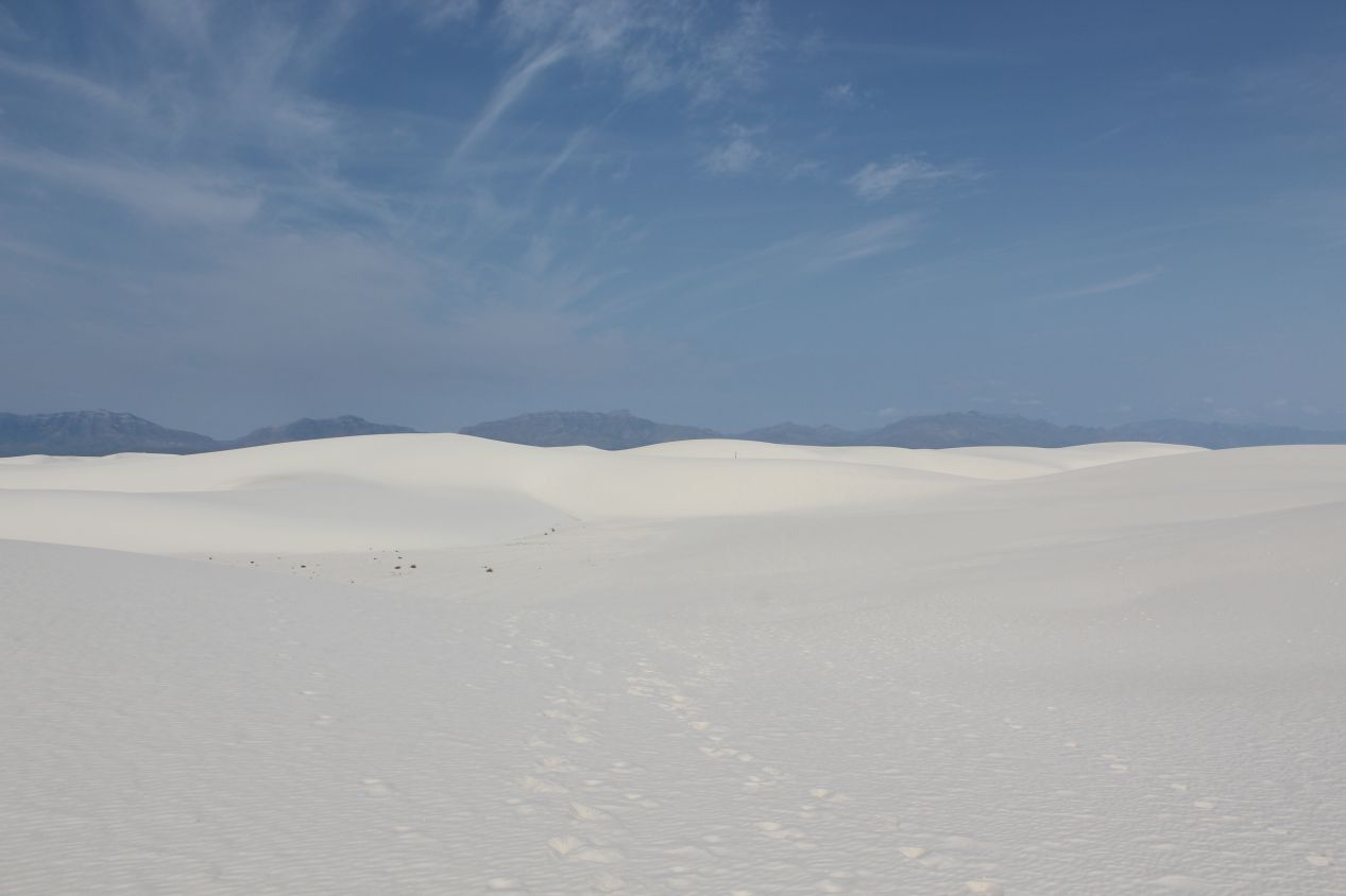

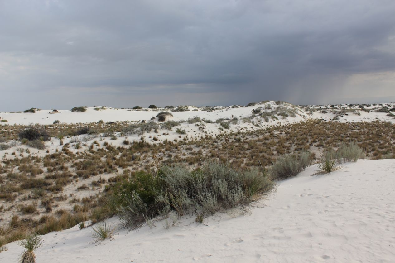
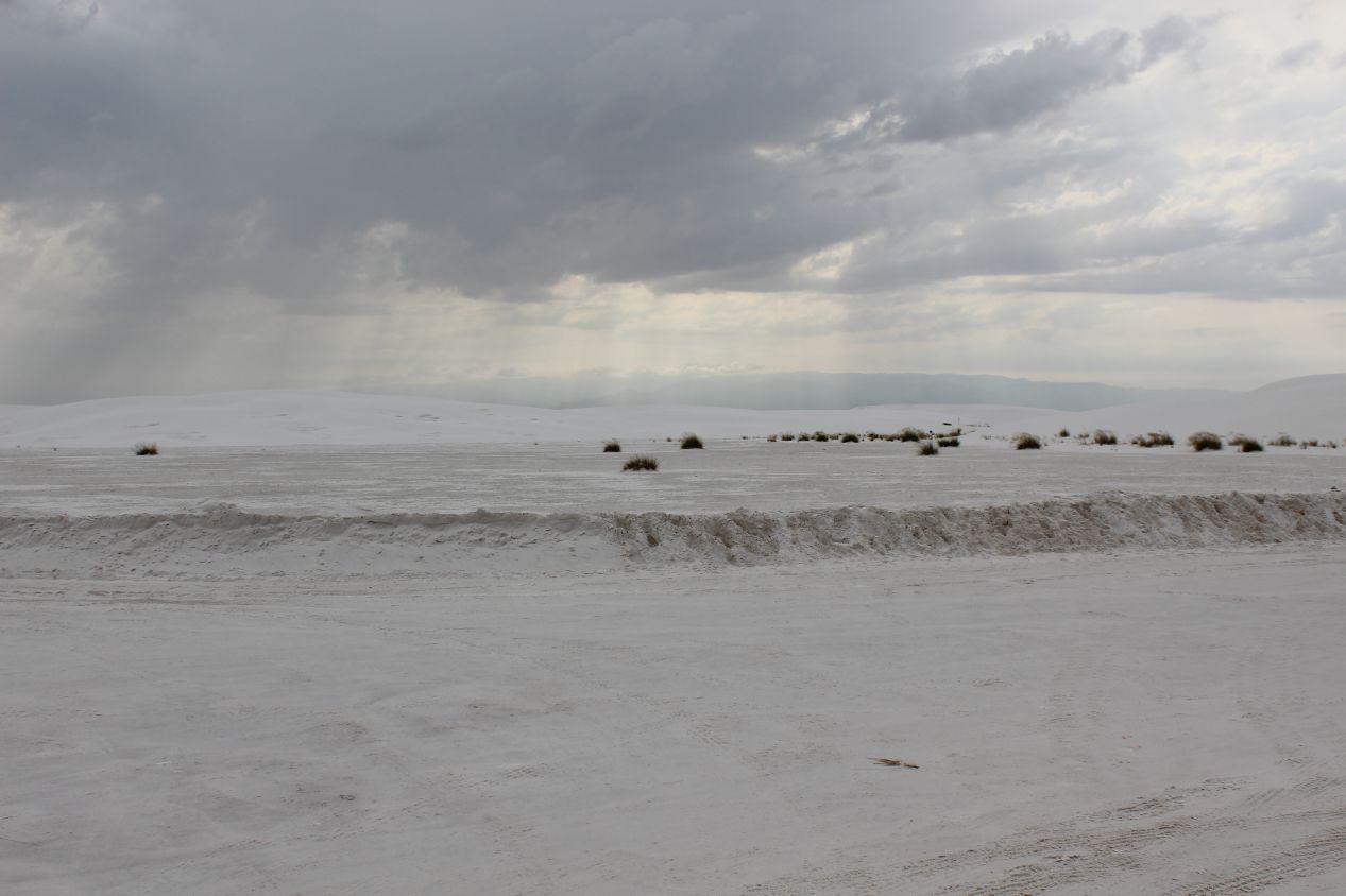
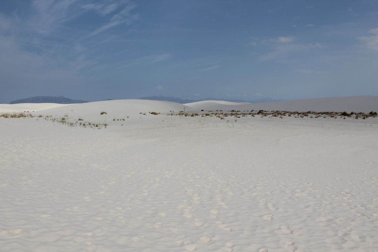
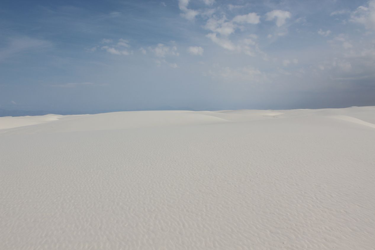
After maybe ten minutes of walking, I was out among the dunes proper and the scenery was transformed accordingly. The dunes rose into towering hills here, with some of them pushing 100 feet / 30 meters in height. Following the path set out by the trail markers was not easy as I clambered up and down through the dunes. Plant life all but disappeared and I walked through a field of unrelieved white sands. Outside of the blue of the sky overhead and the brown coloring of the distant mountains, it was nothing but white everywhere that the eye could see. This could have been an alien desert planet based on the landscape around me. I was probably fortunate that the sun was mostly hidden behind clouds, as this place would have been dazzlingly bright in full sunshine. The white sands themselves are made up of tiny gypsum crystals, and White Sands National Monument comprises the largest gypsum dune field in the world. Normally gypsum is dissolved by rainwater and carried by rivers into the ocean, but the basin around White Sands has no drainage outlet and so the sands have simply piled up over time into these huge dunes.
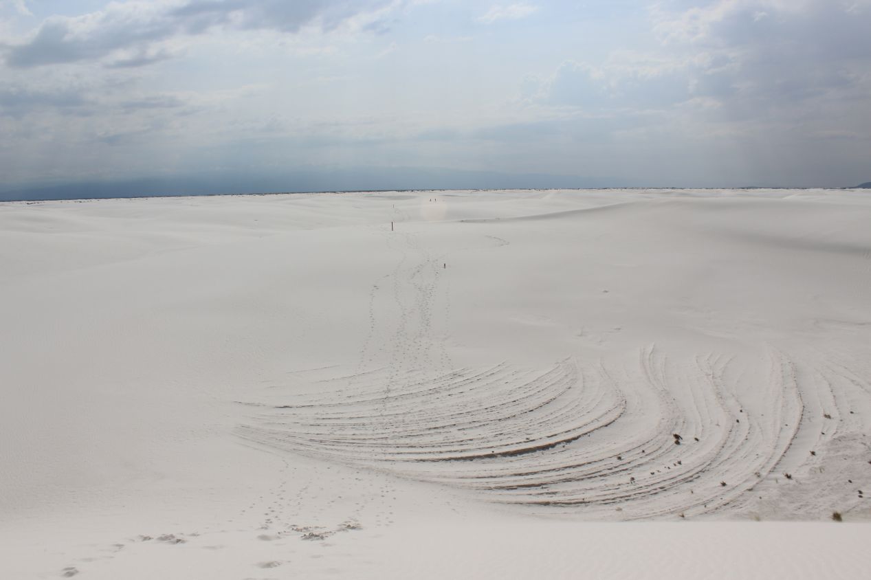
I had traveled about a third of the way around the circular Alkali Flat Trail when I realized that I couldn't tell where the next trail marker was located. I had actually turned around and started walking back the way that I came before I realized what was happening and stopped. Despite my best efforts, I could not find the way forward and attempting to strike out on my own over the dunes seemed like an incredibly foolhardy plan. I'm guessing that one of the trail markers had been buried under the sand or perhaps I simply couldn't see where I was supposed to be heading next. Therefore I ended up turning around and returning back the way that I had started, seeing the same sights in reverse. I ended up walking about two thirds of the trail while seeing only a third of it, which was a shame but I didn't see any other options. There were only a handful of other people on the trail and they seemed as confused as I was. Fortunately I had seen enough of the dunefield to get a good sense of the place, and it was time to leave before the whole area heated up too much and broiled in the midday sun.
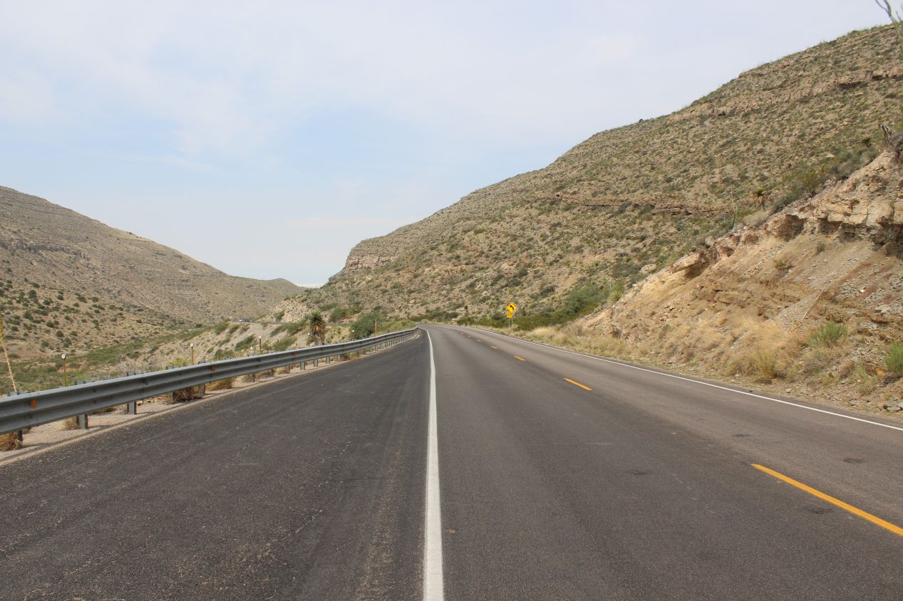
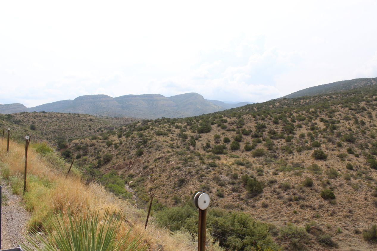
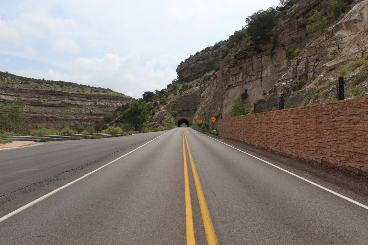
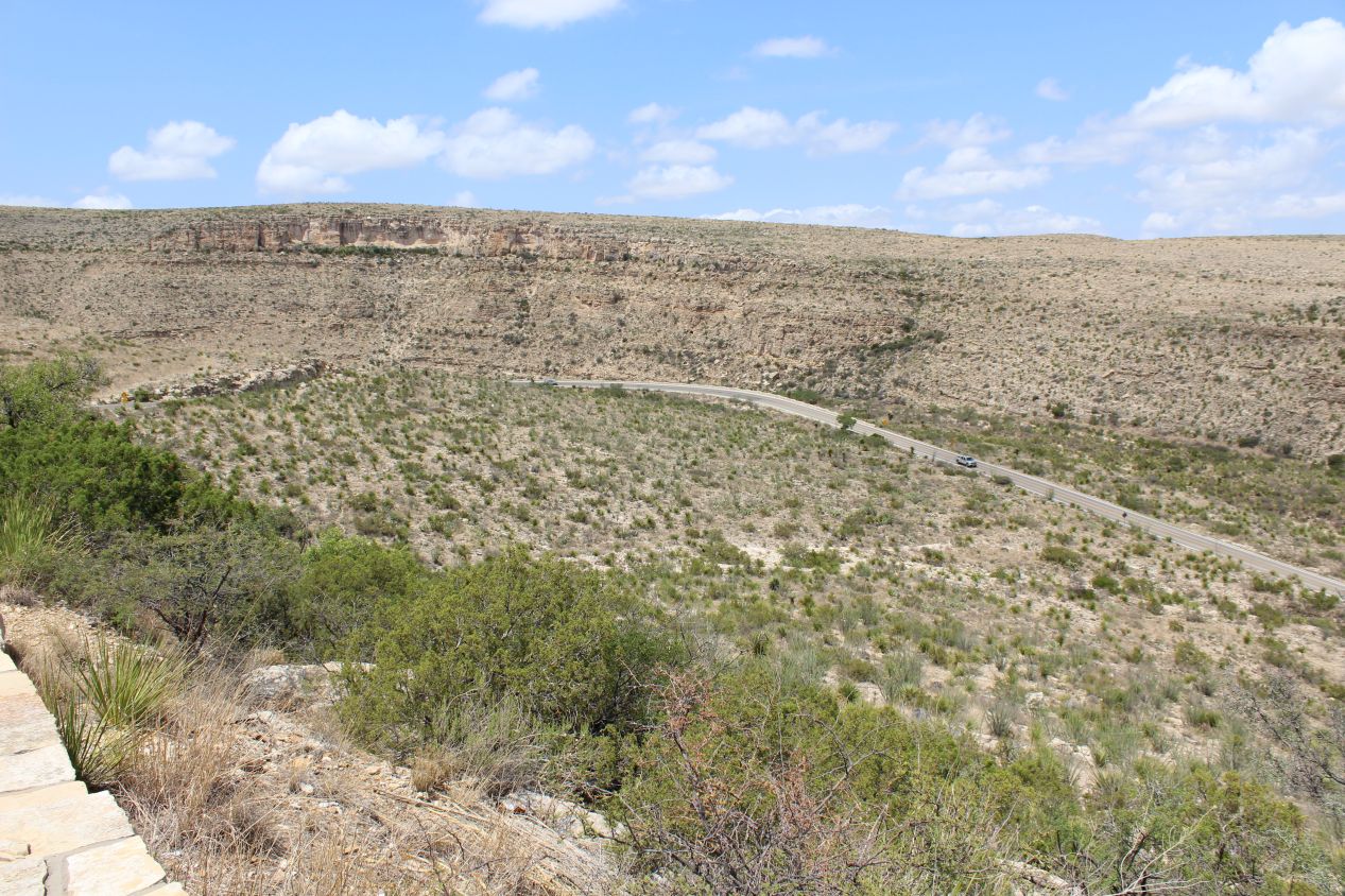
Now I had the second lengthy drive of the day ahead of me, as I crossed from White Sands to Carlsbad Caverns. Again, I'm kind of skipping over the huge amount of time that I spent driving while listening to music and podcasts over the course of this vacation, but trust me, that was very much a part of the whole experience. Most of this particular drive took place on New Mexico state highway 82, as it crossed through the southeastern part of the state from Alamogordo to Artesia. A lengthy stretch of this road passed through an area named Lincoln National Forest, where the above pictures were taken at various different scenic overlooks. I was a bit amused that this area had been given the "national forest" designation when there were clearly few trees to be found. Instead, the region had the distinctive semi-arid climate of the American Southwest, dry hills with low clumps of vegetation. As I've said before, this region looks completely different from my home and it was fun to see a long stretch of quiet backcountry during the drive.
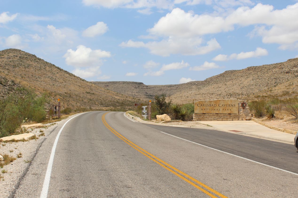
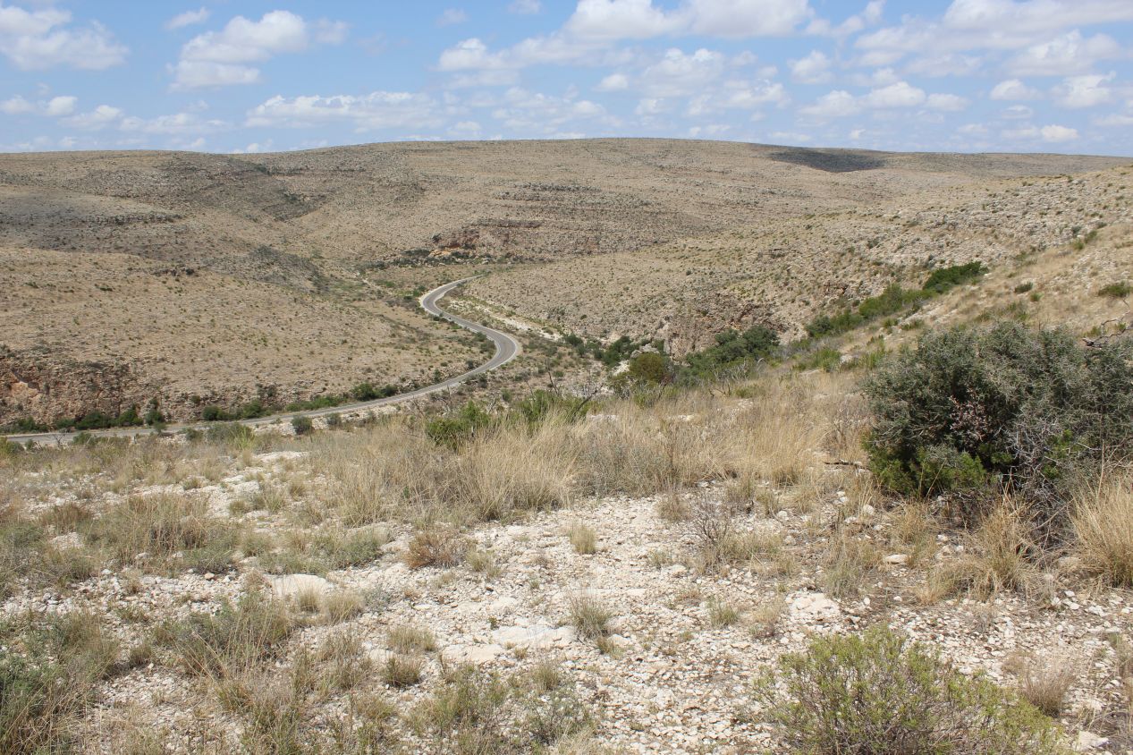
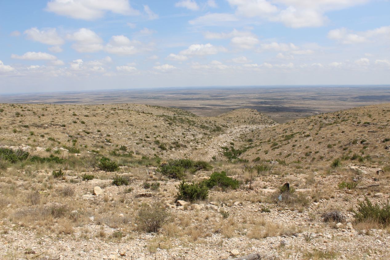
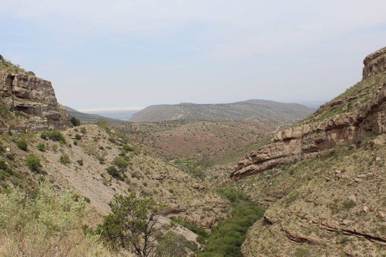
It was drawing close to 3:00 PM when I arrived at the entrance to Carlsbad Caverns National Park. The park is situated in its own separate area off of the main road, and the drive into the park was surprisingly beautiful. Carlsbad Caverns is understandably known for its underground caves, but the land aboveground had its own rugged charm. I stopped at a few more scenic overlooks to capture some of these views, with all of the pictures above coming from the road that led to the main visitor center. There are hiking trails that run through this landscape which would likely be worth exploring for those with more time than I had.
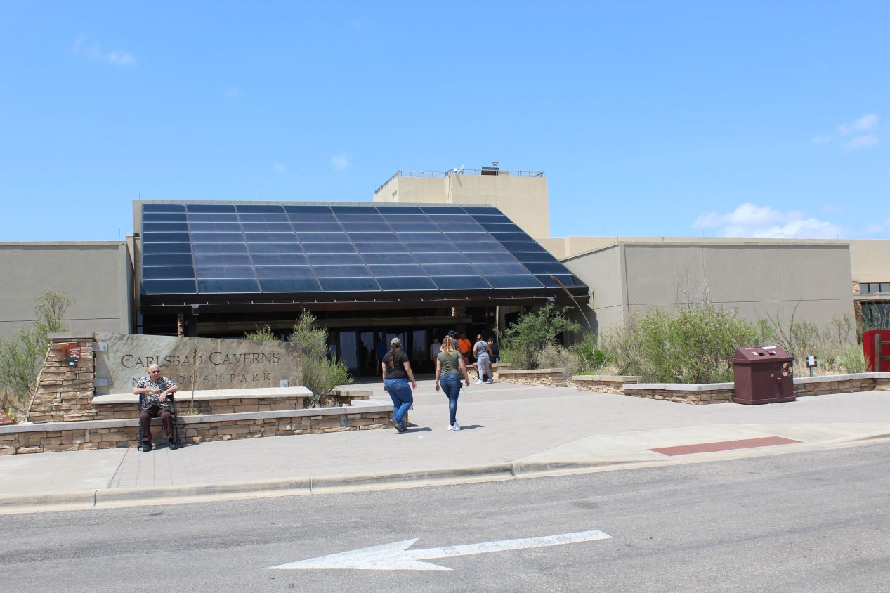
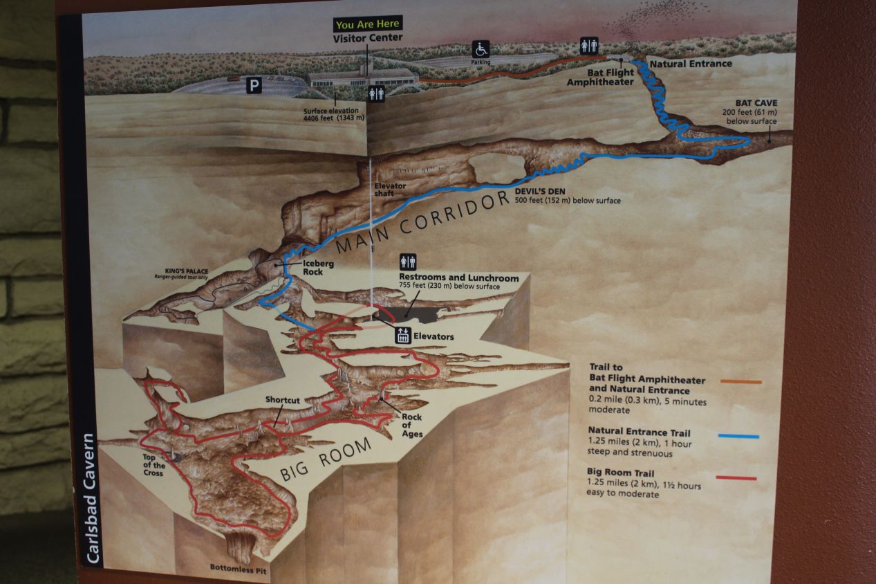
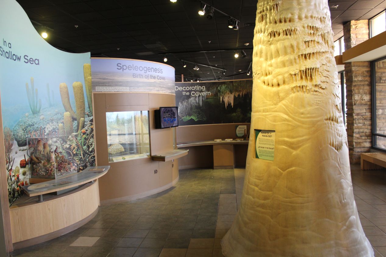
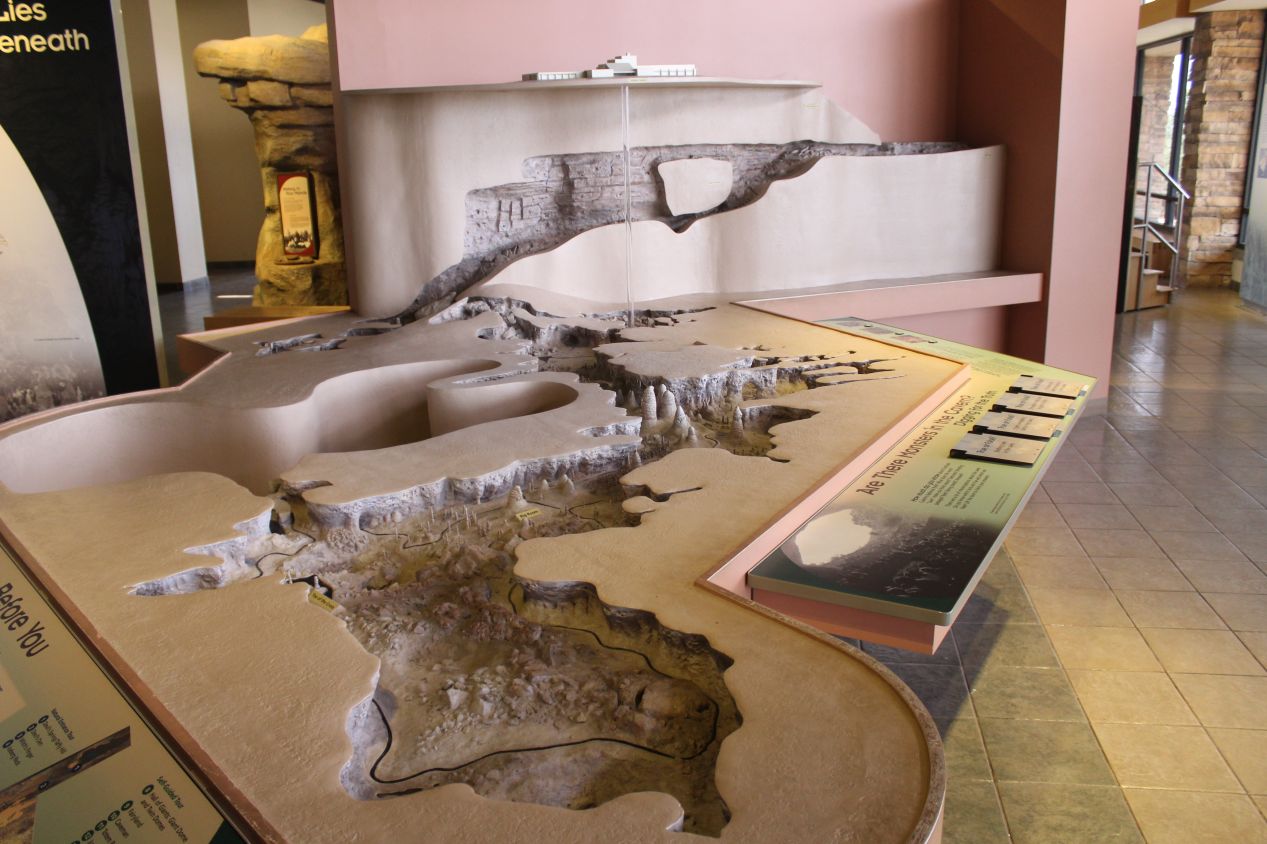
Carlsbad Caverns had an expansive visitor's center as befitting its national park status; it looked like it had been built or expanded recently. In addition to the sizable gift store, the visitor center also had a series of displays explaining how the caverns were formed. It turns out that they are located in a bed of limestone rock, and a combination of hydrogen sulfide from an underground petroleum deposit and oxygen from nearby water created sulphuric acid, which ate away at the limestone and carved out these huge open spaces in the rock. I particularly liked the maps at the visitor center, with both a traditional drawn image and a more elaborate three dimensional model. These maps highlighted the two different ways of accessing the main cavern. The easier route is to take the elevator directly down to the caves; the harder route is to walk down through the natural entrance and descend the 750 feet / 230 meters on foot. The natural entrance sounded much more interesting to me, and I decided that I'd take the long route in and then ride the elevator back up to the top when I was finished.
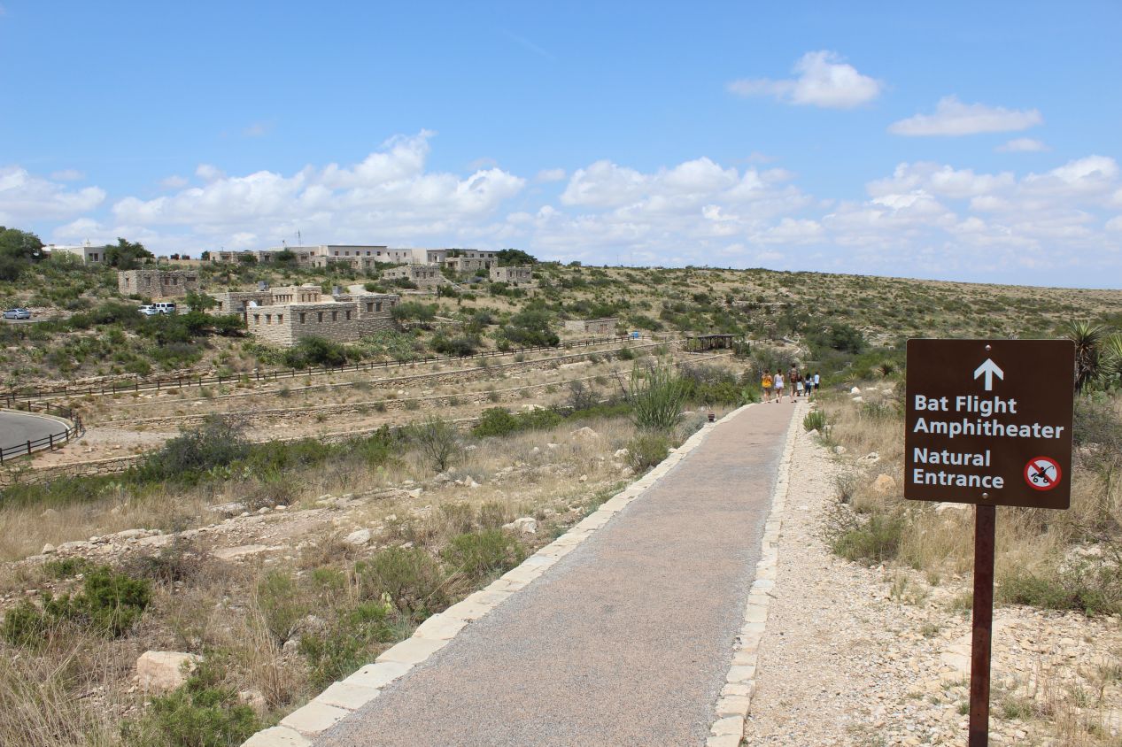
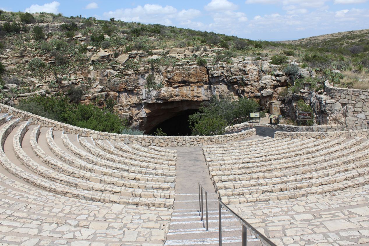
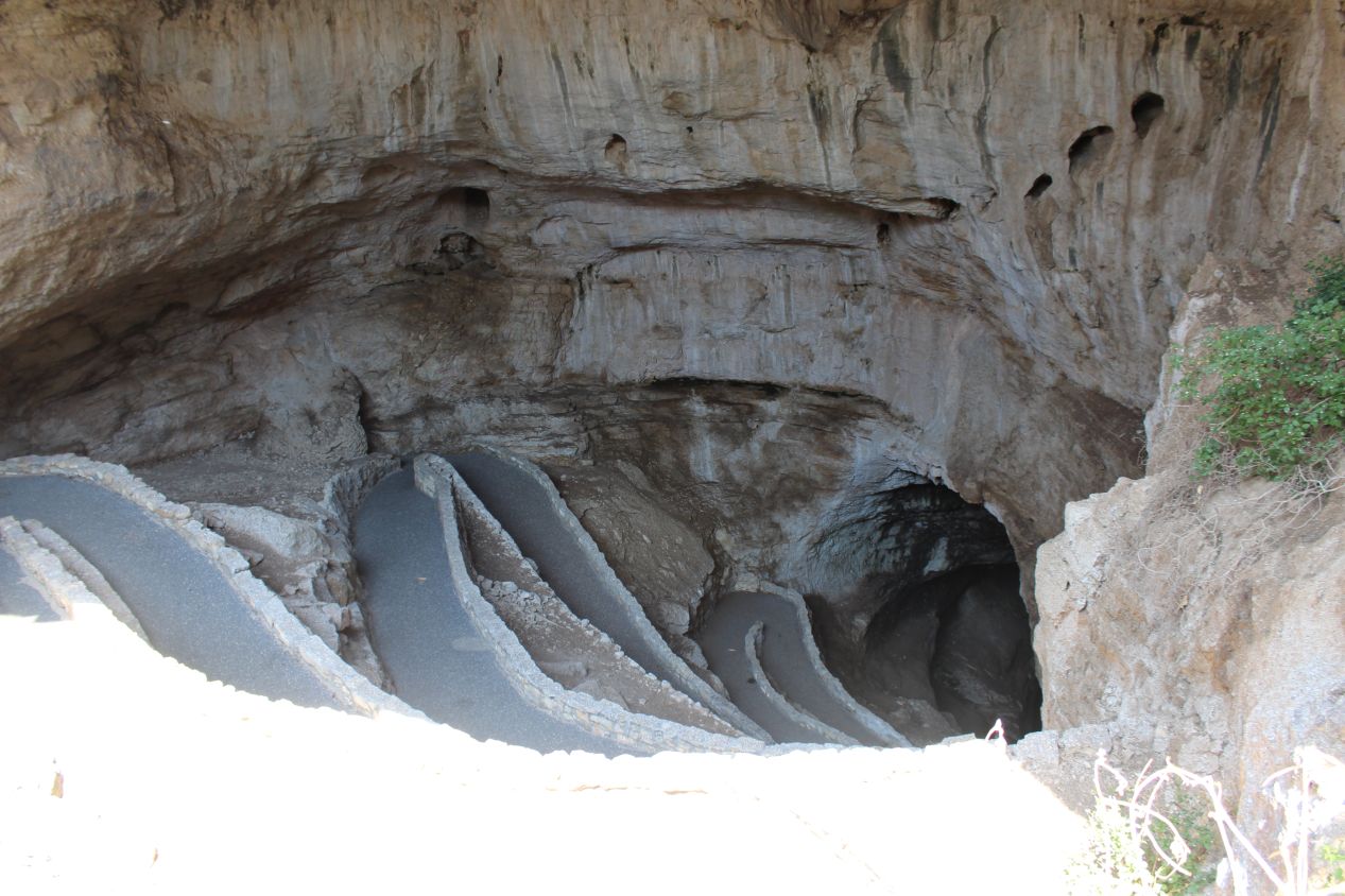
It was a short and easy walk to the natural entrance of the caverns. There's an amphitheatre at this opening point where visitors can sit and watch the most famous residents of the caves emerge each night: bats. That's right, Carlsbad Caverns is famous for hosting a huge population of Mexican free-tailed bats. They come out of the caves at night to feed on insects by the tens of thousands, and it's supposed to be quite a show to watch. This is one of those things that visitors will either delight in seeing or be completely horrified at the thought; I would have liked to stay for this event but didn't want to wait until sunset given how much driving I had planned again for the next day. Before entering the cave, myself and the other random tourists arriving at the same time were cautioned by a park guide about staying strictly on the path and not touching any of the rocks. The oils in the human body will start to dissolve the rocks if everyone keeps grabbing them; in other words, look but don't touch. Then I was off and descending a series of switchbacks into the mouth of the natural cave opening. As it grew progressively darker and the temperature began to drop towards that infamous subterranean chill, it was hard to avoid the sensation that I was walking into the maw of a giant animal. It's easy to see why hell has often been conceived as being located deep underground; it did feel a bit like I was descending into the underworld.
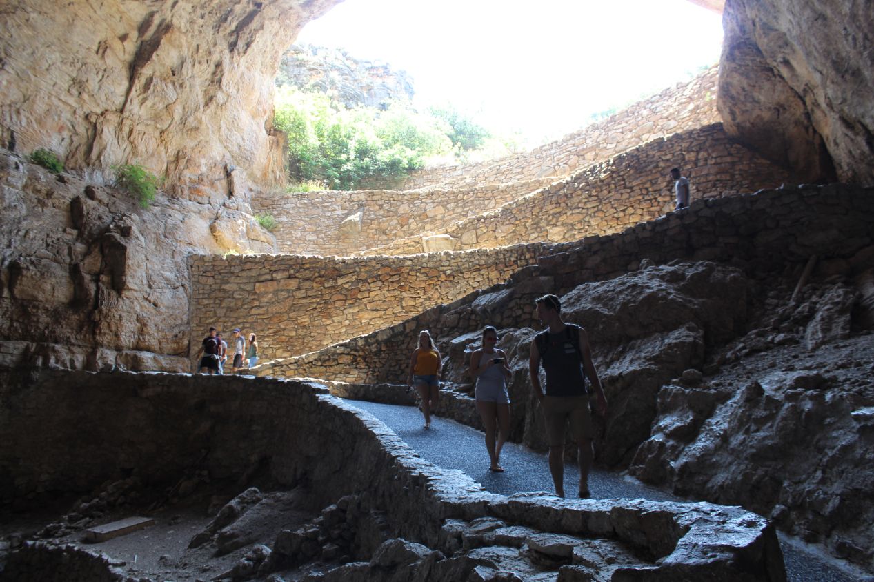
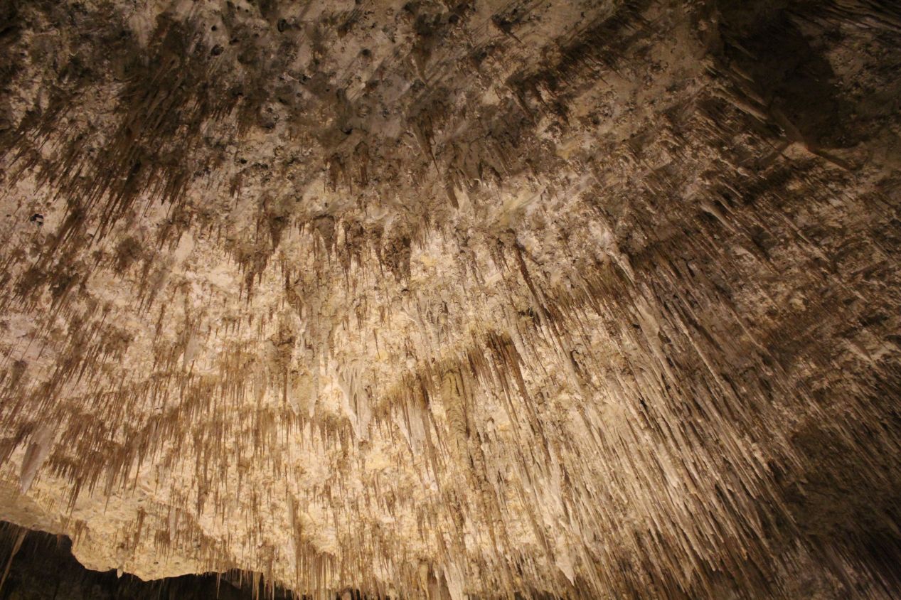
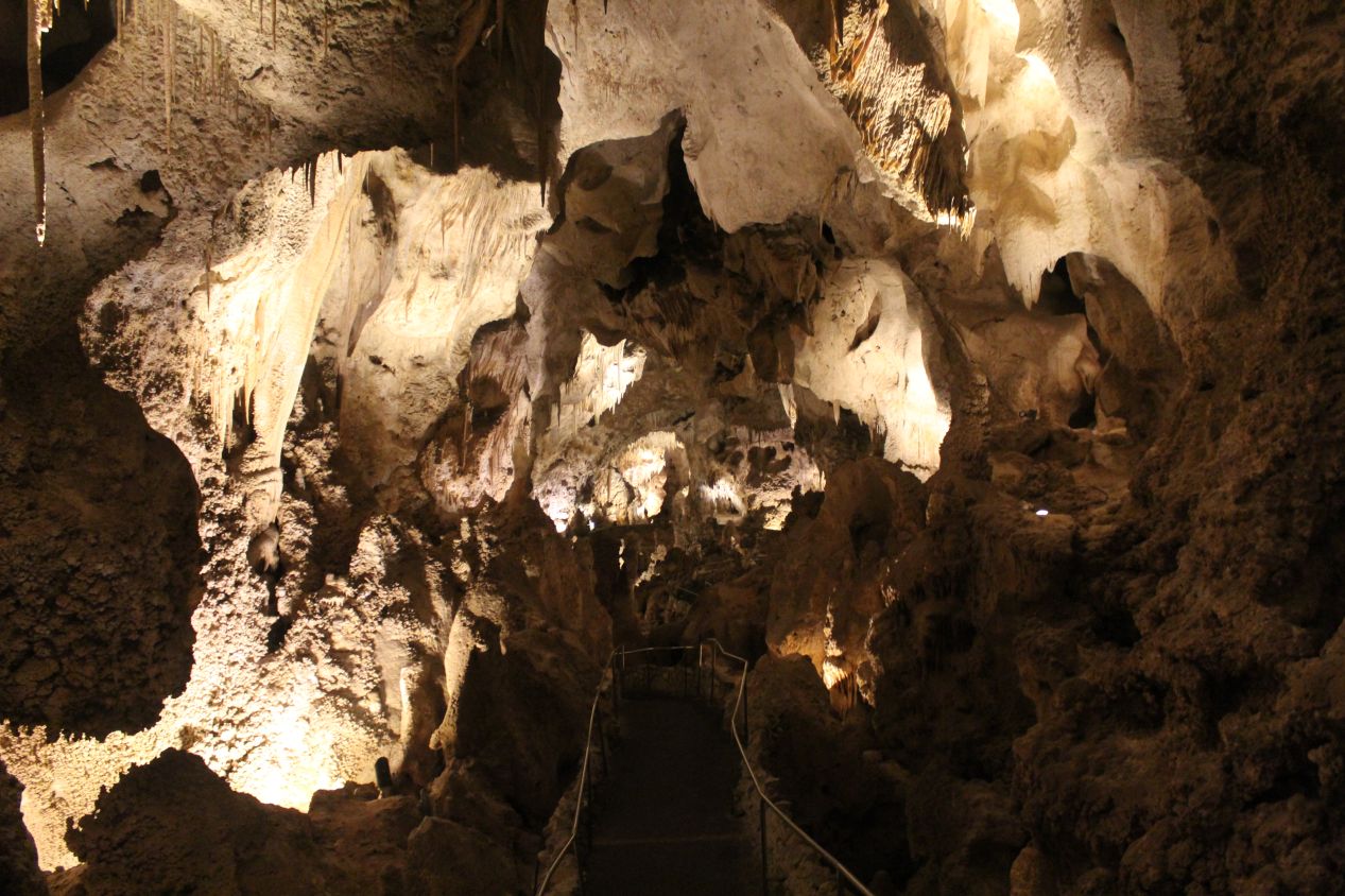
Taking pictures underground is notoriously difficult due to the low light conditions. Without the electric lights that were set up along the path, there would have been nothing to see by whatsoever and the trail would have been plunged into the pure darkness that only exists in caverns. My camera did an excellent job under these conditions at capturing images, as I used the slowest shutter speed possible and did my best to hold the camera steady during the long exposures. This is one place where it would have been worthwhile to bring my tripod along. Anyway, I'll have to beg forgiveness for some blurriness in some of the images as the camera tried to capture details. This section of the natural entrance trail was passing near the Bat Cave 200 feet / 60 meters below the surface and then heading into the area known as Devil's Den. The path continued to wind deeper and deeper underground with each step forward.
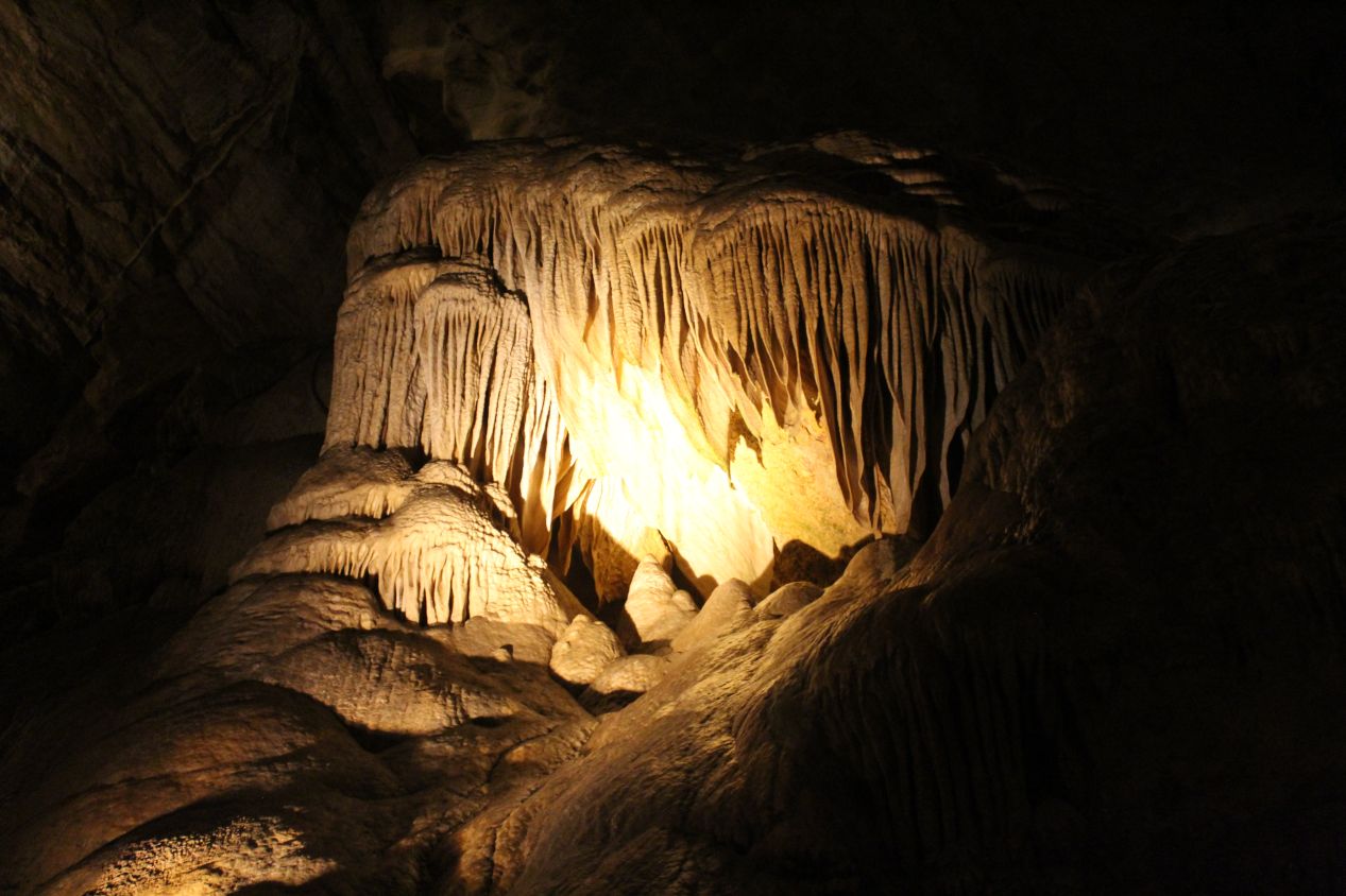
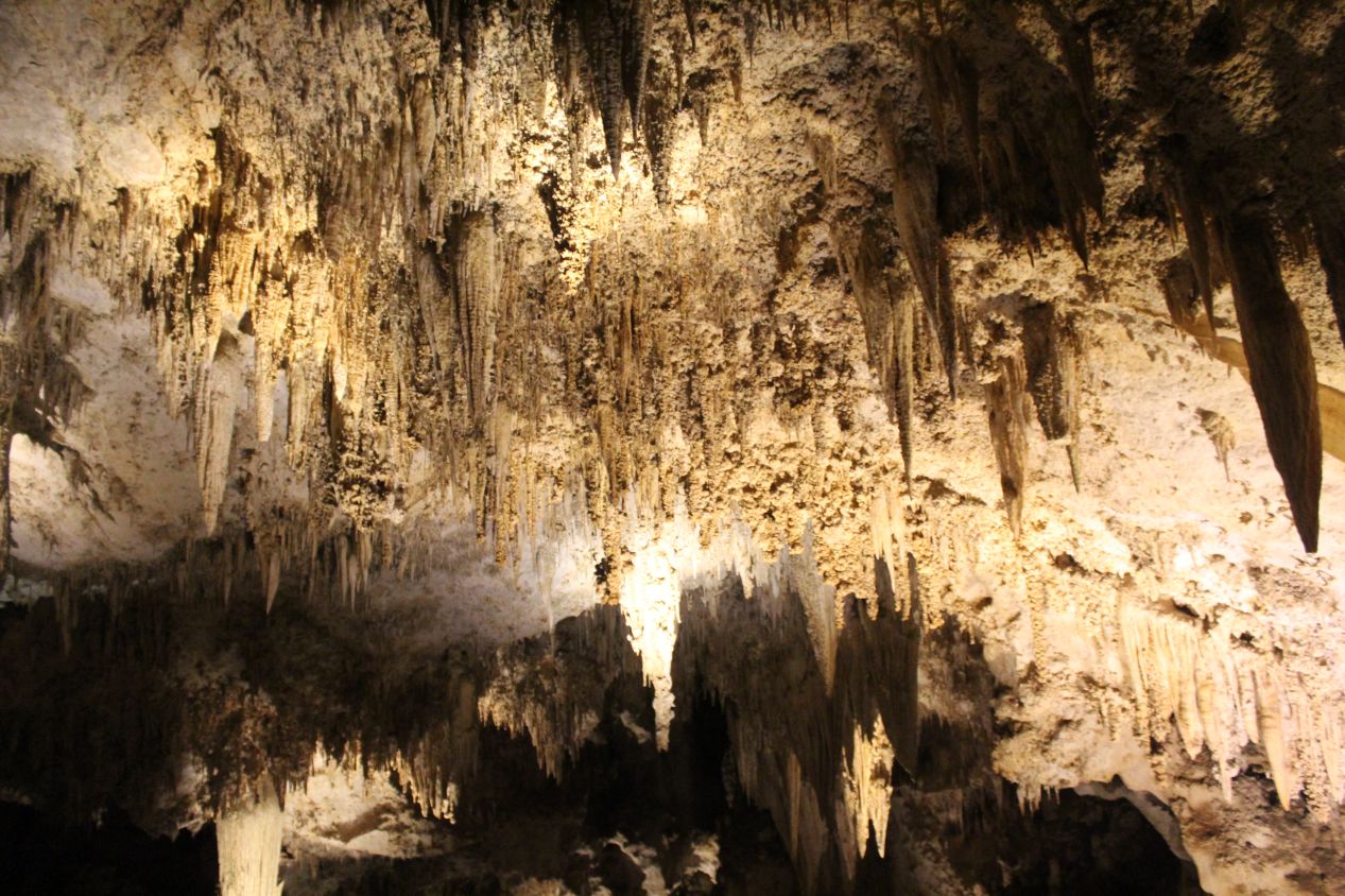
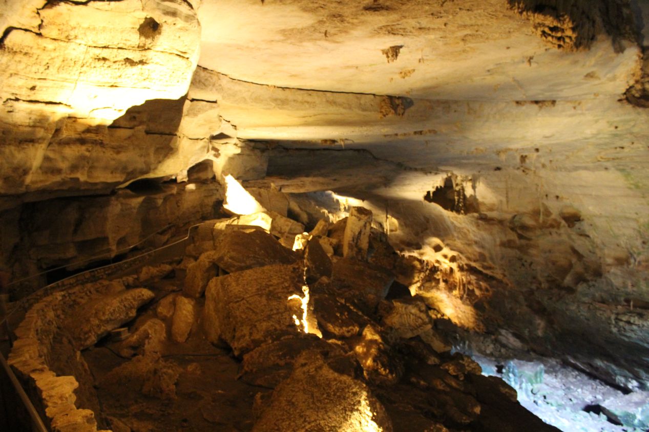
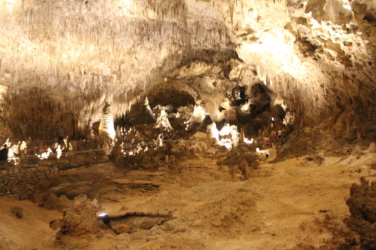
Typically speaking, most caves that I had seen previously were characterized by low ceilings. There might be a few places where they opened up into taller chambers, but generally speaking the passages that I had seen on past tours didn't extend too far above walking height. Carlsbad Caverns was completely different in that regard, with the ceiling in the natural entrance cavern always far overhead and sometimes extending upwards more than a hundred feet. I could look out over the guardrails and see the trail stretching down into the distance. Meanwhile, overhead there was the usual profusion of stalactites clinging to the rocky surface with their jagged points extending downward. The pictures that I captured legitimately do not capture what this place looked like in person, far grander and more impressive than I can put in words. This hour-long walk down from the surface to the main floor of the cavern was nothing less than incredible.
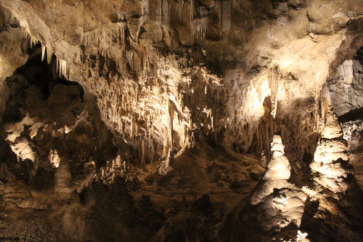
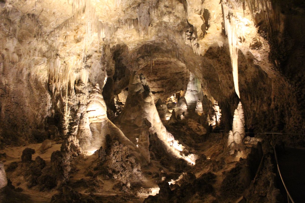
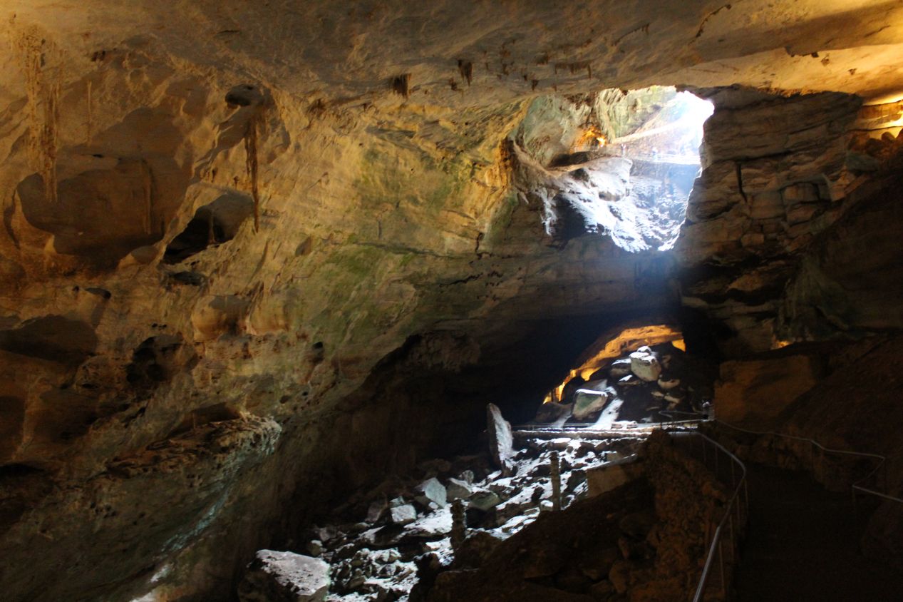
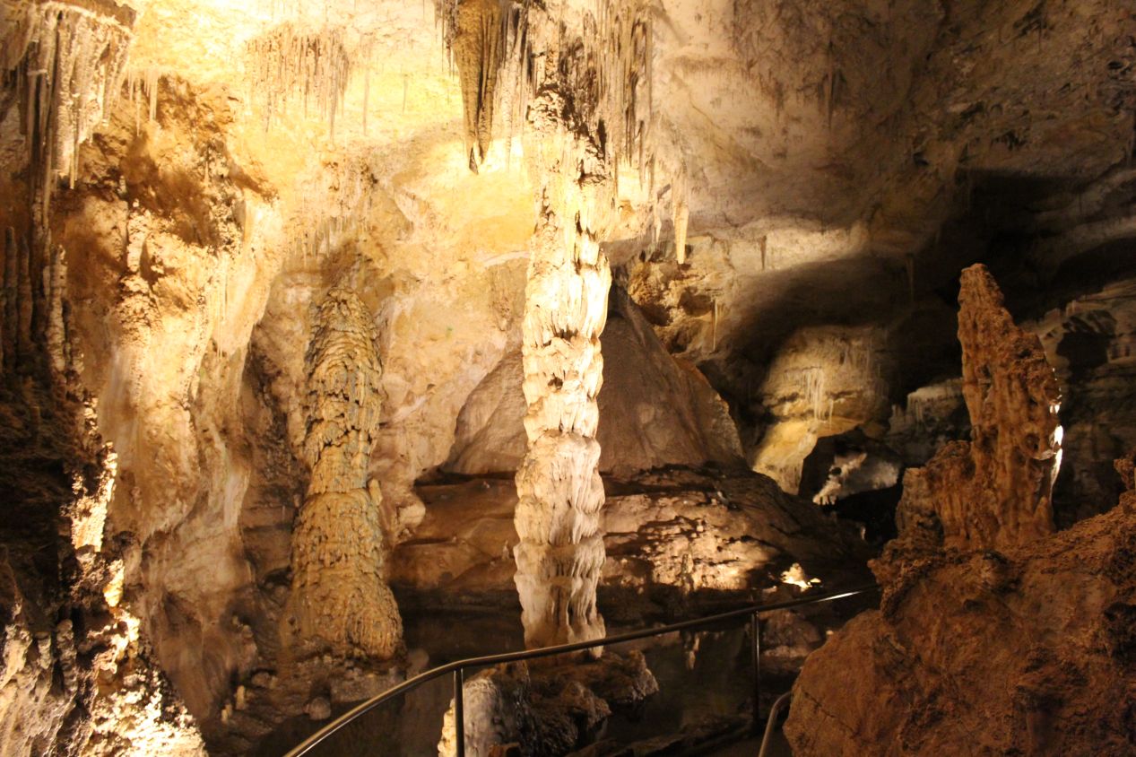
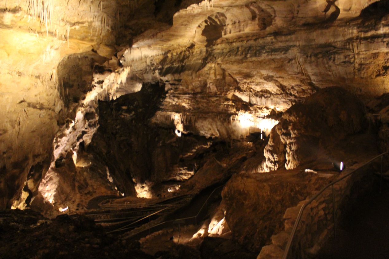
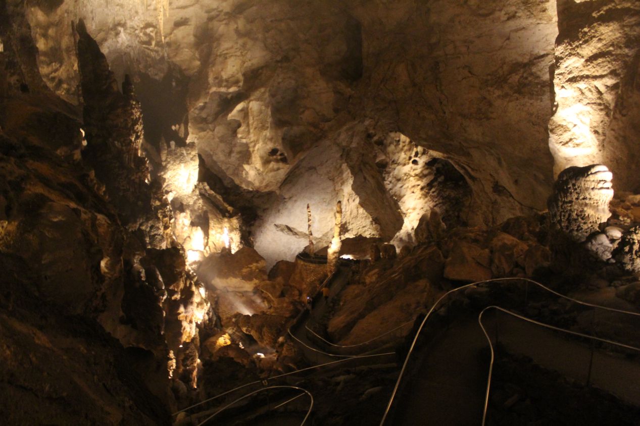
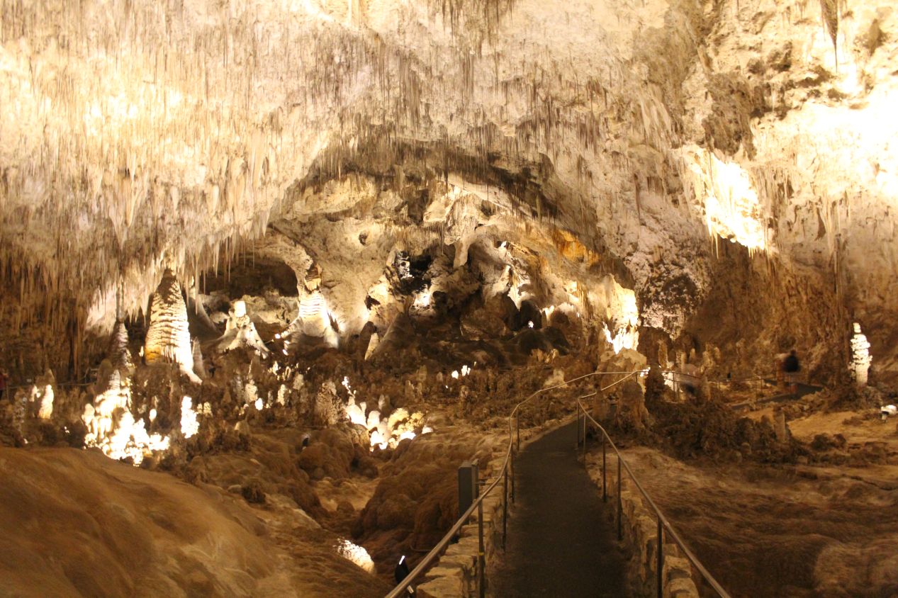
Eventually the natural entrance opened up into the area known as "The Big Room", a mostly level region of the caverns situated about 750 feet below the surface. The Big Room is the largest known natural limestone chamber in the western hemisphere, and the loop trail that runs around its exterior stretches for over a mile in length. One of the informational signs stated that the floor space in this room was about 600,000 feet or comparable to the size of 14 American football fields. Long story short: it lives up to its name. Walking around The Big Room felt very much like walking through a naturally formed cathedral, and some of the features in this place have been given cathedral-inspired names. Some of the stalagmites rising up from the ground in here were nothing less than enormous, dwarfing the people walking past in their shadows.
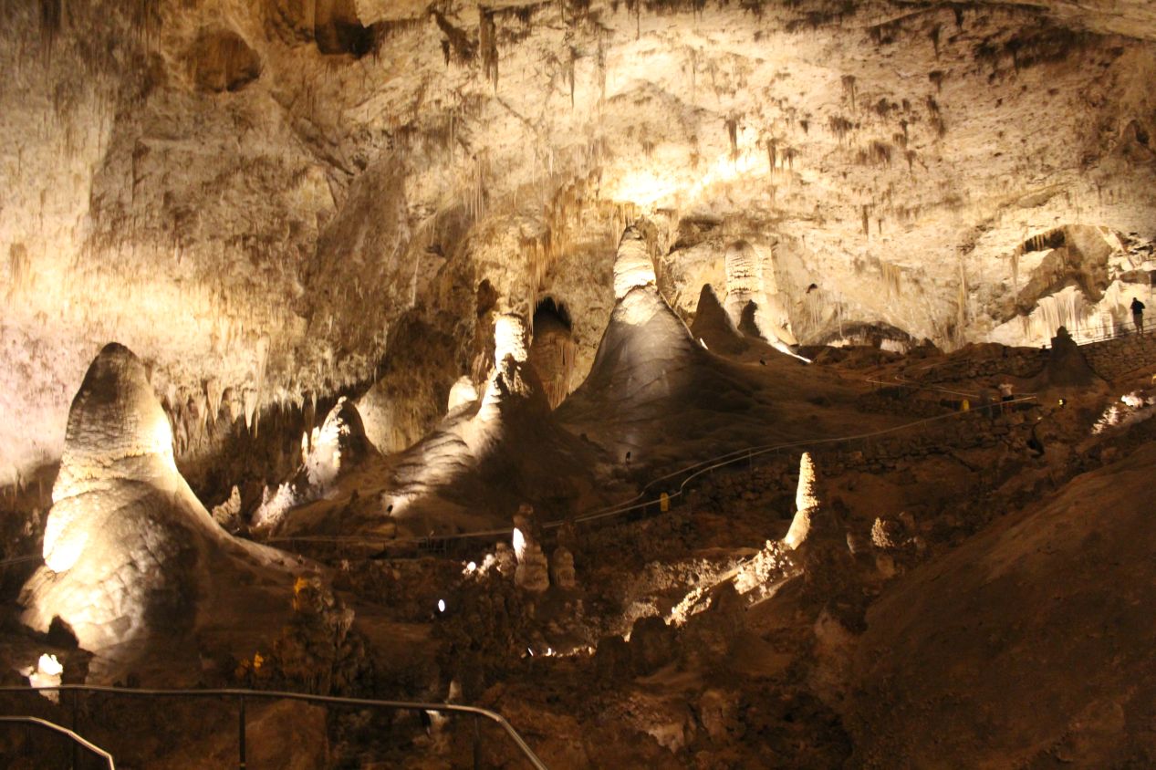
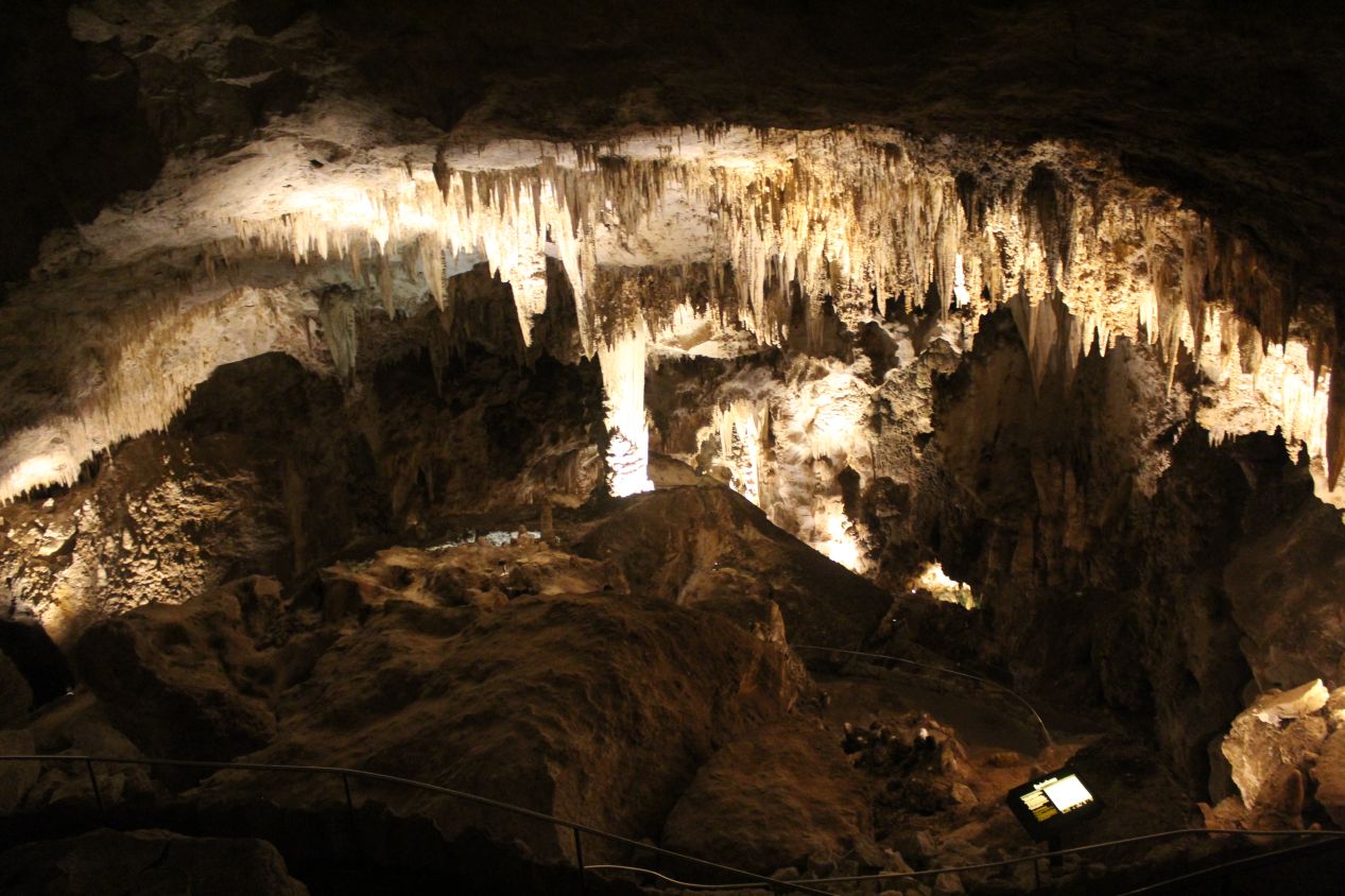
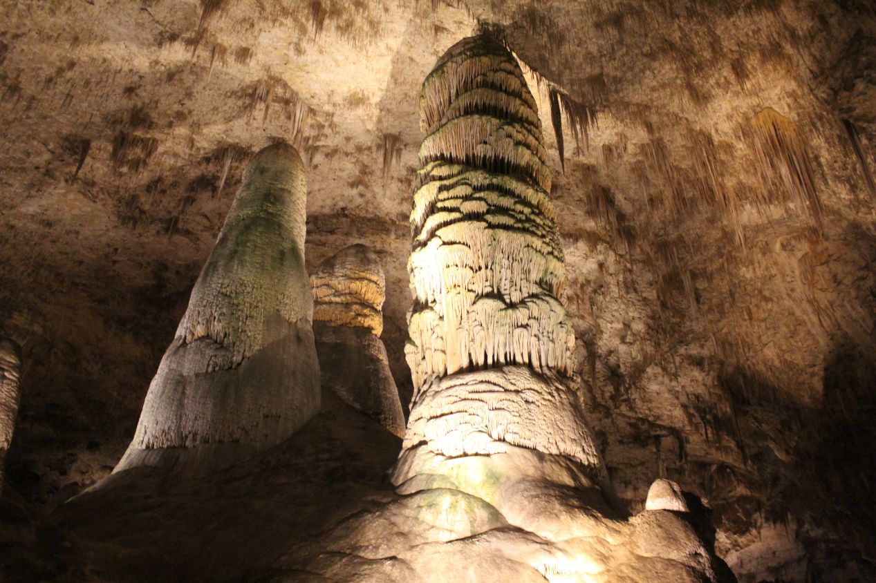
I was able to get some of my best pictures of the caves at the back end of The Big Room, in the section known as "Top of the Cross". This part of the cavern takes the shape of a huge cross, with the ceiling dropping lower here than out in the central portion of The Big Room. The maximum ceiling height in the middle of the main cavern stretches up to 255 feet / 80 meters, far taller than I'd ever seen before in a naturally-formed space. This back portion of the main cave also contains the hole known as the "Bottomless Pit", named because the lights of the initial explorers couldn't see to the bottom and stones dropped into the pit failed to make a sound. This pit is not actually bottomless, of course, and pebbles dropped inside failed to make a sound because it has a floor of sort dirt that muffled any impacts.
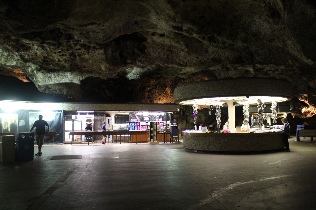
The entire walk around The Big Room took close to an hour to complete. The circular path eventually brought me back to the elevator that led up to the surface, along with the underground cafe that serves meals to visitors. This little restaurant looked completely bizarre, with the bright lights of the food on display situated beneath the massive weight of the overhanging rocks above it. If it hadn't been closing down for the evening, I might have thought about getting some food just for the sheer weirdness of eating a meal in a place like this. Rather than walk the lengthy route back up through the natural entrance, I rode the elevators back up to the surface in the span of a few minutes. I was amused that the elevators list the distance below ground (in feet) rather than the normal floors.
This brought me to the end of the day, as I left Carlsbad Caverns less than an hour before the final elevator ascent of the evening. It was an incredible place to visit, and I'll repeat once again that the pictures I took didn't do this place justice. I would highly encourage anyone reading to try and visit Carlsbad Caverns to take in the incredible majesty of these caves for themselves. This is not one of the more popular national parks, as its somewhat remote location hours away from any major city limits visitors to about 400,000 per year. Despite the difficulty of traveling to southeastern New Mexico, this is one of those places that's worth the time to come and visit.
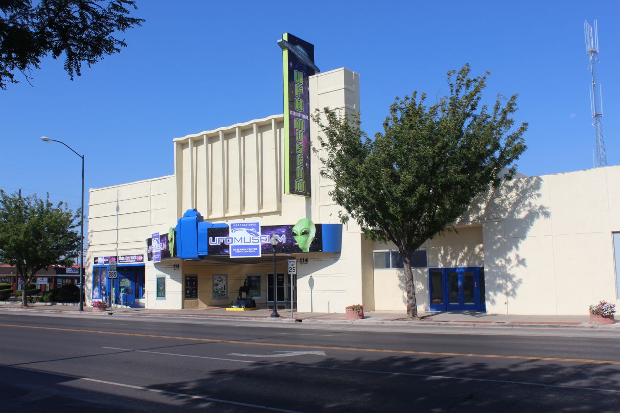
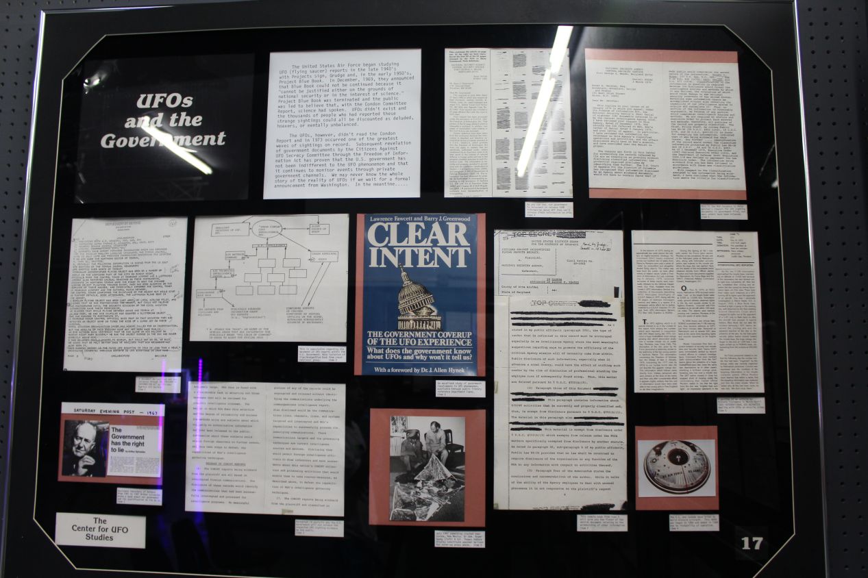
I stayed for the night at a cheap motel in the town of Artesia, located an hour's drive north of Carlsbad Caverns. I had a lengthy drive the next morning to Oklahoma City, but stopped before setting out proper in the infamous town of Roswell, New Mexico. (I figured that these pictures belonged here in the New Mexico section better than on the next page.) Roswell is a popular location for conspiracy theorists due to the belief that an alien spacecraft crashed outside the town in 1947 and the United States government has been concealing the events ever since. These pictures were taken from the UFO Museum in Roswell, a place supposedly dedicated to researching extraterrestrial activity. My skepticism about all of this should be pretty clear, as I am not a believer and there are perfectly logical explanations for the events that took place in Roswell. (The US military has published reports explaining that the crashed object was a nuclear test surveillance balloon, and the secrecy surrounding it at the time was due to the sensitivity of the early Cold War, not aliens.) Still, for those who think that there's a giant conspiracy taking place and the government is hiding the existence of aliens, this is the place to go.
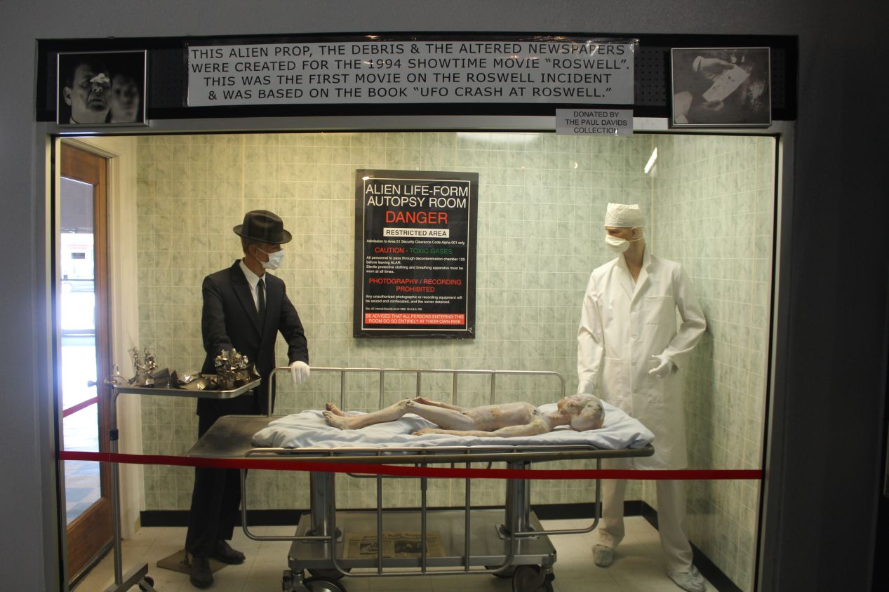
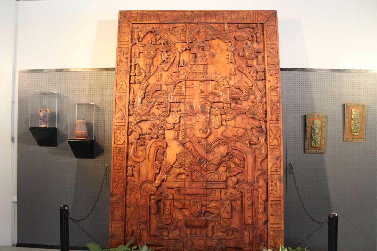

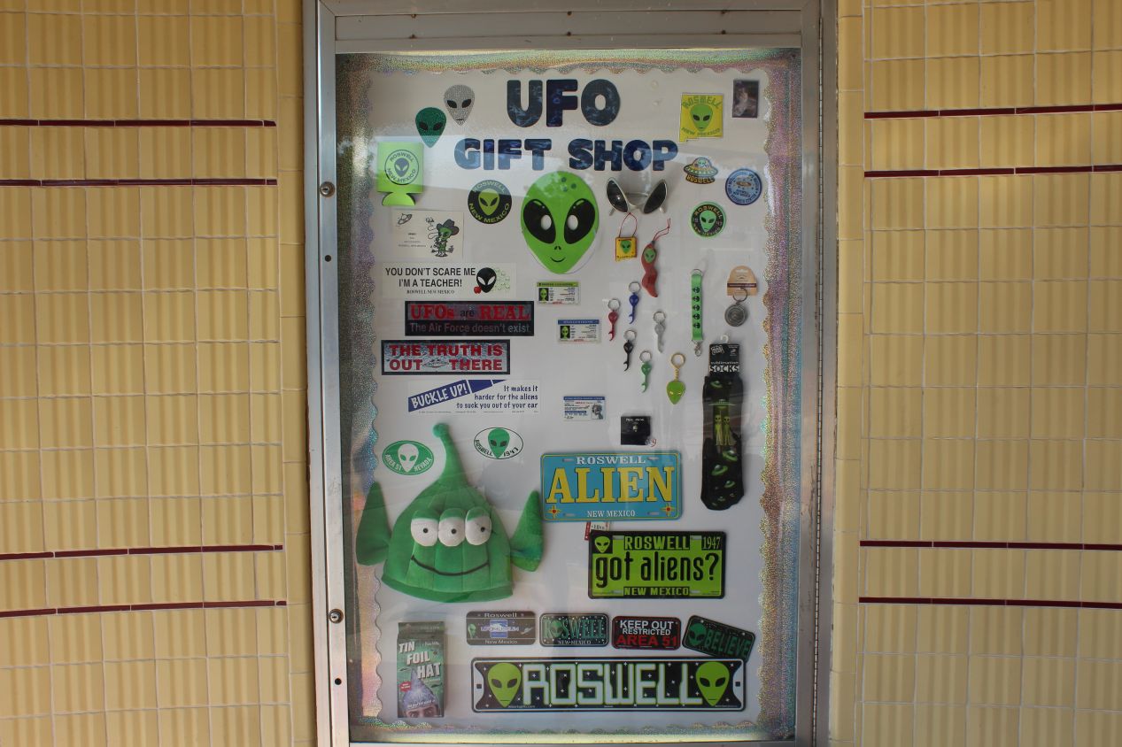
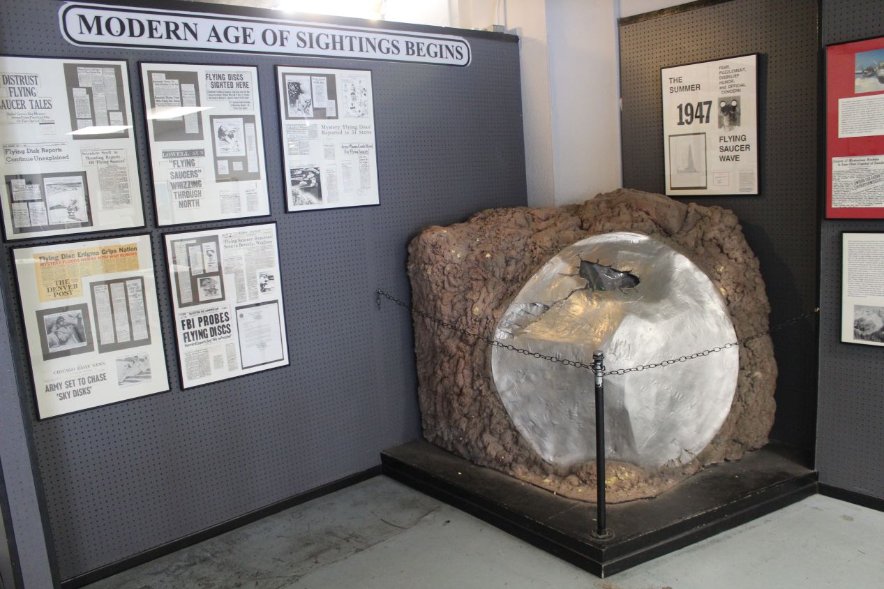
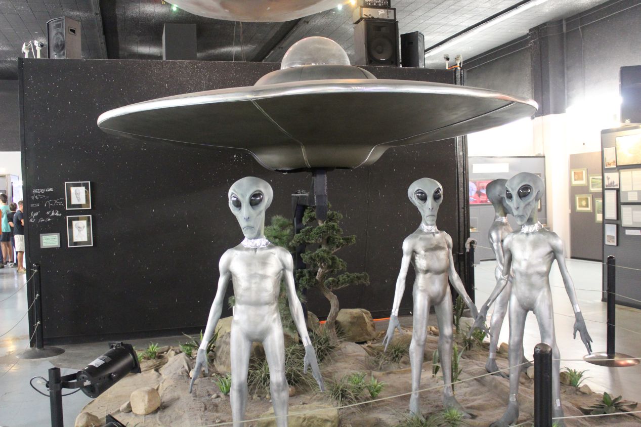
I had low expectations of the UFO Museum in Roswell, and what I found there failed to meet those minimal standards. The information presented in the museum was enthusiastic but amateurish in nature, with lots of leading questions and "eyewitness accounts" from true believers which were not subjected to serious investigation. Meanwhile, the most popular parts of the museum were a series of big displays of different aliens where visitors were encouraged to take selfies. While all of this nonsense is mostly harmless, the last thing that the world needs right now is more groups trafficking in false information, and there are way too many people willing to listen to baseless conspiracy theories. At least the gift shop had a sense of humor, proudly selling "Tin Foil Hats for Humans" in what had to be a self-referential joke. Long story short, this place was a big tourist trap and not worth stopping to see. Definitely do go visit the natural beauty of White Sands and Carlsbad Caverns, and stay away from the alien conspiracy theories in Roswell.
Next up: a visit to another new state in the form of Oklahoma, more than just a famous Broadway musical.


