
After spending the first few days of our trip in Seattle, we headed outside of the city to take in some of the sights of the surrounding region. The first place that we would be visiting was Mount Rainier and the national park surrounding the famous peak. Mount Rainier is the tallest mountain in the Cascade Range of the Pacific Northwest, standing at a total height of 14,411 feet / 4392 meters. It's a highly prominent mountain rising up far above the encompassing landscape, thereby looking taller in relation to the area than it actually is. The glacier-topped slopes of the mountain can easily be seen from downtown Seattle on a clear day and it forms one of the enduring symbols of the state of Washington. None of us had ever been to Mount Raininer previously, and our visit to the park proved to be one of the highlights of our trip.

Mount Rainier is located about 60 miles / 100 kilometers to the southeast of Seattle proper as the crow flies. The distance is significantly longer by car, however, as there is no direct route and most of the park's facilities are located on the southern side of the mountain, the region furthest away from the city. Driving to Mount Rainier dictates passing through a series of small towns along the way, with the scenery becoming more and more forested as the suburbs give way to the natural beauty of the landscape. Mount Rainier would appear and disappear as the roads twisted and turned around on the approach, slowly becoming larger and larger outside of the windows as it drew closer.
The mountain is an active volcano although it's been dormant for the last few centuries. Mount Rainier is considered to be one of the most dangerous volcanoes in the world, however, due to the dense population of the surrounding region to the northwest. If there were another serious eruption, hundreds of thousands of people would be in danger. The mountain also claims lives in other ways, as a small number of climbers continue to meet with fatal accidents while ascending to the top. It's not very many of them, as more than 10,000 people climb Mount Rainier each year and an overall total of 58 people died in the 35 years between 1981 and 2016. However, even with the best modern equipment this is still a dangerous summit to climb, and fatal accidents can and do happen. I still think that I would like to climb the peak if given the opportunity, but I would want to do a lot of training ahead of time to prepare.
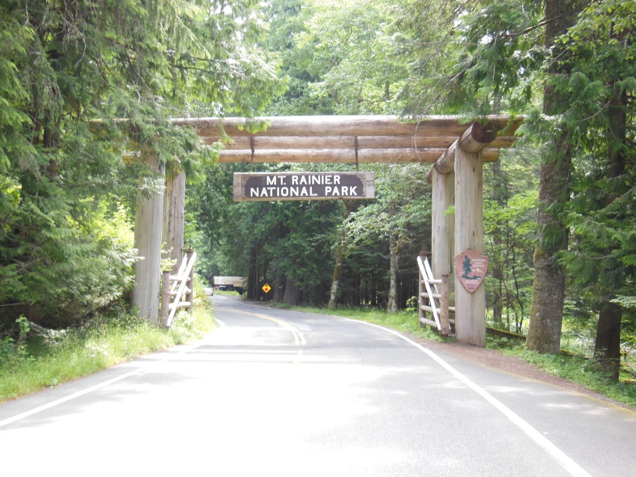
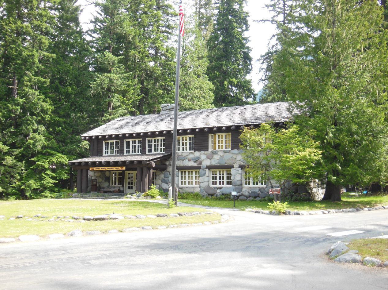
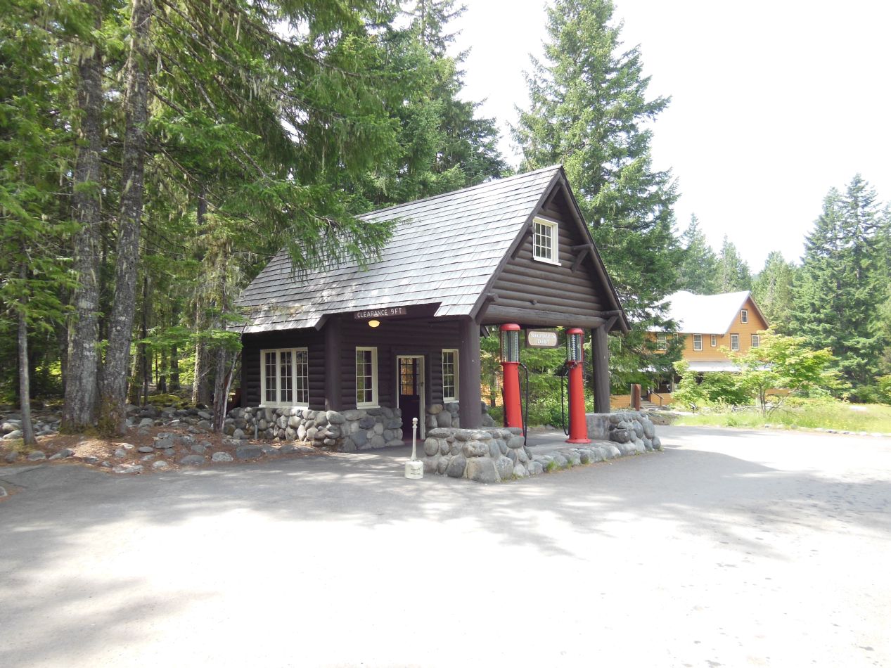
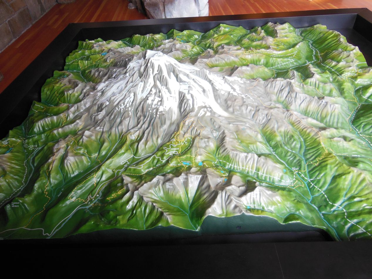
We entered the park via the Nisqually gateway, the route through which most tourists come to see the mountain. That's the spot with the overhanging wooden sign depicted above; it had an old-fashioned charm to it and hearkened back to the earliest days of the National Park Service. The rest of the park entrance was designed with a similar theme, the buildings made out of painted wooden logs that looked like they had been well-maintained for decades. There was a visitor's center near the entrance with maps of the park and information about the day's activities taking place. There was also a great deal of background history on the park itself, naturally, and the natural geography of the mountain. One of the outdoor exhibits had the massive stump of a Douglas fir tree that had begun growing in 1293 and was eventually cut down just short of its 700th year of life. I particularly liked the three dimensional topographic map of Mount Rainier and the way that it depicted the many hills and valleys in the area. It was a low-tech way of conveying information about the unique features of this particular park.
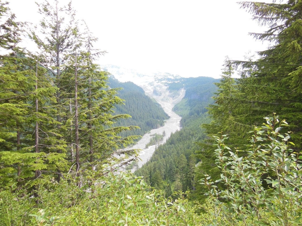
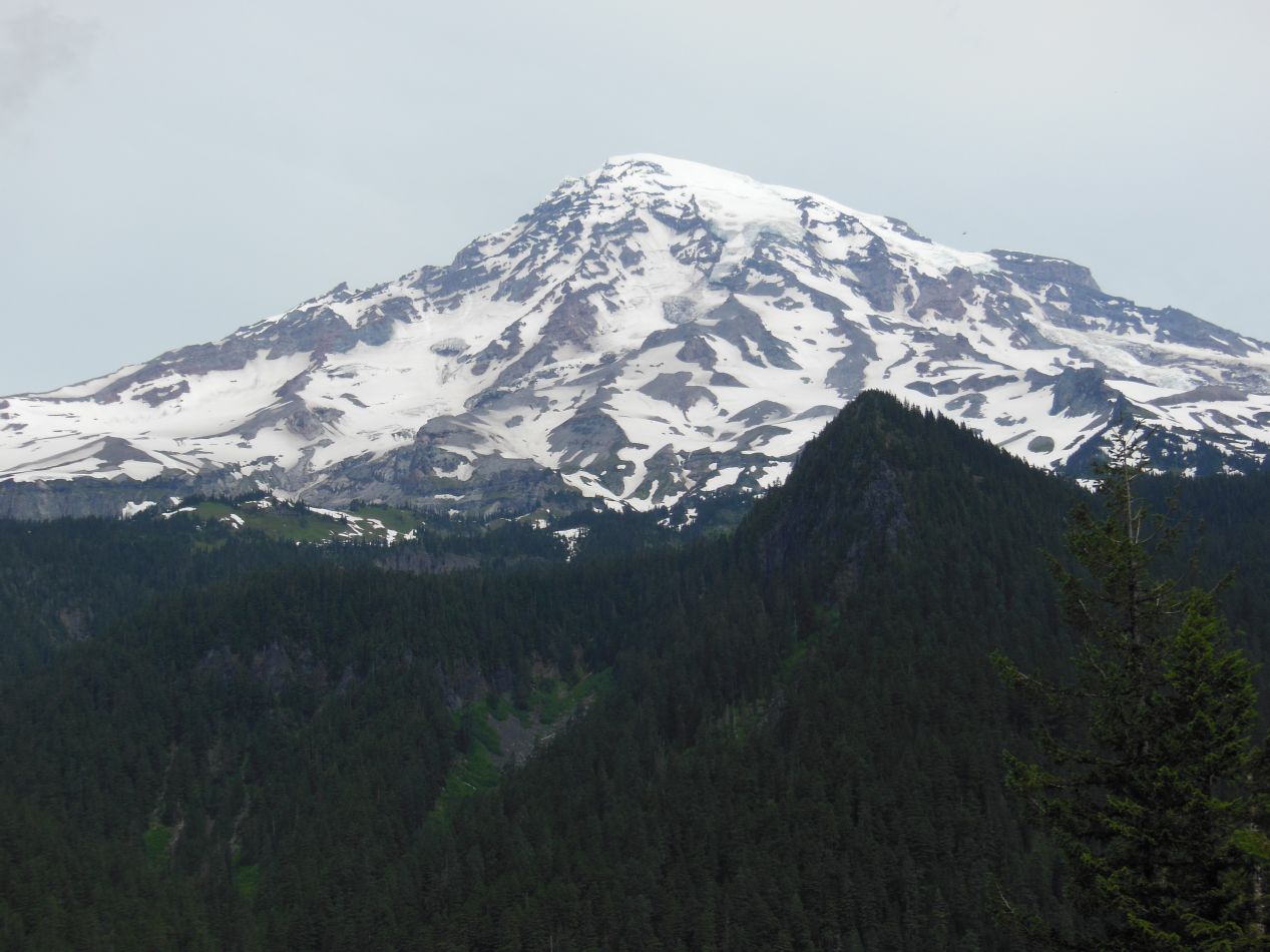
These were some of the pictures that we took from a scenic overlook a little ways inside the park. We were heading east towards the area known as Paradise, where most of the park facilities for Mount Rainier are located, and this was one of the places where the road had stopping points to get out of the car and take some pictures. The valley below had clearly been carved out by water running off of the glaciers of the mountain high above. Although it was mostly empty of water at the time of our visit, just a small trickle of water running through the rocky sand deposits, I'm sure that the riverbed becomes a raging torrent of water in the spring when the glacier melts off some of its winter accumulation. After playing with the contrast settings on my camera, I was also able to get a decent picture of the mountain itself. This was taken from the southwest part of the park looking northeast towards the upper reaches of the mountain.
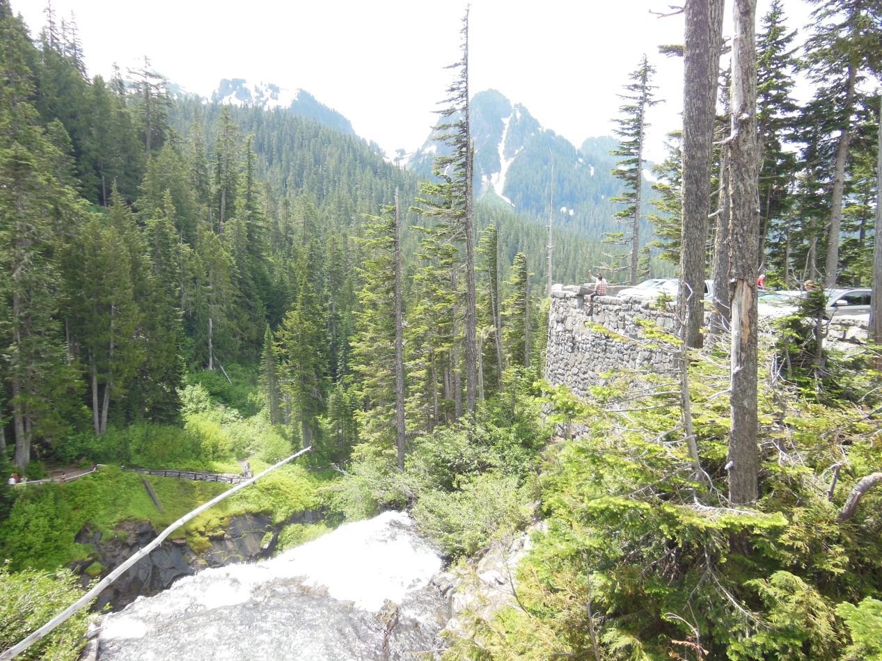
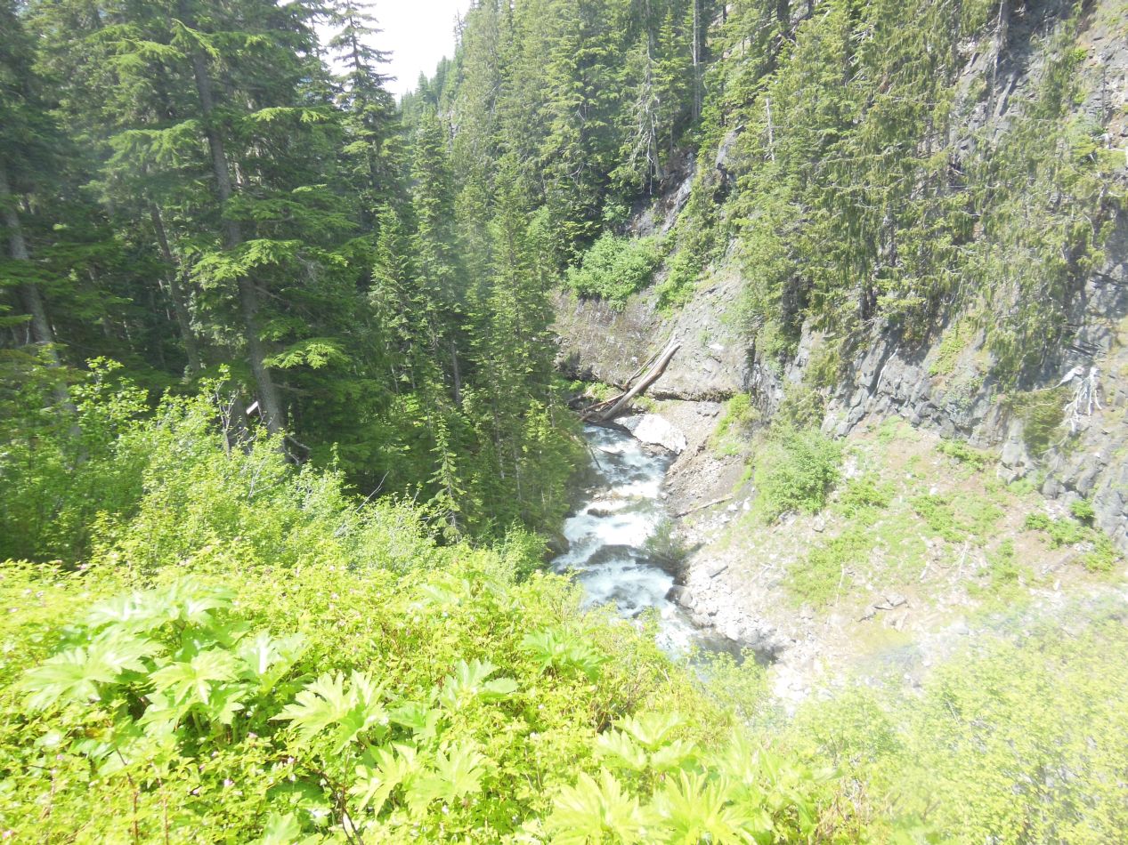
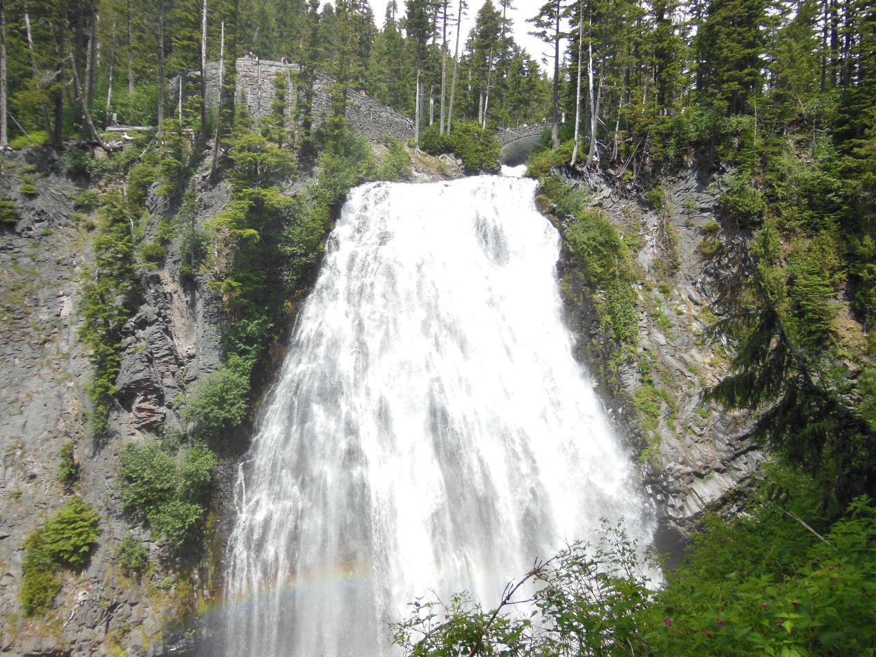
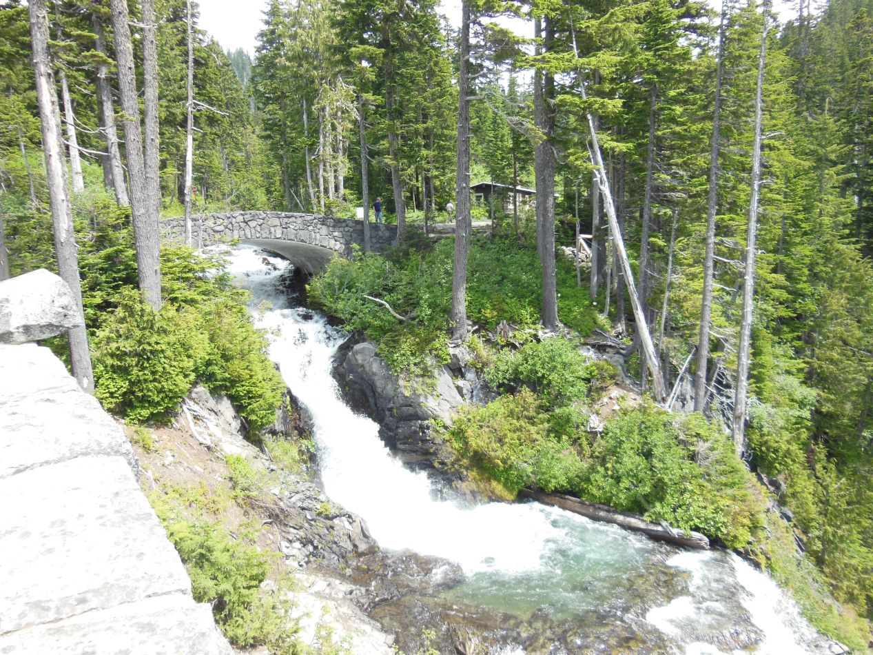
Our first stop of true interest in the park was this waterfall known as Narada Falls. It's one of the most popular attractions at Mount Rainier National Park due to its easily accessible location, right next to the highway that runs in a loop around the central mountain. The accompanying viewing trail that provides some of the best pictures of the falls is only a tenth of a mile in distance, and the falls can be seen quite well from the parking lot above, for those who may not be able to walk the short distance down to their base. Narada Falls has a vertical drop of about 170 feet / 50 meters, and the falls themselves are surrounded by trees growing in all sorts of strange and precarious positions along the edges of the cascade. I was most impressed by the stonework of the viewing platform and the bridge arcing over the water. That looked like some very fine engineering work instead of the more typical (and cheaper) construction made out of wood. It was cool and misty at the base of the falls due to all of the spray kicked up from their passage, a refreshing change of pace on this hot summer day.
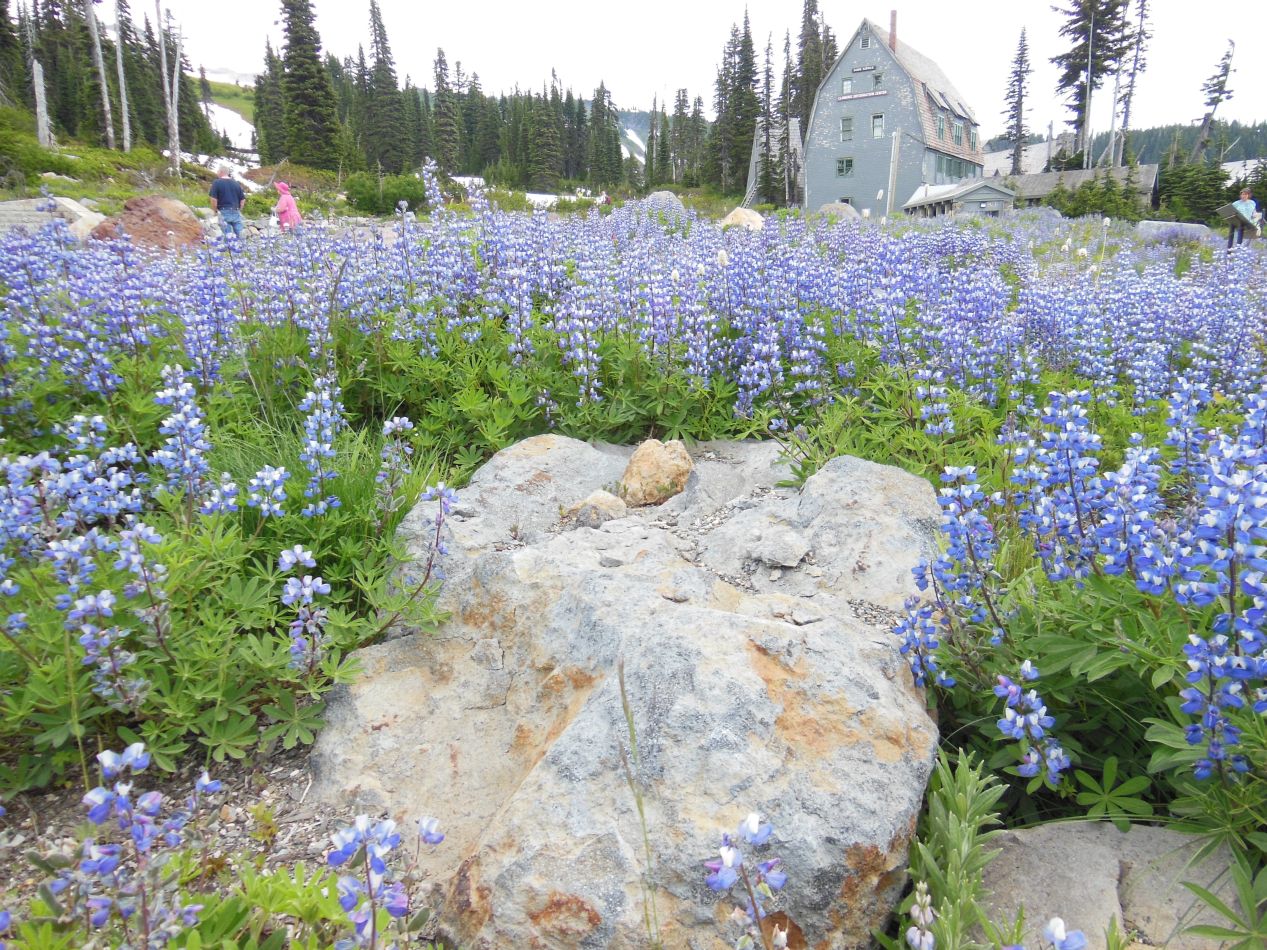
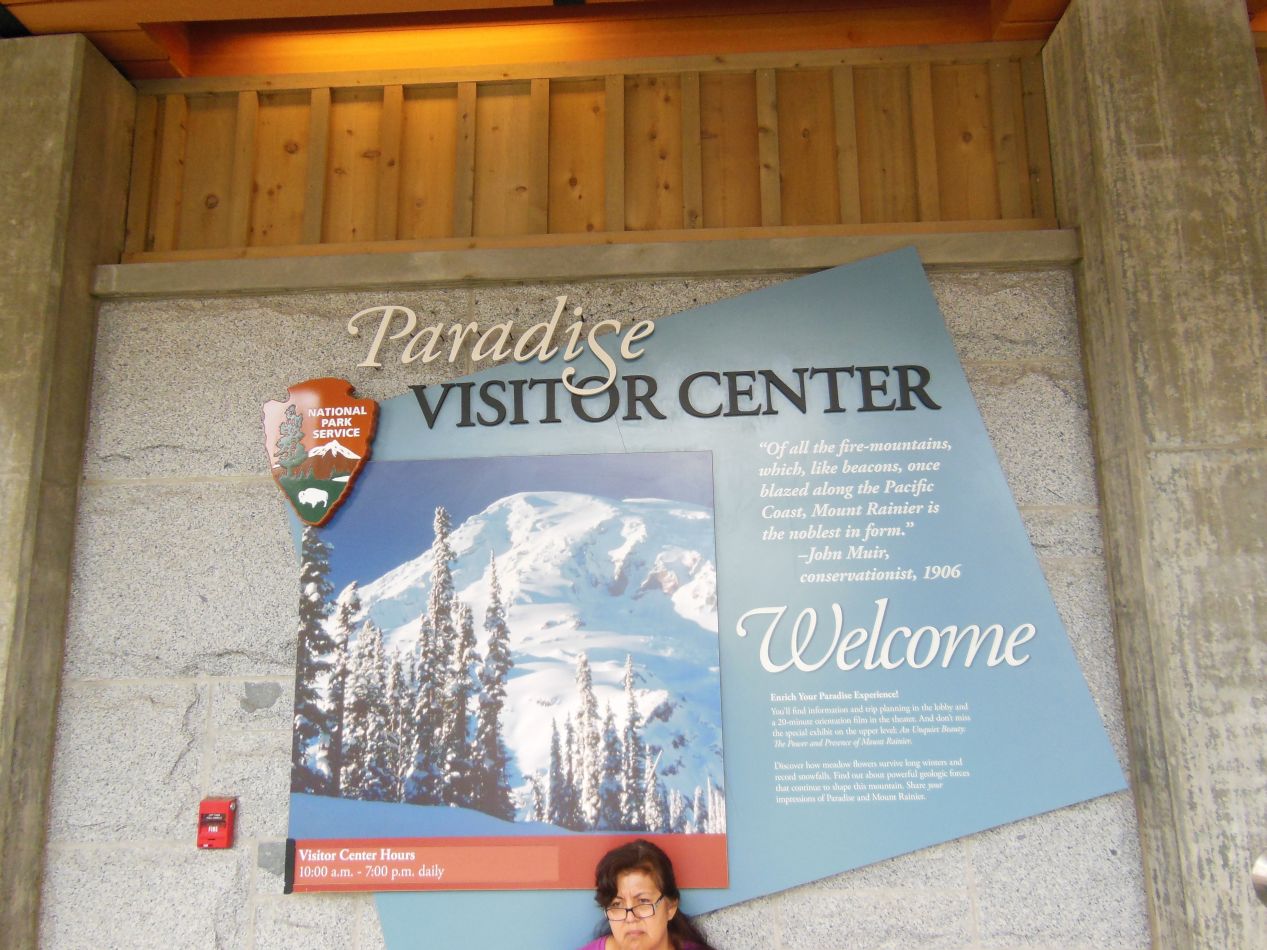
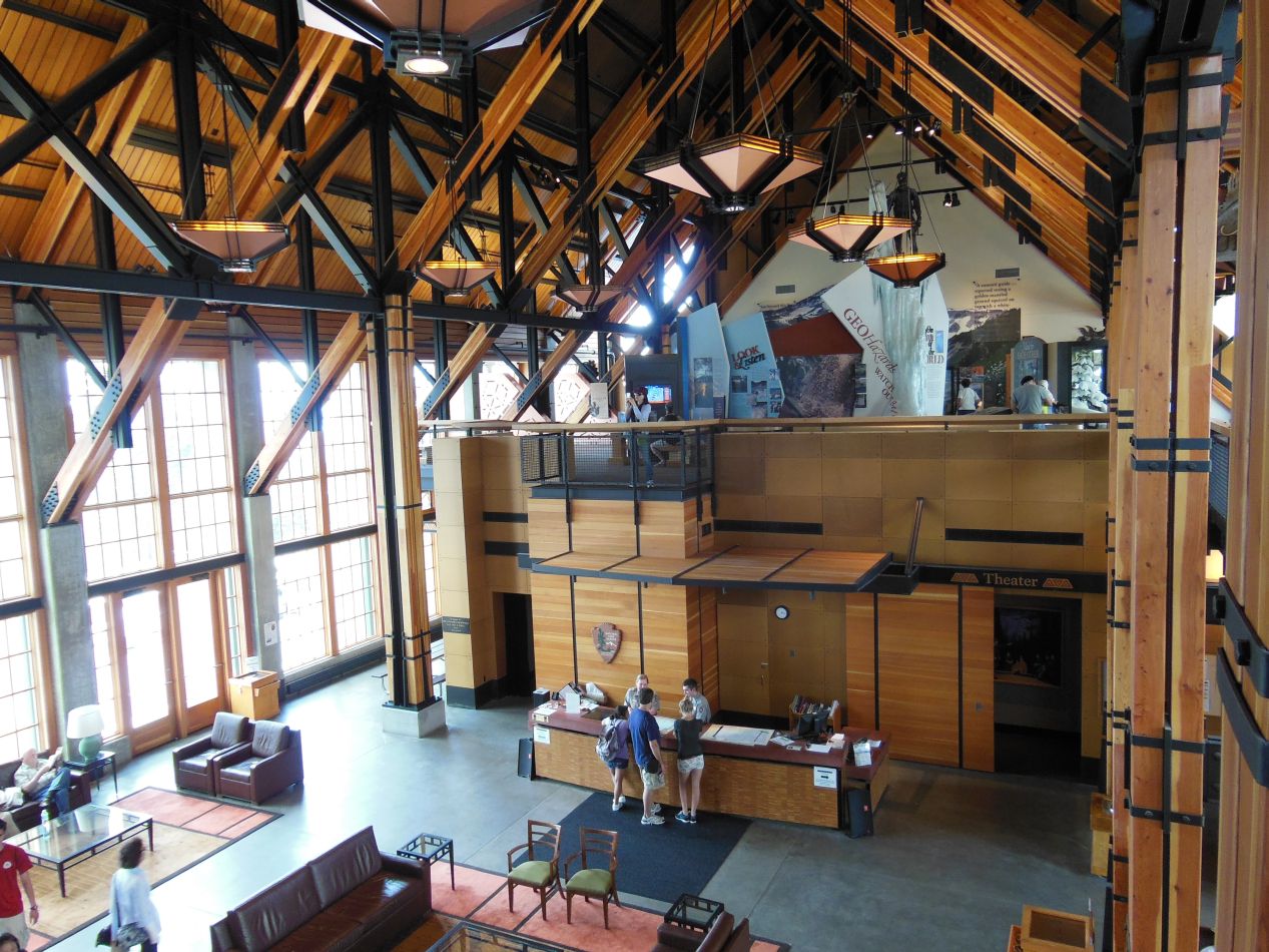
We headed next to Paradise, the hub of the activities taking place in Mount Rainier National Park. This is the location of the largest visitor center with the most guest services, and it's the most-visited destination within the park with almost 1.5 million tourists coming to Paradise annually. It was on this location that the Paradise Inn and Paradise Guest House were built in the early 20th century to attend to the needs of the relatively few individuals who came to Mount Rainier, and they have been preserved down to the present. Nearly all of the expeditions that climb to the summit of the mountain are also organized in Paradise. It was clear that the visitor's center in Paradise was much newer than the one at the park entrance in Nisqually, having opened only a few years earlier in 2008. This was a place where visitors could spend a few hours wandering around and exploring the historic structures and the exhibits on display in the visitor's center.
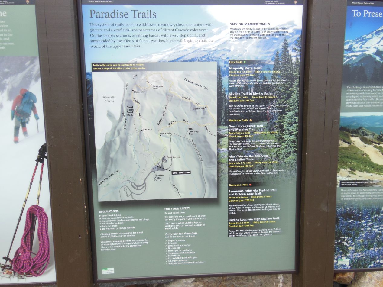
I didn't have much time to spend in Paradise, however. This was the departing point for a number of different trail hikes and I had only a limited amount of time available to head up the mountain. My family would be staying in Paradise for the moment, with an agreement that we would meet back in the parking lot in 2.5 hours. If you look at the trail map above, I figured that this would give me just enough time to reach Panorama Point up at the top of the image. That would be 4 miles round trip distance with a vertical elevation gain of 1700 feet, listed as "strenuous" on the guide. The map said that this hike typically takes around 3 hours, but I figured that I could do it faster than that. No way to find out other than to try it firsthand, right?
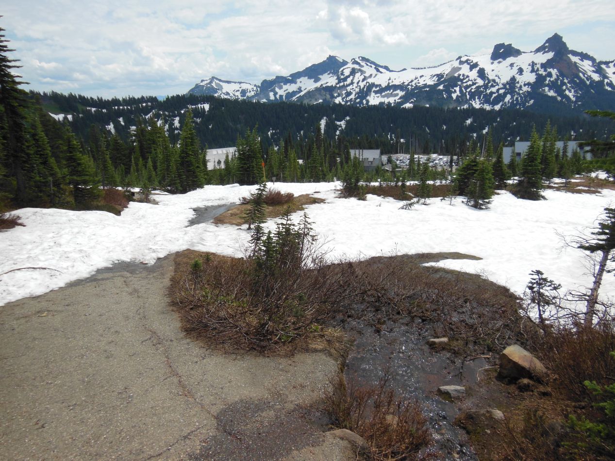
The trail heading upwards from the parking lot started out paved, only to be covered almost immediately by a layer of snow. That's one of my favorite things about alpine hiking, the way that you run into snow even in the middle of the summer due to the higher altitudes. In fact, Paradise is considered to be the snowiest place on Earth where snowfall is measured regularly, as the maritime climate of Seattle encounters the towering peaks of the Cascades and causes the clouds to dump their moisture in the area as snowfall. This spot had an astonishing 1,122 inches (28.5 meters) of snow during the winter of 1971/72, and although the warming climate causes a bit less than that to fall now, it still produces far more snow that almost anywhere else on Earth. There were 367 inches (9.3 meters) of snow on the ground here at one point in time in March 1956, absolutely unreal.
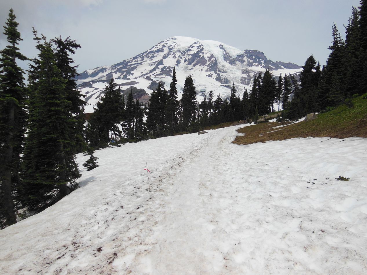
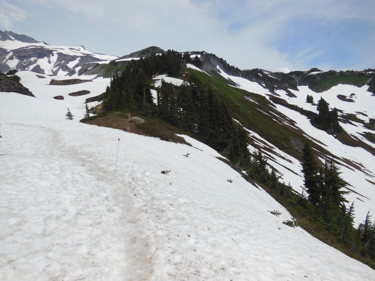
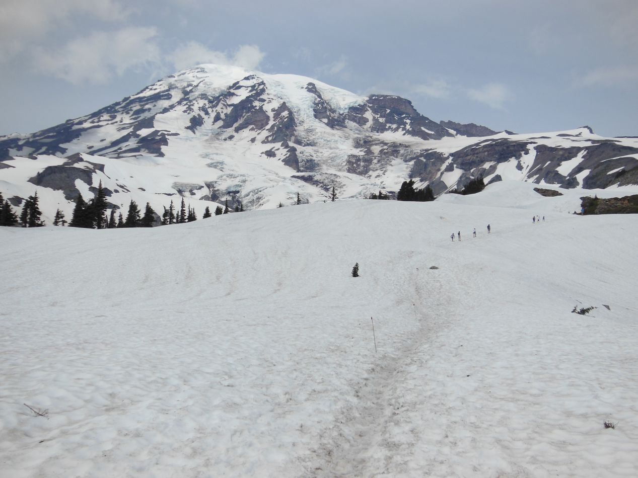
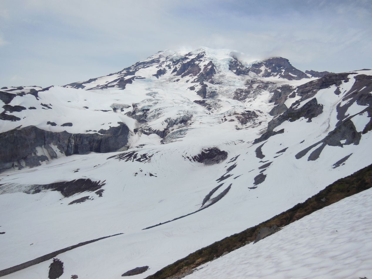
As for the trail itself, it started out uphill and continued further uphill. With the gravel of the trail buried under a coating of snow, the only way to stay on the path was via a series of small flags driven into the powdery whiteness. There was a bit of a beaten track in the snow from other hikers on the trail, and that definitely helped as well. Still, this was highly difficult uphill hiking, not made easier by the fact that I needed to hurry to complete this trek in the limited time allotted to me. I did not have proper hiking boots and my sneakers struggled to get good footing on the uneven ground. The other hikers were in the same situation, many of them staggering along the trail looking exhausted. At least the views were spectacular, with Mount Rainier rising up above everyone to the north. We looked like a tiny line of ants dwarfed by the craggy fortress of ice and snow up above.
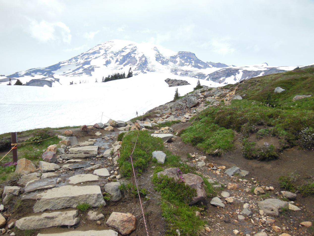
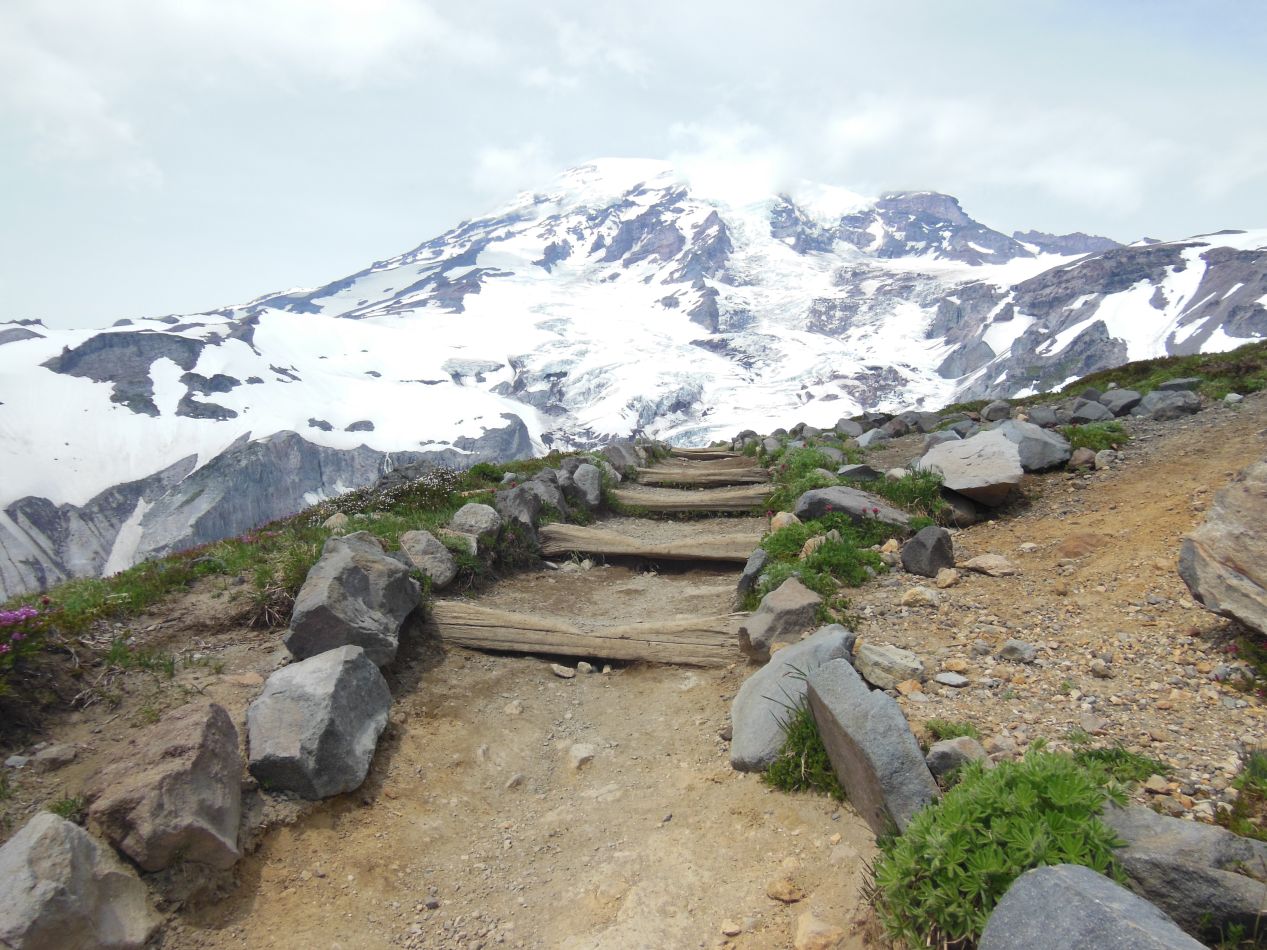
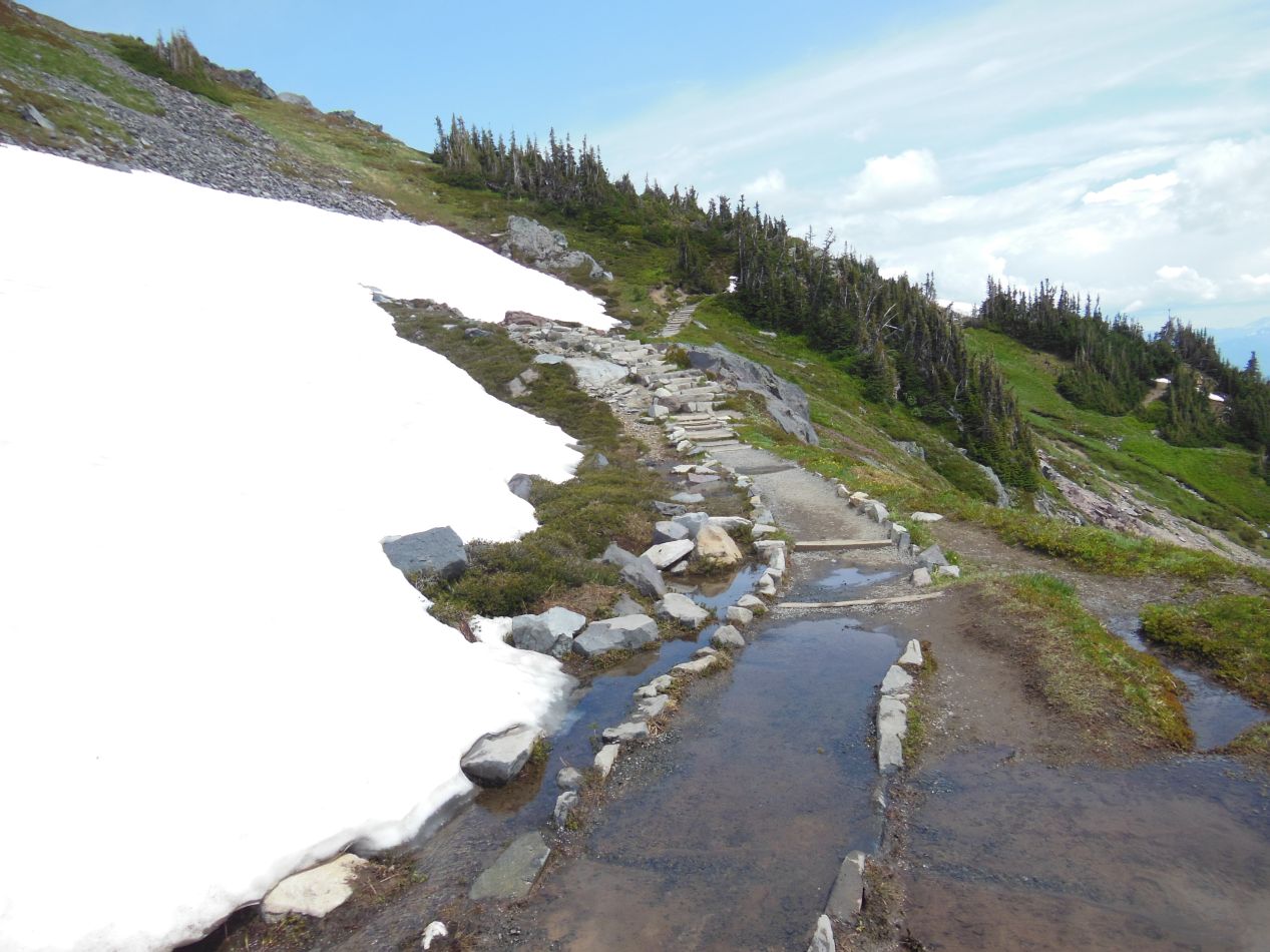
Somewhat surprisingly, the trail became a bit easier up near the top as I drew closer to Panorama Point. There was less snow up here for some reason, and the trail itself became visible again in some places. I'm not exactly sure why that would be the case, perhaps something in the way that the mountain's geography wrapped around that causes more snow to be deposited down by Paradise as opposed to further up the slopes. Regardless, it was quite pretty up here on the high slopes of the path, with fields of snow visible down below on both sides of the trail. I had been walking up a bit of a ridge that ran between more treacherous glacier runoff on both sides. The trail also passed over a small mountain stream at one point, with water from melting snow gurgling over the rocks in little waterfalls a foot or two in height. It was too bad that I had to rush through this area instead of stopping to spend more time to appreciate the natural beauty.
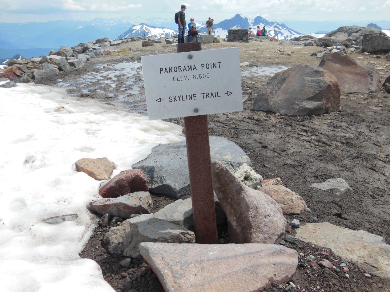
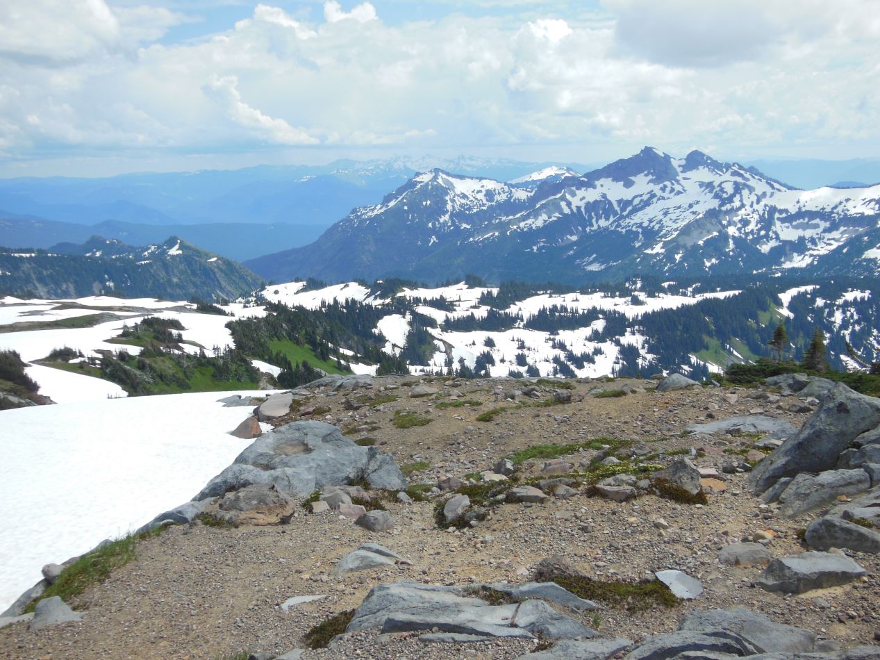

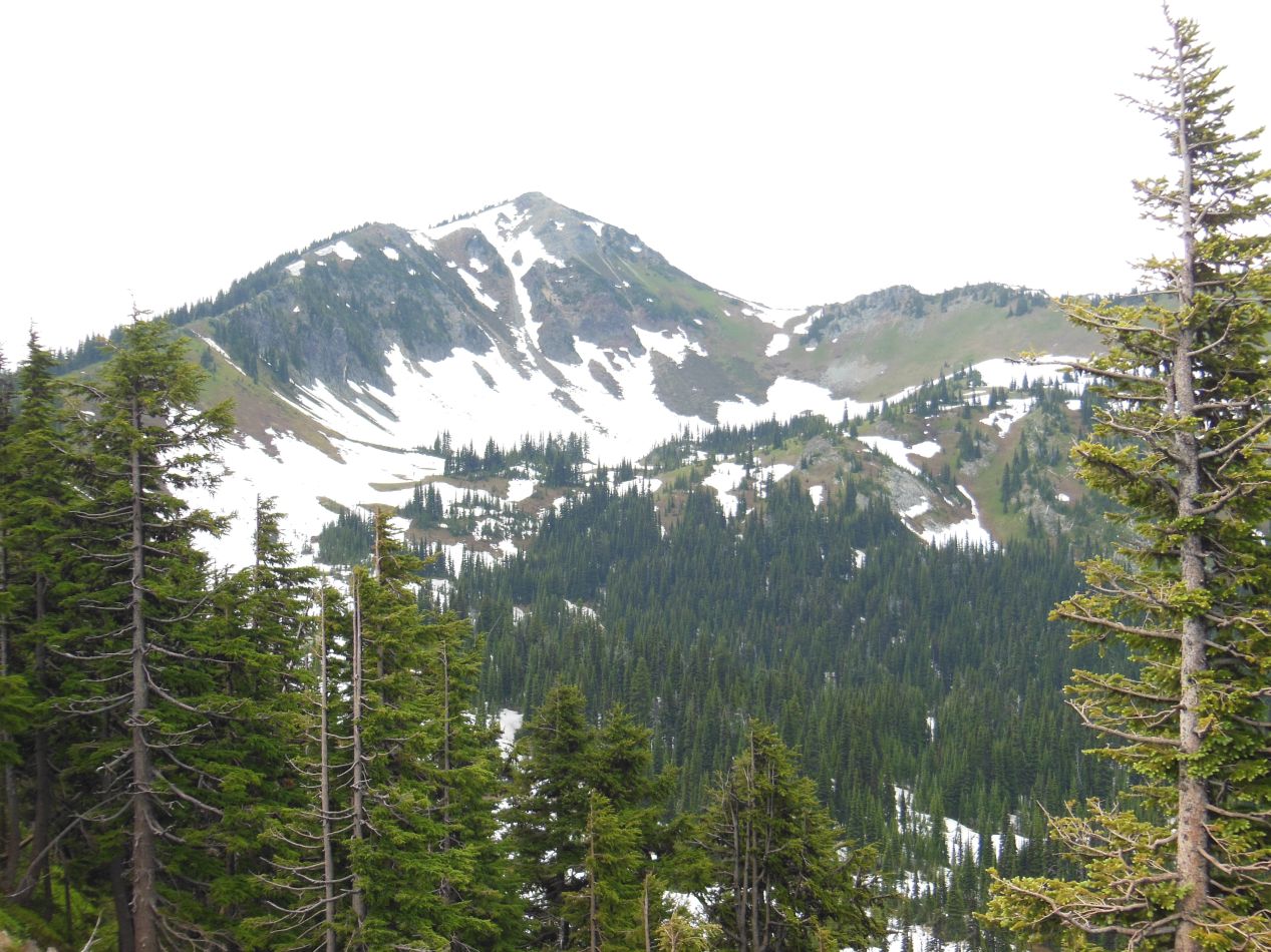
Eventually I reached Panorama Point, elevation 6800 feet (2070 meters) as indicated on the sign. I took a few minutes to rest among the other weary hikers, with my legs and feet crying out in protest from the difficult walk uphill. Now I could enjoy the fruits of my labor in the form of the breaktaking views that stretched out to the east, south, and west. There were dozens of nearby mountains spread out before me, each with its own rocky peak capped by a field of snow. It was clearly visible where the tree line existed, with even the tough evergreens unable to survive up near the peaks where everything was snow and ice and bare rocks. Almost 2000 vertical feet below were the buildings of Paradise, tucked together next to the parking lot and the road that ran off into the distance. This was a place where the natural environment still held sway and human-built creations shrunk into insignificance.
The one direction without panoramic views was the north, where Mount Rainier continued to rise up another 7000+ vertical feet. The trail continued further up the mountain, and I would have loved to keep going and see how long it lasted until running out. However, there was no time for more exploration and I needed to hurry back down to Paradise once again to meet up with the rest of my family. Fortunately going down was a lot easier than going up, and I did manage to make it back at the scheduled time. My brother and I had done a similar hike in the Grand Tetons the previous year and missed our scheduled return by a full hour, with no ability to call on our phones to give warning since we were far up in the mountains with no coverage. Needless to say, our parents had not been pleased.
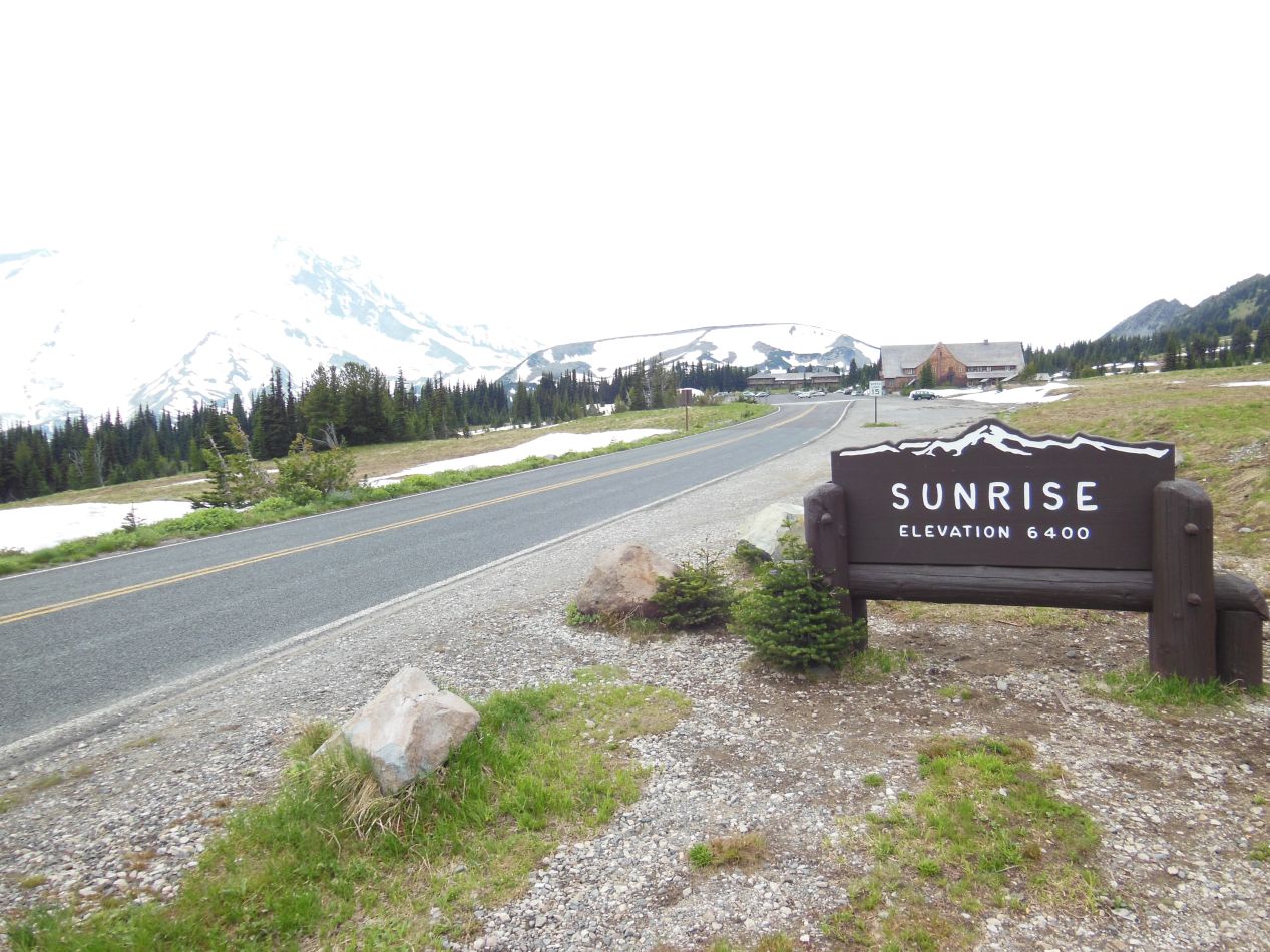
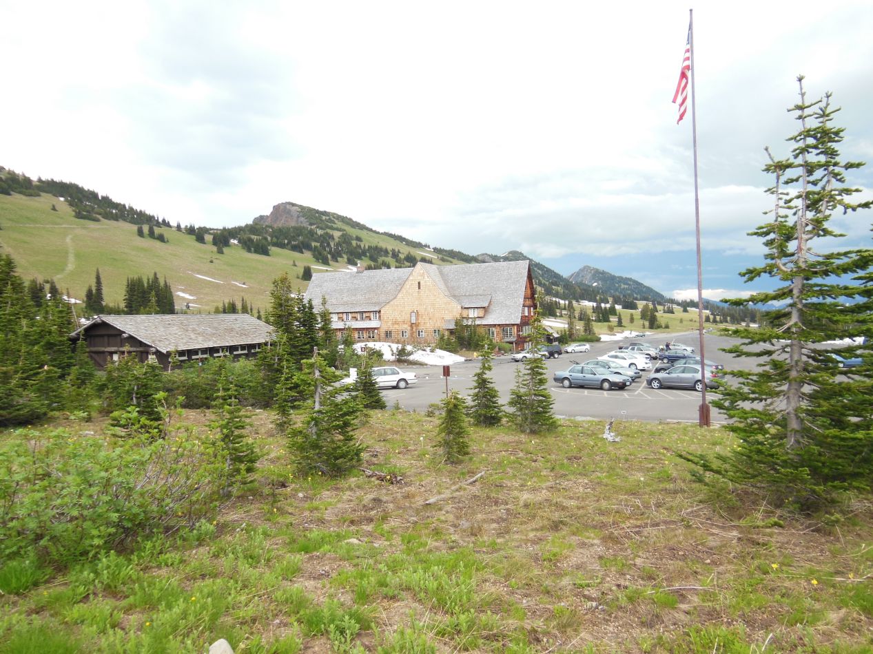
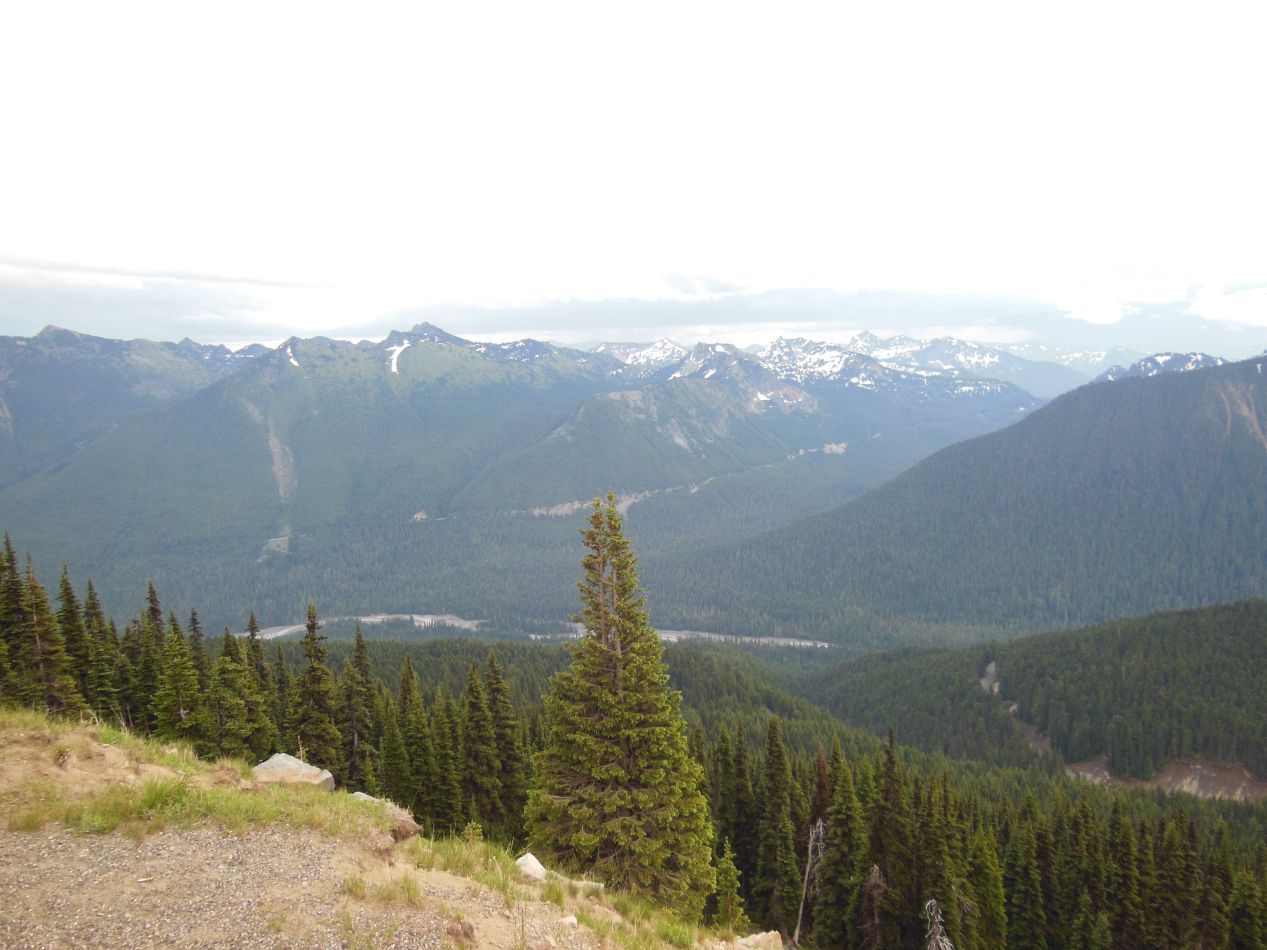
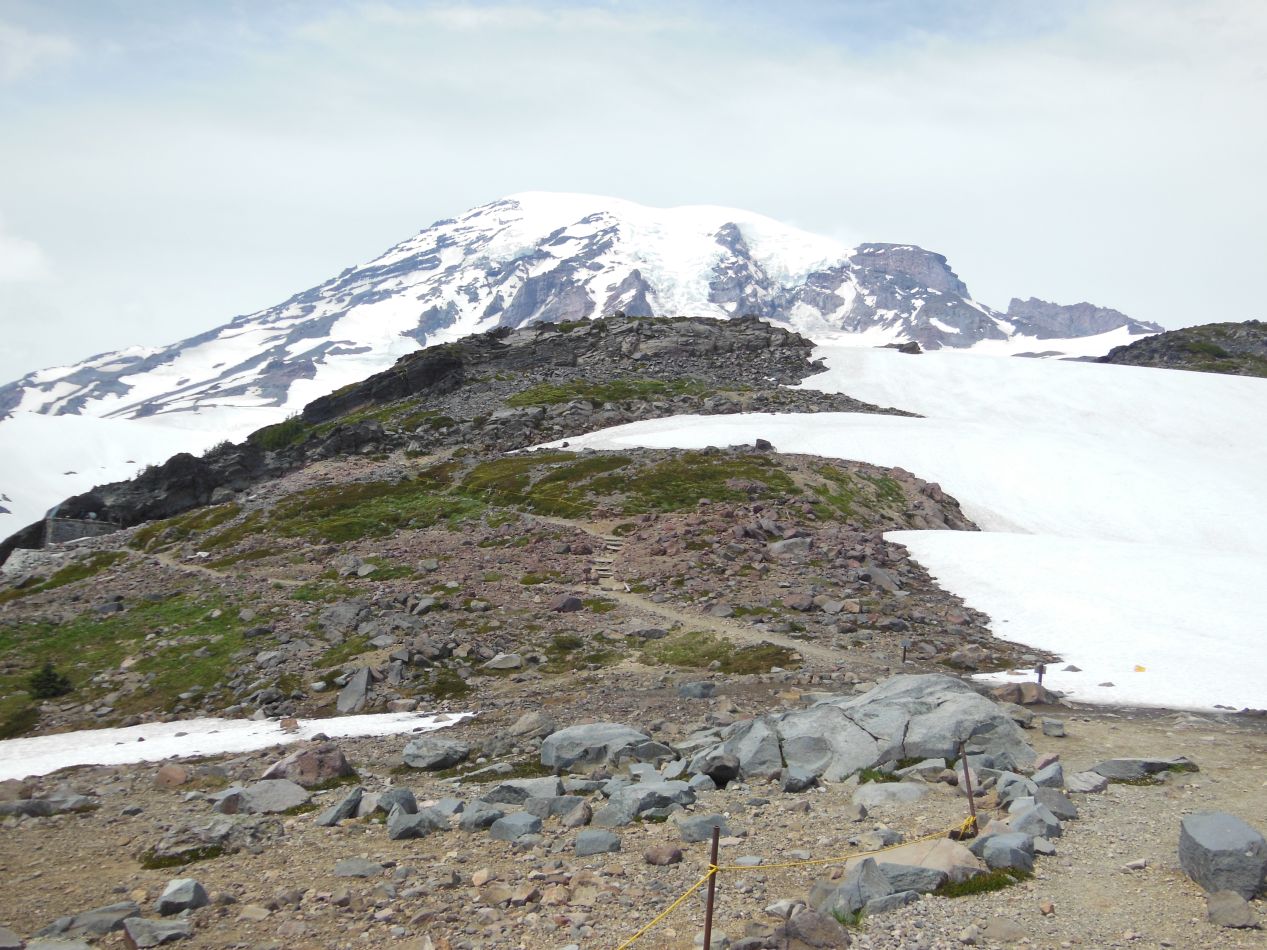
The drive out to Mount Rainier had taken up much of the morning, followed by spending a good part of the afternoon exploring the Paradise area. With the remaining time that we had available, we headed off to the eastern portion of the park and the visitor area known as Sunrise. This is one of the more isolated portions of the park, requiring a drive along a 10 mile / 16 kilometer turnoff from the road that loops around Mount Rainier. We found Sunrise to be almost deserted when we arrived, with nearly all of the tourists sticking to the more accessible Paradise portion of the park. It probably didn't help that the buildings in Sunrise were closing at 5:00 PM and we had arrived at about 4:45 PM, only shortly before everything would be shutting its doors. Sunrise had its own charms though, with its own lodge and smaller visitor's center that looked a bit like something out of the Swiss Alps. This is the highest elevation portion of the park accessible by car, rising up close to the height of Panorama Point at 6400 feet. We were able to experience more views of the beautiful surrounding mountains, this time seeing the ones off to the north that had previously been blocked. As for Mount Rainier itself, the northern face of the mountain wasn't quite as picturesque as the southern face, and due to the greater difficulty of ascending from this direction, most of the climbers head up to the top from the southeastern face. Only about 2% of the climbers try the more dangerous northern ascent, and we certainly didn't see any on our visit.
Once Sunrise shut down, we had a long drive to get back to the southern suburbs of Seattle where we could eat dinner and rest a bit. It had been a thoroughly enjoyable as well as a thoroughly exhausting day. Our next destination would be the western counterpart to Mount Rainier, the variable landscapes contained within Olympic National Park on the other side of the Pugent Sound. There was still plenty more of the beautiful natural scenery of Washington state to take in before we left this region and crossed the border into Canada.


