

Labrador is an actual place, not just the name for a popular breed of dog. It makes up the mainland portion of the Canadian province of "Newfoundland and Labrador", a vast region tucked along the extreme northeastern edge of Atlantic Canada. Although Labrador contains 71 percent of the province's territory, it holds only 8 percent of the population, and Newfoundland itself isn't an especially populous province. According to the data on Wikipedia, Labrador spans about 300,000 square kilometers... and has a total population of only 27,000 people. This is an area of true wilderness, with scattered towns along the coast and only a handful of roads running through otherwise unspoiled wilderness. I would be visiting one of the few parts of Labrador that does have a paved road, the Labrador Coast in the southeast corner. This was a part of the world that I didn't ever think that I would be visiting, and I was excited to see what was up here in "The Big Land" as it's called by locals.


My original plan had been to drive into Labrador from Quebec using the Trans-Labrador Highway. When that travel route had been foiled by wildfires burning in the Labrador wilderness, I had been forced to take the alternate and more common ferry route over from Newfoundland. This service leaves from the little town of Saint Barbe and crosses the Straight of Belle Isle over to the Labrador Coast. (You may have noticed from these place names that there was a strong French presence here in the colonial period.) I drove north from Gros Morne and arrived in plenty of time to catch the ferry, where I had reserved a spot ahead of time. While that turned out not to be necessary, there are only two ferry ships daily in the summer and the last thing I wanted was to waste a whole day sitting around waiting for a ship to arrive. Saint Barbe was miniscule in size and had nothing particular interesting to note aside from the ferry terminal itself. This ship was much smaller than the ferry that had carried me across to Newfoundland, only four decks and with enough space for about a hundred or so cars, not a thousand. I had to drive my car into the belly of the ship along the precarious gangplank pictured above, which was a lot of fun. Don't swerve off to the sides or you'll go right into the water with no guardrails.


It took about two hours to cross the straight and reach the Labrador Coast on the other side. The Straight of Belle Isle is narrow enough that it's possible to see from one side to the other with the naked eye, however the ferry crossing doesn't traverse the narrowest part and it took some time to load and unload everything at each end. I spent a lot of time up on the top deck, first watching Newfoundland recede into the distance and then the Labrador Coast appear up ahead. The ferry would be arriving at the little town of Blanc Sablon, a small collection of buildings sitting along the coast at the foot of a large hill. Even though it was a beautiful day once again, the terrain in Labrador looked bleak up ahead. There were no trees visible along the shoreline, only exposed rocks and tough grasses. I had the feeling that this region was frequently hit with terrible storms coming across the north Atlantic. Blanc Sablon was sheltered by the presence of Newfoundland on the other side of the straight, but further north the towns would have no such protection from the ocean's wrath.

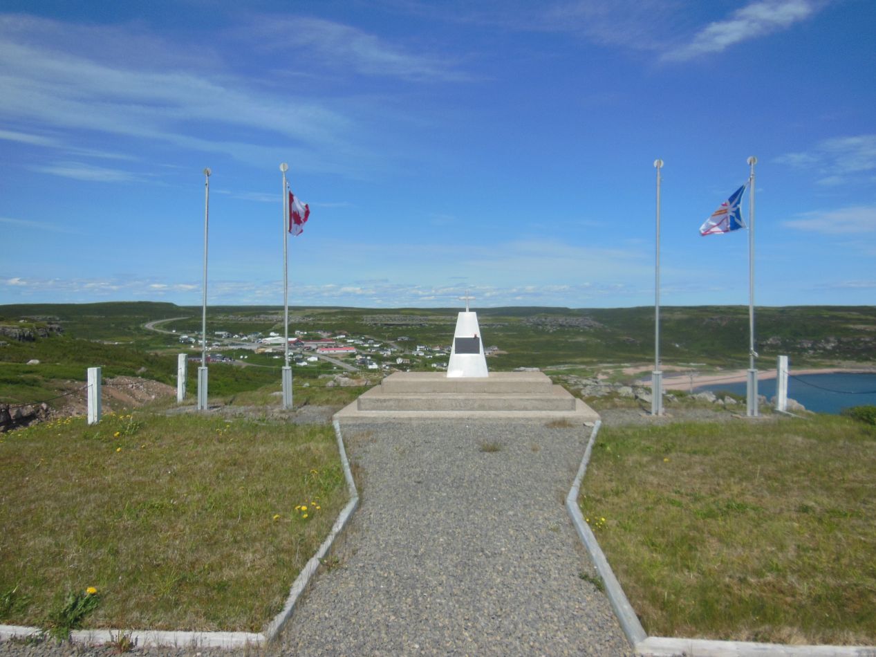

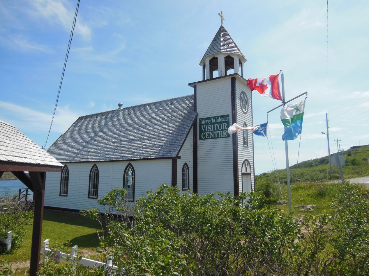
Blanc Sablon is technically in Quebec, with the border to Labrador located only a few miles up the road. (This causes terrible confusion with regard to the times for the ferry, since Quebec and Newfoundland use different time zones that are 1.5 hours apart.) I stopped at the border to snap a picture of the huge sign proclaiming the entrance to Labrador, the home of the "Big Land" as the sign announced. There was another overlook a short distance ahead with a monument to the veterans of foreign wars who had lived in Labrador. The simple memorial stone was placed on a lovely spot up on top of a hill, with a great view looking down at the town of L'Anse-au-Clair (population 264 people) below. That was where the visitor's center for the Labrador Coast was located, in a repurposed former church building. I was able to pick up a few maps and additional information brochures here to supplement my trip. As the flags in the pictures above indicate, it was extremely windy here along the coast. Much like the conditions I recalled in Iceland, there were no trees to block the wind and it howled in from the water without interruption.


The main road that runs along the Labrador Coast is fortunately paved. It only runs as far as the town of Red Bay, however, and if visitors want to detour anywhere off of that main path, they're forced to drive on unpaved gravel tracks. I wanted to stop to see an attraction located in L'Anse Amour (a sarcastically named "Love Cove" in French) and that meant taking this dirt path. It wasn't too bad, not with the weather being so nice outside. L'Anse Amour itself didn't even qualify as a village, just a collection of a few buildings sitting next to the water. According to the most recent Canadian census, it has a permanent population of 8 people.

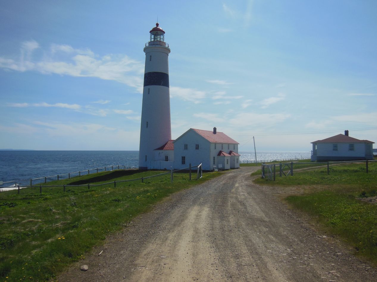

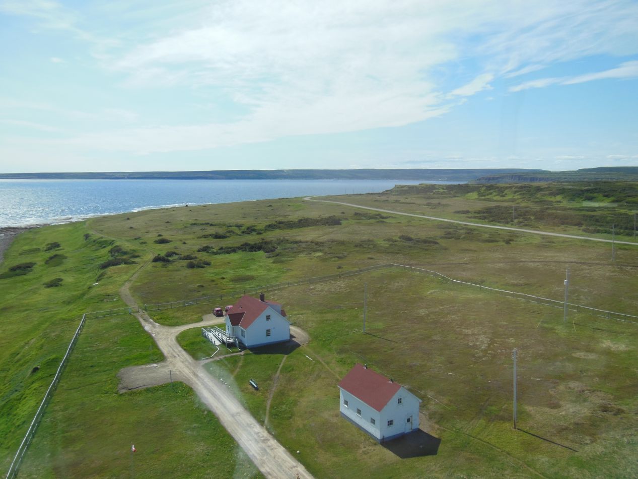
The only attraction in L'Anse Amour is this lighthouse, a provincial historical site designed to protect sailors from crashing on the nearby rocks. This current lighthouse dates back to 1857 and is the tallest lighthouse in Atlantic Canada (and the second-tallest in the country) at a height of 40 meters (125 feet). This lighthouse originally was occupied by a series of lonely lighthouse keepers, who lived in the buildings at the base of the lighthouse. It remains in current use today, although the lighthouse has been automated since the 1960s and no longer requires routine human supervision. I was able to climb a narrow spiraling staircase up to the top of the lighthouse where the big lens was stored, with great views to the north and south along the coast. As the parking lot indicates, it wasn't particularly crowded here today, just me and the one employee there to guide visitors around.

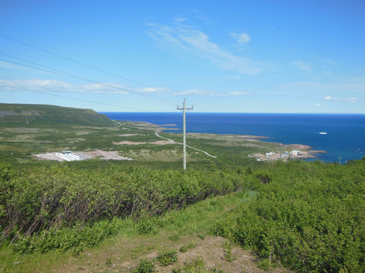


I only had a single afternoon's duration to explore the Labrador Coast, and I had decided that I would travel to the town of Red Bay and then back again towards the ferry crossing. This is the part of the Labrador Coast that had the most towns and attractions to visit, and I simply didn't have enough time to travel up to Mary's Harbor or other points further north. I stopped to take some pictures while driving to Red Bay, and eventually I did begin to see some trees, short and stubby things that looked like they had to fight a constant battle to stay alive. Despite the harsh conditions, it was a beautiful day outside and the scenery was something to behold. Aside from the one road running through the area with its occasional small towns, this was still largely untouched nature. The one unnamed river that I saw snaking through the forest near Red Bay was nothing less than gorgeous, one of my favorite landscape pictures that I've ever taken. You could go backpacking in this area and simply disappear for days or even weeks.

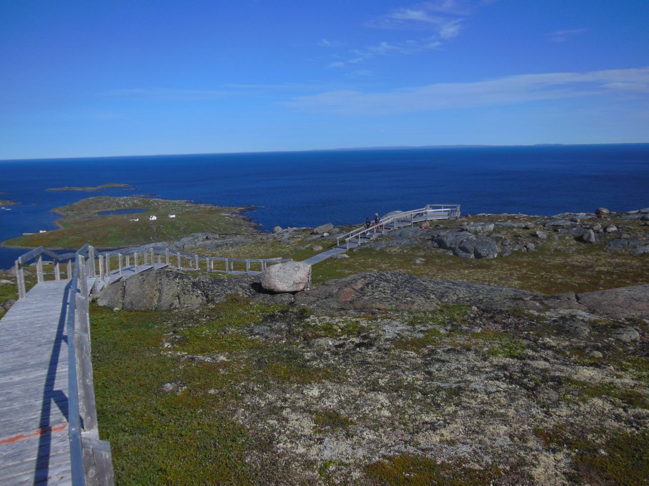
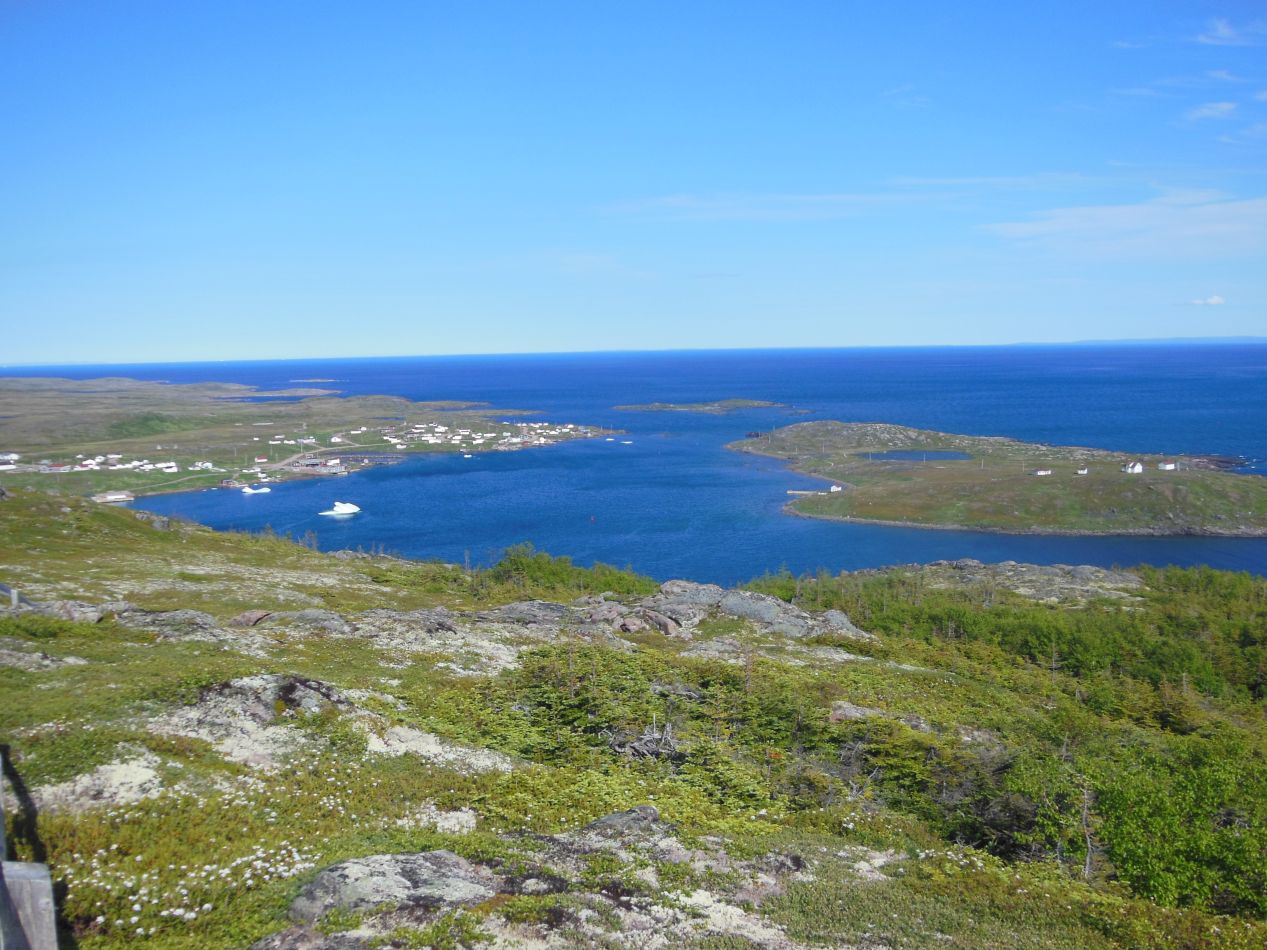

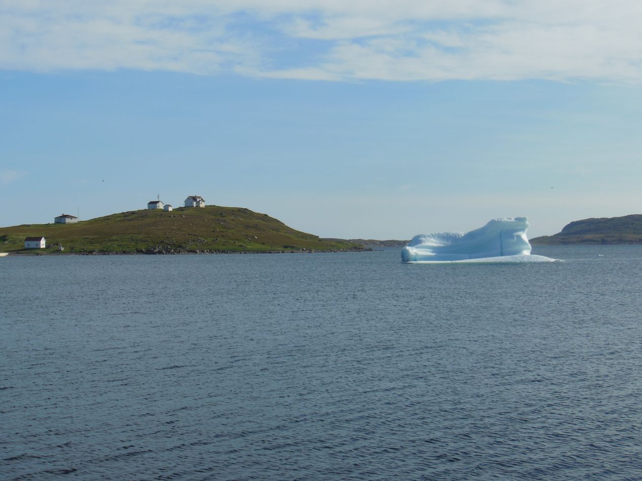
Eventually I reached Red Bay in the late afternoon. The road approaches the town from the south, and there's a short walking path called the "Boney Shore Trail" that runs up a hill overlooking the area. Since I was already arriving from that direction, I figured it would be a good idea to hike up to the top and get a view of Red Bay before entering the town itself. The trail was an easy ascent along a series of wooden boards up to the top, where there was a flat area strewn about with boulders. It looked a lot like the top of Gros Morne peak, without much in the way of vegetation and with rocks everywhere. From the top of this hill I could see out over Red Bay, which spread out below me almost like a series of miniature dollhouses. The bay that gave the place its name was easily visible, a sheltered little port where ships historically took refuge from storms. There were several icebergs in the harbor now - yes, actual icebergs - that had drifted down from further north in Labrador. The little island offshore was known as Saddle Island due to its two humps, featuring a handful of houses separate from the rest of the town. Even though the hill itself wasn't all that high in terms of elevation, I felt as though I could see absolutely forever from up here. The rest of the land was mostly flat and there were no trees anywhere. It was nothing but blue sky, blue seas, and green earth stretching endlessly in all directions.


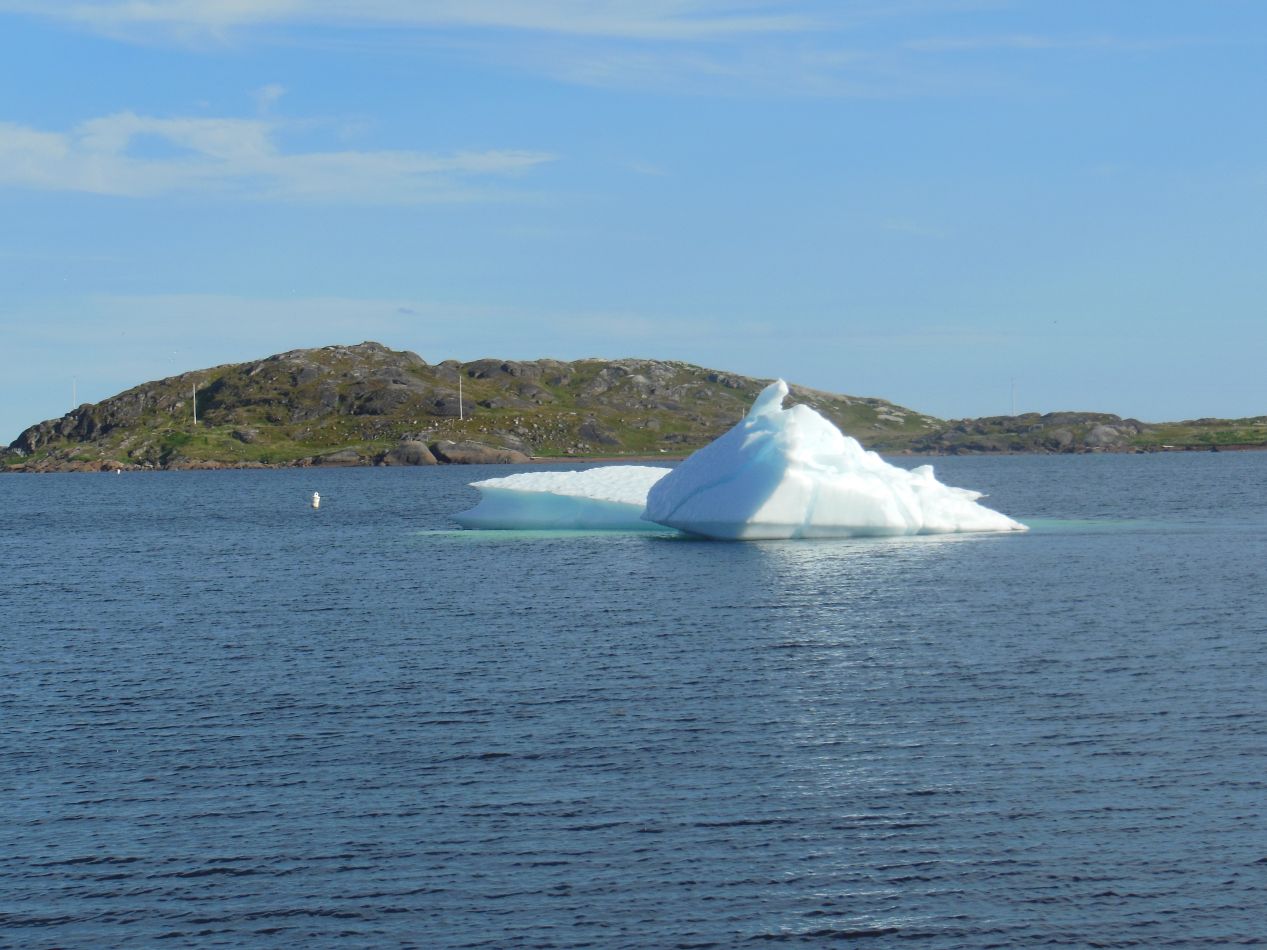
Red Bay itself has a fascinating history for a small fishing and whaling town. The location was originally settled by Basque fishermen as far back as the 16th century, and the red/white/green cross flag pictued above is actually a Basque flag to commemorate that heritage. The other flag is the unofficial banner of Labrador, and I purchased a small version of it as a souvenir from this trip. Anyway, there have been a series of archaeological digs at Red Bay that have uncovered some of the history behind the communities that lived here in the early colonial period. There are also a number of shipwrecks in the Red Bay area that date from the 16th century all the way up to the present day. Today this is an area that mostly caters to summer tourists with whale watching excursions and boat trips to see the icebergs that drift down from northern waters.



One of the most prominent sights in Red Bay is the rusting wreck of the Bernier, a ship that grounded in 1966 and has been sitting overturned in the harbor ever since. It's much more expensive to remove the shipwreck than it is to leave it in place, and as a result the vessel remains stuck in place. I'm not sure that's too great for the local environment but no one seemed overly bothered in Red Bay. At the northern end of the town the paved road came to an end, with the Trans-Labrador Highway continuing further north along a gravel path. The road used to end at Port Hope Simpson before being extended to Happy Valley-Goose Bay around 2010. I'm still hoping to do that drive at some point and take a longer trip through mainland Labrador, not simply the Labrador Coast. Perhaps by the time that I'm able to do that drive the road will have been paved all the way through.


I drove back south from Red Bay to L'Anse-au-Clair, where I stayed for the night at the Northern Light Inn. This is pretty much the only hotel of any size along the Labrador Coast, and it's the place most of the tourists end up staying who visit this area. On the one night that I stayed at the Northern Light Inn, there was a bus tour full of elderly visitors who were taking up most of the hotel. I did have one pleasant surprise though: the television was showing the Blue Jays baseball game, and since the Blue Jays were in a rain delay at the time, the network cut over to show the Baltimore Orioles game instead. This was surreal: I was watching the Orioles game even in a hotel way out in Labrador! Unfortunately the Texas Rangers crushed the Orioles in this game and I soon turned the game off in disgust. Well, you can't win them all.
I only had a single afternoon to explore the Labrador Coast but it was a memorable experience. I enjoyed visiting the small towns that dotted the landscape, driving on the rough roads, and seeing the amazing natural scenery. The view from the hilltop overlooking Red Bay was simply incredible, feeling as though I was standing on top of the world. I'm hoping to have a chance to return one day and spend more time in this remote part of Canada. Next up it was back to Newfoundland to explore the island more fully, still heading further to the east towards my ultimate destination.


