
After covering our time spent in the town of Kailua-Kona itself on the last page, this one features the various side trips that we took in the wider region along the west coast of the island of Hawaii. This area is generally known as the Kohala Coast, named after the volcano of Kohala which is the oldest of the five volcanoes that together comprise the island. We spent several days poking around the coastline both to the north and south of Kailua-Kona, visiting some of the historic sites built by the native Hawaiians along with more modern tourist attractions. These days concluded with a guided tour up to the top of Mauna Kea, the tallest of the five volcanoes on Hawaii, where I was treated to a dazzling sunset and some amazing star-gazing in the thin air of the summit. We covered a lot of ground with our rental car and this is a bit of a grab-bag of different places that we enjoyed visiting along the way.


The Big Island of Hawaii's geography is dominated by those aforementioned five volcanoes that rise up from the underwater seabed. The hot spot in the Earth's crust that formed the islands is slowly moving from northwest to southeast, with the result being that Kohala is an extinct volcano while Mauna Loa and Kilauea are younger and still very much active. The volcano of Hualalai is the closest to Kailua-Kona and it remains active as well, although the last eruption took place in 1800-1801 and it only goes off roughly every 200-300 years. That could be a problem later this century since Kailua-Kona is barely 15 miles / 25 kilometers away from its summit and tourist infrastructure has been built all over the potential eruption zone. These pictures were taken while driving north out of the main town where we could still see evidence of Hualalai's last eruption two centuries earlier. There were clear flows of lava that had cooled into volcanic rock and still didn't have any plant life growing atop them. These rocky black patches stood out against the rest of the landscape and we saw a bunch of them over the course of our drive.


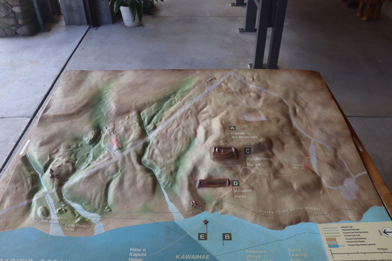

Our first stop of the day was at Pu'ukohola Heiau, a religious temple built by the native Hawaiians right around the time that the islands were first united under one ruler. Today the spot has been preserved as a national historic site where the National Park Service does their best to educate visitors about its importance to the original inhabitants of Hawaii. These are some pictures taken from the visitor center which did a good job of setting the stage for the events that took place here. King Kamehameha I controlled the western half of Hawaii in the late 18th century and decided to build a temple (heiau) dedicated to the Hawaiian war god in the hopes that it would bring him success in his quest to unify the islands under his rule. Pu'ukohola Heiau took about a year to construct in 1790-1791 and awaited only a formal dedication to be completed.


Pu'ukohola Heiau itself was located only a short walk from the visitor center although it felt like it was further away due to the unrelenting sunlight and scorching heat of the Hawaiian summer. This was one of the largest structures built in Hawaii before the arrival of Europeans, with the massive heiau measuring about 225 by 100 feet. It was built entirely out of volcanic rocks carefully piled atop one another without the use of mortar to fasten them. The heiau still holds religious importance to native Hawaiians and as a result visitors cannot enter the grounds themselves, only view the location at a short distance. Pu'ukohola Heiau also turns out to hold a dark history: in order to consecrate the heiau, Kamehameha summoned his cousin Keoua Kuahu'ula (a rival who ruled the eastern half of the island) with an offered peace treaty. This was a lie and when Keoua arrived he was attacked and seized by Kamehameha's forces. Keoua was then ritually murdered to consecrate the heiau to the war god; this horrific act apparently worked because Kamehameha united the rest of the Hawaiian Islands over the course of the next two decades. Perhaps the war god was responsible for giving Kamehameha access to the European firearms that fueled his conquest.


There were a number of walking trails at the historic site and we followed one of them for a short distance down to the coastline. This unassuming patch of ground was once the village of Pelekane, used as a royal residence by Kamehameha in the first two decades of the 19th century. The little cove next to Pelekane was apparently a good place for fishing, including a place where sharks can still be seen to this day, and it was used as an early port by foreign ships arriving from the rest of the world. Today there's little evidence of this as the housing used by the Hawaiians wasn't permanent and only some of the foundation stones remain. Even the much larger Pu'ukohola Heiau was beginning to fall apart by the 20th century before the National Park Service took steps to stabilize the structure and preseve its original shape. All of this information was really interesting and we might have continued to walk further on the paths if it hadn't been so hot outside.


The Kohala Coast is also known for its spectacular beaches and after stopping to get lunch we headed over to one of them. We tried initially to go to a smaller beach only to have access blocked by a hotel gate, instead ending up here at the pictured Hapuna Beach. This was a public beach with free entry along with restrooms for changing and a huge parking lot to accomodate the crowds that inevitably arrive each day. We didn't have an umbrella with us and therefore set up our blanket underneath the shade of the trees; this turned out to be a good idea as it was so windy that we watched many of the beach umbrellas blowing over and flying off. This is pretty much exactly the type of place that people imagine when they think of Hawaii: palm trees, wide sandy beaches, warm waters of a crystal blue color, etc. We stayed here for a couple of hours throughout the afternoon before changing out of our swimsuits and getting ready for our dinner appointment.


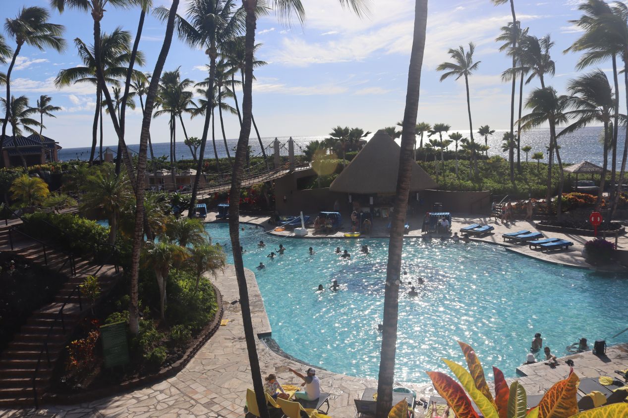

We wanted to attend a luau at some point over the course of our trip, and after having some trouble getting the date and time to line up correctly, we were able to book tickets to something called the Legends of Hawaii Luau. This was hosted at the Hilton Waikoloa Village, a very expensive 4 star resort that sat in an even larger complex of hotels and stores known as Waikoloa. This area felt highly inauthentic, lots of greenery and golf courses sitting in the middle of otherwise near-desert conditions; we would later hear that it costs a fortune to keep everything watered at Waikoloa and prevent the place from reverting back to its native arid conditions. These are pictures of the Hilton Waikoloa Village that I took while we were waiting in line outside the luau before it opened to its guests for the evening. It looked like a really nice place to stay but we didn't want to pay the $400 per night (in 2022 dollars) that the resort was asking for lodgings.


Eventually the gates opened up and we were admitted to the Legends of Hawaii Luau along with the rest of that evening's guests. A luau is of course a traditional Hawaiian feast which has become commercialized over time and seeped into the wider popular consciousness. There are two main components to a modern luau: the food and the entertainment, both of which visitors are paying for when purchasing their tickets. For a huge luau like this one serving hundreds of people at a time, the food was presented as an all-you-can-eat buffet with each table called up one at a time for their dinner. Our luau featured the traditional roast pig and salmon along with rice, vegetables, and popular non-Hawaiian options like steak, chicken fingers, and maccaroni-and-cheese for the kids. The luau was also open bar with staff serving up mixed cocktails on demand which I'm sure was a major component of the price tag. We were looking forward to the food more than the entertainment and enjoyed a delicious meal complete with our souvenir leis.


Once everyone had been served dinner, the nightly entertainment for the luau began. The program was focused on different aspects of traditional Hawaiian culture, especially Hawaiian music, dress, and dance. This most certainly was not a formal historical look at the past and instead was more of a sanitized "Disney" feel to traditional Hawaiian life. Mostly what we watched was a series of different dances with minimal narration from the hostess linking them together. It was a bit all over the place to be honest and I think they could have used tighter scripting in terms of the presentation. (Not that the audience really cared - everyone was drinking and eating to their heart's content which tends to put people in a good mood.)


The show run for about 90 minutes and the sun had long since set by the time that it was beginning to wrap up. The theme of the show shifted at times from Hawaii to greater Polynesia with traditional dances featured from some of the other Pacific islands. The most interesting sketch was probably this one featuring flaming batons, which may or may not have had anything to do with historic Polynesian dance. The performers were very good at wheeling the batons about and even eating them to "breathe fire" towards the end of the show. To its credit, the Legends of Hawaii Luau appeared to have mostly native Hawaiians employed as its performers which avoided the whole issue of cultural appropriation if it had been a bunch of white people doing the show. Anyway, this particular luau wasn't anything special and we would have been just as happy attending whichever one had tickets available. We definitely had a good time here which was largely due to the excellent food and drinks served for dinner.


The next morning we headed the opposite direction out of Kailua-Kona, driving to the south to see what attractions could be found. Before anything else though, we stopped to get breakfast at this little store named Kaya's Coffee. The place had a real hippie vibe to it and featured sandwiches and smoothies in addition to fresh-brewed coffee. Liz loved this place and we ended up having breakfast here twice because she enjoyed the coffee and sandwiches so much. They were definitely doing good business as there was always a line each time that we arrived.


We found that the towns to the south of Kailua-Kona started to look a bit rundown after we left the tourist area, homes and stores that seemed like they'd seen better days in the past and weren't especially welcoming to visitors. After driving around a bit, we made our way to the town named Captain Cook which featured this hiking trail. Part of Kealakekua Bay State Park, the trail ran for about two miles / three kilometers down to the shoreline where there was a monument dedicated to Captain Cook. This was not a trip that pregnant Liz wanted to do and therefore she drove off in the rental car while I began the walk down towards the sea. The trail ran through thick greenery at first, past several privately owned farms on either side without much in the way of scenery. Then I turned a corner and came across a small group of wild goats looking for food among the rocks. They weren't scared in the least by my presence and watched impassively as I snapped a few pictures of them before moving on.


The trail opened up after about a mile of walking and suddenly I had an unobstructed view looking down at the bay below. The trail also became rocky and much steeper in terms of elevation, causing difficult footing as it wound its way downwards. Even with the cloud cover overhead it was hot and humid despite the early morning hour, leading to a haze whenever I tried to photograph the distant waterline. I could see a few tour boats down there as well and I wondered where they were heading. Eventually I drew close to the shoreline and entered into a mangrove forest; I had to be getting close to the coast because those trees can only live near the water. Their branches formed a thick network everywhere outside of the walking path, and to my surprise I found another herd of goats down here as well! They were rearing up on their hind legs to eat some of the leaves off the trees and otherwise wandering around under the cover of the plants. The goats must be a common sight here because they also didn't seem to care about humans nearby.
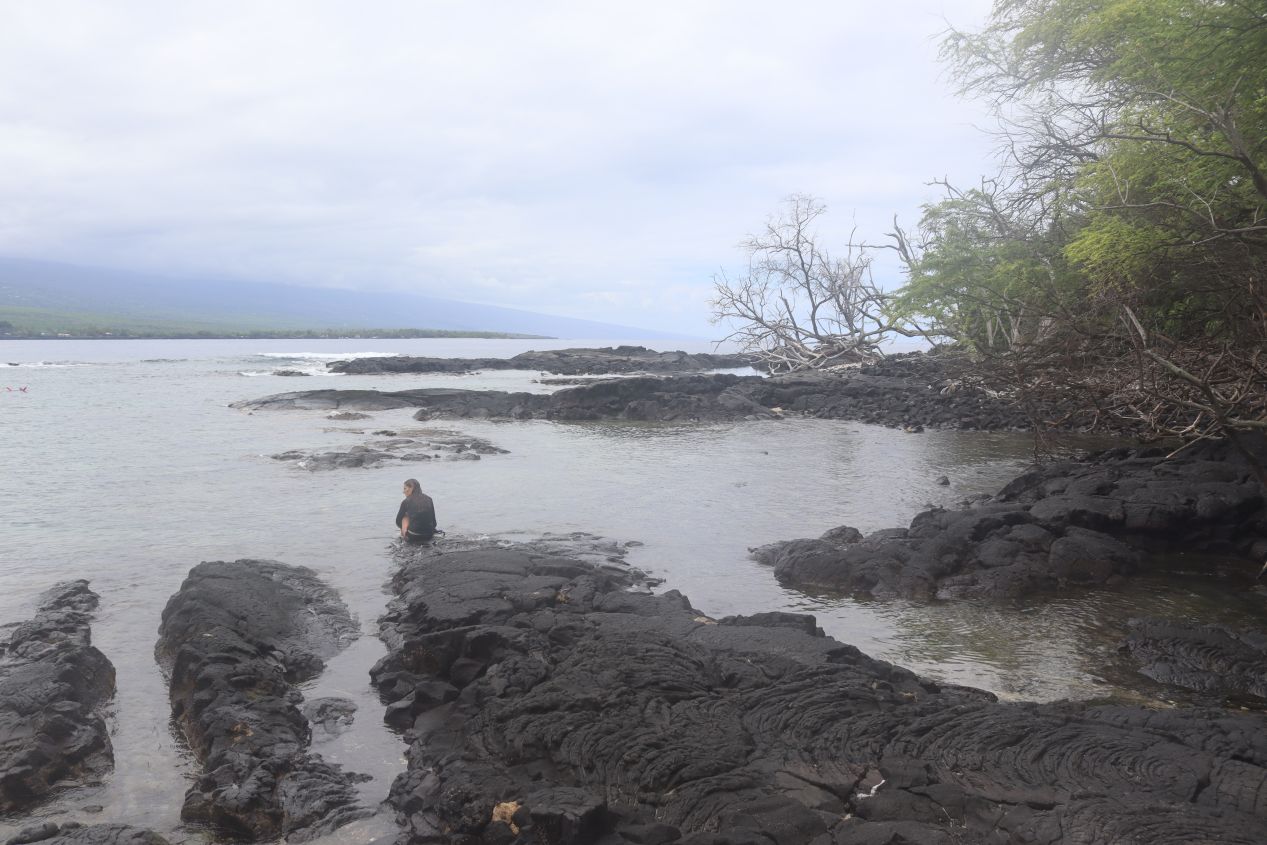


I was hot, sweaty, and tired by the time that I reached the bottom of the trail. It hadn't been very crowded and I only encountered a handful of other hikers over the course of making my way down to the bottom. Imagine my surprise then when I reached the waterline only to find dozens upon dozens of tourists swimming in the ocean!  They had been brought there by the tour boats I had seen earlier from atop the hill and now their passengers were out in the water snorkeling with foam noodles or kayaking in pairs. That was certainly an easier way to reach this otherwise remote spot along the coast. To be clear, I didn't resent their presence or anything like that, I was just surprised to go from near-total isolation to having tourists everywhere seemingly out of the blue.


So why does anyone come to this random part of the Hawaii coastline anyway? And for that matter, why does the nearby town happen to be named "Captain Cook"? The answer is that this is the spot where the famous Captain James Cook was killed during his third voyage in 1779. Cook had earlier visited Hawaii on this trip and been received warmly by the native inhabitants, possibly because his arrival coincidentally made him appear to be an aspect of a local god name Lono. Cook had to return back to Hawaii for repairs to his ships and it seems that he wore out his welcome over time. Tensions grew until some of the Hawaiians stole one of his longboats, leading Cook to rashly attempt to kidnap the local king (the ali'i nui in Hawaiian). As Cook was forcing the king back to his ship, the alarm was sounded and Hawaiians stabbed Cook to death before he could escape. It's difficult to feel much sympathy for what happened to Captain Cook given that his death was entirely his own fault due to mistreatment of the Hawaiians. The exact spot where Cook was killed is unknown but it was somewhere in Kealakekua Bay; this monument was raised in 1874 as a tribute to the man (while politely omitting the details of how he died). Also note the classic late 19th century notion that Cook "discovered" the Hawaiian islands despite tens of thousands of people already living on them!


Now I had a fresh problem on my hands: having made the hike down to the Cook Memorial, I had to retrace my steps back the opposite direction and climb that big hill once again. It was that or catch a ride on one of the tour boats somehow which seemed unlikely. The whole way back was uphill and along with the heat and humidity this was a genuinely tough hike, one of the toughest short ones that I've undertaken. I was dripping with sweat and had lost a dangerous amount of fluids by the time that I made it back to the top; I should have taken more than a single bottle of water with me for this trip. Meanwhile, Liz had spent a few hours exploring the area in the rental car although unfortunately without finding too much of interest. She did manage to take some pictures from the opposite side of Kealakekua Bay though, looking directly at the tour boats and the Cook Monument. Liz also added in the comment above which I found very amusing. 


We went back to Kailua-Kona to eat lunch before preparing for another booked reservation in the afternoon. It was the 4th of July 2022, America's Independence Day, and there was a parade and fireworks scheduled for Kailua-Kona that evening. I wouldn't be seeing them however as I had booked a tour to visit the top of Mauna Kea, the tallest of the volcanoes on Hawaii and a place that can only be visited by arranging ahead of time with a tour group. Unfortunately the high elevation at the summit is unsafe for pregnant women and therefore Liz was not able to go on this excursion with me; it was the one attraction throughout our vacation that we both wished that she could have done. I felt terrible leaving her behind in Kailua-Kona but Liz told me to go ahead and do the tour since it was such a unique opportunity.
In any case, I was picked up in town by a shuttle van run by Mauna Kea Summit Adventures. We had a long drive of more than two hours to get from Kailua-Kona to the mountain itself, including a stop back in the same resort area where we had seen the Legends of Hawaii luau the previous eve ning. The drive eastward across the island passed through arid terrain that often looked like the middle of a desert, not at all how most people envision Hawaii. It turns out that the massive bulk of Mauna Kea and Mauna Loa create enormous rain shadows, with the result that the eastern side of Hawaii gets an incredible amount of rain while the western side gets barely any at all. I could see Mauna Kea off in the distance coming closer long before we arrived, any time that clouds didn't hide the summit at least.
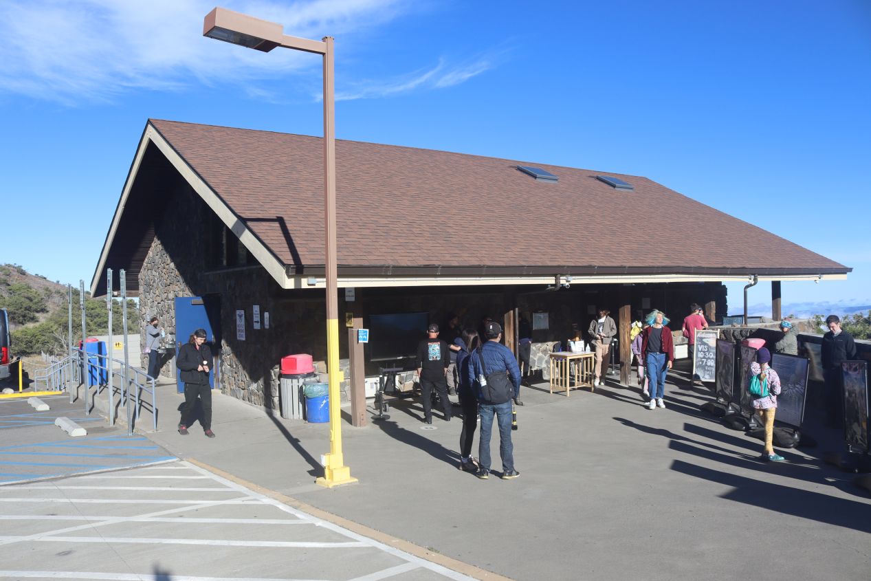


Eventually the shuttle bus brought our tour group to the Visitor Information Station where it paused to let everyone out. This is the highest elevation that visitors can reach on the slopes of Mauna Kea without joining a tour group, more than halfway up the volcano at an official elevation of 9119 feet / 2804 meters. The visitor station was a small affair but still had some handy information about Mauna Kea, including the local conditions for this evening with the time of sunset and a warning of the chilly temperatures up at the top. All of the tour groups heading to the summit are required to stop here for at least half an hour so that visitors can accustom themselves to the altitude. While it wasn't too bad here, I knew from past experience in the mountains not to take the threat of altitude sickness lightly.


I had enough time to poke around the visitor station and eat a small dinner that I'd brought with me since it was getting close to evening by this point. Then it was back onto the shuttle bus again for the remaining trip up to the summit of Mauna Kea. The road was no longer paved after this point and it was a bumpy ride as the bus twisted its way around switchback turns heading upwards. We quickly passed above the tree line and then above the "cloud line" as well, if that's a thing, leaving unobstructed views of bare rock along the slopes of the volcano. The elevation is too high and the climate too cold to support plant life near the summit of Mauna Kea which leaves the whole area looking a bit like the surface of Mars. In fact, the Apollo astronauts did some of their training here in preparation for the Moon landings due to the hostile conditions. Off in the far distance was the shield-shaped form of Mauna Loa, the other giant volcano on the island which is just slightly lower in elevation than Mauna Kea. Unlike this volcano, however, Mauna Loa is highly active and the volcanic activity makes it impractical for most research purposes.


The shuttle bus parked at the top of the mountain and let the group out to wander around for a bit and enjoy watching the sunset off in the west. It was quite cold at the summit even with the heavy parkas provided by the tour group and I could definitely feel the effects of the higher elevation. Mauna Kea reaches a top elevation of 13,803 feet / 4207 meters which makes it the tallest point anywhere in the Hawaiian Islands. By some metrics it's the tallest mountain in the world when measured against the sea floor from which it rose. This height combined with its dry environment, stable airflow, and lack of nearby light pollution makes Mauna Kea one of the best locations in the world for astronomical observation. There are 13 different observational facilities located on top of the mountain as of this time of writing, with more of them planned for the future, and getting observational time on the telescopes is highly contested (and extremely pricey) for the worldwide scientific community. The telescopes are all automated and it wasn't possible to go inside but they still made for impressive figures, sentinels pointing their eyes at the heavens in search of its deepest secrets.


The various telescopes are not located at the exact peak of Mauna Kea, which was off a bit to the side as pictured above in the first two images. The summit of Mauna Kea is one of the most sacred locations in all of Hawaii for the original inhabitants of the islands, and as a result visitors are requested not to hike up to the top. I could see some kind of heiau made out of volcanic rock when I zoomed in with my camera but the details were obscured from this distance. The presence of any observational facilities atop Mauna Kea has been controversial and there are many native Hawaiians who have fought to prevent any new telescopes from being constructed. This is one of those tough issues that doesn't have easy solutions at hand given that Mauna Kea is a completely unique location for both traditional religious practices and also modern scientific research. The most recent attempt to square this circle was to create the Mauna Kea Stewardship and Oversight Authority in 2022 with representatives from universities, astronomers, and native Hawaiians to balance these conflicting interests. Hopefully they'll find some way to allow cutting-edge astronomical research to take place while also respecting and preserving the mountain's traditions.


By now the sun was setting in earnest and I was treated to the dazzling spectacle of the light fading from atop this incredible perch. When there was still enough light to see, it was possible to spot the peak of Haleakala over on the neighboring island of Maui far off across the waves. The clouds above went through a rainbow of different colors as the sun died for the day, everything from reds and oranges and yellows to lavender shades of purple. Finally the sun dropped below the horizon and I was left with the shapes of the telescopes silhouetted against the darkening sky. I couldn't have asked for anything much more beautiful than this and I dearly wished that Liz could have been here with me to experience the same thing. The only downside was feeling a bit dizzy from the altitude as the Earth's atmosphere had only about 60% of its volume here as compared with sea level.
We boarded the shuttle bus again which took us a short distance down the mountain, at which point we waited another hour for complete darkness to fall. Then we emerged from the vehicle again to observe the night sky by becoming amateur astronomers ourselves with the help of a small telescope brought by our guide. It was immediately obvious why Mauna Kea is one of the best places in the world for astronomy: with completely clear skies and no light pollution whatsoever, the night sky was completely filled with stars to a degree that I've never seen before. Normally we can only see dozens of stars at a time from our suburban home, however here on Mauna Kea there were literally THOUSANDS of them in any direction that you could possibly look. Even without the telescope, even with my glasses that I had forgotten to bring, the sight was absolutely mesmerizing. Of course, all of those stars are always there in the sky, we just can't see them due to cloud cover and too much light pollution from living in a city. I tried to photograph this and failed miserably, everything was too dark and there was nothing for the camera to focus on. I wish that I could better convey this experience in words since it was downright magical; here's a comparison of different levels of light pollution on the nighttime sky.
Afterwards, it was another long ride back to Kailua-Kona on the shuttle bus where Liz picked me up in our rental car. We had a great time during this couple of days, having the chance to check out a bunch of eclectic activities ranging from Hawaiian history to sunning on the beach to hiking at Captain Cook's gravesite to reaching the top of a massive volcano. Next up we'd be leaving Kailua-Kona behind and heading over to the eastern side of the Big Island. There were more volcanoes to be found there along with black sand beaches and coffee farms. The other side of the island of Hawaii awaited.


