
This is the story of yet another work trip which left me with just enough time to go and see another tourist attraction that I'd never visited previously. Once again I had the opportunity to travel to San Diego for another work conference held by the American Medical Association. This was my fourth time visiting San Diego in the last nine years as the doctors that make up the membership of the AMA prefer traveling to warm weather locations for their winter meetings. I had previously seen most of the attractions in the San Diego area and this time I decided to travel a bit further afield. My brother and his family had recently visited Joshua Tree National Park in 2023 and thoroughly enjoyed their visit, and when I looked at a map of the region, it appeared that I could make it up to Joshua Tree and back again in one day, if just barely. Therefore I would be renting a car once again and using my one free day before my work conference began to visit the national park before returning back to San Diego proper.
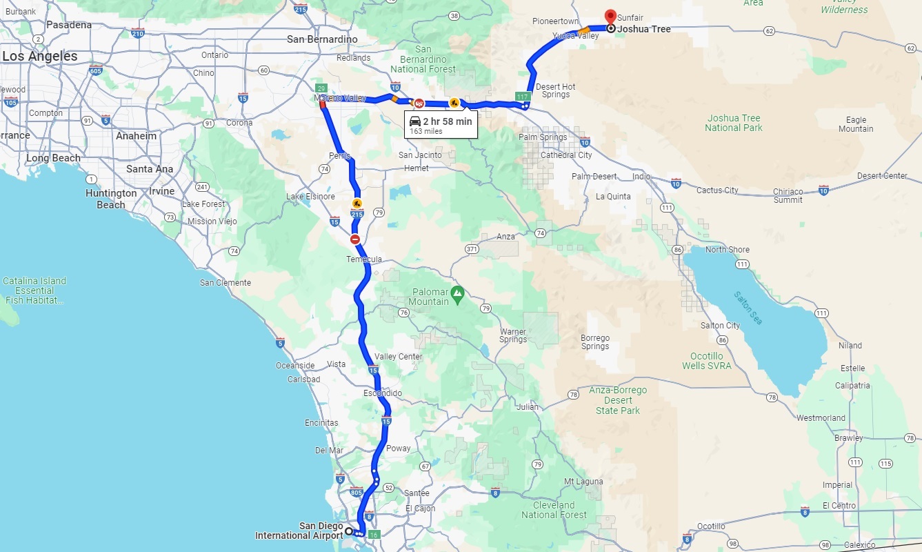
I knew that this was going to be a very long travel day, akin to the trip that I'd done to the Florida Keys and back again in a single day half a dozen years earlier. Joshua Tree isn't particularly close to downtown San Diego and Google Maps indicated that I had a trip of approximately 160 miles / 260 kilometers ahead of me. That was on top of the flight from the Washington DC area to San Diego itself, which was delayed by about half an hour due to the need to defrost the plane thanks to snow and ice that had fallen the previous day in the national's capital. I landed in San Diego around 11:30 AM local time after a five hour flight and it took about an hour to get out of the airport and pick up my rental car. I had scheduled a reservation with Priceline where you don't know what vehicle you'll be getting ahead of time in exchange for a cheaper rental rate. Much to my surprise, I was assigned a gigantic Dodge Ram truck which was not at all what I wanted due to its immense size and atrocious gas mileage. I had no choice in the matter so I climbed up into the massive vehicle and began the journey northeast towards the national park.
The truck did have an inbuilt navigation system which was convenient since it allowed me to conserve battery life on my phone. The estimated time to drive to Joshua Tree was a little over 2.5 hours which meant that I wouldn't be getting there until about 3:00 PM, not leaving much time to explore the park before the sun set for the day. The drive up from San Diego took me through Temecula and the Moreno Valley, parts of California that I had never seen before. Where there was natural landscape along the drive, it consisted of tall hills dotted with scrub brush reflecting the arid Mediterranean-style climate of southern California. Much of the drive along Route 15 and Route 215 consisted of suburban sprawl, however, lots of outdoor malls and car dealerships and the like that stretched along the sides of the highway for endless miles. It wasn't until I turned off the main highway at Palm Springs and drove north on local road 62 that I finally found myself out in the wilderness, and then it turned out that there was more tourist infrastructure packed along the sides of the road as I passed through Yucca Valley and approached the main park entrance. I didn't expect that there would be so many cheesy tourist traps way out here but Joshua Tree attracts a lot of visitors, over three million annually, and these businesses have sprung up to cater to them. You won't be seeing pictures here of the Super 8 motels and Applebees and Taco Bells that crowd the outskirts of the park but trust me, they're there.

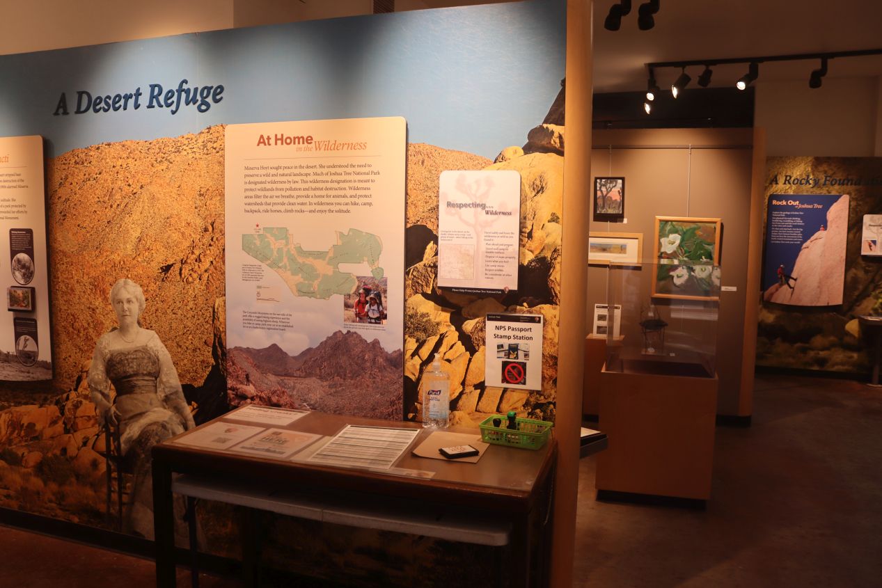


Despite driving most of the distance at a blistering 75-80 miles per hour (about 120 kilometers/hour), the clock was still striking 3:00 PM by the time that I pulled into one of the several different visitor centers near the west entrance to the park. This was a small building located in the town of Joshua Tree itself, a helpful place to stop for a few minutes to pick up a park map and use the restroom before moving on. There were some small exhibits here about the natural environment of the park and its namesake Joshua trees which I had to breeze past quickly for lack of time. The ranger station listed a sunset of 4:56 PM which was going to leave me about two more hours before daylight ran out. I was going to have to move quickly if I wanted to explore the park before darkness blacked out everything.
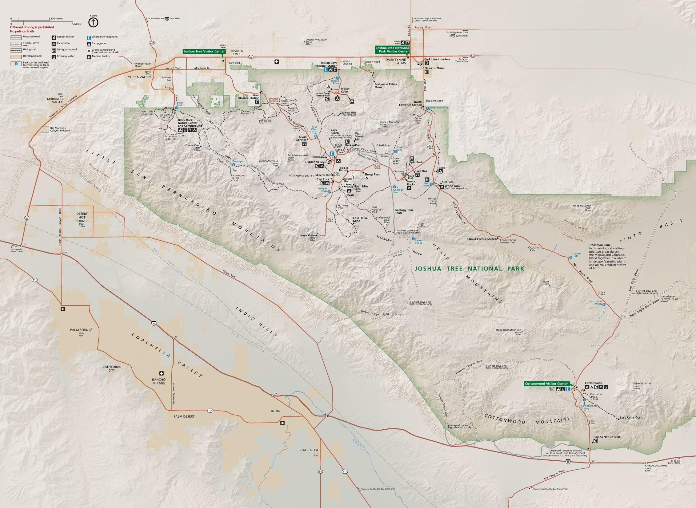
This is the excellent map of Joshua Tree National Park provided by the park service; I was arriving via the west entrance station which is how most visitors access the park. I had researched the various park attractions ahead of time and planned to drive through the central portion, stopping at Hidden Valley for a short hike before driving down to the scenic overview at Keys View, then turning east and heading over to Arch Rock where there was another short walking trail before finally doing the long drive across the eastern desert region before exiting the park at the southern Cottonwood entrance. This would allow me to see the two major climate zones of the park while hopefully providing lots of chance to stop and snap pictures along the way. I knew that I wouldn't make it out of the park before the sun set, fortunately that wasn't a problem because Joshua Tree is open 24 hours per day. The isolated eastern portion of the park is also known for having excellent stargazing conditions due to its extreme darkness which was something that I hoped to sample as well.
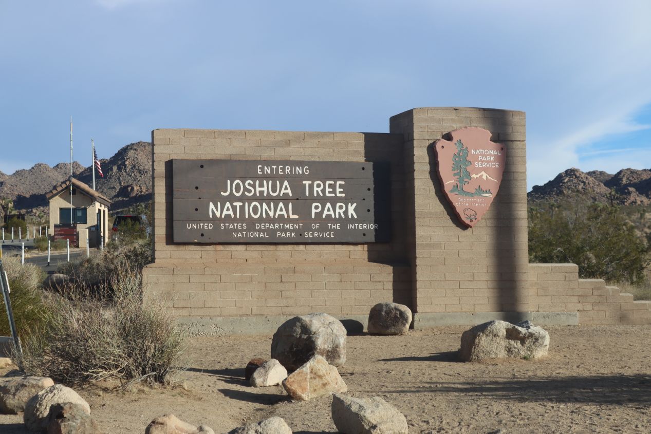
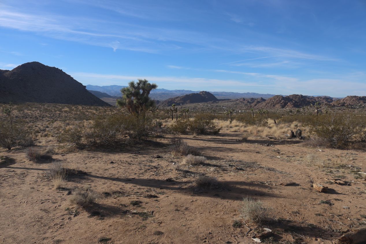


The actual entrance to the park was about 6 miles / 10 kilometers down the road from the visitor station where I had to pay an entrance fee of $30. I don't really mind having to pay to access the national parks since the money helps to ensure that they'll be protected and the visitor pass was good for a whole week, not that that did me much good in this situation. The first Joshua trees were immediately visible as soon as I crossed the park threshold (and some of them of course could be seen growing outside the park borders) with their highly distinctive hand-like shapes. This is not the only place where Joshua trees grow as they can be found in other parts of California, Nevada, and Arizona but it is one of the areas where they thrive in the largest numbers. I was pleased to find that there were few other visitors driving around the park this day, as expected for a late Tuesday afternoon in January, and I would mostly have the place to myself.


These are some pictures that I took while driving along the main park road heading southeast from the west entrance station. There were plenty of places to pull over and snap a few images as I traveled through the increasingly beautiful scenery. One advantage of driving this absurdly oversized truck was that I could stop temporarily and stand on the step (yes there was a step needed to get up into the driver's seat) where I could use the height of the vehicle to get a better view of the landscape. The setting sun and clear conditions ensured that everything was brightly lit and I could see for miles off into the distance. I just had to avoid taking any pictures looking directly west as the sun was completely blinding in that direction and blocked out the view of everything.


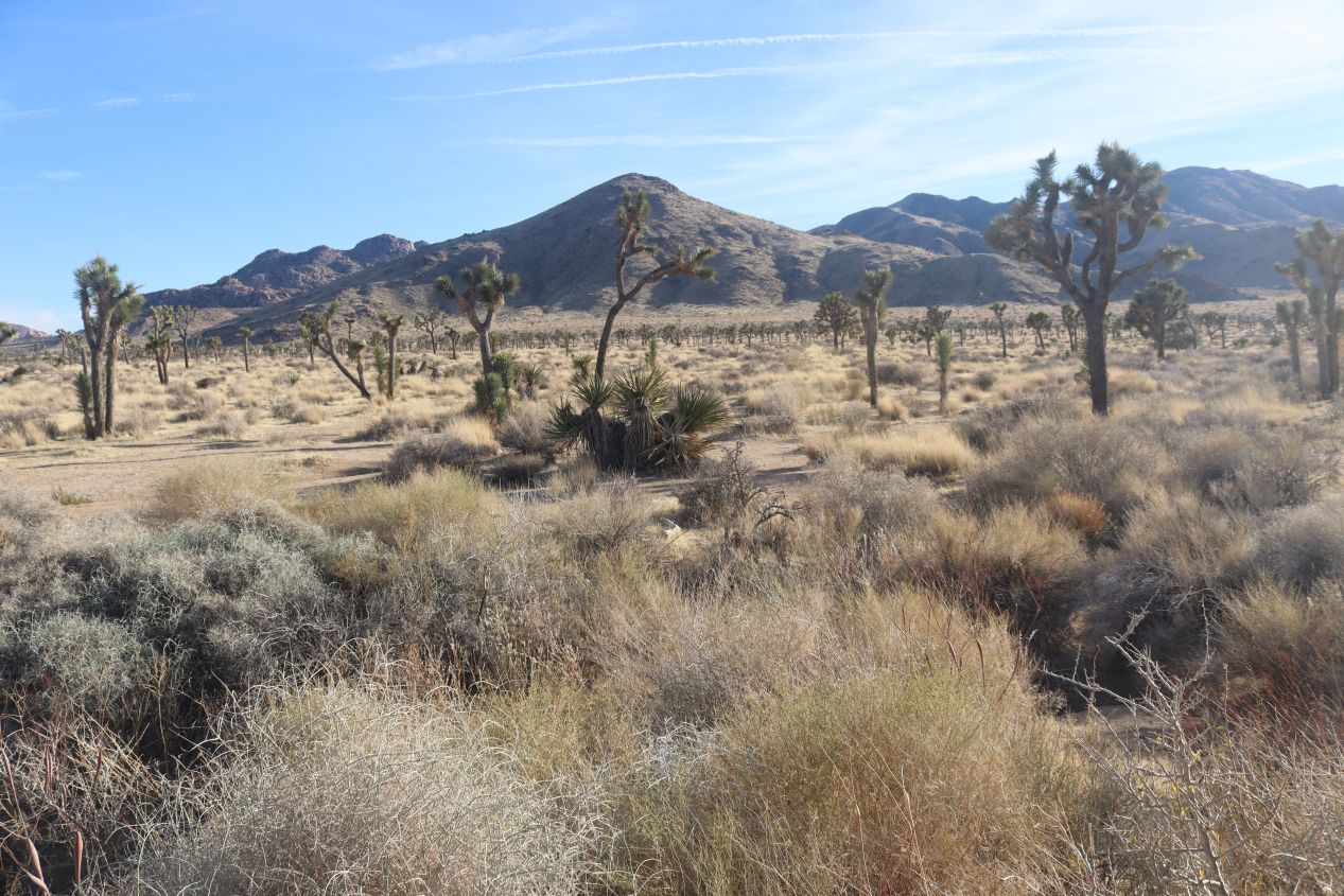
As I continued further into the park and passed by the Quail Springs campground, the prevalence of the Joshua trees continued to increase. Soon there was practically a forest of the things blanketing the sides of the road which looked completely bizarre with their weird, alien-like shapes. Officially known under the scientific name of Yucca brevifolia, the Joshua tree is a desert species that prefers growing at higher elevations in the 1500-6000 foot range and gave the national park its unusual name. No one is exactly sure how these plants ended up with the "Joshua" name but the most common story is that 19th century Mormon settlers were its genesis. According to Wikipedia, the tree's role in guiding them through the desert combined with its unique shape reminded them of a biblical story in which Joshua kept his hands reached out for an extended period of time to bolster the Israelites in their conquest of Canaan. Regardless of the name, these are highly distinctive plants and help give the park its unique character.

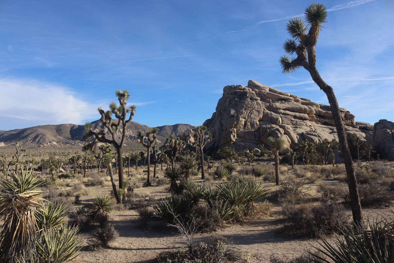


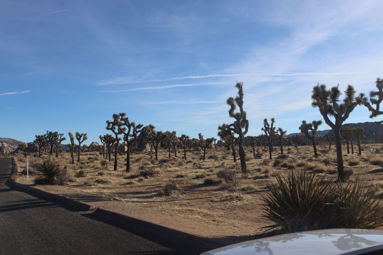
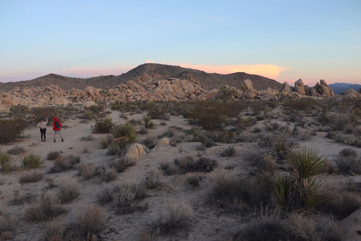
It took me about 45 minutes to reach my first official attraction at Hidden Valley, largely because I kept stopping along the drive to take more pictures. Hidden Valley had a large parking area which was about 15% full and was situated in a massive rock garden where natural formations of boulders rose up in towering pillars in between the groves of Joshua trees. This is apparently a popular place for rock climbers and I spotted a group of brave souls up on top of a rock formation that had to be 100 feet / 30 meters in height. While I do have some modest background in rock climbing, I was here at Hidden Valley to do the short one mile hiking trail that winds through the aforementioned hidden valley. The story goes that a local rancher named Bill Keys blasted a notch through the rocks walls here to improve access for his cattle herds in 1936, just before Joshua Tree was officially designated as a national monument. I was finally able to get out of the truck and stretch my legs for a bit which was much appreciated following all that driving.

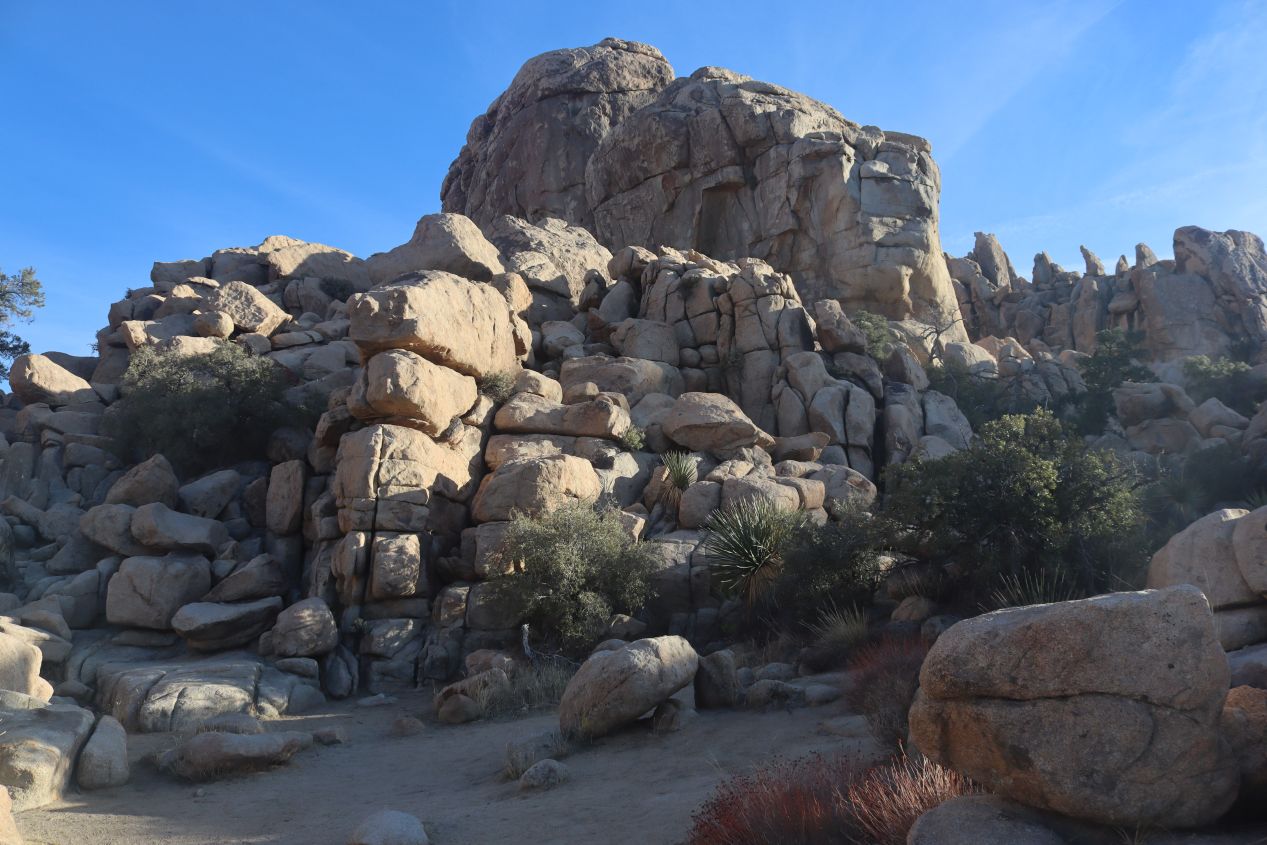


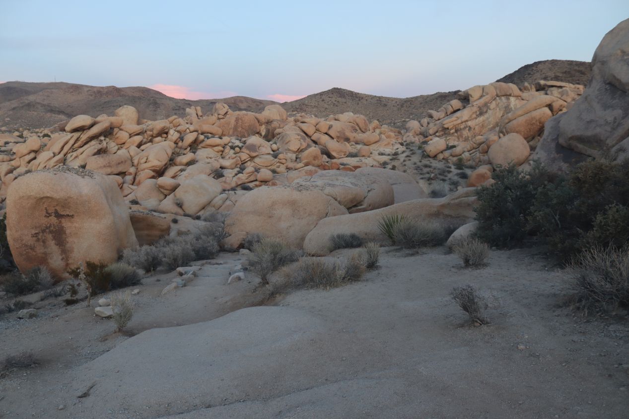
Hidden Valley is one of the most popular trails at Joshua Tree because it's easily accessible from its parking area and features a wide range of plants and animals not typically found together in other sections of the park. There were plenty of Joshua trees here mixed in with pinyon, junipers, and almost half a dozen different types of cacti. The other big draw were the rock formations that surrounded the valley and provided a natural shelter from environmental threats. It looked as if a giant had picked up several huge boulders and smashed them to pieces here. The trail that wound through the valley was difficult to follow at times and I spent a lot of time climbing over and on top of various rock pilings. This looked like it would be an absolute blast for kids to explore and I'm sure that this place is packed with tourists during much of the year. On this day, however, there were maybe half a dozen other people navigating the trail with me and I could pretend that I was traversing the natural environment by myself.

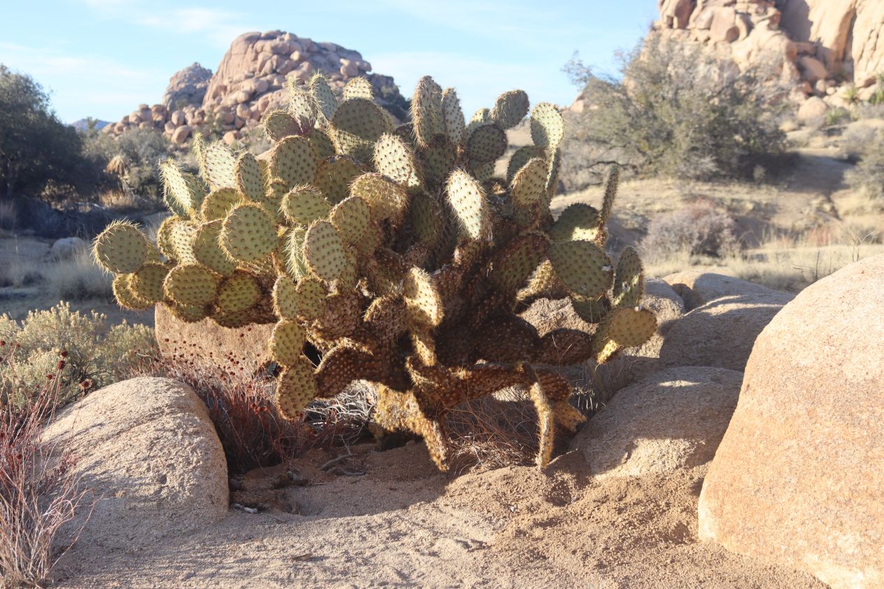


Just a couple more pictures of the flora to be found while walking around the short Hidden Valley trail. There were plenty of opportunities to see the Joshua trees at close range as well as this type of cactus known as the Dollarjoint Pricklypear. I could see where its name came from as those spiky leaves looked a lot like silver dollars. Anyway, even with me stopping to take lots of pictures and scramble across the rocks, this hike still only took about 20 minutes to complete and was absoultely worth the visit. Some of these landscape views of Hidden Valley were downright breathtaking.


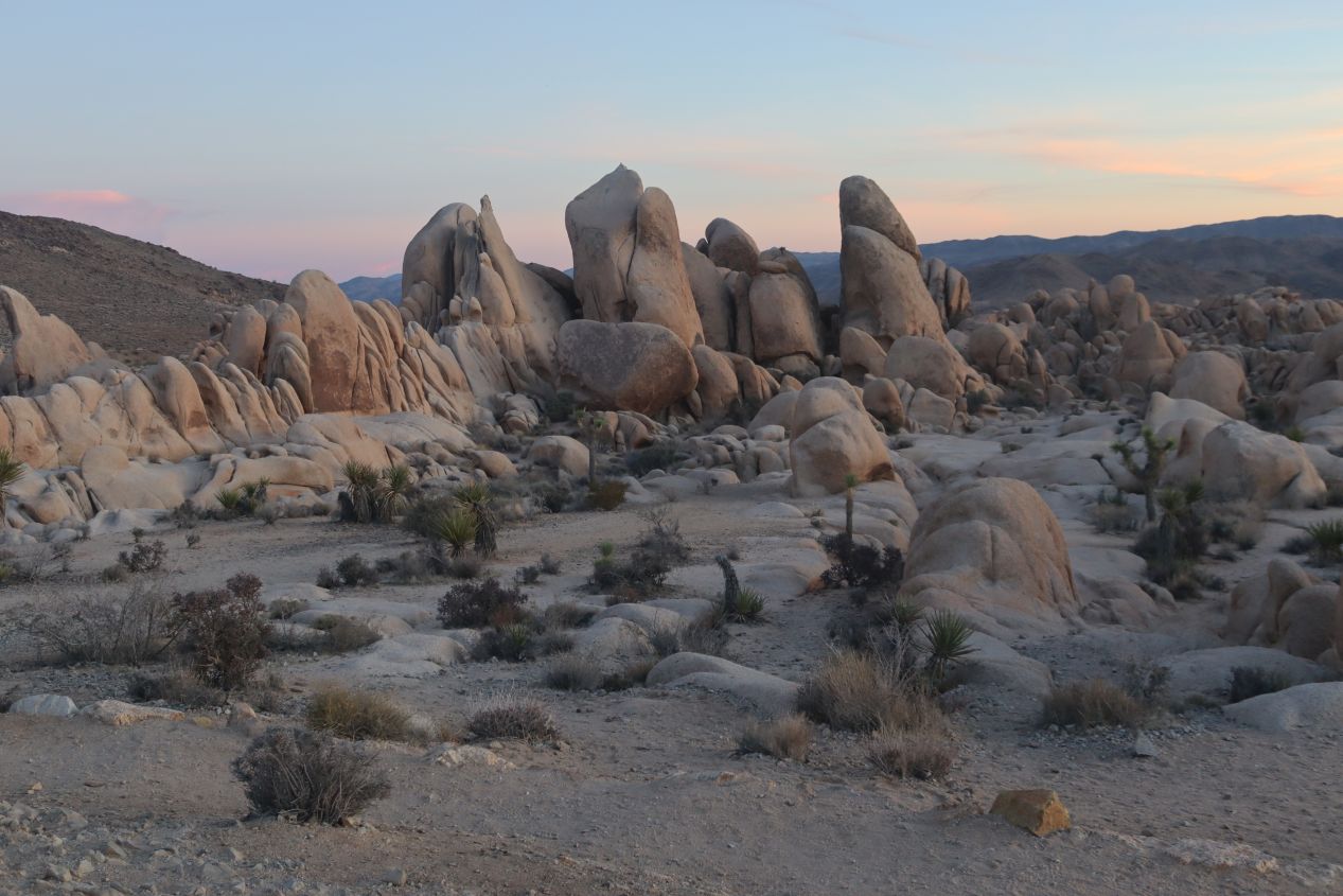
As a further example of some of these huge rock formations, these were a couple of images taken at Cap Rock. There were people climbing atop the giant boulder which I would have enjoyed checking out if I had more time to spare. Instead, I had to hurry onwards to the scenic overlook at Keys View before the daylight ran out:

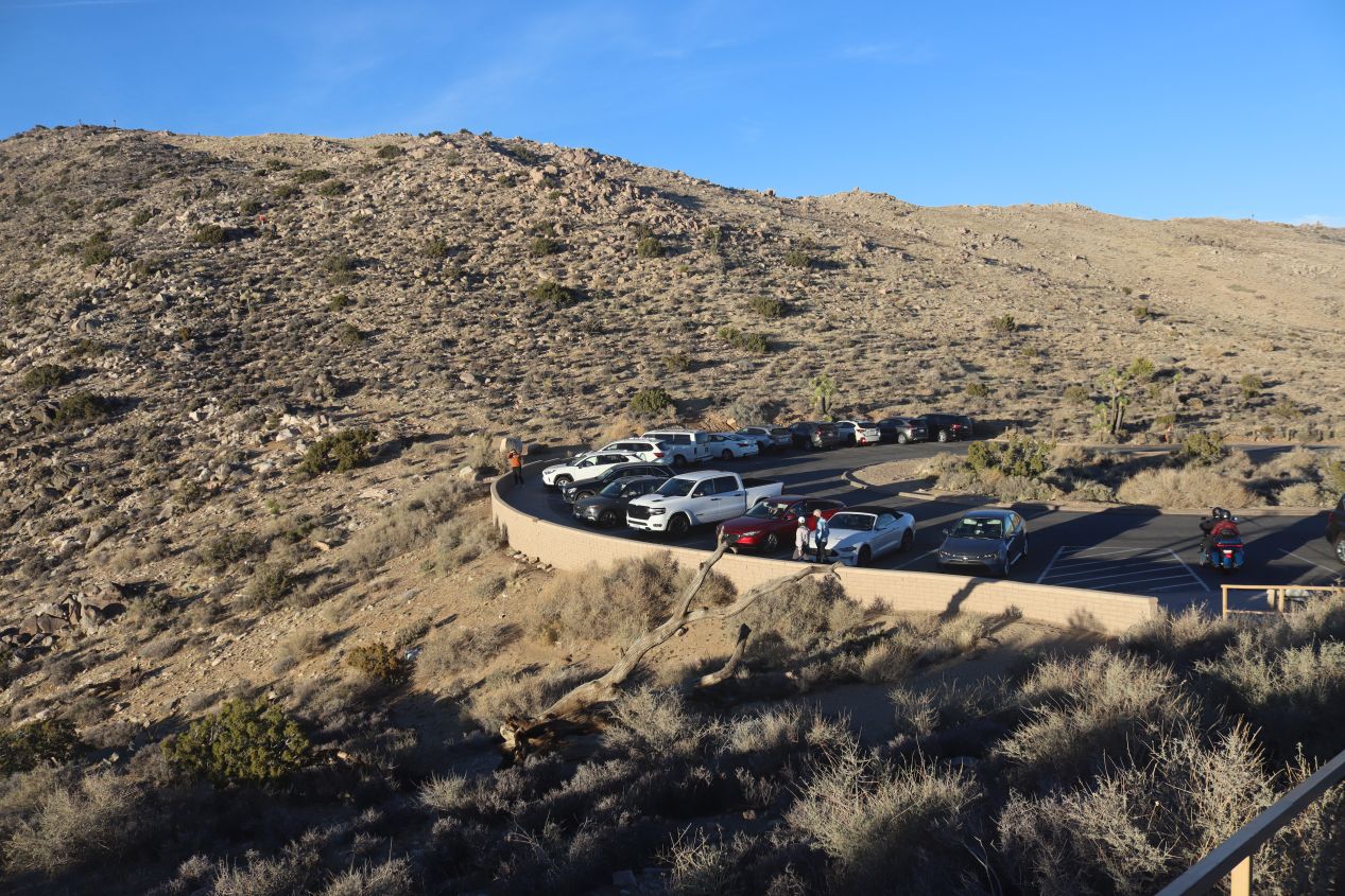


It was a drive of a little less than ten minutes before I arrived at Keys View at the extreme southern end of the park. Keys View is where the road ends atop a ridge sitting at 5185 feet / 1581 meters with panoramic sights looking out over the valleys to the south and west. The sun was about half an hour from setting and it was difficult to see much of anything when looking directly to the west which is why most of these pictures were taken at some kind of a side angle. There were few Joshua trees up here, probably because of the higher elevation, and most of the slopes of the surrounding hills were relatively barren. I'm also glad that I was finally able to capture the rental truck that I was driving: it's the huge vehicle next to the red car in the second picture above.

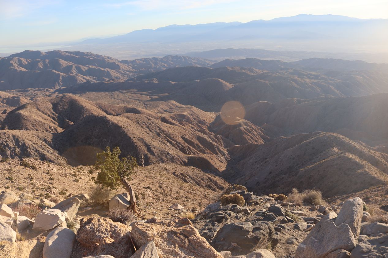


Visitors to Keys View can see features as far as Signal Mountain, 95 miles / 150 kilometers away down near the Mexican border. The Salton Sea was easily visible (at the left edge of the second picture) some 35 miles / 55 kilometers off in the direction of the horizon, the inland body of water that irrigates a vast strech of farmland in south-central California. There were several towns off in the distance as well, by far the most famous of them being Coachella due to the musical festival held there annually. It was difficult to see a lot of these features due to the impending sunset but I did my best to capture the rough desert hills that rolled off to the south from this high vantage point. It was impossible to head any further in this direction so I turned around and drove back north again, passing by Cap Rock and then heading further to the east through the heart of the park.


I wouldn't have minded stopping at some of the hiking trails that ran off from the main park road, places like Ryan Mountain or the impressively-named Skull Rock that had me thinking of the Legend of Zelda series. There was no time available though as I had to scurry over to my final planned destination at Arch Rock before the daylight was completely gone. The clock was showing 5:00 PM by the time that I arrived at my goal, and the sun had already disappeared behind the mountains to the west as I pulled into the latest nearly-deserted parking lot. It was the magical period of twilight, after the sun has gone down but before the landscape has darkened, well-known for being one of the best times to take pictures. There was a short walking trail here at Arch Rock listed at a mere 0.37 miles which I figured would be doable before night could arrive. I walked across the main park road, snapping a quick picture of its empty state, and began heading towards the rock formations off in the distance.


Arch Rock was located in the transition zone between the two deserts contained within the park, with the Mojave Desert comprising the western half of the park while the more arid Colorado Desert makes up its eastern half. There were fewer Joshua trees to be found here and more of the classic desert landscape of the American Southwest, lots of low-lying scrub brushes clinging to life in a very dry environment. My timing for this short walk turned out to be absolutely perfect, with the post-sunset landscape painting the desert sky with an artist's easel of bright colors. The path led onwards to a cluster of rock formations up ahead and everything had a magical, otherworldly feel to it due to the combination of the beautiful twilight conditions and the nearly-deserted state of the natural attractions.


It took maybe 15 minutes to reach the end of the short trail at what had to be Arch Rock, even though I didn't see anything that seemed to fit that name. There were boulders scattered about everywhere that broke up the desert landscape, and a small rise in the terrain that provided a vantage point for better views of the surrounding area. I was surprised to find a small campsite here as well named White Tank which had a handful of campers settling in for the night. This looked like an amazing place to camp out, one of the most isolated parts of the park and with spectacular nighttime views of the sky above.


Now evening was starting to arrive in earnest as the sun continued to drop further behind the mountains in the distance. I paused at Arch Rock for a short time to take more pictures as the shadows continued to lengthen and the daylight slowly ebbed away. It's moments like this that make the long hours and the traveling hardships worthwhile, grumbling through the cost of obtaining a rental car truck and then the hassel of driving for many hours to the out-of-the-way places where national parks can be found. I couldn't help but reflect how lucky I was to be able to experience this kind of gorgeous desert sunset in a unique place like Joshua Tree, it really made the 6 hours of roundtrip driving worthwhile. My one regret was that my wife and our baby son couldn't be here as well, I could picture our son toddling around and having all kinds of fun exploring the rock formations.
There was enough light remaining to make the return trip back to the rental truck without difficulty, but now I had the problem of finding myself stuck in the center of the national park with the city of San Diego and my hotel for the night located almost 200 miles away. Rather than turn around and return by tracing my earlier path through the park, my plan was instead to continue eastwards and leave through the sparsely-visited southern entrance. This meant driving approximately 30 miles / 50 kilometers through the Pinto Basin of the Colorado Desert which is a portion of Joshua Tree that sees few visitors. It grew darker and darker as I drove onwards and I felt a growing sense of isolation as the other cars on the road soon disappeared. Mile after mile of featureless desert passed by with nothing to break up the monotony; there was one point where I saw a mere two cars in 30 minutes of driving. It felt at times like I was driving on the surface of Mars instead of through a popular national park.

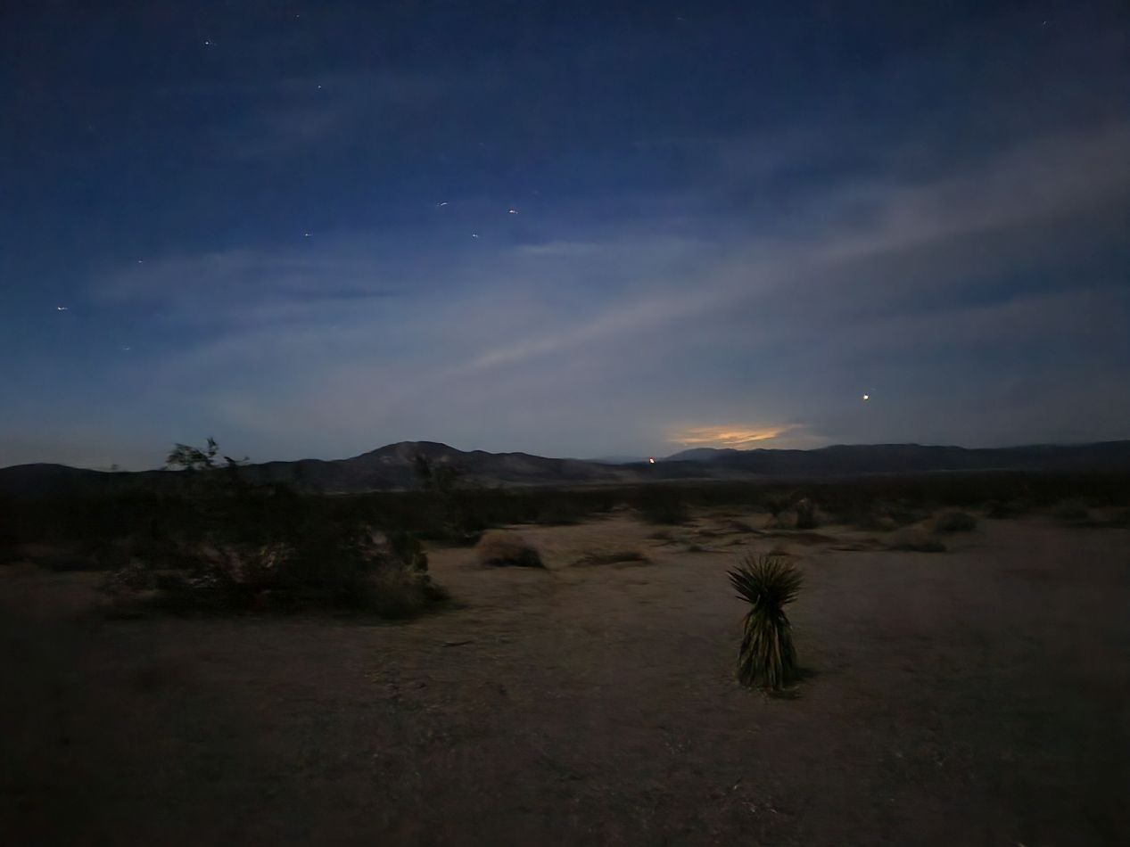


The one thing that draws visitors to the eastern portion of Joshua Tree is caused by its very isolation: the extreme darkness makes it an excellent location for stargazing. Since there are no buildings of any kind for long miles in every direction, this part of the park has blackout conditions with virtually no light pollution at all. I drove until finding a small parking lot near Porcupine Wash where I pulled the truck off the main road and hopped outside to look at the night sky. Once the vehicle was completely turned off, there was no light at all outside of what was coming from the moon and the stars. I found that it was surprisingly easy to see, with the half moon overhead providing plenty of light, enough that I could read the written text printed on my jacket without difficulty. The stars were much easier to see than usual and it was obvious that there were far more of them than I could normally see from my suburban home. My cell phone did a reasonably good job of capturing them with an extremely slow shutter speed; unfortunately our fancy camera wasn't able to capture anything other than blackness. It was completely silent out here as well, and I would have loved to have stayed for an hour just taking in the peaceful environment.
However, the reality was that I still had a looooong way to travel before this day was finished and that meant I had to keep moving. I finished the drive and departed Joshua Tree through the southern entrance; someone from the park service was supposed to check my ticket at the exit but I never spotted anyone along the way. Then I still had to manage the lengthy drive westward along Interstate 10 followed by the southern route down to San Diego. It took a little less than three hours to return to the rental car center at the San Diego airport, and then I had to spend a full $100 filling up the truck's gas tank due to its terrible gas mileage, argh! The gas fillup actually cost more than the rental car itself, believe it or not. Then I caught a taxi to the resort where I would be staying for my work conference which was off in an isolated spot on Coronado Island. I preferred staying in the city itself as we had done a year earlier on my last trip to San Diego but the choice of where to stay definitely wasn't mine to make.

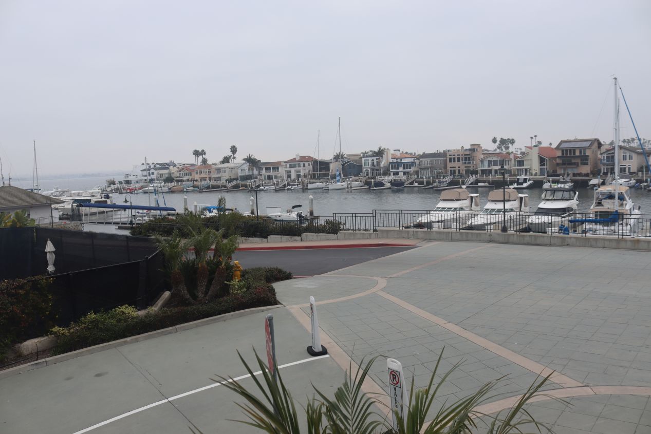


Here are a few pictures of the place where we stayed during the course of the conference, the Lowes Coronado Bay Resort. It was situated on a little spit of land that jutted out into Coronado Bay and unfortunately wasn't particularly close to anything. We had to take a taxi or the resort shuttle to go anywhere and it felt much of the time as though we were stranded at this resort. The place itself was quite nice with all of the normal amenities for a 4 star hotel although the place did feel a bit dated in some respects. And yes, I realize that it's a bit silly to complain about the details of a hotel where you're staying for free due to a work trip, but I really did prefer some of the other places where this conference has been held in the past. We even had the power go out on the second night of the conference and had to flee the resort to go get dinner because all of the restaurants were closed!

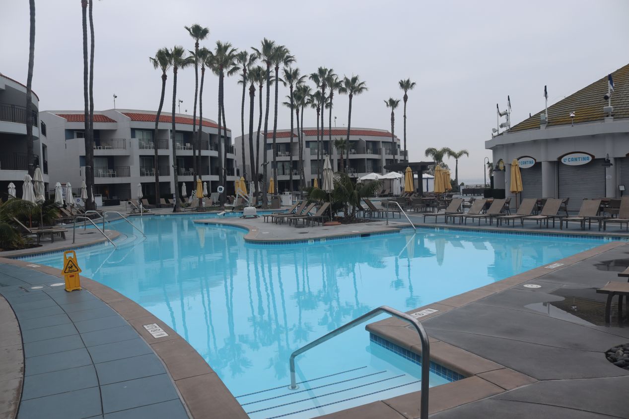


And finally a few more pictures of the resort, with the final one being the large ballroom where I spent most of my time during this conference. We started at 7:00 AM most days and typically didn't finish until 6:00 PM as the doctors that make up the American Medical Association's membership are used to working long hours. Sometimes I wish that we had the cushy work events that I hear about in other industries with lots of time for golfing and eating elaborate dinners. Anyway, I was once again highly fortunate to be able to append a tourist trip to Joshua Tree National Park onto my work travel. This was a very unique place to visit and I'd encourage those who might be traveling to San Diego or Los Angeles to think about checking it out. Joshua Tree is definitely out in the wilderness and not the easiest place to reach but that's part of what makes it special. I also understand that the park gets extremely crowded during the summer months so visiting off-season as I did is likely the best option. Thanks as always for following along with these travel reports!


