
After two nights spent in Ecuador's capital city of Quito, we were preparing for the main event of our trip: flying to the Galapagos Islands themselves. These islands are world-renowned for their unique wildlife and ecological diversity, full of birds and tortoises and iguanas that can't be found anywhere else on Earth. We would be starting our Galapagos trip by traveling to Isabela Island, the largest of the 18 major islands that make up the archipelago. Isabela is a young island (thought to be less than one million years old - that's very recent in geological terms) and contains six major volcanoes, five of which are still active to this day. Despite its size Isabela is sparsely population and only about 3000 people live on the island. We would discover that tourist infrastructure was still in an early stage of development on Isabela and we were able to interact with the local wildlife to a degree that would be unimaginable almost anywhere else.


First we still had to make our way from downtown Quito across a decent chunk of the Pacific Ocean to reach the Galapagos. We left at 5:30 AM and drove through the deserted streets of Quito's historic town through the early morning darkness. We made a wrong turn at one point and wound up briefly on a toll highway where we couldn't pay the toll because there were no people around and we lacked the electronic payment system. Whoops! I think that charge ended up getting automatically applied to our rental car bill. We straightened out the directions and made it back to Quito's airport in plenty of time to make our flight. We did have to pick up a special travel card at the booth in the second picture above in order to fly to the Galapagos. There's an extra fee of $100 per person (plus $20 for the actual travel card) in order to travel to the Galapagos, and then our luggage had to be run through additional screening to make sure that we didn't have any plants or animals with us. The Ecuadorean government works pretty hard to try and preserve the unique ecology of the Galapagos since they're the biggest tourist attraction in the country.


Quito's Mariscal Sucre International Airport was still relatively new when we visited, having been opened eight years earlier in 2013. We hadn't been able to see much of the local landscape when we arrived since it had been dark outside, however here in the morning sunlight we were treated to some amazing views looking out over the Andes. I mentioned on the previous page that Quito is an extremely mountainous city located at roughly 10,000 feet / 3000 meters elevation and we were able to see the rugged dry peaks surrounding the city. It was hard to believe that such a large metropolis with millions of people could be situated this far up in the mountains. Many of the individual peaks stood well above the clouds and there were a few in the area that fell just shy of 20,000 feet / 6000 meters! The Andes were therefore much taller than pretty much anything in North America, putting the Rocky Mountains of the western USA to shame. These mountain vistas were some of the best scenes that I can remember seeing out of the window of an airplane.

Our flight had one stop in Guayaquil, the second-largest city in Ecuador located along the nation's western coast. Guayaquil is a major port city and most flights heading from Quito to the Galapagos make a stop here since it's directly en route. We stayed on the plane and didn't see anything of the city aside from some overhead views while landing and taking off again. From Guayaquil it was an approximately two hour flight to reach the Galapagos themselves; I'm including a map of the islands above for reference. There are only two commercial airports in the Galapagos and we were flying into the older of the two located on Baltra, a very small island situated just to the north of the larger Santa Cruz. There are more than a dozen major islands in the archipelago but only four of them are inhabited by people: Santa Cruz, San Cristobal, Isabela, and Floreana. The overwhelming majority of the residents of the Galapagos live on Santa Cruz or San Cristobal, with Isabela having the aforementioned 3000 or so people and Floreana containing merely 100 people. We would be landing on Baltra and then spending a full day making our way over to Isabela at the western edge of the Galapagos. This would turn into a bit of an adventure before we even started our formal sightseeing.


We were approaching the islands from the east which meant that we flew over San Cristobal first. We were lucky that there was a break in the clouds as our plane was descending that allowed us to spot the island through the windows. We caught a glimpse of the only town of any size on San Cristobal, Puerto Baquerizo Moreno, which we would be visiting over the last three days of our vacation. After another ten minutes in the air, our plane continued descending and we were able to catch a view of Baltra with its lonely-looking airport runway. Balta didn't seem terribly appealing from up here, a rugged and surprisingly arid little island notable only for the airport located smack in the middle of the terrain. The plane flew right over Baltra and then made a loop to come back and land from the north. This allowed us to pass over the even smaller Seymour Norte (North Seymour) island visible in the third picture above, basically a tiny duplicate of Baltra without the airport, and then the even more miniscule Mosquera island. Mosquera was so thin that it would have been easy to toss a rock right across its middle; the fourth picture also managed to capture a cruise ship nearby to provide a sense of perspective.

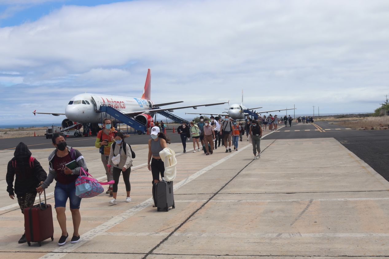


Then our plane touched down on Baltra's runway and we had officially arrived in the Galapagos! As is common in many smaller airports, we disembarked directly onto the tarmac and walked from the plane over to the airport hangar. Several planes had landed at the same time and there were several hundred people all trying to pass through customs at once. We had to show our special Galapagos travel cards that we had picked up back in Quito and then wait for this service dog to sniff through all of the luggage before we could claim it. Liz's suitcase was selected for additional screening because the dog smelled some of the fragrances that we had picked up back at the Temple of the Sun the previous day. What a good boy doing his job!


We had never been to the Galapagos before and we didn't really know where we were going or how to get to our hotel for the night (which was located two islands away from Baltra!) We were supposed to meet with our first local guide here at the airport and it was a huge relief to see someone holding a sign with our names on it. We were working with a tour company named Nature Galapagos who provided excellent sightseeing services and were significantly cheaper than many of the other competing options. However, Nature Galapagos wasn't always the best at communicating with us about where we needed to go next or who would be working with us; I think that our inability to speak Spanish was a real barrier here since all of their guides were local residents of the islands. In any case, we did meet up with our initial guide who shepherded us onto a bus which would transport us across the small island. Balta was much drier than we had been expecting, with an arid climate containing salt bushes and prickly pear cactuses. We spotted a couple of small lizards while waiting to board the bus but otherwise didn't see any wildlife.


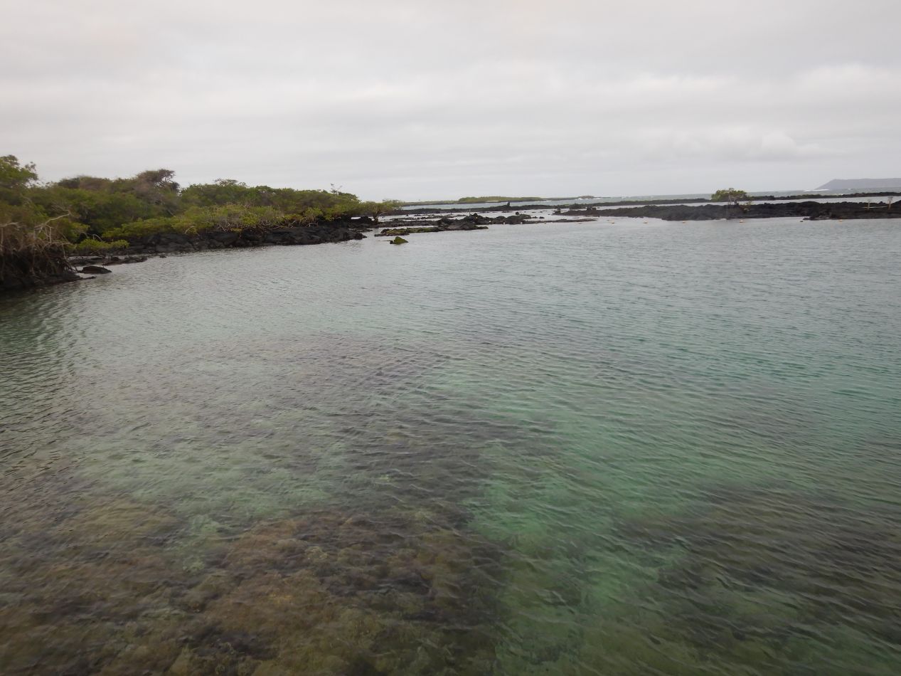
Balta is not a large island and it took perhaps ten minutes for the bus to bring us to its southern tip. This is where the road ended and we found ourselves staring at the narrow Itabaca Channel across to the larger island of Santa Cruz on the other side. This channel shrinks to as little as 400 meters at its narrowest point and it seemed strange to us why the Ecuadorean government has never built a bridge here. Instead, travelers must cross over to the other side using one of the local ferries; perhaps the operators of those ferries have successfully lobbied to prevent the construction of a road across the channel. The water in the Itabaca Channel was a brilliant blue and we could see down to its rocky floor in places where it was shallow. It was a lovely day outside with the color of the water and the sky contrasting with the drab browns of the dry landscape.


There were quite a few boats motoring around in the channel and we only waited a few minutes before a ferry was pulling up to the Baltra docks. We climbed aboard along with about 50 other travelers and sat back to enjoy the brief crossing over to Santa Cruz. (I was amused at how all of the luggage was stored on the flat top of the boat, a sign that the waves don't get too rough in the Itabaca Channel.) This was a short trip from one side to the other that didn't provide much of an opportunity for sightseeing. Even so, it was hard not to feel a rush of excitement at what we were getting to experience. We were crossing the water on a ferry boat in a new and exotic location, with the sound of the waves in our ears and the light touch of the ocean breeze in our hair. I hadn't been sure that we would ever make it to the Galapagos and this trip was a dream come to life.
The ferry deposited us on the northern edge of Santa Cruz where we were greeted by a different tour guide. This individual was responsible for taking us from the ferry dock to the only major town on the island, Puerto Ayora, which happened to be 42 kilometers / 25 miles away at the southern edge of Santa Cruz. There's basically one main road on the island that runs from this dock near the Baltra airport down to Puerto Ayora and our guide was the driver to take us from one end of the island to the other. As it turned out, this guide had a real need for speed and crossed Santa Cruz at a blistering pace. The speed limit was 80 kilometers/hour and we could see the speedometer on his truck holding steady at 110 km/hour for most of the drive. There was hardly anyone on the road so fortunately this wasn't particularly dangerous. The northern half of Santa Cruz was a match for Baltra's arid climate, then we reached the highlands of the island about halfway through the drive where the landscape became significantly more lush. We were still right on the equator and the higher elevation part of Santa Cruz was effectively a rainforest complete with lots of different tropical fruits being cultivated by the locals. This was quite a contrast and served as an introduction to the many changes in climate zones that we would experience over the next week in the islands.


We were dropped off by our guide along the waterfront in Puerto Ayora at this restaurant named La Regata. Lunch at this restaurant was provided along with our tour and and it was quite tasty, especially after having been awake since 5:30 AM that morning to catch our flights. These are a few pictures of the street running along the waterfront (Avenue Charles Darwin) and then the harbor of Puerto Ayora. This is the largest town in the Galapagos with approximately 12,000 residents and we would be returning here in a few days to explore the area more properly. For the moment though, we had time to eat lunch and then proceed to the ferry terminal for our final trip of the day over to Isabela island. The restaurant owner of La Regata proved to be our temporary guide of the moment, walking us the short distance to the ferry terminal and picking up our tickets for the voyage over to the next island.

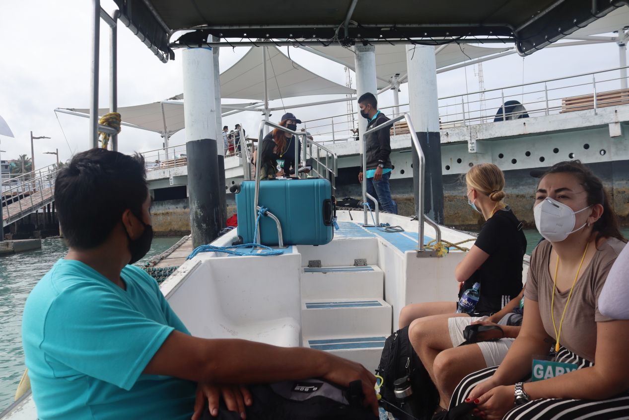


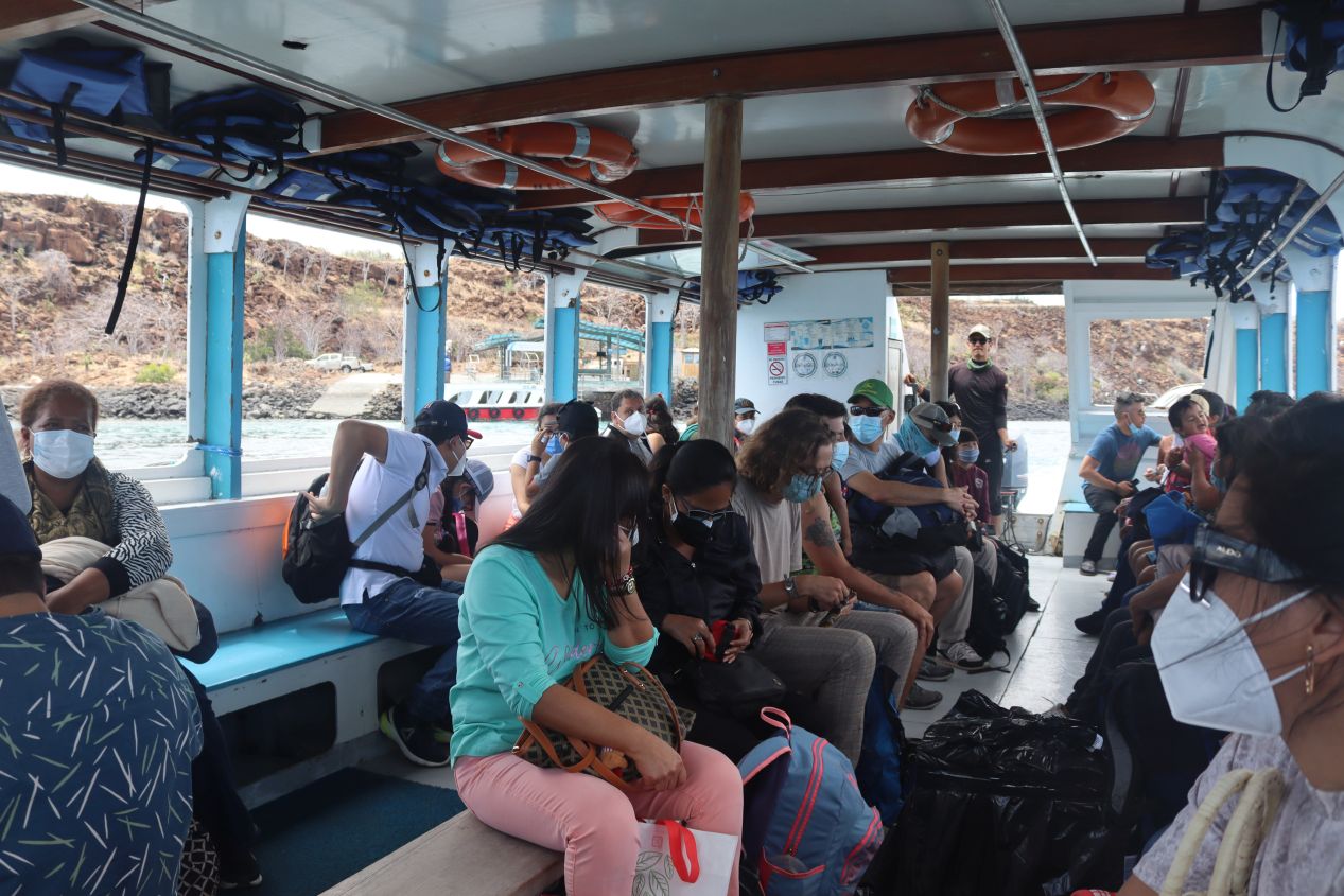
After passing through yet another customs check, we joined a group of about 15 other people in making our way to the inter-island ferry. We had to take a little water taxi out to the ferry boats since the harbor at Puerto Ayora was apparently too shallow for them to dock directly at the main pier. This brought us to our ferry over to Isabela: a boat named either Gaby or Gabi which used both spellings at different times. It should be clear from the picture that Gaby was not a particularly large boat, maybe 10 meters at most from bow to stern. My immediate reaction when first seeing Gaby was thinking that this was another taxi that would take us out to the real ferry. That was not the case, however: this was the actual ferry which would take approximately two hours to cross the distance from Santa Cruz over to Isabela. (Apparently there was an older ferry that used to take four or five hours to make the crossing, ugh!)
We had no idea what to expect from this trip over to Isabela and soon discovered that going into this ferry crossing blind had been a bad idea. The best place to sit on the ferry was in the very back, closer to the motors where there was less jostling up and down as well as more fresh air. By pure chance we had sat in the worst place possible, in the front of the boat where there was no air flow and the turbulence from the ocean was at its worst. Once Gaby left the harbor and entered the ocean proper, conditions on the boat became very rough very fast. Even though the waters weren't particularly choppy on this day, we were still crossing a small part of the Pacific Ocean and Gaby was motoring along at a good 25 to 30 miles/hour. The front portion of the boat was repeatedly thrown into the air, up and down and up again, with everyone on board having to hold onto its sides for safety. Sitting in this position for a full two hours was an awful experience and I spent my time staring out at the horizon with sweat pouring down my face trying to keep from feeling too nauseous. I was able to refrain from throwing up but this was not fun at all, easily the worst part of our Galapagos trip. Worst of all, we knew that we would have to make two more island crossings before our trip was done. At least we now had some inkling of what to expect and could plan ahead to have a better experience on the next ferry trip.


All bad things must come to an end and we did arrive at the southeastern edge of Isabela as the sun was beginning to set in the west. Gaby was pulling into the much smaller harbor on the outskirts of Puerto Villamil where we would be spending the next four nights. While we were taking another water taxi to the docks, we had our first major wildlife spotting in the form of sea lions! These were Galapagos sea lions and they were honestly pretty hard to miss. We saw one sea lion swimming in the water next to our water taxi and then a whole bunch more of them lying on the docks with no concern for the people passing nearby. This would become a recurring pattern not just on Isabela island but everywhere else that we went in the Galapagos: sea lions everywhere along the water's edge. Anytime that we went to a beach or a dock, there would always be some sea lions hanging out there blissfully doing their own thing. The whole archipelago is a giant wildlife preserve and the sea lions were therefore completely unafraid of humans, having no bad experiences to teach them to fear people. I think that this is the best part of visiting the Galapagos: not only do the islands have these amazing and unique animals, they're literally everywhere and completely unafraid of people! We would have more chances later to get even closer to these animals.


We were driven in another car the short distance from Puerto Villamil's docks to our hotel at Coral Blanco. This was a small family-run hotel with only ten rooms located one block away from the beach, within easy walking distance of everything in the little town. The owner of Coral Blanco was also serving as the tour coordinator for the next three days that we would be staying Isabela and we had a very pleasant experience with the whole hotel staff while staying here. Our room was comfy and clean and the hotel served a delicious hot breakfast each morning. We only ran into two issues while staying here: first, we didn't speak any Spanish and the staff at Coral Blanco didn't always speak much English so we ran into a communications barrier at times (though this was mostly our fault since we were the foreign tourists). The other problem was very poor Internet connectivity which was to be expected for a place like the Galapagos. Coral Blanco didn't advertise high speed Internet connections or anything like that, it's just one of the few issues that came to mind when we wanted to share some of the pictures and videos that we'd been taking on our trip.


We came across these maps of the island and the town of Puerto Villamil while exploring the immediate area. Isabela is known for its distinctive shape that looks strikingly like a seahorse. The island was formed out of six separate volcanoes that kept erupting until the cooled lava merged together into a single landmass. We would be visiting the closest one, Volcán Sierra Negra, to take a hike the next day. The town of Puerto Villamil was situated in the southeast corner of the island which is the only part that's been developed for human habitation. Most of Isabela remains an untouched wilderness, especially the northern part of the island which has no roads or people present. The tourist part of Puerto Villamil consisted of only a few blocks that ran along the beach, with the residential parts of the town lying further back away from the coast. We found that we could walk from one side of the town to the other in about ten minutes at a leisurely stroll.


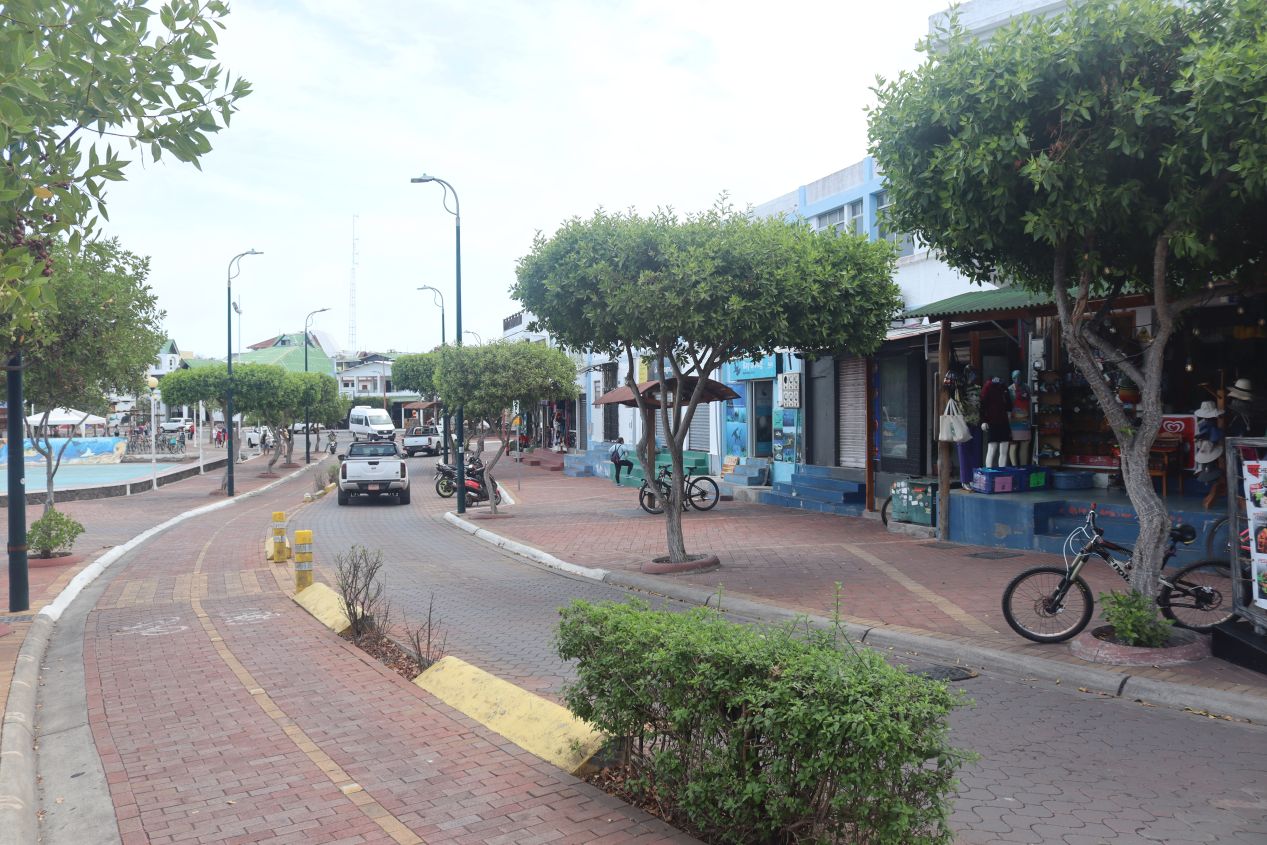
These are a few of the pictures that we snapped while walking around Puerto Villamil, not all of them taken on the same day or at the same time. The streets were unpaved in town and consisted of sand and gravel that had been packed down over time by the passage of vehicles. Since this was the tourist part of town, we found a good number of restaurants and storefronts for touring groups advertising snorkeling and diving trips. Puerto Villamil still had a sleepy feel to it, a town that was starting to develop more tourist infrastructure but was in the early stages of doing so. It still felt very much like the small and isolated community that it had been before the beginnings of the tourist industry a few decades earlier. At the time of this visit, tourism was still minimal due to the ongoing COVID-19 pandemic and we heard from local guides that they were seeing at most 30% of the visitors that previously came to the islands. A very minimal positive side effect of the pandemic was the fact that the Galapagos was therefore uncrowded when we visited and we had more opportunities to spot wildlife. I did some back-of-the-envelope calculations and estimated that there were probably about 100 tourists on the whole island of Isabela when we arrived. Like I said, it clearly wasn't crowded.

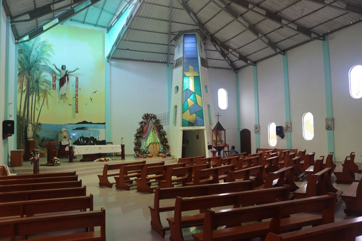


Pictured here was the most notable building in Puerto Villamil, the church Iglesia Cristo Salvador. The population of the Galapagos is overwhelmingly Catholic and this is the main place of worship on the island of Isabela. Cristo Salvador stood out because it incorporated some of the local wildlife into its decorations. We spotted Galapagos penguins, flamingoes, and blue-footed boobies depicted in stained glass windows on the outside of the church, and then the main altar had a landscape painting behind it featuring more of the endemic animals. There was even a big lighthouse that stuck up through the roof of the building and was visible from the street outside. Everything was bright and colorful when we stopped to take a look, with Cristo Salvador having a warm and friendly atmosphere.


Puerto Villamil's beach was right next to the main street in the tiny downtown and reachable in two minutes of walking from our hotel. There was a small boardwalk here with a few restaurants and hotels running along its length, but for the most part the beachfront area remained small and largely undeveloped. I couldn't help but think about how this kind of prime real estate would have been snapped up elsewhere in the world and turned into a bunch of high-rise hotels and condos. That's not permitted in the Galapagos since the whole island of Isabela is protected land in order to preserve the wildlife. Even here in the largest town on the island the natural environment was mostly undisturbed.
There were few tourists to be found in Puerto Villamil and we kept running into the same visitors again and again while doing activities and eating meals. The last picture above is important in that regard because it showcases the restaurant named El Faro ("the lighthouse" in Spanish) where we would eat almost all of our meals on Isabela. El Faro had a ramshackle appearance but the food was excellent, one of those hole-in-the-wall places that winds up being scrumptuous. On our arrival the first night on Isabela, the hotel owner at Coral Blanco gave us a series of meal coupons to let us eat our meals for free at El Faro; this was included as part of the tour package that we had purchased. We soon discovered that the owner of Coral Blanco was also the owner of El Faro and he was directing us to eat at his restaurant in order to receive the meal fees from the touring company. Now the food at El Faro was very good and the service at this family-owned restaurant couldn't have been better but we would have prefer to go somewhere else at times to experience some different options. We figured out later in our trip that we were indeed supposed to have three different restaurant options on Isabela and the hotel/restaurant owner hadn't told us about this. He was a super friendly guy but definitely doing a bit of a tourist hustle on the side.

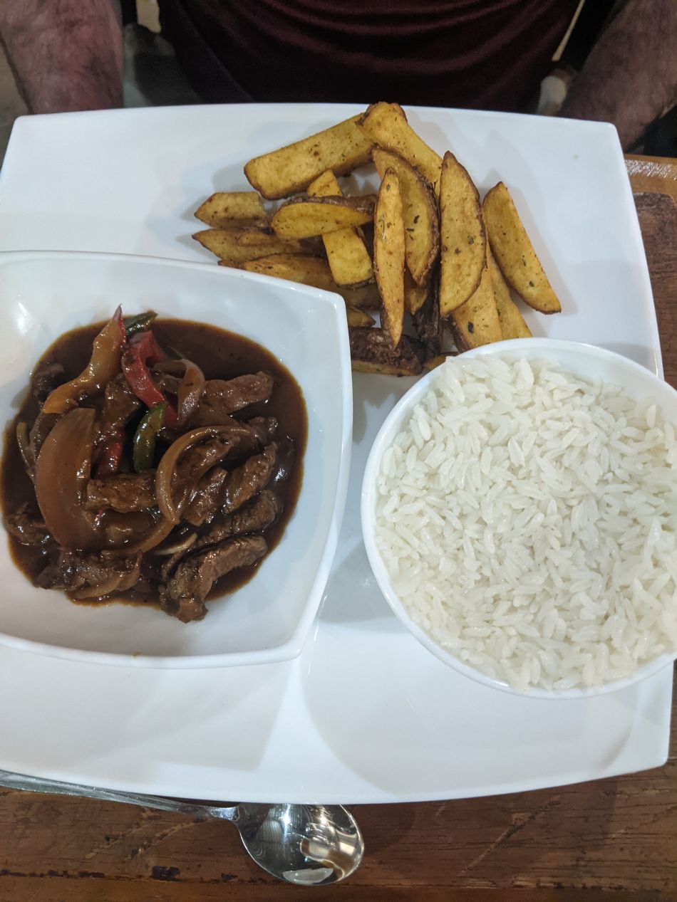


Here are a few pictures of different meals that we ate at El Faro. As I said, the food was very good - we just would have preferred the chance to check out a few more restaurants while we were staying on Isabela.


We woke up and had breakfast the next morning at Coral Blanco in preparation for our first full day in the Galapagos. Our main activity for the day would be the longest hike of our vacation, a lengthy trek to explore the nearby Sierra Negra volcano. We met our tour guide for the day (Pablo) at our hotel and then were driven about 30 minutes to the north until we reached the base of the volcano's caldera. If you take a look at the trail map captured in the first picture, we were hiking the yellow line on the right side of the image that curved around the eastern edge of the volcano. This hike was 8 kilometers / 5 miles in each direction, for double that length including the return trip. We would be passing right by the crater rim of the volcano and then continuing onwards to walk through some of the cooled lava flows from past eruptions. It was cloudy and drizzling and surprisingly a bit chilly at the trailhead as we were starting out, however our guide assured us that the mist would burn off as the day progressed. The initial part of the hike was a steady walk uphill along a dirt road that passed next to privately owned farmland. The most interesting thing that we spotted here was a herd of cattle on the other side of a fence. Needless to say, cows are not indigenous inhabitants of the Galapagos and their presence has often been disruptive for the original wildlife.


Sure enough, Pablo was correct and the overcast skies cleared up after about the first hour of walking. We were traveling in a group of six total people along with our guide; the other four individuals kept racing ahead of the rest of us. It took about 90 minutes to reach the top of the crater rim and we were treated to these views looking out across the caldera of Sierra Negra. This is an active volcano which had previously last erupted in 2018, with previous eruptions taking place in 2005, 1979, 1963, and 1957. Sierra Negra is noteworthy for having one of the largest calderas in the world (at least among currently active volcanoes), with dimensions of 7.2 x 9.3 kilometers. The caldera was so large that we could barely see across to the rim on the other side off at the horizon to the west. Everything down there at the bottom was dried lava and it wasn't safe to take tourists down there for a closer look.


These are a few additional pictures of the two of us at the crater's edge and what the inside of the caldera looked like using a zoomed lens. Lava that had cooled three years earlier didn't look particularly different from any other type of igneous rock, although it was noteworthy that no plants had been able to grow inside the volcano. We would see more evidence of cooled lava flows as the hike continued up ahead. We walked a little bit longer before the group stopped to take a break to drink some water. That's where Liz snapped this picture of a Galapagos finch, one of the more famous native species in the islands thanks to the role that they played in developing Charles Darwin's theory of evolution. Darwin noticed that there were small differences in the finches on each island and wrote about this at length in discussing how natural selection works. I believe that this was a Small Tree-Finch if I'm reading our "Birds of the Galapagos" reference correctly but don't quote me on that. This finch was extremely small and probably weighed about 100 grams since the picture doesn't provide a good sense of scale for comparison.

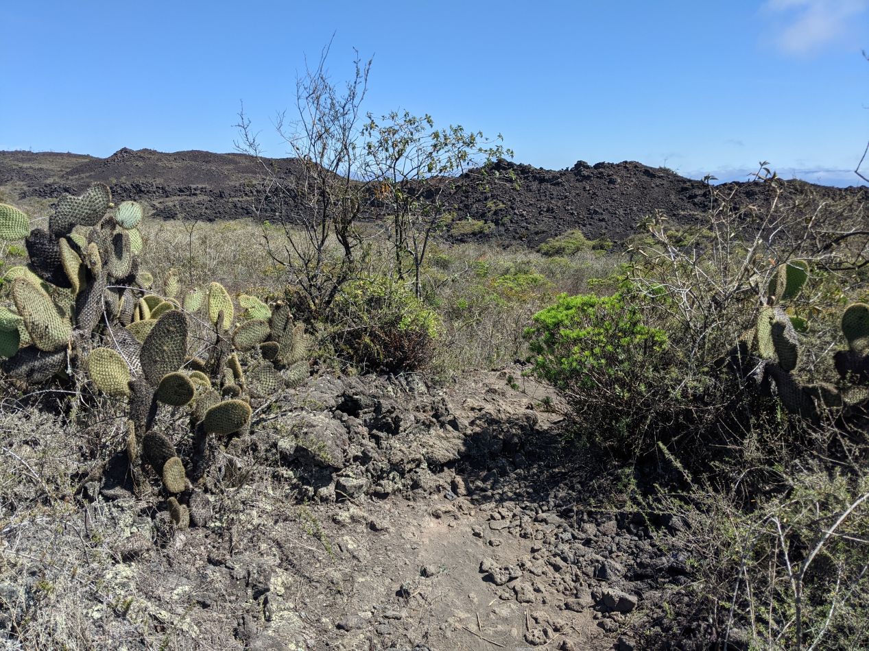


After this short break, we began descending from the crater rim down the northern slope of Sierra Negra. This is the direction that the lava flows when Sierra Negra erupts and it's the reason why the town of Puerto Villamil is located to the southeast of the volcano. All of the houses and the land given over to farming are situated south and east of the volcano; everything to the north keeps getting wiped out every decade or so when Sierra Negra erupts and spills out lava everywhere. We would be walking through past lava flows of various different ages, starting with a region where the dried lava was estimated to be about a thousand years old. Here on the northern slope of the volcano the climate had switched over to being surprisingly arid, much like we had seen back on Baltra when we first landed. There were cactuses everywhere and it felt as though we had been transported into the American Southwest. Did we somehow find ourselves in Arizona without knowing it? The one obvious difference was the nature of the rocks underfoot: everything here was dried lava and igneous in nature which does not match at all the non-volcanic geology of the American Southwest.

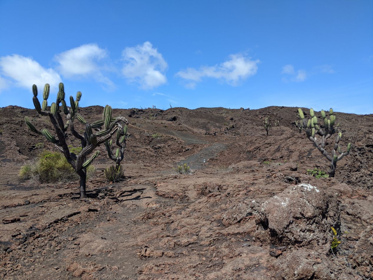


We continued hiking downhill and soon passed into a region with a different lava flow which was estimated to be about five hundred years old. There was noticeably less vegetation here with only a handful of the toughest cactuses able to sink roots deep enough to survive. Most of what we were walking through was bare rock with very little in the way of plant or animal life. Sierra Negra is estimated to be about 500,000 years old and Isabela island only exists because Sierra Negra and its five sister volcanoes kept bringing up more and more lava from inside the Earth's crust until a landmass had formed. Isabela keeps getting slightly larger every time that one of these volcanoes erupts and adds to the accumulated lava flows.

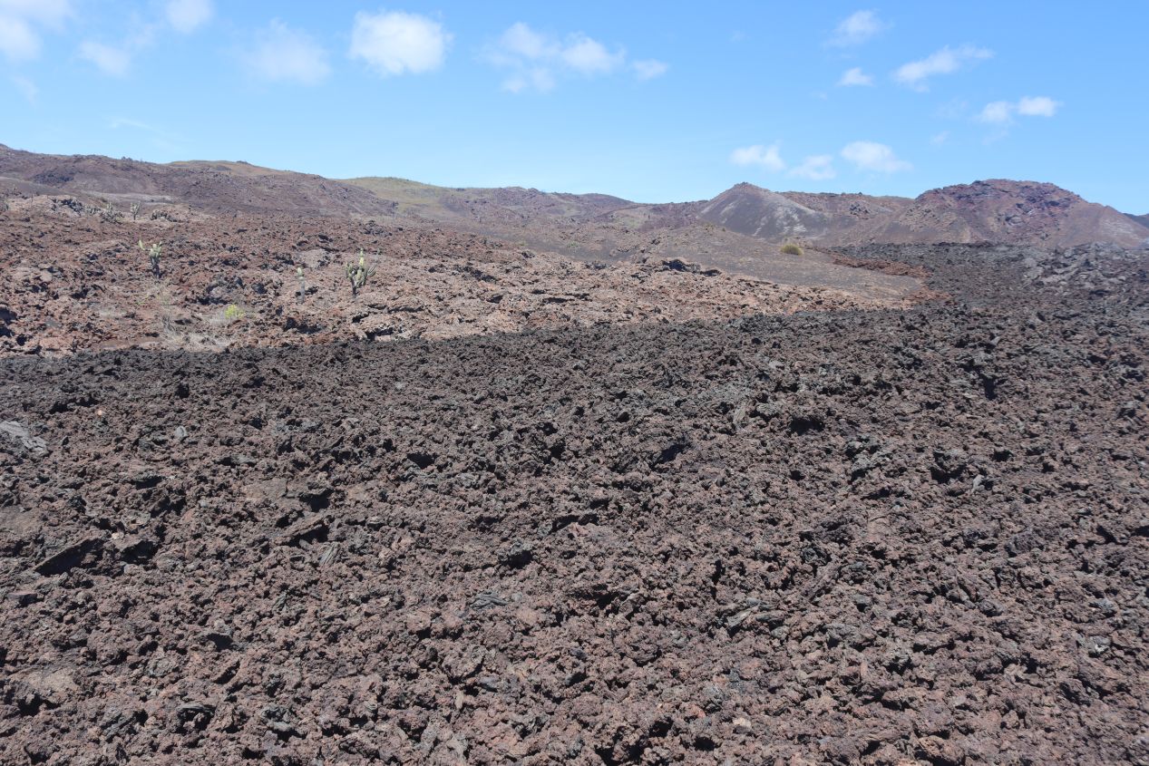


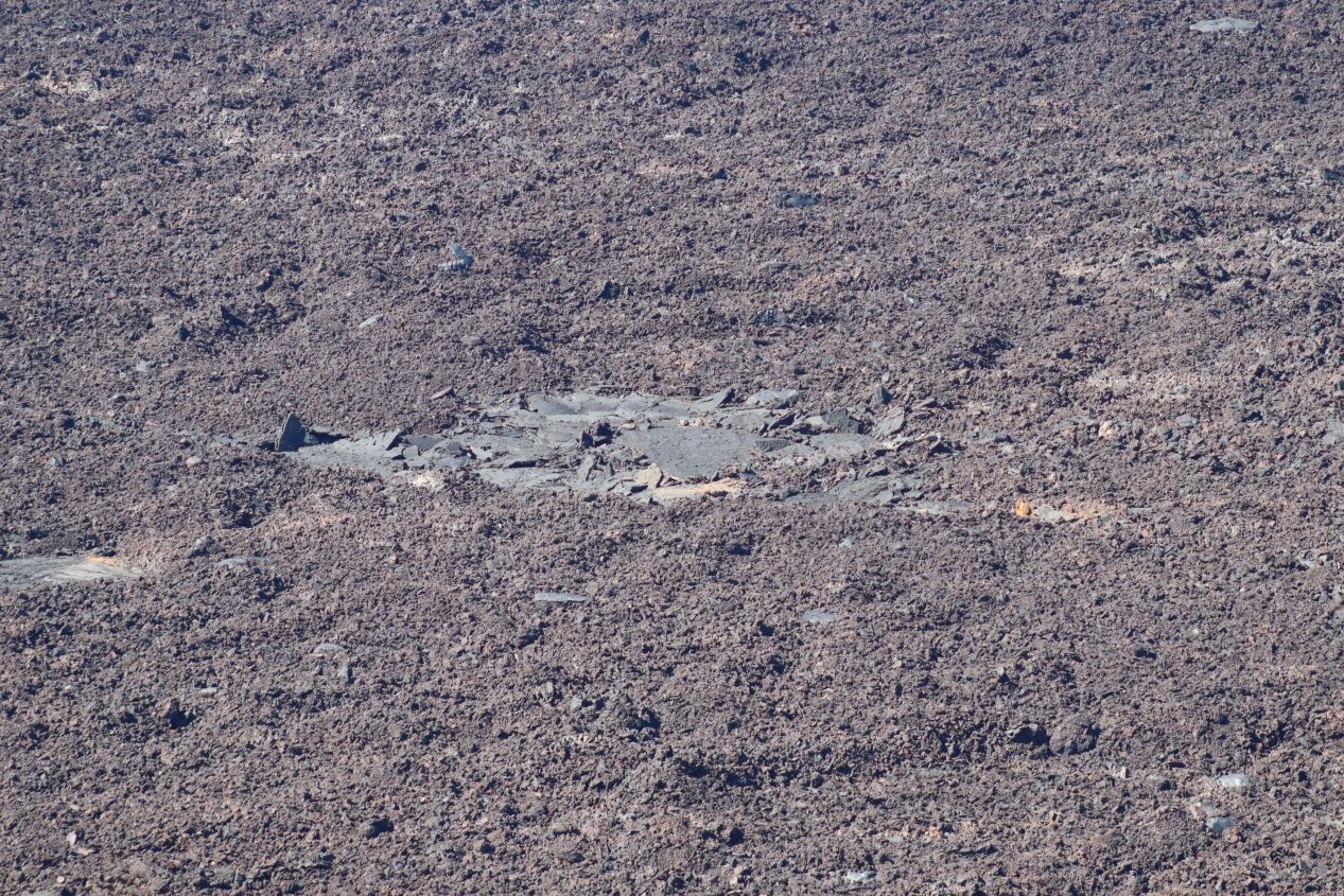
The third and final lava flow that we passed into was much more recent, dating from the 1979 eruption of Sierra Negra. The dividing line between lava flows was starkly visible as there was a division between lighter and darker colored rocks on the ground. It was easy to see where the lava had bent and flowed like some infernal river four decades earlier back in 1979. And while the previous region with the five hundred year old lava flow had contained little in the way of vegetation, the four decade old lava flow had basically nothing at all. We spotted one or two tiny ferns just starting to grow in a few cracks but otherwise the landscape was nothing but unbroken rocks as far as the eye could see. It was perhaps the bleakest scenery that I've ever seen, deader than dead in terms of flora and fauna.


More views of the barren landscape that we encountered in the lava flow from the 1979 eruption. The standard phrase that the tours use to describe this part of Sierra Negra is that it "looks like the surface of the moon" but I don't think that's quite right. The moon doesn't have an atmosphere so its surface is heavily cratered and it lacks any kind of volcanism. I think the much better comparison is that this area looked like the surface of Mars, and aside from the blue sky this definitely could have been one of the images sent back from the Mars rovers. Compare the views above to this picture taken by the Curiosity rover on Mars, for example. It's a reasonably close match and certainly a lot closer than the surface of the moon.


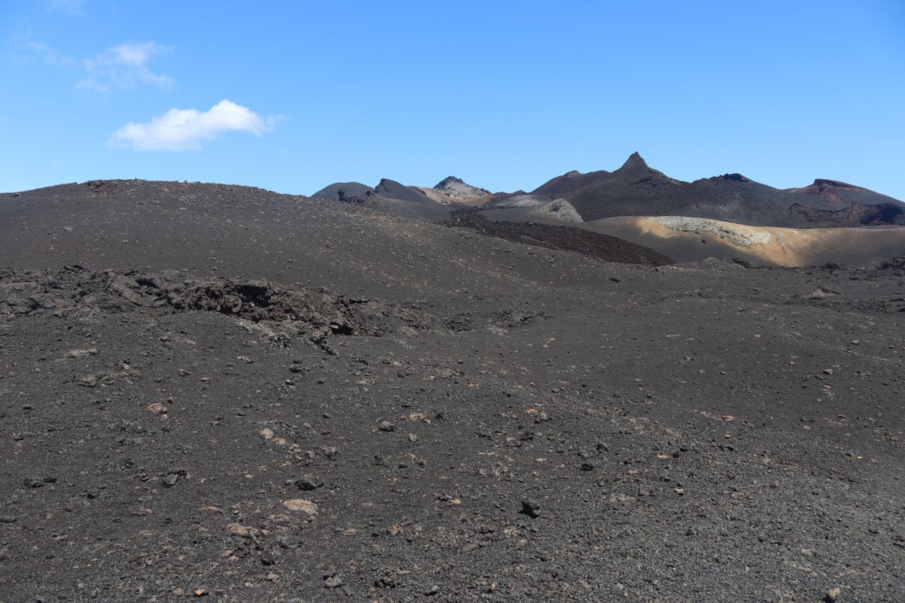
Eventually we reached the end of the hiking trail, up on top of a ridge with commanding views looking north as the land sloped downwards to the ocean. Most of the terrain that we could see from here was equally devoid of vegetation as repeated eruptions from Sierra Negra kept clearing out anything that tried to grow. There were some "islands" of green at the top of hills where the lava hadn't quite managed to reach and plants were able to survive the flowing of the lava downhill. With no trees to block our view from this higher point of elevation, we could see all the way to the horizon undisturbed. In the third picture above, we could clearly see the curve of Isabela island as it hooked back around to the northwest after narrowing. It was also just barely possible to see the next island off to the west, Fernandina, in the top-left corner of the image. Fernandina is the youngest island in the Galapagos and it is uninhabited by people due to its frequent volcanic eruptions; the most recent was in 2020 at the time of writing. Fernandina is expected to merge together with Isabela to become a single island sometime in the next 10,000-20,000 years due to the ongoing volcanic activty, an eternity in human time but a short period geologically.
This was a natural place for our tour to stop and eat the lunches that we had brought with us. There were four or five other tours hiking the same trail that we were doing and therefore it was a bit of a crowd that gathered together at the end of this trail. I'd estimate that there were maybe 50 people in total doing the Sierra Negra hike on this day which was far more people than we saw anywhere else on Isabela. While we were eating lunch, we spotted this bird that I can retroactively identify as a Galapagos dove. It stood out for having a blue ring around its eye and otherwise had feathers that blended into the volcanic landscape. Our guide Pablo said that these doves are rare but I think he meant rare to see around Sierra Negra, as they appear to be fairly common birds to spot in the islands as a whole.


This was an awesome hike and it would have been perfect if we could have somehow teleported back to the starting point from here. Of course that wasn't possible and now we had to do the whole return trip back the same way that we had come. The walk back was naturally less interesting and turned into a bit of a slog since everyone was getting tired by now. The hardest part was the walk back up to the crater rim since it was entirely uphill. The earlier clouds had long since disappeared and it was getting hot out there on the lava fields with zero vegetation to provide cover. We didn't stop to take pictures on the way back because we were seeing all of the same things that we had already encountered on the hike out. What was most noteworthy about this return trip was me getting sunburned badly on my arms, legs, and the left side of my neck. I had applied sunscreen that morning but didn't keep reapplying it throughout the day diligently enough. Liz did not make this mistake and made it through unscathed, a much wiser course of action.

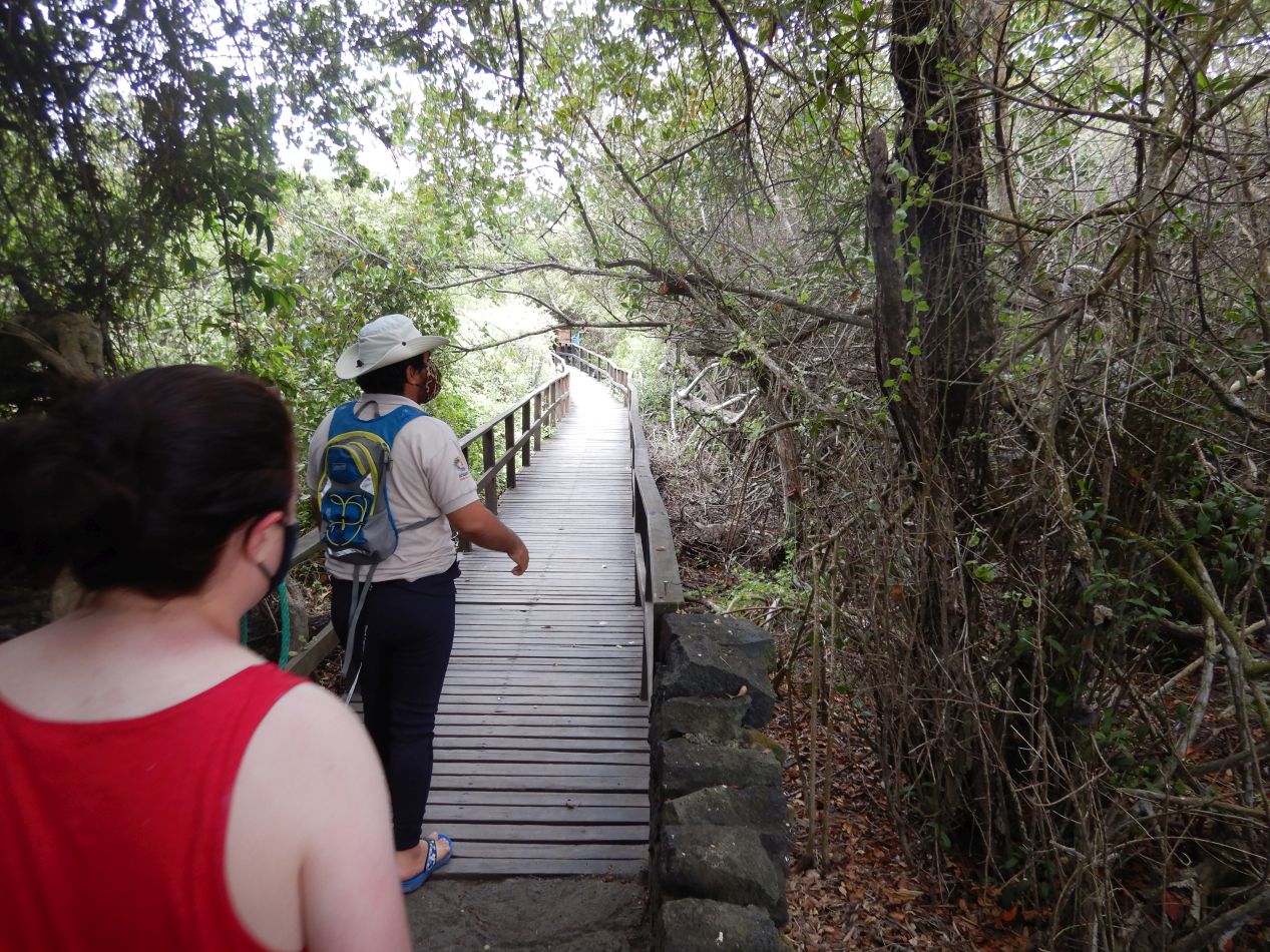


Eventually we made it back to the trailhead and then caught a return car ride back to our hotel at Coral Blanco. After a short break to change our clothes, we headed out for our shorter afternoon activity which would be a snorkeling excursion at a little enclosed area named Concha de Perla. This place could be reached in about five minutes of walking from Puerto Villamil's dock where we had arrived the previous evening. The walk to Concha de Perla turned out to be a boardwalk running through a forest of mangrove trees that grew along the shoreline. Pablo remained our guide for the afternoon (the other four members of our initial tour had disappeared elsewhere so it was just the three of us) and pointed out the different types of mangroves that we were seeing. There are four different types that grow in the Galapagos: red, black, white, and button mangroves. Their branches formed a canopy that the boardwalk passed underneath. We also spotted lots of marine iguanas along with...


Sea lions! Once again the Galapagos sea lions were lying all over the docks and enjoying the boardwalk that people had built here as if it had been made specifically for them. There were all types of sea lions here, bulls and cows and little calves that kept trying to nurse from their mother. Visitors are not allowed to touch or interact with the sea lions and they will walk right past people like the humans aren't even there. It's completely incredibly how close tourists can get to the wildlife in the Galapagos and how unafraid they are. There were times where we had to literally step over the sea lions because they were blocking the path and wouldn't bother to move out of the way.


We were visiting Concha de Perla so that we could go snorkeling in its waters. This is a naturally protected area where water flows in from the surrounding ocean but the waves are blocked by an outer ring of mangroves that almost but not completely encircles the pool. The touring companies often like to pair Concha de Perla with the long hike on Sierra Negra because it's a great way to cool down after a long day of walking. Our visit was taking place in August which is winter in the Galapagos; while the islands are located right next to the equator, they fall almost entirely in the southern hemisphere and the currents in the ocean cause the water to be quite a bit colder in winter. I still think that winter is the better time to visit the Galapagos because there's much less rain but potential tourists should be forewarned that the water can be pretty chilly. I wasn't bothered too much because I grew up swimming in the Atlantic Ocean at Ocean City, Maryland where the water in June was never particularly warm. Still, this wasn't like going to the Caribbean and finding the ocean to be the temperature of warm bathwater.
We knew that we would be doing some snorkeling in the Galapagos and specifically brought a camera which could be taken underwater to get some pictures of the marine wildlife. Unfortunately, I was so eager to try out the new camera that I jumped into the water without checking to make sure that the inner compartment was completely sealed. (There's a warning every time that the camera turns on to do this and I blew right past it out of excitement.) Sure enough, the thing hadn't been sealed properly, water got inside, and it broke immediately. There went several hundred dollars flushed away immediately; I have the worst luck with these cameras. This was especially sad because we had *AMAZING* views of underwater wildlife on this snorkeling trip. We spotted sea turtles, manta rays, sea lions, and more fish than we could count. The rays were a rare sight at Concha de Perla and we were able to swim above them as they glided past underneath like silent underwater ghosts. The sea lions are commonplace here but we were able to swim alongside them as they bobbed up and down playing in the water. It really would have been nice to photograph some of that stuff, argh!  At least I got to pose for a picture with this baby sea lion.
That was the end of our first full day on Isabela. We had two more days of sightseeing ahead and there was so much going on that I had to split this travel page into two parts. Next up we would explore the giant tortoises and the marine wildlife in more detail as we continued our tour of the largest island in the Galapagos.


