

For this day's travel, I would be heading south along the highway known as the Icefields Parkway. This is the descriptive name given to Alberta Highway 93 that runs between Jasper National Park and Lake Louise, a stretch of scenic highway that runs for 230 kilometers / 140 miles from end to end. The parkway derives its name from the glaciers that can be found along its length, in particular the Columbia Icefield located in the mountains to the west of the road. The Icefields Parkway was initially built during the Great Depression as an employment relief project before being modernized in the years following World War II. Today, it draws hundreds of thousands of visitors each summer season to take in the alpine vistas and the wildlife that they contain. The Icefields Parkway often ranks near the top of those lists of "Best Drives in North America", and any trip to the Canadian Rockies will want to include a passage along this stretch of asphalt. I would be starting out at the northern end in Jasper and working my way down to Lake Louise over the course of the day, seeing several of the different attractions along the way.

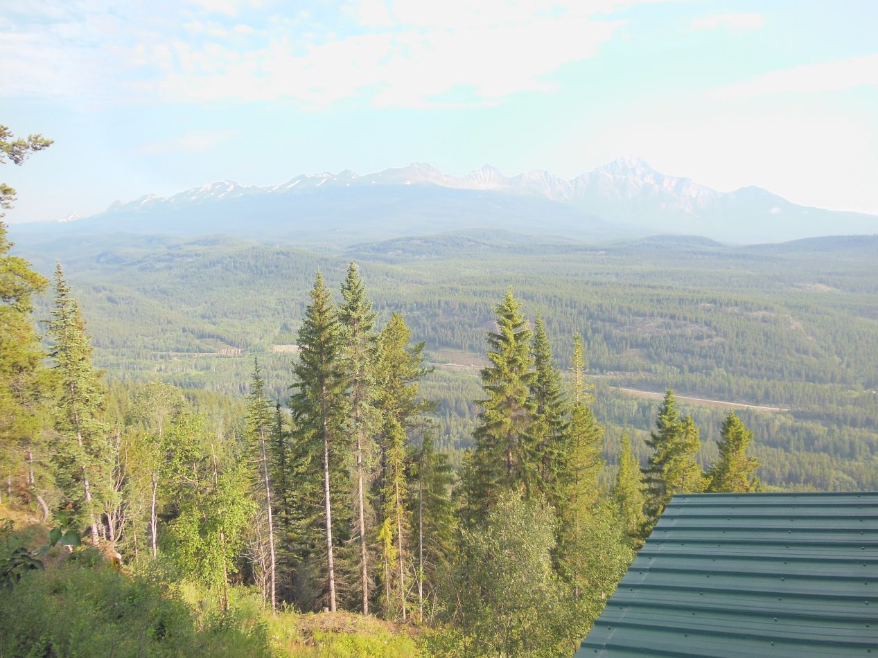


I woke up early again in Jasper to ensure that I would be waiting outside the first attraction of the day when it opened. This was the Jasper Skytram, a gondola system built in 1964 that takes passengers up to the top of Whistlers Mountain. The elevation gain along the way is roughly 1000 meters / 3000 feet, listed in non-metric units as going from 4300 feet at the base of the tramway up to 7400 feet at the end of the cable car system. I purchased a ticket before the tramway started up, and I was in the first gondola car of the day heading up the mountain. The early morning views were as impressive as I had expected despite a slight haze in the air. I was fortunate that the thick fog from the previous day didn't show up again, which would have made it impossible to see much of anything. Looking off to the north, I had a great view of the town of Jasper lying in the valley next to the Athabasca River. It was a small island of modern development in the midst of the encompassing wilderness.

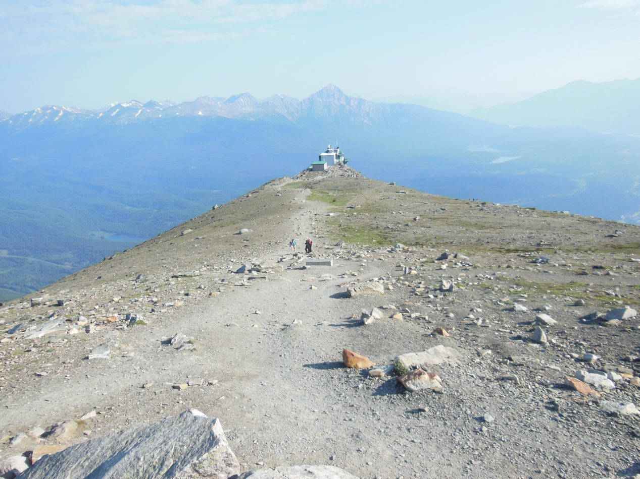


The Jasper Skytram deposited its visitors up near the top of the mountain. This was not the pinnacle of Whistlers Mountain, however, and the peak was accessible via a short path known as the Whistlers Summit Trail. It was only 1.4 kilometers in length, less than a mile, but comprised a 200 meter elevation gain along the way. I quickly found that this was a strenuous trail to hike upwards, and the other passengers on the gondola, mostly families with children, fell behind me in short order. This trail was well above the tree line and the harsh conditions made it impossible for almost anything to grow. Only the very toughest scrub grasses grew here, clinging to life on the exposed mountain face. I also saw a tiny chipmunk at one point, whose gray-colored fur blended into the rocks and made it difficult to see. Mostly though, this was a path of gravel and rocks. A steep path of gravel and rocks. I'm not sure if the pictures convey this properly, but it was a tough haul for such a short trail.

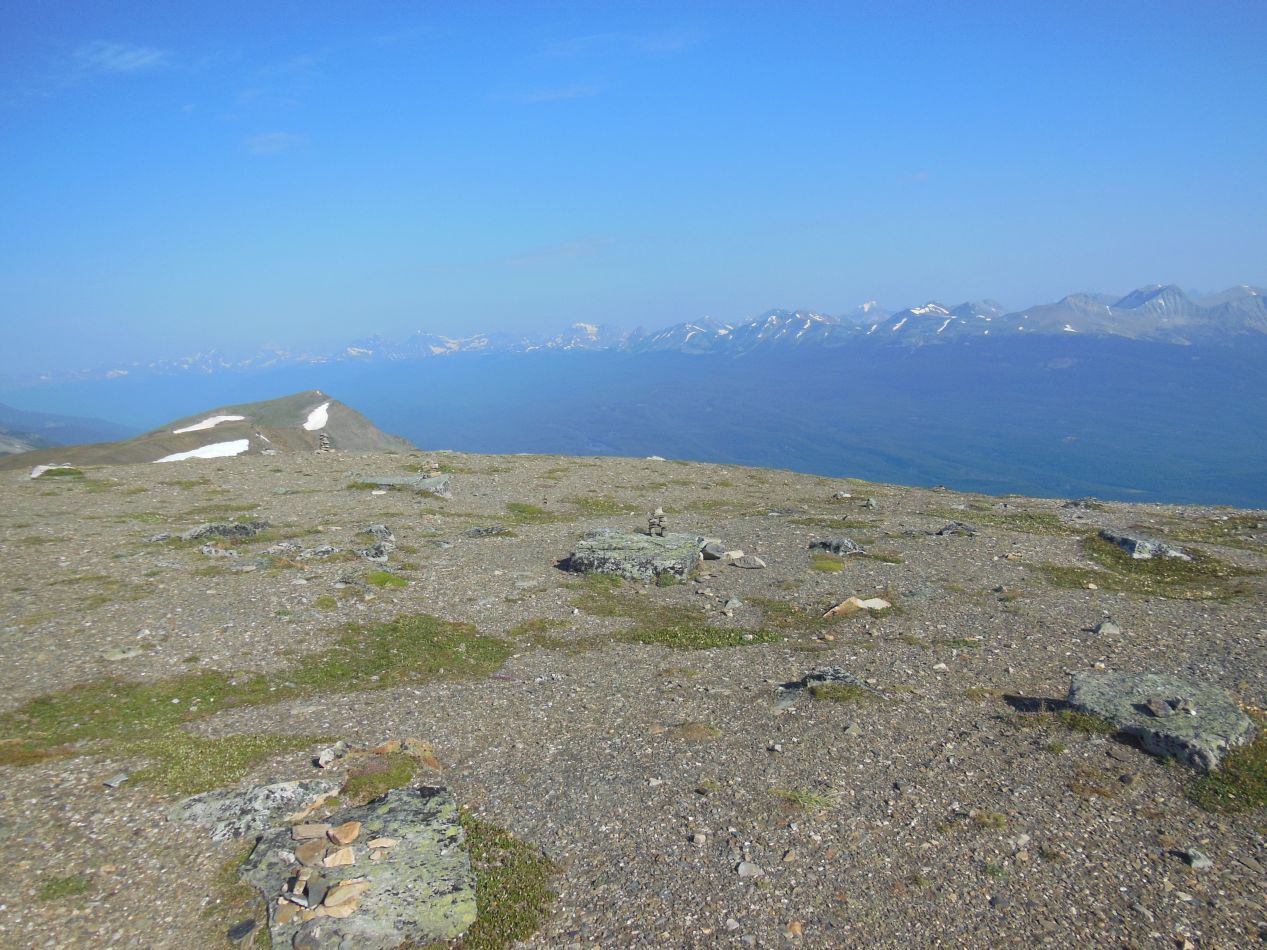


The views up at the top of Whistlers Mountain truly were spectacular though. I could spin in a circle and be surrounded by the snow-capped peaks of the Rocky Mountains in a full 360 degrees. Even better, because I had been on the very first gondola car ride of the day and had outpaced the rest of the small group riding on that first trip, I was completely alone atop the summit for the moment. I could take these pictures without any other tourists in the way to block the views. It felt as though I were in one of the Lord of the Rings movies or something similar, as if this was some kind of computer-generated fantasy imagery. It was hard to believe that this was a real environment and yes, all of those rugged whitecapped mountains actually existed. I was able to snap one picture of the tramway station from the peak, looking like a tiny building far below. That was the best way to get a sense of the distance traveled both horizontally and vertically by the Whistlers Summit Trail. Much further down below, the town of Jasper was also visible from up here at the top of the mountain.


Two quick pictures of the dizzying ride back down to the bottom again on the Skyway. This would not be a good excursion for anyone with a fear of heights. When I made it back to my rental car, I found that the parking lot had completely filled up and there was now a long line to ride the tramway system up to the top. This was another good lesson in the usefulness of arriving early to a popular attraction.

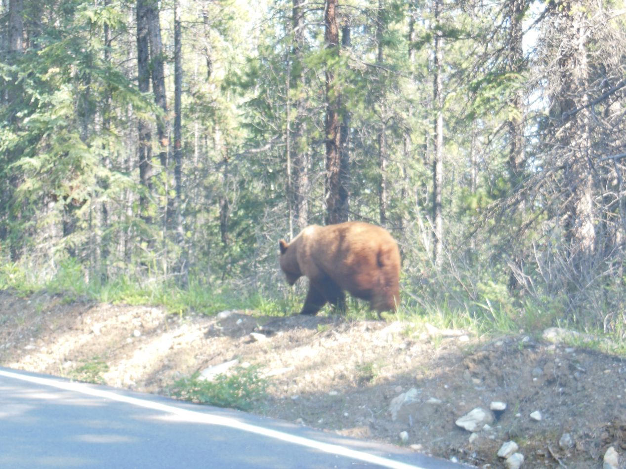


After finishing up at the Jasper Skyway, I started my drive south along the Icefields Parkway itself. En route to my next destination, I noticed some movement off to the side of my car and glanced over to see what it was. I was stunned to realize that I was driving past a pair of grizzly bears!  It was clearly a mamma bear and her cub born earlier in the spring, and the little bear was absolutely adorable. I slowed down to a crawl so that I could take pictures, which backed up traffic behind me on the road but I didn't really care about that. Besides, most of those drivers were probably taking their own pictures. This was just about the best situation possible to come across bears in the wild: close enough to get a fantastic look while still being inside my car for safety. I would not have wanted to run across a mamma bear while she was with her cub out on a hiking trail, as that's about the most dangerous situation possible. The only unfortunate thing was that the two bears were on the passenger side of the road, although I suppose that if they had been on the driver's side the view might have been blocked by cars heading in the other direction who were also stopping to gawk. It was too bad that I didn't have another person with me to take the pictures. It's not exactly easy to photograph out the passenger side window while also driving at the same time. Nevertheless, this was an incredibly lucky find. Two grizzly bears spotted in the wild, amazing!

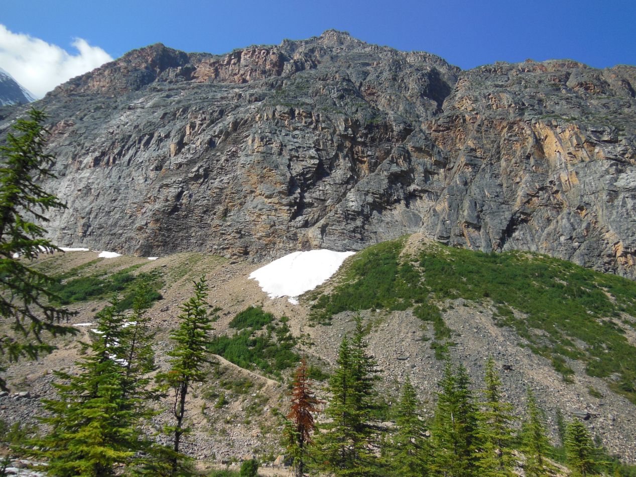


I had technically seen the two bears not on the Icefields Parkway itself, but on the smaller access road that led from the parkway to Mount Edith Cavell, the next destination that I was visiting. Mount Edith Cavell is named after one of the heroes of World War I, an English nurse who was executed by the Germans in 1916 for helping Entente soldiers escape from occupied Belgium. As for her namesake mountain, it's one of the taller and more prominent peaks in this portion of the Canadian Rockies, standing at about 3300 meters / 11,000 feet in height. There are a number of hiking trails surrounding Mount Edith Cavell, and I was taking one of the shorter paths up to the base of the mountain. It reared up directly ahead of me, a huge chunk of rock completely barren of any vegetation. The face of the mountain was coated with snow and Mount Edith Cavell contains multiple glaciers along its slopes. I found it a little bit odd that there were so many short trees along the sides of the walking path until a little sign explained what was going on: as recently as a few decades ago, this whole area covered by the walking path was buried beneath a glacier. With the retreat of the glaciers, the forest was beginning to return to the newly exposed ground. While it was nice to see young trees growing over this barren expense of terrain, the implications of the rapid retreat of these glaciers were ominous.

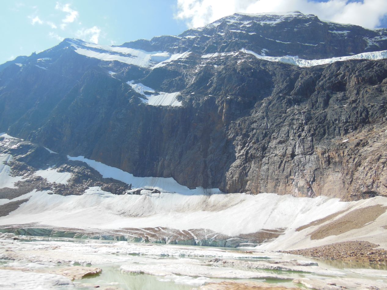


The base of the mountain held a pool formed by glacier runoff. This was where the Cavell Glacier was located, or at least what was left of it. There didn't seem to be too much of it remaining, only a small amount of snow and ice tucked up against the shadow of the overhanging mountain. Angel Glacier, the one situated up above the pool on the overhanging rocks, appeared to be in better shape. It was the middle of the summer of course, and this was the part of the year where the glaciers would be at the minimum extent. I was still nonetheless disturbed to see how reduced in size they were, especially when compared to pictures from the same locations taken 20, 50, and 100 years earlier. Cavell Pond was the name of the little body of water formed by melting glacier runoff, and it was an unattractive spectacle to say the least. Glaciers are surprisingly dirty when seen close up, full of gravel and sand that they pick up along the way when moving. There was a warning sign here telling visitors not to drink the water or swim in it, and I don't think there was much risk of either one.

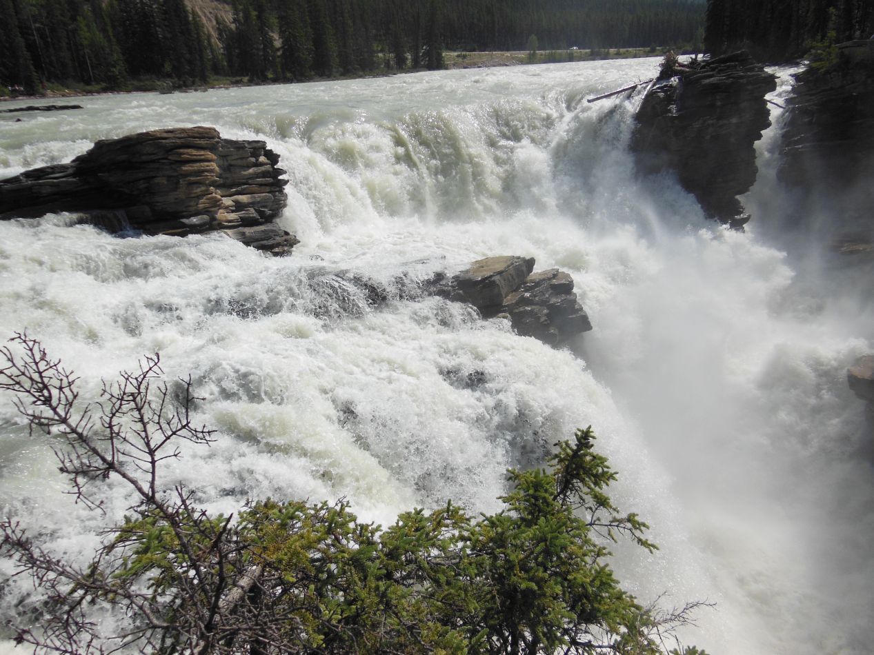


I didn't spend too much time at Mount Edith Cavell, only doing the short hike to the base of the mountain instead of ranging further afield. The next attraction along the Icefields Parkway was this waterfall, known as Athabasca Falls after the river of the same name that flows through them. While this waterfall isn't particularly tall at a size of only 25 meters / 80 feet, the sheer quantity of water passing through them is enormous. I could hear the pounding of the falling water as soon as I reached the parking lot, and the whole area surrounding the falls was bathed in a curtain of mist stirred up by their passing. The view of the mountains in the background with the falls in the foreground was postcard-perfect. Further down at the base of the falls, a small canyon had been carved out over time with little trees growing in odd, seemingly-drunk directions. This is apparently due to the water passing from a layer of hard quartzite over to a much softer layer of limestone, which has been eaten away by the flow of the water. Overall, Athabasca Falls was a nice place to stop and stretch the legs for a short break before continuing on the parkway.


Driving on the Icefields Parkway itself was a real pleasure. The road is a two lane highway for the most part, and once again I didn't find it to be particularly crowded. Outside of the summer tourist season it's probably almost completely deserted. The scenery along the parkway winds through dense forests for the most part, with tall mountains flanking it on both sides. New and unexpected sights kept popping up along the way, like this waterfall off to the side where one family had stopped to let their kids go exploring. At other points I pulled over to the shoulder and stopped my car just so that I could get out and take a picture of the mountains in the distance. The parkway absolutely lived up to its reputation as a beautiful drive.

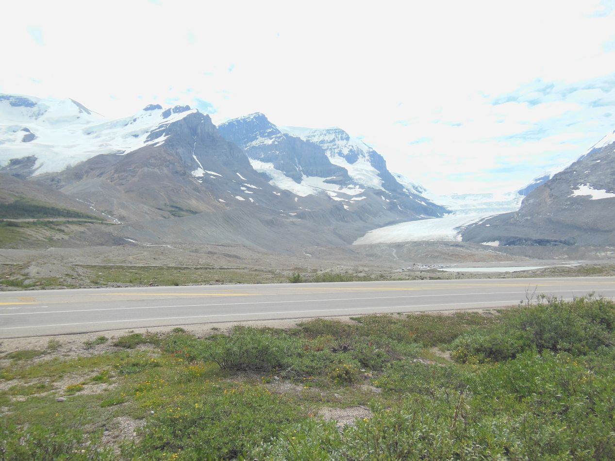


The next major stop took place at the Icefields Center. Located at the foot of the Athabasca Glacier, this is the hub for sightseeing trips that venture out onto the glacier itself. There's also a small museum with information about the history of the glaciers and their retreat over time as the climate has grown warmer. On the topographical map located in the museum, the Icefields Center was situated in the bottom-right hand corner below the Athabasca Glacier. This particular glacier was dwarfed by the much larger Columbia Icefield sitting on top of the mountains, the largest glacier located in the Rocky Mountains. Rivers that originate in the Columbia Icefield drain into the Atlantic Ocean (via Hudson's Bay), the Pacific Ocean, and the Arctic Ocean, making the icefield a triple continental divide. The comparison photographs from 1906 and 2006 were also a sobering reminder of the changing climate in this region. The glacier originally reached all the way down to the Icefields Parkway, but today it was clearly far short of the road.


Tours leave about every 15 minutes to head out onto the glacier, and naturally I signed up to take one. If anyone else is trying to do this trip on the cheap, I should warn ahead of time that this was the costliest excursion in terms of attractions; it was a little over $50 for one person in 2012, and I'm sure that the price has gone up since then. The experience started out by having visitors board a normal bus where I was fortunate enough to get one of the seats up front. This was a short bus ride, taking tourists to the base of the glacier, maybe five minutes total transit time.

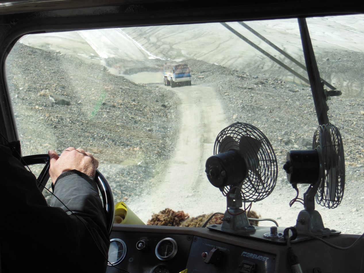


There were more specialized vehicles that traveled out onto the glacier itself, these massive snow coaches designed specifically to travel on ice. I've seen these things before on television shows being used in Antarctica and the ones here on the Icefields Parkway were built to the same design. They're a little bit like a tour bus combined with monster truck wheels. We left the normal bus and boarded one of these snow coaches, then headed down a dirty gravel road that led out onto the glacier. While driving along the "road" that had been cleared out for the snow coaches on top of the glacier, we were treated to up-close views of the snow and ice that made up the natural phenomenon. The glacier was not at all uniform, instead full of bumps and lines that had been caused by running water from the summer meltoff. As I've mentioned before, glaciers are also quite dirty when seen in person. This is not water that anyone would want to try drinking.

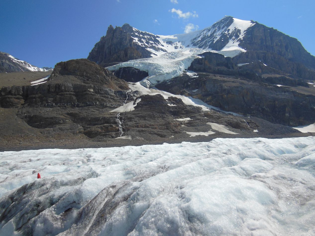


After a few minutes of riding on the snow coach, it stopped to let everyone out at a specifically prepared section of the glacier. The area had been smoothed out and stabilized to make sure that it was safe to let visitors walk around. The operators repeatedly warned everyone not to leave the marked area and go wandering about on the glacier because it wasn't safe and people have fallen through the ice. What happened next? Sure enough, a bunch of idiots ignored all of that and walked out onto the unsafe area to take more pictures.  I swear, people are just morons sometimes. Anyway, this was a really fun chance to stand on top of a glacier, not just one viewed out the window of a snow coach but actually underfoot where you could reach out and touch it. Seen this closely, the glacier had a bluish tint to its coloring that doesn't always come across in pictures. The glacier was also melting nonstop due to the summer heat, with small trickles of water running down the sides of the heaped snow. You can see the running water in some of the pictures above, carving out runnels in the lumpy mass of the glacier. Far off in the distance up ahead, the packed bulk of the Columbia Icefield was hanging on top of the mountains. I could just see a piece of it from this vantage point on the Athabasca Glacier. Overall, this was one of the more unique experiences that I've had the chance to try. While I've seen glaciers elsewhere on other trips, this is the one time that I had the chance to go walking around on top of one.

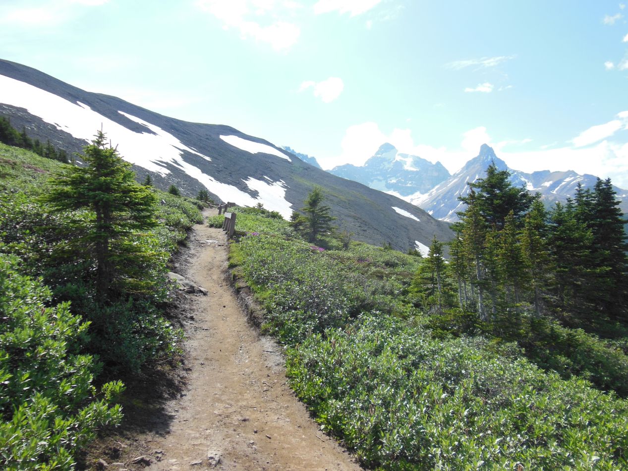


There was one more activity that I had planned for this day. A short distance down the Icefields Parkway, I crossed over from Jasper National Park into Banff National Park, and elected to go on another highly rated hiking trail. This was the Parker Ridge Trail, a short 5 kilometer / 3 mile roundtrip path that took hikers up to the top of Parker Ridge where there were views looking down at another glacier off in the distance. I had mostly been driving throughout the day and this was a good chance to get out and strech my legs a bit more. I found myself regretting that decision a bit when the trail led steeply uphill though. Still, it wasn't too bad and the scenery outside was certainly lovely here. The Parker Ridge Trail served up some beautiful views of the Icefields Parkway itself, which wound its way through the surrounding mountains as it crossed through Sunwapta Pass at 2000 meters / 6600 feet elevation. There were even other people hiking on this trail in a sharp contrast to the isolation of the Skyline Trail from the previous day.

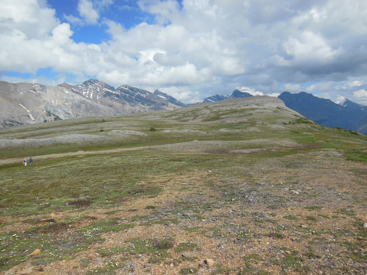


Once I made it to the top of Parker Ridge, the trail flattened out considerably. In fact, it was difficult to spot the trail at all up at the summit because there were no distinguishing landmarks. I had gone above the tree line again with the landscape reduced to tough scrub grass in the midst of otherwise bare rock. This produced a mixture of green and gray terrain that I've only ever seen in alpine regions. The views were outstanding though, and the clear weather allowed me to see for miles in every direction. Mountains, mountains, and more mountains were the story in this area. At the very end of the trail I was able to spot the Saskatchewan Glacier off in the distance, located down below in the valley between two ridges of peaks. It was hard to see from this far away, and since I had just left another glacier, I didn't feel the need to get any closer.


Soon after finishing my hike at Parker Ridge, I noticed this crowd of people pulled over to the side of the Icefields Parkway. I remembered encountering crowds like this at Yellowstone National Park the previous year, and sure enough, it was due to the same reason: a wildlife spotting. It turned out that there was a black bear a little ways off in the brush, in prime view for taking pictures. It was eating something although I couldn't tell what that was from this distance. My luck was obviously continuing: two bear sightings in one day! Black bears are more numerous than grizzly bears in the Canadian Rockies, but this was still better than I could have hoped for. I wasn't worried in the least about this bear being dangerous either, not with the noise of the road to scare it away. Besides, in a worst case scenario I only needed to outrun one of these people and I was pretty sure that I could manage that. 

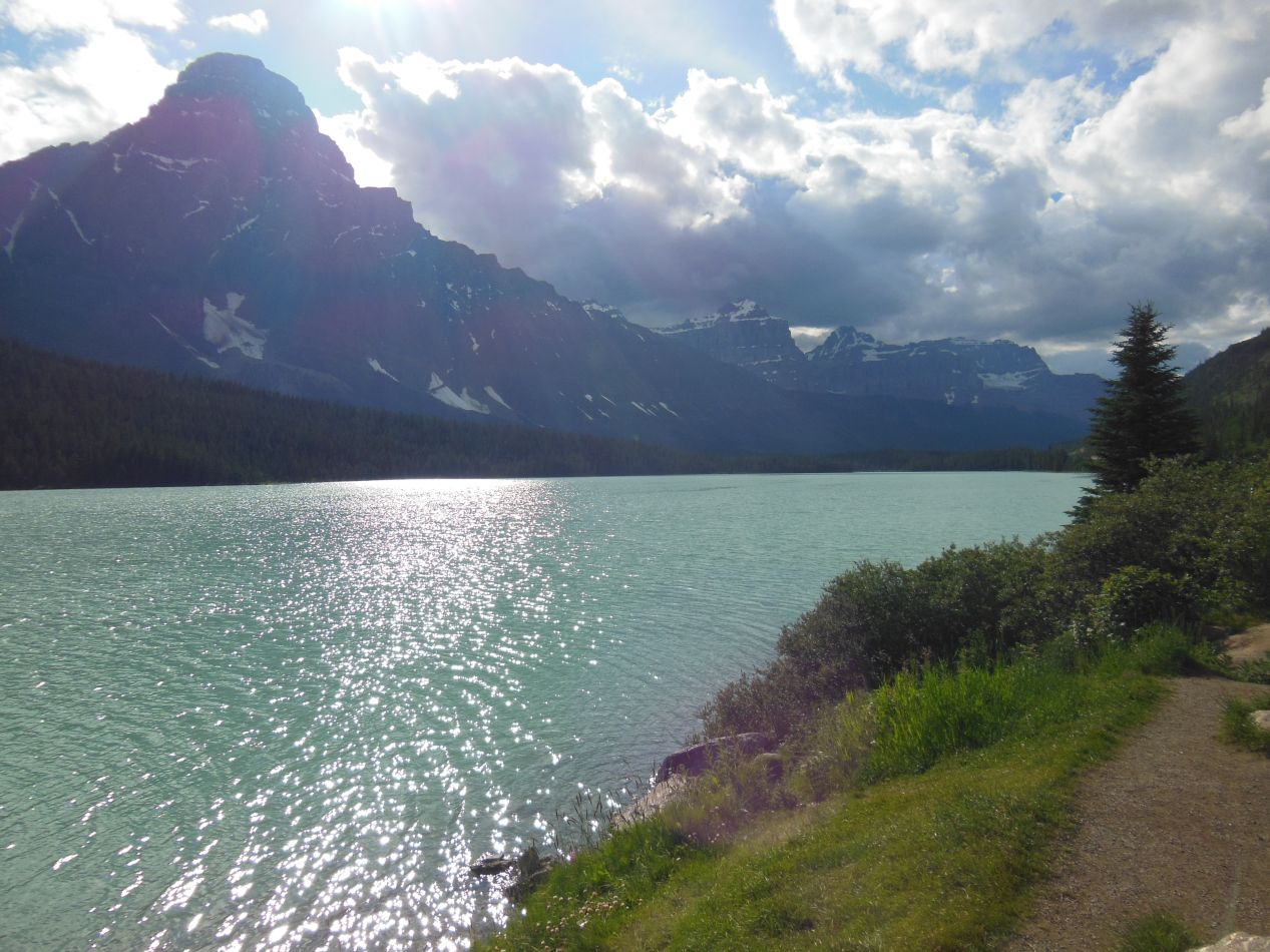
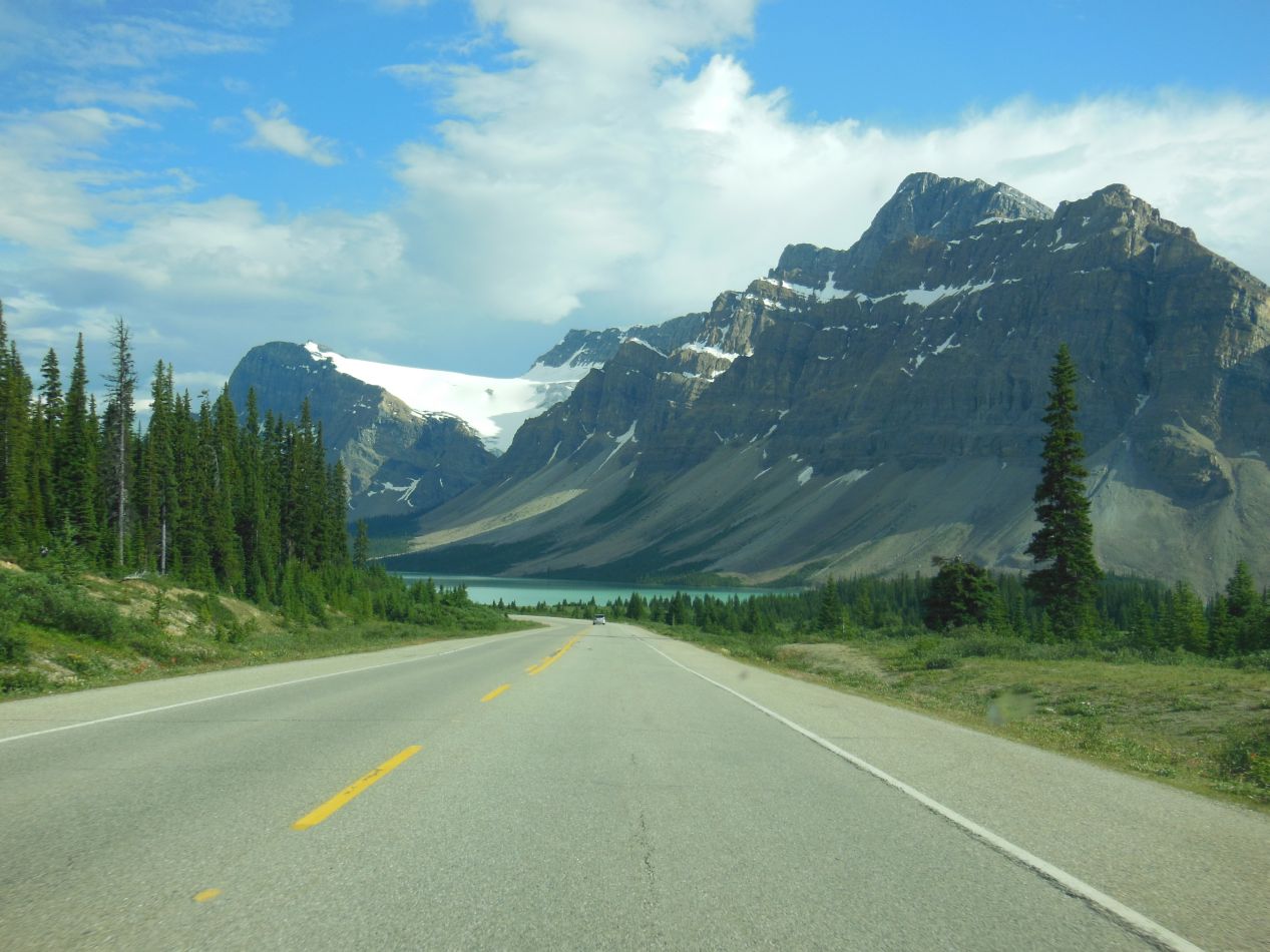

I took all of the above pictures while driving south along the Icefields Parkway. This stretch of highway between Parker Ridge and Lake Louise had a series of gorgeous mountain lakes, with the minerals from glacier runoff giving them a distinct turquoise cast. Add in the whitecapped mountains surrounding them, and it looked like something out of a movie set. Sometimes it's hard to believe that places as beautiful as this really exist.


No particular comment here, I simply wanted to post more of the pictures of these dazzling mountain lakes that accompany the Icefields Parkway.


Eventually I reached Lake Louise in the late afternoon. Somewhat surprisingly, there was a brief but torrential downpour of rain as I was arriving in the town, which fortunately did clear up afterwards. Lake Louise is an even smaller hamlet than Jasper, with only 1000 people living here year round. There were very limited places to eat here, only a single shopping center with about half a dozen stores open. Fortunately I had booked a reservation to stay at the hostel in Lake Louise well ahead of time, as this place was indeed full due to the limited capacity in the town. The main thing that I remember about staying here is that I had a roommate who wouldn't stop talking and it was pretty irritating. That is one of the downsides to being in a hostel with group lodgings.
Anyway, it was quite a day driving south along the Icefields Parkway. I had traveled to the top of two mountains, spotted three bears, seen multiple waterfalls, and walked on a glacier. Not bad for one day's travel! Next up I would be exploring Lake Louise before heading on further south to the resort town of Banff.


