
Every now and then, I get the chance to travel for my work to different parts of the United States to take part in conferences held by the American Medical Association. I've written about a number of these previous trips that took me to places like Miami and Phoenix and San Diego. During the spring of 2023, another one of these work trips took me back to San Diego for the third time in eight years (and fourth time in total after visiting earlier as a kid). I had previously walked around the central downtown part of the city and then visited the San Diego Safari Park outside of the city on my followup trip. For this latest trip to San Diego, I decided to get a rental car for the day and drive around to various attractions that I hadn't previously experienced. There's no particular connection between these locations other than "things that I thought would be interesting" in the greater San Diego area. Before the day was finished, I would be visiting the Pacific coastline, the San Diego Padres baseball stadium, the oldest mission church in California, and the campus of San Diego State University. As I said, a bit of an eclectic bunch.
The day started out with an early morning flight from the Washington DC area to the San Diego airport, with my flight arriving around 11:00 AM local time. I was able to pick up my rental car without needing to wait (Tuesday mornings in April not exactly being the height of the tourist season) and found that I'd been given an older car that was very much at the low end of the pricing spectrum. I didn't need newer features like an onboard computer or a backup camera but it was amusing to find myself in a car that didn't even have power windows - I think it had been about 20 years since I was in a vehicle with the manual rollup knobs. This was perfectly fine for a single day though and I spent the next half hour driving westward towards the Pacific coast. I was going to visit Cabrillo National Monument which is located at the tail end of Point Loma:

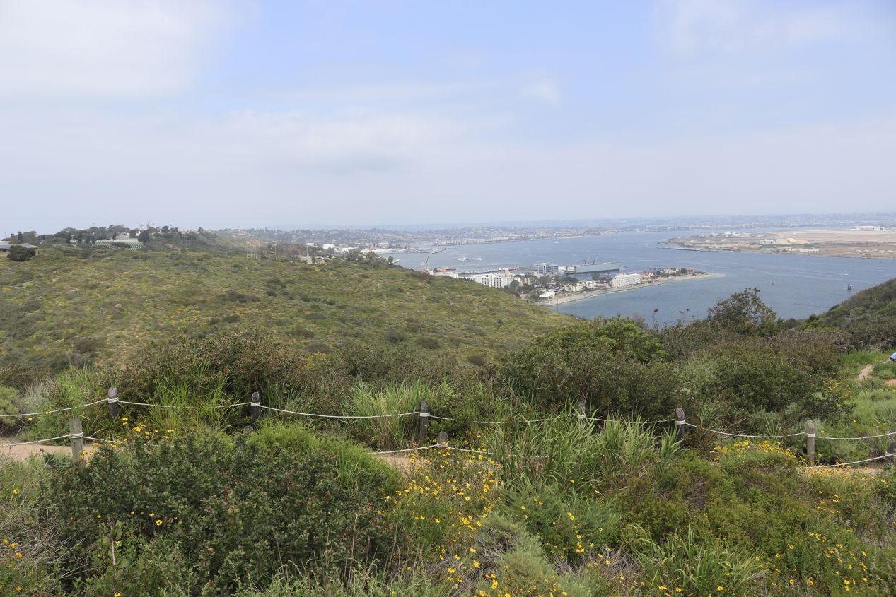


As the name suggests, Cabrillo National Monument commemorates the landing of Juan Rodríguez Cabrillo at San Diego Bay on 28 September 1542, marking the first time that a European reached what would later become the western coast of the United States. Situated at the very bottom edge of Point Loma (the rest of which is mostly taken up by US military installations), this national monument served up some lovely views looking out at the island of Coronado and the city of San Diego across the waters of the harbor. The parking lot was mostly deserted on this random Tuesday morning and I was able to poke around the visitor center without needing to wait in line. There was a small exhibit here on the background of Cabrillo and his 16th century expedition which had the goal of mapping out the Pacific coastline and made it as far north as San Francisco Bay before turning back to the Spanish possessions in Mexico. Like many of the early explorers, Cabrillo did not survive this trip: he cut his leg on a jagged rock which then became infected and led to his death from gangrene. Medical treatment in the early modern period was... not great.

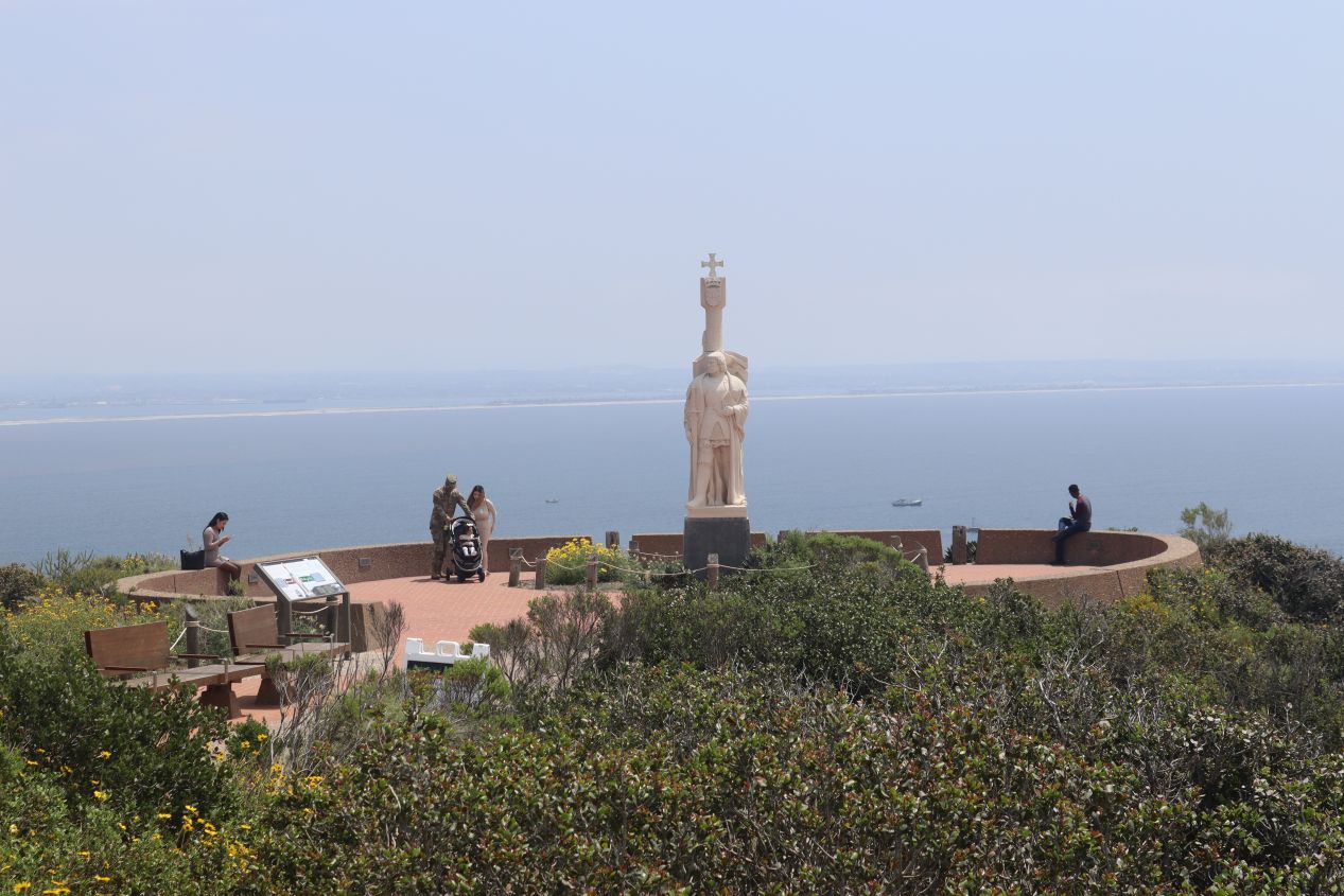


Near the visitor center was a statue of Cabrillo himself situated on top of a hill with steep slopes leading down to the water below. The statue has an interesting history as it was commissioned by the Portugese government in 1939 and gives Cabrillo his Portuguese name (João Rodrigues Cabrilho) despite the fact that the man sailed under the Spanish crown. The statue arrived too late to be part of the 1940 Golden Gate International Exposition in San Francisco and spent some time sitting in a private garage followed by a military base before it was finally put on display here in 1949. The current statue is a replica as the original one was badly eroded by wind and surf. The real attraction of this spot was not the statue though but rather the gorgeous views looking out across San Diego Bay. The downtown was easily recognizable past the airfields on Coronado and I could make out the convention center and the baseball stadium when I zoomed in with my camera. This spot was also isolated enough that my phone thought that I'd crossed the border into Mexico - it sent me a bizarre "welcome to Mexico!" text that I definitely hadn't been expecting.

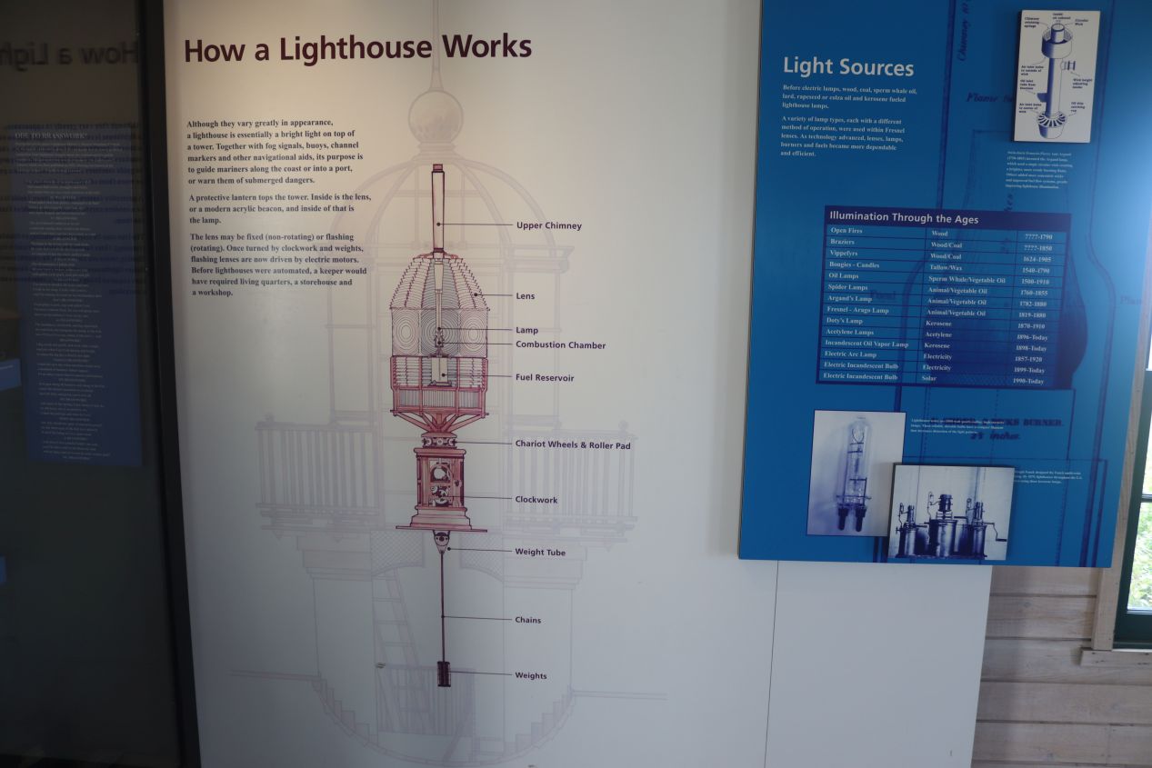


The other item of note near the visitor center was Point Loma Lighthouse which was a short walk away from the Cabrillo statue. This was a reconstruction of the lighthouse that had been built here in 1854-1855 to help serve as a navigational aid for ships entering San Diego Bay. Point Loma seemed like an ideal location for a lighthouse due to its height atop the cliffs overlooking the harbor. However, the lighthouse was somewhat limited in effectiveness as its 400 foot / 125 meter height meant that fog and low clouds often obscured the light from the view of ships - whoops. Point Loma was a long distance away from the fledgling city of San Diego back in the 19th century and the life of a lighthouse keeper seems to have been a very lonely one. There was a little house included as part of the lighthouse and a tiny museum giving some of the backstory of the place; it seemed as though it deserved its nickname of "Point Lonely".

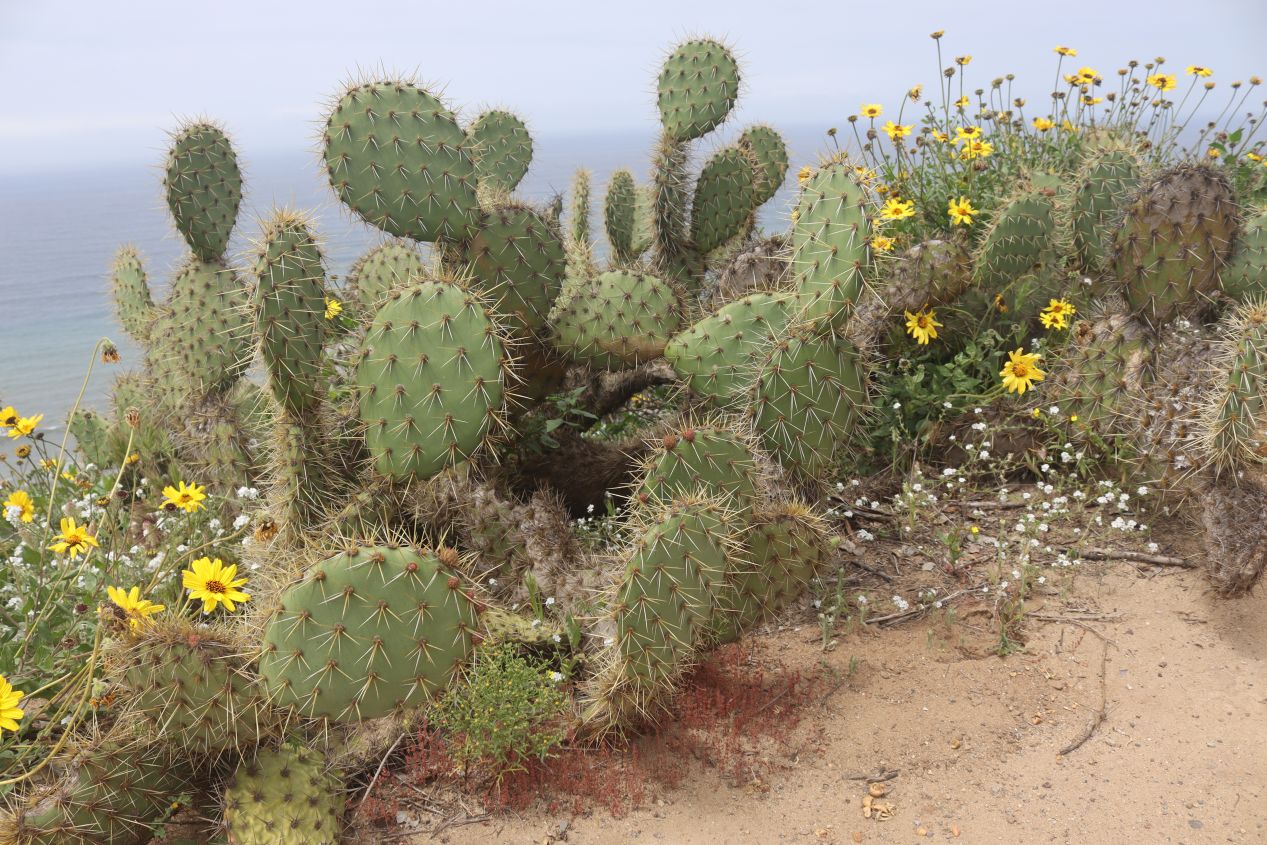


Cabrillo National Monument has some excellent hiking trails that follow the path of the coastline. Unfortunately I didn't have enough time for a hike and instead had to content myself with driving down to the seashore which is known for its tidal pools. The Pacific coast was quite arid here (maybe not surprising with Baja California not far away) and the plant life seemed to be comprised of scrub brush and even some cactuses. As I drove down to the parking lot at the base of the cliffs, I could feel the sea breeze coming off the water and hear waves crashing into the rocks of the shore. I'm always struck by how different the Pacific coast looks from the gentle flat beaches that I experienced near Ocean City, Maryland growing up as a kid. There's nothing like this on most of the eastern seaboard.

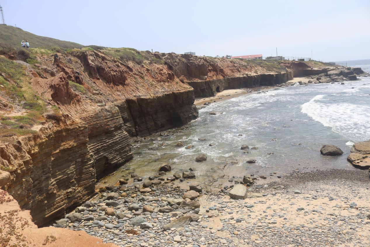


The tidal pools were a spectacular series of craggy rocks where the cliffs met up with the ocean below. There's supposed to be all sorts of animal life that flourishes in this intermixing zone between land and sea, including algae, barnacles, sea lettuce, mussels, sea snails, anemones, hermit crabs, sea urchins, and shore crabs. It was near low tide at the time of my visit and the rocks were exposed to the sun for the moment. There were about a dozen different signs warning visitors not to go near the water due to strong currents which must mean that people ignore those warnings all the time. I didn't see too much in the way of crustaceans but I did see lots of birds flying overhead, especially a group of pelicans that kept sweeping through in formation while riding the strong ocean winds. This was a beautiful place to watch the waves smashing themselves against the rocky coastline and I happily would have stayed longer if I didn't have other places to be around town.

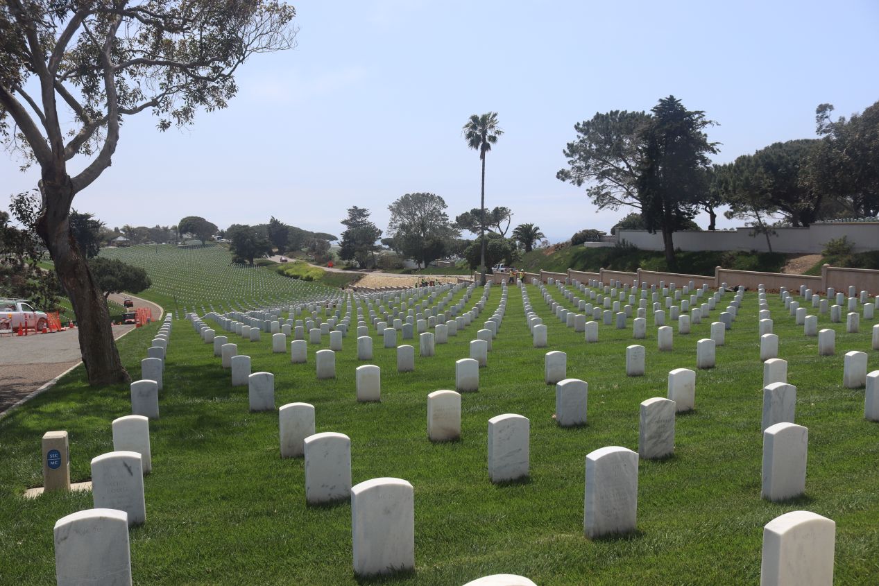


I made one unplanned stop as I began the drive back from Point Loma. I had seen huge numbers of tombstones while driving down to Cabrillo National Monument and realized that this had to be a military cemetery. Sure enough, I read signs indicating that this was Fort Rosecrans National Cemetery and stopped to take a few pictures before returning to San Diego proper. This cemetery dates back to the late 19th century and became a national cemetary in 1934; there are about 120,000 former US service members and their families buried here. There are about two dozen recipients of the Medal of Honor buried here as well as a number of memorials to ships that were sunk while on duty. The location was simply beautiful, with the grave sites running along a series of hills looking out over either San Diego Bay or the Pacific Ocean. I can think of few places better to be buried and a lot of places that would be worse.

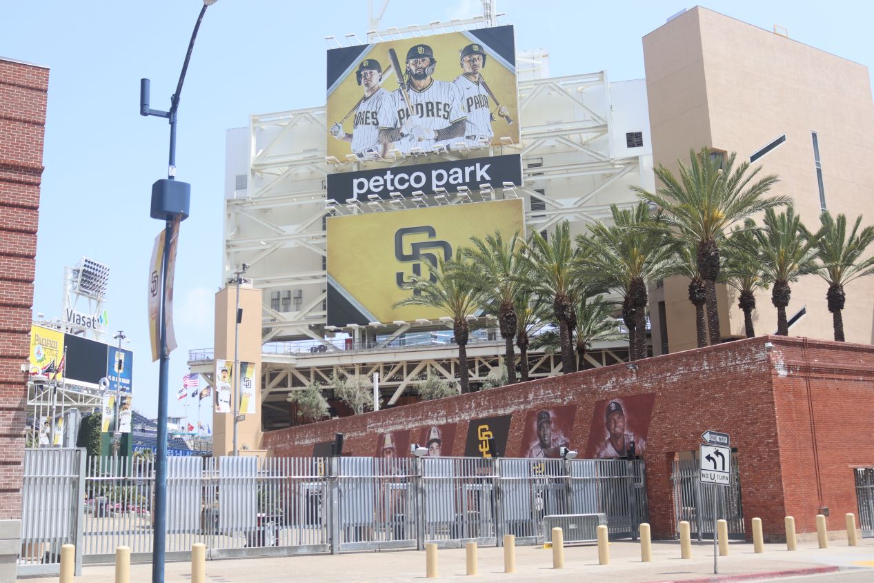


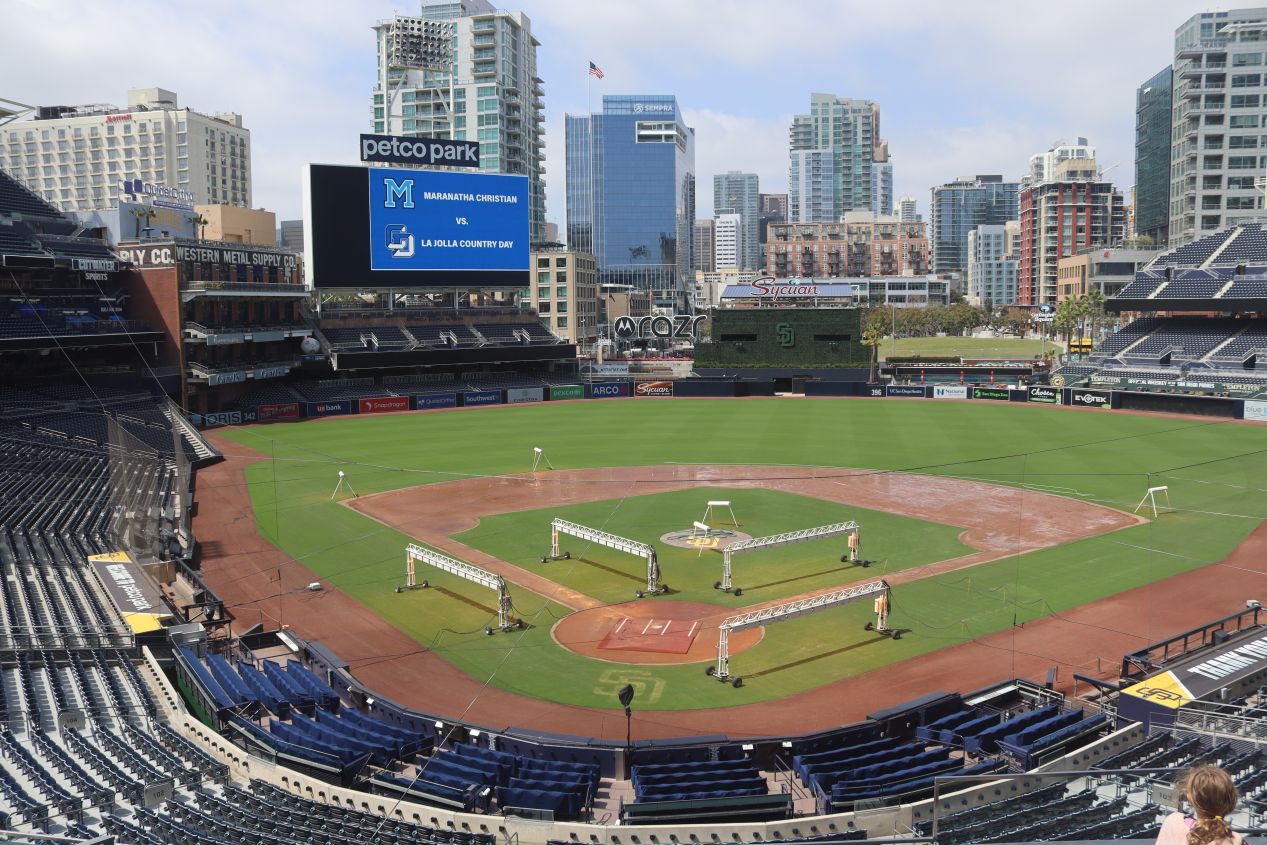
I hadn't been able to spent too much time at Cabrillo National Monument because I had one scheduled event during the afternoon: a tour of Petco Park taking place at 2:00 PM. This is the baseball stadium for the San Diego Padres and is widely seen as being one of the nicest places to catch a baseball game anywhere in the USA. Petco Park is situated at the edge of the city's Gaslamp Quarter, a bustling historic area full of trendy shops and restaurants, and it was the construction of the stadium that helped to revive what had been a rundown part of the downtown. I checked in for the tour about 15 minutes ahead of time and passed the remaining minutes by walking around in the Padres team store. There was the expected assortment here of every possible merchandise under the sun plastered with the Padres team logo. I have to say that I don't think the team uses particularly attractive colors; yellow and brown simply don't look that good as a uniform.

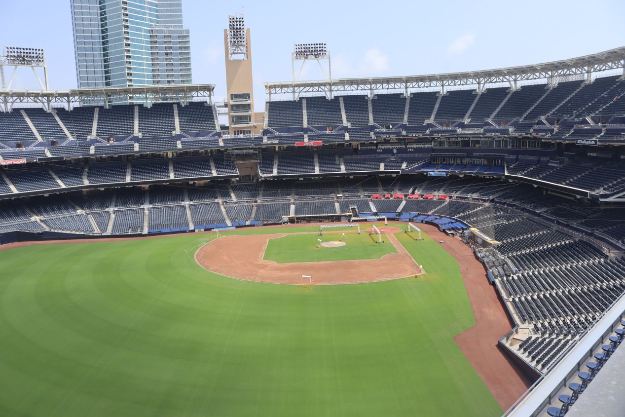


The ballpark tour was hosted by a retired man who had come to live in San Diego due to the military (very common in the city) and had become a big Padres fan over the last three decades. The tour began atop the Western Metal Supply Company building out behind the left field fence. This is the most famous feature of Petco Park, a historic building that couldn't be torn down and was therefore incorporated directly into the construction of the baseball stadium itself. We had great sight lines from here looking out at the seats across the rest of the stadium as well as outside towards the convention center. San Diego's convention center is one of the largest in the United States and has become famous for hosting Comic-Con each year. Just to the south on the other side of the rail tracks was the Hilton Bayfront hotel which happened to be where I was staying for the AMA conference. This was certainly a convenient (and expensive) hotel location!


Petco Park is one of the smaller stadiums in terms of seating capacity for Major League Baseball and it had a very open feel to it. This impression was enhanced by the fact that most of the concession stands were situated next to the stadium in their own buildings rather than being incorporated into the stadium itself, leaving room for more unobstructed views. We were taken to the press box where we could see the perspective of the local and visiting media members who came to cover the Padres. There was a good bit of Padres memorabilia on display here including the pictured wall dedicated to the team's three Hall of Famers. Dave Winfield didn't even play that much of his career with the Padres and mostly went into the Hall wearing their uniform as a way of spiting the Yankees while Trevor Hoffman was a closer, generally not seen as a terribly valuable role by modern analytics. At least Tony Gwynn was beloved by everyone; I'd be seeing a lot more stuff with his name on it throughout this tour.


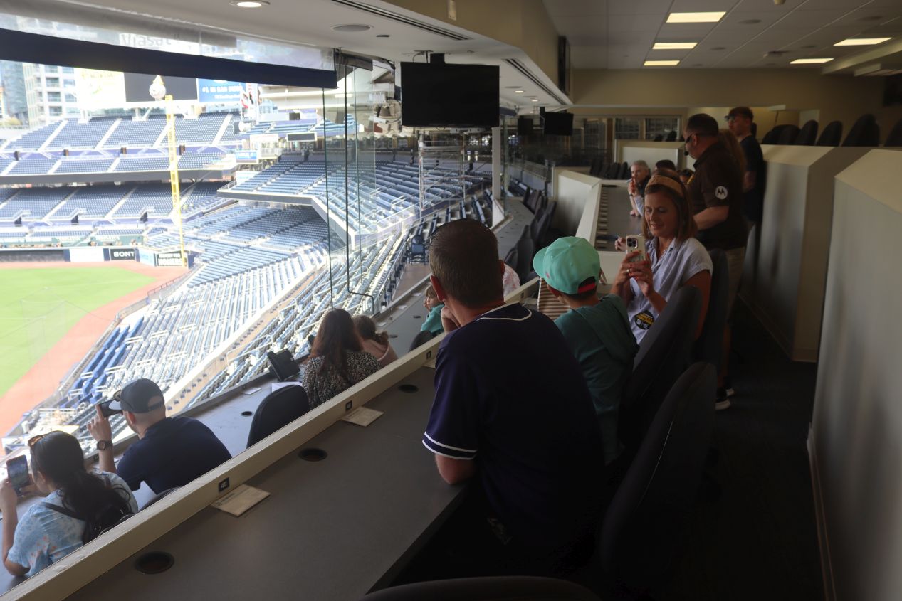
The next part of the tour brought our group into one of the super-luxury boxes available for purchase by corporate groups. All of the luxury boxes are extremely expensive places to watch a baseball game but this one, the "Chairman's Club", cost roughly $50,000 to book. That's per-game, not for the whole season, mind you! It had its own private catering service, full wine bar with dozens of different vintages, and one of the best sight lines possible to watch the game from behind home plate. Then downstairs below the stadium was the Home Plate Club where the last two pictures above were taken, another private area for big spenders to eat and drink before the game while watching the Padres players take indoors batting practice. While all this stuff was certainly impressive, it definitely spoke to the notion that the ultra-rich have way too much money for their own good. I'd like to think that this kind of wealth could be put to better use than accomodating absurd degrees of luxury spending.

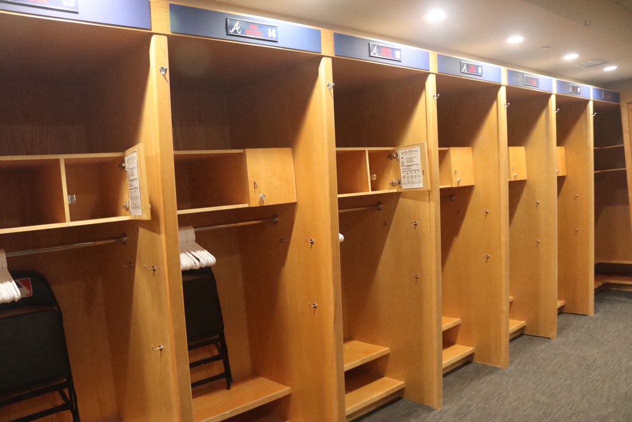


We were then taken to the visiting team's locker room which was only available to see because the Padres were out of town this week. (I'd been hoping to go see a game in the evening and thus had to settle for this ballpark tour instead.) The Padres had most recently played the Atlanta Braves and therefore the locker room was still set up with the names of the various Atlanta players. Apparently each visiting team can assign the players wherever they want to put friendly players next to one another and keep disgruntled players apart. There were tables here for eating or playing cards, a video replay booth so that the coaching stuff can investigate whether to challenge disputed calls, and even a big Golden Tee machine because apparently professional baseball players love video golf. Then we headed out onto the field itself at the visiting team's dugout on the third base side. It was much smaller than the dugouts look on TV and apparently the Padres actually have a dugout that's about 35% larger than what the visiting team gets - the perks of home field advantage. It was another nice day outside, typical for San Diego, and the sun was bright in our eyes from being down at field level.

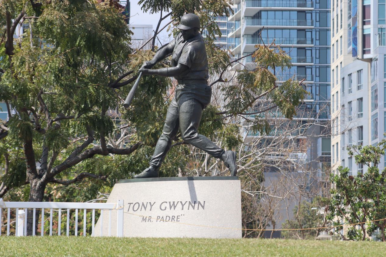


The tour concluded by taking the group through the outfield seating areas and circling back to where it had begun. Petco has a really neat "Park at the Park" grassy seating area behind center field where fans can purchase very cheap tickets and sit on the lawn to watch the game, great for bringing young children who might want to run around. This is also where the Tony Gwynn statue is located; sadly, Gwynn died at the young age of 54 in 2014 due to throat cancer from his lifelong habit of using chewing tobacco. There's a newer statue of Trevor Hoffman next to the bullpen area but it lacks the same reverence from the Padres fanbase. The northwest corner of the stadium next to the team store also contained the Padres Hall of Fame with additional information about the franchise and some of its most famous players. The Padres have not been terribly successful as a team since their founding in 1969, never winning a championship (as of 2023) and having made the World Series only twice in 1984 and 1998. They've almost always been overshadowed by the Dodgers and the Giants, their main West Coast rivals. As an Orioles fan, I have no animosity towards the Padres and would love to see them finally break through with a title at some point.

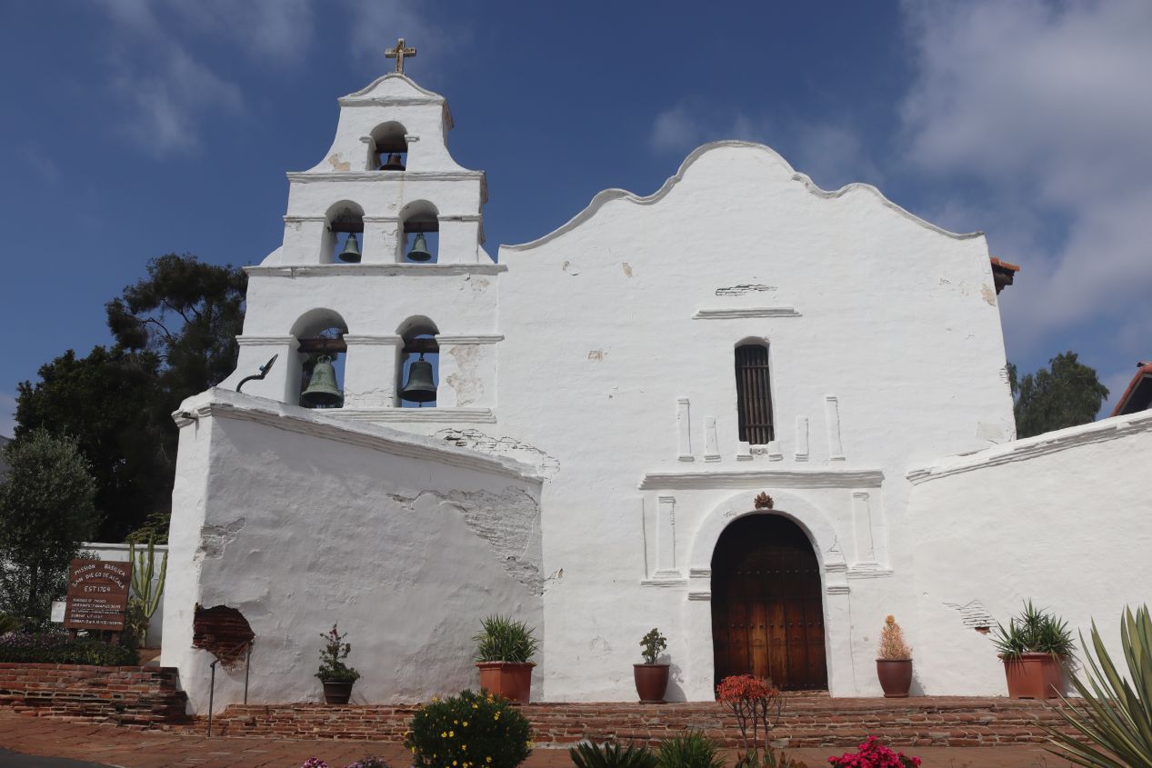


I couldn't stick around to spend more time in the Padres Hall of Fame because I had to make it to the next attraction on my list before it closed. The ballpark tour wrapped up at about 3:15 PM and that didn't leave much room to make it to San Diego de Alcalá Mission before it shut for the day at 4:00 PM. I drove north through the downtown streets of San Diego and arrived about 15 minutes prior to closing time, with the staff on site kindly not charging me the usual admission fee since the day was nearly over. As the sign out front proclaimed, San Diego de Alcalá was the first mission to be established in what's now California back in 1769. It was part of a Spanish colonial effort to take control of the Pacific coastline with a series of missions that stretched up to the San Francisco Bay region. The current mission is the fifth one to stand on this spot and dates back to the early 19th century; several of the early missions burned down in fires and the original one was destroyed in a Native American uprising in 1775.

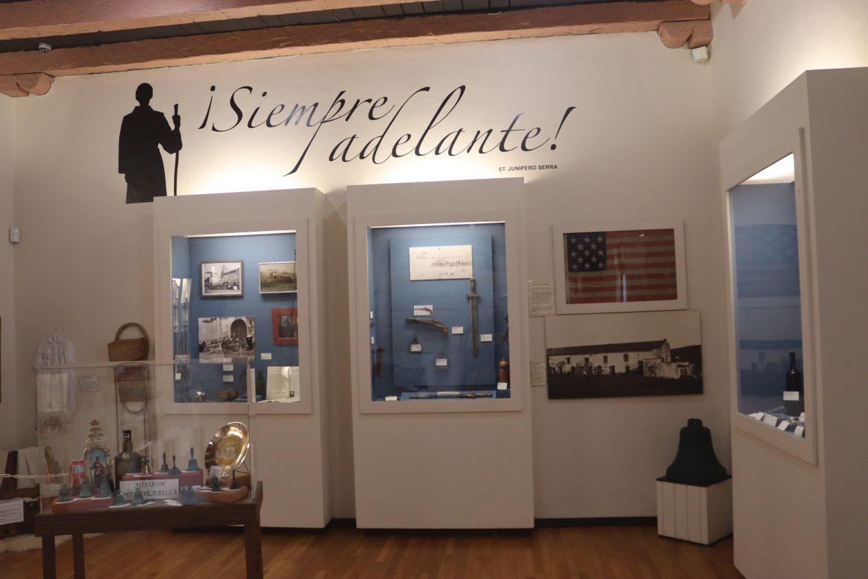


There was a small museum attached to the mission which went into more detail about its history. The missions were intended to serve as vehicles for converting the local peoples to Christianity and tying them eventually to the Spanish crown; they were somewhat if not totally successful at these goals. This was an extremely remote area in the late 18th century and the missions had to be self-sustaining, with San Diego de Alcalá focusing on agriculture (which went poorly due to the dry climate) and livestock breeding. Ownership of the mission changed hands several times, first during the Mexican war of independence against Spain in 1834 and then again following the Mexican-American War in 1848 when it was seized by the American government. Under Abraham Lincoln, the California missions were returned back to the Catholic church where they've remained ever since. Outside the little museum, I found a small garden which was a lovely place to sit and rest for a few minutes, along with the historic bell tower that called the mission to mass. These bells are all replacements, unfortunately, as the originals were lost decades earlier when the mission fell into disrepair.

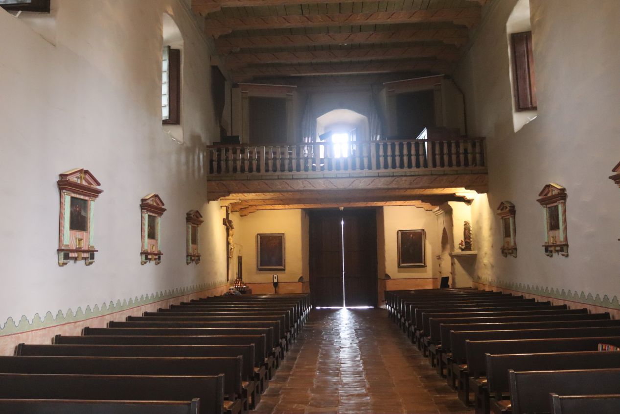


Finally there was the mission church itself at San Diego de Alcalá, this structure dating back to 1813. The church was built in classic Spanish colonial architecture style, which made sense since it was built during the Spanish colonial period, and it felt noticeably older than the rest of the buildings on the site. In a bit of a grisly detail, Father Luis Jayme, California's first Christian martyr who was among those killed during the 1775 uprising against the mission, lies entombed beneath the floor of the church. (I believe the spot was the white cross on the floor next to the altar.) San Diego de Alcalá definitely reminded me of some of the old churches I had seen on earlier trips to New Mexico and Texas, all of them united by the Spanish and then Mexican presence in these states. It's easy for Americans to forget the Spanish cultural influence on these areas centuries before English-speaking Americans began to arrive.

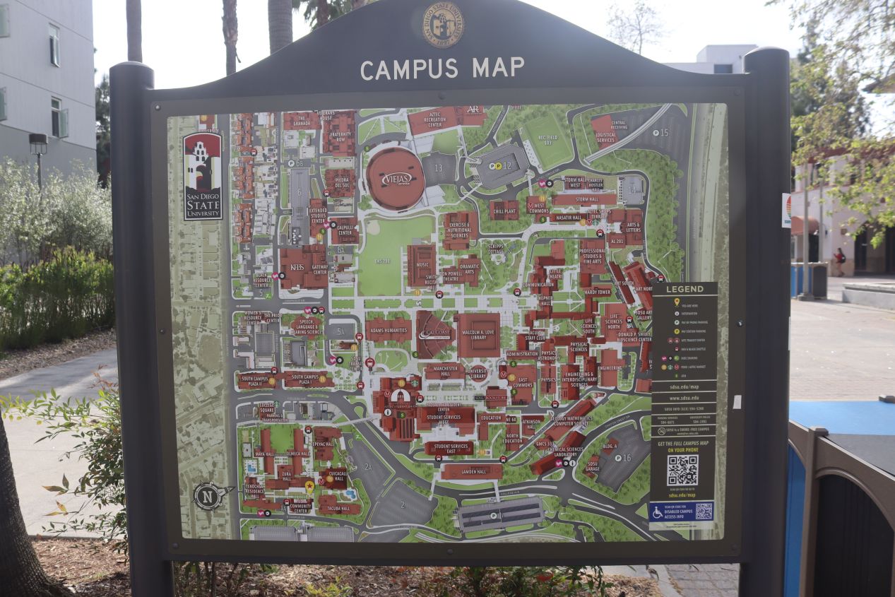


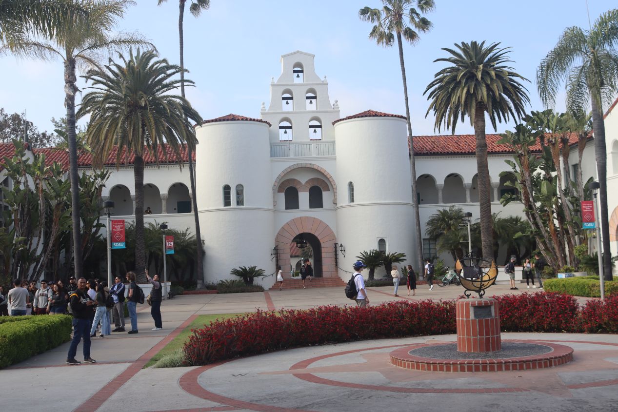
San Diego de Alcalá's early closing was the last time-based obstacle that I had to navigate on this day which meant that I could relax a bit while visiting my remaining targets. I was heading next to nearby San Diego State University which took a surprisingly long time as I had to fight my way through rush-hour traffic and then find a place to park on campus. In any case, I found a garage on the east side of campus and walked from there across the Aztec Center Bridge towards this building pictured above, the Aztec Student Union. San Diego State is somewhat surprisingly the third-oldest university in the California university system and dates back to 1897 when it was founded to educate local women as elementary school teachers. Needless to say, SDSU has changed a lot since then and now has an enrollment of roughly 35,000 students; it's particularly known for enrolling large numbers of Hispanic and Asian American students. The student union building that I passed through was clearly inspired by the same Spanish colonial architecture style that I had just seen at San Diego de Alcalá and would be repeated as a design motif throughout the campus.

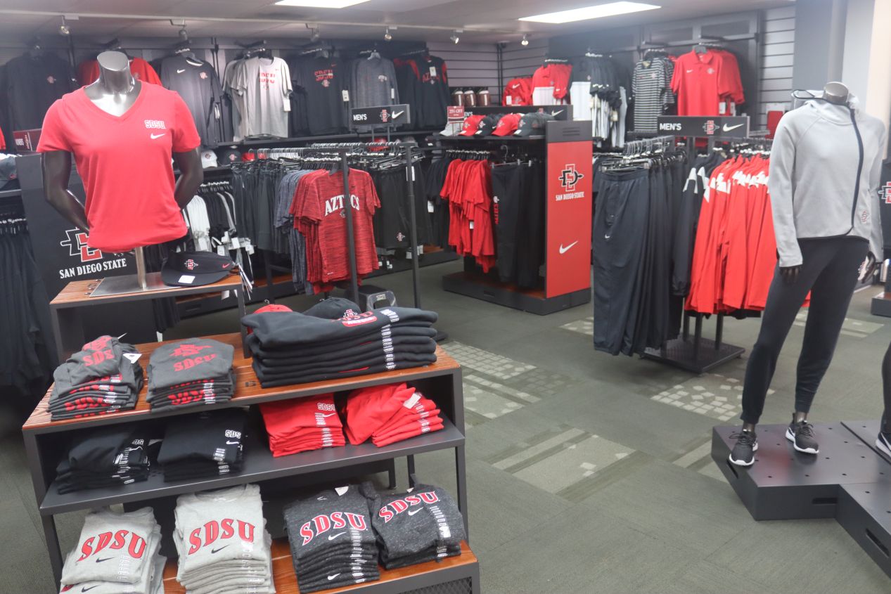


I walked north from the student union through Centennial Plaza, passing by the campus library to my left and then finding myself at the SDSU bookstore. This was the place to get all kinds of clothing and souvenirs branded with the SDSU or Aztecs logo even if it wasn't quite as absurd as I've seen at some other American universities. The big news at the time of my visit was the SDSU men's basketball team which had stunningly made it all the way to the national championship game in 2023 before losing to UConn. That was an order of magnitude better than the team had ever done previously; they had never even reached the Elite Eight before, much less the Final Four! As for the "Aztecs" name used by the SDSU athletics teams, I was baffled as to why the university employed the name of a Native American group that hadn't lived anywhere close to San Diego. The Aztecs were based in central Mexico, more than a thousand miles distant. It turns out that this was another one of those problematic mascot names picked by the student body back in the 1920s when Native American groups were treated much the same way as animal mascots. SDSU has approached the subject much more respectfully in recent years, far better than this logo that they used back in the 1960s, but there's still been sizable pressure for the university to change the team name to something else. As of 2023, they were still using the Aztecs name though.


I wandered a bit further to the west and found myself in an open area named Campanile Mall looking towards Hepner Hall. This was a very pretty part of the campus and the design of this academic hall had to have been inspired by the nearby San Diego de Alcalá; that sequence of bells (which were chiming the hour for 5:00 PM as I passed) looked so similar that it couldn't have been a coincidence. Further to the west were the athletics fields and Viejas Arena where the university's basketball teams play. I took a quick look at these facilities and then looped around to start heading back towards where I had parked. One thing missing from the SDSU campus was much in the way of residence halls: there's apparently only room for about 4000 students to live on campus which means that something like 85 percent of the students are commuters. No wonder parking was so tough for me to find! This should be a clue that San Diego State caters mostly to middle class families and not the wealthy; rich Californians send their kids to Stanford or Cal Berkeley or UCLA. Thus you won't find a lot of politicians or businessmen among the list of famous SDSU alumni; names that I picked out from the university website were people like actor Gregory Peck and athletes Tony Gwynn and Marshall Faulk. Overall, I had good impressions of the rather small campus and I'm glad that SDSU provides educational opportunities to students from traditionally disadvantaged groups.

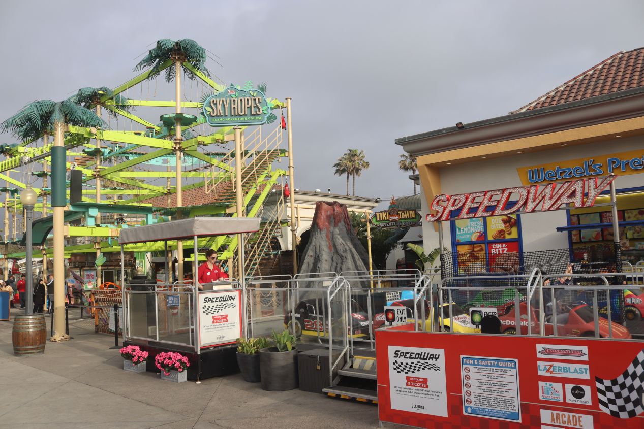


To close out the day, I drove west towards the setting sun until reaching the Pacific coastline once again at Mission Beach. This parking lot turned out to be located right next to the historic Belmont Park, an amusement park which has stood on this spot since 1925. The big draw here was the Giant Dipper, a wooden rollercoaster that dates back to the park's founding, and it was joined by a dozen other carnival attractions like bumper cars and tilt-a-whirls and so on. I was surprised to find that this random weekday in late April had drawn a pretty big crowd to Belmont Park, enough that the place was busy if nowhere near what the summer months would bring. Belmont Park included an indoor pool area named The Plunge, which was originally a huge saltwater enclosure before being torn down and replaced with the modern freshwater pool pictured here. My one disappointment was checking the arcade and failing to find a Dance Dance Revolution machine, oh well.

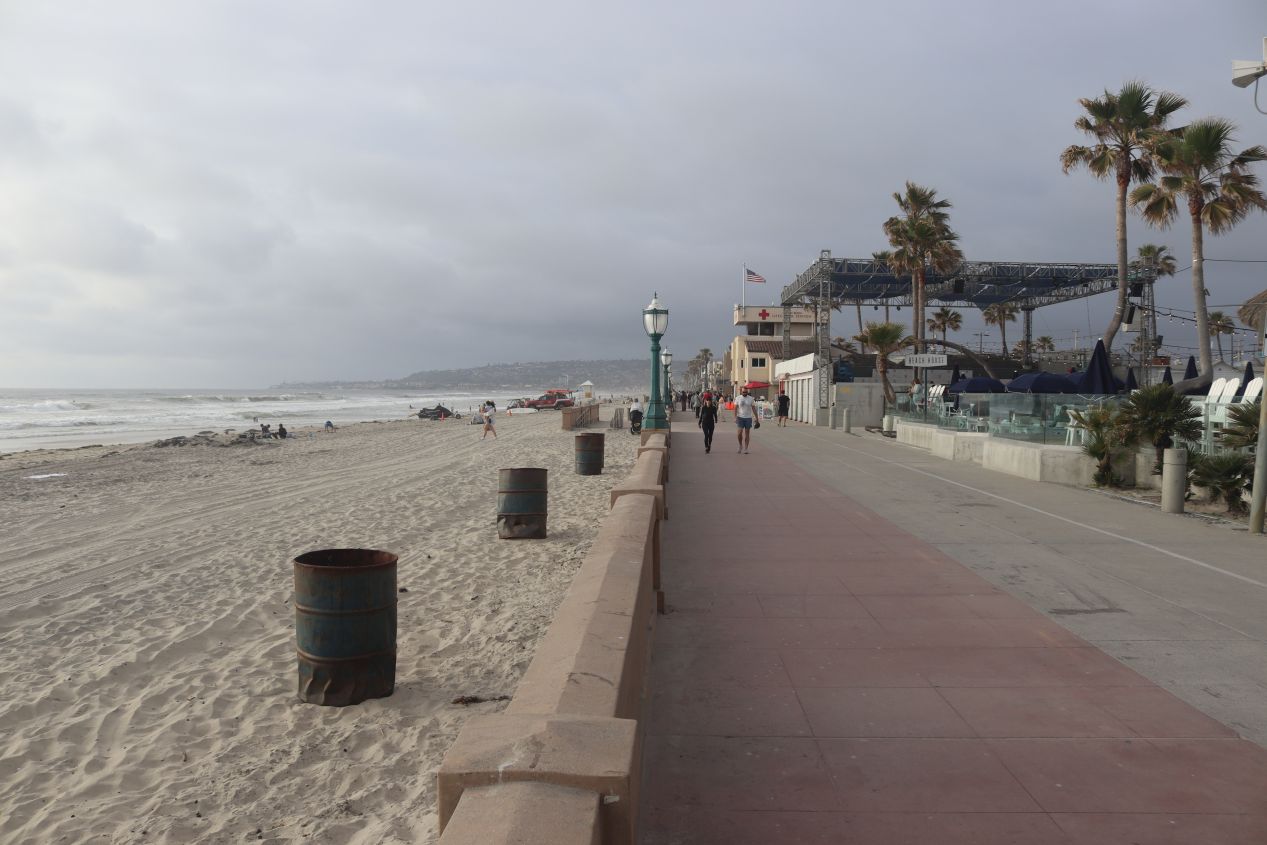


Then there was Mission Beach itself, one of the most popular shorefronts in the San Diego area. There was a boardwalk here with half a dozen restaurants crowded around Belmont Park, with the walking/biking path stretching several miles up to Pacific Beach and its Crystal Pier to the north. This is a great place to swim in the ocean, lay out in the sun, play beach volleyball, or simply relax in the fresh air with a good book. I was arriving towards the end of the day and unfortunately it was heavily cloudy by this point which meant that I wasn't able to watch the sun setting over the ocean. That's always a treat for someone who lives on the eastern side of North America, normally it's only sunrises that take place over the water on the Atlantic side. It was getting late by this point so I ate a quick dinner at a local pizza place, then returned my rental car to the airport and finally made my way to the Hilton Bayfront hotel that I'd spotted earlier in the day.

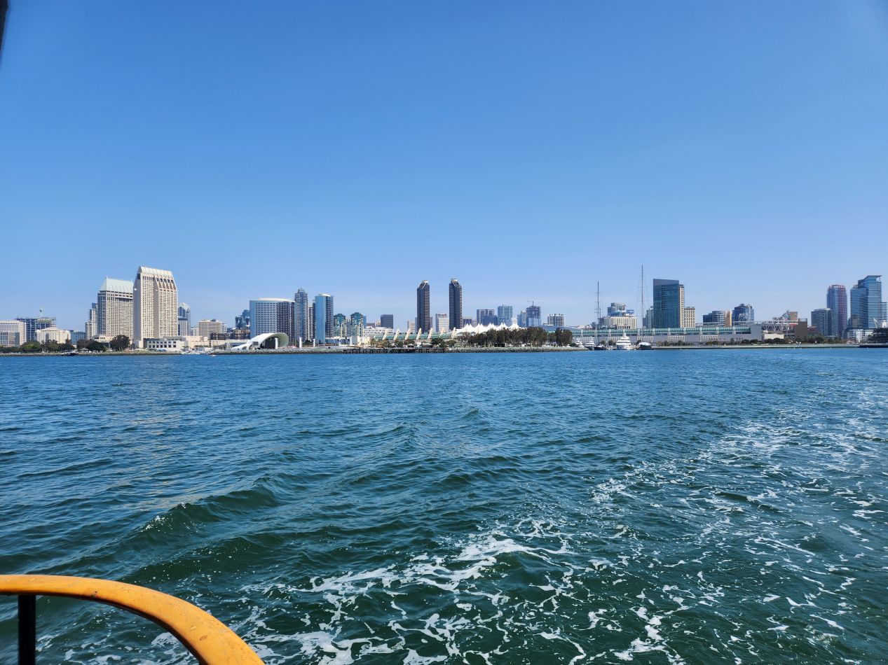


That was the end of my one true tourist day but I did manage to take a few additional pictures on the second day of the conference. We had a light schedule and my work colleagues decided to have a group lunch over on Coronado Island. This required taking the ferry that left near the San Diego Convention Center which was only a ten minute walk from our hotel. It was an absolutely gorgeous day (much nicer than the day when I initially arrived) and we managed to catch the ferry minutes before it departed for Coronado. It only took about five minutes to cross this narrow portion of San Diego Bay during which we enjoyed outstanding views of the skyscrapers in the downtown. I think everyone wished that we could stay out here for the rest of the day instead of needing to go back into more meetings later.

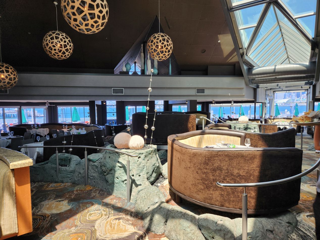


Most of the limited space on Coronado is taken up by a massive United States Navy base that employs about 15,000 people. San Diego is the home of the United States Pacific fleet and the city has always had a strong military presence as a result. In an amusing contrast, the remaining parts of Coronado are mostly given over to tourist draws such as this collection of shops and restaurants accompanying the ferry landing. There was a small walking trail that ran along the waterline which we followed for a little bit before turning around and heading back to get lunch at a restaurant named Peohe's which had the fancy decor pictured above. The plate of drunken noodles seen here was not actually from this restaurant (it was from an excellent Thai place in the Gaslamp Quarter) but we'll pretend that it was since I lack any pictures from this meal. Unfortunately we didn't have enough time to head over to the oceanfront side of Coronado where the famous and luxurious Hotel del Coronado is located. That will have to wait for another trip back to San Diego.


Finally a couple of pictures from the big conference room where I spent most of my time in San Diego on this trip. I always try to stress that these are primarily work trips and normally I'm in meetings from 8:00 AM to 5:00 PM (and sometimes later) every day. I'm fortunate to be able to take these occasional trips and I definitely feel like I've been able to maximize the modest free time that I do have for sightseeing on these excursions. In any case, thanks again for reading about this random collection of places that I visited in the greater San Diego area. I felt that I'd been able to see a good portion of the city across my several different trips here - but I'm always up for another visit, especially when the airfare was paid by someone else!


