
The Grand Tetons are a range of mountains in western Wyoming located a short distance to the south of Yellowstone National Park. They are protected with their own preserve known as Grand Teton National Park, named after the tallest mountain in the range. The snowcapped peaks of the Tetons rise up together and look a little bit like a row of teeth, making for extraordinarily photogenic vistas when seen from a distance. This is a popular destination for mountaineering, hiking, fishing, and other forms of recreation. In the winter, the nearby resort town of Jackson turns into a trendy base camp for skiiers that fly into the area at great expense. While we were here at the wrong time of the year for winter sports, we did plan to take advantage of the magnificent scenery to do some serious hiking up into the mountains. The Grand Tetons would be the place where we underwent the most strenuous sightseeing activities on the whole trip.

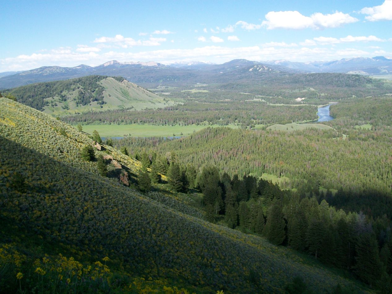


We arrived in the valley of Jackson Hole in the afternoon, driving down from the nearby Yellowstone National Park a short distance to the north. The close connection between the Yellowstone and Grand Teton parks is a major reason why so many visitors come to see the Grand Tetons, with over 3 million of them arriving annually at latest count. We first caught sight of the waters of Jackson Lake as we continued to head south. At the bottom of the lake there was a road leading up to the top of Signal Mountain, with an overlook at the top providing wide-angle views of the surrounding valley. These pictures were taken from the summit of that small mountain. Off to the east, the ground was mostly flat plains with the Snake River winding its way between the trees. The scenery to the west was clearly the more interesting direction, between the presence of Jackson Lake and the spiky points of the Tetons in the distance. It was too late in the day to head over to the mountains, and as a result we went to our hotel and had dinner in the town of Jackson.


We were up bright and early the next morning with the goal of exploring the peaks up close this day. This was the view from the side of the road as we drove towards the visitor center on the shores of Jenny Lake. The Grand Tetons were enormous and looked so picture-perfect that they didn't seem quite real. It was a bit like seeing a fake computer-generated background in a movie, everything looked a little too good to be believed. Part of the reason why the Grand Tetons have this dramatic appearance is due to their relative youthfulness as mountains; this is the youngest mountain range in the Rockies at less than 10 million years old. There hasn't been enough time for the peaks to be worn down by the elements and they still appear fresh and new, or at least as new as anything with an age in the millions of years can be.


For those of you who like maps, I added the two images above sketching out our path of travel for the day. The three dimensional topographical map was located at the Grand Teton visitor center on the eastern side of Jenny Lake, where the red arrow with the "you are here" message indicated. This provided a good overview of the valley of Jackson Hole, with north on the right side of the map as photographed. Jackson Lake dominated the northern end of the valley before giving way to a series of plains that the Snake River flowed through, as we had seen the previous day from the vista on top of Signal Mountain. The second image was the trail map that I used for the day with our path highlighted in yellow. We would be crossing over to the other side of Jenny Lake by boat and then heading up into Cascade Canyon on a hike into the peaks of the Tetons. Of course the path on here was something that I highlighted after the fact; we didn't know where we would be going when we set out in the morning.


There was a small ferry boat service that took pedestrians over to the other side of Jenny Lake, saving a walk of at least two miles around the edge of the water. It was a great deal of fun to be out on the water under the bright light of a glorious summer day. We could see the mountains of the Tetons straight ahead as our boat crossed the lake, with forests on the lower slopes slowly giving way to scrub grasses and then eventually rock and snow up at the peaks. There were plenty of kayakers out on the deep blue waters as we passed by. Jenny Lake was frigidly cold to the touch, and if there's one thing that no one was doing here, it was going for a swim in the snowmelt-fed waters.

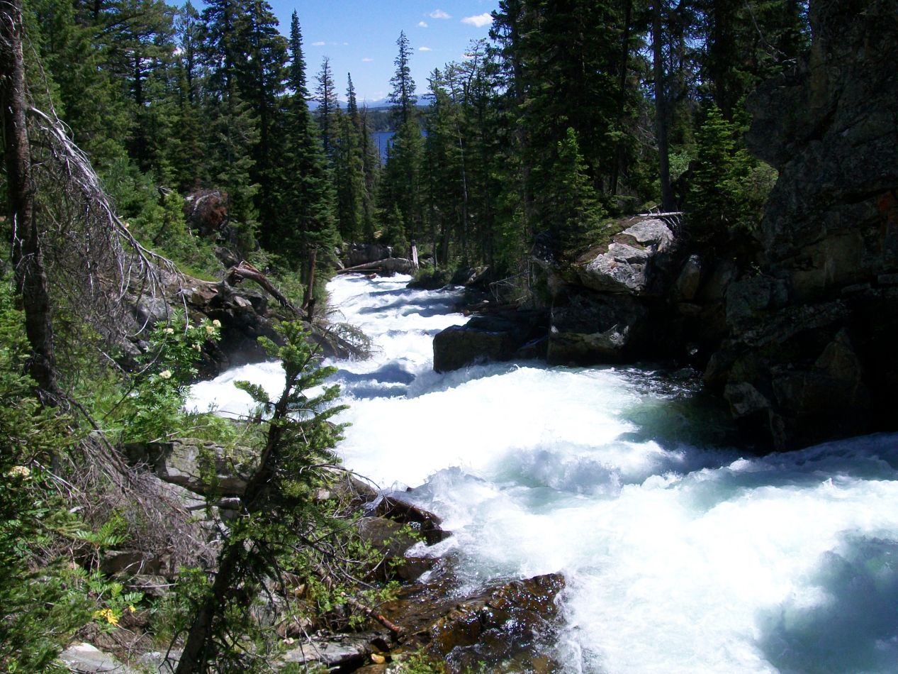


The hiking trail on the other side of the lake had two attractions within easy reach. We walked together to the first one of these, a nearby waterfall known as Hidden Falls. This was an area of dense forest where the small Cascade Creek was churned up into a raging froth as it passed over a series of rapids. Flash floods out of the mountains are a real danger here, and we could see the aftereffects of one such recent storm in the form of a collapsed bridge. We had to detour around a longer route to reach the base of the waterfall. The Hidden Falls were quite impressive, making a loud noise as water fell approximately 100 feet / 30 meters down from above onto a series of jagged rocks. The terrain was quite hilly near the boat dock that crossed Jenny Lake, and this was how the water in Cascade Creek made its way down to the lower elevation of the lakeshore.

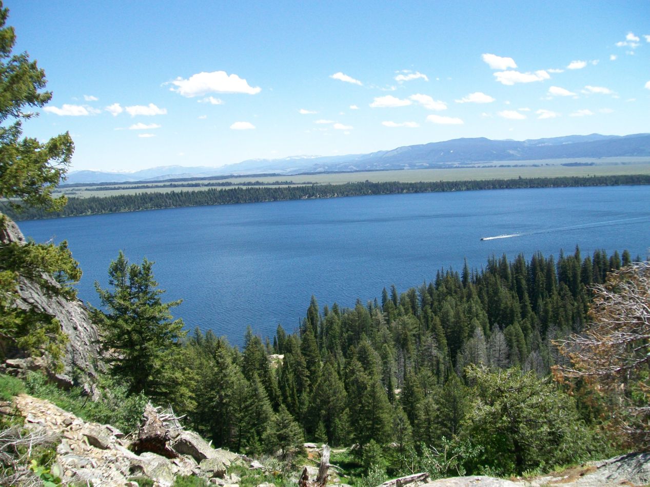


The other attraction near the boat dock was Inspiration Point, a scenic overlook with commanding views that stretched out across the lake and onto the plains beyond. Inspiration Point wasn't located very far away as the crow flies, but it was a bit of a difficult hike due to the distance being located almost entirely up above the starting point. We needed to climb up a series of switchback turns along a rock face, and while I've had more difficult hiking in other places, this was far from easy. Many of other tourists on the trail were visibly struggling at the uphill climb, needing to pause frequently for rests as they headed upwards. It was worth the effort for the views at the top, however, which truly were spectacular. Jenny Lake became a beautiful blue pool when viewed from above, with the ferry boat looking like a toddler's toy craft. Based on the elevation signs, Inspiration Point was about 400 feet / 125 meters of vertical elevation above the shore of the lake; the hiking trail was less than half of a mile in length. As I said, it was a steep slope upwards.


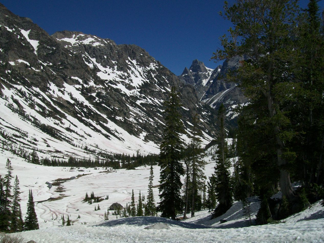
At this point, my brother Scott and I split off from our parents to spend some time hiking on our own. We planned to meet back at the Jenny Lake visitor center in about four hours, and we wanted to see how far we could make it in that time span before needing to turn back. There was only one trail to follow from the top of Inspiration Point, with that being the Cascade Canyon Trail that followed the river back upstream into the mountains. Signs said that it was 4.5 miles until reaching a fork in the trail, and we were confident that we could make it that far before needing to turn around. This was a relatively easy hike that sloped only gradually uphill, certainly a lot less steep than the trip up to Inspiration Point. We enjoyed watching the amazing mountain scenery pass by on both sides as we hiked deeper into the Tetons. Everywherer that we looked there were little streams of water falling down from the melting snow at the top of the peaks, which eventually made its way into the Cascade Creek and from there to Jenny Lake. Scott insisted on taking at least a few pictures of me during our hike, and as a result this is one of the few parts of the trip where I'm photographed. Back in 2011, neither of us had cell phones with cameras yet.


We made it to the fork in the trail without incident and stopped to take a quick rest there next to a bridge over the river. We were doing fantastically well on time, only needing about 75 minutes to reach this point. That prompted a quick discussion; if we were to turn back now, we would likely find ourselves waiting around with nothing to do for some time at the visitor center. Instead, we decided that we would try pushing onward to reach Lake Solitude, listed at 2.7 miles distance ahead. That should be doable in about an hour, and then we would turn around and head back. Hurricane Pass would have been awesome to see (there's a glacier there called the Schoolroom Glacier) but was clearly too far away. Lake Solitude it would have to be.


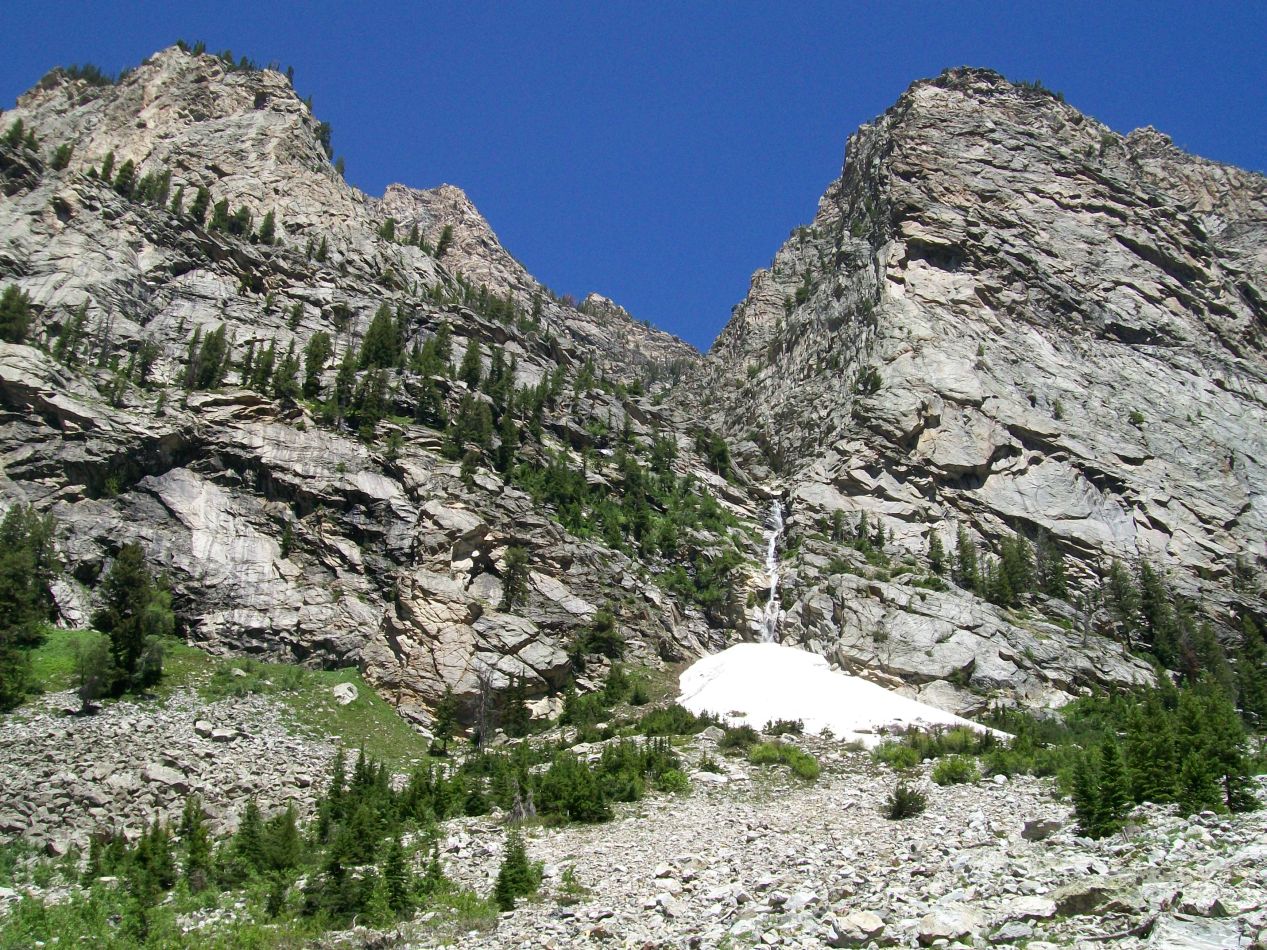
What we failed to anticipate was that the trail become more difficult as we headed up the South Fork trail. The most immediate change was the elevation, as the hiking became much steeper after the relatively flat path of the Cascade Canyon Trail. We found ourselves doing a lot more hiking uphill, and that slowed us down quite a bit. The other big change was the appearance of snow on the ground, first in small patches under the trees, and then in larger and larger stretches as we climbed higher. It wasn't long before remaining on the trail became a difficult exercise, one only made possible due to the beaten path in the slush created by previous hikers. Walking through snow is a lot more difficult than walking on normal ground and neither of us had brought the proper equipment for these conditions. It was sunny and warm down at the lake shore - the last thing we had been expecting was a hike through a snowfield! On the other hand, the scenery around us was only growing more and more spectacular, and neither of us wanted to stop now.

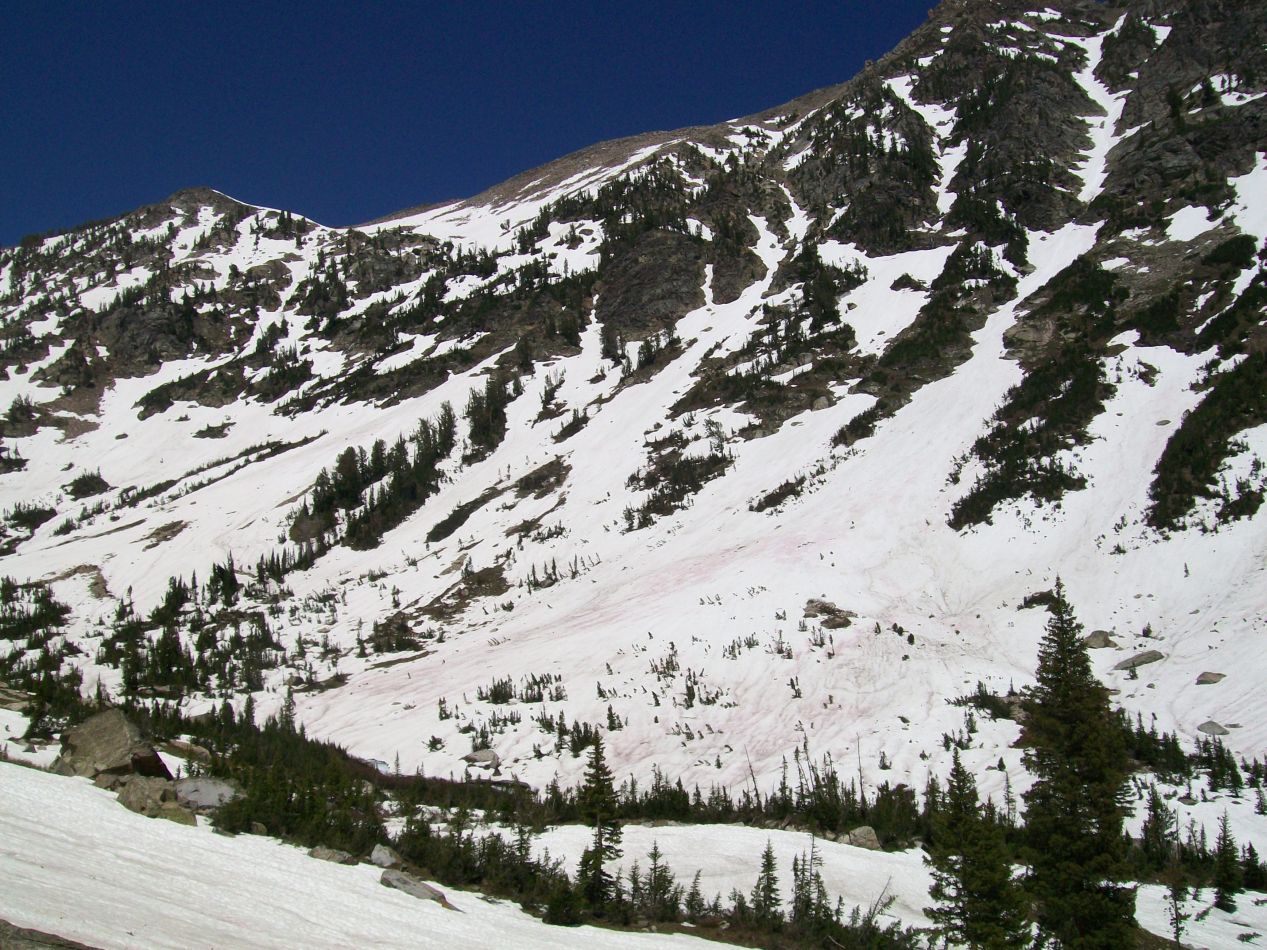


After a certain point, any pretense of a hiking path vanished and we were left with an expanse of pure snow. The trees were narrowing out as we continued climbing ever higher and began to approach the tree line up above. There was still life up here in the mountains, and we saw a pair of marmots at one point scurrying around in the snow a little ways off. But more and more we were in the grip of wilderness up here along with the handful of other travelers that we saw on the trail. Many of them had ski poles and thick hiking boots, evidently knowing the alpine conditions better than we did. The higher elevation was also contributing to the difficulty of the hike, as we had already been sitting at roughly 7000 feet at the start of this trip and had gone up well over a thousand feet from there. The last hill before reaching Lake Solitude was extremely taxing, and I felt ready to keel over in exhaustion. I'm not sure if I could have kept going without having Scott along with me. This was really difficult stuff; pictures don't do it justice.

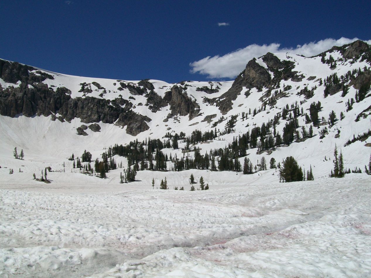

The reward of finally reaching Lake Solitude at the top was pure bliss. Most of the lake was frozen over and covered with snow, with a small pool of water left exposed to the air. This little collection of water was dwarfed by the presence of towering mountains surrounding it in a bowl on three sides, making Lake Solitude appear even smaller by way of contrast. There were only a handful of trees here and almost everything was buried under a sheet of snow. Given that we were visiting in mid-July, most of this area probably remains snowbound throughout the whole year. Looking back down the canyon in the direction that we had come, it was hard to believe how far we had traveled. Lake Solitude sits at 9000 feet elevation which meant that we had gone up almost 2000 additional vertical feet since leaving Inspiration Point. I wouldn't say that it was hard to breath up there but it wasn't exactly easy either. We had hiked just under 7 miles from Jenny Lake and it had been one tough slog.


That's me sitting on the rocks at Lake Solitude enjoying a well-deserved rest. There was one obvious problem about making it all the way to Lake Solitude on a day hike: now we had to get back down again to the bottom of the trail. This would have been tricky enough under normal circumstances but we were also trying to meet a time deadline to reunite with our parents. It was already obvious that we were going to be late to the meeting spot, with the question now becoming just how late we would be. We had already taken a little over three hours to reach the lake and we were supposed to be back at the Jenny Lake visitor center in four hours. Clearly that wasn't happening. We did the best we could to hurry back down the trail, with the snowfield limiting how fast we could travel. Once we made it back down to the Cascade Canyon Trail, we were able to move faster and we were actually jogging our way downhill for a good portion of the trip. My leg muscles were protesting fiercely but that could wait for later. We had to get back as soon as possible. While you might think that we could call ahead with our phones, that was also impossible because there was no coverage this deep in the mountains. Not in 2011 anyway. Instead, we hurried along as best we could.
We were late, of course, and very late despite our best efforts. Our four hour hike had ended up taking about five and a half hours to complete. My parents were not at all happy that they had been left waiting and worrying at the visitor center for more than an hour. As guilty as I felt, I did not regret taking the extra time to see Lake Solitude. That was a once in a lifetime hiking experience, and well worth the limping around that I was doing for the next few days. (That's not an exaggeration, I could barely walk the next day. It was similar to how I felt after I ran my half marathon.)

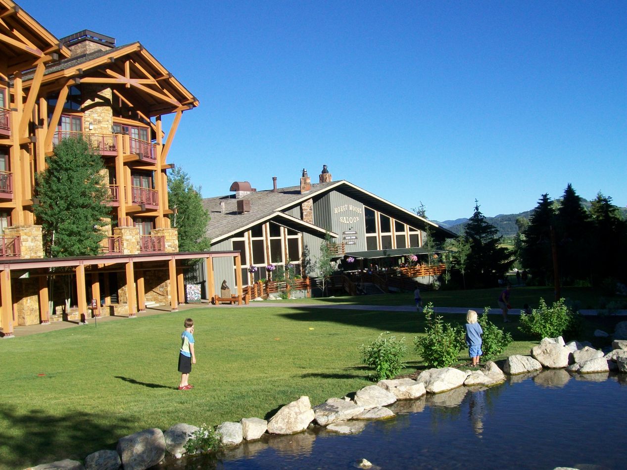


The rest of that evening was naturally a bit anticlimactic. We stopped at the nearby Jackson Hole ski resort where we had a nice dinner at the Mangy Moose Saloon. The original plan had been to ride one of the gondola cars up to the top of the mountains, which we were unable to do because my brother and I had taken too long on our hike and the gondolas were already closed for the evening. Ummm, sorry about that. The weather was still holding up outside though, and we were able to enjoy a glorious outdoor meal. This resort area looked like a nice place to stay if it wasn't so expensive. I took a few pictures later that night of the street scenes in Jackson, the largest town in the Jackson Hole valley. Jackson has a population of about 10,000 and it has emerged in recent decades as a trendy ski resort area, a bit like Aspen but with more in the way of cowboy hats. I took a few pictures of the Million Dollar Cowboy Bar next to the central town square, and would have taken more if my crummy camera could have handled the nighttime lighting conditions better. We didn't spend too much time in Jackson on this trip, concentrating instead on the mountains in the park.
That was the end of our time in Grand Teton National Park, essentially a day and a half given over to visiting this region. We loved the hike that we were able to do up into the mountains, and our main regret was that we didn't have more time to spend so that the hiking wouldn't have been so rushed. If we had known more about the trail situation, Scott and I could have left in the morning and allotted more time for hiking to avoid the need for making our parents wait. Hindsight is obviously 20/20 in these situations. Regardless though, we were able to enjoy some spectacular scenery through a place that was nothing short of an alpine wonderland. This was one of the most memorable days that I can remember from a vacation trip. 


