
The first question on reading the title of this page might very well be, "what in the world is the Bay of Fundy?" This is the body of water formed by the inlet between the southern half of Nova Scotia and the rest of the Canadian mainland, the portion of the Atlantic coast directly east of the state of Maine. The Bay of Fundy is noteworthy for having the most dramatic tides in the world, with a difference as large as 55 feet / 17 meters between high and low tide on a daily basis. I would observe these tidal shifts for myself throughout my time in the region, and indeed it felt as though I was never far away from the water during these two days spent in New Brunswick. I would be stopping first in the port city of Saint John to spend the night, then driving up the coast through Fundy National Park to observe some of the tidal shifts in action.

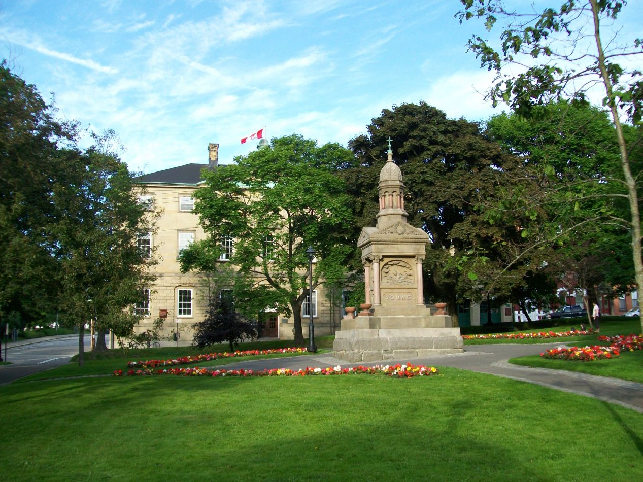


I arrived at Saint John in the late afternoon following a drive of roughly three hours from Bar Harbor. This involved crossing over the Canadian border at the easternmost location possible in Maine, the little town of Milltown. Things looked much the same on the other side of the border, aside from many of the road signs having dual French/English language text on them. Saint John was a small city about the same size as Portland, Maine with roughly 65,000 residents in total. It shared many of the same features as Portland too, specifically with a long history of shipbuilding and fishing as the city's major industries, but Saint John also had some different dimensions by virtue of being on the Canadian side of the border. In particular, Saint John was first established immediately following the American Revolution by Loyalists fleeing the former colonies who wanted to remain under British rule. I saw evidence of this immediately in the oldest part of the city, where I walked through King's Square (with a memorial to King Edward VII) and the Loyalist burial ground located next to it. The oldest graves here dated back to the late 18th century and held that initial generation that had fled from American rule in the aftermath of the revolution. Needless to say, there hadn't been anything like this back in Portland.

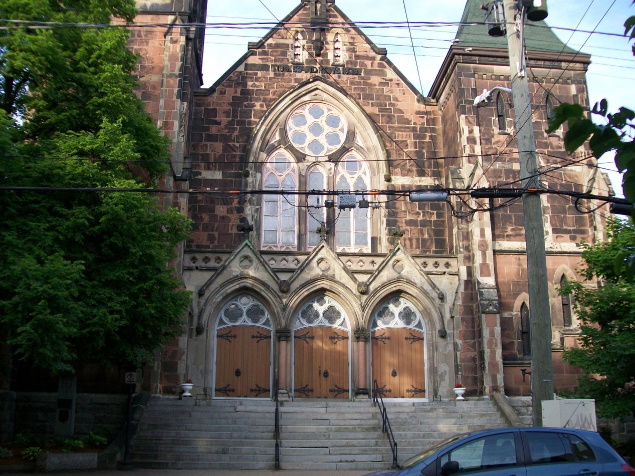


Saint John is split in half geographically by the St. John River, and these pictures were taken in the oldest part of the city, the section on the eastern bank. While walking through the quiet streets on this Sunday evening, I came across several of the oldest churches in the city. Trinity Church was the oldest one, an Anglican place of worship dating back to 1783 (the same year that the American Revolution ended) and calling on its sign for visitors to "enter, rest, and pray in the church of the Loyalists." Hmmm, it sure sounded like some people still had ruffled feathers from events more than two centuries earlier! Nearby was another stone church, the Kirk of Saint Andrew and Saint David, with the name indicating that this was the combined Presbyterian/Congregationalist/Methodist denomination that makes up the United Church of Canada. This area was surprisingly residential for the downtown portion of a city, even one as small at Saint John. Apparently the business district was in the other direction.

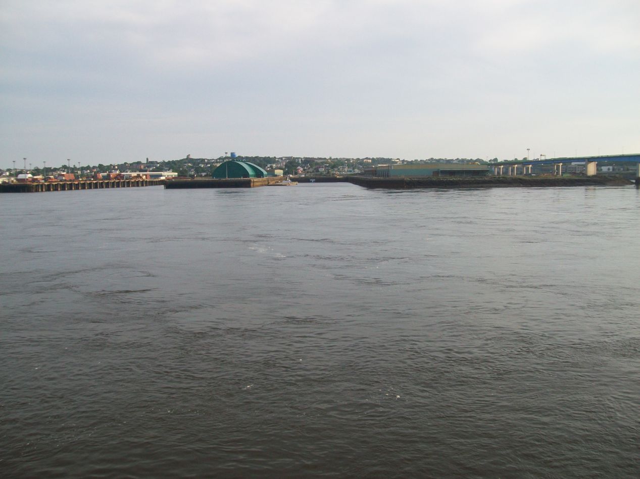


I finished up my brief tour of Saint John by walking down to the waterfront district. This was where the heart of the city was located for most of its history, a sheltered deepwater harbor that never freezes in the winter and served as a hub of the shipbuilding industry. Saint John is the only city located on the Bay of Fundy and naturally became the hub of industry as a result. This was also the port city where repeated waves of Irish immigration entered Canada, transforming much of the local character of the city in the mid-19th century. Most of the heavy industry has dried up in Saint John today, and the city has shifted towards the service sector instead. It has emerged somewhat surprisingly as a significant tourist destination for cruise ships, which leave from New England ports and travel up to Maritime Canada, stopping at locations like Saint John along the way. This is also the home of the Moosehead Brewery, Canada's only nationally distributed independent brewery. The harbor was almost entirely empty on this evening when I went down to the water's edge, although that was likely due to the fact that it was late on a Sunday evening.

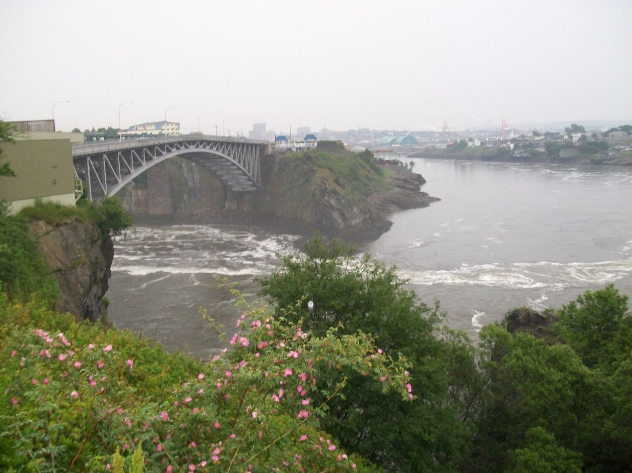


I spent the night in a mostly deserted hostel and woke up early again the next morning. My goal for the day was to visit some of the sights along the Bay of Fundy and to experience the dramatic tidal shifts for myself. I had looked up the tides the night before and spotted that low tide would take place around 8:30 AM while high tide would occur six hours later at about 2:30 PM. By getting up early enough, I would be able to experience both of them in a single day. My first stop took place in Saint John itself at the natural phenomenon known as the "Reversing Falls". These are a series of rapids on the St. John River where the river runs through a narrow gorge before emptying into the Bay of Fundy. The tides in the bay are so strong that they force the flow of water to reverse itself against the current when the tide is high, creating the bizarre spectacle of water flowing uphill backwards up the river. Unfortunately I wouldn't be able to stick around to watch that since the times didn't line up correctly, but I was able to see the Reversing Falls themselves, formed by high cliffs overlooking a narrow canyon of water. There was a steady rain falling and the waters below were churned up into white froth by their passage though the falls. There honestly wasn't too much to see here outside of the specific moment each day when the falls reverse their flow, and that led to one publication dubbing this to be among the worst tourist attractions in the world.

Most of my time this day would be spent in Fundy National Park, a small park about an hour's drive northeast up the coastline from Saint John. Fundy National Park contains a rugged area of coastline along the Bay of Fundy with several dozen walking trails that lead to a series of different waterfalls. I snapped this picture of a park map from one of the signs near the entrance, an area that was unsurprisingly deserted given that this was a rainy Monday morning. I planned to come back later and hike the Third Vault Falls trail, which was supposed to lead to one of the best waterfalls in the park. For the moment, however, I needed to get down to the coastline to experience what it looked like at low tide. There was only a limited amount of time to do that before the tide started to come back in again; I couldn't exactly wait for the next low tide at 8:30 PM. This meant that I would have to bypass the Third Vault Falls trail for now, pass through Alma in the southeast corner of that map, and then come back again later on. This day was going to involve a fair amount of backtracking.

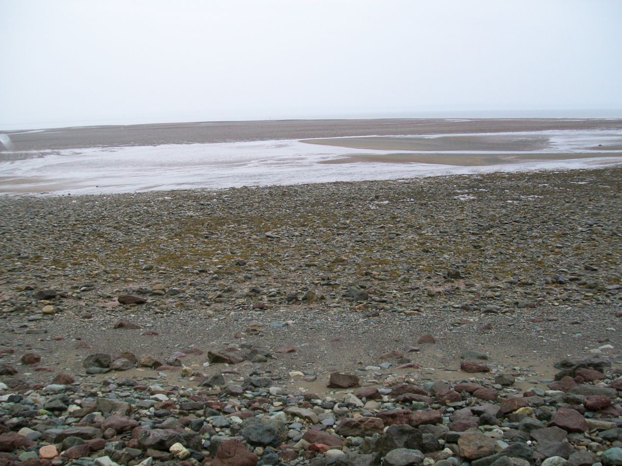


These pictures were taken at the beach outside Alma, the tiny little hamlet at the edge of Fundy National Park. I imagine that this is a beautiful place on a sunny summer day, but it was rather dreary with the poor weather that I was experiencing here. I reached Alma pretty much exactly at low tide, and the resulting sight was a long expanse of mud flats stretching off into the distance. The water was at least a full football field's length away if not further. I experienced that same result as I drove further up the coast to the east, with long exposed sandbars everywhere. I ended up getting lost a bit on this drive, as my dashboard navigation system (back in the pre-Google Maps days) didn't seem to know quite where we were located. It actually sent me on a dirt road that dead ended into a farmer's field at one point! I had to do the low tech thing and turn it off, navigating by a foldout paper map instead. I was helped by the fact that there was pretty much only one road to take in this rural area, and as soon as I ignored the navigation system and took that road, things worked out just fine.

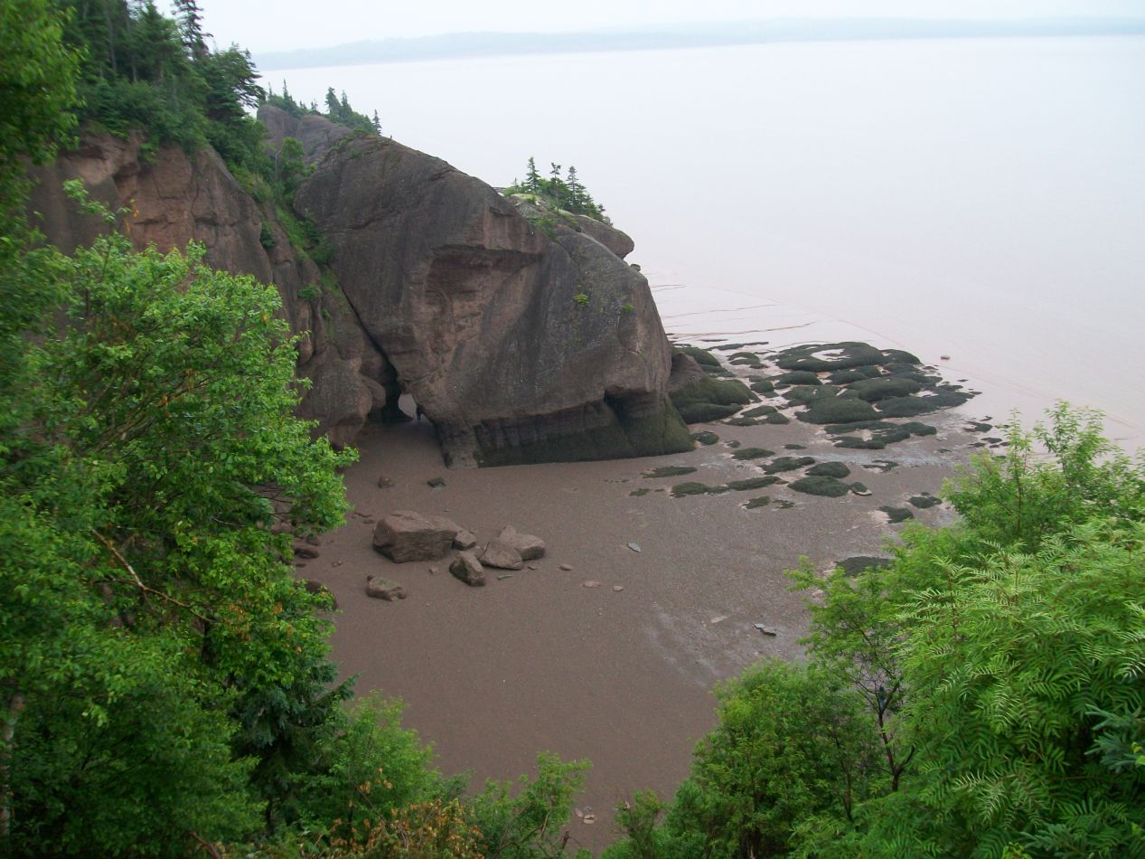


The Hopewell Rocks had been my destination on this drive, probably the biggest tourist attraction located along the Bay of Fundy. These are a series of rock formations caused by the tidal erosion of the bay, with the massive tides resulting in rocks that appear to be standing up on top of stilts. While there isn't too much to be seen at high tide when the base of the rocks are submerged, at low tide visitors are able to walk around the the exposed mud flats and examine the rocks from close up. This is a truly unique natural phenomenon caused by the tides in the Bay of Fundy, and my plan was to visit the Hopewell Rocks at both low and high tides to see the difference that a few hours could make. I arrived about an hour after low tide and looked down from the cliffs above at the exposed land on the beach. The area off to the south beyond the rocks was just crazy, with the revealed beach stretching for hundreds and hundreds of feet. All of that would be swallowed up under the waves in just a few hours.

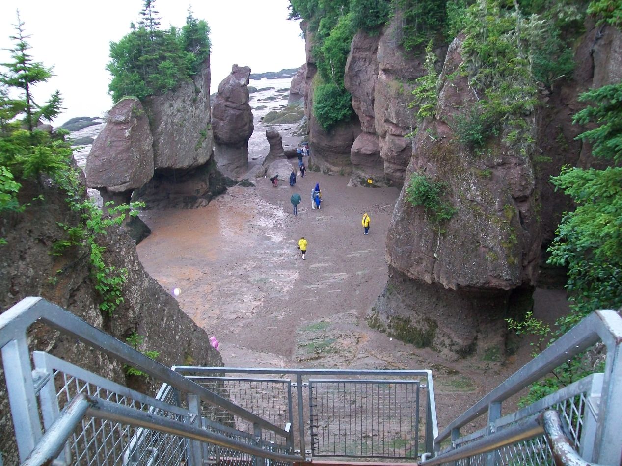


A bright yellow warning sign informed visitors that they had to evacuate the beach by noon in order to avoid being trapped by the rising waters. That was certainly a first - I'd never seen a sign with "Danger: Rising Tides" on it before. I descended down a metal staircase to the beach below, joining a scattering of other tourists who had braved the rainy conditions. The rock formations were larger than I expected when seen from up close, mushroom-like shapes with narrow stalks eaten away by the sea supporting larger stone heads. Many of them were actually growing trees on the top, perched precariously on top of these uncertain platforms. I also can't avoid mentioning the fact that the beach itself was nothing but mud, and it formed a pretty disgusting surface with treacherous footing. My sneakers sunk into the mud with every step and I knew that I'd have to spend some time cleaning them up later. We were basically walking on the floor of the bay so I probably should have expected this.


The beach area where visitors were permitted to roam stretched on for about half a mile before hitting fenced off barriers. I was able to poke around here and there, checking out the rock formations up close and exploring some of the narrow channels that they formed. At times the beach almost turned into a series of cave passages below the rock pillars. It was nice to be here at a time when there were few tourists, although again it would have been a lot more pleasant without the rain pouring down from above.

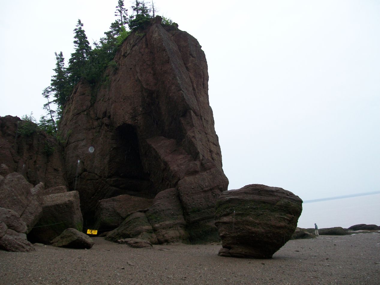


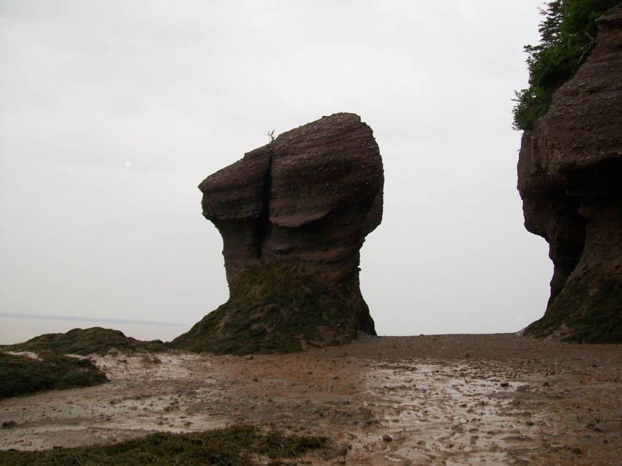
More pictures of the Hopewell Rocks. The southern end of the beach was the most open, perhaps because the cliffs were also higher in that area. The informational signs explained that the rocks along the coastline were mostly sedimentary conglomerate and sandstone rock, softer types of stone that are highly susceptible to being eaten away by water over time. The rock pillars are in the process of slowly collapsing due to erosion, and part of one of the Hopewell Rocks collapsed as recently as 2016, a few years after this visit.

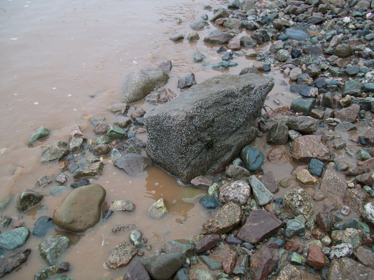


Here's a photo sequence demonstrating the rising tide. I had the idea of picking out one of the rocks along the shoreline and taking a picture every few minutes to showcase the incoming waters. In the first picture you can see the rock that I chose, in the right-center portion of the image about a foot or two from the waterline. In the minute that it took to walk over there and decide that I was going to snap these pictures the tide had already reached the base of this rock. Then I thought that I would take a picture every five minutes or so, only to discover that the rock was halfway submerged after two minutes, and almost completely gone after another two minutes. Compare back to the first image to get a sense of how quickly the beach was being submerged. I could literally see the tide coming in, with each successive little wave noticeably swallowing up a bit more of the land. That warning sign at the entrance had not been joking - there was a legitimate danger of someone drowning if they didn't pay attention. The Hopewell Rocks are located up near the head of the Bay of Fundy and experience the full 55 feet / 17 meters of difference between high and low tide. It's incredible to watch, and I was determined to come back a few hours later to see what the place looked like at high tide.

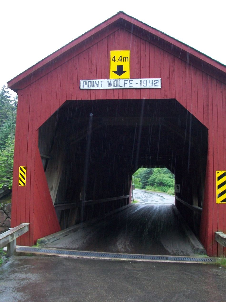


Now that I'd seen the Hopewell Rocks at near-low tide, I could return back to Fundy National Park to do some hiking. I drove through Alma once again and stopped to see the covered bridge at Point Wolfe. This bridge didn't appear to be historic judging by the 1992 date above its entrance, but it was situated in the middle of forested hills overlooking a river and had a well-chosen spot for photogenic images. I drove through the bridge in my car for fun and then drove back again since the covered bridge didn't take me in the correct direction. The rain was pouring down in torrents now, making it difficult to drive at all. Fortunately there was almost no one else on the road on this very wet day.

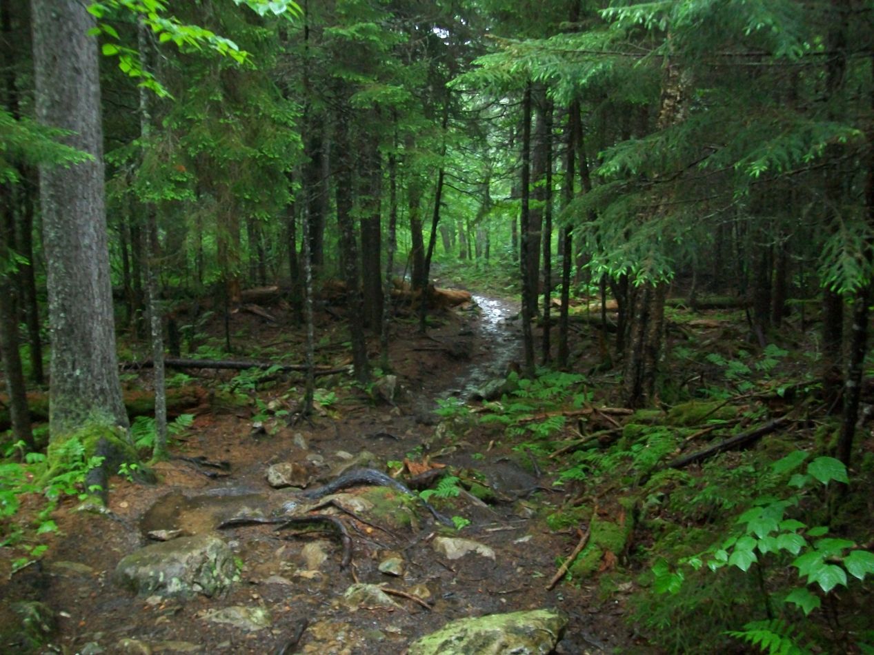


I made my way back to the Third Vault Falls trail and set off on the roughly five mile roundtrip walk. It was more than a little bit crazy to be doing this hike with the weather in such terrible shape, and I had serious regrets when I found myself soaked to the bone. Still, what else could I do if I wanted to see the falls? I only had a single day to spend in the area and it was unlikely that I'd ever be coming back this way again. This was my one and only chance, and I felt that I had to take it. The heavy rain had turned the hiking path into a soggy mess, and the downhill course basically became a small river as I continued to descend. Eventually I reached the Upper Vault Brook where the path just kind of turned into the waterway itself, which I followed as it continued to run downhill. The trail was practically bursting with plant life, and everything seemed to be different shades of green. This is an area that gets a lot of rainfall and it felt a bit like being in a temperate rainforest. The whole experience would have been amazing without the drenching rain.


My reward for reaching the end of the trail was the sight of the Third Vault Falls themselves. I could hear the falls long before I could see them, heading towards the roaring sound for some time before finally rounding a bend and suddenly there they were. Coming across this spot in the midst of all that rain, on a trail totally devoid of other people, it was a magical experience. It felt like this was a kind of secret place set aside just for me to see, and if there is such a thing as "communing with nature", that was what I was doing here. All of this was wonderful and all that... right up until I had to hike back out to my car again, a hike that was entirely uphill. This was very much not a magical experience, as I continued to get further soaked and had to watch my footing on the slippery trail. It took almost an hour to return and I spent the latter half of that in a kind of half-asleep daze. I can remember violently shivering with the cold when I made it back to my car and finally was able to change into a dry set of clothes. Although the whole thing made for a cool story and some great pictures, I'm not eager to go through it again.

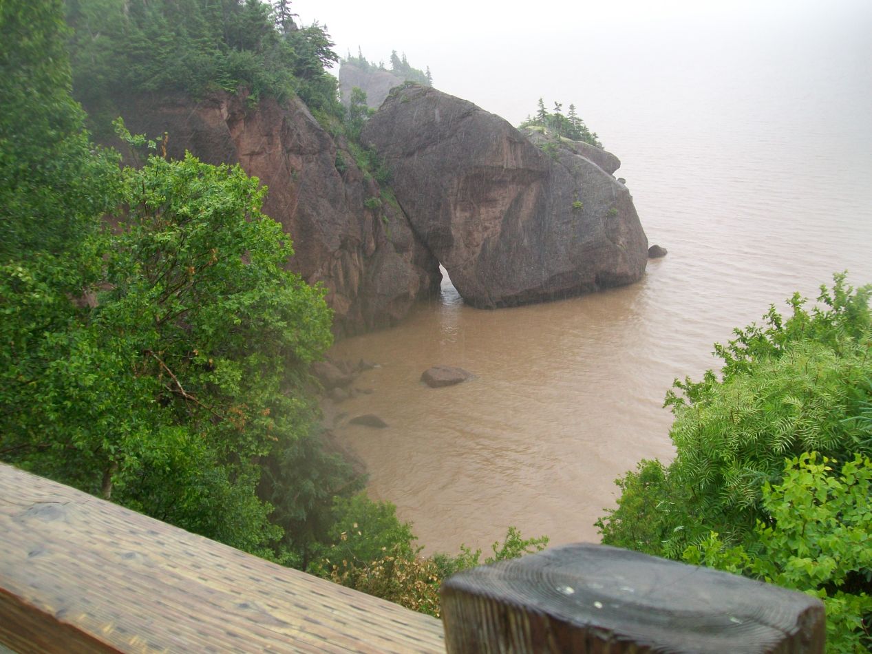


It was high tide by this point and so it was time to return back to the coast once again to see what had changed. I passed through Alma for the third time this day and snapped the first picture above. Compare to the earlier images to see what a difference a few hours had made: the whole beach had completely disappeared beneath the water. It actually looked cleaner this way, without the muddy sediment stretching out into the distance. Then it was back to the Hopewell Rocks, where the tide had similarly swallowed the area where I had walked before. Muddy brown waters completely submerged the base of the rocks, as well as the bottom steps on the staircase leading down from the visitor center. There honestly wasn't that much to see here on this second visit since the whole walking area on the beach was now underneath a dozen feet of water. This was a really cool place to visit though, and you pretty much have to devote a full day to seeing the Hopewell Rocks in order to get both the high tide and low tide experience. It's the comparison between the two that makes them stand out.
This brought my time along the Bay of Fundy to a conclusion. The poor weather helped to make this a memorable day, and it was fitting that there had been so much rain falling from the sky on a day that seemed to be entirely centered around water. I was glad that I'd had the chance to experience the crazy tidal fluctuations for myself, and the old saying is true here: seeing it in pictures alone isn't enough. There's a different feeling to having walked on a beach at 10:00 AM and then coming back at 3:00 PM and having the entire place simply gone under the waves. The whole thing was a little bit spooky.
Next up I would be traveling to the largest city by far in Maritime Canada: Halifax, Nova Scotia.


