
For my second full day in Alaska, I had two destinations in mind. First up was visiting the only landbound portion of Kenai Fjords National Park open to the public, the hiking trail that accompanies the Exit Glacier. I expected that this would take up most of the morning, and then I would drive back to Anchorage to use the afternoon exploring the city. As usual for me when traveling alone, I was up at 6:00 am in order to get an early head start on the day's activities, and reach the glacier trailhead before it could become crowded.

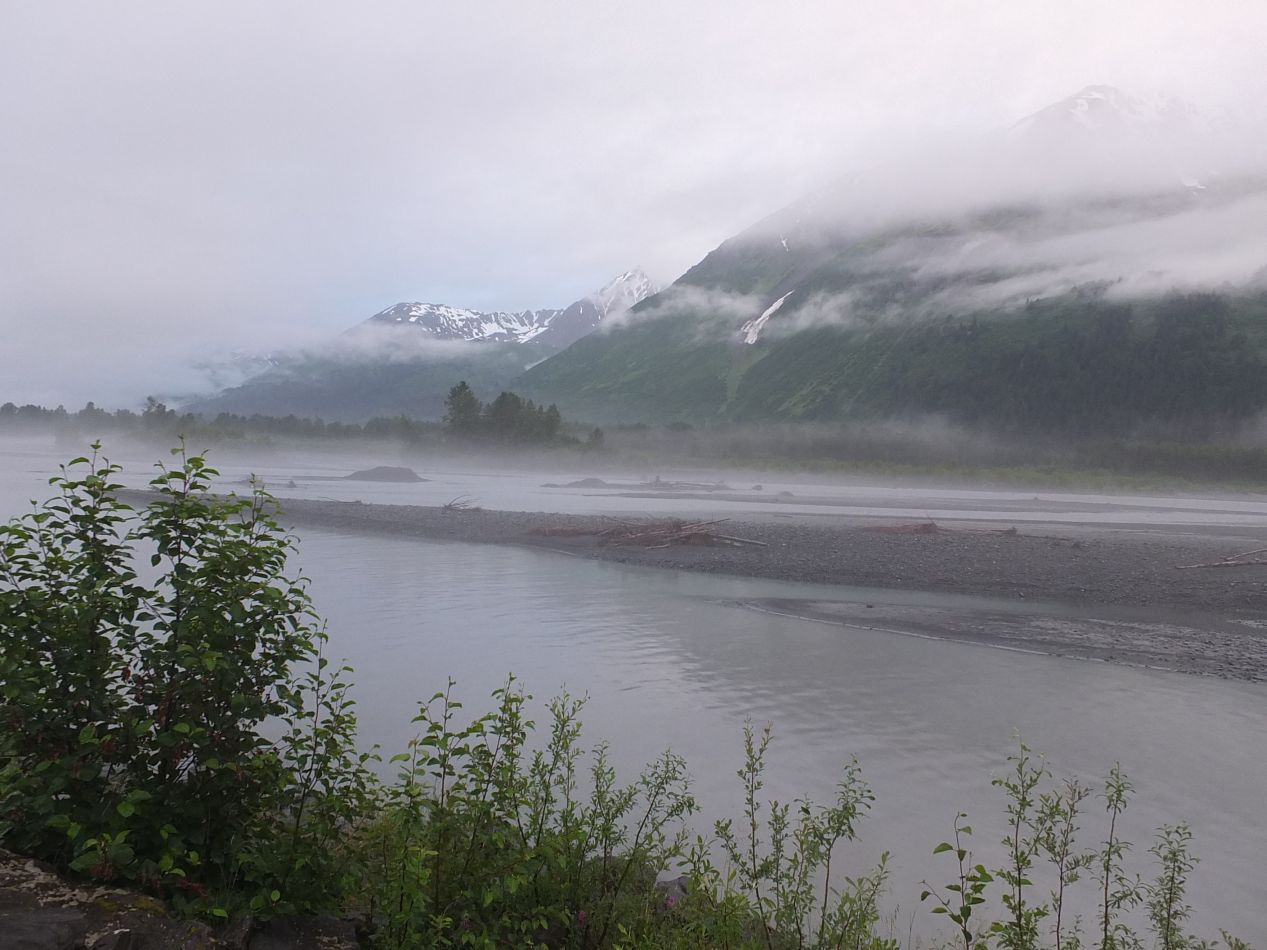


This morning dawned overcast and rainy once again. As I said before, typical for the southern coast of Alaska in summer. The road to Exit Glacier diverts off the main highway just a few miles north from Seward, and this early in the morning everything was deserted. There was a river that paralleled the road on the approach to the icefield, which I later realized was caused by the runoff water from the glacier. The surrounding mist and lack of other people gave everything a surreal feeling, as though this place existed somewhere out of time and memory. I could have been a thousand miles from human habitation instead of less than a dozen.

I'll include a picture of the trail map to provide an overview of this particular hiking trail. The Harding Icefield Trail parallels Exit Glacier, winding back and forth for just under four miles while gaining 3000 feet in vertical elevation. I've hiked in the mountains on a number of occasions, and that much gain in elevation results in a very strenuous climb. Imagine walking up a flight of stairs for several hours and you get a good idea of what it's like. I intended to climb all the way to the end of the trail, with the emergency shelter near the top serving as the only distinct marker of progress. One nice thing about today's digital cameras is the ability to snap a picture of the trail map like this, then refer back to it on the camera's viewscreen while hiking. This image would be my guide for the next few hours.

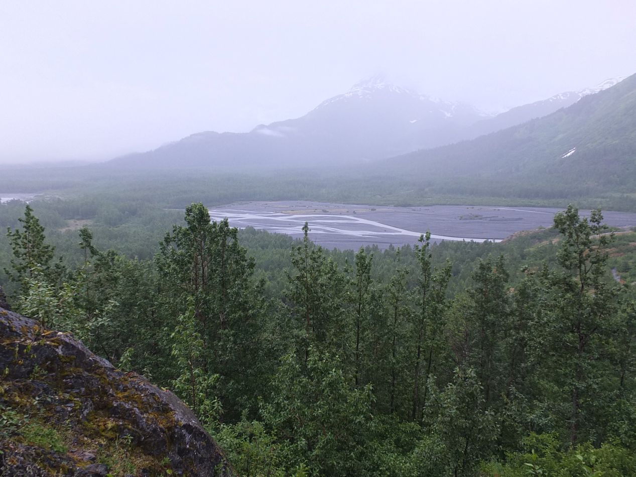


The trail was mostly easy going for the first mile or so, steadily uphill but nothing too bad. Visibility was limited by dense tree cover and most of the time I couldn't see much more than the path in front of me. Occasionally, I would get an open view of the surrounding vista, like the outwash plain pulling away from the base of the glacier or the mountains extending outwards in every direction. The fog's density grew and shrank throughout the early morning, sometimes closing in and sometimes pulling away for better views. I crossed the little bridge indicated on the map and continued heading upwards. I was starting to get some views of the glacier itself off to the left as I kept going, with the same muddy streaks of gray that I had seen the previous day at the Holgate Glacier. There was no one else visible on the trail, and my biggest concern (as always when hiking alone in the wilderness) was running into wild animals, specifically bears. Down here in the forest, I could turn a corner and walk into one without warning, and that does present a potential danger. I've had half a dozen bear encounters in the past, although fortunately only once outside of a vehicle while hiking, and that one time the bear turned and ran away as soon as it saw me. Fortunately, nothing materialized on this particular trip as I kept hiking onwards.
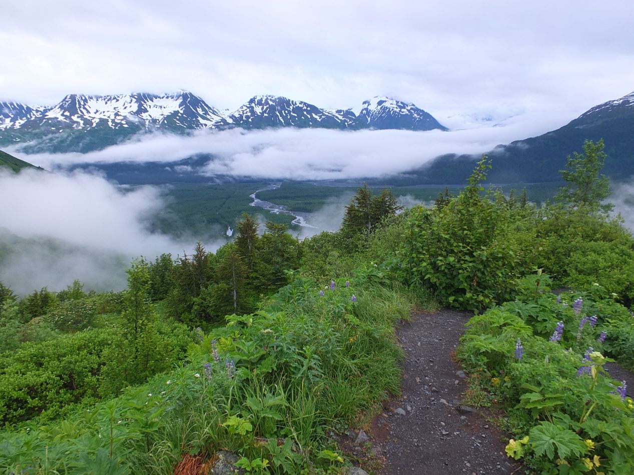
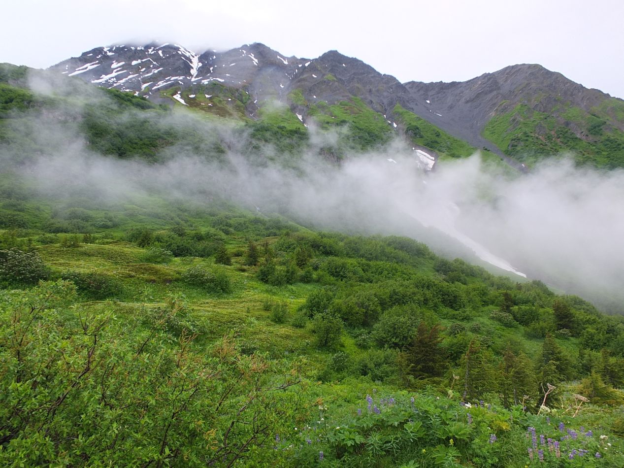

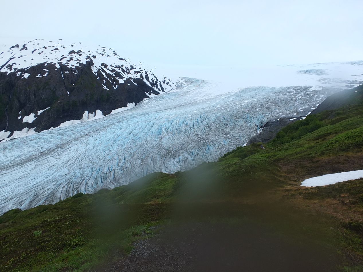


Roughly two miles into the hike, I began to run into what the map referred to as "the cliffs", and the path became noticeably steeper. As the elevation continued to increase, the trees became shorter and were eventually replaced by tough bushes of some kind, as the soil became too weak to support larger plant growth. This also had the effect of opening up the view to the stunning natural scenery. Between the greenery hugging the lower slopes, the white of the snow on the upper expanses of the mountains, and the curls of mist continuing to wind through the air, the trail turned into a kind of enchanted wonderland. I could also see that I wasn't completely alone; with the view opened up so much, there were a handful of other hearty souls out on the trail, some further ahead and others further behind. That was reassuring in the event of a potential emergency. With further elevation gain, the small bushes dropped away as well, leaving only grasses, mosses, and lichen over bare dirt and rocks. I was also starting to see more and more snow cover on the ground off to the sides of the path. The trail was steep going at times, although once I reached the top of the cliffs it leveled off somewhat and stopped twisting through so many switchbacks.

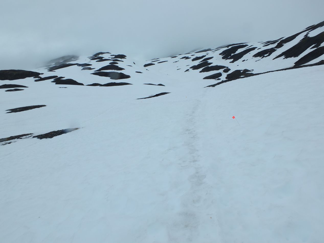


At some point roughly three miles into the journey, all plant growth ceased completely and the dirt track of the trail became buried in snow. Only a series of small orange flags poking through the white blanket indicated where the trail was located. Tromping uphill through the snow didn't make this trip any easier, although at least this time I was wearing hiking boots instead of sneakers. My brother and I ran into snow unexpectedly on a hike in the Grand Tetons a number of years earlier and found ourselves lacking the proper footwear. The terrain up here near the top of the trail was beautiful as well, in a desolate fashion. With this being the height of summer, it was clear that almost nothing could live at this altitude where the world remained permanently shrouded in snow and ice. What would this place look like in winter, I wondered? It wasn't a hike that I would be eager to try.

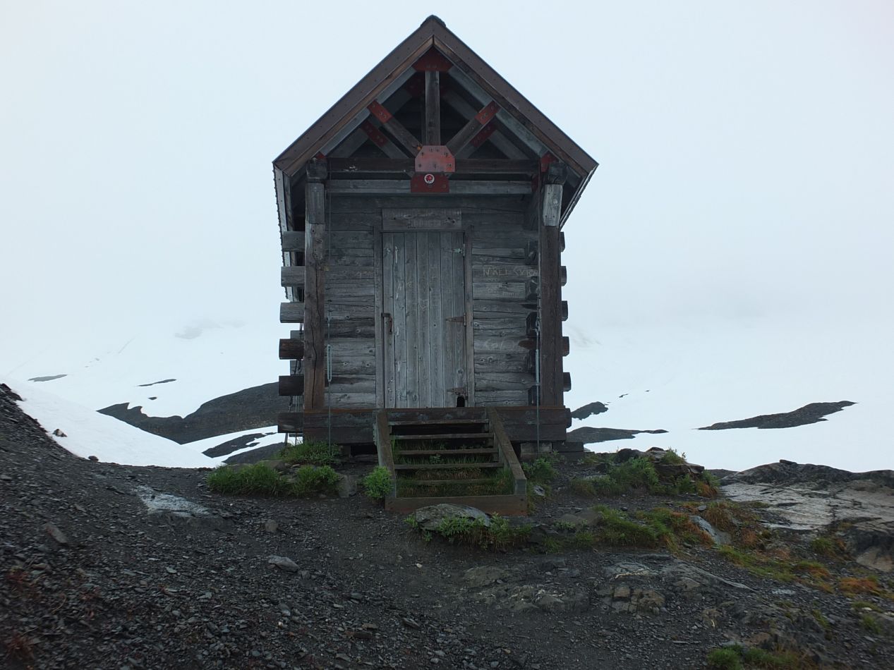


Near the end of the trail, the emergency shelter that I had spotted on the map came into view. A small wooden shack, it crouched on top of a bare patch of rock surrounded by snow. The structure was tiny inside, with enough room for two or three people to lie down and nothing more. It was definitely warmer inside the shelter than outside, and the building looked very sturdy - as it would have to be to remaing standing in this location. The whole structure was covered with messages and carvings from hikers, some of them dating back decades. I imagine that the freezing climate helps to preserve this structure without much in the way of erosion. I love the last picture in this set, taken out the front door of the shelter looking down towards the glacier. Now that would be an amazing view to wake up and see in the morning!

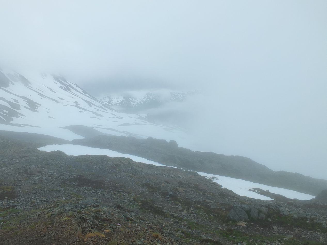


Further up beyond the emergency shelter, it became extremely foggy, or perhaps the trail simply had reached a high enough elevation to be up among the clouds. I thought there would be some kind of marker indicating the end of the trail, but I never found one if it exists. The small flags marking the way simply disappeared. With the heavy fog cover, I did not want to become lost and made no effort to try exploring further ahead. Wandering around in the middle of a cloud with glaciers on all sides seemed like a recipe for becoming one of those "tourist disappears in mountains" headlines, and I wanted no part of that.  I was able to take two final pictures of the Exit Glacier on my way down, capturing the point at which the snow cover of the Harding Icefield gave way to the packed ice of the glacier itself. All told, this hike took about five hours to complete, and I would highly recommend it to anyone who happens to be in the Seward area.

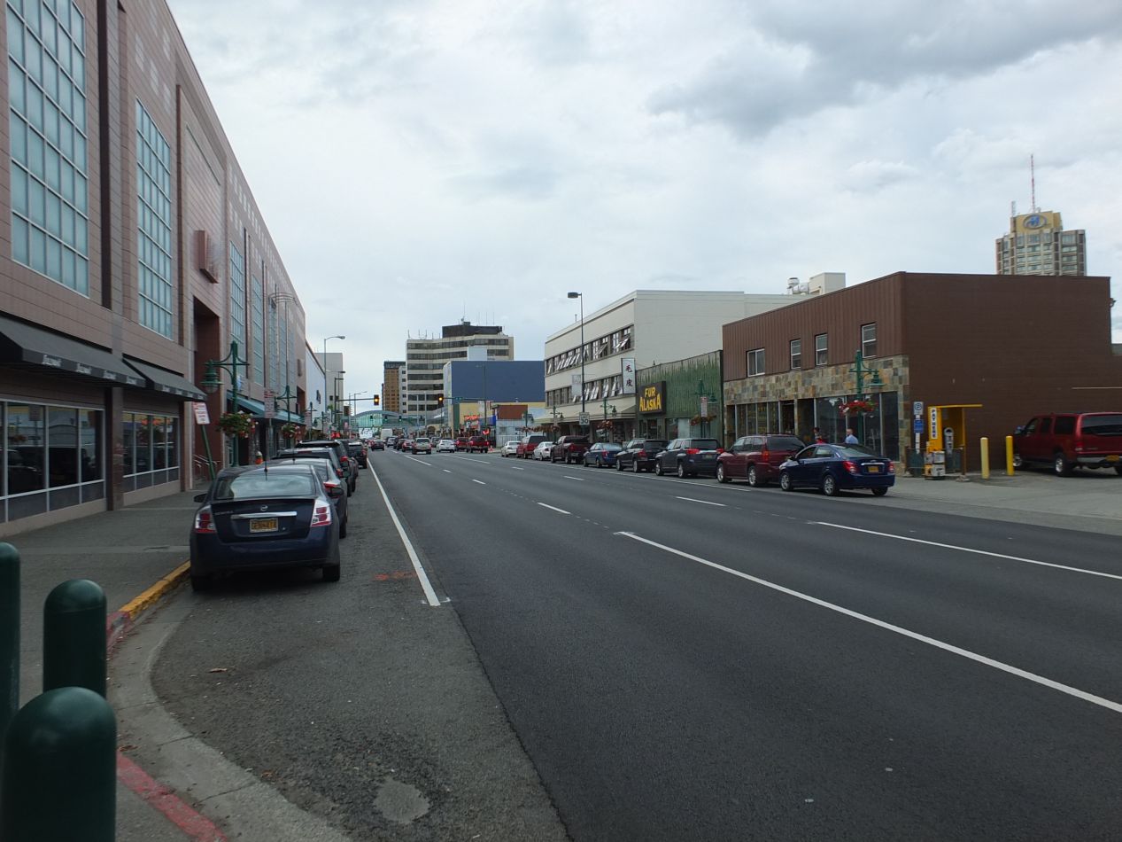


But wait, this day wasn't completely over yet! After another drive of nearly three hours, I was back in Anchorage again, this time with an opportunity to see the city a bit better. The first picture above gives a view from atop one of the taller buildings in Anchorage, showcasing the mountains off in the distance. One of the surprising things about the city is how spread out it is; due to the cold climate and the vast open spaces in Alaska, Anchorage is a city that has been built "wide" rather than "tall". The positive is that there's very little traffic congestion in Anchorage, and none of the confining urban spaces that can be found in other cities. The negative is that Anchorage is not a very walkable city, and going anywhere outside of the small downtown area requires a car. Alaska is so big and so open that everyone assumes you have your own method of motorized transportation. Don't expect the kind of public transportation and car-free lifestyle common in Western Europe or East Asia.
Anchorage is a distinct city for these very reasons though, and visiting in the summer was pleasant. I've taken pictures above of the quaint City Hall building and the historic downtown close by where the Iditarod sled dog race is held each year. I don't know if I have the exact location captured in these pictures; it all looks much different in the summer as compared to the start of the event in winter. Anchorage was not an especially touristy destination, and mostly seemed to be functioning as the economic and commercial hub for the state. Almost half of Alaska's population lives in the greater Anchorage area, and most everything other than the state government buildings (which are located in Juneau) are here. I walked past the Anchorage open air summer market, where I saw a vendor selling reindeer meat, and had a chance to walk on part of the Tony Knowles coastal trail. I was slightly disappointed by this walking trail, but perhaps that was only in contrast to the hike I'd done earlier in the day. Anchorage has dozens of miles of walking/biking trails, and this is an excellent city (and state!) for those who love outdoor activities.


The main destination that I visited in Anchorage on this afternoon was the city museum, which is located in this unusual glass structure. As a trained historian, I'm always an eager customer for these kind of cultural exhibitions, and the Anchorage Museum was well worth visiting. There was a temporary exhibit up on the top floor chronicling the story of Alaska baseball, which boasts a long history and a semi-professional local league in the state. I was planning on going to a game in the Alaska Baseball League later on during this trip. The museum also had a permanent exhibit on the First Peoples of Alaska, with hundreds of artifacts on display, along with a large exhibit on the general history of the state. It's easy for visitors to forget the unusual path that this land took to becoming a US state, such as the century that Alaska spent under Russian rule as a colony of the tsars, or the heavy fighting that took place in the Aleutian Islands during World War II. There are also materials detailing the devastating effect of the Good Friday earthquake in 1964, one of the largest ever recorded on the Richter scale at 9.2, the construction of the Alaska Pipeline in the 1970s and the importance of oil to the state's economy, and Anchorage's little-publicized failed bids to host the Winter Olympics. For anyone who likes museums, this is well worth visiting for an hour or two.
That would be all for this day. I had to turn in for an early night in order to be up in Denali the following day. The true wilderness was yet to come.


