

Wednesday was the middle day of Liz's work conference and therefore the one selected for a group dinner to take place in the evening. We had known this ahead of time and, since I wouldn't be able to have dinner with my wife, it meant that I had more time available to range further afield for sightseeing purposes. The area that I was most interested in seeing was the historic county of Cornwall, situated down at the extreme southwestern tip of the island of Britain. Cornwall has always stood apart from the rest of the counties comprising England due to its semi-remote location and its unique cultural heritage. This was a region inhabited by Celtic speakers who had their own Cornish language (closely related to Welsh) that didn't die out until the advent of the printing press and standardized versions of English killed it off in the late 18th century. Cornish might be a dead language today, with a very small number of local speakers trying to keep it alive, but the unusual historical background and dramatic natural beauty of this peninsula made it very much worth visiting.

Now for the hard part: doing the actual travel from where we staying in Bristol down to Cornwall itself. Cornwall might be a peninsula and not an island, not to mention the fact that we were already visiting the southwestern part of the United Kingdom by attending this event in Bristol, but that didn't mean that it was easy to make it all the way down to the tourist locations that I wanted to see. It was about 190 miles / 305 kilometers from Bristol to the town of St. Ives which Google Maps indicated would take somewhere around 3.5 hours since there was major construction taking place on the roads along the way. Then I would need to spend a series of hours traveling around the coastline of Cornwall to see various tourist attractions, followed by making the same drive back again later in the day. Even with Liz heading out for dinner with her work colleagues, I knew this was going to make for a wild sequence of traveling if I was going to head off to Cornwall and back again in a single day.
As a result, I woke up at the extremely early hour of 3:00 AM to begin the long drive down to Cornwall. I actually had to park in a separate 24 hour garage a bit further away from our hotel because the standard parking garage understandably wasn't open that early. Bristol's Centre wasn't completely deserted despite the early hour as there were a handful of people still walking around, though I was content to avoid everyone else as usually nothing good is happening at such an odd hour. I made my way out of downtown Bristol and drove southwest for the next few hours, with the sun slowly rising behind the car in the rear view mirrors. It was only ten days until the summer solstice and the northern latitude of Britain caused the sunrise to take place very early as well, with first light around 4:00 AM and the whole sun up a little before 5:00 AM. I listened to music and podcasts while dodging around road construction, fortunately having the roads almost entirely to myself. There were a number of truckers hauling their freight and otherwise that was about it.


It took a little less the estimated 3.5 hours to arrive in the idyllic beachfront town of St. Ives with the clock reading just after 6:30 AM. I had to drive through the deserted early morning streets of St. Ives until reaching a parking lot on "The Island", the name given to a headland on the northern edge of the town that juts out into the surrounding waters. These were the first pictures that I took for the day, looking down at the gorgeous expanse of Porthmeor Beach stretching off to the west. This is a popular beach with swimmers and surfers, and the houses of the town rose up on the hills behind it before receding off into the distance. Above them, the sky had a mixture of inky black clouds giving way to the morning sunlight, an effect that even produced a rainbow barely visible in that first picture above. After such a long drive to get down here, I felt my spirits soaring at having such an incredible sight immediately visible within the first minute of leaving the rental car.

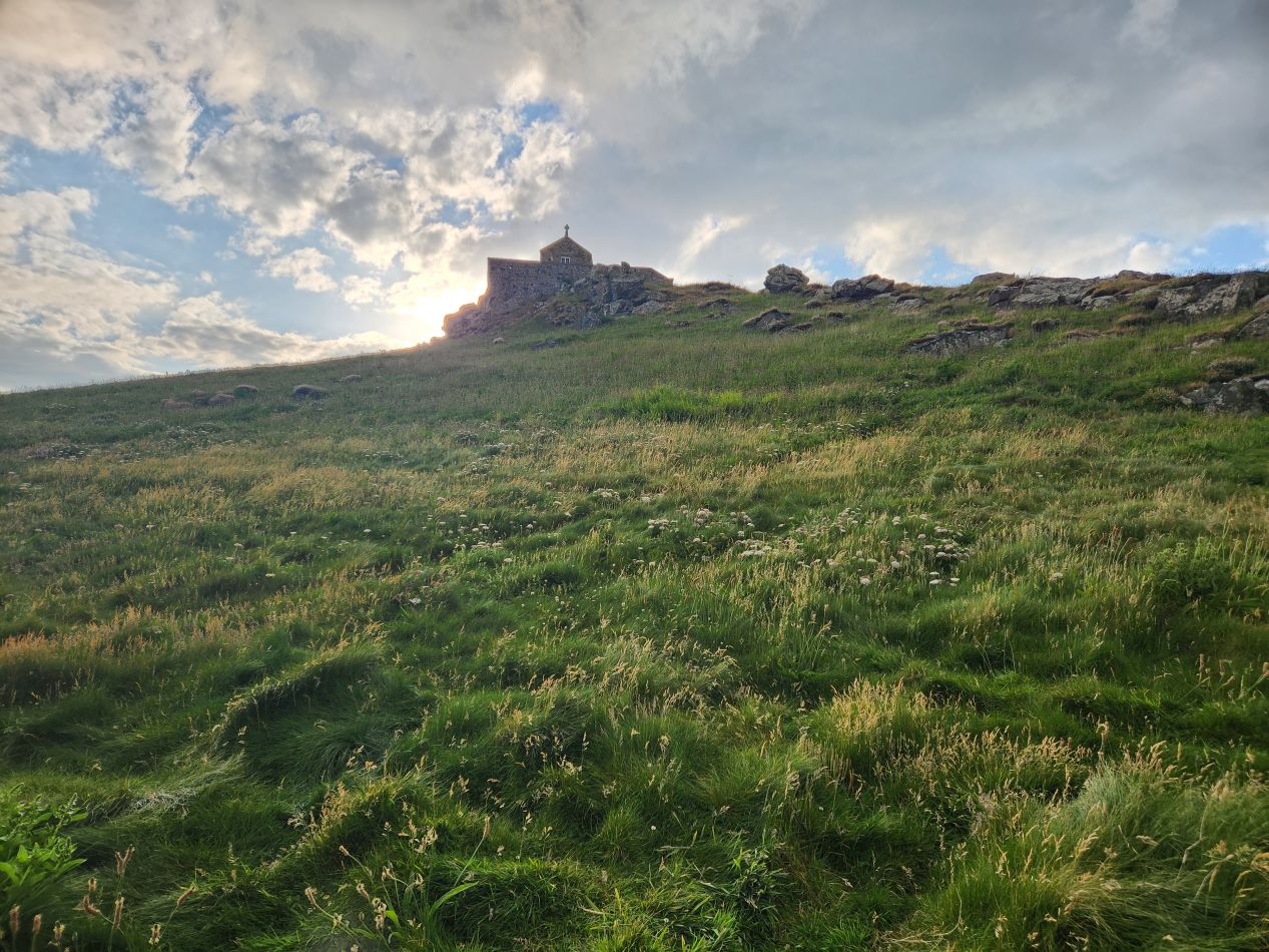


There was a small hiking trail that led up to the top of The Island where I snapped these pictures looking down at the rocky coastline and the town of St. Ives. There was a little stone chapel here named after St. Nicholas which had apparently stood atop the headland for centuries before being dismantled by the War Office in 1904, then restored afterwards when there was no longer a need for military structures. This spot overlooking the rest of the town had some of the best views of the immediate area and it's been a popular spot for artists to depict for at least the last two centuries. And while the sea was calm at the moment, I had read that this headland is sometimes hit by hellaciously strong storms rolling in off the Atlantic which have caused the death of many local fishermen.

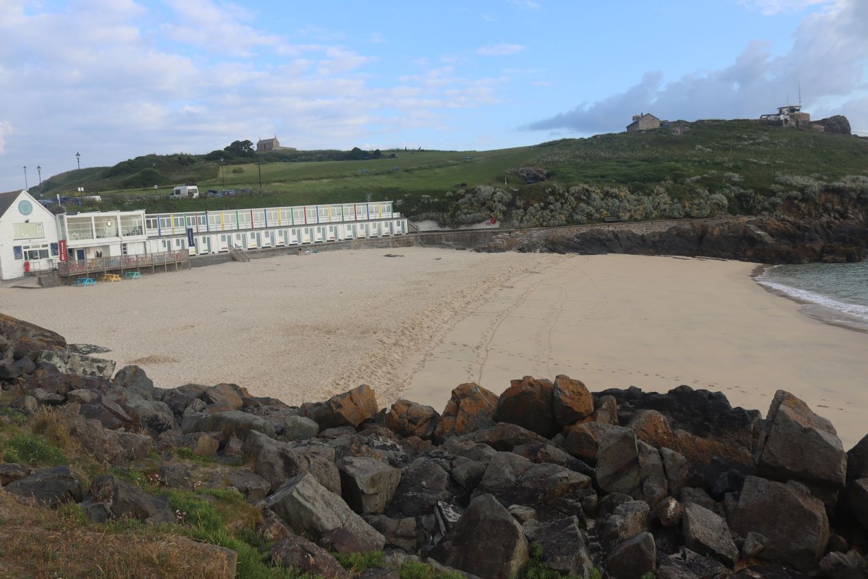


I walked down from the top of The Island heading towards St. Ives proper. There was another small beach here named Porthgwidden Beach, the Welsh-sounding name providing another sign of the historic Cornish language. This cute little beach had a cafe and a series of changing areas for swimmers, all of it deserted at this early hour aside from one woman who I saw coming in from a morning swim. It was certainly a scenic place to enjoy the ocean assuming that the water wasn't too frigid. As I continued onwards, there was an even smaller and rockier stretch of sand named Bamaluz Beach which was more notable for having a series of apartment buildings rising above it, built directly on top of the rocks adjorning the seashore. This was also the location of the St. Ives Museum which might have been worth visiting if it hadn't been roughly 7:00 AM at the time.

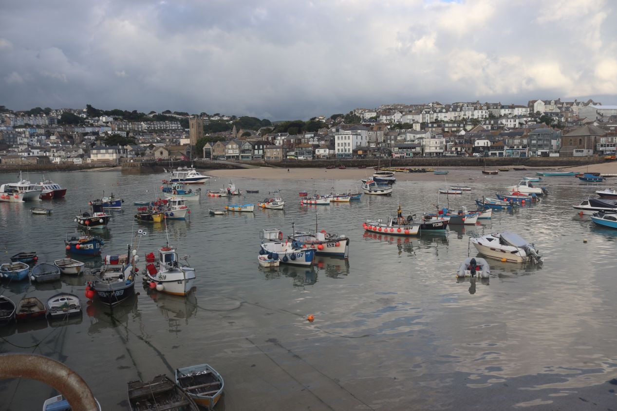


Just past the local museum, I turned around a sharp corner and suddenly the harbor of St. Ives unfolded in front of me. St. Ives is a small town with about 10,000 residents at the time of writing; due to the rural nature of Cornwall, this still makes it one of the ten largest population centers in the county. This sheltered natural harbor is the reason why a town grew up here in the first place and I could see that there's still a good deal of commercial fishing that takes place in St. Ives today. I even saw one fishing vessel leaving the harbor right at this moment which I was able to capture as it headed out into St. Ives Bay. Since there was no one around, I walked out on Smeaton's Pier to the end of the docks where there was a small lighthouse to guide boats into the harbor. Between the fresh sea breezes and the picturesque little town rising up on the hills beyond the harbor, it was a beautiful morning to be out sightseeing.

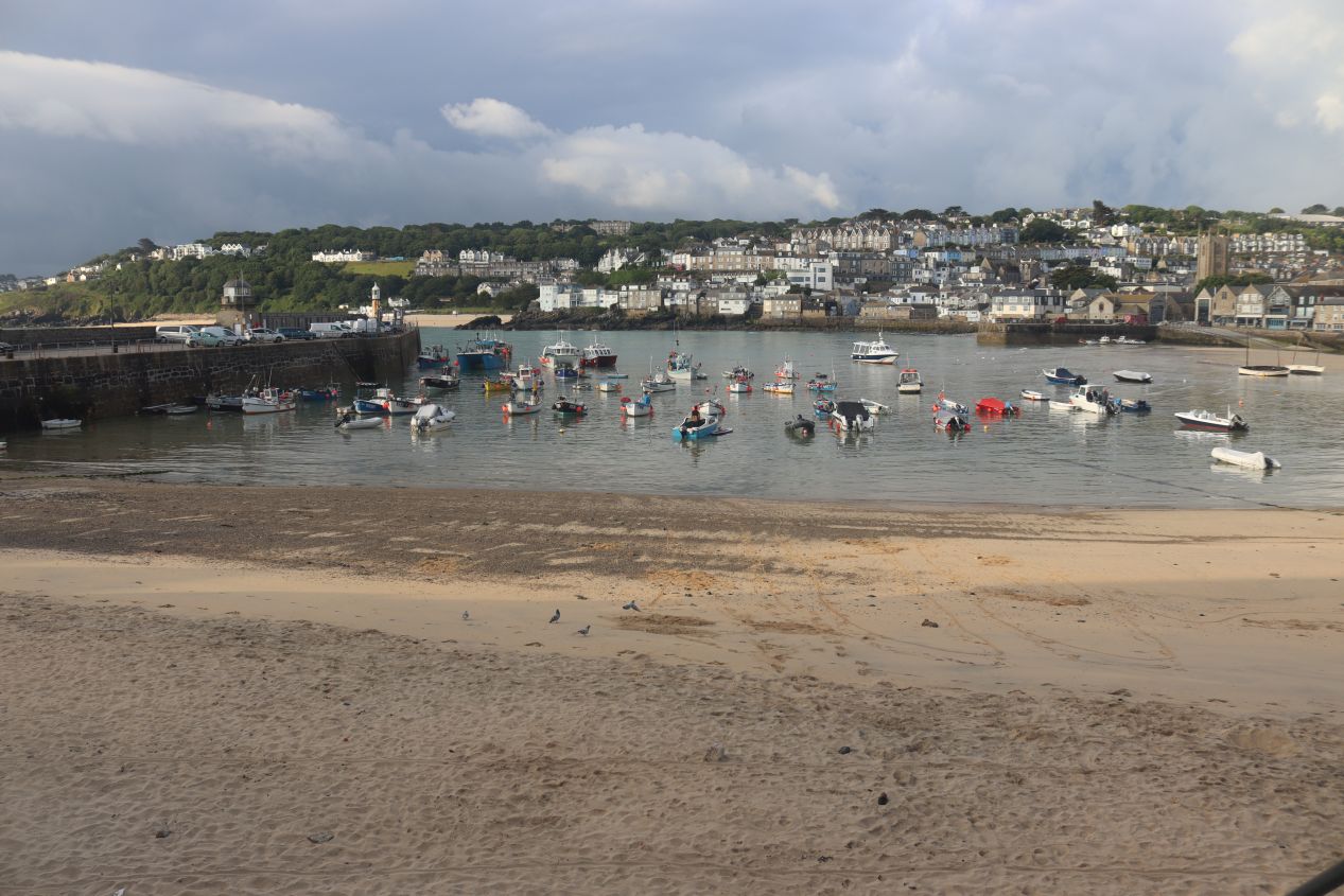


These were a few more pictures that I took while walking around the harbor as it curved towards the center of town. St. Ives was historically a fishing town where most of its residents made a living from the sea in some fashion, whether that was catching fish or manning ships as sailors. There was a statistic on Wikipedia that this town averaged 9000 hogsheads of caught fish in the early 19th century which calculates out to approximately 300 million individual fish caught each year (!) Beginning in the late 19th century, a railroad line that ran to St. Ives led to the construction of the first seaside resorts and over the course of the 20th century St. Ives shifted most of its local economy over to tourism. That's the reason why most people come to St. Ives today and I saw advertisements for a bunch of hotels, boat tours, and restaurants scattered around town. The Sloop Inn pictured above claims to date back to 1312 which is probably an exaggeration but does speak to how travelers have been coming here for long centuries on end.

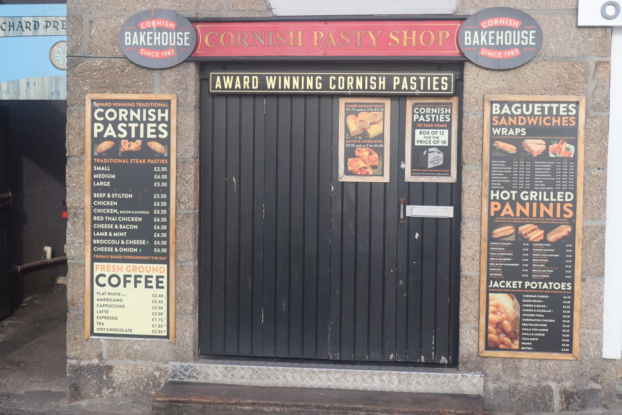


I continued along Wharf Road until reaching the pier that marked the historic center of St. Ives. There were a number of places selling Cornish pasties, the most famous dish associated with Cornwall, which I would have been willing to try for breakfast if anything had been open this early. The small pier had a food truck parked on it selling pizza and sandwiches but of course it too was closed here in the early morning. Everything was calm and peaceful as if the whole town was just waking up for the day.

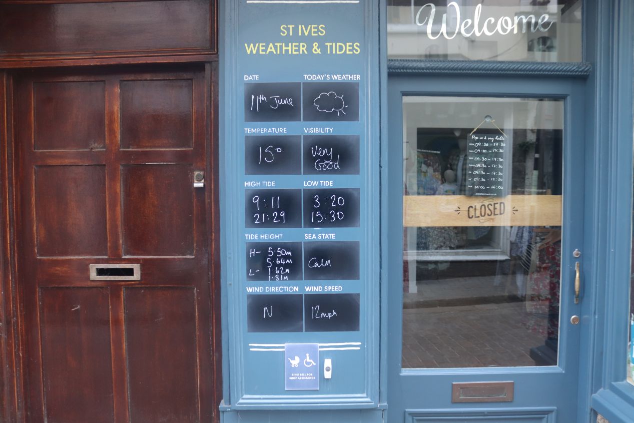


Now I had to make my way back to where my rental car was parked, and rather than retracing my steps back along the harborfront, instead I walked through the narrow streets of the historic part of St. Ives. The buildings here were mostly made out of stone and looked like they were a century or two in age, with the streets often having cobblestone paving to match their age. Aside from being a tourist draw, St. Ives is also known for its community of artists who have come here to draw inspiration from the natural beauty of the area. I saw signs for a whole bunch of art studios and art galleries while making my way through the town, all of them closed at the moment of course. The largest and most famous of these is the Tate St. Ives located a few blocks to the west of the harborfront; it didn't open until 10:00 AM and I certainly wasn't sticking around several hours just to see the artwork inside. (Longtime readers of this website know that art museums tend to be rather low on my priority list of tourist attractions to visit.) One more thing to point out: that last picture above was the alleyway that led to the parking lot where I had left my rental car. Yes, that absurdly narrow lane barely wide enough for one car to pass through was the only entry point to a major parking area. Did I mention that the roads in England were narrow?

With sightseeing finished in St. Ives, it was back to the rental car again for another drive to the next attraction on my list. I was traveling to the westernmost tip of Cornwall at the appropriately-named Land's End, which was only about 18 miles / 28 kilometers away but took nearly an hour to reach by car. This was due to the need to drive on the tiny and meandering local roads that passed through this out-of-the-way portion of Cornwall. In particular, the route leading south from St. Ives down to Penzance was named B3311 and was little more than a backcountry farm road, just barely wide enough for two cars to pass one another as it ran between pastures, and I found myself gritting my teeth with a deathgrip on the steering wheel every time that another car went past. The road west out of Penzance was the A30 and therefore a little bit more suited to traffic while still only having a single lane in either direction. For someone who had already been awake since 3:00 AM this wasn't exactly a relaxing drive!


Eventually I arrived at Land's End around 8:00 AM with the sun still rising in a cloudy sky behind me. Land's End has the distinction of being the westernmost point in mainland England, apparently just barely missing being the westernmost point of the whole island of Britain to a spot in the Scottish Highlands. People have been coming here to visit the dramatic seaside cliffs for several centuries, with enough travelers arriving for a hotel complex to develop over time and eventually morph into the current attractions. I was a bit surprised to discover that Land's End is basically a small theme park, with various family attractions like miniature golf and a movie theatre complex. It reminded me of the attractions in Ocean City, Maryland that I used to visit every summer while growing up. Everything was once again deserted due to the morning hour though I did spot a couple of people stirring here and there, likely guests at the Land's End Hotel.

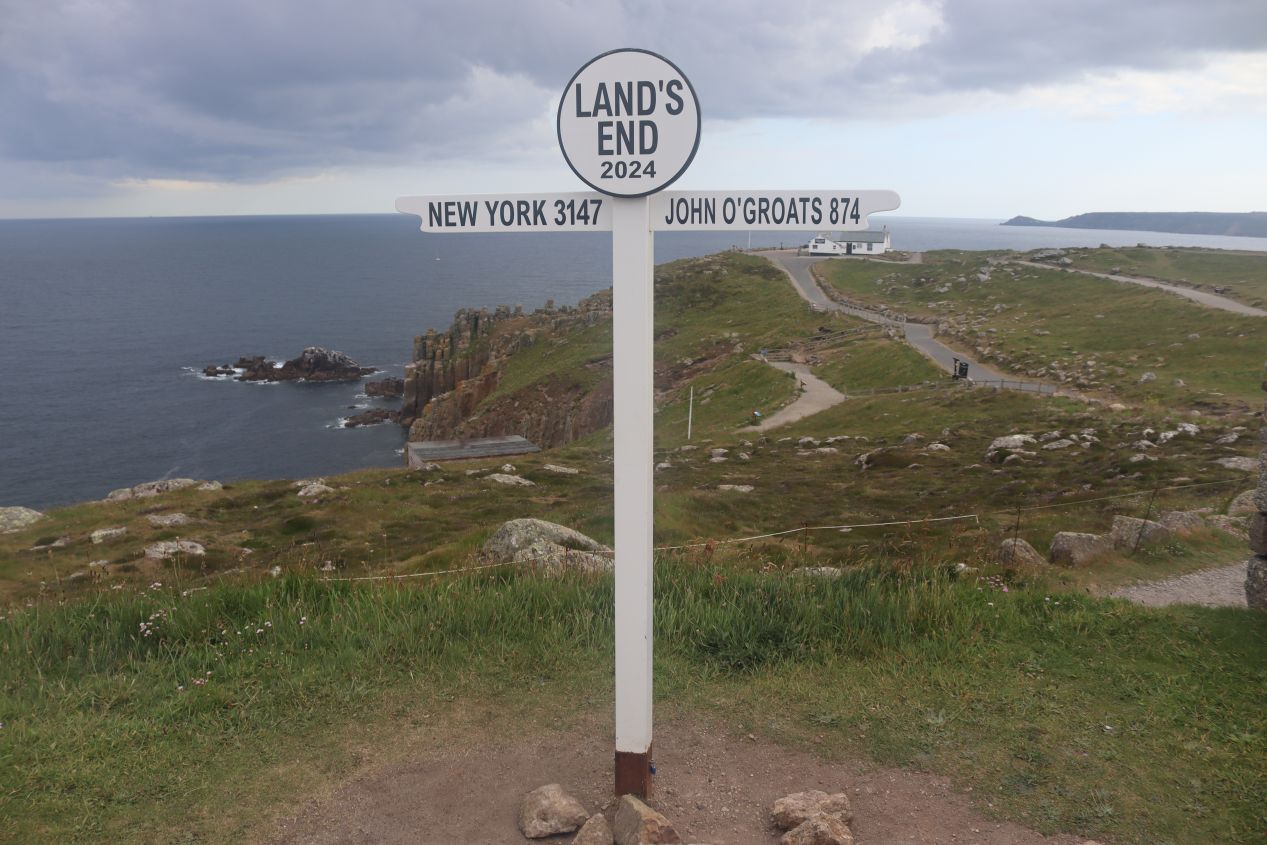


I hurried past the tacky tourist stuff that wasn't even open and walked over to the natural scenery along the shore. Just past the hotel was the location of the "world famous" Land's End Signpost with the distance in miles to New York City and John O'Groats. That latter entry deserves some explanation, as it's a similarly tiny tourist attraction at the extreme northeastern edge of Scotland. Travelers have been doing the "end to end" journey from Land's End to John O'Groats since the early 19th century, initially by horseback and now often by bike or motorcycle. A short distance off to the north was the First and Last House which sells snacks and other refreshments while providing more excellent views of the waterside. I noticed that there was the distinctive flag of Cornwall flying next to the First and Last House, a white cross on a field of black dedicated to St. Piran; I would see the flag in a bunch of other places throughout the day's traveling. I also captured a picture of the Land's End Hotel itself which was starting to wake up for the day and had some of its guests eating breakfast in a spot overlooking the cliffs.


Then there were the cliffs themselves, the main reason why I had undertaken the drive out here to Land's End. The landscape was made up of granite rocks which resist weathering and have therefore lasted long enough to produce steep cliff faces. The sign indicating "dangerous cliffs" was not an exaggeration as a number of people have fallen into the sea and drowned over the years, including four schoolchildren who died here in 1985. Despite that unfortunate history, the cliffs themselves were breathtakingly impressive to behold as the green landscape fell away into the water and whitecapped waves crashed against the rocky shores. There was also a lighthouse here situated a mile and a half offshore; named Longships Lighthouse, it was completed in 1875 and was actually inhabited by a lighthouse keeper until 1988. There are some photos of that lighthouse getting pounded by massive waves stretching as much as 20 feet / 6 meters in height and I can't imagine living there on a permanent basis. No doubt the presence of the lighthouse was necessary due to the rocky shoreline but that would have been a tough life to live.

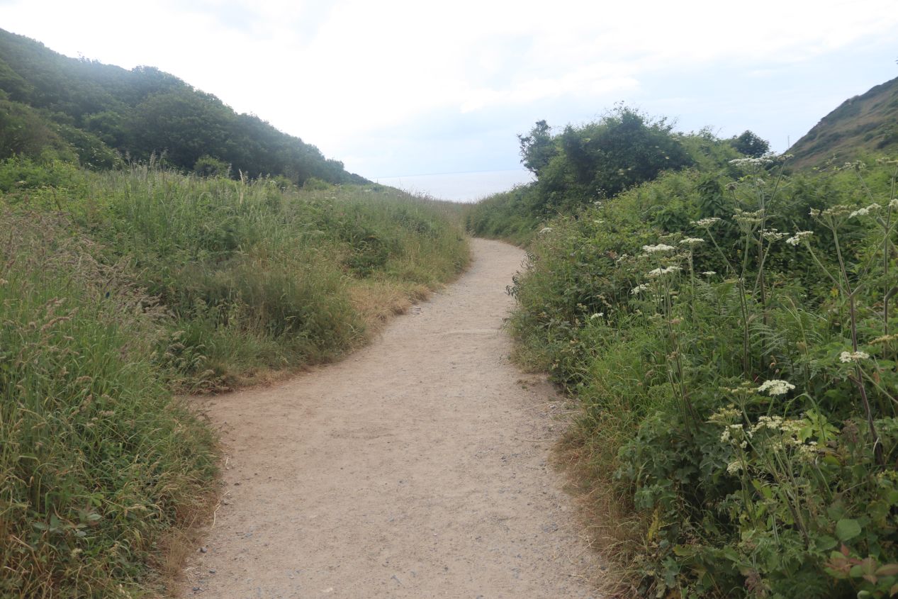


After wrapping up at Land's End, I drove a short distance southeast through more farming country until reaching Porthcurno Beach. (It's visible on the map above to see the beach's location in relation to Land's End.) Porthcurno Beach was nestled in between two steep hills that rose up on either side, with a short walking trail that led from an empty parking lot down to the water's edge. This beach is widely considered to be one of the most visually stunning in Britain and it has been listed by several different travel publications as being one of the ten most beautiful bays in the world. I could see the attraction as I walked out onto the sandy expanse which was empty aside from two people in wetsuits swimming in the water and a couple walking their dogs. Porthcurno Beach gets incredibly crowded during the peak summer season, with every spare bit of sand occupied by visitors, but I basically had the place to myself on this slightly chilly morning.

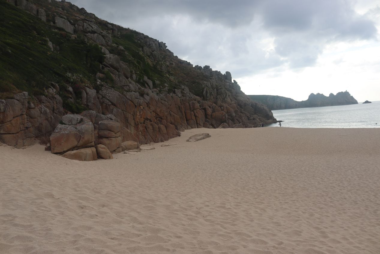


These were some of the views of the cliffs rearing up on the two sides of Porthcurno Beach. Note the stone staircase carved into the rocks of the last picture above; that was part of a walking trail that winded its way upwards until reaching the top of the hill. There was an outdoor theatre perched up there named the Minack Theatre which I had hoped to visit and snap a few pictures of its location looking down at the beach below. Unfortunately it was closed for the morning and visitors were not allowed inside; I'd been hoping to park my car up there and walk down the cliffside trail to the beach but it was not to be. This would have been a fantastic place to do some hiking in the gorgeous natural scenery but I was watching the clock and knew that I had to keep moving. The next place where I was traveling had a timed entry and I didn't want to miss it.

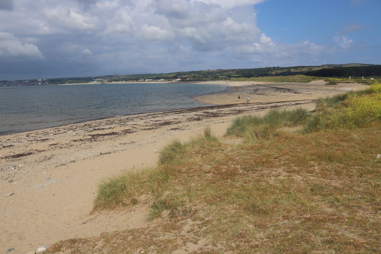


That destination was the tiny offshore island known as St. Michael's Mount, situated in Mount's Bay a little bit to the east of the town of Penzance. I didn''t have time to stop in Penzance as I drove through the town before parking my car a few miles to the east in a miniscule hamlet with the name of Marazion. The beach area here was the designated parking spot for visitors to St. Michael's Mount and I could see the island a short distance away across the waters of the bay. This was the attraction that I was most interested in visiting in Cornwall, a smaller English version of the more famous Mont St. Michel on the other side of the English Channel over in France.

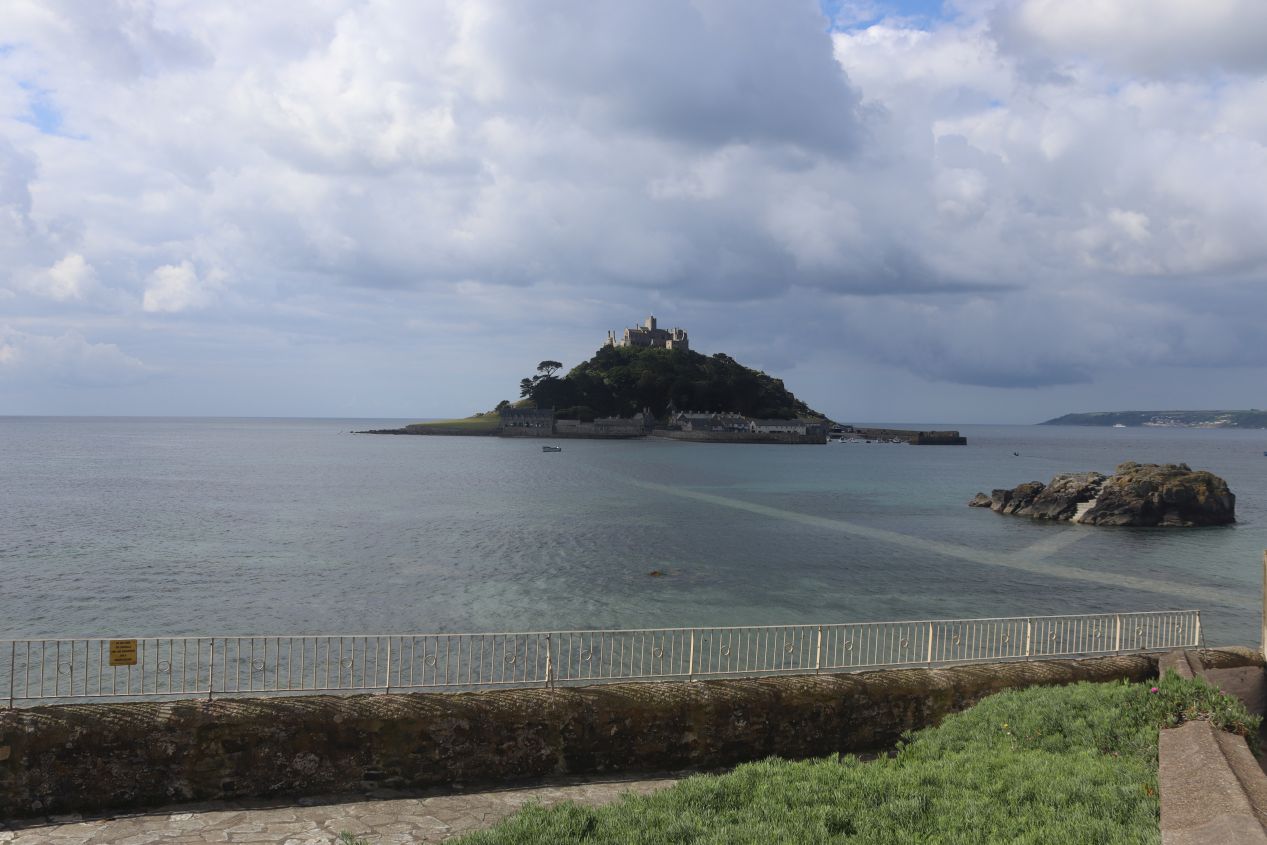


As an offshore island, St. Michael's Mount required some additional effort for me to visit. This part of the English Channel has strong tides with the water level rising and falling by about 16 feet / 5 meters between high and low tide. In fact, the water level shifts enough that St. Michaels Mount is not an island at low tide and can be reached by means of a causeway. The submerged path was visible in one of the pictures above although it remained out of reach unless I was willing to go for a swim. I was visiting at the initial entry time for the day at 10:00 AM which was only an hour after high tide; as a result, I would have to take the ferry boat even though I would have preferred to walk across using the causeway. Low tide wasn't going to arrive until about 3:00 PM which was simply too late in the day and therefore I had reserved a boat ticket online a couple weeks earlier.


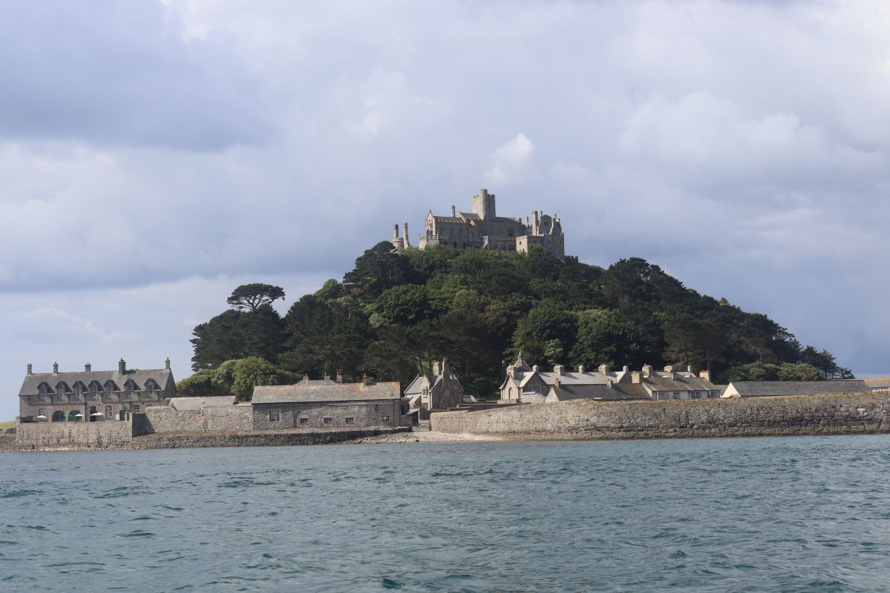
I made my way down to the stone docks where I presented my digital ticket and hopped aboard one of the little shuttle boats. These weren't even commercial boats designed for ferrying passengers, more like normal recreational craft which had been pressed into service. There was an adorable dog making the trip across the bay with us and everyone on board had the chance to get in some head pats while we were making the crossing. Once the boat cast off and headed out into the channel, we were presented with the sight of the small island growing in size as it rushed towards us. The weather was turning increasingly sunny as the day wore on and the waters were calm enough to see the causeway quite clearly beneath us. We were also able to look back at the shoreline of the mainland that we were departing:

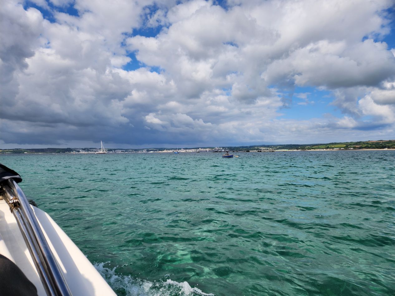


Marazion only had a handful of buildings hugging the coastline before giving way to the houses of its residents on the slopes of the hills. Further off in the distance to the west was the much larger town of Penzance, visible over at the other end of the bay. It only took a few minutes to make this short crossing before our boat was pulling up at the docks of St. Michael's Mount. This was a working port in earlier centuries with its own local fishing industry before giving way entirely to tourism in the modern era. At its height, the island had about 200 people living here before most of them moved back to the mainland over the course of the 19th and 20th centuries. There are still a handful of people who live in the pictured houses on the island, mostly staff for the castle who receive housing as part of their benefits package. This would be a really cool place to have a summer job as a college student even if it's probably not something you'd want to do full time.


The immediate area by the docks at St. Michael's Mount held a series of small shops designed to cater to the visiting tourists. There was a gift store here where I purchased a print depicting the island along with a cafe and a restaurant, all of which were opening up for the day's arrivals. The main attraction though was the castle itself, perched atop the highest crest of the hill in the center of the mount, and I headed in that direction right away in the hopes of beating any crowds that might show up later. The path leading up to the top of the mount was quite steep, sloping sharply upwards and with several large staircases along the way. There's actually a tiny underground railroad that ferries supplies from the docks up to the castle but it's not open to the public as it's not suited to carrying passengers. I quickly found myself outpacing most of the other early arrivals who stopped to take more pictures or catch their breath on the walk up the hill.

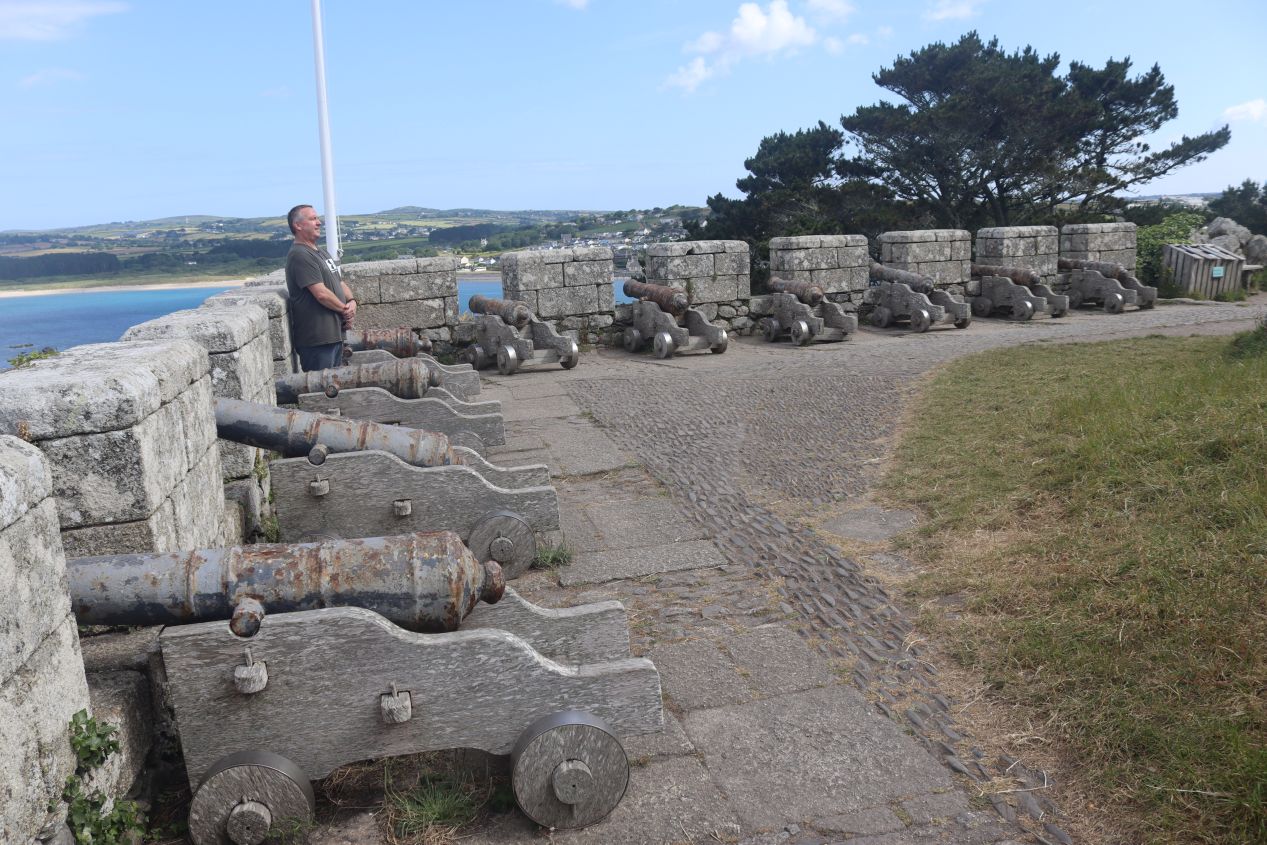


There was one spot of interest on the trip up to the castle, this lookout close to the top of the path on the western side of the island. Nestled beneath another Cornish flag was a series of old cannons pointed out over the bay, an indication that St. Michael's Mount had been fortified at times in the past and fought over during some of England's various wars. There was a siege here during the War of the Roses in the 15th century and then another siege two centuries later during the Wars of the Three Kingdoms as a royalist force held the island against the parliamentarians. As recently as 1940 the island was occupied by the British military and pillboxes were constructed during fears of a potential German invasion. Today this spot mostly provided sweeping views overlooking the surrounding bay, with little Marazion on the eastern side and the far larger Penzance over in the west. It was also the best place to capture a picture of the castle itself, looking like something out of a storybook with its ancient stone walls and British flag flying from the tallest tower.

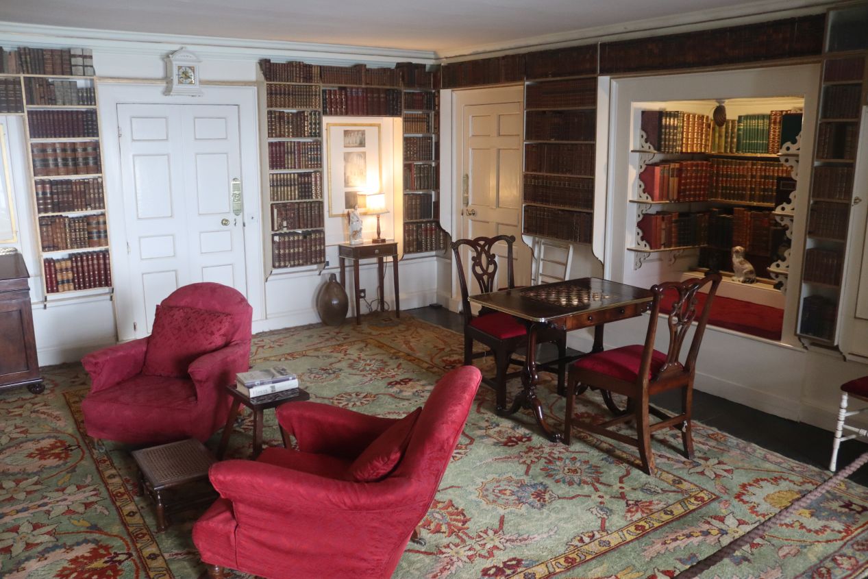


Finally I reached the top of the mount and entered the castle proper through the main entrance on the western side. Visitors are allowed to tour a good portion of the several dozen rooms making up the castle, with everyone provided with an audio tour that held additional details about the building. St. Michael's Mount has been owned by the St. Aubyn family since 1659, an unbroken line of descendants holding the place for nearly four centuries at this point. The head of the family lived at St. Michael's Mount for most of that time and many of the rooms in the castle had been decorated to appear as they would have looked in the late 19th or early 20th centuries. It was a little surreal to have these furnishings that resembled a stately hunting lodge, only to glance out a window and realize again that everything was sitting on top of a hill situated on an island.

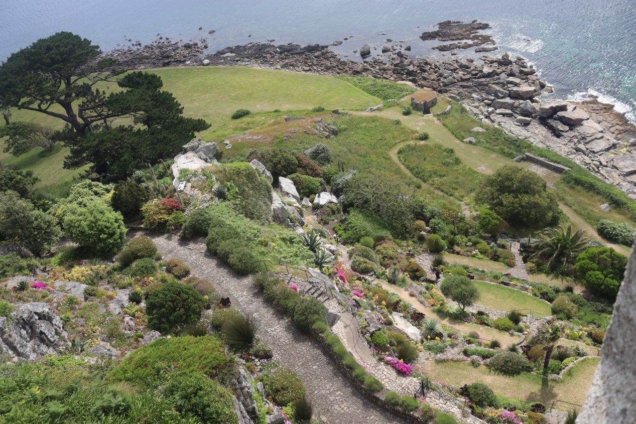


After winding through the great hall, the library, and several studies, the listening tour took me outside to a balcony on the southern side of the castle. There was an extensive series of gardens that occupied this part of the island and ran from the water's edge up to the castle mount. There was a separate fee to tour the garden portion of the island, one that I had already paid as part of a combined entry ticket, but I decided that I had a good enough view of them from up here and ultimately didn't walk on any of the garden paths. As nice as they looked, I had to keep moving with all of the things that I had planned for today. While still exploring this outdoor portion of the castle, I turned around to the eastern side of the building where there was a viewpoint looking back across the water at Marazion. This was the best view yet of the still-submerged causeway and little town on the other side of the bay.

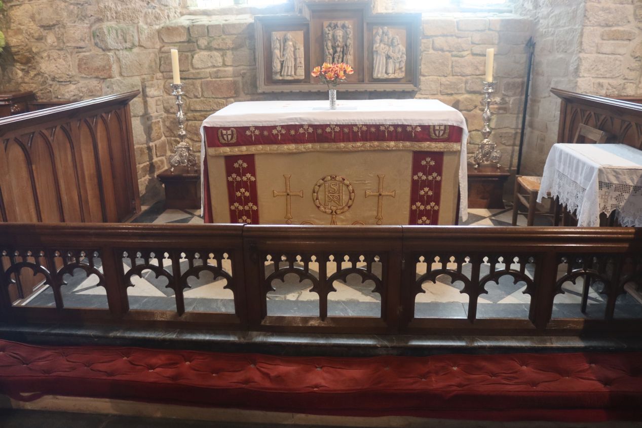


The highlight of the castle tour was probably the visit to its chapel. This stone structure was one of the oldest surviving parts of the building and it had a very intimate feel as it could only hold perhaps 50 people at a time for services. The chapel is dedicated to the Order of Saint John (yes, this is the group that traces its origin back to the Knights Hospitaller in Jerusalem) and serves as a bit of a callback to the early history of the island. St. Michael's Mount was originally the home to a series of monasteries throughout the medieval period, right up until Henry VIII dissolved the monasteries across England and the island reverted back to the crown. When I arrived at the chapel, the staff member inside told me that I was the very first visitor of the day. This allowed me to explore the place and take some pictures with no one else present, instead of having to fight through a sea of other tourists. I really liked this place and I can't think of too many places prettier than this one for religious services.

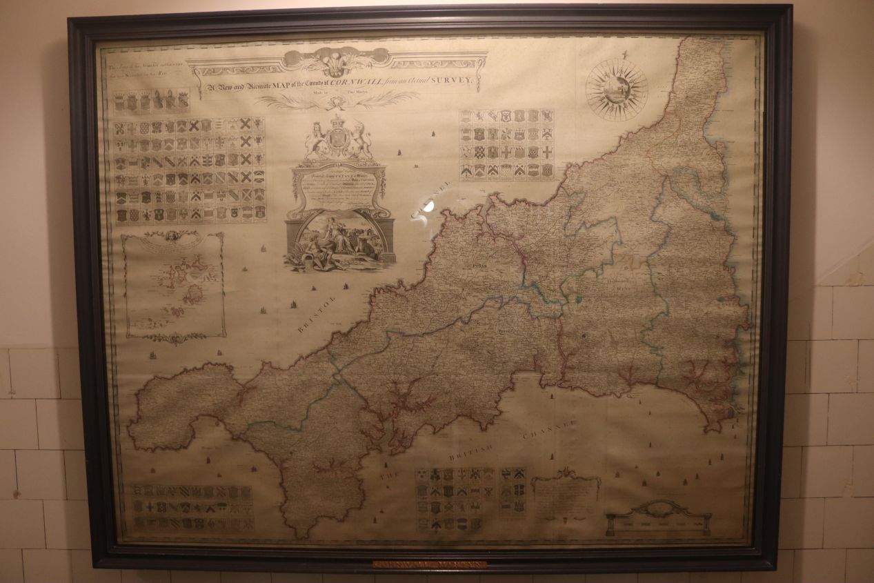


These were some of the featured attractions from the remainder of the audio tour inside the castle. This part of the tour passed through some of the apartments where members of the St. Aubyn family had lived in earlier eras as well as looked at a few of the collections held by the owners. I enjoyed seeing the map room which had a whole bunch of depictions of Cornwall at various points over the past few centuries. There were also nautical maps of Mount's Bay, a miniature model of the island, and an extensive collection of armaments from around the world including full samurai regalia for some reason. It was the sort of eclectic collection that you would expect to see from a family's private holdings and I enjoyed having the chance to explore more of this unique structure. I almost felt sad when the tour came to a close and I had to begin the trip back to the mainland again.


It was a little after 11:00 AM by the time that I made my way back down to the harbor of St. Michael's Mount. The boat operators seemed surprised that I wanted passage back to Marazion again since everyone else was arriving on the island, not departing it, and I was the only passenger who accompanied the boat's pilot back to shore. I would have preferred to walk back on the causeway but that still wasn't an option, even though the water level had clearly dropped by three or four feet in the 90 minutes since I had first arrived. I even saw one family walking on the submerged causeway over to Chapel Rock with the water a little more than ankle-deep on them. There were a whole bunch of signs warning people not to do what they were doing because it wasn't safe, at least I managed to get a neat picture of the situation though.

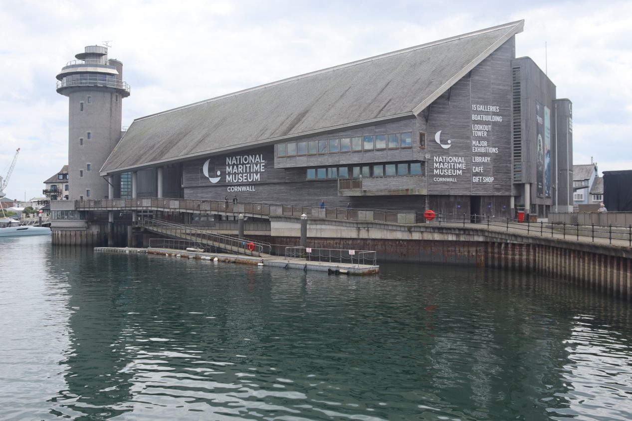


I bid farewell to St. Michael's Mount and returned to my rental car to make the drive east to the town of Falmouth. This trip took a little less than an hour and I found myself once again parking in a lot next to the waterfront. Like every other town that I had visited thus far, Falmouth was another port that had most of its history tied to the sea. Falmouth's claim to fame came from having one of the deepest natural harbors in the world which made it a perfect spot for hosting ships of war. This town has always had a strong military presence and a powerful series of fortifications were built at the entrance to the harbor which was where I would be visiting next. These pictures were taken along the main waterfront which still features a good deal of commercial fishing to this day, even though Falmouth's local economy has mostly given way to tourism. There's an excellent museum here named the National Maritime Museum of Cornwall which I really would have liked to see, however I didn't think that I had enough time to stop inside.


Basically, I could have gone to the museum or I could have eaten lunch, and, well, eating lunch won out.  More seriously, I had been up since 3:00 AM and I had already skipped out on breakfast in the interest of moving faster. It would not have been a good idea to skip another meal given the distance that I still had to travel before the day was finished. There were a series of restaurants located along Falmouth's waterfront and I grabbed a quick lunch here at the Pizza Express. The pizza was delicious, or maybe I was just really really hungry, but in any case this was 20 minutes well spent before I was off and doing tourist stuff again.



Once I was finished with lunch, I left the harbor portion of Falmouth and drove about a mile to the east where there's a headland that juts out into the surrounding waters and protects the harbor entrance. This natural defensive location is the home of Pendennis Castle which has been fortified since the time of Henry VIII in the mid-16th century. It was a short uphill walk from the parking area to a tunneled entrance that passed through the earthworks and into the central portion of the castle grounds. Pendennis Castle has been developed and re-developed repeatedly over the centuries as newer forms of military technology were created. What was originally a stone castle constructed by Henry VIII saw modernization during the Wars of the Three Kingdoms, during the threat of invasion posed by Napoleon, again during a period of strained relations with France in the 1850s, and then once again during both World War I and World War II. The result is a hodgepodge mixing of various defensive structures that forms a fascinating combination for someone like me with a background in military history. These pictures above showcased the barracks constructed in 1902 and used to house soldiers stationed here during the world wars; it later became a youth hostel for several decades and has since been converted into a museum that featured an exhibit about life at Pendennis Castle during the Great War.

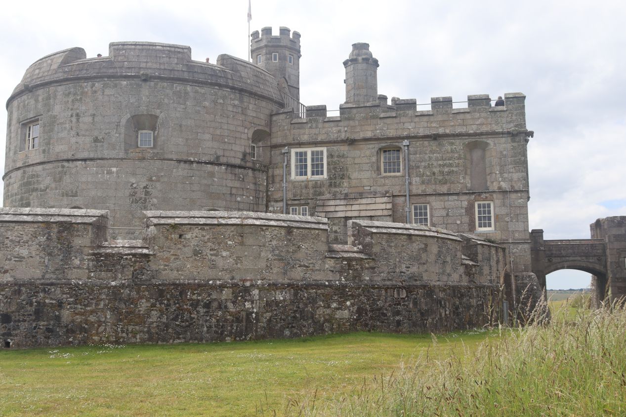


The most famous part of the castle grounds was the oldest structure, the circular fortress built in 1539 by order of Henry VIII. Construction took place here out of fear of invasion from France and Spain, with the site of Pendennis Castle being a critically important location to defend the entrance into Falmouth's harbor and the body of water known as Carrick Roads behind it. This original building had a vaguely medieval appearance, with the entrance defended by a portcullis and drawbridge which were already very much obsolete by the mid-16th century. The main function of the castle was to serve as a platform for firing cannons, which were on display up on the second floor of the structure:

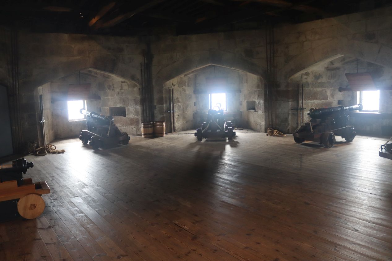


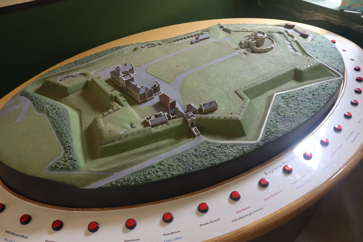
From this position on top of the fortress, itself on top of the headland jutting out into the sea, these cannons would have been able to fire upon any hostile ships trying to force their way into the harbor. However, this was still a badly flawed design in terms of fortifications; while these guns certainly would have been able to attack incoming enemies, they were complete sitting ducks for return fire. A vertical tower made of stone sticking up above the rest of the terrain was unbelievably vulnerable to enemy cannon shots and in any real conflict this structure would have been blasted apart in short order. It's a good thing that the castle built by Henry VIII never saw actual fighting; as the model that I photographed above indicates, it didn't take long before this rather silly castle was further fortified with star-shaped earthenwork defenses which actually would stop incoming cannon shots. Those designs were a lot less pretty, but they worked, and thus were a mainstay of European defenses for several centuries.


Henry VIII's castle might not have worked for its intended purpose, however the tall height of the tower did provide sweeping views looking out in every direction. I mentioned before how the weather had been clearing out throughout the day and by this point it was a glorious time to be outside enjoying the fresh air coming in off the English Channel. Off to the west was the modern barracks with the town of Falmouth and its harbor further beyond, whereas to the south and east the land fell away to be replaced with the dark blue waves of the sea. There were a number of sailboats out on the water enjoying the fine weather, and across the entrance to the harbor I could barely make out the smaller companion fortress of St. Mawes Castle that defended the eastern side of the harbor entrance. Even if I didn't care about the military background of Pendennis Castle, it would have been worthwhile coming here for these views alone.


As mentioned above, Pendennis Castle was built upon many different times over the centuries as defensive technology changed. Most of the current focus for visitors is on the tower built by Henry VIII since that's the oldest building still extent, however the castle grounds also hold a number of more modern structures that date from the two world wars of the 20th century. The largest of these was the Half Moon Battery built during World War II and located a short distance towards the water from the venerable tower. Visitors had to walk through an underground tunnel to reach the battery where there were two 6 inch (152 mm) guns on display. These things looked extremely deadly and there was a guide on hand giving a presentation about them to a group of tourists, walking them through how the guns could be rotated to fire across a wide field and all of the stuff that had to be done to load and then fire the massive shells. Pendennis Castle did see minor combat during World War II when the guns were used to chase off raiding German E-boats and it was one of the many staging locations for the D-Day invasion. This site is no longer in use by the British military which is great for the general public as it allows visitors to come and see this fascination location.
I had one more attraction to visit for the day which meant leaving Falmouth behind. I was heading to something called the Eden Project which holds a massive series of indoor biomes hosting plants and animals from several different climate types. It could be found about 30 miles / 50 kilometers to the northeast near the town of St. Austell which Google Maps said would take about an hour to reach. Unfortunately I made one wrong turn along the way, during one of the innumerable roundabouts that had multiple exits right next to each other, and this ended up detouring me through more country backroads that added about 20 additional minutes to the drive. Eventually I made my way to the tourist attraction and found a parking space in one of the huge lots on site, then walked down a series of hills to reach the entrance:


These were the sights that greeted me at the visitor entrance and then the overlook immediately past it where the view opened up to reveal the big bubbles of the habitats themselves. Getting a ticket at all proved to be unnecessarily difficult, as the employee at the cash register initially didn't want to sell me an entry pass because it was 3:15 PM and the Eden Project closed at 5:00. I kept repeating that yes, I did want to go inside, and yes, I was aware that they were closing in less than two hours, now could you please shut up and take my money? That was some bizarre behavior, not least because there was a number of other people also buying entry tickets at other cashiers at the same time. Anyway, the visitor center had a spacious cafeteria and gift shop which I hurried past since I didn't have a lot of time to waste. It was a good thing that I'd been watching the time carefully throughout the day to be able to visit this place at all.

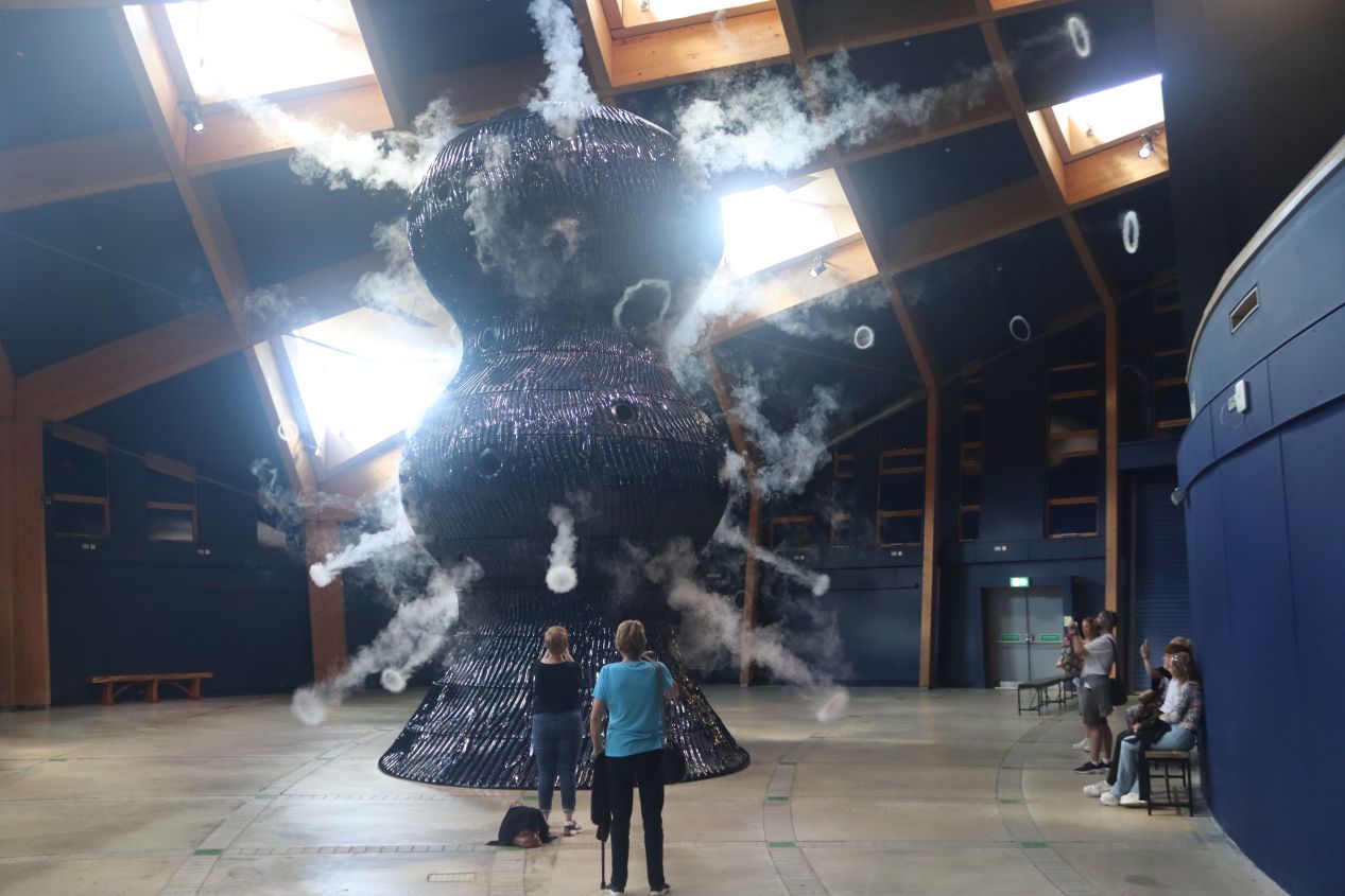


The Eden Project is therefore a somewhat educational form of eco-tourism nestled into the hills of Cornwall, and it's been successful enough since opening in 2001 to be the most popular tourist attraction in the county. I started out by visiting the Core, the more recent addition to the complex which houses various artwork and educational spaces. There was another cafeteria here on the upper floor and a series of smaller exhibits that focused on the "invisible world" of tiny things like cells and bacteria and so on. The most impressive part of the Core was the pictured huge sculpture named Infinite Blue, which had its own room to itself and kept releasing smoke rings in irregular patterns. This was supposed to represent cynobacteria conducting photosynthesis which led to the Great Oxidation Event around 2.5 billion years ago and completely transformed Earth's atmosphere. There wasn't a ton to experience here in this building but it was worth stopping in for a little while to see the various art objects on display.


Neat as some of the stuff inside may have been, the Core was still ultimately a sideshow at the Eden Project. I wanted to speed over to the main biomes before too much more of the afternoon passed, though I actually had some trouble finding where the entrance was located. How did you get inside those giant domes anyway? It turned out that they had a shared entrance in between the two domes, with visitors funneling in past a cafe and yet another souvenir shop (as if the one at the main entrance wasn't enough!) I don't know what was going on with the flag decorations either, they looked a bit like Tibetan prayer flags but definitely were something else. Since it was getting late in the day, there were more people leaving than entering the two biomes when I arrived which suited me just fine. I had to pick which one to see first and opted for the Mediterranean climate:

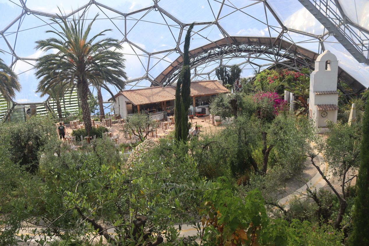


This biome focused on the warm temperate portions of the world's climate, with listed environments including southern California, South Africa, southwestern Australia, and of course the Mediterranean itself. Needless to say, these areas have a much warmer and drier climate as compared with England which was why the enormous overarching dome was needed to grow the various plants on display. It was definitely warm inside the biome as I strolled along the marked path, with flora from each of these regions separated into their own distinct parts of the biome. There was an Italian villa here where even more food was available for purchase, fruits and nuts being grown in the Australia portion, olive trees in the Greek section, various citrus plants in the California section, and so on. I'm not much of an expert on plants but it was still pleasant to stroll through the biome looking at all of the different greenery on display, even with the weird hexagons of the dome always hovering in the background. The Mediterranean biome is the smaller of the two at about 1.5 acres in size and stretching to a height of 115 feet / 35 meters. That meant that the other rainforest biome was even larger:

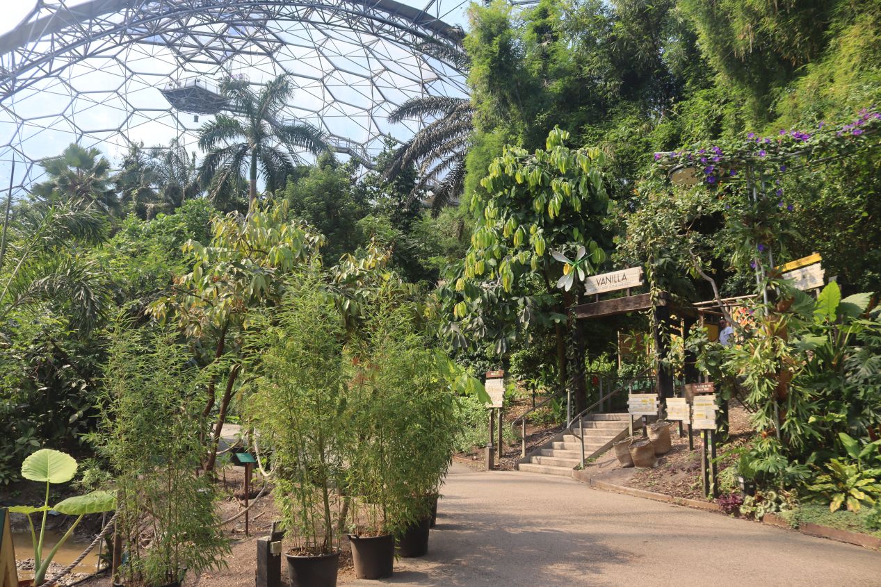


Both of the biomes required visitors to pass through a kind of airlock for entry in order to maintain their respective climates. If the Mediterranean biome was warm, the rainforest biome was downright hot with a sign at the entrance warning tourists that the temperature inside frequently exceeded 30 Celsius / 86 Fahrenheit. The plants and animals inside were drawn from the world's equatorial belt where the rainforests are concentrated: Central and South America, West Africa, and Southeast Asia. These plants could only be described as lush, with giant leaves designed to catch heavy rainfall and trunks stretching far up into the sky. The rainforest biome covers four acres of space and reaches a height of 180 feet / 55 meters to allow room for these gargantuan plants. Having visited southern Vietnam only a few months earlier, this biome was definitely reminiscent of the climate that I had encountered there.

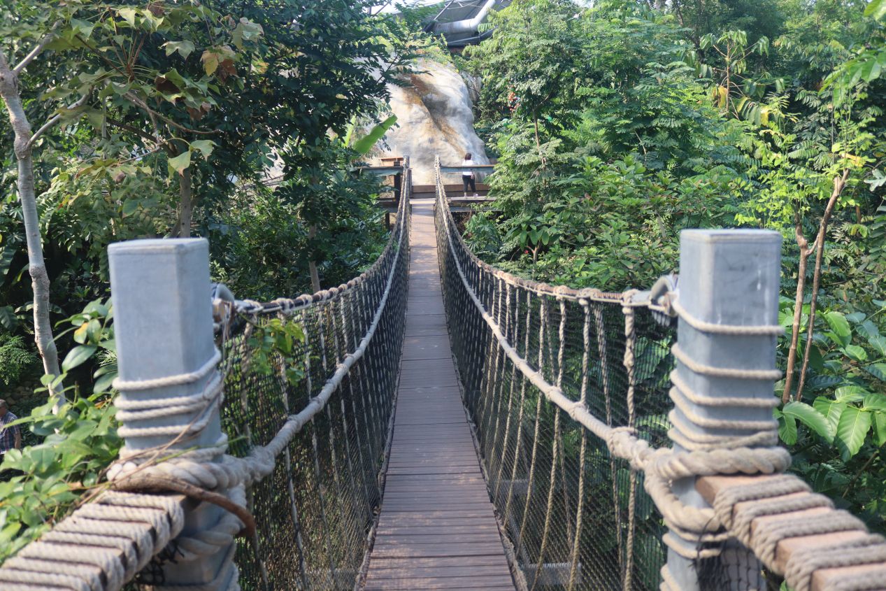


The rainforest biome also had something that the Mediterranean one lacked: an elevated canopy walkway that allowed visitors to explore part of the dome at the treetop level. I'd estimate that this was about 50 feet / 15 meters above the floor of the biome and climbing the stairs to the top in this hot, muggy atmosphere left a number of the other visitors audibly gasping for breath. I was certainly working up a good sweat as it was quite unpleasant to be exercising in that heat. At least the views from the canopy were excellent, with the chance to see more of the treetops up close and as much of the dome as possible that wasn't blocked by even more trees. There was a rope bridge here that swung a bit back and forther along with a good-sized waterfall that plunged down to the floor below. After exiting the canopy walkway, the remainder of the path featured tropical crops like bananas and avocados along with, of course, sugar cane and coffee beans. There were even free samples of tea made from plants grown at the Eden Project which was a nice refreshment after walking through this hot climate.


The only other attraction of note at the Eden Project was their concert stage which was situated in front of the two main biomes. It was designed to look like them using the same bubble-like shape and there was a concert taking place later that evening as part of the Eden Sessions event. Wikipedia claims that the artist this night was an Australian band named Crowded House that I had never heard about before, although I'm hardly any kind of an expert on rock music. This was the whole reason why the place was closing at 5:00 PM as the Eden Project needed to boot out everyone who hadn't paid to see the evening show. It was getting close to 5:00 PM by this point and I needed to make my way back to the rental car for the drive home. Unfortunately the Eden Project is located down at the bottom of a large hill (due to the fact that this was previously a massive clay pit before it became a tourist attraction), and the walk was entirely uphill to get back to the parking area. Basically, it's easy to get in but it's hard to leave this place. Overall, the Eden Project was pretty neat to see but visitors should be aware that it's quite pricey; my single ticket admission was 45 pounds in 2024 which felt steeper than what the place should have been charging.
Then I still had to make my way back to Bristol which took another full three hours from the Eden Project. Even though I was able to stay on major roads the whole time, this was still pretty exhausting given how long my day had been. I was definitely fighting off drowsiness for the last hour or so before finally making it back to downtown Bristol around 8:00 PM. It was a rather insane day of sightseeing but I was able to stop everywhere that had been on my list and experience a decent cross-section of Cornwall. This is one of the more remote parts of Britain and I doubt that I'll have a chance to come back again so I'm very glad that I had this opportunity, even if it was only for a single madcap day!


