
By and large, up to this point I had been visiting different cities on my trip across America. Whether it was large cities like Detroit and Indianapolis or smaller locales like Springfield and Iowa City, everywhere that I had traveled constituted an urban center of some kind. This was about to change here on the seventh day of my trip, as I left the cities of eastern Nebraska behind and headed out into the open prairies in the western portion of the state. My route was taking me completely across Nebraska and then across the border into Wyoming, where I would visit yet another state capital before the day was finished. Along the way, I would be stopping at the natural monuments of Chimney Rock and Scotts Bluff, otherwise obscure locations known to a generation of schoolchildren who grew up playing the "Oregon Trail" computer game in the 1980s . These natural rock formations are basically out in the middle of complete nowhere, and as a result they don't see too much in the way of tourists. This was my chance to cross the Great Plains and spend some time in a part of the country that I'd never visited previously.

I knew going into this day that I needed to cover a lot of ground from a geographical perspective. Nebraska is a large state and I would be crossing nearly its full extent, hundreds and hundreds of miles of farmland with nothing but small towns to mark the distance passing by. It was a full 500 miles / 800 kilometers to reach Cheyenne on the other side of the state border in Wyoming, and I'd have to detour off of the main interstate to reach Scottsbluff to see the natural rock formations along the way. This meant that I would be spending roughly eight hours driving throughout the day, limiting the amount of time available for sightseeing. Fortunately I would pick up one extra hour of daylight as I crossed over into the Mountain time zone, but I would still be racing against the clock to reach Cheyenne before everything tourist-related shut down for the day. As a result, I would need to be up early again and keep an eye on the time throughout the day.
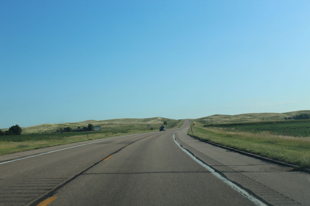
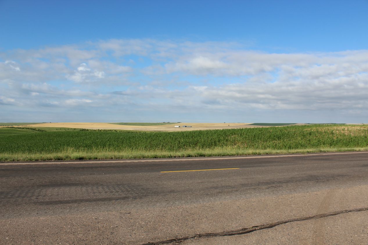
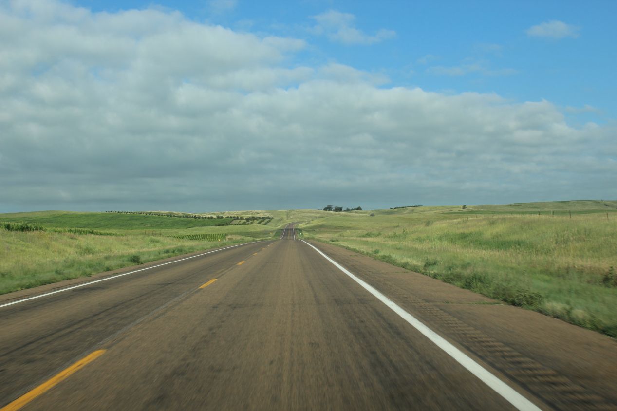
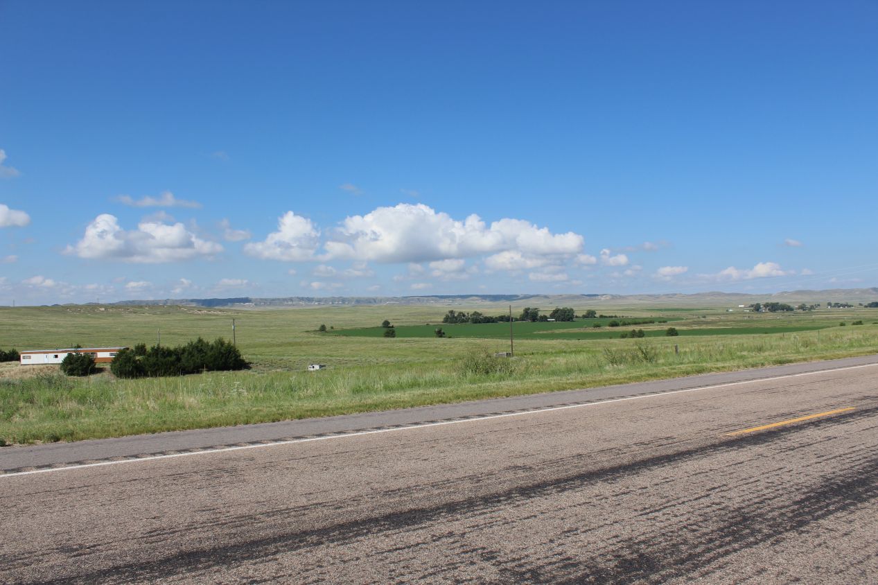
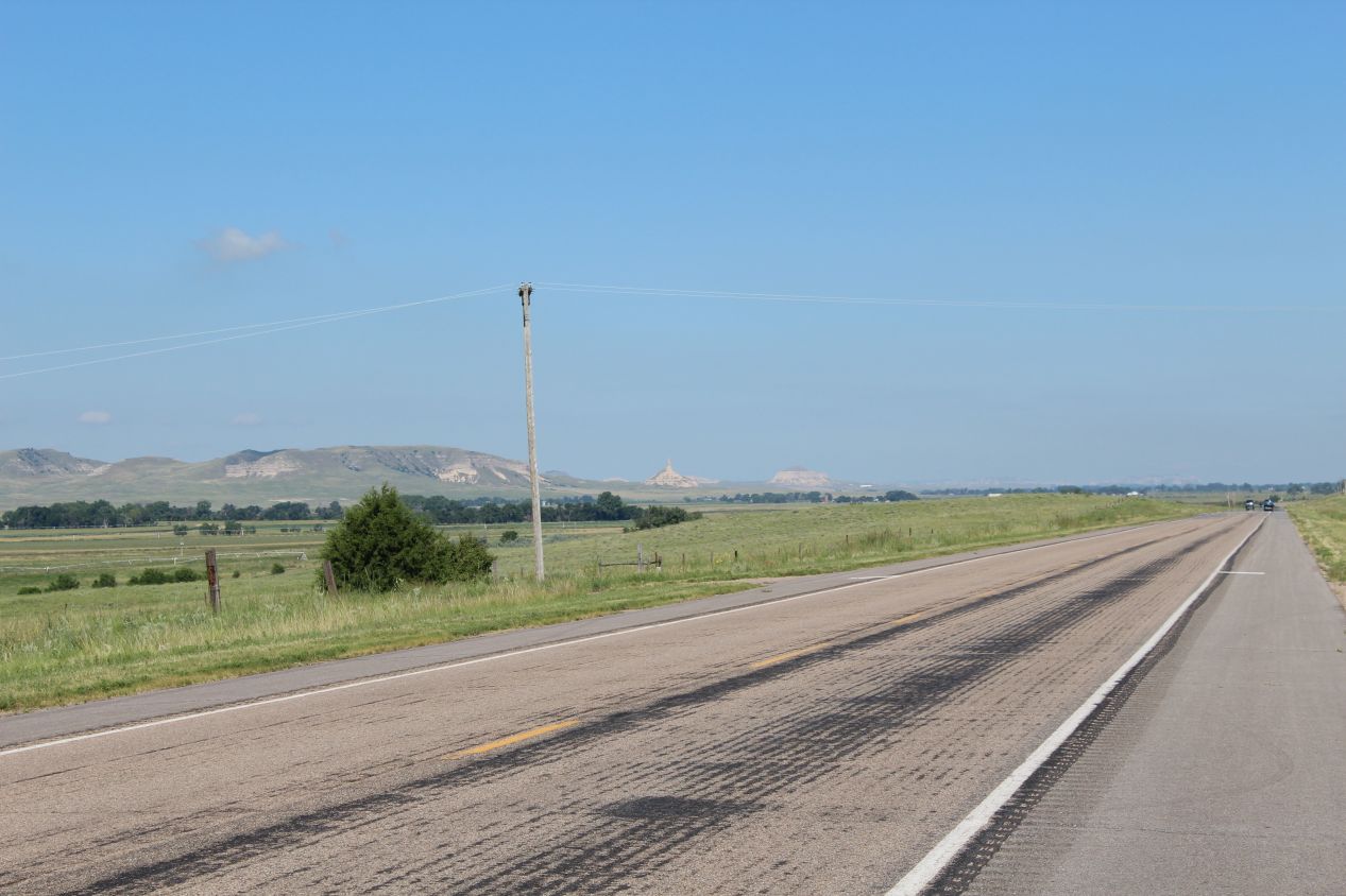
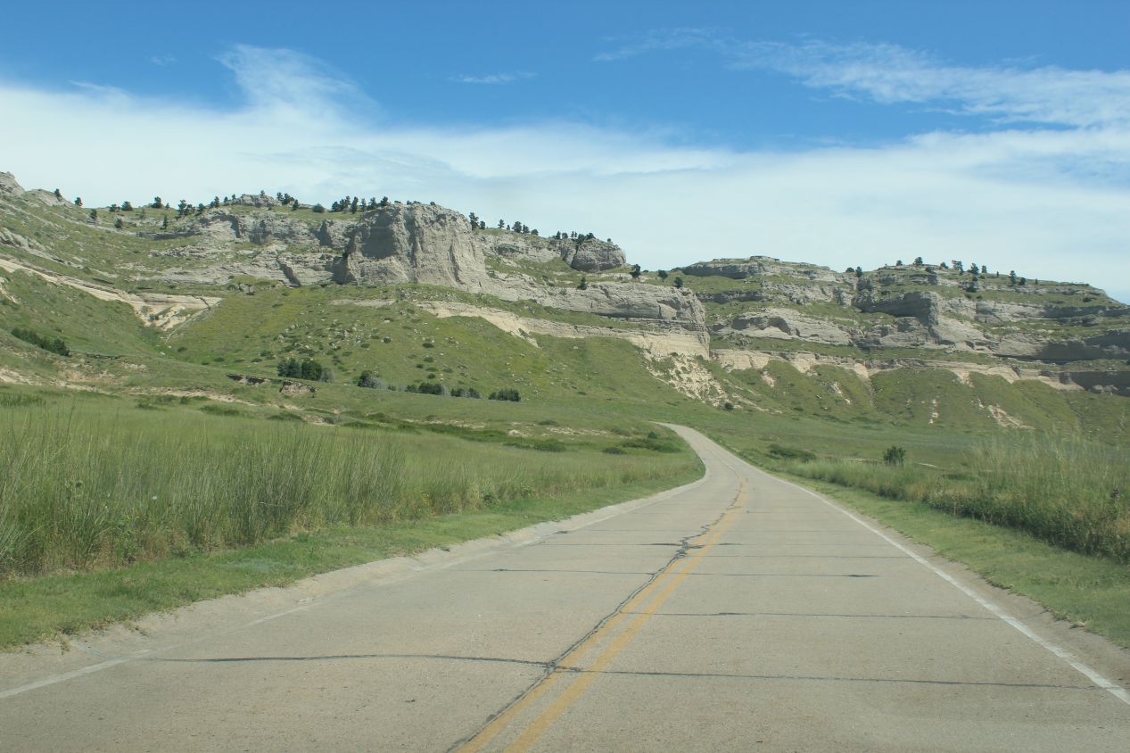
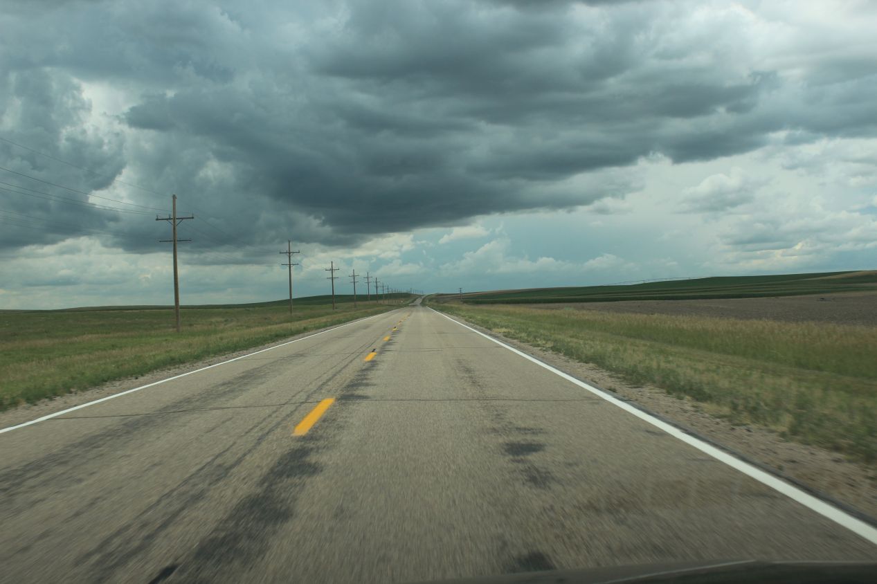
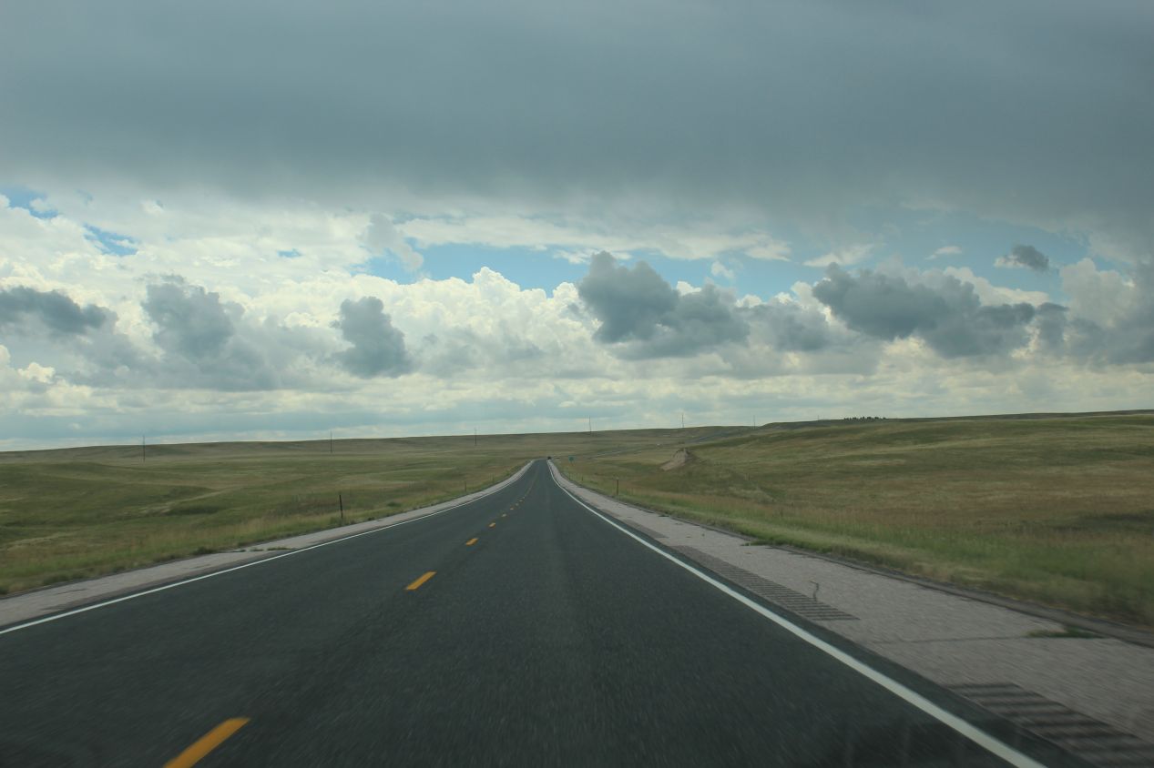
I woke up at 5:30 AM and hit the road immediately. The first few hours of driving were unremarkable, with the sun slowly rising into the sky behind me in my rear-view mirror as I headed west on Interstate 80. There was little of note along the way, just lots and lots of farms and small towns passing by at 75 miles/hour. I did see a big dealership for John Deere tractors at one point next to the interstate, that was about the biggest thing out of the ordinary as I rolled through central Nebraska. Things became more interesting around midmorning when I reached the little town of Ogallala and turned off the main highway, splitting off onto Nebraska state highway 26. That's where the above pictures were taken, as I found myself traveling along a mostly deserted single lane road with more endless cropland stretching to the horizon. The land was starting to become a bit rougher as I passed into western Nebraska, a little bit rockier, and at times the farms gave way to open fields of waist-hight grass. This was the Great Plains in its full glory, one of the few regions of the United States where I hadn't traveled before. The landscape was made up of very gently rolling hills, with little in the way of trees or any distinctive landmarks. Whenever the road crested one of those low hills, it felt like I could see forever as the horizon extended endlessly into the distance.
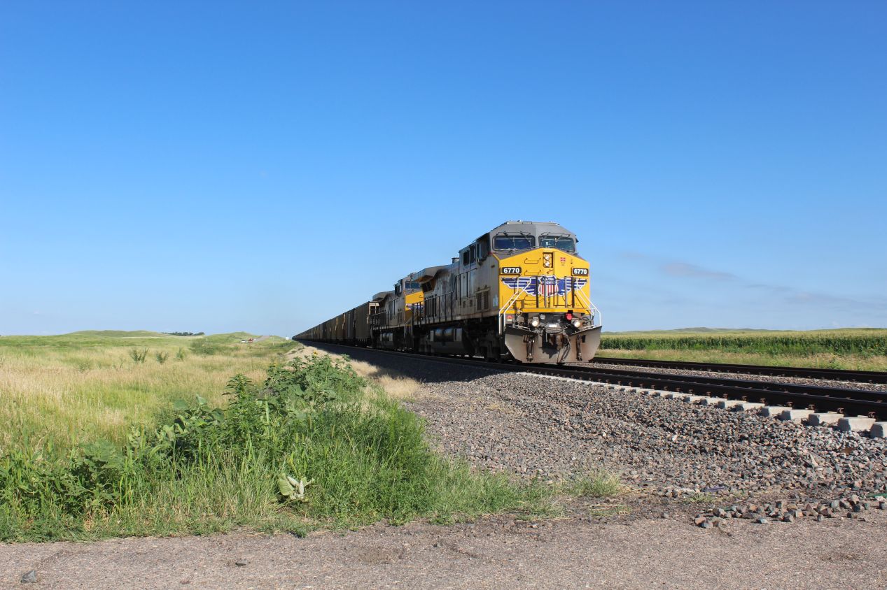
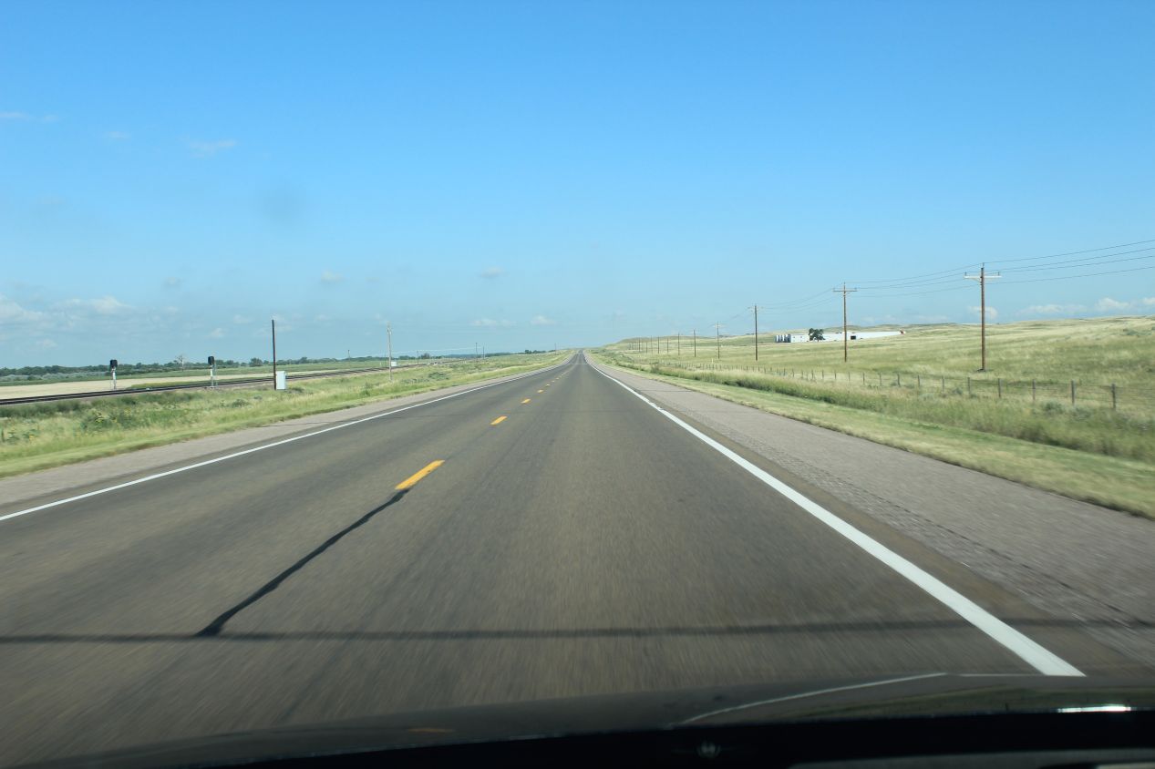
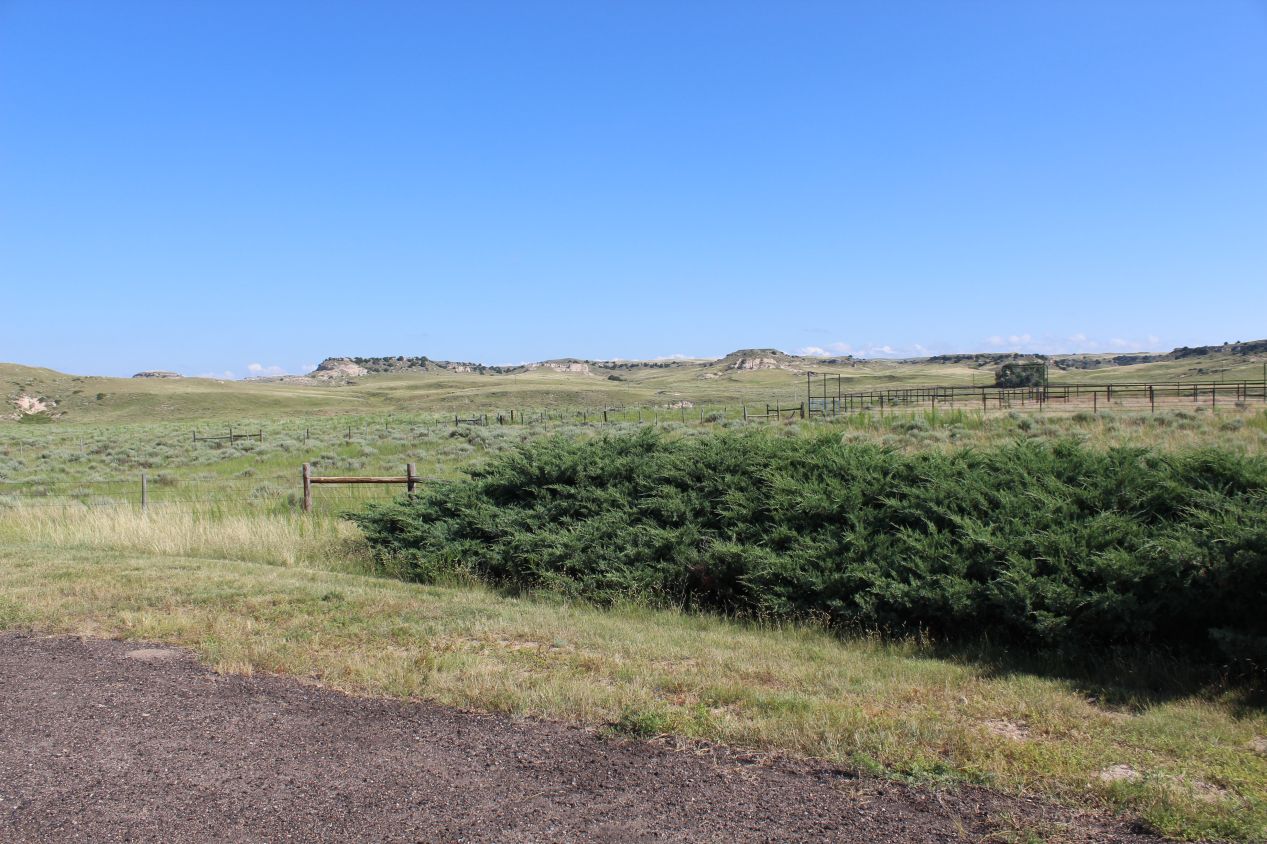
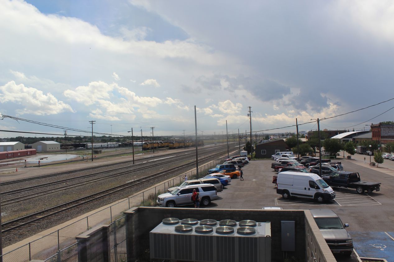
I tried to stop occasionally to take some pictures of this environment when there was something that stood out. For example, I was able to see a train coming in the distance and snapped this picture of the Union Pacific railroad as it passed in the opposite direction. The tracks were paralleling the road and I saw a couple more trains throughout the drive. Mostly though, the landscape was generally flat and it seemed to stretch on forever, like in the second picture above. There was just the road, the rails, and a single line of telephone poles running together towards the horizon. Traffic from other cars was light, if not truly deserted as I had seen in some parts of Alaska and Iceland on previous trips. During the last 20-30 miles as I approached my first destination, I did notice that some rock formations were starting to appear along the way. This was the first sign that I was beginning to reach the western edge of the Great Plains, and that they would eventually give way to the mountainous terrain of the Rockies.
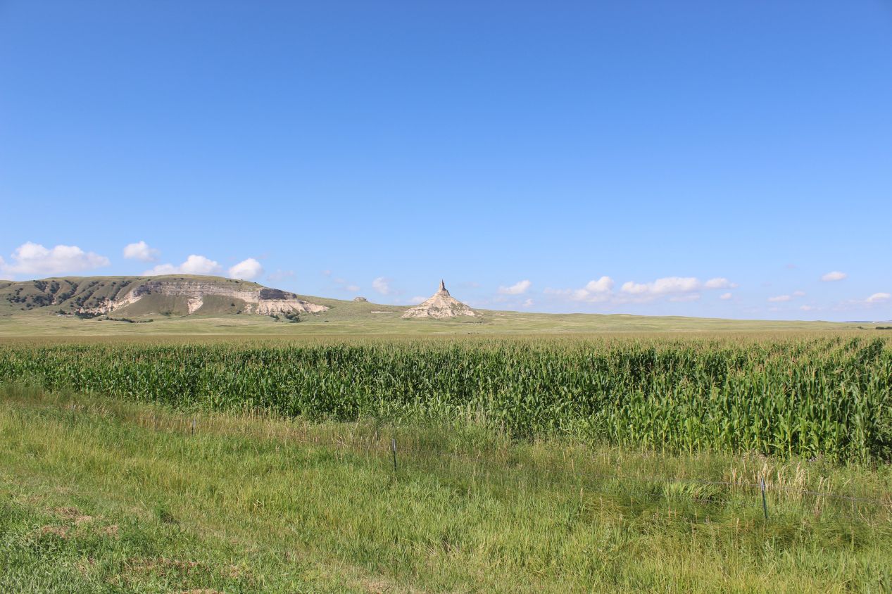
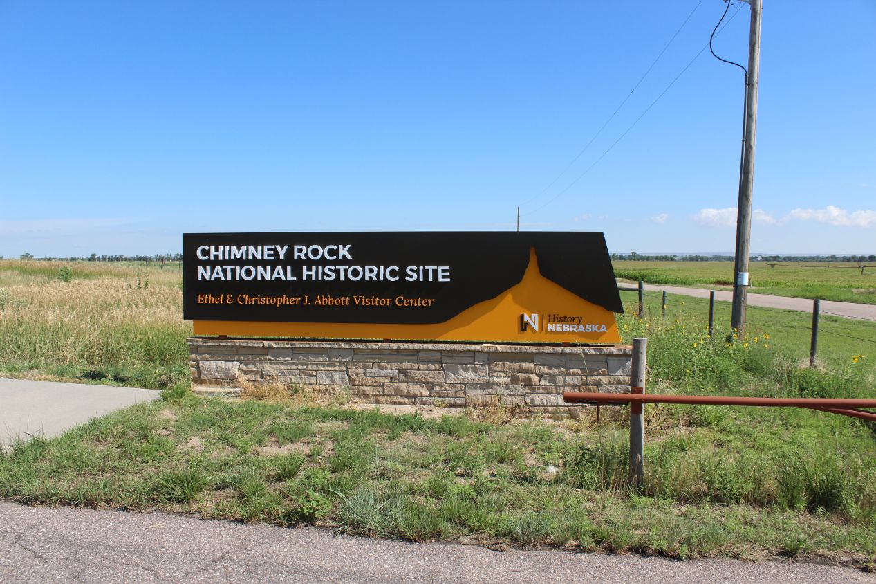
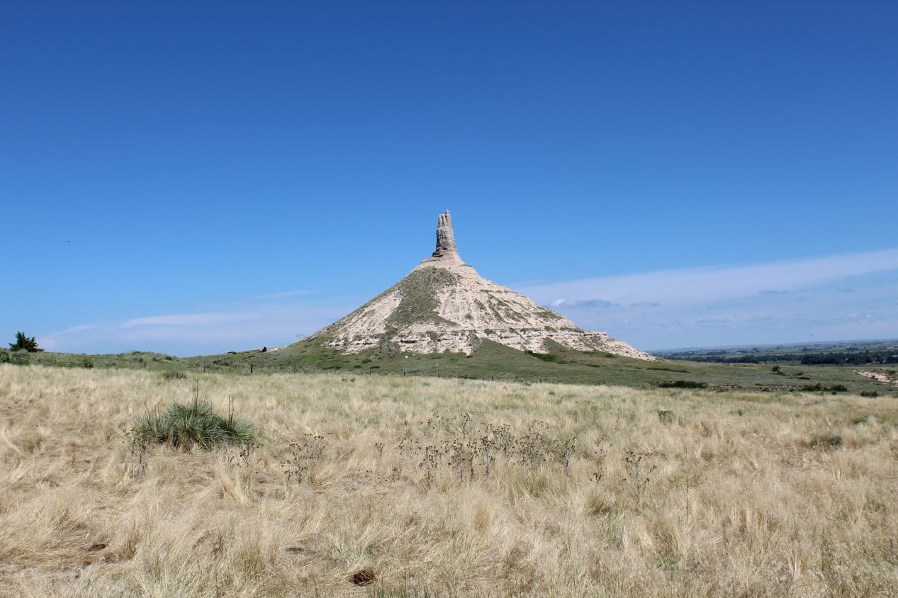
Chimney Rock was where I was headed, and its distinctive shape rising up from a mostly flat plain made it visible from a long distance away. I had the location entered into my phone on Google Maps, and I was surprised to realize that I could spot Chimney Rock when my directions were telling me that it was still about eight miles away. This is the whole reason why the place became famous, of course, as pioneers heading west used it as a landmark because it could be seen from such a great distance. Chimney Rock had a visitor center that was located about half a mile away from the natural monument, at the end of a local road that was otherwise indistinguishable from a thousand others I had passed along the way. It was not a large visitor center and the parking lot had spaces for about 30 cars; in other words, this wasn't a place that too many people come to visit. I was both amused and slightly taken aback by the prominent sign warning visitors to stay on the paths because "rattlesnakes are common in this area." Good to know!
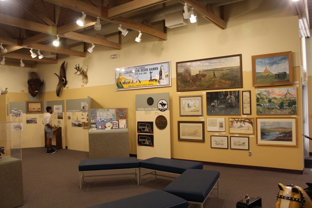
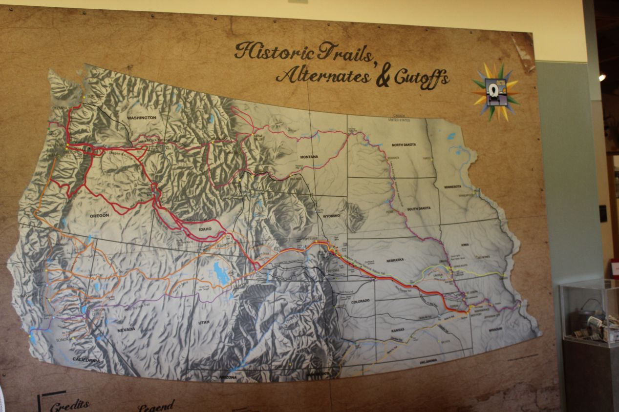
While the visitor center at Chimney Rock was small, it did a good job of putting the historical importance of the rock formation into context. With its height of roughly 300 feet / 90 meters, Chimney Rock served as a landmark along the Oregon Trail, the California Trail, and the Mormon Trail during the mid-19th century as pioneers headed for the western coast of the USA. Most of the exhibits in the visitor center focused on the men and women who crossed the Great Plains in covered wagon trains, a dangerous journey that resulted in thousands of deaths along the way. Nearly all of those fatalities were due to disease, hunger, or lack of adequate medical care; the exhibits here made clear that the local Native Americans usually were interested in trading with the settlers and almost never attacked them. There were far more cases of the travelers attacking the indigenous population than vice versa. I also liked the big map of the historic trails, as it showed not only the route taken by those pioneers but also just how mountainous the landscape became after crossing into modern Wyoming. After leaving Chimney Rock in western Nebraska, the trip became much harder shortly thereafter.
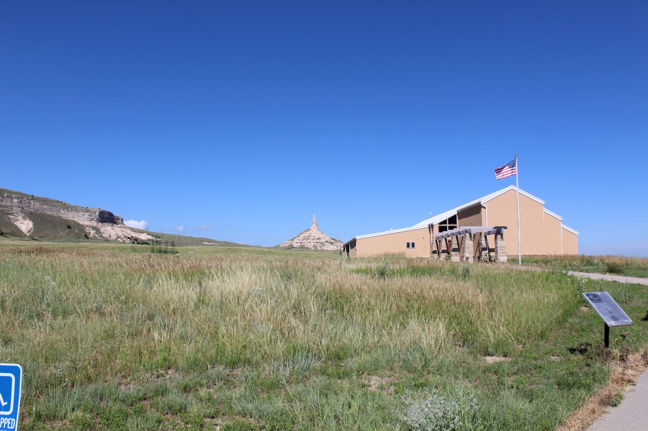
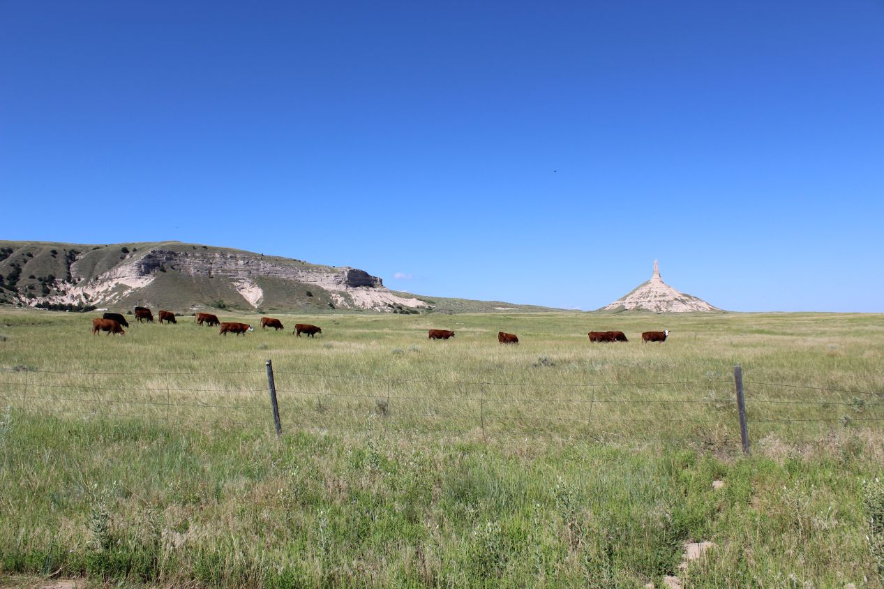
I took some more pictures of Chimney Rock itself from behind the visitor center. A herd of cattle decided to photobomb me in the process, albeit a very slow moving photobomb as they walked past. Unfortunately most of the land immediately surrounding Chimney Rock is privately owned, and these cows were the property of a local rancher. They seemed blithely unconcerned about the tourists at the visitor center on the other side of the fence.
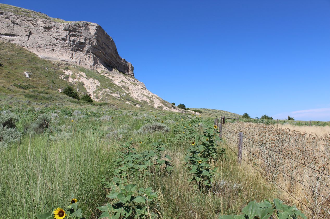
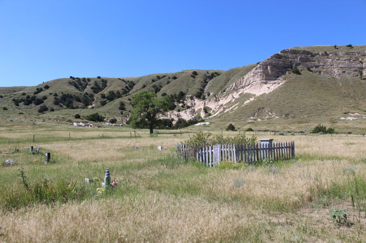
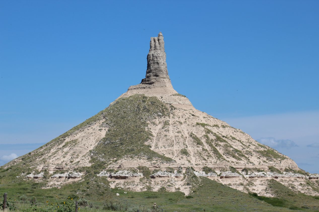
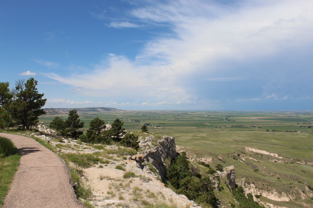
There is no direct access to the historic site itself. The closest that I could do was to follow a dusty dirt road that ran past the visitor center to the Chimney Rock Cemetery a short distance away. There was no parking lot here and no one else present, only an end to the dirt road and the small cemetery. According to Google Maps, there was a hiking trail here that led to Chimney Rock itself, and I did my best to follow it. However, that trail existed more in theory than in practice, and the first picture above depicts what that "trail" looked like in reality. Although I think that there was a path there at one time, it had been completely neglected and was now overgrown with plant life. There were also tons of little jumping bugs here (grasshoppers, I think?) that were leaping up with every step that I took through the grasses. I didn't care about them, but I did care about the rattlesnakes that were common in the area. With their coloring, I would never see one in the tall grass that I was moving through until it was too late, and with zero other people around, there would be no one to send for help if the worst happened. This didn't seem like the wisest decision and I stopped trying to follow the path to the base of Chimney Rock. My camera was able to get some great pictures from about a thousand feet away, as well as capture the tiny cemetery dedicated to those settlers who had perished along the journey west.
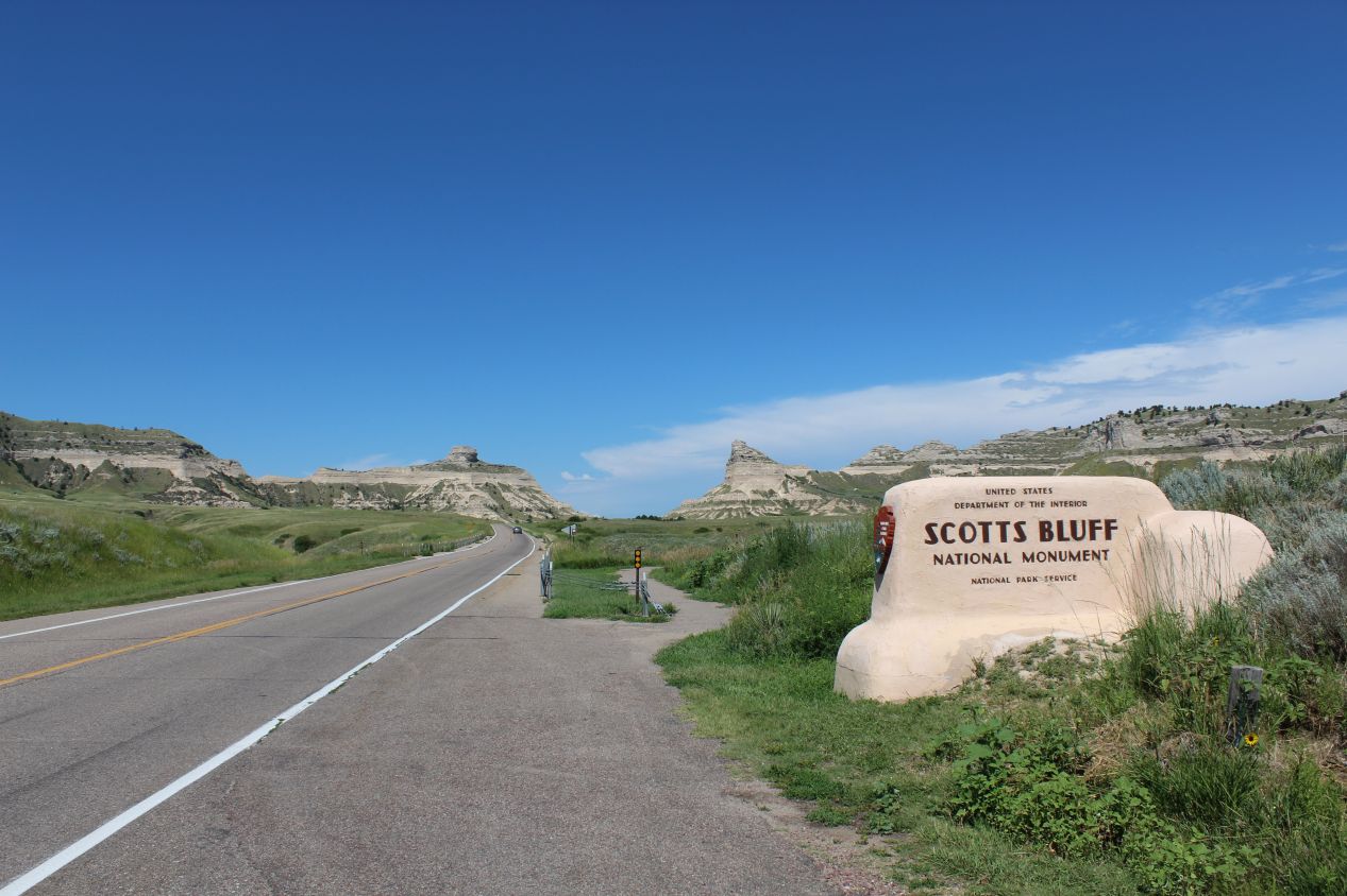
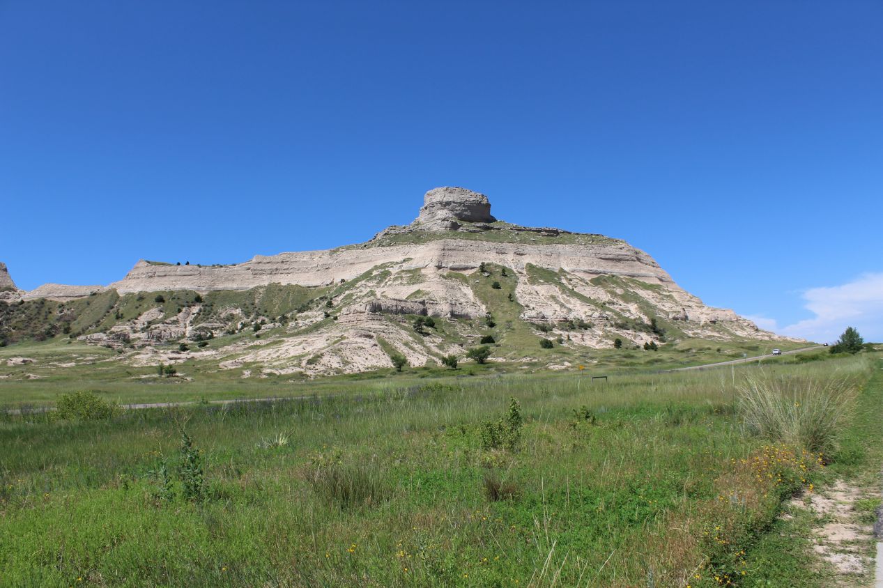
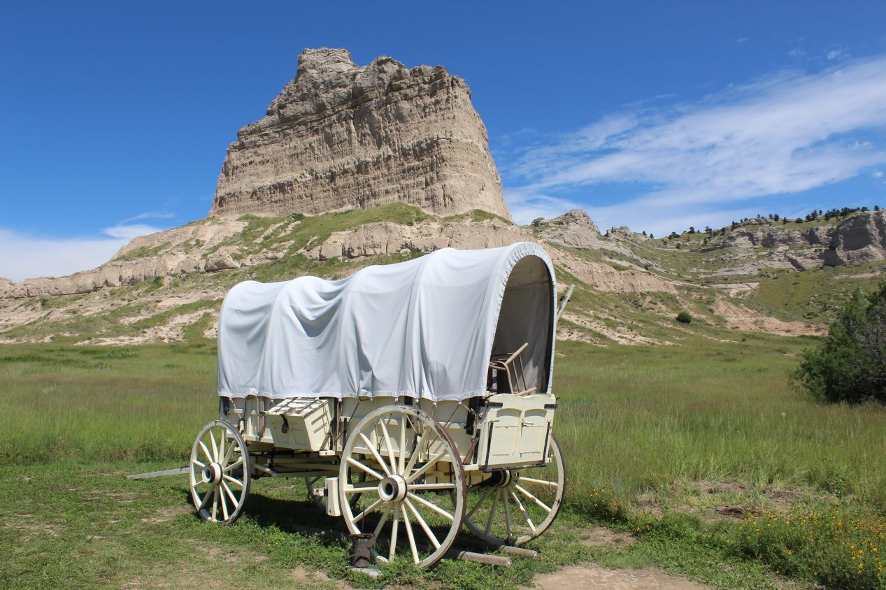
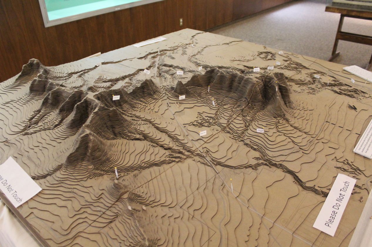
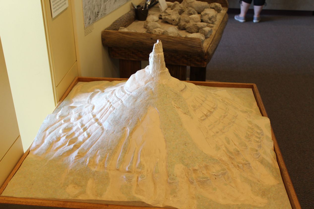
In addition to Chimney Rock, there's a second national monument located a relatively short distance away known as Scotts Bluff. Situated about 20 miles / 35 kilometers further west, Scotts Bluff National Monument was another important 19th century landmark on the Oregon Trail where the route passed between two tall bluffs. Scotts Bluff is the taller of the two with a height of about 800 feet / 240 meters above the plains at its highest point. The name of the location has a rather morbid origin story, as it comes from fur trader Hiram Scott who died near the bluffs in 1828. For two decades in the 1840s and 1850s, thousands of pioneers heading westward passed through the bluffs at this spot in covered wagons like the one pictured above. By 1870, however, the intercontinental railroad had been completed and there was no further need for covered wagon trains. There was also a visitor center at Scotts Bluff, this one even smaller than the one at Chimney Rock, and unfortunately the information inside was pretty dated. My favorite thing on display was the three dimensional topographical map depicting the two bluffs and the modern road running between them.
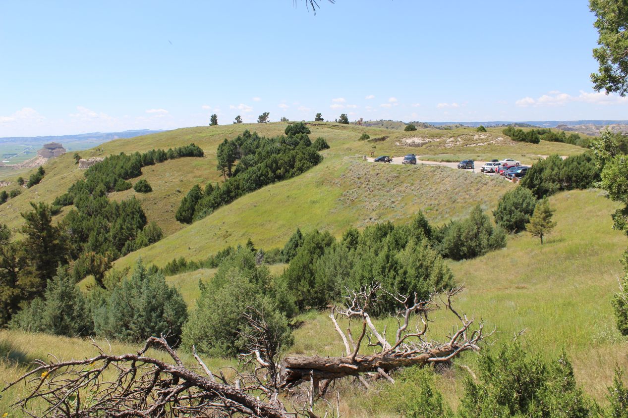
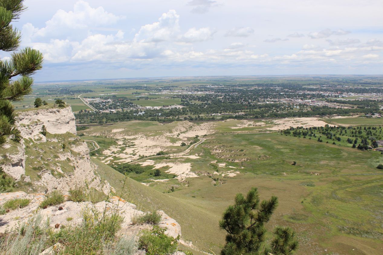
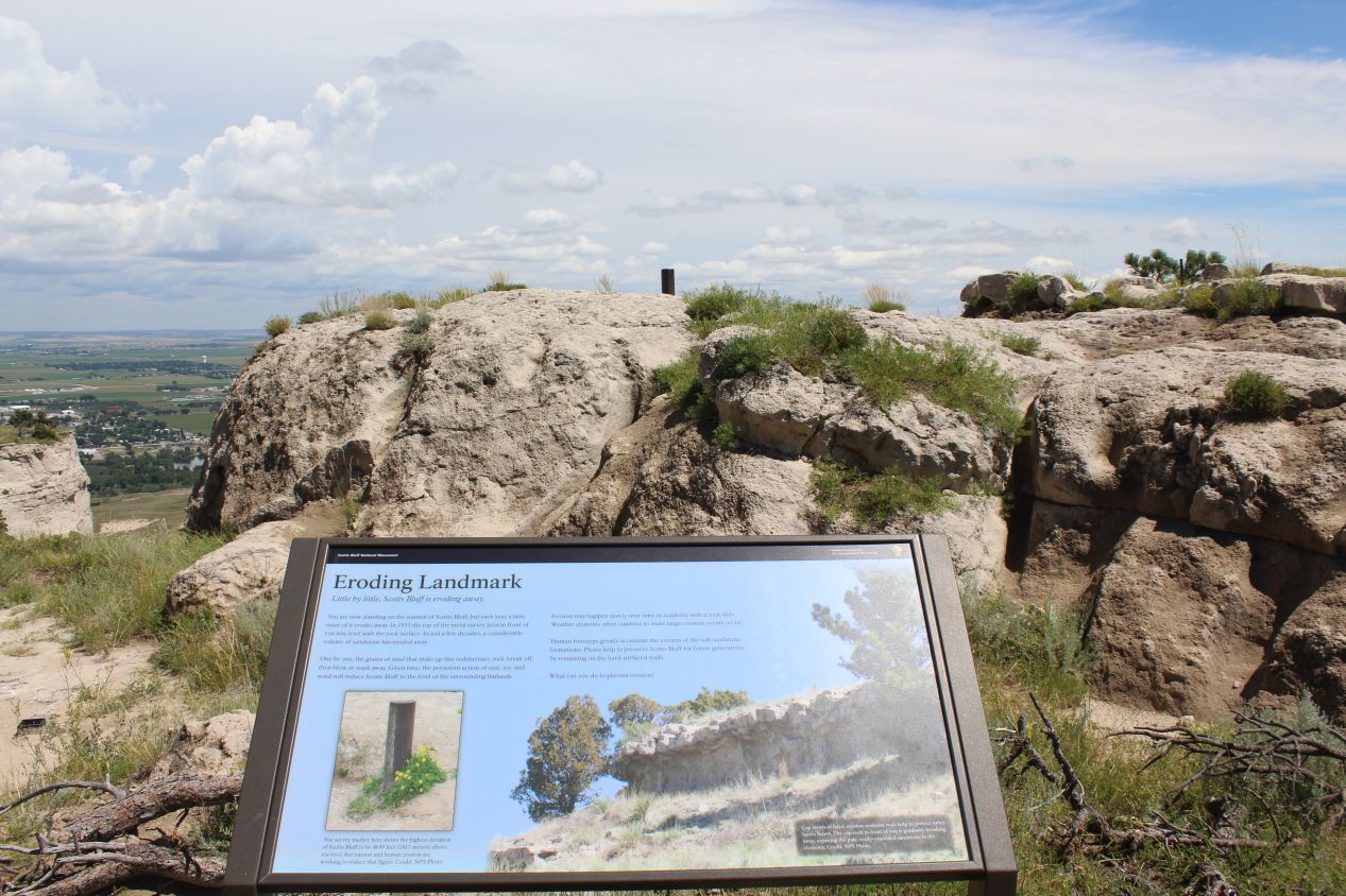
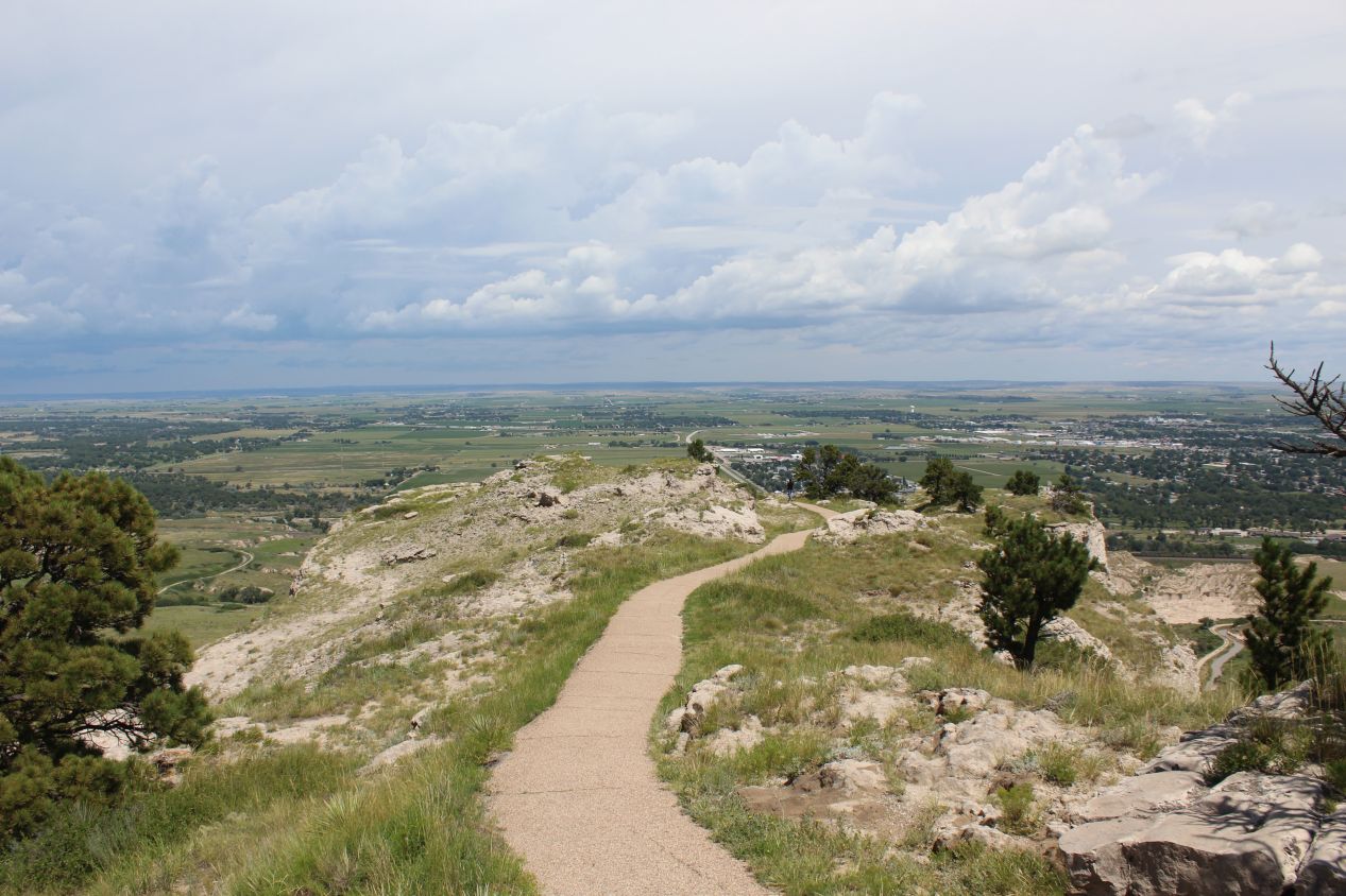
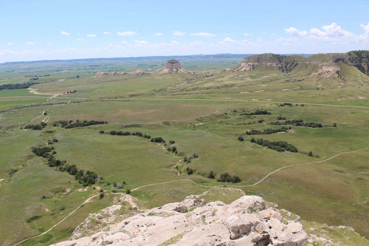
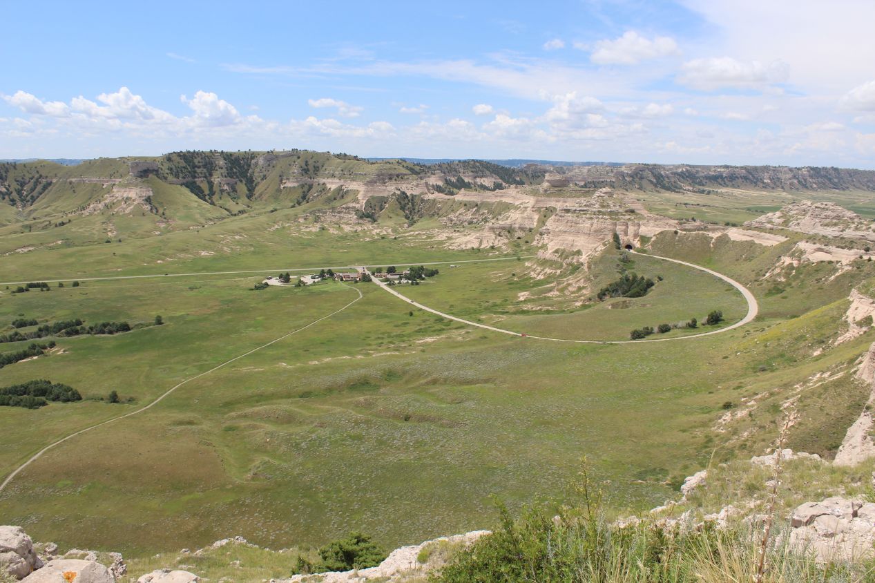
One of the neat things about Scotts Bluff is that there's a road running up to the top of the cliffs. As a result, unlike the situation at Chimney Rock, it's possible to reach the high ground and enjoy a panoramic view looking out over the plains from above. The closest object in view was the modern town of Scottsbluff (one word unlike the national monument's name), which spread out to the north and east from the banks of the North Platte River. Scottsbluff has a population of about 15,000 which makes it one of the larger towns in western Nebraska. There's a walking trail that runs along the top of the cliffs, and I took the short hike from the parking lot over to the western edge of the bluffs. There was an exhibit along the way that explained how the sedimentary rock that makes up Scotts Bluff is slowly being eroded away by wind and rain. Geologists buried a metal pole into the ground in 1933 to demonstrate this, and by 2018 there was more than a foot of the pole sticking up out of the soil. The bluffs are expected to be completely gone in about a million years, obviously far longer than a human lifespan but short in geological time.
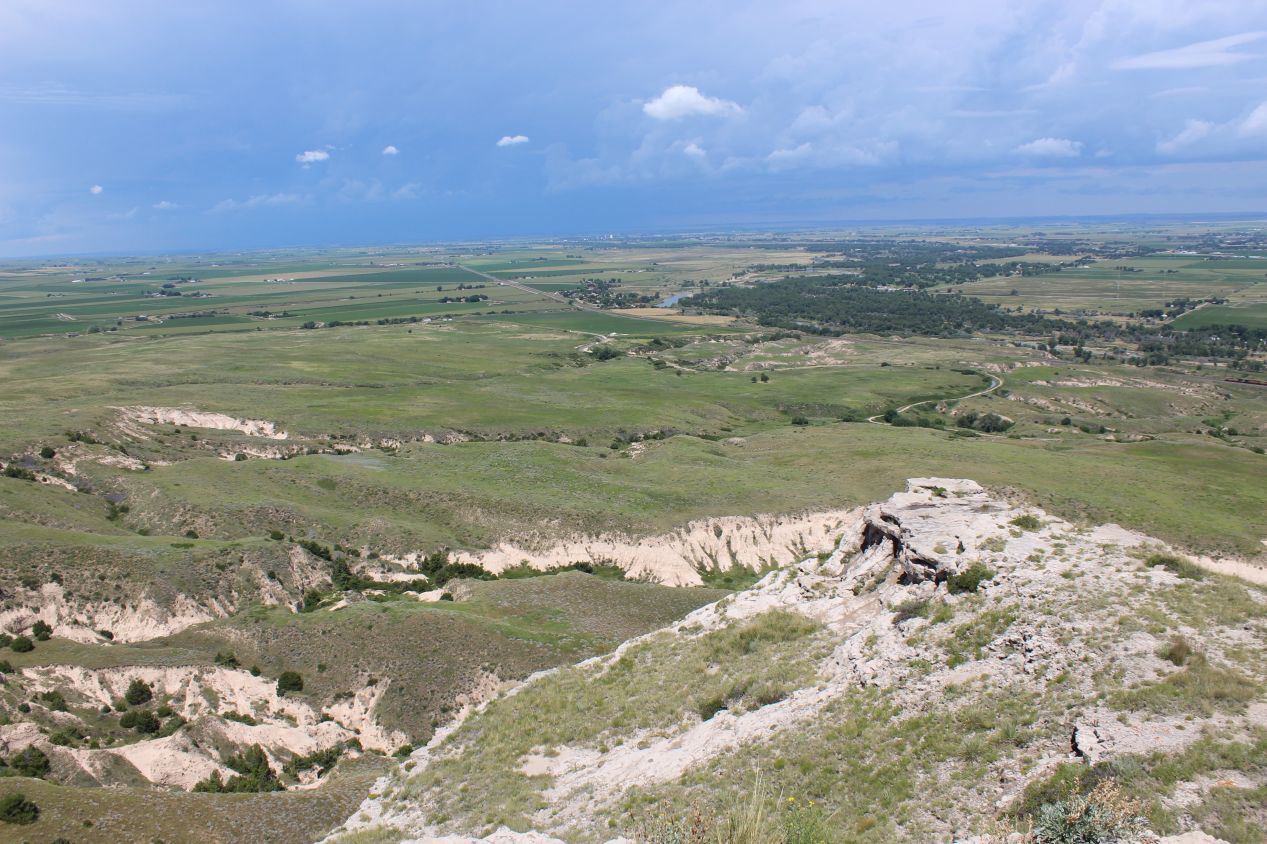
Unlike the view of the town to the east, the view to the west looked out over a prairie landscape of scattered individual farms. This was another one of those times where the height from the top of the cliffs and the otherwise mostly flat landscape made it feel like I could see forever, and that was true to an extent. I was high enough that the horizon was roughly 20 miles / 35 kilometers away, and that was far enough that I could see to the invisible border with Wyoming off in the distance. It also meant that I could see a long ways off in the skies above, far enough that I noticed a formation of dark storm clouds heading towards me. This is something that I had heard about before, how the flat landscape of the Great Plains often allows people to see thunderstorms coming in the distance long ahead of time. I knew at this point that it was only a matter of time before the rains arrived and drenched everything; I wanted to finish up here at Scotts Bluff before they could appear.
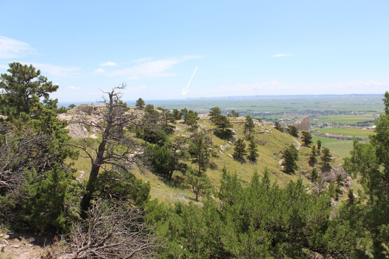
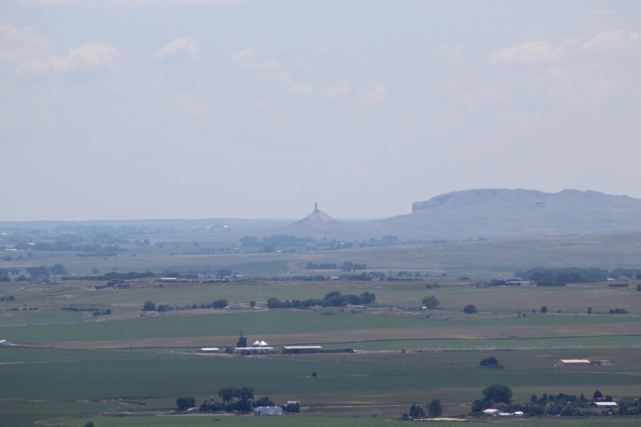
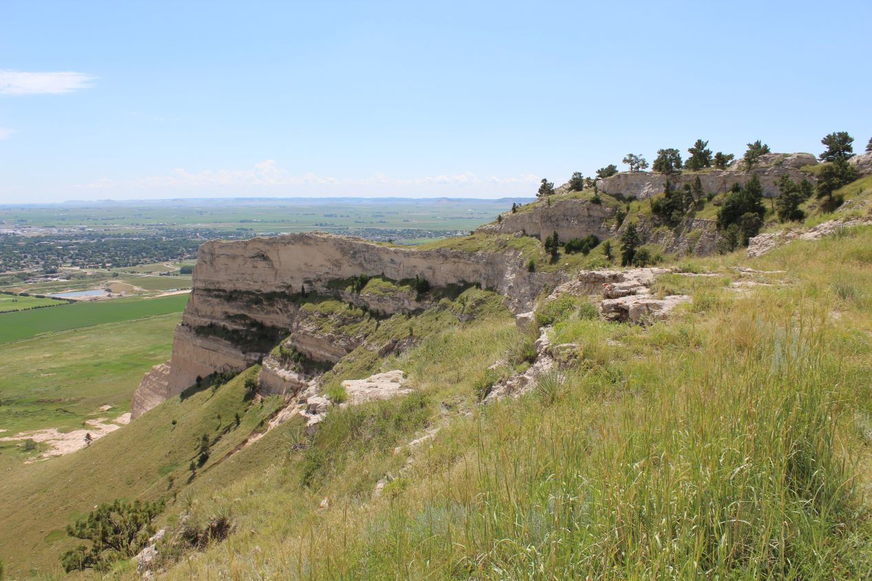
The last place where I followed the walking trail was to the southern edge of Scotts Bluff. The trail continues all the way down to the visitor center below, but even if I wanted to do that particular hike, I had no way of making it back to the top again afterwards. With a thunderstorm incoming, I was content to enjoy the view looking down. One of the other tourists also pointed out something to me: if you look carefully to the east, it's possible to see Chimney Rock off in the distance. The other historic site is a full 20 miles distant but it can be seen, just barely. I arrowed it in the picture above and then zoomed in with my camera to capture Chimney Rock more closely. Sure enough, the rock formation's narrow profile was unmistakeable. I couldn't help but think about how it would have taken the early settlers two full days to travel from Chimney Rock to Scotts Bluff, and it would have taken them six weeks to go from Lincoln, Nebraska to where I now stood. I had traveled that span by myself in the length of a morning's drive. This is one of the many situations where I was quite glad to enjoy the benefits of 21st century technology.
I was only on the road again for about ten minutes when the thunderstorm hit, and it brought a deluge of rain to the open plains. The Great Plains are well known for suffering through sudden and intense storms, including tornadoes, and this one dumped a pretty good soaking of water on my car. I was heading south and west from Scotts Bluff towards Cheyenne, Wyoming at this point and between the foul weather and the local state roads I was passing through some truly deserted countryside. This wasn't an area with towns or even individual farms, just empty grassland as far as the eye could see. It wasn't until I reached the outskirts of Cheyenne that I began to see signs of civilization again; this had been the emptiest stretch of countryside that I passed through all day.
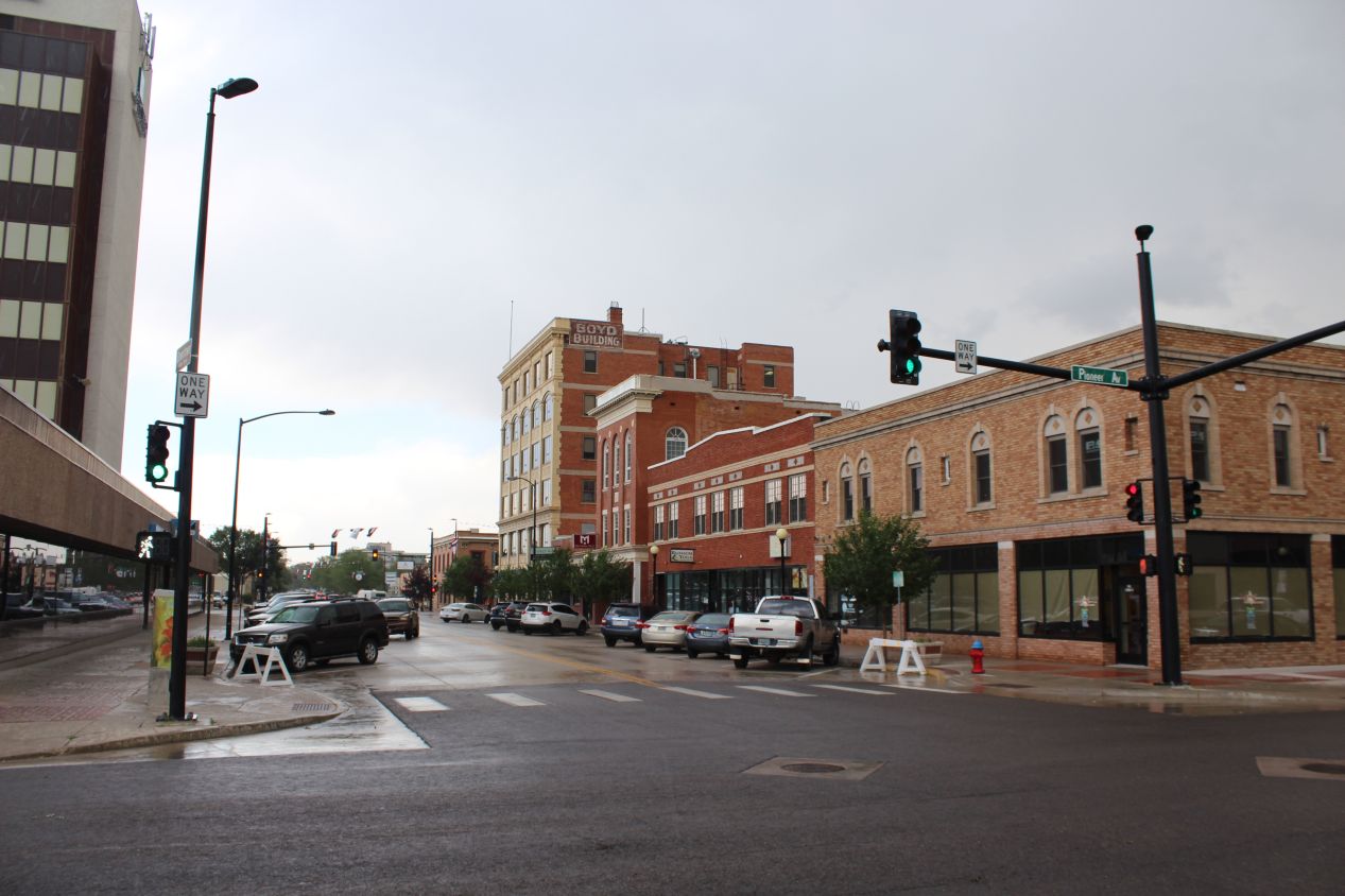
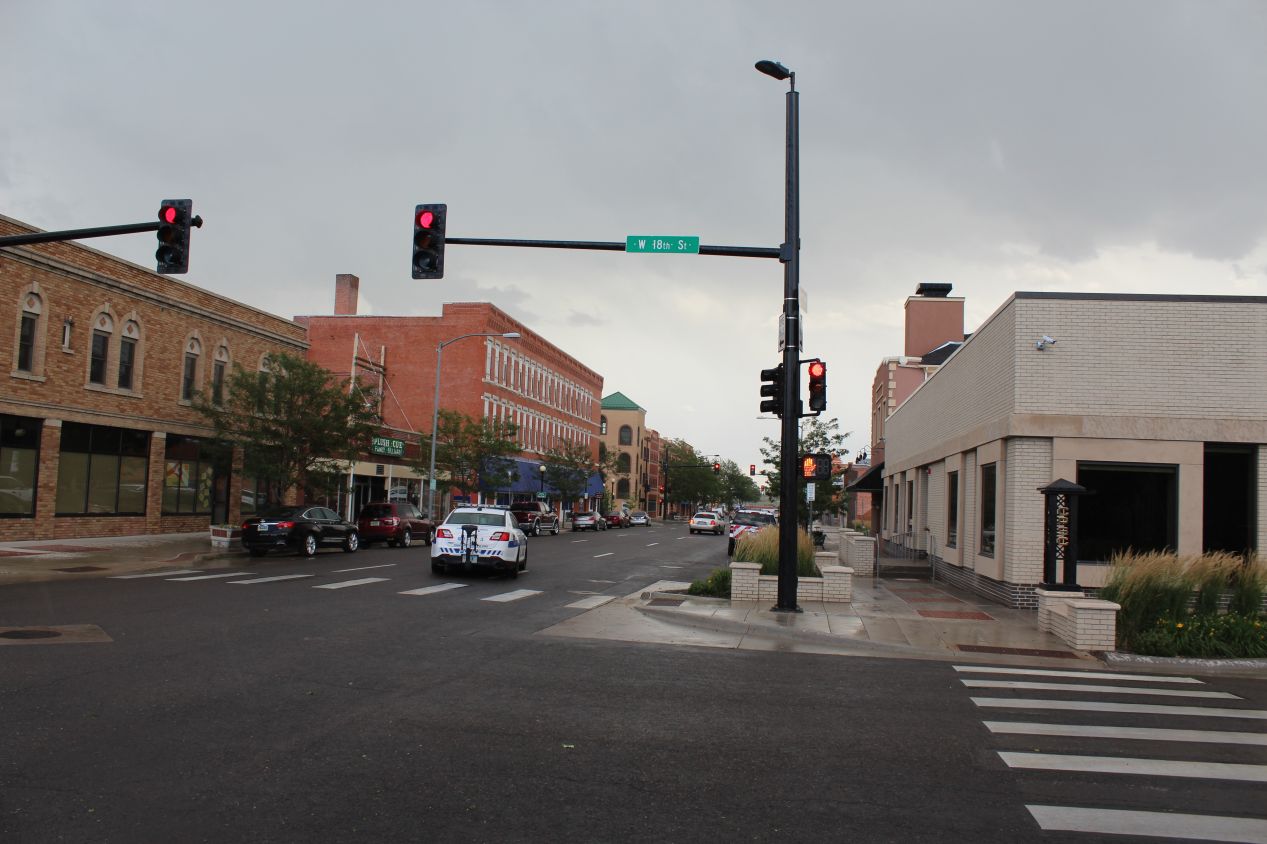
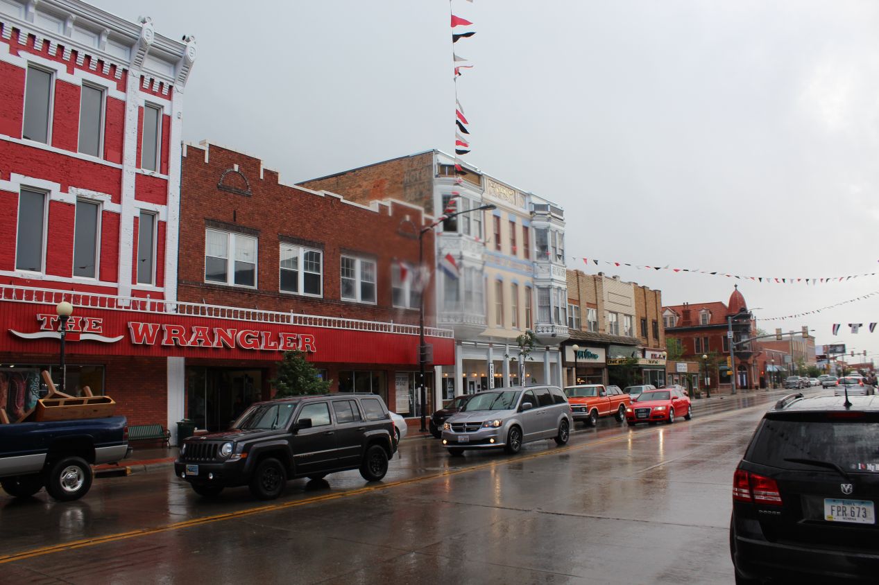
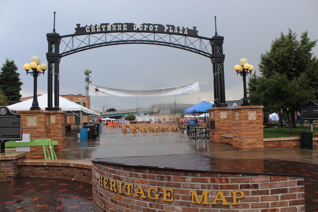
It was still raining when I reached Cheyenne in the midafternoon, and the gloomy skies contrasted with the flags and festival atmosphere that I saw on display. Cheyenne is both the capital and the large city in the state of Wyoming, despite its odd location at the extreme southeastern edge of the state. A lot of states have a centrally-located capital city but not Wyoming. Cheyenne only has a population of about 60,000 people which should serve as an example of the sparse population of the overall state. If you haven't heard this before, Wyoming has the smallest population of any state in the USA despite being the tenth-largest in land area; only Alaska has a lower population density. I parked my car near the Cheyenne civic center and walked towards the small city's original core of buildings near the railroad tracks. Cheyenne quite literally owes its existence to the railroads, as there was no settlement here before 1867 when the city site was specifically chosen to service the first intercontinental railroad while it was under construction. As a result, Cheyenne's Depot Plaza next to the historic train station is the main public gathering space and the symbolic heart of the city.
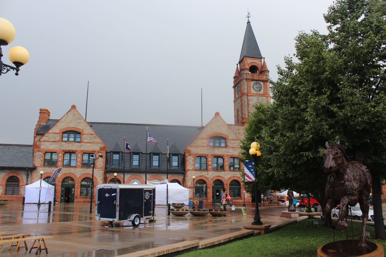
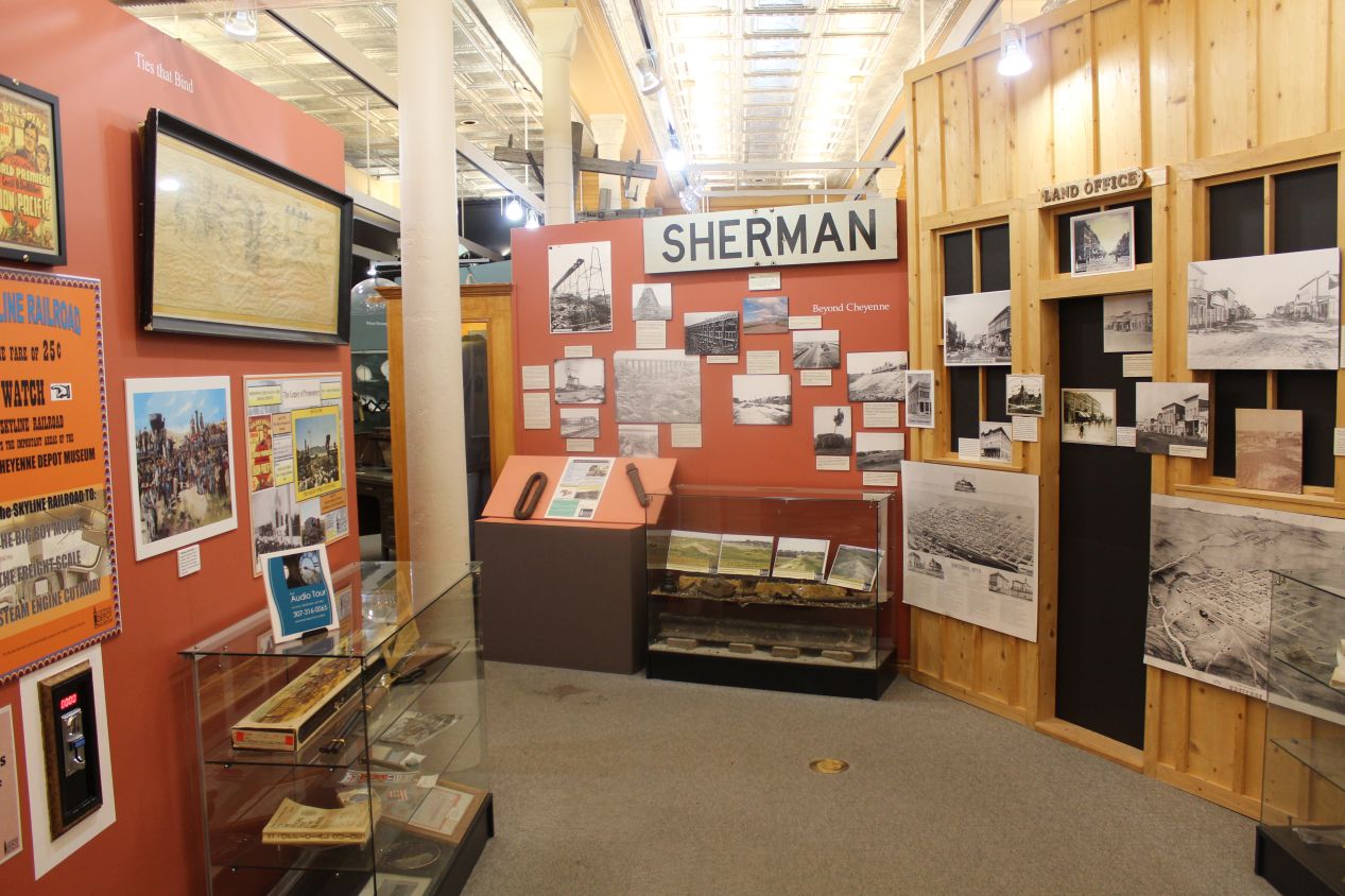
The old train station has been turned into a museum, much like I had seen the previous day in Omaha, with the local version here known as the Cheyenne Depot Museum. This building certainly couldn't compete with the much larger Durham Museum in Omaha, but it still had distinctive stonework and a central clock tower that resembled something from a church. The museum on the inside was a little bit disappointing to me, as it mostly focused on the railroads and the early history of Cheyenne. The displays were pretty old fashioned and looked like they hadn't been updated in a while. I don't want to be too hard on this place since it's clear that the Cheyenne Depot Museum was working with limited resources, but the exhibits here were probably the weakest as compared to any of the other historical museums that I'd visited thus far on my trip. At least there were good views of the train tracks, which still run past the museum with active trains.
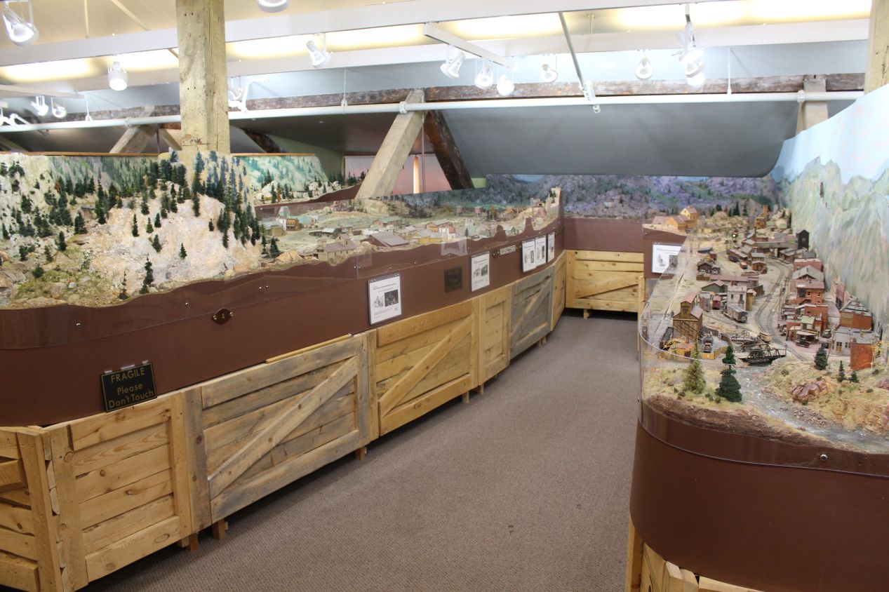
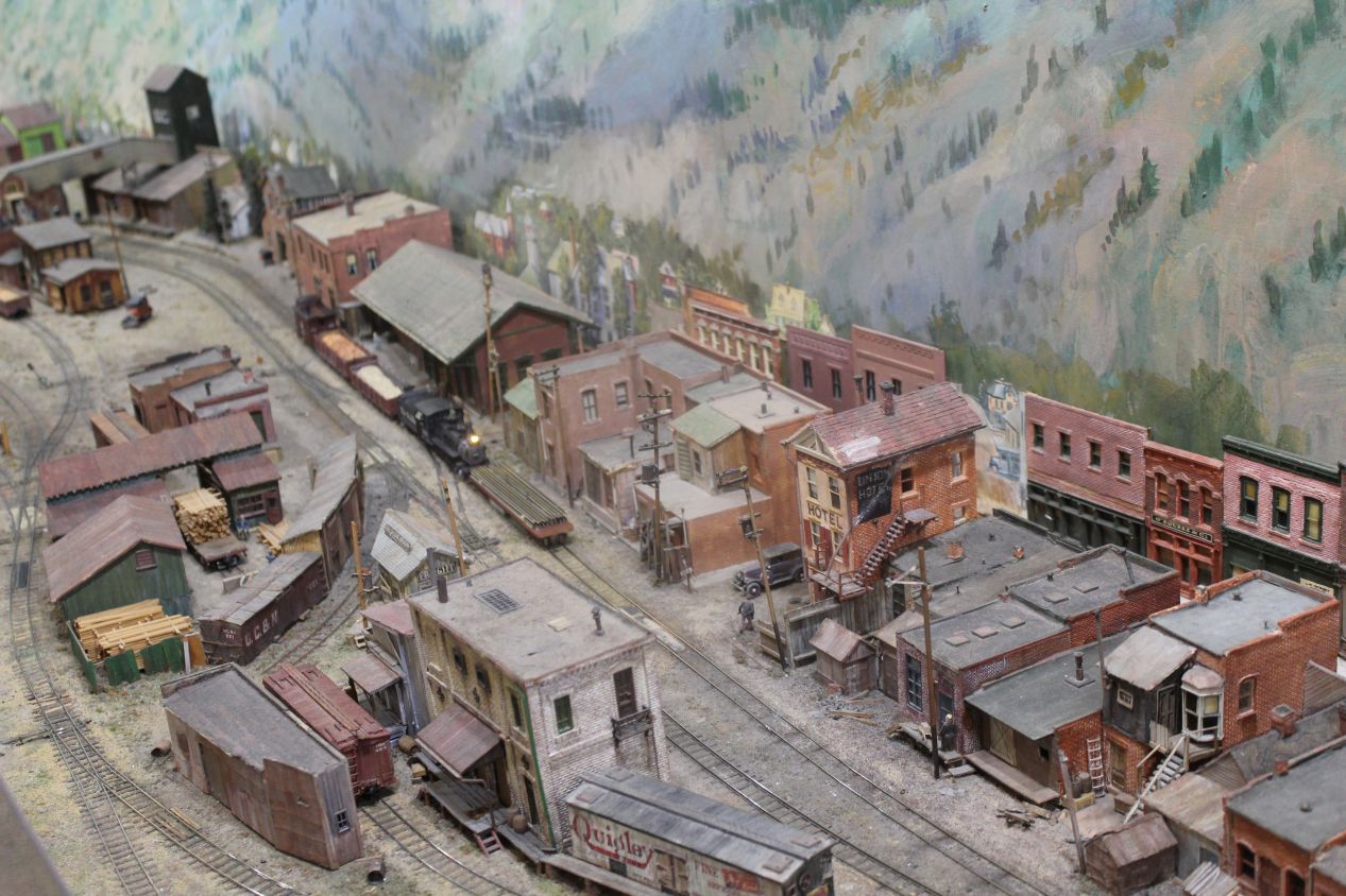
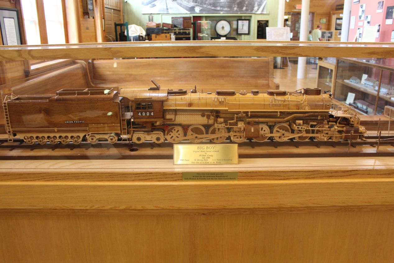
The small second floor of the Cheyenne Depot Museum also contained an extensive miniature train garden, which wasn't terribly historical but was arguably the best part of the museum. A lot of time and care went into setting up the train display here with fine attention to detail. This was one time when I wish that my dad could have been along for the trip, as he loves these train displays and used to set them up at our house at Christmas time. We still go to see some of the local train displays as a family sometimes; there's a bit of a tradition that local fire departments set them up as a fundraiser in Baltimore during the holidays.
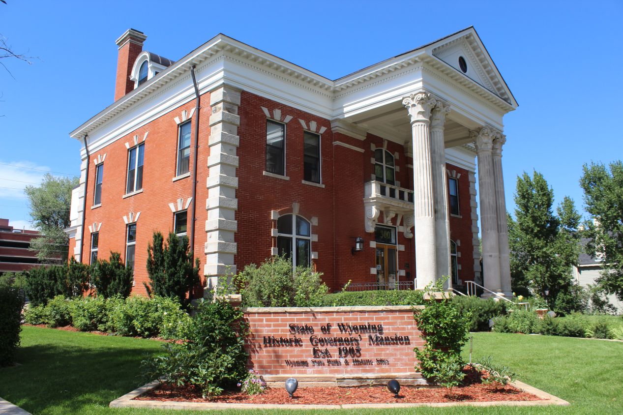
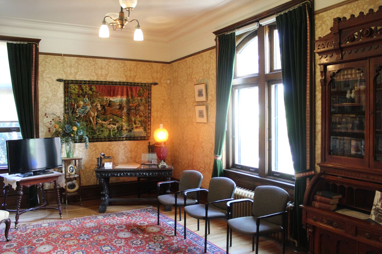
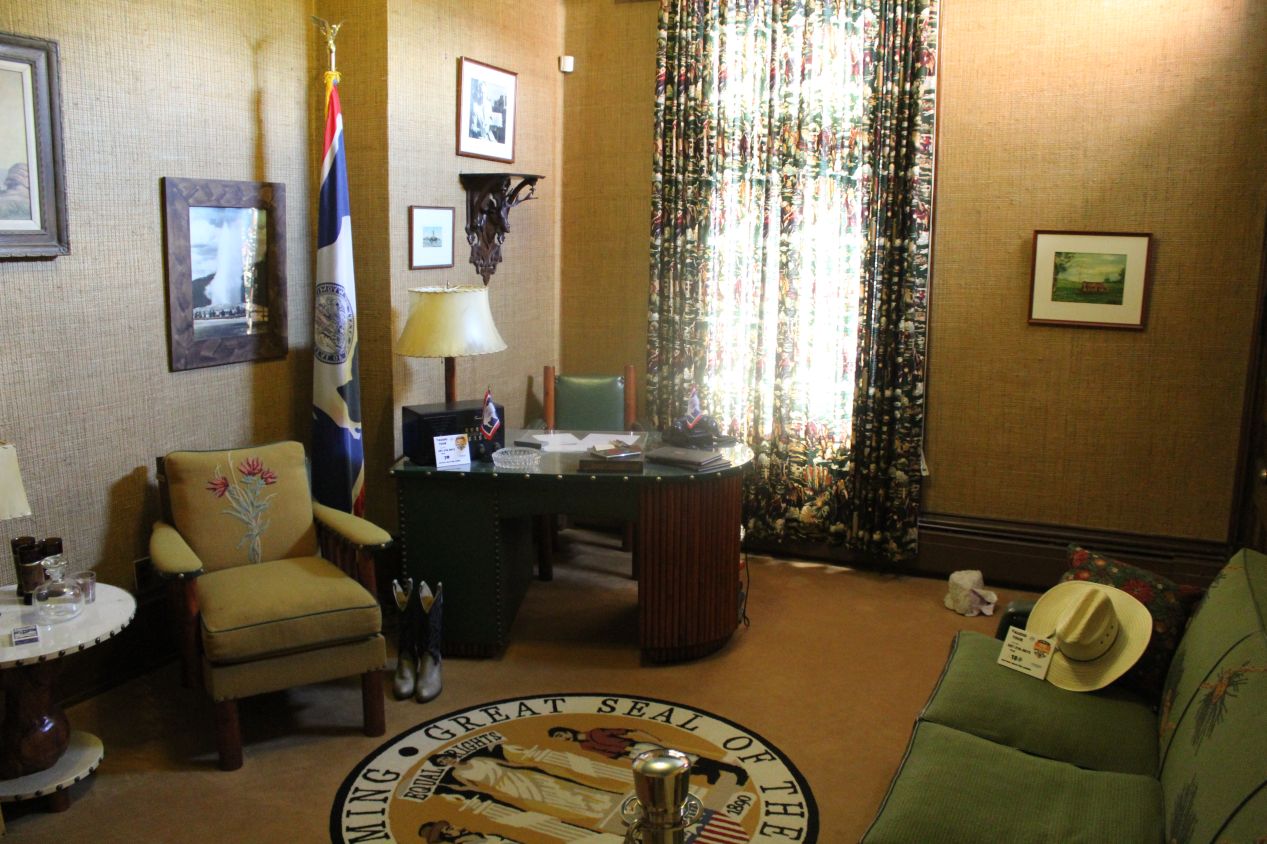
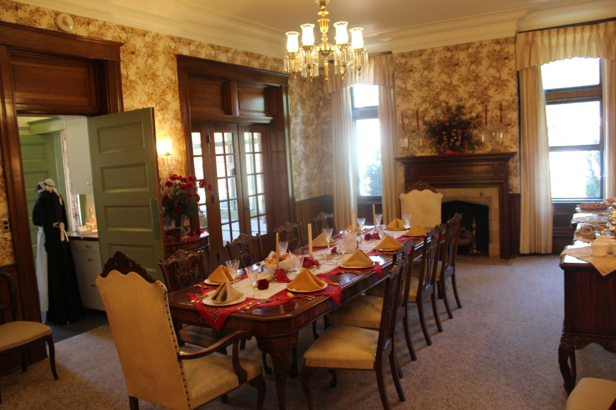
By the time that I was finished at the Cheyenne Depot Museum, the rain had stopped and the sun came out again. From the clear blue sky in the picture above, you would think that this was a completely different day instead of merely an hour later. While walking around the small city I decided to stop at the Historic Governor's Mansion, this red brick building that dated from 1905. The Historic Governor's Mansion was in use as the residence of Wyoming's governor until 1976 when a larger and more modern structure was built in the city. The house was quite small inside, definitely smaller than what I would consider to be a mansion, but elegantly furnished on the ground floor with various design motifs related to the state's geography. There were quite a few bison (buffalo) here, the animal represented on Wyoming's state flag. The former governor's office was almost comically tiny, tucked into one of the side rooms with a small desk and the state seal on the floor as the only things to indicate its purpose. Even though Wyoming tends to be a more informal state due to its small population, I found it hard to believe that the governor was conducting official business out of this office as late as the 1970s.
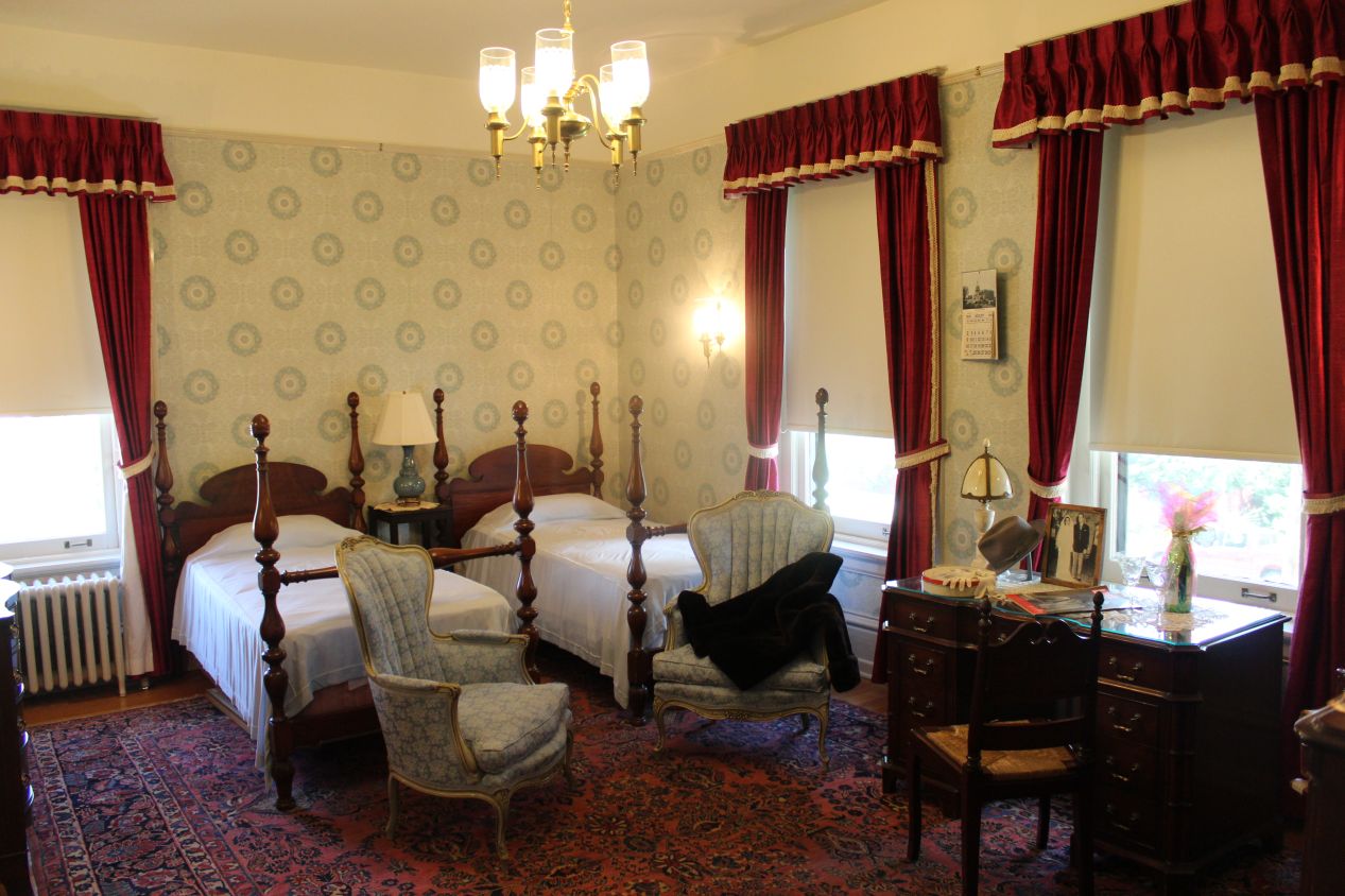
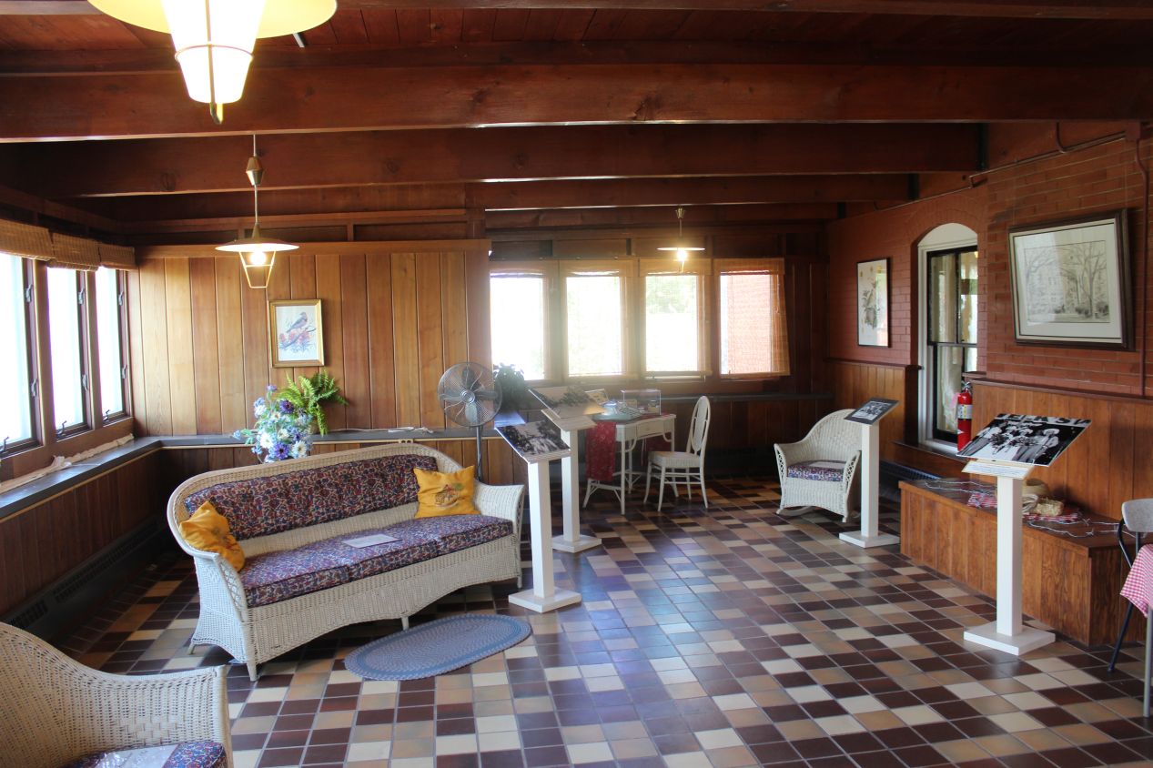
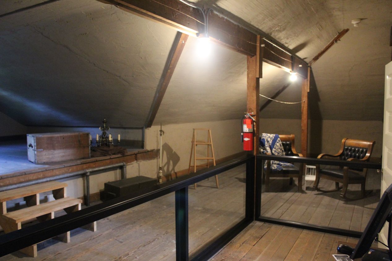
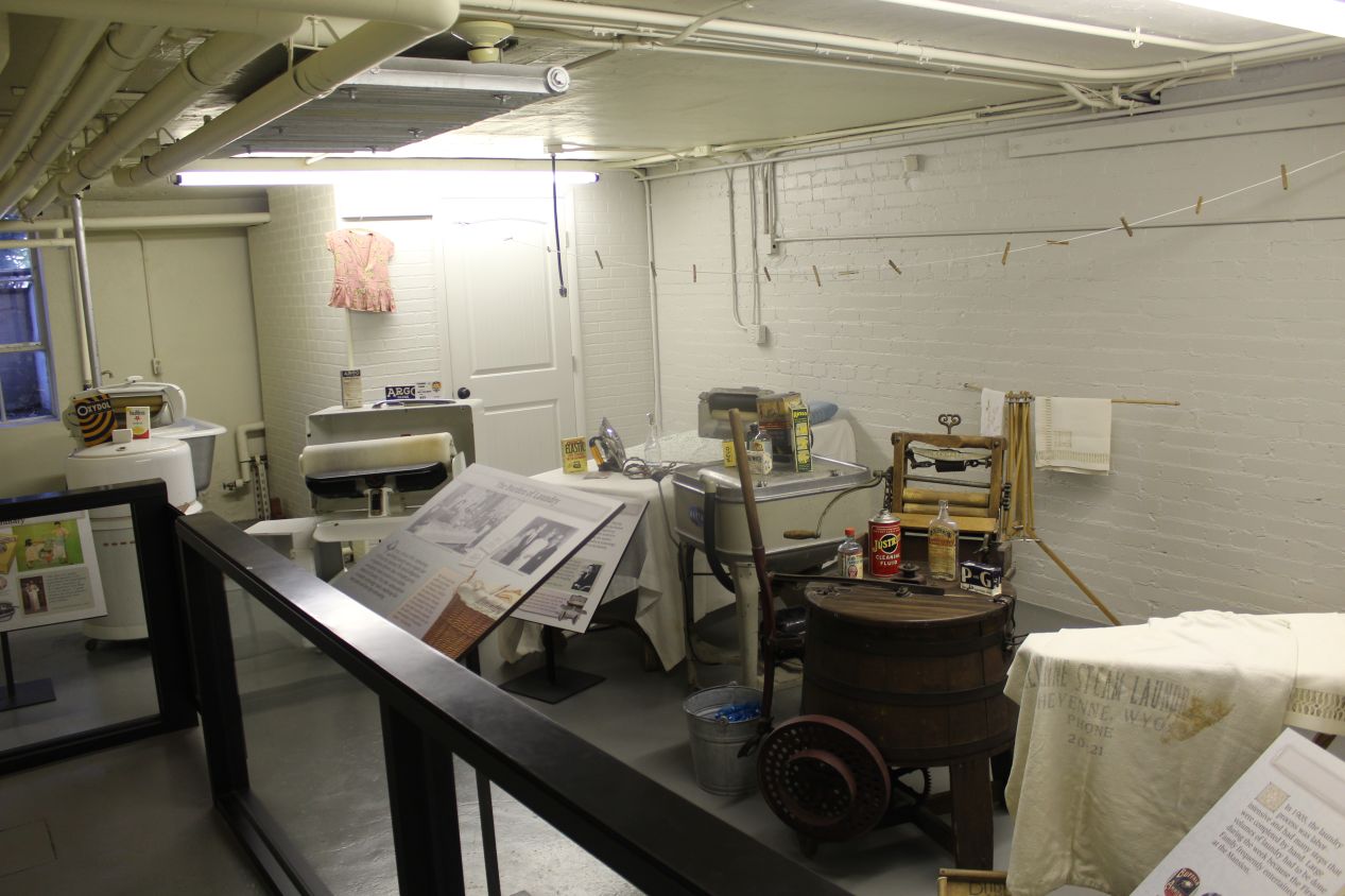
The second floor of the Historic Governor's Mansion contained the living quarters for the family, complete with old-fashioned bathrooms that hadn't been updated since the early 20th century. The most interesting room here was an enclosed porch on the back of the structure, where the governor's family could relax and play tabletop board games. This didn't look much like the "mansion" of a state governor, more like the home renovation project of an upper-middle class family. Visitors were also able to head further upstairs into the small attic space, and down into the basement where there was a Cold War fallout shelter. While it probably did make sense for a government official to have one of those in their residence, I don't think that Cheyenne would have been too likely to get targeted by an atomic weapon given its remoteness and lack of strategic importance.
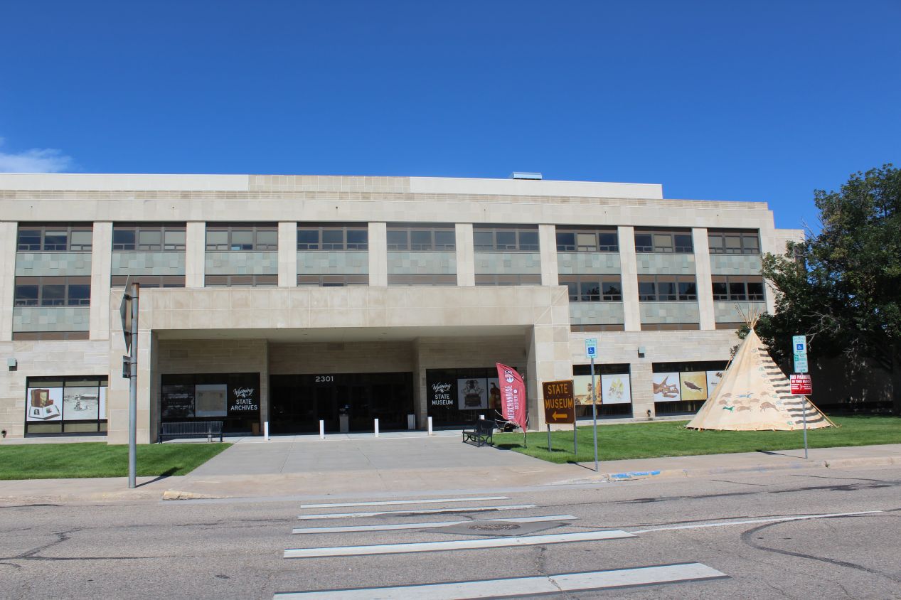
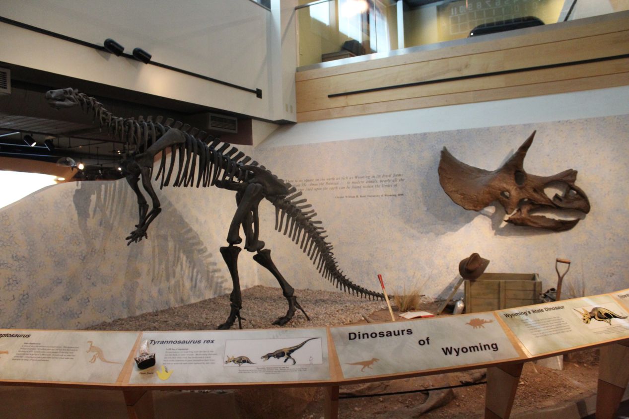
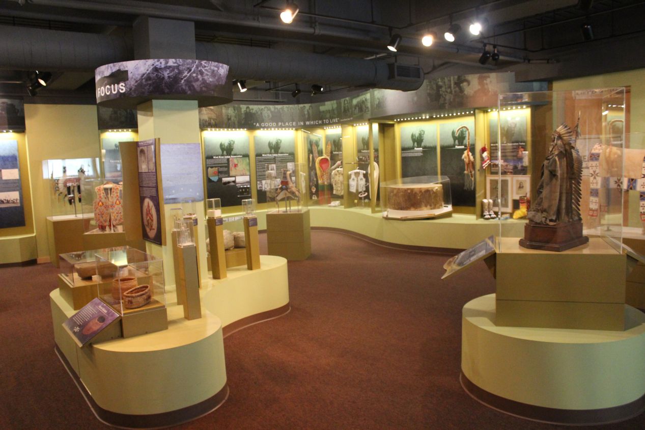
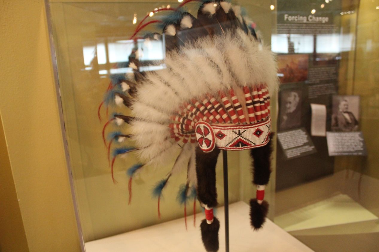
A few blocks away in a cluster of state government buildings was the Wyoming State Archives and State Museum. The collections on display here were notably better than the ones in the Cheyenne Depot Museum, and I was scrambling to try and see as much as I could before the building closed. I had arrived at 4:30 PM and the place was closing at 5:00 PM so there wasn't much time to spare. The ground floor at the Wyoming State Museum was dedicated to natural history, and that's something that Wyoming has in abundance. There were displays here about the wildlife in the state, particularly the bison, as well as the coal produced in Wyoming. This is one of the largest states in terms of coal and natural gas mining, and Wyoming's economy remains heavily dependent on agriculture and resource extraction. The presence of those carbon-based resources means that dinosaur fossils are also widespread, and this has been one of the best states for paleontologists to study and excavate. The second floor was more devoted to the cultural history of the state, with information on everything from the Native American tribes that still live in Wyoming to the women's suffragettes who made Wyoming the first territory and then the first state to grant the right to vote to women. That might seem hard to believe in today's political climate where Wyoming is one of the most conversative states in the nation, but it was quite progressive when it came to extending the right to vote back in the late 19th century.
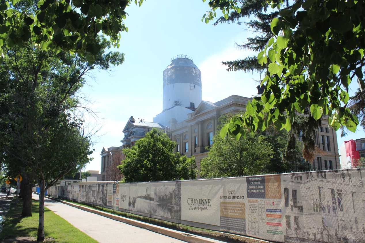
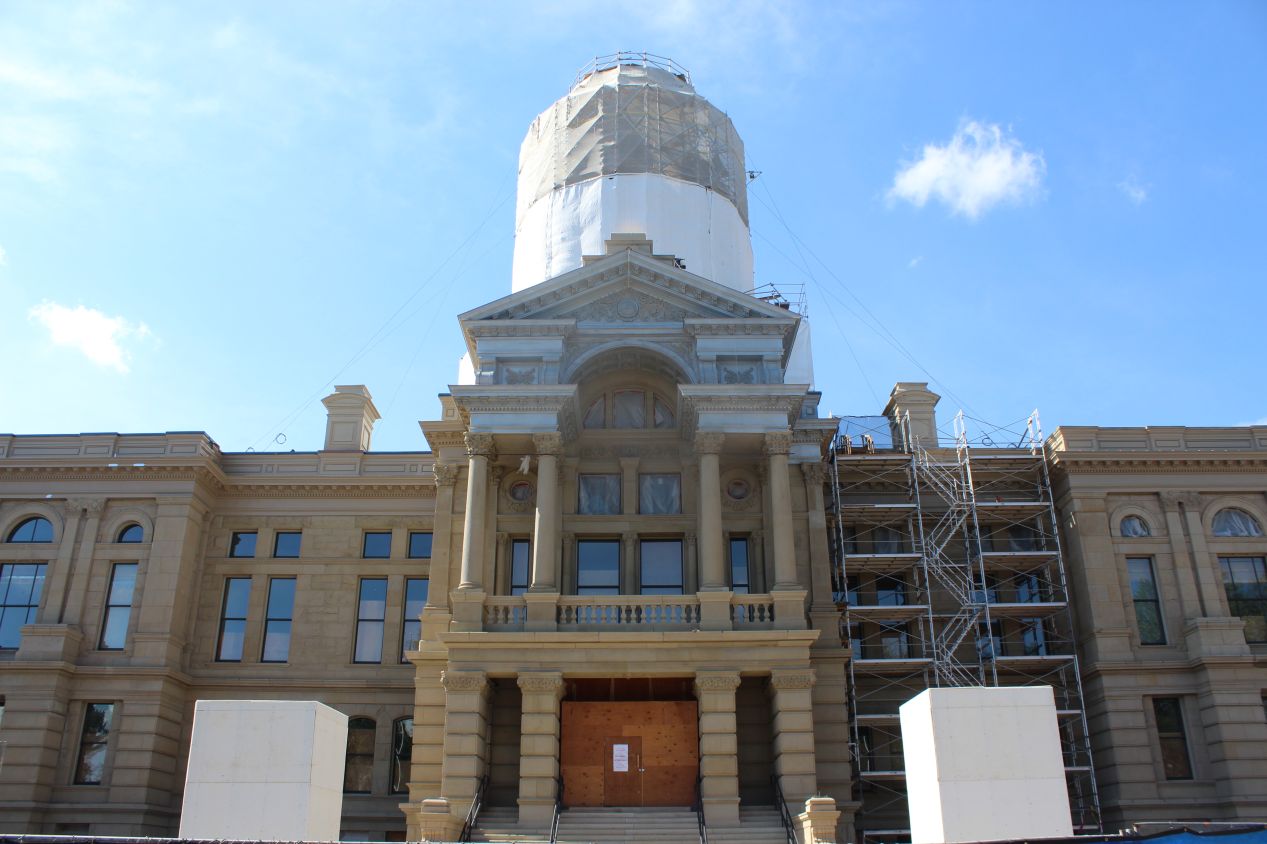
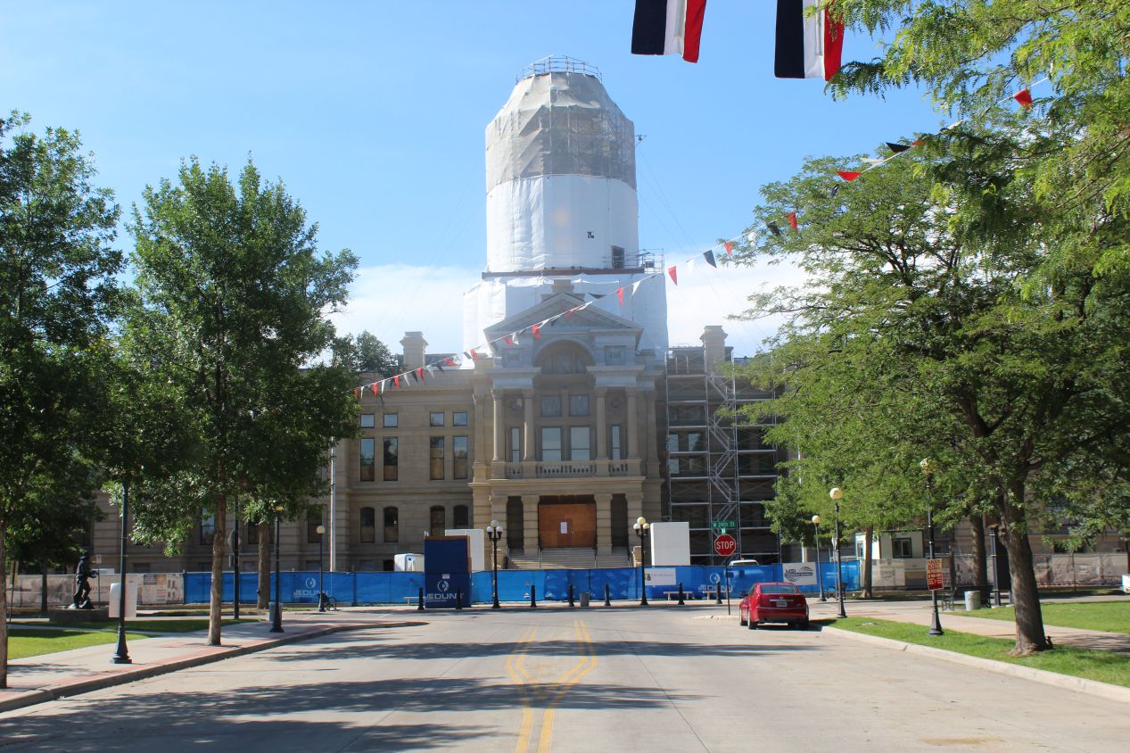
The Wyoming State Capitol building was nearby as well, but I had known long before I arrived that this was a state capitol that I wouldn't be able to enter. The structure was under heavy construction in the summer of 2018 and off-limit to everyone other than the workers on the project. It was due to reopen again sometime in 2019. The Wyoming State Capitol building contains the two houses of the state legislature along with the modern governor's office. The architectural style when not under construction was a bit less classically-themed than other state capitols, without much in the way of Greek pillars and instead featuring more of a Renaissance design emphasis in terms of the main entrance. The central part of the building was, of course, capped off with a dome underneath that white sheet. The core of this building dates from the 1890s and it was expanded several times over the years to reach its current size. Even with these expansions, the Wyoming State Capitol was the smallest state capitol building that I'd seen to date on my trip. It would have been swallowed up by the huge structures that I'd visited in Illinois and Iowa a few days earlier.
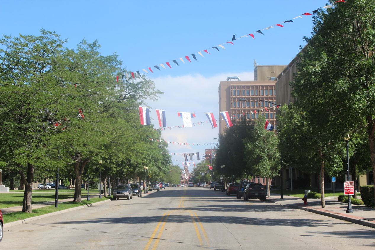
Readers have probably noticed all of the red-white-and-blue flags hanging in the streets near the Wyoming State Capitol. This was due to the fact that I was visiting during Cheyenne Frontier Days, the biggest festival of the year in Cheyenne. Frontier Days advertises itself as the "World's Largest Outdoor Rodeo and Western Celebration", and its weeklong festivities attract roughly 200,000 people annually to view the show. The core of the event is a major rodeo, but Frontier Days also comprises several parades, amusement park rides, livestock judging competitions, and everything else that one would expect to see at a state fair. There are concerts held each year too that are big enough to attract some top names in country music; the headliner in 2018 was Florida Georgia Line, to give one such example. I had no idea that Frontier Days even existed until I started looking to book lodgings in Cheyenne and found that everything was inexplicably expensive for a random Thursday night in late July. The week before and the week after my visit I could get a hotel room for $50, but everything cost $150 or more during the week of Frontier Days. As a result, I spent the night with the family of one of my fiance's friends from college instead, as they kindly allowed a relative stranger to use one of their spare bedrooms.
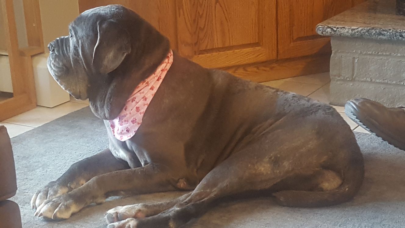
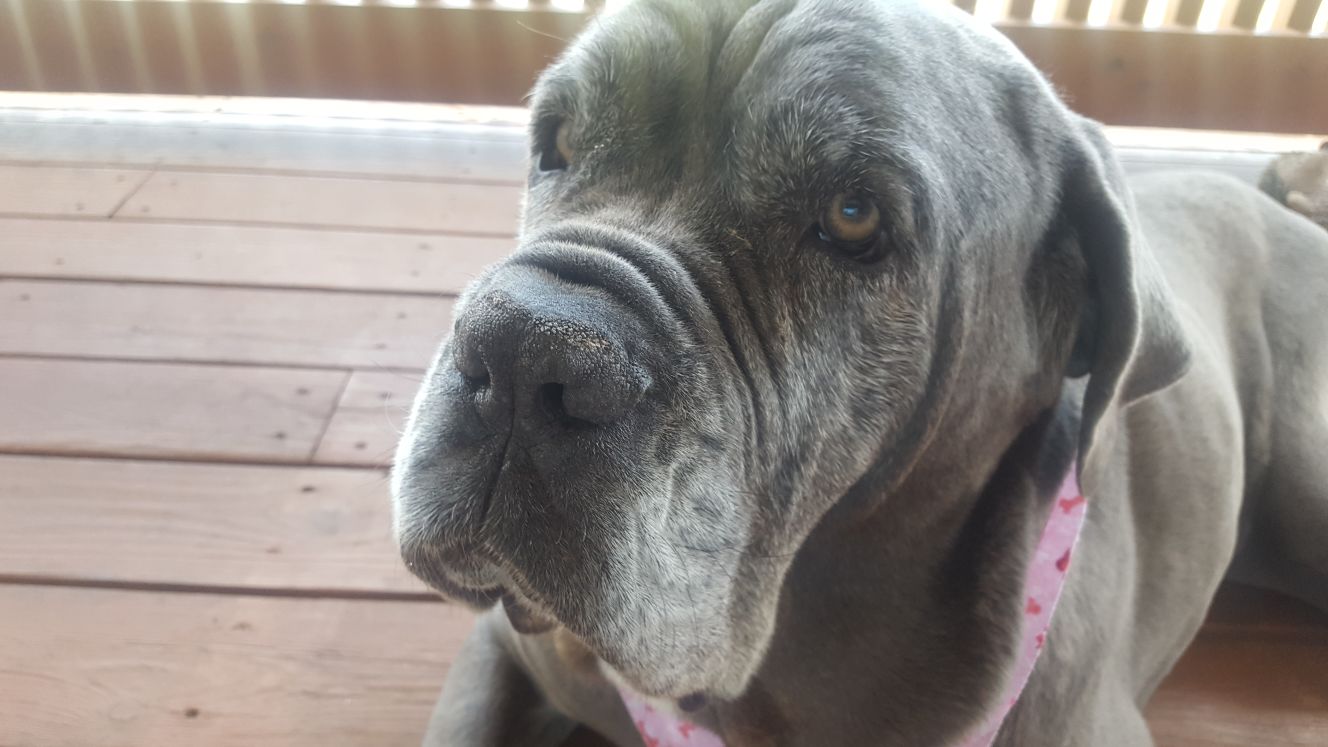
This was their dog Emma, a thoroughly lovable English mastiff. This is an enormous breed of dog, with adult males weighting anywhere from 150 to 250 pounds (68 to 113 kg), and even an old female like Emma had to weight around 120 pounds / 55 kilos. Emma was ten years old when I visited and definitely not the fastest dog on her feet, but she was extremely sweet and good-natured. I absolutely love big dogs and she reminded me very much of our dog Sidney, with the same kind of lazy mannerisms. My plan was to head over to Frontier Days after I ate a shared dinner with my host family, but there was an even more violent thunderstorm that dropped pea-sized hail on my car outside, and I wasn't eager to go to the festival after that. By the time that the rain came to a close, it was pushing 9:00 PM and I needed to be up again very early the next morning for another full day of hiking. Unfortunately that meant no Frontier Days visit for me on this trip.
I enjoyed this opportunity to get out into the countryside on this day and see two national monuments at Chimney Rock and Scotts Bluff. While those rock formations were interesting in their own right, it was the vast open stretches of the prairie that really stole the show on this day. I've mostly been glossing over the long stretches of time that I spent driving on this trip since it doesn't make for much of a story, but this was a day where the drive through the farms and small towns in western Nebraska was a huge part of the tale. There's no better way to get a sense for the endless farming country in the Great Plains than to hop into a car and spend long hours driving through it. That farming country was coming to an end though, as the next day was going to take me up into the mountains for the first time. I was about to visit the Colorado Rockies, in two different senses of the term.


