

It's a long drive to reach Cape Breton Island from the major cities of America's east coast, but the trip is very much worth the time investment. I was about to spend the next two days exploring a region of great natural beauty, a place where generations of hardy inhabitants have scratched out a living in defiance of the rugged terrain. My main destination was Cape Breton Highlands National Park, a remote area on the northwest coast of the island that gained its name due to a similarity to the Scottish Highlands. Windswept hills run along the coastline for mile after mile, with only a few scattered tiny villages to break up the wild environment. This is a fantastic area for wildlife sightings, and I would end up having plenty of luck in that regard on this trip. Cape Breton Island has been a mixing pot for various different "outsider" cultural groups, from the native Mi'kmaq to the French Acadians to later immigration from the Scots and the Irish. It's a place where only the tough have been able to survive, and that has helped to breed a fiercely independent group with their own oral traditions and folk music. I was looking forward to exploring this region for its unique blend of unspoiled nature and diverse local inhabitants.


I woke up along with the rising of the sun and prepared for another lengthy day of sightseeing. Leaving the bed and breakfest from the previous night behind, I drove north along the western coast of the island from Margaree Forks, heading for the entrance to Cape Breton Highlands. There was hardly anyone on the road and even outside of the national park the scenery was impressive. The wind came howling in off of the water and sent the tall grass into swaying dances back and forth. The little towns that I passed through had a distinctly French flavor to their names: Belle Côte, Cap Le Moine, Grand Étang, and Chéticamp. This was an Acadian region, the frontier fringe lands where the dispossessed settlers of colonial New France were allowed to live after Britain seized control of the region in the mid-1700s. I saw a few Acadian flags from time and time, and more French text than I would have expected in an area outside of Quebec.
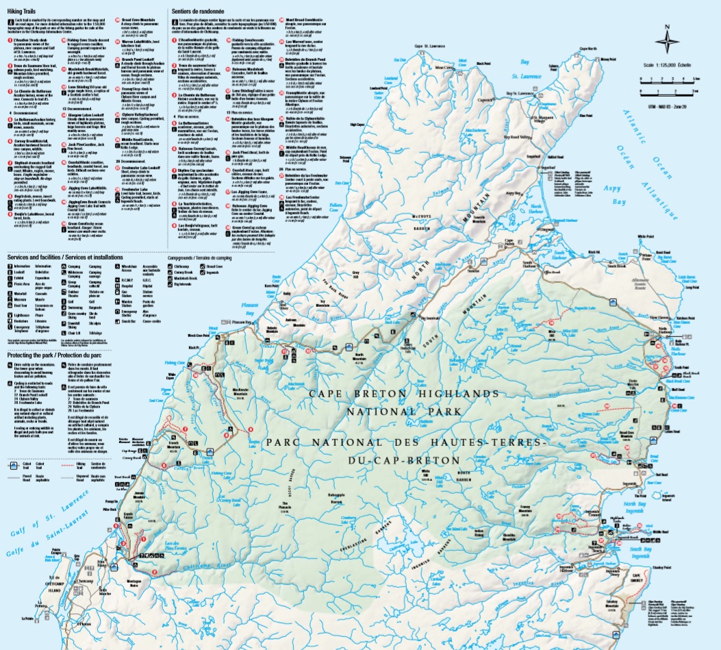
I would be spending most of the day in Cape Breton Highlands National Park, which stretches across most of the northwestern tip of the island. This was the first national park to be established in the maritime provinces of Canada back in 1936, and it's known for steep cliffs and deep river canyons that carve into a forested plateau bordering the Atlantic Ocean. There's a wide variety of different environments contained within the park's boundaries: mountains, valleys, waterfalls, and rocky coastlines. The official park map identified 26 different hiking trails, including the featured Skyline Trail (#7 on the map) which I would be checking out later in the day. I was entering the park via the western entrance at Chéticamp and expected that it would take all day to circle around to the north and east while stopping to visit the various park attractions along the way.

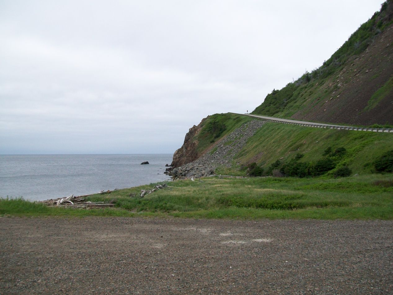


There's only one road that runs through Cape Breton Highlands, which is named the "John Cabot Trail" in reference to the English explorer who is believed to have made landfall on the island in 1497. The road immediately ascended a series of rocky hills upon entering the park, commencing a series of ups and downs as it tracked along the path of the coastline. The views of the Gulf of Saint Lawrence off to the west were nothing less than stunning from here, and on a clear day it's sometimes possible to see all the way to Prince Edward Island. The thin gray line of the road looked a bit like an earthworm snaking its way through the otherwise undisturbed wilderness.


I came across my first wildlife spotting almost immediately and it was a doozy. A black bear was walking along the side of the road, and I managed to snap a picture of it before it could dash away into the trees. This is the best way to run into a wild bear, from the safety of a car's interior. I had previously run across a black bear while hiking near Asheville, North Carolina, and I would later find more bears (both black and brown varieties) in Yellowstone National Park and in the Canadian Rockies. These cool forests along the coast were a perfect climate for black bears, in a place that has little contact with humans.

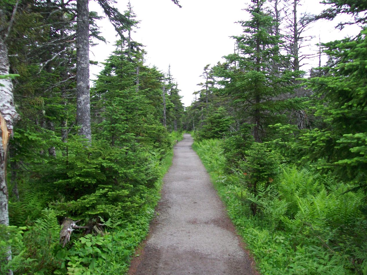


After driving for about half an hour, I reached the entrance to the premier hiking experience in Cape Breton Highlands: the Skyline Trail. This is a 4 mile / 7 kilometer looping trail that starts in the forest before passing out into an open meadow at the top of a cliff face with dramatic views down to the sea below. I also have to mention that the trail has a somewhat infamous reputation due to a fatal coyote attack that took place on it in 2009, something that I knew nothing about at the time of my visit. The sign at the entrance to the trail did warn hikers to beware of wild animals, and had a whole section about needing to watch out for the presence of moose. "Oh come on", I was thinking at the time, moose? Seriously? Well lo and behold, I hadn't gone more than a mile before I ran across a moose in the trees on the side of the trail. It was a bull moose and my goodness was that thing ever huge!  I immediately revised my earlier impressions: moose are indeed dangerous animals and you don't want to mess around with them. This guy didn't seem to notice me and slowly retreated further into the woods while continuing to munch down on the plants underfoot. I was fortunate that real life wasn't a Greek morality play where I would have been punished for my moose hubris.

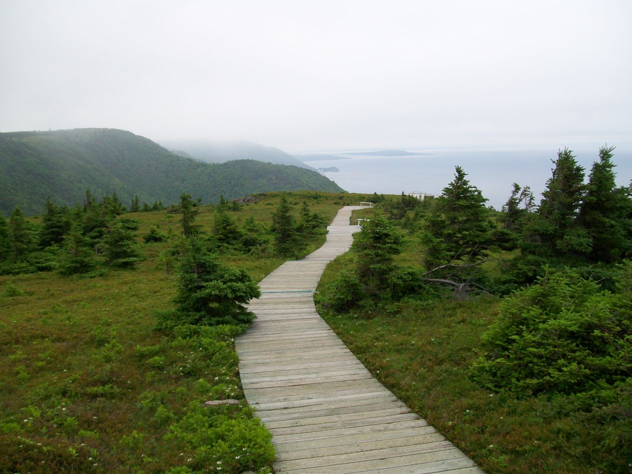


It took about 45 minutes of walking to reach the cliffside region of the Skyline Trail. Here the trees fell away and the path was exposed to the open winds coming in off of the Gulf of Saint Lawrence. I could look off to the left and spot the thin line of the Cabot Trail as the road hugged along the side of the hills. In the opposite direction, the ground plunged downwards in a steep (and almost certainly fatal) drop of 250 meters down to the waters below. There was a single boat far below in an otherwise unbroken stretch of cold blue sea. The park service had constructed a series of boardwalks here to help protect the fragile plants that grew on top of the cliffs, and they made it easy to walk around in an area that would otherwise induce a dizzying amount of vertigo. The views from up here were nothing less than sublime.

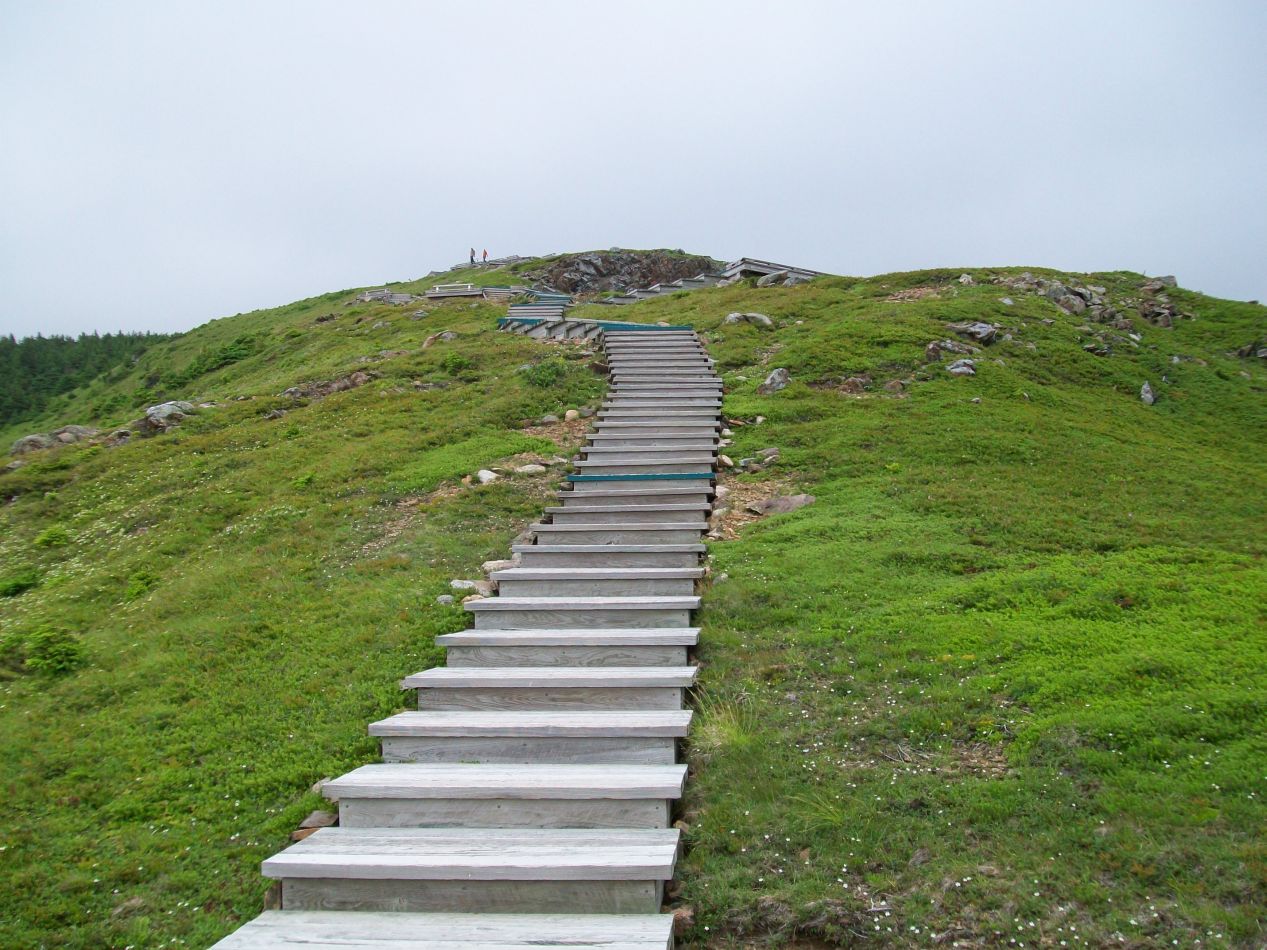


More pictures from the cliffside region of the Skyline Trail. This was one of the most spectacular hikes that I've ever done and fortunately a fairly easy one to complete as well. No crazy ascents going up 2000 vertical feet or anything like it here. It made the long trek up to Cape Breton Highlands totally worth the effort.


The Skyline Trail runs in a loop with the cliffs portion located at the tail end. Hikers can either walk back the same way that they came initially, or take the rest of the loop on a slightly longer return. I opted for the latter route and found that this part of the trail wasn't as heavily forested, instead having scattered trees passing throw meadows of tall grasses. The trail was also less well maintained here, consisting of an overgrown dirt track instead of the gravel-lined path that had led me along the other part of the loop. I gathered the impression that most people don't bother walking along this part of the trail and simply return back the way that they came initially. It was empty and a bit melancholy out here, the kind of place where I would expect to hear one of those Irish ballads that's simultaneously both sad and pretty at the same time.

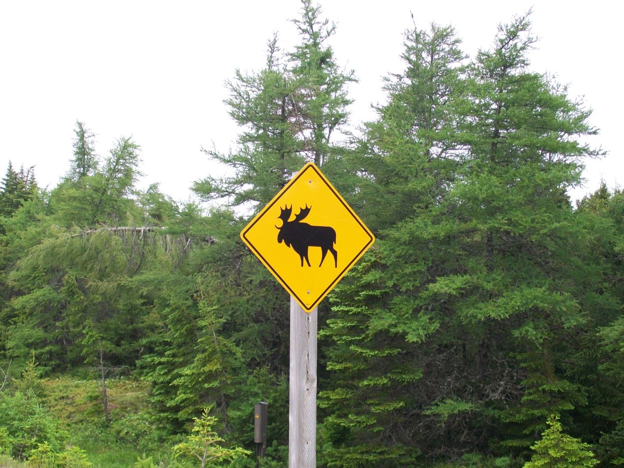


With the hike finished, it was back to driving for a bit on the Cabot Trail. The road turned inland here away from the coast and proceeded along the crest of a ridge of mountains. There were only a couple of hiking trails in this region and no places to stop, with this being a remote area even by the standards of Cape Breton Highlands. The weather remained overcast and at times the clouds dropped down to ground level, creating a few sections where I was driving through dense fog. It never quite rained though, and the gloomy outlook was perfectly in character for a region known as the "Highlands". Oh, and I definitely got a kick out of the moose crossing road signs, something that I've never seen outside of Canada. There are enough road accidents involving moose in Cape Breton and Newfoundland that those signs are legitimately important to have in place.

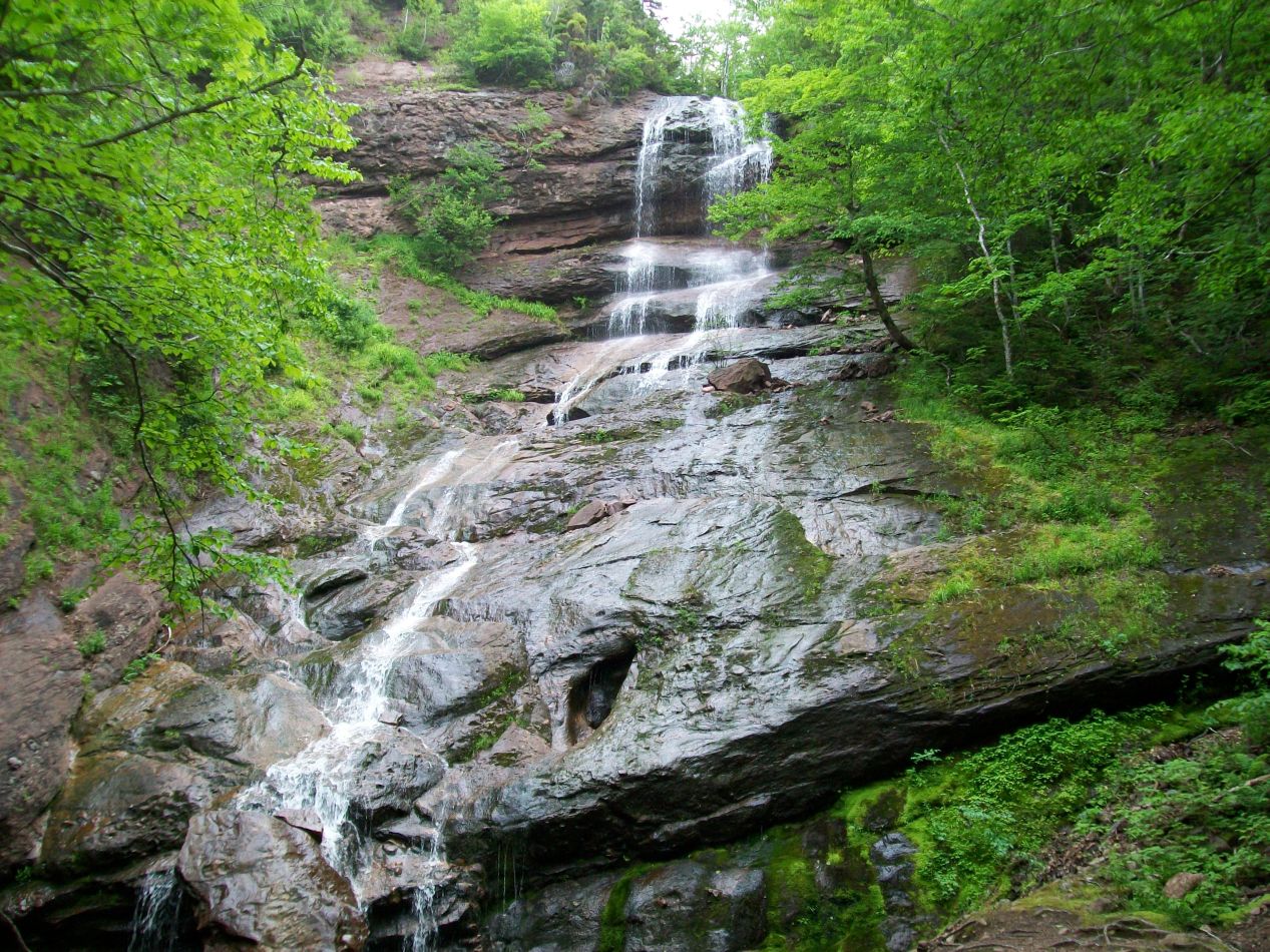


One of the few attactions in this part of the park was a waterfall known as Beulach Ban Falls. (Ummm, there might have been some Scottish influence in this area.) A small dirt road led right up to the base of the falls, and I figured it was worth stopping for a few minutes to get some pictures. While the flow of water was relatively low at Beulach Ban, it made up for this by having a steep vertical plunge downwards over a series of rocks. I saw that the right side of the falls had some grasses and looked climable, and went ahead and clambered up to where the water was falling. This was preposterously stupid as the whole thing was slippery with water, a fall from here would have resulted in at least a broken leg if not worse, and there was no one around to call for help. I didn't even have phone service this far out in the middle of nowhere. Once again I was not punished for being an idiot, as I was able to scramble down safely from the top. Apparently I succeeded on my Dexterity savings throw, if not my Wisdom one.

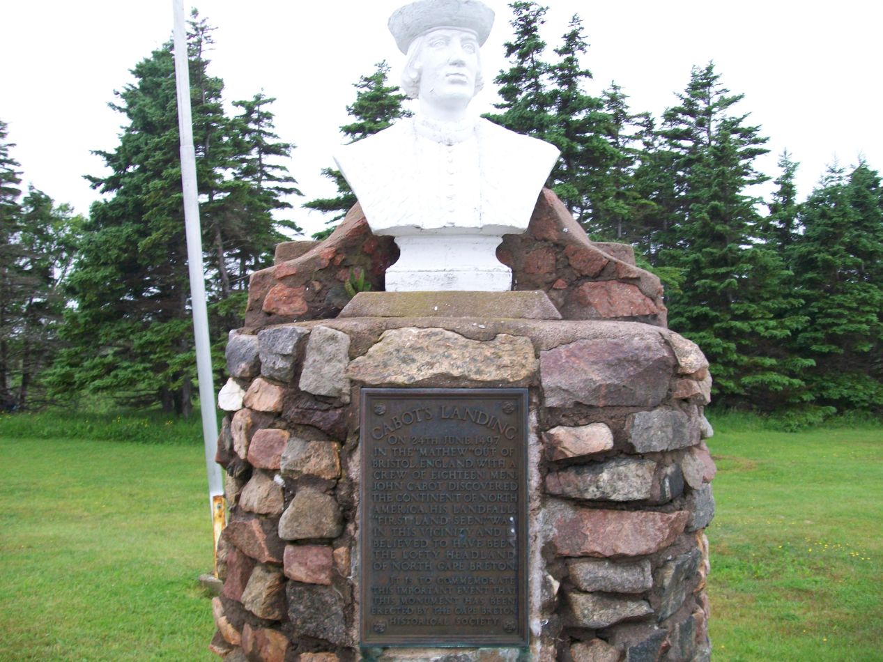


I stopped next at a spot known as Cabot's Landing, the place where John Cabot is believed to have first made landfall in North America back in 1497. This spot is technically located outside the grounds of Cape Breton Highlands National Park, although there's no northern entrance to the park like there is at the eastern and western boundaries. Only a handful of tiny fishing villages lie to the north of the park and it's not worth the effort to bother with a northern entry point. Cabot's Landing turned out to be one of the bleakest beaches I had visited, especially on an overcast day like this one. It was foggy and perhaps raining just a little bit, with absolutely no one else around on a windswept empty beach. Maybe it was the bleached driftwood on the beach, or maybe it was the haunting cries of the seabirds overhead in the fog, but in any case the small park felt a bit haunted. This place would probably be a lot more welcoming on a sunny day - not so much today.


Another half hour's driving time brought me to the eastern coast of Cape Breton Highlands, where another string of little hamlets sat up against the Atlantic Ocean proper. These pictures were taken at the town of Neil's Harbor, which had all of about 300 residents and is best known for having a small lighthouse. When I parked my car to check out the lighthouse, I found that it was tightly boarded up, and I was getting dirty looks from one of the townspeople because I had apparently parked in front of his house. I moved along quickly to get off of his property. The fog was back again and it gave the little town a bit of a ghostly look, like I was driving into the setting of a Silent Hill game, complete with early-3D-game amounts of fog.

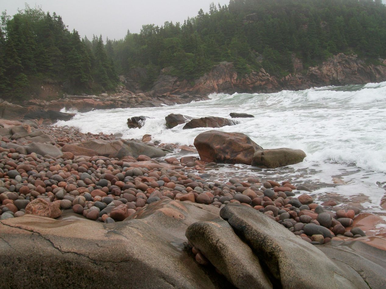


A short distance down the coast from Neil's Harbor was Black Brook Beach where the above pictures were taken. If some of the earlier spots along the Cabot Trail had been rugged in an empty sort of way, this beach was rugged in an in-your-face aggressive fashion. The beach was made up of thousands of small round rocks instead of sand, rocks that looked like they must have been worn smooth by the inflowing ocean. Waves from the Atlantic pounded the beach in endless succession, sending up booming crashes and great pillars of foam when they met with the jagged stony barriers. Evergreen trees also grew right down to the water's surface, and they provided the only splash of color to a tableau that otherwise seemed to be nothing but shades of gray and brown. The ocean felt wild and primal here in a way that I haven't quite come across elsewhere.

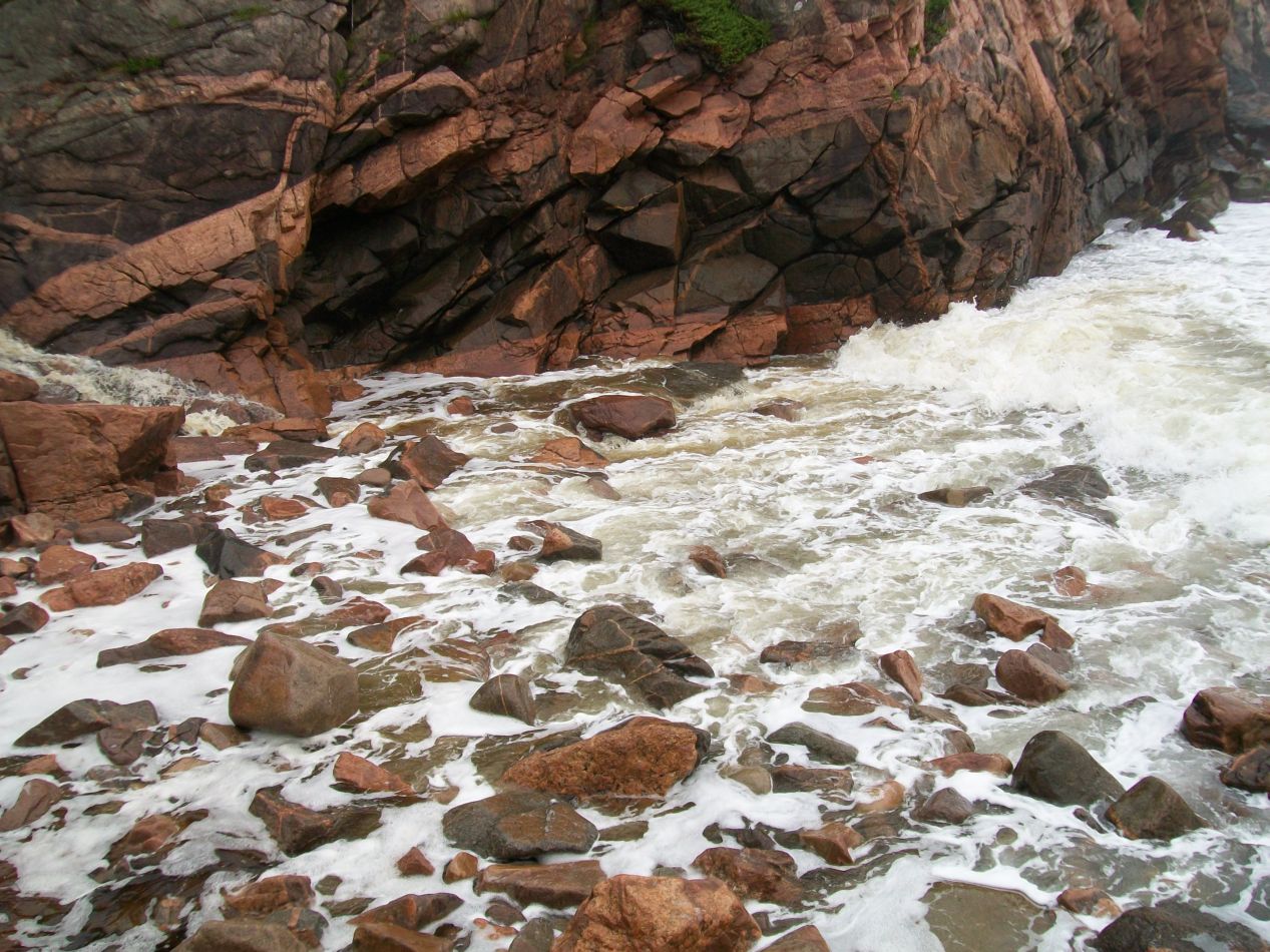


In addition to all of that, there was also a small stream that flowed directly into the ocean here. Known as the Black Brook, this little river provided yet another cool aspect to this one particular spot. Perhaps it was the foggy clouds hovering low overhead and adding to the overall mood, but I felt enraptured by this one particular beach and couldn't stop taking pictures of it. This felt like the essence of the Cape Breton Highlands, a rough and mysterious place where human civilization had left only the lightest of touches to date. I enjoyed visiting Black Brook Beach enough to take a very rare selfie here, and ended up getting a pretty good result on about the third attempt. Years later, this would end up being the most popular picture of myself on my online dating profile. This have been a small contributor to my eventual marriage - chalk up another point in Black Brook Beach's favor!

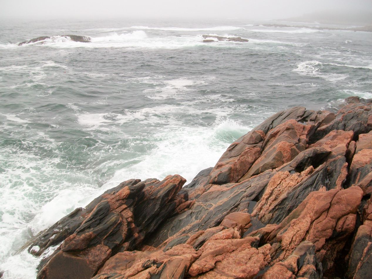


Down the road nearby from Black Brook Beach was Green Cove, another rocky protrusion stretching out into the Atlantic. While the conditions here weren't quite as perfect as they had been at the previous beach, I still enjoyed having the chance to watch waves crash in and dash themselves against the rocks of the shore. The rocks and the waves were both larger here, and there was a sign specifically warning anyone against trying to go swimming. I can't imagine that would have ended in anything other than grief. The fog seemed to be even thicker here, and it continued to cling to the shoreline as I kept driving to the south. It was still hovering overhead when I reached Ingonish, the town that marked the eastern entrance to Cape Breton Highlands. I could barely see the houses here in this tiny community, and it didn't seem like they would be getting many tourist visitors today. This is the most developed part of Cape Breton Highlands, with a golf course here and a decent sized hotel with the terrible name of "Keltic Lodge" on hand. Like everywhere else I went on this day, the golf course had only a handful of hardy souls out on the links.

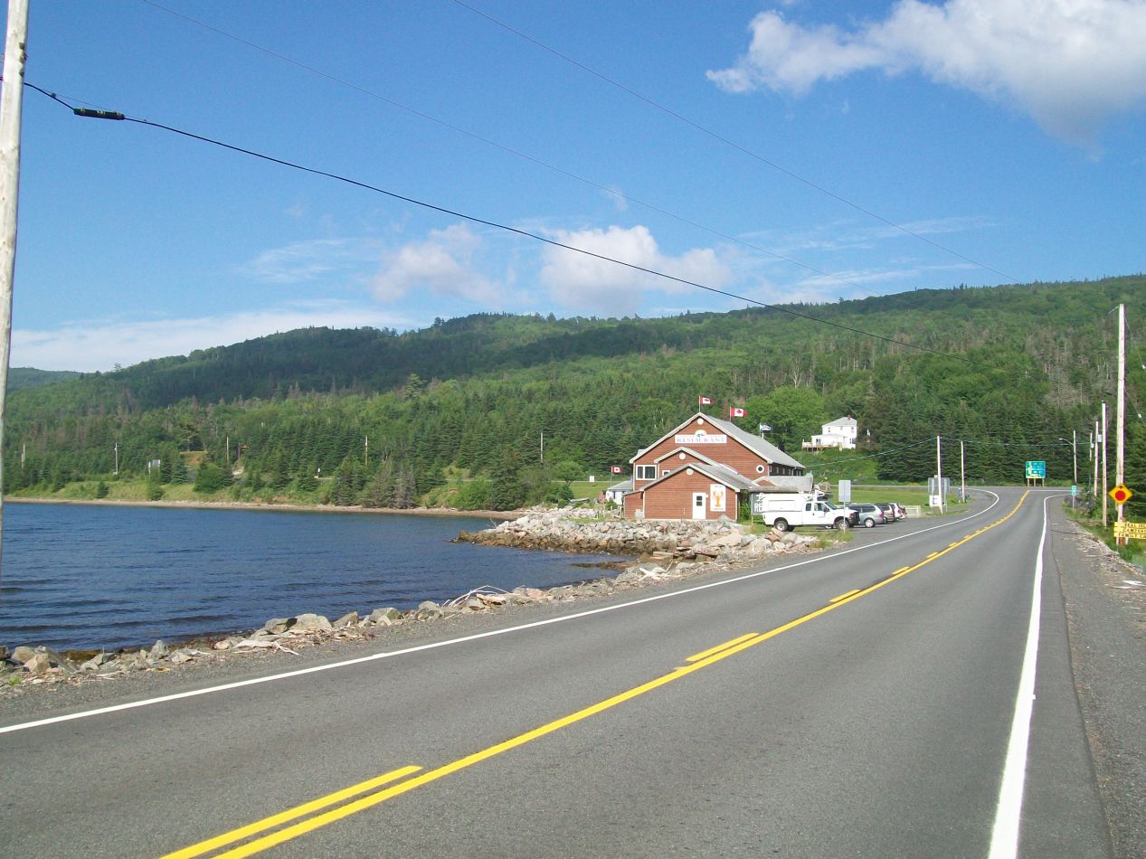


I was staying for the night in the town of Sydney, the largest population center on Cape Breton Island with about 30,000 residents. Sydney is located about two hour's drive away from the eastern entrance to Cape Breton Highlands, and I snapped some pictures of the drive along the way as I passed by the Bras d'Or Lake that sits in the center of the island. Much to my surprise, I left the overcast weather behind that had been dogging my steps all day, emerging into bright sunshine and a brilliant blue sky. I couldn't get over the deep blue color of the Bras d'Or Lake, which looked like it came straight from a pure mountain spring. At one point I was driving up on top of a ridgeline, and I looked down into the valley below to see a literal wall of clouds hugging the water at the bottom. It was a pretty drive and I made it to Sydney in the early evening when the sun was just beginning to set. I ended up not walking around the town and taking pictures, which was a mistake in retrospect as I have nothing to look back upon from that visit. All that I can mention is that I stayed in a basic hotel room and made sure to get some rest for the next upcoming day.

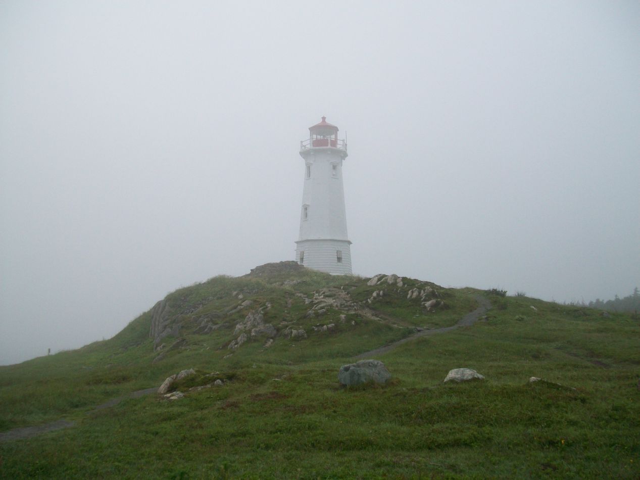


I planned to spend the next morning visiting the last destination on my list in Cape Breton, the reconstructed fortress town of Louisbourg. This was a French settlement built to defend the colony of New France against the British, and it has been restored back to the way that it would have looked circa 1750 as a living history museum, in the same fashion as colonial Williamsburg in the United States. Louisbourg was located on the northeastern coast of Cape Breton, about half an hour's drive away from Sydney. I arrived in the morning at a time when the small town was still enveloped in a layer of dense fog. The modern town of Louisbourg has about a thousand residents, and it largely exists to provide restaurants and lodgings for the tourists who come to visit the fortress. The historic site wasn't open for the day yet and therefore I used this time to check out the lighthouse at the mouth of the harbor. The current lighthouse was the third one to be constructed on this site and dates to 1923, replacing an older Victorian-era design that burned down. That in turn had been the replacement for the original lighthouse built by the French in 1734, which was deliberatedly demolished by the British during the successful siege of Louisbourg. I stopped to see the shattered remnants of the original lighthouse, but there wasn't much left of it after two and a half centuries.

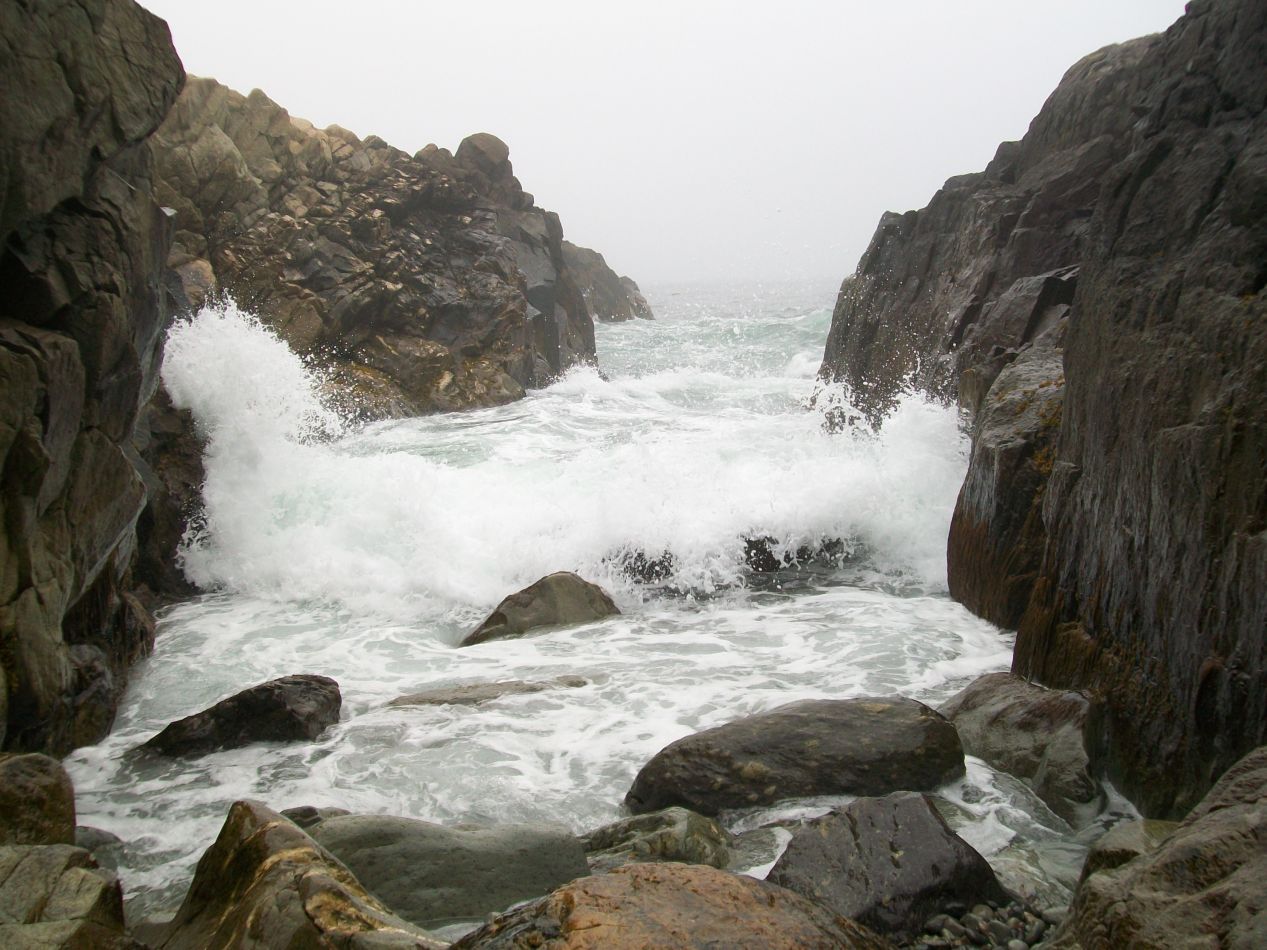


What to do while waiting around for an hour until the fortress opened for the day? I decided to use this time to climb around on some of the rocks along the coastline, with this being another place where the ocean's waves crashed up against a jagged shoreline. It was quite pretty here in a rugged way, especially with that thick fog continuing to shroud everything more than a few hundred feet away. Unfortunately this was where my earlier luck in scrambling over rocks ran out, as I slipped and cut open the bottom part of my left hand. It looked worse than it actually was, and I was able to patch things up by stopping in a little convenience store and purchasing some Band-Aids. All better now.


The historic site proved to have a good-sized visitor center when it opened for the day. Cars are not allowed to drive directly to Louisbourg due to its protected status, and visitors must either walk about a mile from the parking lot or take one of the buses run by the park service. I spent about half an hour exploring the visitor center first, checking out the excellent displays that provided additional backstory for the place. There was a great overview map of the area (which unfortunately I captured in a blurry image) showing the sheltered harbor where Louisbourg was built, the lighthouse on the northeast point, the fortress at the southern side of the same body of water, and then the modern town colored in white at the back. The reconstruction of Louisbourg was done to quarter scale, i.e. one fourth of the original fortress town was rebuilt. That alone was a massive undertaking that took decades to complete and was a questionable use of spending given the remote location of Louisbourg. There were other models here in the visitor center showing what the place would have looked like in the mid 18th century, along with the siegeworks that the British constructed to aid in its capture.


After finishing up with the visitor center, I hopped on one of the park buses for the short ride to the fortress site. I was among the first groups of tourists entering Louisbourg for the day, and the employees at the fortress (all wearing different sorts of period costume) were just getting started with their work. The weather remained overcast and foggy, giving the whole place a gloomy feeling like something out of an Elder Scrolls game. I crossed over the wooden bridge and entered through the gates bearing the insignia of the colony of New France. Time to check out the interior of the fortress town.

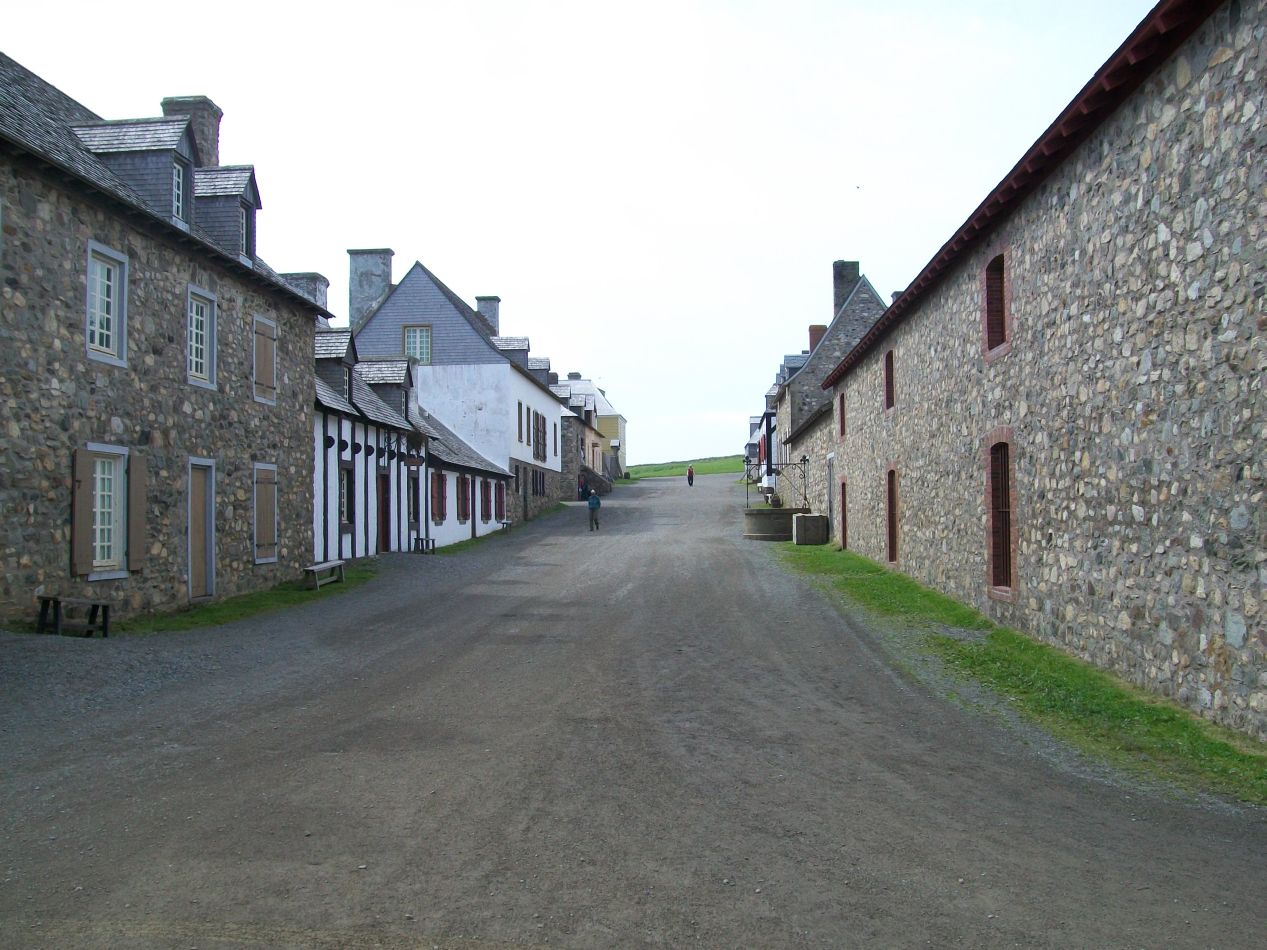


Louisbourg has been reconstructed with the idea of recreating what it looked like in 1750. At the time it was the second-largest French settlement in what is now Canada (after Quebec City), with approximately 4000 inhabitants. This was the local capital of French Cape Breton Island, which used the French name of Île Royale until it passed over to British control. The French and the British fought a lengthy struggle for control over what is now the provinces of Atlantic Canada during the first half of the 18th century, with the British slowly squeezing out the French until winning a decisive victory in the Seven Years War (1756-1763). Louisbourg was built as a fortress town to defend the territories of New France, just as the British built Halifax in response to defend their own territories. It turned out that Halifax was much more successful in this regard, although I doubt that it would have fared any better if the French had been the ones with the dominant navy.

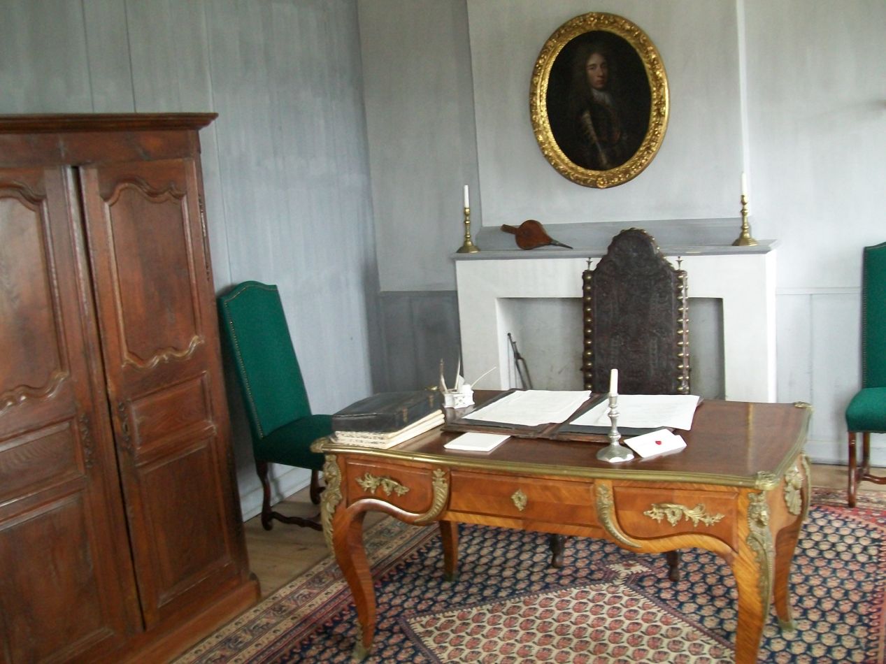


I spent some time wandering the streets of Louisbourg without having any particular destination in mind. Most of the buildings in the town were open for visitors to explore, often containing a reenactor working at some kind of traditional job or serving as a storage space for (fake) cargo and trade goods. One of the first houses that I ended up visiting contained the colonial governor's office, where a writing desk had been restored in an attempt to recreate what the room would have looked like in colonial days. Other areas were more focused on the mundane but vital task of keeping the colony's people fed, and therefore there were several pens holding different kinds of barnyard animals. The sheep pen was particularly adorable, with several different lambs that had likely been born in the spring a few months earlier. Louisbourg's climate wasn't suited to farming and most of the food in the fortress town came from fishing or animal herding. This proved to be a serious liability when Louisbourg found itself facing sieges.

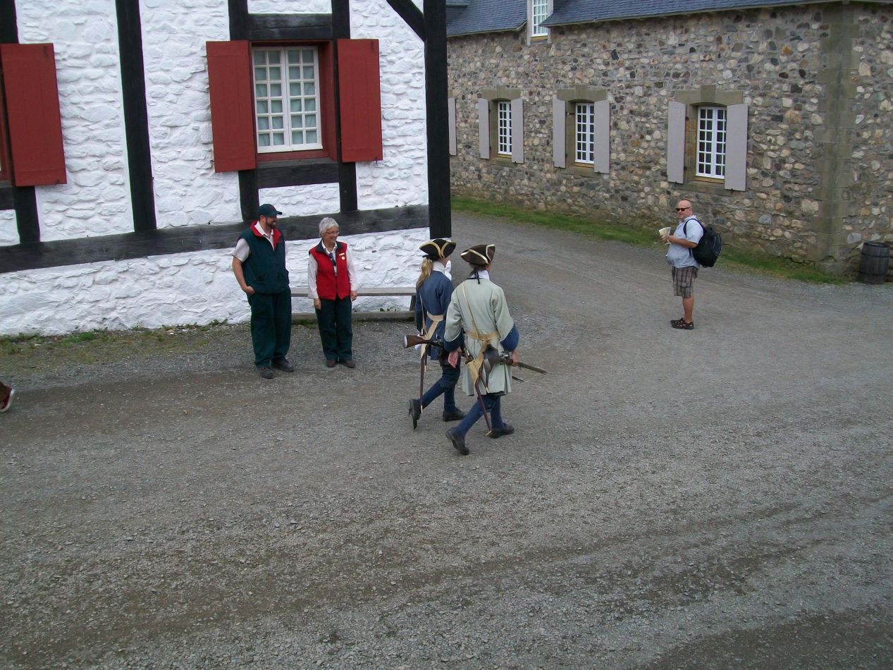


Then there were the townsfolk dressed up in period costumes to add to the realism of the place. As a history Ph.D, I'm always a bit torn on places that conduct historical reenactment using period costumes. On the one hand, there's a fundamental dishonesty to the whole practice in the sense that you can't really capture the worldview of people who lived in a different culture at a time 250 years in the past. Modern living history sites will do things like putting women in soldier's attire which never would have been permitted in the 18th century, and the very fact that all of the clothes and city streets were clean here at Louisbourg presented a distorted image of the past. (No one would want to visit the muddy, manure-filled streets of an actual town circa 1750!) On the other hand, general public understanding of history is woefully ignorant and historical reenactment sites like Louisbourg are helping to provide at least some education of what the past looked like. I generally agree with the old maxim of not letting the perfect be the enemy of the good, and Louisbourg's imperfect rendition was still a lot better than nothing. Besides, I tend to like 18th century fashion, even if the peasant garb on display here wasn't anywhere near as sharp as what the wealthy would have worn.

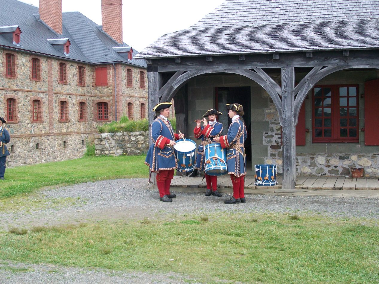


The southern side of Louisbourg held the largest of the reconstructed buildings, home of the soldier's barracks and the military chapel. There was a mustering ceremony taking place outside the building and I timed my visit to be able to see it. A small squad of soldiers in the blue coats of colonial France marched up to the entrance to the accompaniment of fife and drums. I've seen a number of similar ceremonies with actual military units, and the most charitable way that I can describe this group of park employeees is that they were trying their best. Inside the building was the military chapel, a small room painted almost entirely in white with gold trim. This was a Catholic chapel of course by virtue of Louisbourg being a French settlement, and there was more ornamentation here than anywhere else in the fortress town. The interior of the soldier's barracks looked much like the interior of the Halifax Citadel that I'd visited two days earlier, an open space that could be used for marching and drilling. The soldiers would have been quartered inside the large building, with their military supplies stored underneath the surrounding walls. The actual fortress of Louisbourg had walls circling the entire town, as opposed to this restoration where they were only constructed around the initial entrance and this barracks.

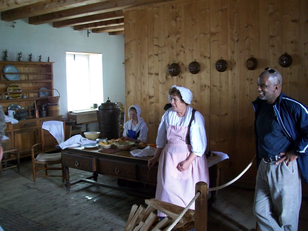


So what ultimately happened to the French colony at Louisbourg? It turned out that the initial choice of this location, which was picked for its excellent natural harbor, had serious and ultimately fatal flaws. The fortress was erected on low-lying ground commanded by nearby hills, places where a land-based siege could easily set up artillery pieces and shoot down into the fortress. Furthermore, the walls of Louisbourg were constructed with masonry rather than with earth, which made them prone to shattering when struck by cannon fire and also made them difficult to repair. Louisbourg ended up facing two different sieges, both of which were successful. The first one took place in 1745 during the War of Austrian Succession, when a force from colonial New England surrounded the poorly-supplied fortress and induced a surrender shortly before an assault was to take place. American colonists were enraged when Louisbourg was returned to France following the war in exchange for the British gaining territory in what is now Belgium plus the city of Madras in India. The second siege took place a dozen years later in 1758 during the Seven Years War, led by the famous General Wolfe as part of the campaign to occupy all of colonial New France. After the fortress was again surrounded and the harbor occupied by the British fleet, the defending French garrison surrendered a second time. (This was perfectly understandable as they were badly outnumbered and in the process of starving.) The British followed up this critical victory by invading and capturing Quebec City the following year, gaining complete control over New France on a permanent basis. Louisbourg was evacuated and systematically demolished in 1760, leaving nothing left of the fortress town until its modern reconstruction.
This brought my time on Cape Breton Island to a close, as I headed off at this point to Prince Edward Island. I had been transfixed by the natural beauty of Cape Breton Highlands, one of the most impressive national parks that I've ever visited. While it's pretty far out there, this is one of those places that I'd strongly encourage everyone to visit. For anyone living in New England or even the Mid-Atlantic states, it's ultimately not that difficult to reach in a few days of driving. Cape Breton Island also offers the possibility to continue onwards via the ferry to Newfoundland or Prince Edward Island, or to stay in the area and visit Louisbourg. This is a unique place and a fantastic location to experience on a vacation.


