
Up to this point in time, our path on this vacation had never strayed very far away from Australia's coast. A line of mountains named the Great Dividing Range runs the full length of Australia's eastern seaboard, separating the fertile coastal region from the much drier and more inhospitable interior. (Nearly all of the country's population lives within a short distance of the coast; there are no cities of any size located in Australia's interior, with Alice Springs being the largest at about 25,000 people.) We were planning to see a small portion of the vastness of Australia by visiting the Blue Mountains, a portion of the Great Dividing Range located in the western suburbs of Sydney. The Blue Mountains gained their name due to the a blue-colored haze that often characterizes the region, adding a fuzzy aspect to anything seen far off in the distance. We had originally planned to spend a full day visiting the Blue Mountains but cut into that time by stopping at Bondi Beach, which was located in the wrong direction on the other side of Sydney. This would limit us to a single afternoon up in the mountains.

One of the neat things about Sydney's natural geography is the rapid shift from one climate type to another in a small area. We were traveling from Bondi Beach to the town of Katoomba, the main destination for visitors in the Blue Mountains, and this trip only took about two hours thanks to a direct route via the M4 and A32 highways. The first half of this drive was spent traveling through Sydney itself, including passing literally underneath it through a series of tunnels that passed below the downtown area, followed by the long trek through the western suburbs of the city. Those seemed to go on forever as Sydney sprawled out dozens of miles away from the city center. After an hour or so of driving, the road began to gain in elevation and started switching back on itself, a sign that we were starting to enter the mountains. Unfortunately this was where the excellent weather that we'd enjoyed in Sydney began to desert us, with rain showers appearing once again to drop brief outpourings of precipitation followed by returning to sun again afterwards. It was also growing noticeably colder as we traveled onwards, and the climate shifted by a surprisingly large amount considering the relatively small distance covered.

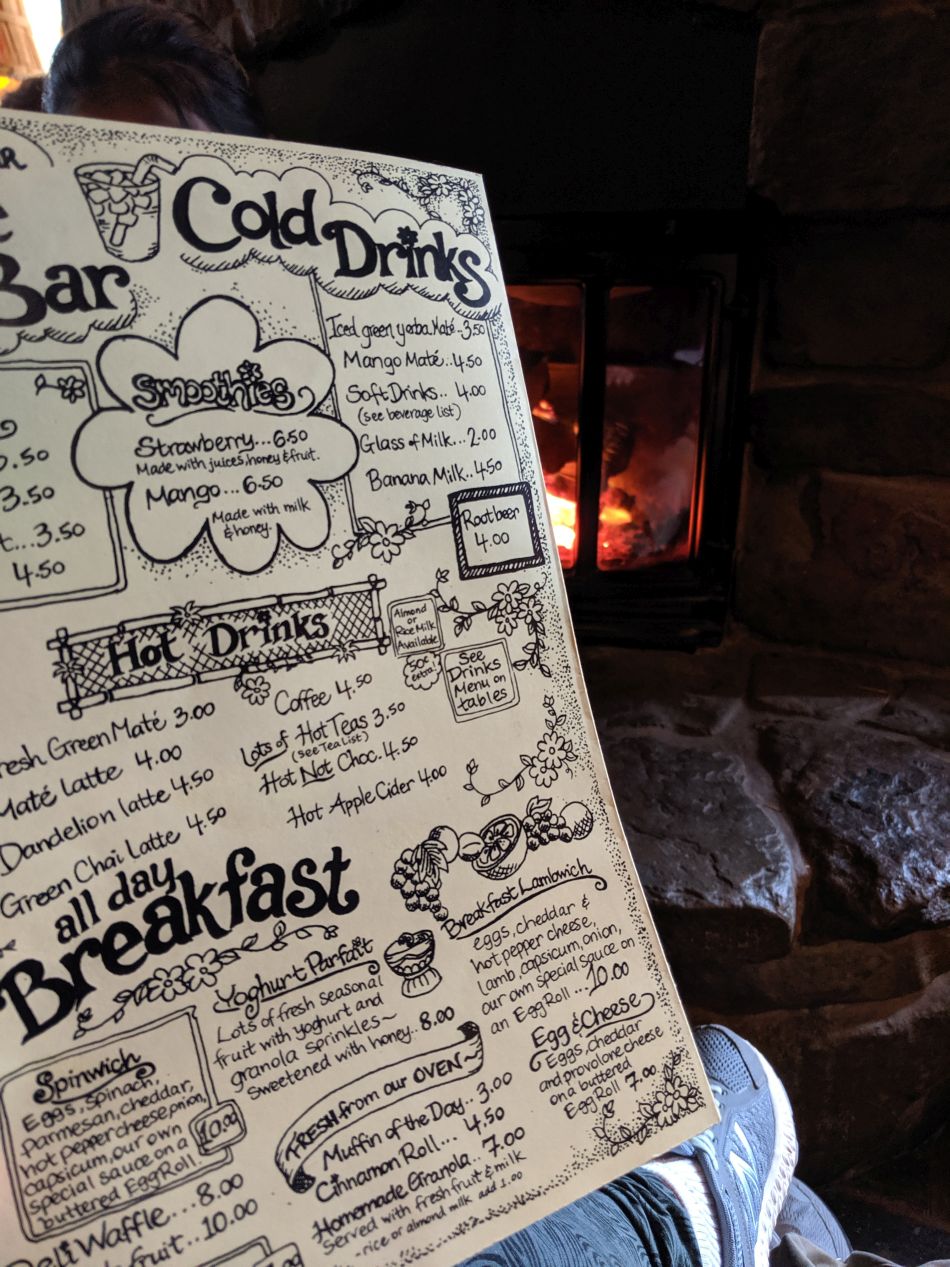


It was raining and cold when we arrived in Katoomba a little after noon, and we decided that the first thing to do was grab something warm to eat for lunch. We quickly settled on a cafe named the Yellow Deli, which had a setup designed to look like an old-fashioned country store, complete with a welcome fire burning in the fireplace. The Yellow Deli seemed to have a counterculture hippie feel to it, from the hand-drawn lettering on the menu decked out with flowers to the bearded and tie-dyed appearance of the cafe's staff. There were informational brochures that revealed the Yellow Deli was run by a collective that had settled in Katoomba a few decades earlier, a group that sounded suspiciously like a cult in the sense that everyone lived together and no one received money for the work that they did at the deli. But, uh, the food was excellent, no doubt about that! Liz had some chili and I ate some bread, with the picture above showing me doing my best starving orphan face at having a meal of bread alone. (That was by my own choice - I love fresh bread!)

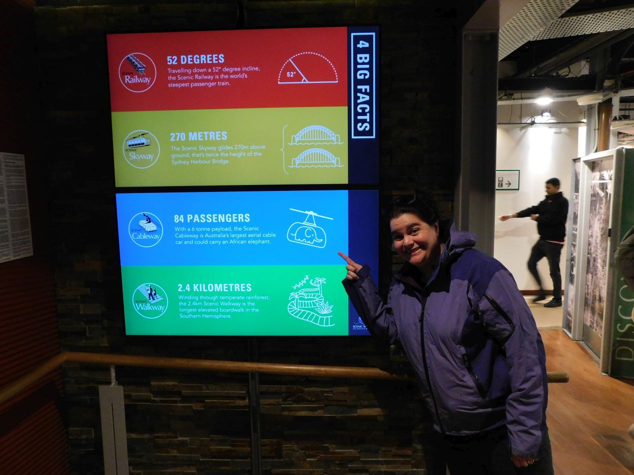


The main attraction that we would be visiting for the day was Scenic World, the name given to a series of different transportation experiences associated with viewing the Blue Mountains. This place started out by commercializing the Scenic Railway, an old coal mining track that runs at a ridiculously steep angle of 52 degrees, and then added the Scenic Skyway in 1958 and the Scenic Cableway in 2000 to continue attracting more visitors. This is a bigtime tourist attraction and there were lots of tourist buses already present at Scenic World when we arrived; with this being the slow winter season of the year, I'd hate to see how crowded the place gets in the summer. We poked around the gift store for a few minutes and picked up a couple souvenirs for the family back home, then tried to figure out which attraction we should try first.

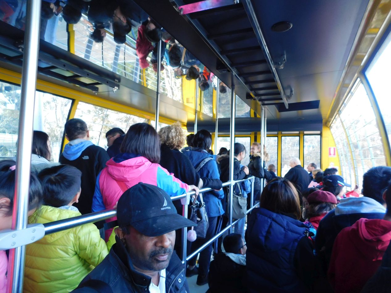


The Scenic Skyway seemed like the best place to begin. This attraction consisted of a large cable car that spanned the gorge above Katoomba Falls, 270 metres / 885 feet above the valley floor below. The cable car operators can take about 70 people at a time across to the other side of the gorge, and the car itself includes a glass floor that allows passengers to look down at the valley passing far beneath their feet. This seemed to be the most popular of the various different attractions at Scenic World and we had to wait in line for about 10 minutes before we were able to board the gondola. We were packed in along with several dozen other visitors and tried to position ourselves to get a clear view out the windows. The best views were out the right hand side of the cable car, offering sights looking out at the Jamison Valley and the iconic Three Sisters natural rock formation.

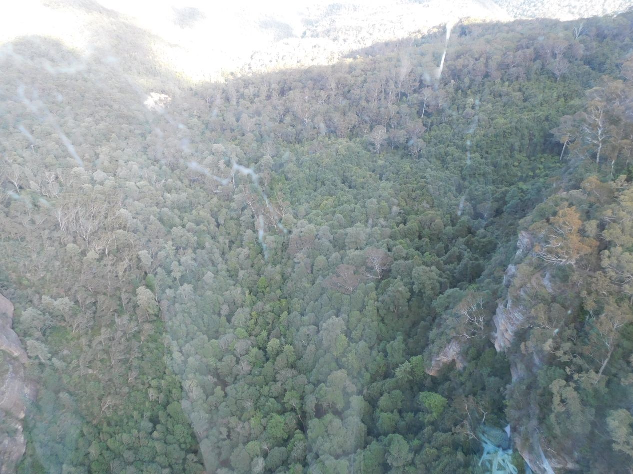


The ride on the Scenic Skyway proved to be a short one, lasting roughly three minutes to reach the cliffs on the other side. Scenic World has to keep the cable car moving along at a brisk pace because there's only one gondola which has to be loaded and unloaded for every single trip. (I'm a little surprised that they don't have two cable cars for the summer months, one able to move in each direction simultaneously.) Even though the ride was brief, we did manage to enjoy some impressive sights along the way. The best of these involved looking directly down through the glass floor, providing a perspective that we wouldn't be able to see otherwise throughout the rest of the day. There was a thick forest down below that we planned to explore later. Near the far end of the gondola route, we passed close by Katoomba Falls as they plunged over the cliffs down to the forest floor. Aside from a bit of a glare from the afternoon sunlight off the glass of the cable car, these were some excellent views and very much worth seeing.

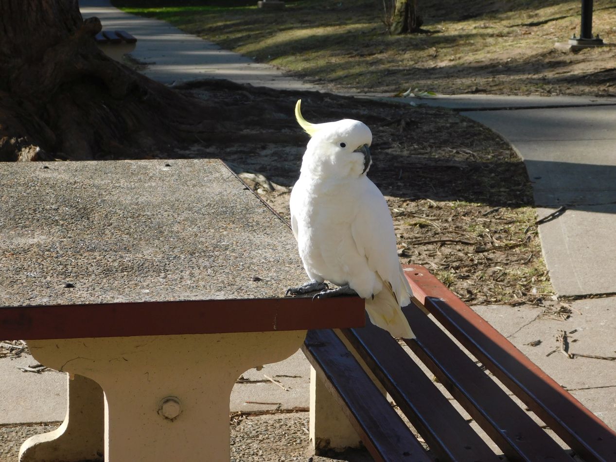


Now we were on the opposite side of the cliff face from Scenic World and had to figure out what to do next. We could either take the same Scenic Skyway back to the main entrance (what most of the passengers were choosing to do) or try walking back along some of the trails that ran through the area. This whole region was part of Blue Mountains National Park, and there were walking trails everywhere running both along the tops of the cliffs and down into the valley below. Scenic World was only about a mile's distance away around the rim of the cliffs so we decided that we'd try the walking path, hopefully running into some interesting stuff along the way. The first thing that we encountered was a group of cockatoos hanging out in a small public park. These birds didn't seem scared of humans in the slightest and I'm guessing that they regularly ran into people who fed them. Then we found ourselves crossing the waters of the Kedumba River shortly before it plunged over the cliffside as part of Katoomba Falls. This was the most popular part of the walking trail, with several different families investigating the waters with their kids.

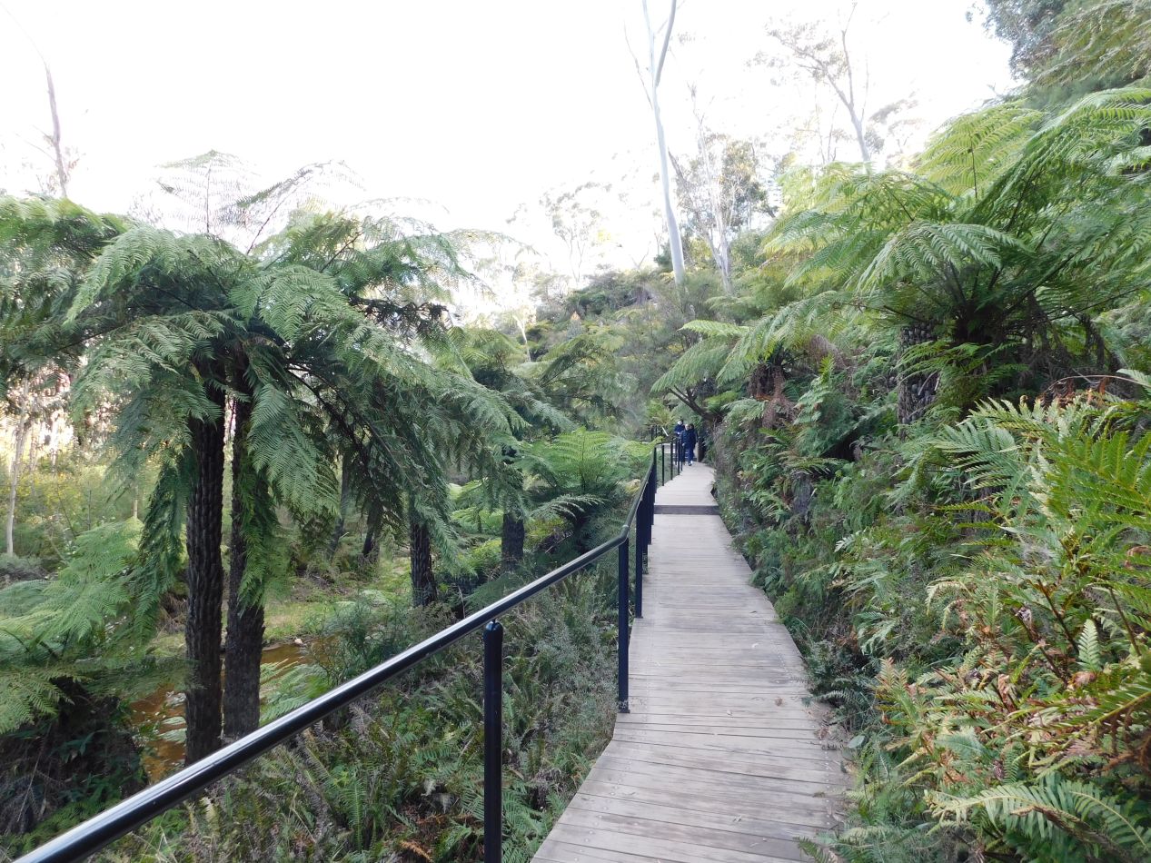


After crossing the small river, the path followed its course until the water spilled over the cliff's edge, at which location there was a small viewing platform looking out over the Jamison Valley. This was the most scenic part of the trail between the various ferns flanking the raised boardwalk and the dramatic views looking down at the valley floor below. The weather was alternating between brief rain showers and periods of sunlight, and we were able to capture that mixture of different elements up in the sky while looking at the cable car passing overhead. This was probably the best perspective to get a view of the Scenic Skyway itself, looking like a little cigar box floating in the middle of open air. At least it was easy to see where we had to go: keep heading to the right until we reached our starting point at Scenic World again.

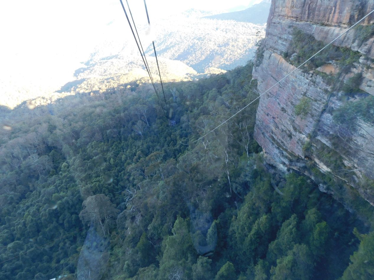


Now it was time to test out one of the other attractions in the form of the Scenic Cableway. This was a similar gondola setup to the Scenic Skyway that we'd ridden earlier, but instead of staying at the same elevation and crossing to the other side of the cliffs, the Scenic Cableway dropped 500 meters / 1650 feet down to the valley floor. The promotional materials and the cable car operator both mentioned that this gondola was strong enough to hold the weight of an African bull elephant. There was certainly no need for that here, as the cableway car held only the two of us and another couple along with the operator, looking oddly empty since it had space to hold about 50 people at a time. The view looking straight down as the gondola descended was somewhat vertigo-inducing, and it was better to look off to the left at the Three Sisters in the distance. It only took a couple of minutes to find ourselves deposited down in the Jamison Valley, looking back up at the cliffs where we'd been walking earlier.

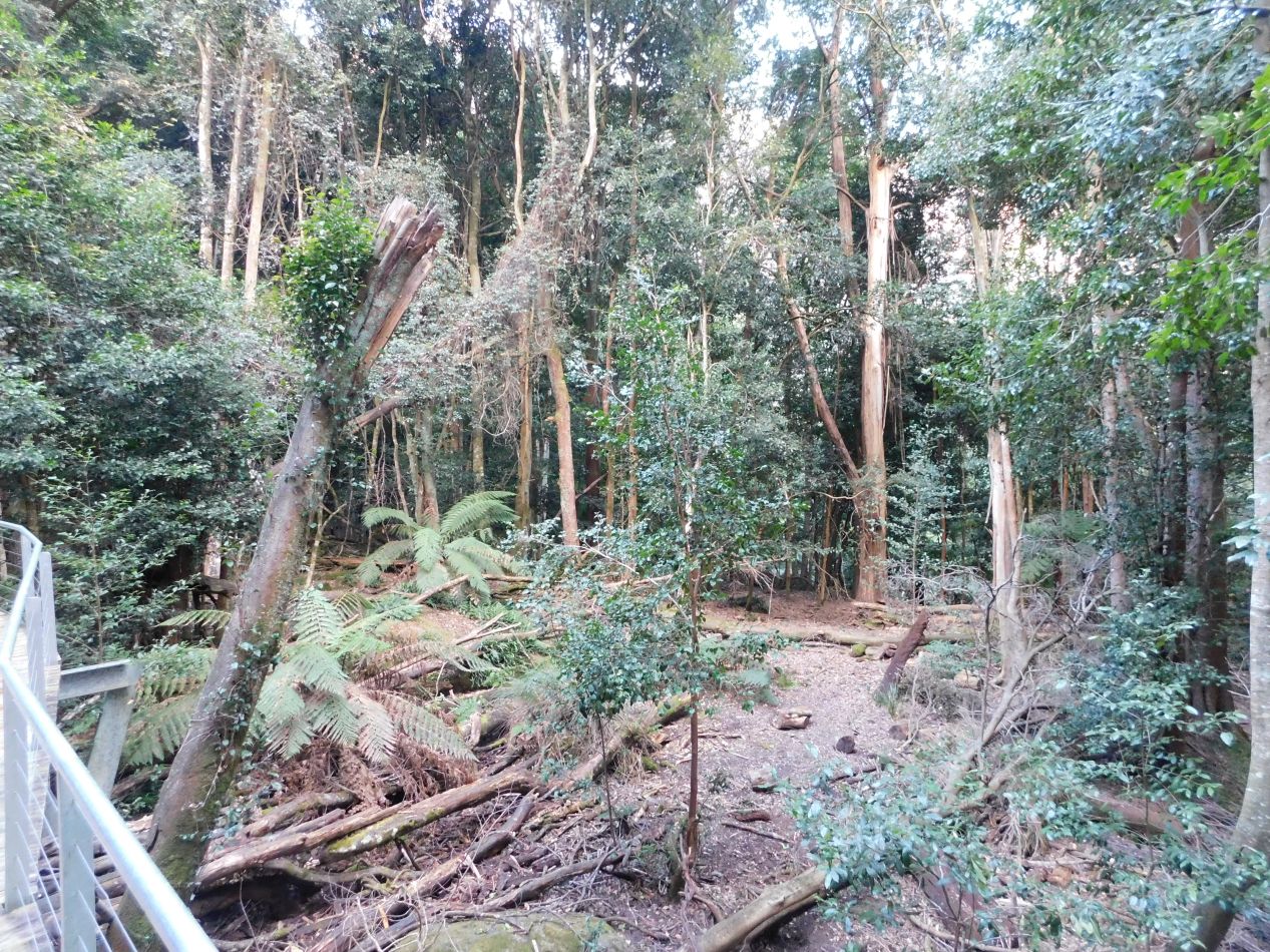


There were more walking trails down in the forest at the valley floor, which Scenic World had branded as the "Scenic Walkway" as part of their ongoing naming gimmick. It was late in the afternoon at this point, with Scenic World closing for the day in less than an hour's time, and we had the walking paths all to ourselves. Walking through the forest on the raised boardwalks was quiet and relaxing, probably because there were no loud tourists to interrupt the natural beauty of the area. It was notably warmer down here in the valley as compared to up at the top of the cliffs and the temperature was almost pleasant for a change. The one type of wildlife that we spotted along the way was a group of lyrebirds, notable for their huge tails that trailed behind the rest of their bodies. The lyrebirds were digging in the leaves on the forest floor, scratching the soil with their feet and snapping up any insects that they uncovered in the process. It was quiet enough that we could easily hear the sounds of their feet kicking the ground, a series of "scratch-scratch" noises. We were the last ones out of these walkways for the day, with the park staff closing and locking the gates behind us at the exit.

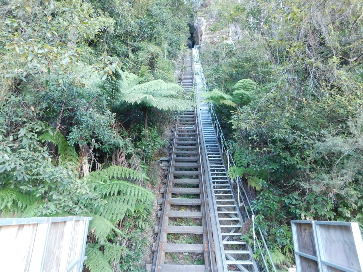


We still had to get back up to the clifftops though, and this was where the final attaction of Scenic World came into the picture. This whole area was originally used for coal and oil shale mining back in the 1880s, and an extremely steep railroad was built in that era for hauling ore from the valley floor up to the cliffs. Starting in the 1920s, this railroad was used for carrying coal during the week and for carrying passengers during the weekends. The railroad cars from that era were tiny little boxy things, open on all sides and decided not safe-looking. The mining operation shut down in 1945 after the end of World War II, but the railroad continued to carry tourists as part of Scenic World, albeit with much larger and safer cars today. We were amazed at the steepness of the railroad's vertical incline, which was greater than a 45 degree angle. I think that we were both happier to be going up as opposed to down on this thing. The Scenic Railway itself was entirely enclosed in glass and allowed passengers to choose the angle at which their seat inclined, everything from the actual angle of ascent (52 degrees) to a less scary position (30 degrees). The trip up on the railway took just over a minute in duration and felt like sliding up a tube, with the walls of the cliffside hugging close to the tracks on both sides. I would have enjoyed getting the opposite experience and riding the railcar back down into the valley, however at this point the whole place was shutting down for the night and they weren't letting anyone else ride down into the canyon.

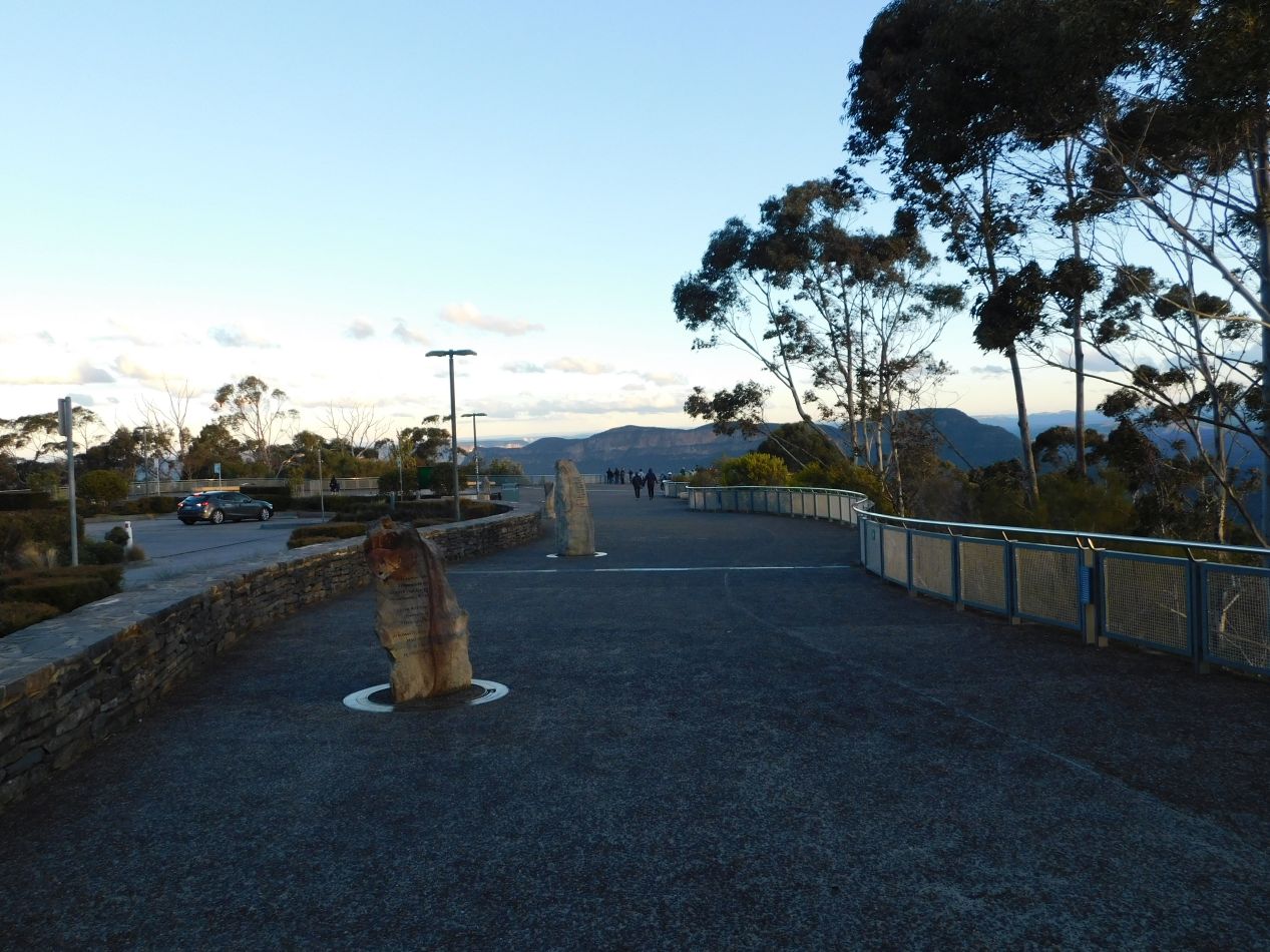


With Scenic World about to close for the day, we hopped back into our rental car and made the short drive over to Echo Point. This was close to where the Scenic Skyway had deposited us earlier in the day, and constituted a lookout point with the best views of the Three Sisters. The sun was just about to set behind the cliffs in the west, and we were enjoying watching how the fading light kept shifting as it passed behind different clouds and then emerged once again. This was a great place to take some last looks at Scenic World and the Skyway cable car as it made its final crossings of the day over the valley below.

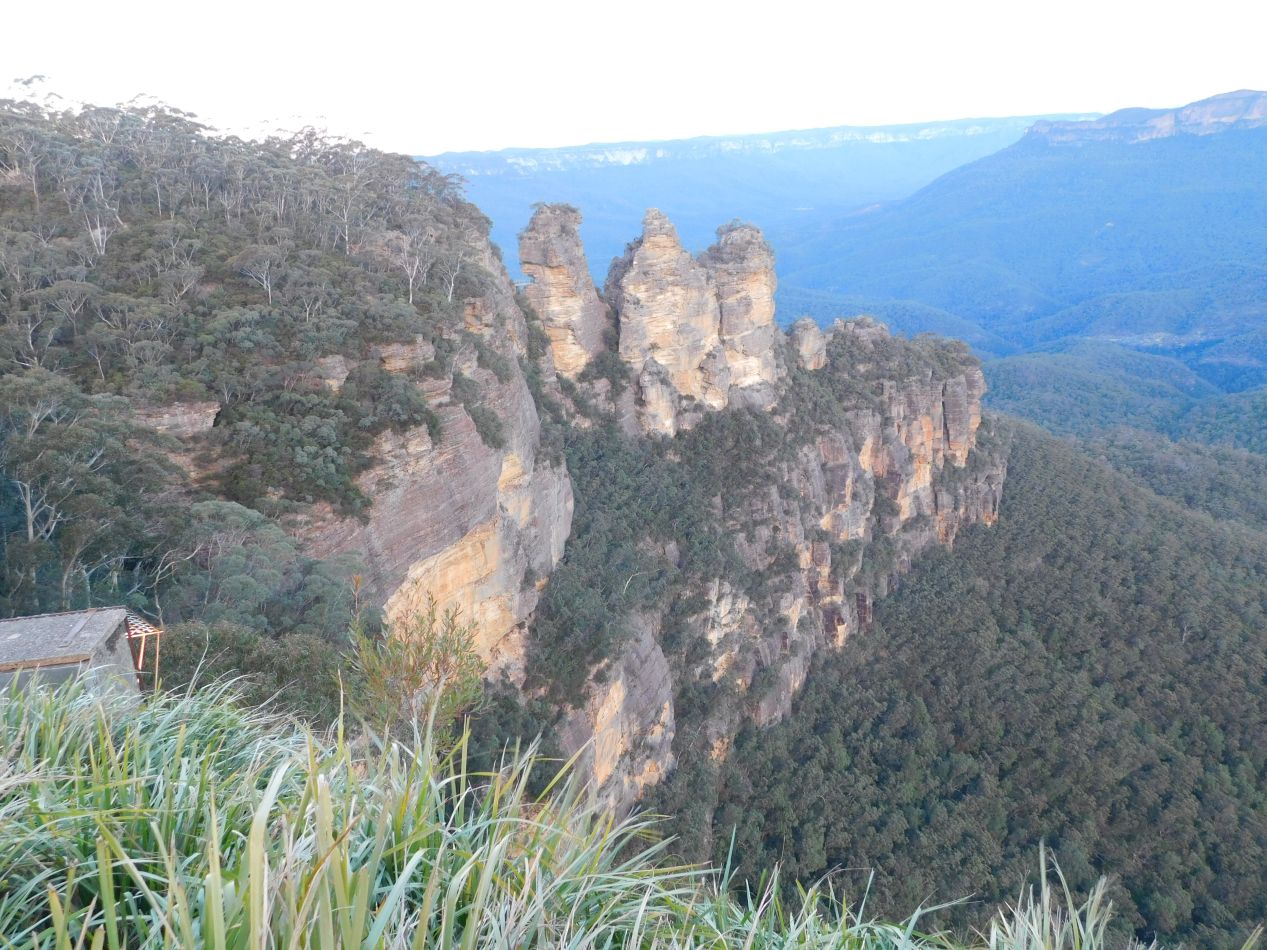
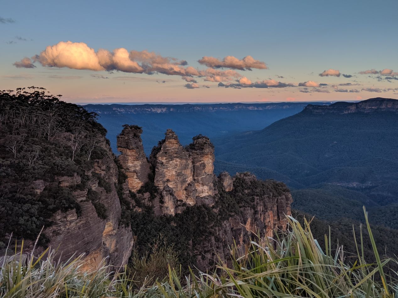

But the real attraction at Echo Point was the Three Sisters, the famous rock formation responsible for Katoomba being a tourist destination in the first place. The three pillars are made out of eroded sandstone, with the different colors of the rocks indicating different amounts of erosion by wind and water. The Three Sisters are a sacred monument for the local Gundungurra people; a traditional story tells that these were originally three sisters named Meehni, Wimlah, and Gunnedoo who were turned to stone to protect them from a battle but were unable to be transformed back into humans afterwards. The views from this spot were excellent, not just of the Three Sisters but also of the wider Jamison Valley beyond them, which seemed to stretch out endlessly towards the horizon. There are lengthy hiking trails that led out into the distance to Castle Head and Mount Solitary, where there are a number of backwoods camping sites for hardy adventurers. We definitely weren't going out there since it was already cold at Echo Point and the temperature was dropping further as the sun continued to set.


Liz was experimenting with her camera phone and trying to get the sunlight to show up with a halo effect behind her head. It didn't work out quite right but I love these pictures anyway. 

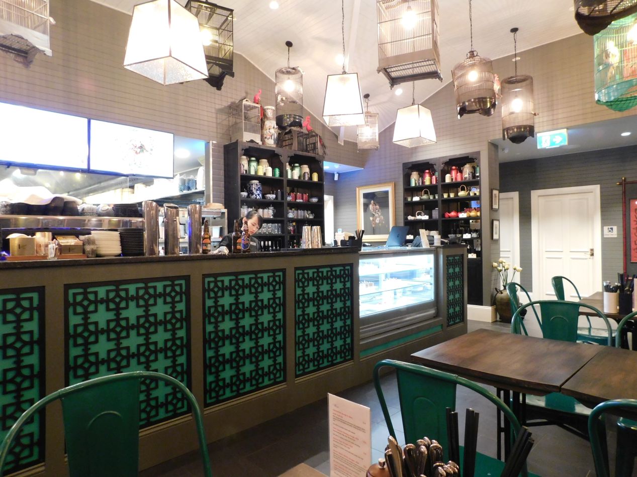


We ate dinner that evening at a restaurant named Miss Lilian's Tea House located near Echo Point. This was an Asian-themed restaurant that was a bit on the pricey side but served up an excellent menu in a relaxing setting. Liz ordered a noodle dish (pork ramen I think?) while I had a type of shrimp curry with a hot, spicy flavoring. There weren't many people at the restaurant since this was a Thursday night in the middle of the winter doldrums, and I think that we were the only ones present who weren't staying in the hotel attached to the restaurant. Miss Lilian's was one of the better places where we ate on this trip and we'd highly recommend it to anyone who happens to be visiting Katoomba.

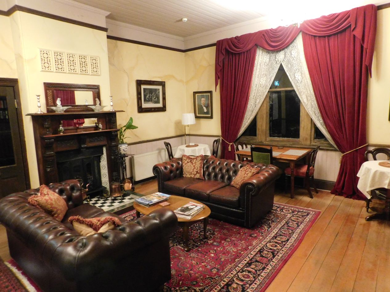


Finally, these are a few pictures of the bed and breakfast where we stayed for the night. This place was known as the Kurrara Historic Guest House and it was located in a quiet neighborhood in the small town, only a dozen or so blocks away from Echo Point. The bed and breakfast only had four or five rooms to rent out to visitors, and the house itself was more than a hundred years old. This meant that quarters were a bit on the cramped side, but the place made up for its age with elegant furnishings throughout the common rooms on the ground floor. We had a snug bedroom on the upper floor, where we turned up the heat and listened to the wind whistling around outside the window panes. It was quite cold outside on this night, colder than anywhere else we visited in Australia, with the temperature dropping below the freezing point. The mountains in the southern portion of the Great Dividing Range are just about the only place where it snows in Australia outside of Tasmania, and although we didn't see any snow on this trip, the conditions weren't far off from it. We heard that portions of Victoria did see snow on this night due to the chilly weather conditions.
That's all of the pictures that we had to share from this abbreviated trip to the Blue Mountains. Considering that we only had an afternoon's worth of time to spend in the area, we were happy that we'd been able to see the Three Sisters and at least a small part of the Jamison Valley. Blue Mountains National Park would be a great place to visit in the summer, when the weather would be warmer and there would be ample room to try additional outdoor activities like camping and whitewater rafting. We were continuing onwards though, heading next for Australia's capital city: Canberra.


